
Marlieux
| Marlieux | ||
|---|---|---|

|
|
|
| region | Auvergne-Rhône-Alpes | |
| Department | Ain | |
| Arrondissement | Bourg-en-Bresse | |
| Canton | Châtillon-sur-Chalaronne | |
| Community association | Dombes | |
| Coordinates | 46 ° 4 ' N , 5 ° 4' E | |
| height | 263-282 m | |
| surface | 16.85 km 2 | |
| Residents | 1,112 (January 1, 2017) | |
| Population density | 66 inhabitants / km 2 | |
| Post Code | 01240 | |
| INSEE code | 01235 | |
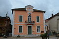
 Mairie Marlieux |
||

Marlieux is a French commune in the Ain department in the region Bourg-en-Bresse . Until the French cantons were reorganized , Marlieux was one of the 10 municipalities in the canton of Villars-les-Dombes and became part of the canton of Châtillon-sur-Chalaronne in 2015 . It borders in the northwest and in the north with Saint-Germain-sur-Renon , in the northeast with Saint-Paul-de-Varax , in the east with Saint-Nizier-le-Désert , in the south with Le Plantay , in the southwest with Villars-les -Dombes and to the west at La Chapelle-du-Châtelard .
Population development
| year | 1962 | 1968 | 1975 | 1982 | 1990 | 1999 | 2008 | 2014 |
|---|---|---|---|---|---|---|---|---|
| Residents | 624 | 641 | 632 | 679 | 633 | 677 | 801 | 1032 |
Attractions
- Saint-Pierre-aux-Liens church
- War memorial

Saint-Pierre-aux-Liens church

War memorial
former mairie

mail department

Marlieux - Châtillon train station


Web links
Commons : Marlieux - collection of images, videos and audio files