
Curciat-Dongalon
| Curciat-Dongalon | ||
|---|---|---|
|
||
| region | Auvergne-Rhône-Alpes | |
| Department | Ain | |
| Arrondissement | Bourg-en-Bresse | |
| Canton | Replonges | |
| Community association | Bassin de Bourg-en-Bresse | |
| Coordinates | 46 ° 29 ' N , 5 ° 9' E | |
| height | 187-218 m | |
| surface | 23.94 km 2 | |
| Residents | 440 (January 1, 2017) | |
| Population density | 18 inhabitants / km 2 | |
| Post Code | 01560 | |
| INSEE code | 01139 | |
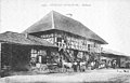
 Mairie Curciat-Dongalon |
||

Curciat-Dongalon is a French commune in the Ain department in the region of Auvergne Rhône-Alpes . It is bordered by Romenay to the north-west, Montpont-en-Bresse to the north-east, Varennes-Saint-Sauveur to the east, Saint-Nizier-le-Bouchoux to the south, Courtes to the south-west and Vernoux to the west .
Population development
| year | 1962 | 1968 | 1975 | 1982 | 1990 | 1999 | 2008 | 2014 |
|---|---|---|---|---|---|---|---|---|
| Residents | 773 | 725 | 575 | 512 | 449 | 404 | 437 | 451 |
Attractions
- Malmont Manor, Monument historique
- Saint Laurent Church
- War memorial
Malmont mansion

Saint Laurent Church

War memorial


Web links
Commons : Curciat-Dongalon - collection of images, videos and audio files