
Halver
| coat of arms | Germany map | |
|---|---|---|

|
Coordinates: 51 ° 11 ′ N , 7 ° 30 ′ E |
|
| Basic data | ||
| State : | North Rhine-Westphalia | |
| Administrative region : | Arnsberg | |
| Circle : | Märkischer Kreis | |
| Height : | 410 m above sea level NHN | |
| Area : | 77.23 km 2 | |
| Residents: | 16,083 (Dec. 31, 2019) | |
| Population density : | 208 inhabitants per km 2 | |
| Postal code : | 58553 | |
| Area code : | 02353 | |
| License plate : | MK | |
| Community key : | 05 9 62 012 | |
| LOCODE : | DE IHL | |
City administration address : |
Thomasstrasse 18 58553 Halver |
|
| Website : | ||
| Mayor : | Michael Brosch ( SPD ) | |
| Location of the city of Halver in the Märkisches Kreis | ||
  |
||


Halver [ ˈhɑlfɐ ], sometimes also [ ˈhɑlvɐ ], is a small town in North Rhine-Westphalia , Germany . As a district town , it belongs to the Märkisches Kreis and is located in the western foothills of the Sauerland not far from the border with the Bergisches Land .
geography

Geographical location
Halver is located in the western Sauerland in the Brandenburg region on the border between the Rhineland and Westphalia , about 10 kilometers west of Lüdenscheid . The main town is located on a hilltop at an altitude of 374 m above sea level. NN (Bolsenbachtal) up to 420 m above sea level NN (southern urban area). The lowest point in the entire urban area is 275 m above sea level. NN near Oberbrügge, the highest with 433 m above sea level. NN at Hagebücherhöh .
The Glör rises in the north of the city , the main tributary of the Glörtalsperre . North of the main town the Löhbach , south of the main town the Bolsenbach , both tributaries of the Ennepe . The Ennepe itself rises about 2.5 kilometers southeast of the city on the western flank of the Störllenberg ( 410.2 m ), flows in a north-west direction towards the Ruhr and is dammed about 5.5 kilometers from the center of Halver in the urban area of Breckerfeld to the Ennepetalsperre .
The Hälver , a tributary of the Volme , and the Neye , Hönnige and Bever , all tributaries of the Wupper, arise in the northeast of the city . The watershed between the river systems of the Ruhr and the Wupper runs through the city of Halvers .
Expansion of the urban area
The urban area extends over 12.7 kilometers in a north-south direction from the Glörtalsperre in the north to the Kerspealsperre in the south. In a west-east direction, it extends over 11.5 kilometers from Schwenke in the west to Oberbrügge in the east. The urban area covers 77.37 square kilometers, of which 26.83 square kilometers are forest and 39.55 square kilometers are used for agriculture. Buildings, operating and open spaces take up a total of 5.61 square kilometers and traffic areas 3.45 square kilometers.
Neighboring communities
| Breckerfeld | Breckerfeld | Schalksmühle |
| Radevormwald |

|
Ludenscheid |
| Wipperfürth | Wipperfürth | Kierspe |
Halver borders in the north on Breckerfeld in the neighboring Ennepe-Ruhr district and Schalksmühle , in the east on Lüdenscheid , in the southeast on Kierspe . Like Halver, these belong to the Märkischer Kreis . To the southwest of Halver lies Wipperfürth and to the west of Radevormwald , which belong to the Oberbergisches Kreis .
City structure
In addition to the core city, Halver has the following districts and locations:

Ahe | Altemühle | Stop | On the Heede | On the Wiebusch | On the Eicken | On the cools | On the Bever | On the brake | On the mark | Bärendahl | Beisen | Beiserohl | Basin | Mountains | Bergfeld | Berken | Birch tree | Bochen | Bocherplatz | Bommert | Borkshof | Brenscheid | Brocksiepen | Break | Brüninghausen | Books | Büchenbaum | Book mill | Burbach | Castle | Buschhauser Hammer | Carthausen | Collenberg | Clev | Dahlhausen | Big sip | Diekerhof | Dommelnheide | Dornbach | Thinning | Noble churches | Ehberg | Ehringhausen | Eichhofermühle | Eichholz | Eickerhöhe | Eickerschmitte | Engstfeld | Ash trees | Eversberge | Hardness | Gesenberg | Giersiepen | Glörfeld | Grafweg | Reason | Green tree | Grünewald | Rose hips | Hagebücherhöh | Hawthorn | Hakenberg | Hello | Halverscheid | Handweiser | Hartmecke | Heerenfelde | Heesfeld | Heesfeld Hammer | Heesfeld Mill | Yeast flour | Heinken-Hedfeld | Herweger Schleifkotten | Hesseln | Hinterhedfeld | Hohenplanken | Hollow | Holte | Howarde | Hulvershorn | Husen | In the Heede | In the swamp | Im Wiebusch | In the Eicken | In the half | Kamscheid | Kirchlöh | Kotten | Krause beech | Kreimendahl | Screech | Way of the Cross | Kückelhausen | Landwehr | Lousy Mountains | Lingen | Lingensiepen | Löhbach | Löhrmühle | Lömmelscheid | Magdheide | Mesenhohl | Mittelcarthausen | Mittelherweg | Niederbolsenbach | Niederbommert | Niederbuschhausen | Niederennepe | Niederhedfeld | Niederhövel | Niederhürxtal | Niederlangenscheid | Niedervahlefeld | Neuenhaus | Neuenherweg | Neuenvahlefeld | Nun nepe | Nordeler Schleifkotten | Nordeln | Oberbolsenbach | Oberbommert | Oberbrugge | Oberbuschhausen | Obercarthausen | Oberherweg | Oberhövel | Oberhürxtal | Oberlangenscheid | Obervahlefeld | Oeckinghausen | Oege | Oesterberg | Osenberg | Ostendorf | Othmaringhausen | Pottheinrich | Rothenbruch | Schanzmannsmühle | Battle wheel | Schlade | Schlechtenbach | Schlemme | Schmalenbach | Schmidthausen | Schmidtsiepen | Snow hollow | Schöneberge | Schröder's Herweg | Schüreichhofen | Schulten Hedfeld | Pan | Siepen | Solberg | But | Steinbach | Stenkenberg | Stings | Stichterweide | Stieneichhofen | Sticks | Controversy | Sundern | Vahlefelderheide | Vommelbach | Trunk | Vorst | Voswinkel | Forest | Wegerhof | White horse | Wiebusch-Hedfeld | Vienna | Wilhelmshöh | Winkhof | Desert
history


Prehistory and early history
The first traces of people in the Halver area date from the Mesolithic . The largest discovery site is the Pottheinrich station near Berge, from which 3600 artefacts originate. There are three find complexes with 700, 1400 and 1500 stone objects. Another station is Normecke with around 500 finds. In addition, the Hundsberg camp site with 270 artifacts found, twelve rest areas (5 to 50 artifacts) and 25 stray finds (one to five artifacts) are known from this period .
Several Neolithic objects were found near Haus Heide / Hürxtal (spearhead, flint scraper, stone ax, cutting piece of a stone ax, working ax) in Gesenberg (stone ax, working ax). Bergfeld, Altemühle, Schlechtenbach, Linger Weg, Vahlefeld and Brünninghausen are individual sources of tools from the Neolithic Age.
Finds from the Bronze and Iron Ages are not known to Halver.
Medieval village
The Oberhof Halvara , located at the intersection of two old military routes , was first mentioned in a document around 950 in the Provostry register of the Werden monastery . Thus Halver is one of the oldest villages in the Brandenburg Sauerland. According to documents from the 10th century, the name of the village was very probably derived from the nearby Hälver brook . In terms of canon law, Halver belonged to the parish in Lüdenscheid in the early Middle Ages . The fact that Halver formed its own parish from 1127 speaks for the growing importance of the place.
At least since 1243 there had been a vein court in Halvere , which was best known through the trial between Henry XVI. the rich of Bavaria-Landshut and the knight of Toerring , which took place on May 2, 1430. In 1753 the Vote Court was dissolved. In the 18th century, the next court instance was the high court in Lüdenscheid. Even if the place had no town charter in the period before 1900, the reference to the existence of a court points to town-like functions.
The Reformation took place in 1550. In the years 1635/36 the plague hit Halver and killed 1100 people.
The place benefited from its geographically favorable location at the intersection of the old military routes from Cologne to Soest on the one hand and from Hagen to Siegen on the other, which have been used as regular long-distance roads since ancient times.
The beautiful location prompted the Westphalian President Ludwig von Vincke to say that Halver was "the most beautiful village in Westphalia" .
History of industrialization
As part of the County of Mark , the place was connected to the history of this dominion. This included the early onset of industrialization . This began with approaches to iron and metal processing as early as the 1780s. About ten years later, 200 workers were already making a living from metal processing.
In 1818 there were 678 inhabitants in Halver. According to the location and distance table of the government district Arnsberg , the place was categorized as a patch and in 1838 had a population of 521, of which 20 were Catholic and 501 Protestant. Halver was the capital of the municipality and mayor of Halver and at the same time the titular place of the Halveran village farmers . It had two churches, seven public buildings, 72 residential buildings, nine factories or mills and 24 agricultural buildings.
In the 19th and 20th centuries, the local economy was determined by its drop forging , small iron and tool industries , but also by plastic processing. In 1934 the economy had an iron factory , wire factories , small forged goods and building hardware , drop forges , wide hammers , forges , grinding shops for the manufacture of shovels , spades , pans , as well as drilling and wagon beam factories and the electrical industry .
The municipality encyclopedia for the province of Westphalia from 1887 gives a number of 7,787 inhabitants for Halver together with the suburbs of the municipality, who lived in 201 places in 947 houses.
The rise and fall of the railroad
In the 19th century, the railroad in particular led to an upswing in the community. This included the Volmetalbahn from 1877 , which only briefly touches the urban area near Oberbrügge, from 1888 the narrow-gauge Hälvertalbahn (the so-called "Schnurre") of the Altenaer Eisenbahn from the Schalksmühle station on the Volmetalbahn to the center of Halveran and from 1910 the Wuppertalbahn from Oberbrügge Via Halver and Radevormwald to Barmen , today Wuppertal . From Wuppertal track a track chain in stop after Wipperfurth from.
The Hälvertalbahn was finally shut down as the first railway line in 1952, the Wuppertalbahn in the direction of Radevormwald and the branch to Wipperfürth followed in 1968. Passenger traffic had already ceased four years earlier. Goods were transported in the direction of Oberbrugge until 1995, when the temporary shutdown followed. In 2000, Schleifkottenbahn GmbH acquired this section and reactivated it for sporadic freight traffic.
Outsourcing of Schalksmühle
With effect from October 1, 1912, the district of Schalksmühle split off from the municipality of Halver and became an independent municipality. Both municipalities then administered the Halver office, which until then was only an “ office ” in name , because it administered only one municipality (office = administration of several municipalities).
As part of the municipal reorganization in the Altena district , the Halver office was dissolved on January 1, 1969. The municipality of Halver was named "City". The community of Schalksmühle formed the new "large community" of Schalksmühle with the rural community of Hülscheid from the Lüdenscheid office .
Eve of National Socialism 1925–1933


In 1926 a local NSDAP group was founded in Halver . As early as November 7, 1925, an advertisement in the Halveran newspapers invited to an “advertising evening for the purpose of founding a local group”. Eight people appeared at this meeting in the Prussian court, of whom the later local group leader Paul Steller, the later SA Obersturmbannführer Erich Schulte, Max Schäfer and Karl Sanker declared their accession to the NSDAP.
On January 1, 1931, the party had 35 members. In addition, there were the members of the SA, which had already been formed in April 1930 . A group of thugs gathered under the name "Sturm 41 Halver". He took over the hall guard at political rallies or attacked other people.
On January 24, 1931, the SA's first torchlight procession took place in Halver. "500 to 600 men took part in this parade," noted the local police officer. On March 9, 1931, Hermann Göring appeared as a speaker in the hall on Karlshöhe. "Far more than 1,500 nationally-minded people stood at Karlshöhe waving their flags and greeted Göring," said one of the police officers on duty.
The SA home was inaugurated on January 31, 1932. The day before, the newspaper “Flail - National Socialist Combat Journal for Halver and Surroundings” was published for the first time. The aim was to break the “Jewish monopoly on news” in order to let the Germans know “the truth”. A short time later, the Hitler Youth and the Young People were founded.
In the following weeks more events took place. The tone in the speeches grew harder and harder. It was reported about the "Jewish republic", which "sucks" the Germans. Spontaneous moves by Halver followed. Songs were sung like: "Our flags are bloody that pave the way to freedom (...) roll heads, Jews howl (...) when the flags flutter in the wind, the machine guns rattle." At the end of 1932, Halver already had 128 NSDAP members -Party members. Then there were the members of the Hitler Youth, the Young People and the SA. In addition, a large number of associations from this period can be assigned to the National Socialist spectrum.
Right-wing and national combat alliances such as the “ Stahlhelm ” or the SA radicalized the political struggle in the years before Hitler came to power. Communist and socialist associations came together to act against the "browns" - also in Halver.
With the increased activity of the NSDAP, resistance also formed. In Halver, at least seven groups could be assigned to the “anti- National Socialist spectrum”, including three KPD local groups, the Reichsbanner Schwarz-Rot-Gold , the Red Aid Germany , the Iron Front and the SPD . This gradually resulted in a number of local "self-protection organizations". Several of their own newspapers, such as “People wake up - Kampfblatt der Eiserne Front”, “Hammer und Sichel - Organ der Arbeiters von Halver” or “United Front - Journal of the KPD” were intended to address the workers in particular and to warn them about the National Socialist ideology . While the communist papers relied on caricatures and denounced “big business” because it supported the NSDAP, the “Iron Front” increasingly relied on calls to fight.
“The red plague, beat it to a pulp! Who wants to be offered that? We say that if you want to be beaten, then show these bandits that workers' fists know how to beat harder! ”Demanded the“ Iron Front ”in its newspaper“ Volk wach auf ”on July 24, 1932. Targeted attacks on SA men followed . In small groups of three to six men, they fought each other with the " brown shirts ". NSDAP events were disrupted with heckling such as “Heul Hitler”. Parallel to the growing number of visitors to the National Socialist rallies, the Halver police station also recorded an increase in socialist and communist efforts. More than 300 spectators were often counted at events. Above all, Carthausen and Oberbrügge were districts that were firmly in the hands of the “left”.

time of the nationalsocialism
The Catholic priest Josef Neunzig became vicar in 1941. On August 23, 1941, he was arrested and sent to the Gestapo prison "Steinwache" in Dortmund for giving cigarettes and chocolate to Polish civilian workers after a church service. He was to pay for this at the age of five years in the Dachau concentration camp. After four years of imprisonment, Josef Neunzig did not return to Halver until a few weeks after the end of the war. He demonstrated human greatness by helping friends and enemies in need and not seeking retribution. In 1948, 90 was recalled to his home diocese of Trier. The parish hall bears his name.
post war period
In the 1950s and 1960s, the acute housing shortage had to be remedied. Later, the requests for suitable residential building plots for one and two-family houses had to be met more and more. Today around 17,500 people live in the city. It should be noted that since 1989 approx. 1200 ethnic German repatriates, mainly from the former USSR, have been brought in and integrated. Industry determines the life of most of the population. From workshops and small factories, today's businesses in the field of steel forming, the drop forging industry, iron, sheet metal and metal goods manufacture, plastics processing as well as the electronics and electrical industries developed. On September 6, 1994, the bypass road was opened to traffic as a "building of the century".
religion
The Evangelical Church of Westphalia and the Roman Catholic Church each have a parish in Halver and Oberbrugge. In addition, there are Protestant free churches such as the Free Protestant Congregations in Halver and Bever and an Evangelical Baptist Brothers Congregation and a Mennonite Brethren Congregation in Halver. There is also a congregation of the New Apostolic Church and a Turkish-Islamic congregation in Halver.
According to the city's population statistics as of December 31, 2019, 40.8% of the 16,667 inhabitants are currently Protestant and 16.1% Catholic. The large remainder, 43.1%, belong to other religions and denominations or are non-denominational. Two years earlier on December 31, 2017, 41.5% of the citizens were Protestant and 16.1% Catholic. The remaining 42.3% belonged to other religions and denominations or were non-denominational.
Incorporations
On January 1, 1969, parts of the neighboring community of Kierspe and the dissolved community of Lüdenscheid-Land were incorporated.
Population development

|
Halver municipality
|
City of Halver
|
politics
Municipal council
After the local elections on May 25, 2014, the 34 seats in the Halver City Council are distributed among the individual parties as follows:
| Party / group | Seats |
|---|---|
| CDU | 11 |
| SPD | 10 |
| UWG | 6th |
| Green | 5 |
| FDP | 2 |
| total | 34 |
mayor
In the mayoral election in 2015, Michael Brosch (SPD) became the new mayor of Halver. He sat down with 58.99 percent against the previous incumbent Dr. Bernd Eicker through.
coat of arms

The coat of arms shows a table and femlinde on a golden (yellow) background on a silver and red beam in three lines.
description
The red and white checkerboard pattern of the bar is the symbol of County Mark , to which Halver was a part. The stone table above it under the linden tree and the Femlinde are reminiscent of the free stool of the Vote Court in Halver in the 13th century. The coat of arms was designed by Otto Hupp and awarded on March 29, 1935 by decree of the Reich and Prussian Ministers of the Interior .
Town twinning
Since September 30, 1963, Halver has had a town partnership with the Swedish town of Katrineholm , which had developed from contacts between the musicians' guild from Halver and a folk dance group from Katrineholm.
Since April 25, 1975 there has been a twinning with the French city of Hautmont and since 1989 a friendship with Pardes-Hanna in Israel .
Culture and sights
Museums
In Halver, in the former Catholic elementary school, there is the Halver local history museum , which mainly presents exhibits from agriculture and handicrafts. This also includes a shoemaker's workshop and a forge fire with bellows and anvil. The production of butter is also shown. There is also a department on the subject of forests and water.


Buildings
The Protestant Nicolai Church was built in 1783 and forms the center of the village. The listed organ from the 19th century is remarkable .
The Löhrmühle , first mentioned in 1566, is the oldest still existing water mill on the Ennepe. The current building dates from the early 19th century. The Heesfelder Mühle was restored by a citizens' association and is now part of the Center for Nature Conservation and Cultural Landscape Management.
A lookout tower was built on Karlshöhe in 1893, providing a good view of the Ebbegebirge and the Bergisches Land . The Karlshöhe observation tower has been closed since summer 2007 because it is very dilapidated and stones have already loosened from the masonry. It is still unclear when the tower will be renovated.
Medieval soil monuments
- On the Bollberg in western Halver there is an early medieval ring wall .
- Parts of the Bergisch-Märkische Landwehr form the city limits to Radevormwald.
Protected areas for nature
The urban area belongs to the Sauerland-Rothaargebirge nature park . Areas outside the built-up districts and the scope of a development plan are designated as landscape protection areas, unless there is a higher protection status such as a nature reserve (NSG). In the urban area, the three nature reserves Wilde Ennepe with 5.73 hectares, In der Bommert with 3.56 hectares and Halver Hülloch cave with 6.61 hectares were designated.
Several dozen quartz-containing monoliths can be found in the Wilde Ennepe nature reserve . This collection of quartz blocks is protected as a natural monument.
Sports


Air sports
The Halver air sports club also operates the Halver airfield, also known as Halver glider airfield, "Im Heede" . It is located south of the main town at an altitude of 418 meters above sea level. The runway has a length of 1000 meters and consists of unpaved ground (lawn). There is an aircraft hangar on the site that is used by the aviation club. Flight operations take place on weekends and public holidays.
Since 2006 the Halver airfield "Im Heede" has not been in operation. Since then, the Halver aviation club has only used the hangar, flight operations take place at the Wipperfürth-Neye airfield .
hike
In addition to a well-developed network of hiking trails with a marked target hiking trail to the Glörtalsperre and 20 local hiking trails, Halver also has a 50-kilometer circular hiking trail around the city limits. This hiking trail is marked with the sign H in a circle.
swim
Halver has a popular forest swimming pool that is fed by the Herpine , one of the Hälver's source streams. With 6000 square meters of water, it is one of the largest in North Rhine-Westphalia. There is also a 40 meter long water slide. There is also a beach volleyball facility , paddling pool and many play facilities for children on the premises . There is also an indoor swimming pool in the school center.
Skiing
The club's own ski area of the Ski Club Halver 1957 e. V. with ski hut and lift is located on the Collenberg in Halver and is in use throughout the sporting year. In winter, the ski club's children's ski school takes place when the lift is open to the public. In summer, grass skiing and mountain boards are used at the lifts .
Handball
- SG Schalksmühle-Halver (SGSH): A handball game community with the following sponsoring clubs: TuS Halver 1848 e. V., TuS Stöcken-Dahlerbrück 1885 e. V., TuS Oeckinghausen 1888 e. V., Schalksmühler TV 1893 e. V. The first team plays in the 3rd League West. The reserve plays in the Association League Westphalia, Season 2. One women's and three men's teams take part in the senior division. The youth department has been outsourced to its own SGSH Juniors youth game community. The SGSH plays its games in the Löh sports hall (Schalksmühle) and Mühlenstrasse sports hall (Halver).
- SGSH Juniors: The SGSH Juniors were founded on January 11th, 2009 in the Schalksmühle fire station . It emerged from the JHG Mark Süd, whereby the JHG statutes were adopted unchanged. So it was really just a name change. The JHG Mark Süd was again formed as a result of the merger of the SG Halver-Oeckinghausen and the HSG Schalksmühle. In spring 2003 the JSG Schalksmühle and the SG Halver-Oeckinghausen merged to form the JHG Mark Süd. On April 18, the founding meeting for the JHG Mark Süd took place in the TuS Oeckinghausen tennis home on Susannenhöhe.
- TuS Grünenbaum: Only since the founding of SG Schalksmühle-Halver has there been handball at TuS Grünenbaum. A group has joined the TuS that did not want to support the merger with Schalksmühle. In the meantime, TuS is one of the largest youth departments in the Lenne-Sieg handball district. Furthermore, two men's teams will be starting in the 2006/07 season.
sports clubs
- FC Phoenix Halver 08
- JC Halver
- LG Halver-Schalksmühle
- Märkischer Angelsportverein Halver eV
- Sauerland Mountain Association SGV-Halver
- Ski Club Halver 1957 e. V.
- SV Halver
- TC Halver 1960
- TuS Ennepe
- TuS Grünenbaum
- TuS Halver
- TuS Oberbrugge
- TuS Oeckinghausen
Economy and Infrastructure
The economy in Halver was mainly shaped by the forging industry. This is how today's economic structure developed. Steel deformation, the drop forging industry, and iron and metal goods production are important here. There is also electrical engineering and plastics processing.
On June 30, 2017, there were 6,279 employees subject to social security contributions in the city area. 4,218 of them worked in the manufacturing sector. 928 worked in trade, hospitality, transport and storage, 46 in agriculture, forestry and fisheries. 1,087 were employed in public and private services. Several small and medium-sized companies dominate. Since 2018, local world market leaders include Märkisches Werk , a producer of components and cylinder head systems for large engines, NEOSID , a manufacturer of electronic components, and Casp. Arn. Winkhaus (CAW) , a specialist in package switches for electrical applications. The Turck group of companies from Halver is active nationwide in the field of industrial automation .
At the end of 2014, in the Bruch district of Halveran, a previously agriculturally used area was developed as a further industrial area Susannenhöhe with 86,000 square meters of area.
In Oeckinghausen and the adjoining Bruch, a new industrial area with seven plots is to be built on a field below the Susannenhöhe. The city wants to use it to meet the needs of local companies. It is assumed that around 90 jobs could be created in the new industrial park. However, some of them are supposed to be existing jobs that would only be relocated from Halver. The Susannenhöhe industrial park is therefore also seen as an important factor in securing the Halver business location. In January 2013, three building inquiries for the new industrial park near the city of Halver are said to have been received. So far, however, there have been both directly and indirectly affected people who are rather skeptical of the plans for the new industrial park.
traffic
Road traffic
Halver is on the federal highway 229 running through the town in an east-west direction . Via this one reaches the junction Lüdenscheid-Süd of the federal highway 45 about 16 kilometers away in about 20 minutes driving time. Furthermore, the state road 528 coming from Hagen leads in a north-south direction through Halver to Meinerzhagen.
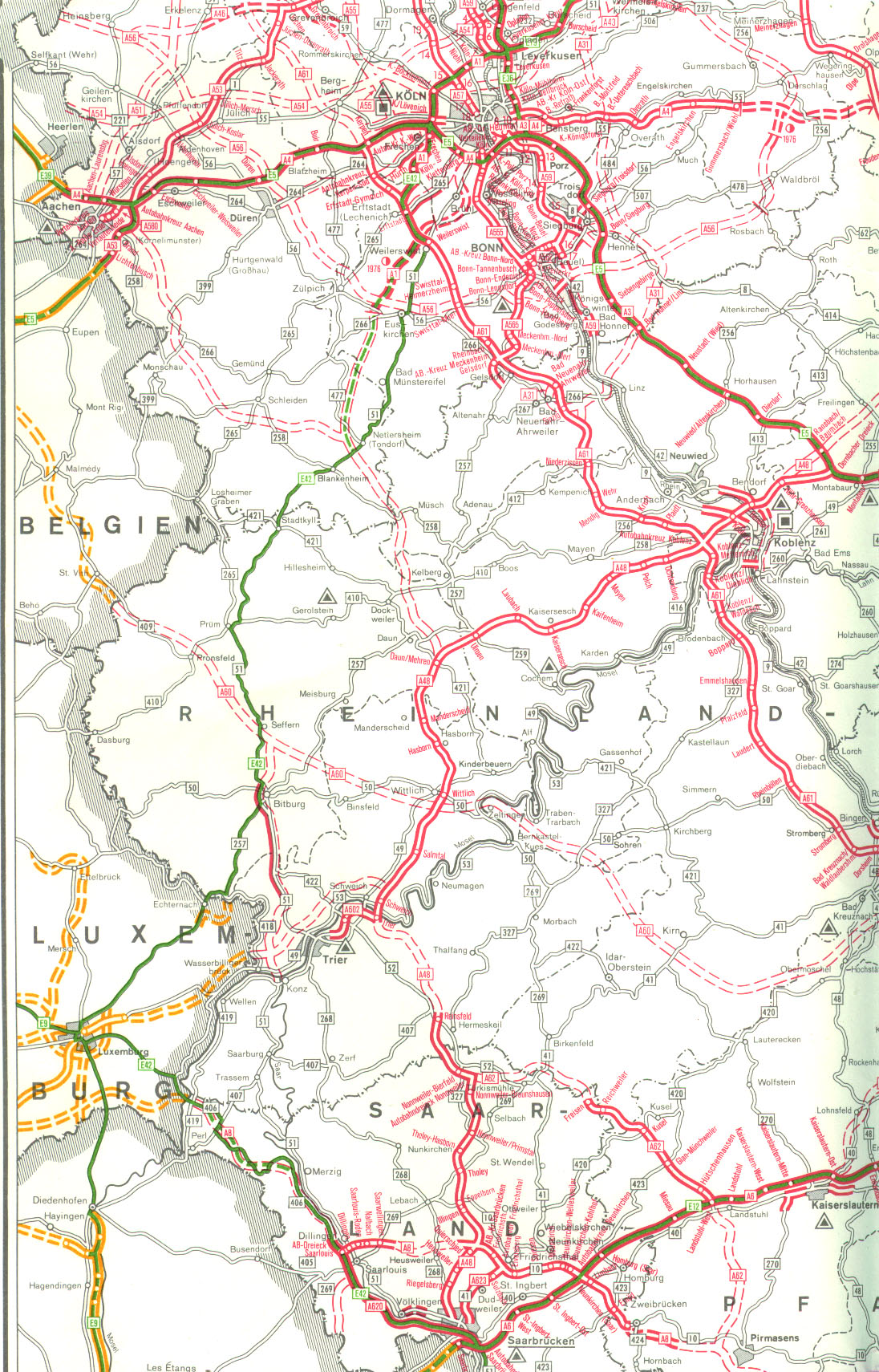
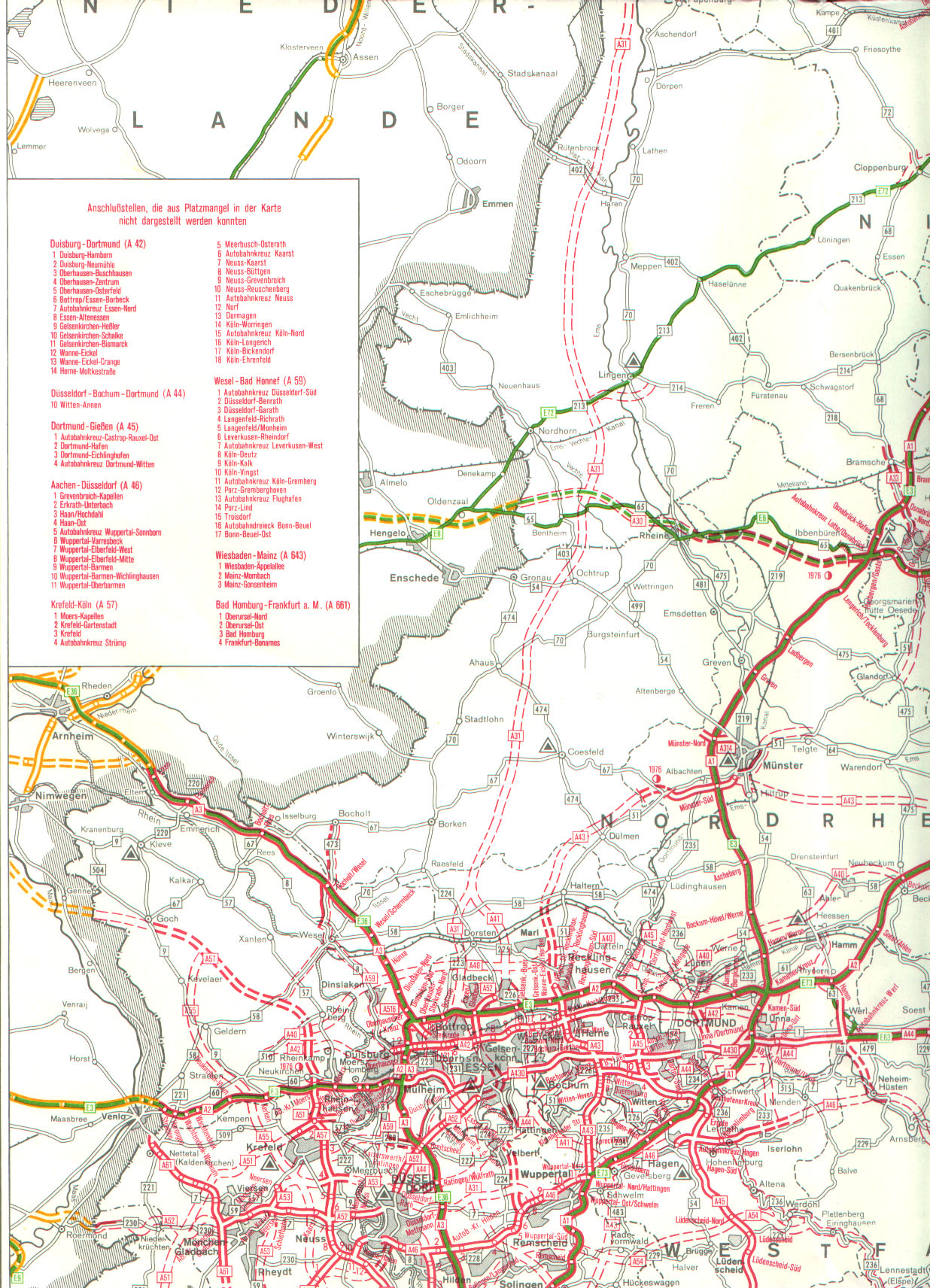
Originally, a federal motorway A 54 (also formerly known in part as A 208) was supposed to run from the Dutch border at Brunssum via Puffendorf , Bergheim , Langenfeld , Solingen , Remscheid , Radevormwald , Halver, Lüdenscheid and Werdohl to Plettenberg in the Sauerland . The crossing point with the then already existing A 45 motorway would have been south of today's exit 13 Lüdenscheid-Nord. Except for two sections, today's A 542 and the state road 141n running through the Solingen city area, the A 54 was never completed.
Train traffic

Halver no longer has its own passenger station since the Wuppertal Railway was shut down . From 1888 to 1949 (in freight traffic: 1952) Halver also had a connection to the Hälvertalbahn of the Altenaer Eisenbahn to Schalksmühle.
The next train station is now in Bruges, from where the Volmetalbahn in the direction of Hagen and Lüdenscheid and the Oberbergische Bahn to Cologne. With the reopening of the Oberbrugge train station, there has been another stop in Halver city area since December 2019.
According to the “Regional Integrated Development and Action Concept Oben an der Volme”, a connection with the Volmetalbahn at the Oberbrügge stop could be made via the Schleifkottenbahn in order to connect the city of Halver directly to the local rail transport .
At the former Halver train station, north of the Kulturbahnhof (former reception building) is the platform, as well as P + R and K + R parking lots and taxi stops. South of the Kulturbahnhof there is a bike station, supplemented by services and offices, in a two-story building.
In September 2012, the administration of the city of Halver offered the 38,000 square meter station property for sale in a detailed exposé. A total of around 4500 square meters are available as retail space on the railway site. This includes around 2000 square meters for a full-range supplier with a beverage store and around 1000 square meters for a discounter. In addition, residential development at the level of Tannenweg through the city of Halver is desirable.
In October 2012 it was announced that in the course of the Regionale 2013, 136,500 euros would go to the city of Halver for the upgrading of the Oberbrügge train station. The upgrading of the station in Oberbrügge is related to the reactivation and expansion of the Volmetalbahn. The Volmetalbahn is to run from Hagen via Schalksmühle, Halver, Kierspe to Meinerzhagen from 2015. From the point of view of the regional planners, the resumption of local rail transport is the most important common focus and also the backbone of a future-oriented, sustainable development in Volmetal. The connection of the four Volmekommunen to the Ruhr area in the north and to the Rhine rail in the south should help to keep the population in the existing places and to bring new residents and tourists to the region.
In order to connect the city of Halver to this Volmeband, a link with the central railway line at the Oberbrügge stop can be made via the Schleifkottenbahn. On behalf of the Zweckverband, Deutsche Bahn AG will equip the former station as a stop with a new platform.
Bus transport
The bus traffic is today mainly carried out by the Märkische Verkehrsgesellschaft (MVG) and the Busverkehr Ruhr-Sieg (BRS) as well as the citizen bus Halver .
The following bus connections exist:
- 55 Lüdenscheid – Halver – Wipperfürth
- 84 Kierspe – Halver – Breckerfeld – Hagen
- 85 Schalksmühle – Halver
- 91 Oberbrügge – Halver – Giersiepen
- 92 Halver – Neuen-Vahlefeld
- 93 Halver – Kirchlöh
- 134 Radevormwald – Halver – Lüdenscheid (BRS)
- N 5 Halver – Deutsches Eck (currently discontinued)
- Other public bus routes exist as a supplement to the regular bus service
Public facilities
There is no hospital in the city of Halver. Halver's medical care is provided by the hospitals in Lüdenscheid, Wipperfürth and Radevormwald.
The Bethanien senior center and the Waldfrieden Halver nursing home are located in the city center . There is also a day care center for the elderly in the Von-Vincke-Straße multi-purpose building (former Catholic elementary school). The local history museum is also housed here.
The former station building was transformed into the “Kulturbahnhof” with a city library, catering and an event hall measuring around 170 square meters.
In Halver, six kindergartens are run by various providers. There are five of them in the city center and one in Oberbrugge. The supporters are the Evangelical and Catholic parishes, the workers' welfare and the DRK.
education
In addition to two primary schools in the main town, there is another one in the district of Oberbrügge .
The Halveraner school center includes a secondary school , which has been running full-time since 2006, a secondary school and the Anne Frank Gymnasium (AFG), all types of schools for secondary level I , and AFG also for secondary level II.
The Eugen-Schmalenbach-Berufskolleg is the commercial school of the Märkisches Kreis and is based in the Ostendorf district.
The music school Volmetal, based in Meinerzhagen, takes care of the musical education in Halver and maintains a district office in Halver. The Volkshochschule Volmetal operates a branch in Halver and provides various offers for adult education.
Personalities
Honorary citizen
According to local law, honorary citizenship of the city of Halver , the ring of honor of the city of Halver , the coat of arms plate or the coat of arms of the city of Halver are awarded to honor deserving personalities . The honorary citizenship includes the awarding of the ring of honor. Heraldic plates or shields are also awarded to long-term council members or long-term members of the volunteer fire department.
Before the guidelines on honoring deserving men and women by the city of Halver came into force in February 1980, the city of Halver had two honorary citizens. The factory owner Hugo Wippermann (1851–1909) became the first honorary citizen in 1908 for the donation of several properties to the municipality of Halver. In 1973, Mayor Ernst Stamm (1898–1976) received honorary citizenship for his work in local politics and special services to the reconstruction. On March 19, 1999, Mayor Günther Vahlefeld received this honor for outstanding service to the general public. The entrepreneur Werner Turck (1932–2015) received honorary citizenship on November 15, 2012 for special services to the well-being and reputation of the city of Halver, as well as his many years of local political activity.
sons and daughters of the town
- Adolf Schönnenbeck (born May 10, 1869 in Stenkenberg; † January 30, 1965 in Waldbröl ), painter and professor at the Art Academy in Düsseldorf
- Ferdinand Bender (born October 24, 1870 - † October 26, 1934), politician, member of the Reichstag (SPD)
- Eugen Schmalenbach (born August 20, 1873 in Schmalenbach; † February 20, 1955 in Cologne ), economist , after whom the local commercial vocational school was named
- Wilhelm Bäumer (born November 17, 1783; † May 13, 1848 in Arnsberg), Protestant theologian of the Reformed Church and Prussian consistorial councilor
Personalities who have worked on site
- Heinz Steguweit (born March 19, 1897 in Cologne , † May 25, 1964 in Halver), writer
- Gerhard Bergmann (born July 25, 1914 in Hagen ; † November 20, 1981 in Esslingen am Neckar ), Protestant theologian and missionary
Personalities who work in the place
- Markus Beyer (* 1967 in Plettenberg ), German children's book author and educator
- Axel Ertelt (born April 3, 1954 in Lüdenscheid ), German non-fiction author
literature
- Peter Bell: Halver through the ages . Wilhelm Bell Jr.
- Pictures and stories from Halver - Volumes I and II . Wilhelm Bell Jr.
- Werner Sinnwell: Between famine and economic miracle . Bell
- Manfred Diezel, Klaus Gutberlet, Julius Krefting, Werner Sinnwell, Hanspeter Winkhaus: Rund ums Hälvertal , Bell Verlag & Medien, Halver 2011
- Justus Schellewald: On the history of Halver , Halver 1902, new edition of the original edition from 1902, HR-Typo Verlag Harald and Heidrun Rediger, Halver 2012
- Werner Sinnwell: Herpine forest outdoor pool. Bell Verlag & Medien Halver 2013
- Werner Sinnwell: The village schools around Halver. Bell Verlag & Medien, Halver 2015
Web links
- Internet presence of the city of Halver
- Halver in the Westphalia Culture Atlas
- Halver - my city in the Sauerland by Axel Ertelt
Individual evidence
- ↑ Population of the municipalities of North Rhine-Westphalia on December 31, 2019 - update of the population based on the census of May 9, 2011. State Office for Information and Technology North Rhine-Westphalia (IT.NRW), accessed on June 17, 2020 . ( Help on this )
- ↑ Numbers and data from the city of Halver ( Memento of the original from August 10, 2011 in the Internet Archive ) Info: The archive link was inserted automatically and has not yet been checked. Please check the original and archive link according to the instructions and then remove this notice.
- ↑ Manfred Sönnecken: Finds from the Middle Stone Age in the Märkisches Sauerland, Balve 1985
- ^ Manfred Sönnecken: Prehistory and early history in the Lüdenscheid district. In: home chronicle of the Lüdenscheid district. Cologne 1971, p. 22 ff.
- ↑ Johann Georg von Viebahn : Local and distance table of the government district Arnsberg, arranged according to the existing state division, with details of the earlier areas and offices, the parish and school districts and topographical information. Ritter, Arnsberg 1841.
- ↑ Royal Statistical Bureau (Prussia) (ed.): Community encyclopedia for the province of Westphalia, based on the materials of the census of December 1, 1885 and other official sources, (community encyclopedia for the Kingdom of Prussia, Volume X), Berlin 1887.
- ↑ Stephanie Reekers: The regional development of the districts and communities of Westphalia 1817-1967 . Aschendorff, Münster Westfalen 1977, ISBN 3-402-05875-8 , p. 240 .
- ↑ By Claudia Homuth: There have been Catholic pastors in Halver for 100 years. May 6, 2012, accessed on May 21, 2020 (German).
- ↑ City history. In: halver.de. Retrieved December 7, 2015 .
- ↑ Churches and religious communities. In: halver.de. Retrieved December 7, 2015 .
- ↑ City of Halver Figures and Statistics Current population figures on December 31, 2019 , accessed on July 14, 2020.
- ↑ City of Halver Figures and Statistics Accessed on July 27, 2019.
- ↑ Martin Bünermann: The communities of the first reorganization program in North Rhine-Westphalia . Deutscher Gemeindeverlag, Cologne 1970, p. 75 .
- ↑ Numbers & Statistics. In: halver.de. Retrieved January 18, 2017 .
- ↑ Halver - Rstswahl 2014
- ↑ City arms. In: halver.de. Retrieved December 7, 2015 .
- ↑ Landesbetrieb IT.NRW: Kommunalprofil Halver (p. 15) Accessed on July 28, 2019.
- ↑ Brochure World Market Leader and Industry Best Performances from South Westphalia , 5th expanded edition, August 2018, pp. 103, 112, 171 Accessed July 28, 2019.
- ↑ Company register: Turck Holding GmbH (register information / consolidated financial statements) Retrieved on July 28, 2019.
- ↑ City of Halver: Economic development for the new industrial area Susannenhöhe. Accessed on July 28, 2019.
- ↑ Article from the Westfälische Rundschau from March 8, 2012: "Planning Committee - Compensation for Commercial Space"
- ↑ Article from the Allgemeine Anzeiger from January 10, 2013: "Heated discussion about the 'Susannenhöhe' industrial estate '"
- ↑ Article from the Westfälische Rundschau from January 10, 2013: "Industrial area - three building requests for Susannenhöhe"
- ^ Map with motorway plans (part 09) from January 1, 1976 from autobahn-online.de
- ↑ Article from the Süderländer Tageblatt of February 13, 2011: "A motorway through the Versetal"
- ^ Map with motorway plans (part 05) from January 1, 1976 from autobahn-online.de
- ↑ Page 121 of the concept "Regional Integrated Development and Action Concept Oben an der Volme" (PDF; 44.3 MB)
- ↑ Page 124 of the concept "Regional Integrated Development and Action Concept Oben an der Volme" (PDF; 44.3 MB)
- ↑ Article from the Allgemeine Anzeiger from September 26, 2012: "City is looking for investors for the railway site"
- ↑ Article from the Westfälische Rundschau dated October 9, 2012: "Funding - Arnsberg turns signal to green"
- ↑ Guidelines on honoring deserving men and women by the city of Halver. (PDF; 231 kB) Accessed December 7, 2015 .
Altena | Balve | Halver | Hemer | Herscheid | Iserlohn | Kierspe | Lüdenscheid | Meinerzhagen | Menden (Sauerland) | Nachrodt-Wiblingwerde | Neuenrade | Plettenberg | Schalksmühle | Werdohl