
Elbląg
| Elbląg | |||
|---|---|---|---|

|
|
||
| basic data | |||
| State : | Poland | ||
| Voivodeship : | Warmian-Masurian | ||
| power : | independent city | ||
| Area : | 83.32 km² | ||
| Geographical location : | 54° 10′ N , 19° 24′ E | ||
| residents : | 118,582 (Dec 31, 2020) |
||
| Zip code : | 82-300 to 82-314 | ||
| Phone code : | (+48) 55 | ||
| License plate : | NO | ||
| economy and transport | |||
| Street : | DK7 ; DK22 | ||
| DW500 | |||
| DW503 | |||
| railway : | Malbork-Olsztyn | ||
| Elbląg–Braniewo (without regular service) | |||
| Nearest international airport : | Gdańsk Lech Wałęsa Airport | ||
| Gmina | |||
| Gmina type: | township | ||
| Surface: | 83.32 km² | ||
| Resident: | 118,582 (Dec 31, 2020) |
||
| population density : | 1423 inhabitants/km² | ||
| Municipality number ( GUS ): | 2861011 | ||
| Administration (Status: 2014) | |||
| Mayor : | Witold Wroblewski | ||
| Address: | ul. Łączności 1 82-300 Elbląg |
||
| Web presence : | www.elblag.eu | ||


Elbląg ( ˈɛlblɔ̃k ), German Elbing , is an independent town in Poland 's Warmian-Masurian Voivodeship near the Baltic Sea coast . It has around 119,750 inhabitants, a port and is the seat of a Roman Catholic diocese .
Geographical location
The city is located on the south-western edge of the Elbląg Heights in the Elbląg lowlands near the confluence of the rivers Elbląg (Elbing) and Nogat in the Vistula Lagoon (Zalew Wiślany). It is about 30 kilometers southwest of Frombork (Frauenburg) , 30 kilometers northeast of Malbork (Marienburg) and about 60 kilometers southeast of Gdańsk (Gdańsk).
Historically, Elbląg is located in the Prussian landscape of Pogesania . This area was part of the Teutonic Order state from the 13th century and was Germanized in the course of the German colonization of the East. Subject in 1466 as part of Prussia's royal portion of the Polish crown, the region passed to Prussia as part of the province of West Prussia in 1772, was annexed to the province of East Prussia in 1922 and passed to Poland in 1945.
story
Hanseatic city in the Teutonic State
_ID_644686.jpg)
In 1237 the Teutonic Order under the Landmeister Hermann von Balk built a fortress near the Drausensee. The city was founded in 1237 as Elbing under the protection of the Teutonic Order by craftsmen and merchants from Lübeck . Initially, a settlement with a grid-shaped road network was laid out. The center formed the later "old market", which was located on the great trade route between Thorn and the Samland. Before 1238 the parish church of St. Nikolai was built. In 1238, Landmeister Hermann von Balk had the Church of Our Lady and a Dominican monastery built. Until 1246, other citizens immigrated, most of whom also came from Lübeck. In 1246 Elbing received city rights according to Lübian law and received the privilege of striking its own coins. In the south of the city, the order castle with a Holy Spirit Hospital was built during the 1240s. In the years 1251 to 1309, the Elbląg Order Castle was the deputy headquarters of the Order State (the headquarters were then Acre and later Venice ) and the seat of the Landmeister of Prussia and the Grand Spittler , at the same time the residence of Bishop Anselm of Warmia , who died here in 1274.
The Church of St. James (branch of the parish church) was built in 1256. The Corpus Christi Church with a leper hospital was built in 1292. Around 1300, the order built the city's fortifications with 14 defensive towers. During this period, Elbląg had grown into a major trading town, acquiring significant trading privileges from the kings of Poland , the dukes of Pomerania , the Scandinavian rulers and even King Philip IV of France. In the 13th century the schola senatoria (council school) was established. founded, and in 1314 the Elbląg city tower was built.

Together with Danzig and Thorn , Elbing developed into one of the leading Hanseatic cities in eastern Central Europe. At the beginning of the 14th century, the city had grown so much that in 1337 the Elbinger Neustadt was laid out outside the gates by the Elbinger Commander Siegfried von Sitten. It had its own council and was governed by the law of Lübeck. On February 25, 1347, Grand Master Heinrich Dusemer granted this new town the privilege.
From 1350 the Elbląg fleet took part in the Hanseatic League ’s battles against Norwegian and Danish pirates in the Baltic Sea. In 1360 the plague raged in Elbing , killing about 13,000 inhabitants (about 90%).
In 1367 Elbing joined the Cologne Confederation with Kulm and Thorn . The Church of Saint Bridget of Sweden was built after 1379. In 1397 the League of Lizards was formed : the revolt of the nobility and the towns against the rule of the order began. After the Battle of Tannenberg , Elbing was occupied by Polish troops for eight weeks. Polish troops besieged the Elbląg order castle in 1414, but without success.
In 1440, the Prussian Hanseatic cities, including Elbing, together with the provincial estates, founded the Prussian League , which was directed against the rule of the order and aimed for autonomous self-government under the suzerainty of the Polish king. In 1452 they got their rights and privileges from Emperor Friedrich III. confirm. In the Thirteen Years ' War of the Prussian Confederation that followed, together with Poland against the Teutonic Order (1453-1466), the citizens of Elbing took part in the siege of the Order's castle by the Poles and destroyed the castle after its capitulation. The ruins of the castle were removed 100 years later. A part still stands today. In 1454, the city paid homage to the Jagiellonian king of Poland, Casimir IV, as its patron. He and his successors upheld all the old privileges and bestowed many new ones on the city. In 1478 the previously independent halves of the old and new town of Elbing merged.
Elbing as a free city republic in Royal Prussia


The Thirteen Years' War ended in 1466 with the Second Peace of Thorn , in which the Order had to give up Pommerellen , the Culmer Land and Ermland , as well as Danzig, Elbing and Marienburg. As royal Prussia , these areas voluntarily submitted to the Polish crown. This resulted in a division of Prussia into a western Polish part and an eastern part of the Teutonic Order, which, however, had to recognize Polish suzerainty. In 1525 the Order's land was converted into the secular Duchy of Prussia . The army of the last grand master , Albrecht von Brandenburg-Ansbach , was still besieging the city of Elbing in 1521, led by Commander Kaspar von Schwalbach. The siege was repelled. Victory Day has for several centuries been celebrated in the city on the first Friday after Laetare Sunday as a "day of joy".
In 1536 the first evangelical grammar school was established by Willem van de Voldersgraft or Wilhelm Fullonius , a religious refugee from The Hague. Christoph Hartknoch described his life or Vita Guilielmi Gnaphei in his Acta Borussica III . The Prussian cities including Elbing are also shown in Hartknoch's works. The rector of the Elbląg Gymnasium had to leave Elbląg by decree of the Catholic Prince-Bishop of Ermland and then became Councilor to Duke Albrecht of Prussia, as well as rector and professor at the University of Koenigsberg. In 1576, King Stephan Báthory confirmed the privilege of the Protestant school, which had an academic claim until Johann Wilhelm Süvern became director in 1803. In 1558, King Sigismund II August granted the Protestant city of Elbing temporary freedom of religion.
However, on the occasion of the establishment of the Union of Lublin at the Lublin Sejm on March 16, 1569 , King Sigismund II was perceived as foreign rule until 1772.
In 1567 the city was able to achieve full religious autonomy and expelled the Jesuits from the city. The Lutherans took over the Nikolaikirche in 1577. Church registers with entries for baptisms, marriages and burials have also existed since that time .
From 1579 the city maintained close trade relations with England , which was able to trade freely in Elbląg. Many English and Scottish merchants settled in Elbląg and became citizens of the city. They organized themselves into the Fellowship of Eastland Merchants . The Church of Scotland established the Brotherhood of the Scottish Nation at Elbing . Family graves named Ramsay, Slocombe could still be found in the St. Mary's Cemetery in Elbing's old town until 1945. Other families from this circle included the Lamberts, Paynes, Lardings, Wilmsons.
The Gdańsk rebellion against King Stephen Báthory of Poland in 1580 was skillfully exploited by the Elbingers, who remained loyal to the king. For Poland, Elbląg now played a key role in overseas trade. The Nogat, which was then deeper than the Vistula estuary near Gdansk, was used to export grain from Poland to Western Europe and, conversely, to import Western luxury goods further to Poland. The city had 30,000 inhabitants in 1594, and the turnover of goods sold by Elbląg merchants in that year reached 1,247,850 thalers , which was high for those times . The parish church was handed over to the Catholic clergy in 1617.
Thirty Years' War and Northern Wars

Around 1620 the city left the Hanseatic League due to its strong trade ties with England . An outbreak of plague followed in 1625, killing 3,608 people. The troops of King Gustav II Adolf of Sweden took the town in 1626 and held it until 1635 as their headquarters in the fight in support of the Evangelicals against the Catholics in the Thirty Years' War . The Swedish king appointed his confidante and imperial chancellor Axel Oxenstierna in Elbing as governor-general for the new Swedish possessions. From 1626 to 1631, in addition to regional business, he also carried out some of his national tasks from Elbing. The approximately 1500 surviving letters by Oxenstierna from Elbing reflect military, regulatory, economic and foreign policy issues of the time. The Swedes took valuables, furniture and books as spoils of war and sent them home.
In 1646, the Elbing town clerk Daniel Barholz documented that the Elbing town council had hired amber lathe operators ( paternoster makers ). Later members of the Barholz family were prominent as city councilors and mayors. The baroque poet Daniel Bärholz also belonged to this family. The processing of amber (Prussian gold), not only for jewelry and church articles, but also as a remedy and for polishing varnish, was an important economic factor at that time. The guild members of the paternoster makers were subject to special laws. In the years 1655 to 1660, during the Second Northern War , Elbing was occupied a second time by Swedish troops under Karl X Gustav . Charles X Gustav proceeded in a similar way to his uncle Gustav Adolf.
The Polish King John II Casimir pledged Elbing and its territory to the Great Elector in the Treaty of Wehlau in 1657 for the sum of 400,000 thalers and also assured him sovereignty over the Duchy of Prussia. When the Polish crown failed to reimburse the above sum, the successor of the Great Elector, Frederick I in Prussia, exercised his right and in 1703 took possession of the Elbląg territory, which consequently became Prussian.
The sizeable income that had previously flowed from the territory to the city was severely curtailed by this step, which led to a paralysis of the economy and a concomitant decline in the city's importance. In addition, the city of Elbing maintained its autonomy, but had to endure multiple occupations in the following decades and had to make the associated contributions. During the Great Northern War , Elbląg was successively occupied by Swedish (1703–1710), Russian (1710–1712) and Saxon (1712) troops. During the Seven Years' War , the city was conquered by Russian troops in 1758 and was occupied until 1762.

The imperial mathematician and geographer Johann Friedrich Endersch completed a map of Warmia entitled Tabula Geographica Episcopatum Warmiensem in Prussia Exhibens in 1755 . This map shows the town and country of Elbląg west of Warmia and every village in the area. The 1755 map also bears the name Prussia Orientalis (in German: East Prussia). Endersch also made an engraving of the sailing ship (Galiot), named D.Stadt Elbing (D=der Bauer), later also known as Die Stadt Elbing , which was built in Elbing in 1738.
In 1772 Elbing became part of the Prussian state as part of the first partition of Poland . Although Elbing lost its urban autonomy and some of the privileges that came with it, the German city's full independence from the Polish crown was now restored.
in the Prussian state

Frederick II supported Elbing with many tax breaks, and trade began to flourish again. In 1807 Napoleon's troops occupied Elbing and within four days forced a contribution of 200,000 thalers. On May 8, 1807, Napoleon I held a large parade of troops in Elbląg. From December 1812 to January 1813, after his failed Russian campaign, the city had to feed 60,000 returning French soldiers, 8,000 officers and 22,000 horses.
After the Stein-Hardenberg administrative reforms , from 1815 Elbing was part of the district of Elbing in the administrative district of Danzig in the province of West Prussia . Elbing remained the administrative seat of this district until 1945, but became an urban district (district-free city) in 1874 and since then has no longer been under the jurisdiction of the district office.
Industrialization and the construction of transport routes determined the fate of the city in the 19th century. In 1828 the people of Elbing commissioned the first steamboat in East Prussia. The Schichau works were founded in 1837 . From 1840 to 1858, the Oberländische Kanal between Deutsch Eylau , Osterode and Elbing was laid out according to plans and under the direction of the Royal Prussian Building Councilor Georg Steenke . On October 23, 1844, the Elbing Baptist Church was founded.
In the 1840s, a secondary school was established in addition to the already existing grammar school . Around the middle of the 19th century, the shipowners represented in the port of Elbląg had 14 merchant ships at their disposal. In 1853 the railway line to Königsberg was completed. From 1858 to 1918 there was a great economic boom in the city. The city had many factories: the Schichau-Werke , which now also manufactured locomotives, among other things, the Loeser & Wolff cigar factory , a large brewery and distillery, a chocolate factory and many other businesses. At the beginning of the 20th century, Elbing had seven Protestant churches, one Catholic church, four prayer houses of various free churches and denominations, and a synagogue .
In the industrial city of Elbing, the SPD always received the majority of votes, in the Reichstag elections of 1912 even 51%. According to the Prussian census of 1905, 94,065 people in the districts of Elbing Stadt and Elbing Land spoke German and 280 people spoke Polish or Kashubian.
Weimar Republic and Third Reich


After World War I , under the terms of the 1920 Treaty of Versailles , Germany had to cede most of West Prussia to Poland for the purpose of establishing the Polish Corridor . At the same time, the ethnically German Free City of Danzig , which was politically dependent on Poland, was formed and also separated from the Reich. The parts of the district of Elbing west of the Nogat fell to the new Free State of Danzig. The city of Elbing was one of the areas that remained with Germany and was annexed to neighboring East Prussia after the dissolution of the province of West Prussia. The newly added West Prussian territories formed the administrative district of West Prussia , the administrative center of which was in Marienwerder , but in which Elbing was the largest city. In 1926 the Pedagogical Academy in Elbing was set up to train elementary school teachers .
The global economic crisis after 1929 had a very unfavorable effect on Elbing's situation. The important bus and truck factory Franz Komnick und Söhne AG went bankrupt in 1930 and was taken over by Büssing AG .
In the years of the Weimar Republic, Elbing was a stronghold of the KPD . The policy of the NSDAP , aimed at Germany's rearmament, brought a great economic upswing for Elbing from 1933, mainly through the expansion of the Schichau works, the construction of an aircraft factory and the opening of many new schools. In 1937 the city had 76,000 inhabitants. After the invasion of Poland in 1939, which returned the territories removed in 1920 to the Reich, Elbing was annexed to the government district of Danzig in the Reichsgau Danzig-West Prussia .
During the Second World War there were five labor camps in Elbing, mainly for forced laborers from Poland , who were subordinate to the Stutthof concentration camp . There were also 15 other forced labor camps in the Elbing district that worked for armaments production.
After a large part of the inhabitants had left Elbląg in January 1945, a siege by the Red Army began around January 23, 1945 . The city with its strategically important location was defended until February 10th. In the end, 60 percent of the city's buildings lay in ruins (a total of 5,255 buildings). All monuments were badly damaged, only six houses in the old town remained standing, including the Kramer guild house and the post office. About 5000 German soldiers fell, many civilians drowned while fleeing the besieged town in the Vistula Lagoon .
Elbing housed book treasures of European importance. The City Archives , which had been founded in the 17th century, contained many valuable parchments from the 13th century and valuable historical collections from the 15th century. The library at the grammar school (15,000 volumes) owned, among other things, a Polish law book from the 13th century, the library at the Nikolaikirche (founded before 1403) 23 old manuscripts and 1,478 old theological works. The library at St. Mary's Church had an outstanding collection of music manuscripts - 520 works from the 16th to the 19th century. The City Library (founded in 1601) had the most valuable collection: 30,000 volumes, including 214 manuscripts, 123 incunabula and 770 maps. The City Museum housed the former library of the Dominicans, including 50 manuscripts and 15 incunabula . All of these book treasures have been missing since 1945.
People's Republic of Poland


By the end of the Second World War, the city had around 100,000 predominantly Protestant residents of German nationality. After the Red Army had conquered Elbląg, it placed it under the administration of the People's Republic of Poland , while all the machines in the factories that had remained undamaged - for example in the Schichau works - were dismantled by 1946 and transported to the Soviet Union as reparations . Kitchen stoves, tiled stoves, bathtubs, Junkers stoves, door locks and door handles from undamaged private homes were also brought there. The first representatives of the Polish authorities appeared in Elbląg in March 1945. The Polish administration introduced the place name Elbląg . Until 1947 , a population exchange took place in Elbing through the expulsion of the local residents, who mainly ended up in the British occupation zone of Germany, and the settlement of Poles , who had been expelled from the former Polish eastern territories in the course of the forced resettlement of Poles in 1944-1946 .
In 1946, the Soviet military authorities handed over the seaport to the Polish city administration. Since the exit to the Baltic Sea at Baltijsk (Pillau) was now under Soviet control, the port could only be used to a very limited extent.
In 1948 the city had 40,000 inhabitants. From 1950 the reconstruction of the Elbląg industry began. The city again became an important center of machine and transport industries, besides, the city has wood, food and textile industries. The city had 81,400 inhabitants in 1962. Many residents of Elbląg, together with citizens of Gdańsk and Szczecin , took part in the uprising against the communist government in Poland in 1970.
The city became the capital of the Elbląg Voivodeship of the same name during the Polish administrative reform in 1970 . The strikes in August 1980 led to the establishment of the free trade union Solidarność with the participation of many residents of Elbląg.
Third Polish Republic

From 1990, the old town was rebuilt using historicist designs such as pointed gables facing the street and half-timbered imitations. After the year 2000, many buildings are again close, but not directly on the Elbląger "Waterkant". In 1992 the city became the seat of the Catholic Diocese of Elbląg , which belongs to the newly created Archdiocese of Warmia . In 1994, the port got back its rights as a seaport with limited usage options, since the exit to the open Baltic Sea continues to run through Russian sovereign territory through the Pillau Depression in the Vistula Spit .
Elbląg lost its rank as the capital of a voivodeship during the administrative reform in 1998, since then it has belonged to the Warmian-Masurian voivodeship administered from Olsztyn (Allenstein) and is again an urban district and the seat of the district administration for the Powiat Elbląski . In 1999 the city received the EU prize for environmental care. In 2000 the city received the international award "European Flag".
demographics
| year | population | Remarks |
|---|---|---|
| 1781 | 15,768 | inhabited by Germans, almost all Protestants, a few Mennonite families, some Catholics in the suburbs |
| 1817 | 18,407 | |
| 1826 | 22.115 | |
| 1831 | 17,761 | in 2,110 residential buildings |
| 1864 | 27,537 | including 456 military personnel |
| 1867 | 28,055 | on December 3 (including 382 military personnel), including 22,010 Evangelicals, 4,973 Catholics, 411 Mennonites and 490 Jews |
| 1875 | 33,520 | |
| 1890 | 41,576 | 32,104 of them Protestants, 8,115 Catholics and 484 Jews |
| 1900 | 52,518 | including 10,235 Catholics and 415 Jews |
| 1910 | 58,636 | on December 1, of which 45,638 Protestants, 10,819 Catholics, 369 Jews, 1,610 others (58,330 with German , 115 with Polish and 1 resident with Kashubian mother tongue, 128 residents speak German and another language); According to other information, 58,636 inhabitants, of which 45,713 are Protestants, 10,940 are Catholics and 371 are Jews |
| 1925 | 67,878 | thereof 54,835 Protestants, 11,755 Catholics, 143 other Christians and 434 Jews |
| 1933 | 72,409 | of which 57,724 are Protestants, 12,308 are Catholics, twenty are other Christians and 357 are Jews |
| 1939 | 83,190 | of which 63,530 are Protestants, 14,418 are Catholics, 624 are other Christians and 48 are Jews |
| 1945 | 22,179 | of which 16,838 Germans, 5,341 Poles (as of November 1, 1945) |
development of the school system
The first schools in Elbląg were founded at the beginning of the 14th century, less than 100 years after the founding of the city in 1237. At first these were community schools, in later years also secular schools, private, municipal or state schools. The first mention of an elementary school in Elbląg was the parish school of St. Nicholas, which was located in the village of Elbląg. The first mention of an elementary school (primary school) in Elbląg, which was the parish school of St. Nicholas, located at today's Rybacka Street 14, dates back to 1310. After the takeover of Elbląg by Prussia in 1772, as a result of the First After the division of Poland, a compulsory elementary school system was introduced, similar to the rest of Germany, which was proclaimed in 1773 by the Prussian King Frederick II. For example, in 1828 in Elbląg there were 19 elementary schools of varying and not very high quality, including 10 public, 7 church and 2 private schools, attended by 1,914 students aged 6 to 12-14 years. At the beginning of the 16th century, the founding of the first Prussian university in Elbing was considered. Mainly because of religious disputes about the foundation and equipment of the university, it was not realized.
elementary schools
In the building of the popular Hala Targowa, the now significantly expanded department store on Gwiezdna Street, was the municipal Margaret School. It was opened on October 10, 1830 and was attended by children from the poorest Elbląg families. The Knights' School was located in the building of today's Surveying and Cartographic Society at 11 Tysiąclecia Avenue. The building of today's Elbląg Diocese Seminary at 10 Bożego Ciała Street housed the Catholic Nicolai School from October 12, 1891. In the building of today's foreign language teachers' college at 22 Czerniakowska Street, built in 1886, was the Luisen Girls' School. In the building of the now defunct branch of the Warmian-Masurian Pedagogical State Library in Olsztyn at 1 Pocztowa Street, next to the 1st general secondary school built in 1886, there was a Hansa school. In the current building of Gimnazjum No. 2 at 173 Robotnicza Street, until recently Elementary School No. 2, built with the sports facilities on Krakusa Street in 1925-1927, there was the Paulus School, which was opened on 20 It was officially opened on December 1927 and renamed the Horst Wessel School in the 1930s.
The monumental, magnificent building of today's Gimnazjum No. 5, until recently Elementary School No. 3 at Agrykola St. 6, was built with the sports facilities of the school in the late 1920s, where the Jahnschule sports elementary school, which was inaugurated on October 10, 1929, took the name of the German sports and gymnastics promoter Friedrich Ludwig Jahn (1778-1852), who was known as the "father of the Gymnastics in Prussia”.
The Truso school was located in the building of today's elementary school No. 4 at 41 A. Mickiewicza Street, built in 1912/13. In the building of today's Humanities University at 197 Robotnicza Street, where elementary school No. 5 was located until the early 1990s, a parish elementary school (Adalbertus School) was built at the end of the 19th century. On the site of today's elementary school No. 7 at Browarna Street. 1, which was built in 1926 and has since been extensively renovated, has housed a primary school for girls since 1873, the Elisabeth School. In the building of today's elementary school No. 8 at Szańcowa Street 2, built in 1891 and heavily reconstructed, the church Marian School was housed
high schools
The best-known educational institution in the former Elbing was the famous Elbinger Gymnasium, founded by Jacob Alexwangen , mayor of Elbing, and Wilhelm van der Voldergraft, a Dutch religious émigré who settled in Elbing in 1531 and became the school's first rector. Originally, the school was housed in the abandoned monastery buildings of the Order of St. Bridget, bought by the Elbląg City Council, and its inauguration took place on September 29, 1535. Then on November 25, 1599 it was moved to a new building, today's seat of the State Museum in Elbląg at Zygmunt II August boulevard 11, where it functioned almost until the end of the 19th century, various vicissitudes and numerous ups and downs lived through and was under the legal and financial protection of the city of Elbląg throughout its existence. It was nationalized on January 1, 1847 and in 1882 it was moved to a new building, the current building of the Second General Gymnasium at 42 Królewiecka Street, where it functioned as the State Gymnasium until 1945. At the school u. a. the famous Bohemian pedagogue and educational reformer Johann Amos Comenius , who stayed in Elbląg in the years 1642–1648. Elbinger Gymnasium was the first secular gymnasium in West Prussia and the second in what is now Poland, after the school in Poznań, which was founded in 1519. Today's Middle School No. 1 at 2 Pocztowa Street was built in 1873–1875 and housed the Higher Girls' School .
teacher seminar
In the current building of the Oskar-Lange business school complex, erected in 1909 at General-J.-Bema-Strasse 50, the Evangelical Pedagogical Teachers' Seminar was housed until 1926. The Pedagogical Academy, the first of its kind in East Prussia, was renamed the College for Teacher Training in 1933.
technical and vocational schools
In the building of today's Mechanical School Complex at 39 JA Komeński Street, built in 1929, there was a Higher School of Practical Farming.
In 1919, a Municipal Vocational School for girls - the Municipal Girls' Vocational School - was opened in the building at today's Zacisze Street 11. Królewiecka 128, built in the years 1926-1929, where the State Vocational School for Housekeeping for Girls and the Higher Vocational School for Girls - Girls' Vocational School, commonly called "Klopsakademie" by the Elbląg residents of that time, were housed. In the building of today's Elbląg Town Hall at 1 Łączności Street, built in 1910–1912, there was a reformed secondary school for men, which was ceremoniously opened on April 17, 1912 and named after Heinrich the Elder von Plauen in 1931 – Reform-Realgymnasium Heinrich von Plauen, which was moved from today's Wapienna Street, the current building of the boarding school, where it functioned since 1837.
On March 15, 1941, the state engineering school named after Ferdinand Schichau was inaugurated in today's police building at Królewiecka Street 106. Because of the ongoing war, operations had to be shut down in 1942 because men studying were sent to the front.
politics
mayor
The city administration is headed by a mayor , who is directly elected by the population. Since 2014 this is Witold Wróblewski.
In the 2018 election, Wróblewski again ran with his own electoral committee, which included the PSL . The SLD also supported him . The voting brought the following result:
- Witold Wróblewski (Witold Wróblewski Electoral Committee) 48.8% of the votes
- Jerzy Wilk ( Prawo i Sprawiedliwość ) 28.7% of the votes
- Michał Missan ( Koalicja Obywatelska ) 19.3% of the vote
- Stefan Rembelski ( Kukiz'15 ) 3.2% of the votes
In the necessary run-off election, Wróblewski prevailed with 72.0% of the votes against PiS candidate Wilk, who was his predecessor as mayor until 2014, and was re-elected.
City council
The city council consists of 25 members and is directly elected. The 2018 city council election resulted in the following:
- Koalicja Obywatelska (KO) 32.1% of the vote, 9 seats
- Prawo i Sprawiedliwość (PiS) 30.0% of the votes, 9 seats
- Election Committee Witold Wróblewski 23.4% of the votes, 6 seats
- Sojusz Lewicy Demokratiecznej (SLD) / Lewica Razem (Razem) 10.0% of the votes, 1 seat
- Kukiz'15 4.5% of the vote, no seat
coat of arms
Blazon : "Parted by silver and gold-barred red, above and below a cross in confused tinctures."
The two paw crosses refer to the founding by the Teutonic Order. Silver and red are also the colors of the “mother city” of Lübeck. The lower net probably stands for fishing.
The surviving bronze stamp of the SIGILLVM BVRGENSIVM IN ELVIGGE used in 1242 shows a cog steered to the left by a skipper on waves, with a small cross floating above it. The silver stamp of the second great seal is also still there; here the small cross is in the flag, while the third ship's seal (15th century) shows the two crosses in it, which the decree of the 14th century already shows in the triangular shield and which all later seals contain.
town twinning
Elbląg has partnerships with 14 towns and villages:
- Empty , Germany
- Kaliningrad , Russia
- Baltiysk , Russia
- Bremerhaven , Germany
- Ronneby , Sweden
- Druskininkai , Lithuania
- Liepāja , Latvia
- Navurudak , Belarus (Belarus)
- Ternopil , Ukraine
- Compiegne , France
- Trowbridge , United Kingdom
- Coquimbo , Chile
- Baoji , People's Republic of China
- Tainan , Republic of China (Taiwan)
buildings
Municipal and civic buildings and monuments
- Some surviving or reconstructed town houses with Gothic, Renaissance and Baroque ornaments (14th to 17th centuries)
- Market Gate (Gothic, 1314)
- Gothic store
- Fragments of the Gothic buildings of the castle forecourt and the city wall (both 13th century)
- Former high school (1599, rebuilt 1808/09), today Archaeological Museum, previously Brigitte Monastery
- Monument to the victims of the 1970 anti-communist uprising
churches
_ID_644706.jpg)

- Cathedral of St. Nikolai (Gothic, 13th-15th century, rebuilt in the 18th century; picture above)
- former St. Mary's Church (13th-16th centuries), rebuilt 1960-1982, since the 21st century art gallery Galeria EL , belonged to the Dominican monastery
- Church of the Holy Corpse (Gothic, around 1400), center of Christian culture
- Church of the Holy Spirit , with hospital (Gothic, 14th century), used as the city library
- Former Mennonite Church (1590), art gallery
- Dorotheenkirche, half-timbered building, around 1705, baroque
- Church of the Good Shepherd
- Church of the Elbląg Baptist Congregation
Not far from town
- Schlosshotel Cadinen, Polish Kadyny near Tolkemit , until 1945, since 1899 owned by the Prussian royal family. The emperor's grandson and later head of the House of Hohenzollern , Prince Louis Ferdinand of Prussia , spent the war years here with his family. The majolica factory founded by the last Kaiser Wilhelm II is back in operation.
- Truso am Draussensee, settlement from the 8th/9th c. century (replica)
transport and economy
road traffic
Until 1945, Reichsstrasse 1 ran through the city, on whose route today Droga krajowa 22 , Droga wojewódzka 500 and Droga wojewódzka 504 are laid out.
Elbląg is located on the Droga krajowa 7 (former German Reichsstrasse 130 ) ( Gdańsk – Warsaw ) and 22 (former Reichsstrasse 1 ) to Gorzów Wielkopolski (Landsberg an der Warthe) and Kaliningrad (Königsberg (Prussia) ) respectively .
railroad

Elbląg has a station on the Malbork–Braniewo (Marienburg–Braunsberg) railway line , the former Prussian Eastern Railway . In Elbląg begins the largely disused Elbląg–Braniewo railway , the former Haffuferbahn , and the Elbing–Miswalde railway , which has been disused since 1945 .
air traffic
Elbląg Airport is a commercial airfield in the Nowe Pole (Neustädterfeld) district . The nearest international airport is Gdańsk Lech Wałęsa Airport .
ship traffic
In June 2006, a new seaport on the Elbląg River was put into operation for shipping traffic, in which up to 750,000 tons of goods can be transhipped annually. The port is also intended for passenger and car ferry traffic on the Baltic Sea. Furthermore, the marina was modernized. However, Elbląg does not have free access to the Baltic Sea, the shipping route leads via the Vistula Lagoon (Polish Zalew Wislany , Russian Kaliningradski Zaliw ) through Russian sovereign waters ( Kaliningrad Oblast ). In May 2006, this route was closed to international traffic by the Russian side. In order to avoid this problem, the canal is being built through the Vistula Spit .
From the beginning of 2011, after five years without shipping, Russian cargo ships started calling at the port again.
Industry
The former Schichau works were renamed ELZAM in 1945 and have belonged to the Asea-Brown-Boveri group (then Alstom , today General Electric ) since 1990. The company produces turbines and electric motors. The Elbrewery Brewery ( EB brand ) is the city's second largest employer. In addition, the city has important transport equipment factories, a shipyard, and dairy, meat, leather, textile and furniture industries have settled here.
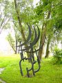
art in public space
Residents and visitors of the city encounter sculptures by Polish and international artists on streets and squares. Since the first Biennial of Spatial Forms took place in 1965, numerous lasting works have emerged that help shape the cityscape of Elbląg.
The most prominent participant in the first Biennale was Magdalena Abakanowicz with the steel sculpture Standing Shape . In 1973 the exhibitions came to an end. It's been around since 1986.
The Galeria-EL (Pani Marii), which is located in the building of the former St. Mary's Church, the oldest church in Elbląg, plays an important role in the implementation of the Biennale . This was built in the 13th century as a church building for the Dominican order. An evangelical church until 1945, it was no longer used as a church after 1945. The city administration has set up an art gallery here, in which pictures and sculptures by contemporary artists are shown, which are exhibited next to preserved tombstones and epitaphs from St. Mary's Church and commemorate the merits of former noble and merchant families, city patricians and clergymen.

Sculpture by Julian Boss-Goslawski (* 1926) in front of the EL

Sculpture by Antoni Starczewski (1924–2000)
Stanislaw Sikora (1911–2000): At Sea

Jan Eric Visser (* 1962): Crusader head in the courtyard of the library


education and sports
The following educational institutions operate in Elbląg (as of the 2010s):
- State University of Applied Sciences in Elbląg (Państwowa Wyższa Szkoła Zawodowa w Elblągu) with the departments of economics, application-oriented computer science, educational sciences and modern languages as well as technical sciences. In the ranking of the national daily newspaper Rzeczpospolita , it is one of the best universities of applied sciences in the country (2005: first place, 2006: third place).
- Higher Seminary
- University of Humanities and Economics (EUHE)
- Branch of Bogdan Jański University of Economics in Warsaw
The football club Olimpia Elbląg plays in the second Polish league.
personalities
honorary citizen
1800-1945
Since 1946
rural community
The city is the administrative seat of the rural municipality of Elbląg, but does not belong to it as an independent municipality. The rural municipality of Elbląg is part of the powiat Elbląski (Elbing district) and forms a belt around the independent city of Elbląg. The community has 7,239 inhabitants (30 June 2014) on an area of 191 km² and is divided into 37 localities, 24 of which have a mayor's office .
Partner communities of the Gmina Elbląg are Barßel in Lower Saxony since 2001 and Chechelnyk in the Ukraine since 2004.
See also
- Próchnik , village in Elbląg urban area
literature
In order of appearance
- Alexander Nicolaus Tolckemit : Elbingscher teacher memory, that is: Life and writings of all evangelical teachers who have taught since the Reformation in all churches, as well as at the Gymnasio in Elbing, together with an appendix from the Elbingers who are in teaching offices abroad and a message from the Elbingsche Medicis and Physicis, ... scribe, Danzig 1753 ( digital copy of the SUB Göttingen ).
- Johann Friedrich Goldbeck : Complete Topography of the Kingdom of Prussia . Part II, Marienwerder 1789, pp. 14–16 .
- Michael Gottlieb Fuchs : Description of the city of Elbing and its area in topographical, historical and statistical terms . Volume 1, Elbing 1818 , Volume 2, Elbing 1821 , Volume 3, First Division, Elbing 1826 , Volume 3, Second Division, Elbing 1827 , Volume 3, Third Division, Elbing 1832 .
- August Eduard Preuss : Prussian country and folklore or description of Prussia. A manual for the elementary school teachers of the province of Prussia, as well as for all friends of the fatherland . Bornträger Brothers, Königsberg 1835, pp. 447–454, no. 62.
- The city of Elbląg. wish for jubilee celebration . In: Prussian provincial sheets , volume 17, Königsberg 1837, pp. 164-170 .
- Friedrich August Voßberg : Coins and seals of the Prussian cities of Danzig, Elbing, Thorn, as well as the dukes of Pomerellen in the Middle Ages. With many coin and seal illustrations . Berlin 1841 ( digital copy ).
- Heinrich Gottfried Philipp Gengler : Codex iuris municipalis Germaniae medii aevi. Regesta and documents on the constitutional and legal history of German cities in the Middle Ages . Enke, Erlangen 1863, p. 709 ( digital copy ).
-
Max Toeppen : Elbląg antiques. A contribution to the history of urban life in the Middle Ages ( links to digital copies );
- First issue, Danzig 1871 ( Google ),
- Second issue, Danzig 1872 ( Google ),
- Third Issue, Danzig 1873 ( Kujawsko-Pomorska Digital Library ).
- Max Toeppen: History of the spatial spread of the city of Elbing with special reference to its fortifications and its most important buildings . In: Journal of the West Prussian Historical Society , Issue XXI. Th. Bertling, Danzig 1887, pp. 1–142 ( digital copy ).
- Max Toeppen: The Elbinger historians and historians presented in a critical overview. In: Journal of the West Prussian Historical Society, Issue XXXII. Gdansk 1893 ( digital copy ).
- Elbing (encyclopedia entry). In: Meyer's Large Conversational Lexicon . 5th edition, volume 5, Leipzig/Vienna 1906, p. 596 .
- Theodor Lockemann (arr.): Elbing . Deutscher Architektur- und Industrie-Verlag (DARI), Berlin-Halensee 1926 ( Germany's urban planning ; digital copy ).
- Edward Carstenn : History of the Hanseatic City of Elbing . 2nd Edition. Publisher of Leon Sauniers bookstore, Elbing 1937.
- Kurt Dieckert , Horst Grossmann : The fight for East Prussia . Munich 1960, ISBN 3-87943-436-0 , pp. 105–109.
- 750 years of Elbląg. Order and Hanseatic city - industrial and university city. Publication series of the West Prussian State Museum 18 (1987) [Catalogue of the exhibition April 11, 1987 – September 20, 1987].
- Hans-Jürgen Schuch: Elbing. From 750 years of history of the religious, Hanseatic and industrial city . Westkreuz-Verlag, Berlin / Bonn / Bad Münstereifel and others 1989, ISBN 3-922131-65-4 ( East German Town Pictures 5).
- Werner Neugebauer , Jürgen Udolph : Elbing. In: Real Lexicon of Germanic Archeology (RGA). 2nd Edition. Volume 7, Walter de Gruyter, Berlin/New York 1989, ISBN 3-11-011445-3 , pp. 115-127.
- Bernhard Jähnig , Hans-Jürgen Schuch (eds.): Elbing 1237–1987 . Contributions to the Elbing Colloquium in November 1987 in Berlin. Nicolaus-Copernicus Verlag, Münster 1991, ISBN 3-924238-14-6 ( sources and descriptions of the history of West Prussia 25).
-
Historia Elblaga . 6 volumes. Gdansk 1993-2006
- Stanisław Gierszewski, Andrzej Groth (eds.): Historia Elbląga . Vol. 1: do 1466r. Wydawnictwo Marpress, Gdansk 1993, ISBN 83-85349-25-1 .
- Andrzej Groth (ed.): Historia Elbląga . Vol 2.1: 1466–1626 . Wydawnictwo Marpress, Gdansk 1996, ISBN 83-85349-67-7 .
- Krystyna Greczychom (arr.): Historia Elbląga . Vol. 6: Bibliografia Elbląga . Wydawnictwo Marpress, Gdansk 2006, ISBN 83-89091-75-5 .
- Hans-Joachim Pfau: Elbing: seal, coat of arms, flags, 1999, ISBN 3-00-004958-4 ; Coins and Medals, 2000, ISBN 3-00-005173-2 ; Harry Schultz, Volumes 1+2, 2003/2005, ISBN 3-00-012538-8 , ISBN 3-00-016136-8 .
- Matthias Blazek: "How beautiful you are!" West Prussia - The country on the lower Vistula . Stuttgart 2012, ISBN 978-3-8382-0357-7 .
- Fridrun Freise: Elbing . In: Wolfgang Adam, Siegrid Westphal (eds.): Handbook of Early Modern Cultural Centers , Vol. 1. Berlin 2012, pp. 467–497 .
web links
- City website
- hans-pfau-elbing.de Extensive German-language site about Elbing and the surrounding area
- Current pictures and short history of Elbing as a city of the Teutonic Order
- Historical recordings
- Church book films since 1577 of the inhabitants of Elbing
- Report of the expulsion and escape after the Second World War
- Municipal register 1939
itemizations
- ↑ a b Population. Size and Structure by Territorial Division. As of December 31, 2020. Główny Urząd Statystyczny (GUS) (PDF files; 0.72 MB), accessed 12 June 2021 .
- ↑ a b Johann Friedrich Goldbeck : Complete topography of the Kingdom of Prussia . Part II, Marienwerder 1789, pp. 14–16 in Google book search.
- ↑ Johannes Voigt : History of Prussia, from the earliest times to the fall of the rule of the Teutonic Order , 2nd volume: The time from the arrival of the order to peace in 1249. Königsberg 1827, p. 290 in Google book search.
- ↑ Max Toeppen : Historical-Comparative Geography of Prussia. Gotha 1858, pp. 187–195 in Google book search.
- ↑ a b L. Wiese: The higher school system in Prussia. Historical-statistical representation. Berlin 1864, pp. 71-75.
- ↑ Hans Prutz : History of the Neustadt district in West Prussia . Danzig 1872, p. 104 .
- ↑ A. Reusch: West Prussia under Polish sceptre. Speech held at the Elbinger Gymnasium on September 13th. 1872 . In: Old Prussian Monthly , NF, Volume 10, Königsberg 1873, pp. 140–154, especially p. 146 .
- ↑ Hans Prutz , p. 104 ff.
- ↑ Historical view from 1729: Delineatio Geometrica Civitatis Elbingensis in Borussia Regali à Sereniß. Suecorum Rege Gustavo Adolpho Magno Munitae Ano. 1629 and Sera. Suco-Gothorum Regi Carolo Gustavo deditae 10 Decemb. 1655 . ( urn : nbn:de:hbz:061:1-123273 )
- ↑ Gustav Adolf Harald Stenzel : History of the Prussian State: From 1688 to 1739 , Gotha 1841, p. 83.
- ↑ Hartmut Boockmann : German history in Eastern Europe. East Prussia and West Prussia. Berlin 1992, p. 291.
- ↑ Fridrun Freise : Elbing . In: Wolfgang Adam, Siegrid Westphal (eds.): Handbook of Early Modern Cultural Centers , Vol. 1, Berlin 2012, p. 471.
- ↑ Endersch map of Warmia
- ↑ Albert Reusch : West Prussia under Polish sceptre. Speech held in the Elbinger Gymnasium on September 13th. 1872 . In: Old Prussian Monthly . Volume 10, Königsberg 1873, pp. 140–154.
- ↑ E. Wendt & Co. (ed.): Overview of the Prussian Merchant Navy . Stettin January 1848, p. 9 ( online [accessed 4 June 2015]).
- ↑ a b Meyers Large Conversation Lexicon . 5th edition, volume 5. Leipzig/Vienna 1906, p. 596 ( online at Zeno.org ).
- ↑ Hans-Werner Hoppe: The Pedagogical Academy Elbing 1926-1945. In: Udo Arnold (ed.): Prussia as a university landscape in the 19./20. Century. Nordostdeutsches Kulturwerk, Lüneburg 1992, pp. 105-122, 143-150.
- ↑ Alexander August Mützell, Leopold Krug : New topographical-statistical-geographical dictionary of the Prussian state . Volume 1: A-F. Halle 1821, p. 334, number 671.
- ↑ a b August Eduard Preuss : Prussian country and folklore . Königsberg 1835, p. 447 ff.
- ↑ H. Oelrichs: The government district of Danzig since 1816 . In: New Prussian provincial sheets . fourth episode. Volume 5, Königsberg 1868, p. 299.
- ↑ CE Rhode: The Elbinger circle in topographical, historical and statistical terms. In addition to 7 maps on 2 sheets. A. W. Kafemann, Danzig 1871, p. 155.
- ↑ Gustav Neumann: Geography of the Prussian State . 2nd edition, volume 2, Berlin 1874, pp. 42-43, number 4.
- ↑ a b c d e Michael Rademacher: German administrative history from the unification of the Reich in 1871 to the reunification in 1990. elbing.html. (Online material for the dissertation, Osnabrück 2006).
- ↑ Royal Prussian State Statistical Office: Community encyclopedia of the administrative districts of Allenstein, Danzig, Marienwerder, Posen, Bromberg and Oppeln. Based on the census of December 1, 1910 and other official sources . Issue 2: Province of West Prussia, District of Danzig . Berlin 1912, pp. 18–19, paragraph 1 below: Elbing .
- ↑ Meyer's local and traffic lexicon of the German Reich. 5th edition. Bibliographic Institute, Leipzig/Vienna 1912, p. 424 ( online on Meyers Gazetteer ).
- ↑ Sylwia Bykowska: The Rehabilitation and Ethnic Vetting of the Polish Population in the Voivodship of Gdańsk after World War II . Peter Lang Publishing Group , 2020, ISBN 978-3-631-67940-1 , pp 116 (English).
- ↑ Result on Electoral Commission website, accessed 7 August 2020.
- ↑ Result on Electoral Commission website, accessed 5 August 2020.
- ↑ Erich Keyser : German town book - handbook of urban history, Volume I Northeast Germany. W. Kohlhammer Verlag, Stuttgart 1939, pp. 42-47.
- ↑ Jens Stüben: Elbing/Elbląg . In: Online encyclopedia on the culture and history of the Germans in Eastern Europe , 2013. (as of February 4th, 2015). Retrieved September 24, 2019.
- ↑ Otto Hupp : German coat of arms . Coffee Trading Company , Bremen 1925.
- ↑ The buildings of Elbing. In: Central Journal of the Building Administration , 1885, p. 423; accessed November 6, 2020.
- ↑ GOV: Neustädterfeld, Nowe Pole, Elblag-Nowe Pole
- ↑ Goods traffic across the Haff , Preußische Allgemeine Zeitung / episode 17-11 of April 30, 2011
- ↑ See http://www.gminaelblag.pl/wspol.php
Urban districts: Olsztyn | Elbląg | Insterburg | Koenigsberg i. Pr | Memel | Tilsit
Counties: Olsztyn | Angerapp (Darkehmen) | Angerburg | Bartenstein (Friedland) | Braunsberg | Darkehmen (Angerapp) | Ebenrode (Stallupönen) | Elkniederung (lowland) | Fischhausen | Friedland (Bartenstein) | Gerdau | Goldap | Gumbinnen | Heiligenbeil | Heilsberg | Heyde mug | Insterburg | Johannesburg | Koenigsberg | Labia | soldering | Lyck | Memel | Mohrungen | Neidenburg | Niederung (elk lowland) | Oletzko (Treuburg) | Ortelsburg | Osterode | Pillkallen (Schloßberg (Ostpr.)) | Prussian Eylau | Prussian Holland | Ragnite | Rastenburg | Rössel | Samland | Schloßberg (East Pr.) (Pillkallen) | Sensburg | Stallupönen (Ebenrode) | Tilsite | Tilsite-Ragnit | Treuburg (Oletzko) | Wehlau
1922-1939 affiliated circles: Elbing | Marienburg | Marienwerder | Rosenberg | Stuhm
1939-1945 affiliated counties: Mackeim | Mielau | Ostenburg | Ploehn | poga | Praschnitz | Sharp Meadow | Schrottersburg | Sichelberg | Sudauen | Zichenau


Independent cities: Elbląg (Elbing) | Olsztyn _
Districts: Bartoszyce (Bartenstein) | Braniewo | _ Działdowo (Soldau) | Elbląg (Elbing) | Elk (Lyck) | Giżycko | _ Goldap (Goldap) | Iława (German Eylau) | Kętrzyn | _ Lidzbark (Heilsberg) | Mrągowo (Sensburg) | Nidzica (Neidenburg) | Nowe Miasto (Neumark) | Olecko (Treuburg) | Olsztyn (Solitary Stone) | Ostróda (Osterode in Ostpr.) | Pisz (Johannisburg) | Szczytno (Ortelsburg) | Wegorzewo (Angerburg)