Dours
| Dours | ||
|---|---|---|

|
|
|
| region | Occitania | |
| Department | Hautes-Pyrénées | |
| Arrondissement | Tarbes | |
| Canton | Les Coteaux | |
| Community association | Coteaux du Val d'Arros | |
| Coordinates | 43 ° 18 ′ N , 0 ° 8 ′ E | |
| height | 244-343 m | |
| surface | 4.99 km 2 | |
| Residents | 223 (January 1, 2017) | |
| Population density | 45 inhabitants / km 2 | |
| Post Code | 65350 | |
| INSEE code | 65156 | |
Dours is a French commune in the department of Hautes-Pyrénées in the region Okzitanien in previous Pyrenees . It has 223 inhabitants (as of January 1, 2017) who call themselves "Doursois (es)".

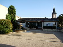
Mairie from Dours
geography
Dours is about ten kilometers northeast of the city of Tarbes . In the south is the municipality of Sabalos .
history
The municipality used to be called Dours en Bigorre .
Demographics
| year | 1962 | 1968 | 1975 | 1982 | 1990 | 1999 | 2016 |
|---|---|---|---|---|---|---|---|
| Residents | 170 | 173 | 141 | 143 | 141 | 183 | 226 |
Web links
Commons : Dours - collection of images, videos and audio files
Individual evidence
