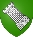
Tournay
| Tournay | ||
|---|---|---|

|
|
|
| region | Occitania | |
| Department | Hautes-Pyrénées | |
| Arrondissement | Tarbes | |
| Canton | La Vallée de l'Arros et des Baïses (main town) | |
| Community association | Coteaux du Val d'Arros | |
| Coordinates | 43 ° 11 ′ N , 0 ° 15 ′ E | |
| height | 249-511 m | |
| surface | 14.32 km 2 | |
| Residents | 1,209 (January 1, 2017) | |
| Population density | 84 inhabitants / km 2 | |
| Post Code | 65190 | |
| INSEE code | 65447 | |
 Place d'Astarac |
||
Tournay is a French commune in the department of Hautes-Pyrénées in the region Occitania . It is located in the Arrondissement of Tarbes and is the capital of the canton of La Vallée de l'Arros et des Baïses .
geography
Tournay has 1209 inhabitants (as of January 1, 2017) on 14.32 square kilometers and is located about 14 kilometers east-southeast of Tarbes in the former county of Astarac am Arros . The Autoroute A64 (junction 14 - Tournay) leads through the municipality . Tournay train station is on the Toulouse – Bayonne railway line .
history
It is unclear whether the name of the place is derived from an Aquitaine tribe ( Tornaten ). Tournay was built as a bastide in 1307 by the Seneschal Bohemond d'Astarac. Tournay was destroyed in the Huguenot Wars . In 1632 there was a plague epidemic . From 1951 to 1958, the Notre-Dame de Tournay Benedictine abbey was built in a bend in the Arros river.
Population development
- 1962: 1.136
- 1968: 1,076
- 1975: 1.161
- 1982: 1,065
- 1990: 1.109
- 1999: 1,142
- 2006: 1,237
- 2010: 1,310
Attractions
The Benedictine abbey and the Saint-Étienne church should be highlighted among sacred buildings.
Community partnerships
Tournay maintains an intra-French partnership with the municipality of La Vraie-Croix in the Morbihan department .
Personalities
- Francis Jammes (1868-1938), poet
- Marc Baget (* 1984), rugby player

