Lizos
| Lizos | ||
|---|---|---|

|
|
|
| region | Occitania | |
| Department | Hautes-Pyrénées | |
| Arrondissement | Tarbes | |
| Canton | Les Coteaux | |
| Community association | Coteaux du Val d'Arros | |
| Coordinates | 43 ° 16 ' N , 0 ° 9' E | |
| height | 311-409 m | |
| surface | 1.73 km 2 | |
| Residents | 117 (January 1, 2017) | |
| Population density | 68 inhabitants / km 2 | |
| Post Code | 65350 | |
| INSEE code | 65276 | |
| Website | Lizos | |
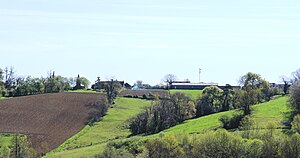
 Lizos - town view |
||
Lizos ( Occitan Lidòs ) is a southern French municipality with 117 inhabitants (as of January 1, 2017) in the center of the Hautes-Pyrénées department in the Occitania region .
Location and climate
The municipality of Lizos is located in the foothills of the Pyrenees at an altitude of around 360 m . The nearest town, Tarbes , is just under 8 km southwest. The climate is temperate to warm; Rain (approx. 840 mm / year) falls mainly in the winter half-year.
Population development
| year | 1800 | 1851 | 1901 | 1954 | 1999 | 2016 |
|---|---|---|---|---|---|---|
| Residents | 78 | 138 | 106 | 64 | 78 | 112 |
Because by the phylloxera crisis in the wine sector and the increasing mechanization of agriculture caused rural exodus , the population of the municipality continuously declined since the mid-19th century. The proximity to the city of Tarbes triggered a new population growth around the year 2000.
economy
The community is almost exclusively agriculturally oriented.
history
The place name Loit or Loid was first mentioned in a document in the 13th century. From the Middle Ages until the beginning of the French Revolution , the municipality was part of the historic Bigorre province .
Attractions
The Église Saint-Michel is a rather squat building from the 19th century.

