Aureilhan (Hautes-Pyrénées)
| Aureilhan | ||
|---|---|---|

|
|
|
| region | Occitania | |
| Department | Hautes-Pyrénées | |
| Arrondissement | Tarbes | |
| Canton | Aureilhan (main town) | |
| Community association | Tarbes-Lourdes-Pyrénées | |
| Coordinates | 43 ° 15 ′ N , 0 ° 6 ′ E | |
| height | 284-385 m | |
| surface | 9.44 km 2 | |
| Residents | 7,745 (January 1, 2017) | |
| Population density | 820 inhabitants / km 2 | |
| Post Code | 65800 | |
| INSEE code | 65047 | |
| Website | http://www.ville-aureilhan.fr/ | |
Aureilhan is a French commune in the department of Hautes-Pyrénées in the region Occitan (previously Midi-Pyrénées ). It is located in the Arrondissement of Tarbes , about 2.5 kilometers northeast of the city center of Tarbes and is the main town ( chef-lieu ) of the canton of Aureilhan .
Aureilhan has 7745 inhabitants (as of January 1, 2017) on 9.44 square kilometers and is located on the Adour .
An early Gallo-Roman settlement is proven by archaeological finds. The Order of Malta maintained a here Coming .
Attractions
- Saint-Gérin church
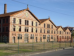
- Industrial monument Usine de céramique Oustau from 1873 ( Monument historique ) with the Villa Oustau
sons and daughters of the town
- Pierre Guichot (* 1963), fencer
- Jean Glavany (* 1949), politician, former Minister of Agriculture
- Christian Laborde (* 1955), writer
- Laurence Oustau (1835–1929), industrialist
Twin town
- Alfaro in the Spanish region of La Rioja (since 1981)
Web links
Commons : Aureilhan - collection of images, videos and audio files

