
Azereix
|
Azereix Asereish |
||
|---|---|---|
.svg)
|
|
|
| region | Occitania | |
| Department | Hautes-Pyrénées | |
| Arrondissement | Tarbes | |
| Canton | Ossun | |
| Community association | Pays de Trie et Magnoac | |
| Coordinates | 43 ° 13 ′ N , 0 ° 0 ′ W | |
| height | 325-463 m | |
| surface | 15.2 km 2 | |
| Residents | 986 (January 1, 2017) | |
| Population density | 65 inhabitants / km 2 | |
| Post Code | 65230 | |
| INSEE code | 65057 | |
| Website | http://www.azereix.fr/ | |
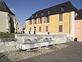
.JPG) Town hall (Mairie) of Azereix |
||

Azereix ( Occitan : Asereish ) is a French commune with 986 inhabitants (as of January 1, 2017) in the Hautes-Pyrénées department in the Occitania region ; it belongs to the Arrondissement of Tarbes and the Canton of Ossun . The inhabitants are called Azereixiens .
geography
Azereix is located around seven kilometers west-southwest of the city center of Tarbes . Azereix is surrounded by the neighboring communities Ibos in the north, Juillan in the east, Ossun in the south and west and Ger in the northwest.
Population development
| year | 1962 | 1968 | 1975 | 1982 | 1990 | 1999 | 2006 | 2013 |
| Residents | 535 | 570 | 672 | 783 | 911 | 906 | 955 | 1.009 |
| Sources: Cassini and INSEE | ||||||||
Attractions
- Saint-Fructueux church, historic monument since 1979
- Saint Roch chapel
- Former rectory

Saint-Fructueux church
Former rectory
_1.jpg)
.JPG)
Web links
Commons : Azereix - collection of images, videos and audio files