Bugard
| Bugard | ||
|---|---|---|

|
|
|
| region | Occitania | |
| Department | Hautes-Pyrénées | |
| Arrondissement | Tarbes | |
| Canton | Les Coteaux | |
| Community association | Communes du Pays de Trie et du Magnoac | |
| Coordinates | 43 ° 16 ′ N , 0 ° 19 ′ E | |
| height | 318-458 m | |
| surface | 5.32 km 2 | |
| Residents | 89 (January 1, 2017) | |
| Population density | 17 inhabitants / km 2 | |
| Post Code | 65220 | |
| INSEE code | 65110 | |
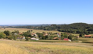
 View of the center of Bugard |
||
Bugard is a French commune with 89 inhabitants (as of January 1, 2017) in the Hautes-Pyrénées department in the Occitanie region (before 2016: Midi-Pyrénées ). The municipality belongs to the Arrondissement of Tarbes and the canton of Les Coteaux (until 2015: canton of Trie-sur-Baïse ).
The inhabitants are called Bugardais and Bugardaises .
geography
Bugard is about 20 kilometers east of Tarbes in the historic Bigorre county .
Bugard is surrounded by the six neighboring communities:
| Lamarque rustaing | Villembits | Lustar |
| Sère-Rustaing |

|
Bonnefont |
| Orieux |
Population development
After the records began, the population rose to a high of around 265 by the middle of the 19th century. In the following period, the size of the community fell to around 85 inhabitants by the first decade of the 21st century, before settling on this Level could stabilize.
| year | 1962 | 1968 | 1975 | 1982 | 1990 | 1999 | 2006 | 2011 | 2017 |
|---|---|---|---|---|---|---|---|---|---|
| Residents | 128 | 111 | 100 | 95 | 93 | 99 | 87 | 89 | 89 |
Attractions
- Parish Church de l'Assomption ( Assumption of Mary ). It was rebuilt in the 19th century, with only a few elements of the earlier structure remaining, such as the pointed arched arcades under the bell tower and between the partition walls between the main nave and the south aisle.
- Remains of the castle of the landlord family . In the middle of the valley, south of the center of the municipality, a spacious square is surrounded by moats, which probably formed the site of the former stately castle, which was owned by the Saint-Paul family from 1272 to 1751.
Economy and Infrastructure
Bugard is located in the AOC zones of the Porc noir de Bigorre pig breed and the Jambon noir de Bigorre ham .

total = 13
traffic
Bugard is crossed by Routes départementales 21 and 136.
Web links
- Website of the Working Group of Noir de Bigorre (French)
- Bugard on the website of the Pays de Trie et Magnoac Tourist Office (French)
Individual evidence
- ^ Informations sur la commune de Bugard ( fr ) Marie-Pierre Manet. Retrieved October 31, 2019.
- ↑ Notice Communale Bugard ( fr ) EHESS . Retrieved October 31, 2019.
- ↑ Populations légales 2016 Commune de Bugard (65110) ( fr ) INSEE . Retrieved October 31, 2019.
- ↑ Bugard ( fr ) Tourist Office of the Pays de Trie et Magnoac. Retrieved October 31, 2019.
- ↑ Institut national de l'origine et de la qualité: Rechercher un produit ( fr ) Institut national de l'origine et de la qualité . Retrieved October 31, 2019.
- ↑ Caractéristiques des établissements en 2015 Commune de Bugard (65110) ( fr ) INSEE . Retrieved October 31, 2019.


