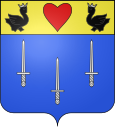
Angos
| Angos | ||
|---|---|---|

|
|
|
| region | Occitania | |
| Department | Hautes-Pyrénées | |
| Arrondissement | Tarbes | |
| Canton | Moyen-Adour | |
| Community association | Agglomération Tarbes-Lourdes-Pyrénées | |
| Coordinates | 43 ° 12 ' N , 0 ° 9' E | |
| height | 270-431 m | |
| surface | 2.98 km 2 | |
| Residents | 223 (January 1, 2017) | |
| Population density | 75 inhabitants / km 2 | |
| Post Code | 65690 | |
| INSEE code | 65010 | |
 Mayor's Office ( Mairie ) of Angos |
||
Angos is a French commune with 223 inhabitants (as of January 1, 2017) in the Hautes-Pyrénées department in the Occitanie region (before 2016: Midi-Pyrénées ). The municipality belongs to the Arrondissement of Tarbes and the canton of Moyen-Adour (until 2015: canton of Séméac ).
The inhabitants are called Angosois and Angosoises .
geography
Angos is located about eight kilometers southeast of Tarbes in its catchment area ( Aire urbaine ) in the historic province of Bigorre .
Angos is surrounded by the eight neighboring communities:
|
Calavante Lespouey |
Bordes | |
| Barbazan debate |

|
Lhez |
| Allier | Montignac | Mascaras |
Angos lies in the catchment area of the Adour River . The Ruisseau de l'Ousse, a tributary of the Canal d'Alaric, has its source in Angos. Angos is also irrigated by the Lassarenc, a tributary of the Arrêt-Darré .
Toponymy
The Occitan name of the municipality is Angòs. There are many theories about its origin. Probably it comes from a name of a man and the Aquitaine suffix -ossum . The community's nicknames are Los caps de pòrc ( German for the pig's heads ) and Los paisans ( German for the farmers ) in the derogatory sense with a clumsy appearance and rough manners.
Toponyms and mentions of Angos were:
- D-Angos (1313, Tax List Debita regi Navarre),
- de Angossio (1379, power of attorney Tarbes),
- Angos (1406, Green Book by Bénac ),
- Anguos and Angos (1429, Bigorre County census list),
- Angos (1750, map by Cassini ).
Population development
After records began, the number of inhabitants rose to an initial high of around 215 by the first half of the 19th century. In the period that followed, the size of the community fell to around 105 inhabitants by the 1930s, with short recovery phases. It followed a relatively short phase with moderate growth to around 125 inhabitants in the 1950s before another stagnation set in. In the 1990s, a phase of relatively strong growth finally set in, which increased the size of the community to around 230 inhabitants by the turn of the millennium.
| year | 1962 | 1968 | 1975 | 1982 | 1990 | 1999 | 2006 | 2011 | 2017 |
|---|---|---|---|---|---|---|---|---|---|
| Residents | 117 | 117 | 115 | 173 | 201 | 203 | 228 | 226 | 223 |
Attractions
- Parish Church of Saint-Saturnin
Economy and Infrastructure
Angos is located in the AOC zones of the Porc noir de Bigorre pork breed and the Jambon noir de Bigorre ham .

total = 19
education
The municipality has a public primary school with 22 students in the 2019/2020 school year.
traffic
Angos can be reached via Routes départementales 5, 85, 285, 305 and 817, the former Route nationale 117 .
The Autoroute A64 , called La Pyrénéenne , also crosses the municipality, but without a direct exit to the village. The closest exit 13 (Tarbes est) is about five kilometers away and serves the capital of the Tarbes department .
Web links
Individual evidence
- ↑ Hautes-Pyrénées ( fr ) habitants.fr. Retrieved September 13, 2019.
- ↑ Aire urbaine de Tarbes (072) ( fr ) INSEE . Retrieved September 13, 2019.
- ↑ Ma commune: Angos ( fr ) Système d'Information sur l'Eau du Bassin Adour Garonne. Retrieved September 14, 2019.
- ^ Angos ( fr ) Hautes-Pyrénées department. Retrieved September 14, 2019.
- ^ David Rumsey Historical Map Collection France 1750 ( en ) David Rumsey Map Collection: Cartography Associates. Retrieved September 14, 2019.
- ↑ Notice Communale Angos ( fr ) EHESS . Retrieved September 13, 2019.
- ↑ Populations légales 2016 Commune d'Angos (65010) ( fr ) INSEE . Retrieved September 13, 2019.
- ↑ Institut national de l'origine et de la qualité: Rechercher un produit ( fr ) Institut national de l'origine et de la qualité . Retrieved September 13, 2019.
- ↑ Caractéristiques des établissements en 2015 Commune d'Angos (65010) ( fr ) INSEE . Retrieved September 13, 2019.
- ^ École élémentaire ( fr ) National Ministry of Education. Retrieved October 9, 2019.


