Saint-Michel (Pyrénées-Atlantiques)
|
Saint-Michel egg alarm |
||
|---|---|---|

|
|
|
| region | Nouvelle-Aquitaine | |
| Department | Pyrénées-Atlantiques | |
| Arrondissement | Bayonne | |
| Canton | Montagne Basque | |
| Community association | Pays Basque | |
| Coordinates | 43 ° 8 ′ N , 1 ° 13 ′ W | |
| height | 177-1,417 m | |
| surface | 30.30 km 2 | |
| Residents | 295 (January 1, 2017) | |
| Population density | 10 inhabitants / km 2 | |
| Post Code | 64220 | |
| INSEE code | 64492 | |
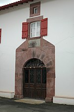
 House in Saint-Michel |
||
Saint-Michel is a French commune of 295 inhabitants (at January 1, 2017) in the department of Pyrénées-Atlantiques in the region Nouvelle-Aquitaine (before 2016: Aquitaine ). The municipality belongs to the Arrondissement of Bayonne and the canton of Montagne Basque (until 2015: canton of Saint-Jean-Pied-de-Port ).
The name in the Basque language is Eiheralarre . The inhabitants are named accordingly egg alartar .
geography
Saint-Michel is located about 55 km southeast of Bayonne in the historic Pays de Cize ( Garazi in Basque ) of the historic province of Lower Navarra in the French part of the Basque Country . The municipality borders in the south on the Autonomous Community of Navarre in northern Spain .
The highest point in the municipality is the Urkulu ( 1417 m ) in the south of the municipality, right on the Spanish border.
Saint-Michel is surrounded by the neighboring municipalities:
| Saint-Jean-Pied-de-Port | Caro | Aincille |
| Uhart-Cize |

|
Estérençuby |
| Arnéguy | Aezkoa (Spain) |
Saint-Michel is located in the catchment area of the Adour River .
One of its tributaries, the Nive , which is still called Nive de Béhérobie here in the upper reaches , flows through the area of the municipality with its tributaries,
- the Ruisseau d'Orion,
- the Ruisseau de Mendiola and its tributary,
- the Ruisseau d'Olhaberry,
- the Urtchipia and
- the Latsarritako Erreka.
Tributaries of the Nive d'Arnéguy also cross the municipality,
- the Ruisseau de Landarréta, also known as Ruisseau d'Alamey or Alameiko Erreka, and
- the Ruisseau de Sourits, also called Zuritzeko Erreka.
history
A very old route for crossing the Pyrenees marks the border with neighboring communities to the west. Today route départementale 428 essentially follows the course of this route. Finds from prehistory testify that people followed this route in earlier times. Several dolmens , numerous barrows and cromlechs can be found in the municipal area along this path. One vase could be dated to the early to middle Bronze Age . The barrows were used for cremation until the Middle Ages , which is attested by the age of the charcoal found at the same time . This route leads over a high path to get from today's Saint-Jean-Pied-de-Port to Roncesvalles . After the Roman Empire took over the area north of the Pyrenees in the first century BC. Chr. Conquered, there was a need for a road of the same length as possible, which could be used all year round. A parallel path through the valley of the Nive d'Arnéguy was therefore built.
Saint-Michel was able to develop in the Middle Ages because the pilgrims first used the “Höhenweg” on their way to Santiago de Compostela . A commandery was even set up under the monastery of Roncesvalles . From the 13th century onwards, the pilgrims gradually preferred the route through the valley of the Nive and Saint-Michel was nicknamed "le vieux". In 1350 there were 21 farmhouses in Saint-Michel. Part of their production will certainly have contributed to supplying the Commandery. A dozen noble houses have also been counted in the village, including that of the Alzu family. A descendant, Bernard d'Alzu fled at the beginning of the French Revolution to Pamplona , where he died 1792nd Much of his property was auctioned off as "national property".
In his book Les Basques De Labourd, de Soule et de Basse Navarre , the historian Philippe Veyrin states that until around 1660 in Saint-Michel, civil status documents were issued exclusively in Castilian , and only in French since 1707.
On June 11, 1842, the municipality lost part of its territory to the newly founded municipality of Estérençuby.
Pignon fortress
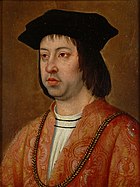
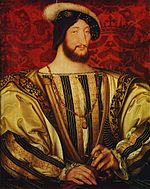
After Fadrique Álvarez de Toledo conquered the part of Navarre located south of the Pyrenees ridge for Ferdinand II of Aragón in July 1512, John III. expelled by Navarre and Catherine of Navarre . They gave up their neutral position between the French king and the Spanish crown and sought an alliance with Francis I of France . A first attempt at reconquest failed in the autumn of 1512, but Ferdinand took the subsequent peace in 1513 as an opportunity to set up a chain of defense to protect against renewed attacks from the north. The choice of the location of the new fortress Peñón de Santamaría fell on the summit of a 1177 m high mountain in the area of Saint-Michel near the old mountain path from Saint-Jean-Pied-de-Port to Roncesvalles. In May 1521, Henry II of Navarre and Francis I made another attempt to recapture. The troops, led by André de Foix , had a strength of 12,000 men and were able to force the garrison of fortress Pignon to give up quickly, also because the fortress had not yet been fully defensible. After André de Foix was crushed on June 30, 1521 near Noáin (5 km south of Pamplona), the Spanish troops retook Navarre, and in July 1521 the fortress of Pignon fell back into Spanish hands. When this Spanish offensive stalled for lack of money, the Navarrer and their French allies were able to repel the Spanish troops. The small Spanish garrison of the fortress of Pignon withdrew hastily and again fell into the possession of the Navarre. Until the complete occupation of Lower Navarra in late 1523 or early 1524, the fortress changed hands several times. This did not leave the building fabric without a trace, because in a record from 1571 the fortress was described as destroyed.
During the Franco-Spanish War (1635–1659) a small incident occurred on the fortress when Spanish troops occupied it and were driven out by French troops two days later. The Peace of the Pyrenees put an end to the conflict between France and Spain, and the location of the fortress retained its strategic importance. The proof should be provided in the First Coalition War , when Spain on the occasion of the execution of the French King Louis XVI. fought together with other states against revolutionary France . The fortress ruins were rebuilt on the French side as a redoubt and, together with fortifications on neighboring mountain peaks, sealed off the high path to Saint-Jean-Pied-de-Port. With a numerical superiority and under the protection of a thick fog, the Spaniards, under the command of General Ventura Caro, were able to take the Redoubt on June 6, 1793 and drive away the French troops, led by General La Genetiere, with heavy losses. The French general was injured and taken prisoner. The French troops fled in great disarray to Saint-Jean-Pied-de-Port, where they consolidated in the days that followed without the Spanish troops following them. Despite the loss of the Redoute Pignon, the defeat on the French side was rated as a success in view of the greater strength of the Spanish units and the higher losses on the enemy side. On June 18, the Spanish general Ventura Caro had his units withdraw to their previous positions.
On July 25, 1813, the last battle took place near the fortress of Pignon. After the defeat in the Battle of Vitoria on June 21, 1813, the French armies had to retreat from the approaching Allied English, Portuguese and Spanish troops under the command of Arthur Wellesleys , later the Duke of Wellington . Maréchal Nicolas Jean-de-Dieu Soult was ordered by Napoleon Bonaparte to Bayonne and transferred the supreme command of the Armée en Espagne et sur les Pyrénées . Soult arrived in Saint-Jean-Pied-de-Port on July 21, reorganized the units and from there planned an offensive on Pamplona, which was besieged by Wellington. The first attack by the French at dawn on July 25th 1813 was repulsed by the cannon-armed defense of the Allies. Soult then sat himself at the head of the attackers and was able to finish the resistance by noon. The way was clear for the French troops, who on July 27 at Pamplona encountered the main power of Wellington, who won the subsequent battle of Sorauren .
Toponyms and mentions
Toponyms and mentions of Saint-Michel were:
- in vico sancti michaelis (1072),
- Villa sanctis michaelis (1140),
- Sant miguel el uieyllo and Sant miguel lo vieyl (1350),
- San-Miguel-el-Viejo en Ultra Puertos (1500, documents of the cathedral chapter of Bayonne),
- Sant-Miguel (1513, documents from Pamplona),
- Saint Michel (1750, map by Cassini ),
- Saint Michel and Nive-Montagne (1793, Notice Communale or Dictionnaire topographique du département des Basses-Pyrénées) and
- Saint-Michel (1801, Bulletin des Lois ).
coat of arms
According to Guy Ascarat, heraldist and historian, the coat of arms can be interpreted as follows.
The two crooks in the upper left field are reminiscent of the commandery of the monastery of Roncesvalles and the geographical location on a pilgrimage route to Santiago de Compostela. The sheep in the upper right field stands for sheep breeding and pasture farming in the municipality. The field at the bottom left shows the bottle-shaped decoration of house facades as a local architectural element, which often occurs in Lower Navarre. The black eagle in the field at the bottom right is the simple symbol of the kings of Navarre and underlines their former affiliation.
Population development
After records began at the end of the 18th century, the parish grew to around 920 inhabitants until parts of its territory were ceded in 1842. As a result, the number of inhabitants was reduced to 240 in the first few years of the new millennium during short recovery phases. This was followed by a growth phase that continues to this day.
| year | 1962 | 1968 | 1975 | 1982 | 1990 | 1999 | 2006 | 2009 | 2017 |
|---|---|---|---|---|---|---|---|---|---|
| Residents | 351 | 318 | 286 | 299 | 276 | 254 | 243 | 254 | 295 |
Attractions
- Parish church dedicated to Saint Vincent de Xaintes , martyr in the third century and the first bishop of the Dax diocese . It was built in 1905 to replace the former parish church of Saint-Michel Archange , which lay on the left bank of the Nive and of which only the cemetery that had surrounded it remains today. During the 20th century the new church was restored. In the west, the long building with a nave is preceded by a bell tower above the entrance porch. It has a square floor plan, three floors and a tent roof . The polygonal apse in the east is less high than the long building. In the north the sacristy is set up in an extension. On the north wall of the bell tower, a straight outside staircase made of sandstone leads to the gallery inside the church, the seats of which are reserved for male church visitors during a mass . Stained glass windows from the years between 1905 and 1910 are signed by the glass painter Louis Gesta from Toulouse . The nave is covered with a false barrel vault, the choir with a false semi-dome vault, as well as a false ribbed vault can be found. Disc-shaped grave steles , which originally stood in the cemetery, are built into the walls of the church.
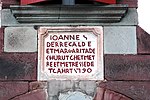
- House Arbelaenia. It was built in the 17th century on the site of the former Roncesvalles hospital . This received and cared for the passing pilgrims and was therefore equipped with an oratory dedicated to the Apostle Bartholomew . The lintel of the entrance door is a reminder of the past, as its inscription has engraved two crooked bars, which symbolize the Roncesvalles coat of arms, in addition to the presumed year "1671" when the building was built. These mean characters have also found their way into the coat of arms of the municipality.
- Lodaenea farm. The farmhouse was originally one-storey and a gable roof covered. The year "1781" entered in the lintel of the right window on the front probably goes back to the time when the building was increased by one floor and an attic. The rear stable and the hayloft have not been extended. All windows and the gate were redesigned in the 19th century. The frame of the windows is made of wood with the exception of the two windows on the ground floor, which are faced with sandstone . The center of the residential wing is the eskaratz , from which a wooden, right-angled staircase leads to the first floor. The kitchen is to the left of the eskaratz . The lintel of the right window shows the year, two rosettes , a cross and two candlesticks. The house was in poor condition when it was listed as a national treasure in 2000.
- Lakoa Farm. The dating of the construction of the farmhouse is likely to go back to the second half of the 17th century due to its use of timber framework . The facade was repaired at the end of the 18th century, as indicated by the year "1799" on the lintel of the left window on the ground floor. In the second half of the 19th century an annex was added on the left side, and in the second half of the 20th century the poultry and pigsty was demolished. The gable roof of the house is covered with hollow tiles. The left partition wall has collapsed so that the uprights of the truss are visible. The central eskaratz leads to the kitchen on the right and the previous bedrooms on the left. A fireplace with triangular consoles and an old stone sink have been preserved in the kitchen . The stable occupies the entire rear part of the farm. The north-eastern facade of the house is embellished with wooden slats filled with briquettes and clay. The wooden slats have four triangular holes. The windows on the ground floor are made of sandstone, those of the attic are made of wood. The lintel of the left window shows the year, a monstrance , four rosettes and two Basque crosses, called Lauburu . The right door of the facade has replaced a window. The house was in poor condition when it was listed as a national treasure in 2000.
- Arzitia farm. The house of Arciat was recorded as a noble house in the census of the Kingdom of Navarre in 1334, 1366 and 1412. The current building is believed to be from the second half of the 17th or the first half of the 18th century. The left window on the ground floor has never been restored, the other windows as well as the gate were repaired or installed in the 19th century. An extension with a poultry and pigsty was added to the facade in the second half of the 19th century. The gable roof of the house is covered with hollow tiles. Its purlins are decorated. The central eskaratz leads to the kitchen on the left and the bedrooms on the right. The stable and the hayloft are located on the back as an extension of the residential wing. The rectangular front door and the windows are made of wood except for the window on the left-hand side on the ground floor, which is made of sandstone and has a protruding sill .
Economy and Infrastructure
Agriculture, with a focus on grazing, viticulture, animal husbandry and cheese production, is the municipality's most important economic factor.
Saint-Michel is located in the AOC areas of Ossau-Iraty , a traditionally made semi-hard cheese made from sheep's milk, as well as the pig breed and the ham "Kintoa".
The Garazi cheese dairy produces u. a. Ossau-Iraty.

total = 28
education
The community has a public primary school with 20 students in the 2017/2018 school year.
sport and freetime
- The GR 65 long-distance hiking trail from Geneva to Roncesvalles leads along the traditional high-altitude trail past the fortress ruins of Pignon. It follows the Via Podiensis , one of the four historic St. James' paths.
- A circular route classified as very easy with a length of 4 km and a difference in altitude of 180 m leads from the parking lot at Col d 'Arnostéguy in the extreme south of the municipality directly on the Spanish border past a barrow, remains of a redoubt from the Napoleonic wars and the around 20 m high tower from Gallo-Roman times on the Urkulu ( 1417 m ).
traffic
Saint-Michel is crossed by Routes départementales 301 and 428.
Personalities
- Bernard D'Etchepare ( Basque Beñat Etxepare ), born between 1470 and 1480 in Bussunarits-Sarrasquette , died in 1545, was a priest and writer. He wrote the book Linguæ Vasconum Primitiæ , published in Bordeaux in 1545 , which is considered the first book in the Basque language. In the first half of the 16th century he was pastor of the parish in Saint-Michel. A plaque hangs on the wall of the parish church of Saint-Vincent-de-Dax .
- Jakes Ahamendaburu, born on August 7, 1961 in Saint-Michel, is a poet and Bertsolari. He writes poetry in the Basque language. A Bertsolari ( German poet ) is a singer of verses in Basque who improvises in front of an audience.
Web links
- Atlas du Patrimoine Historique et Culturel with images from Saint-Michel (French)
- Information about Saint-Michel on the Association of Municipalities website (French)
- Website of the AOP Ossau-Iraty association (French)
- Filière Porc Basque website (French)
Individual evidence
- ↑ Lieux - toponymie: Eiheralarre (Garazi) ( fr ) euskaltzaindia . Retrieved December 6, 2017.
- ↑ géoportail - Saint-Michel ( fr ) Institut national de l'information geographique et forestière . Retrieved December 6, 2017.
- ↑ Ma commune: Saint-Michel ( fr ) Système d'Information sur l'Eau du Bassin Adour Garonne. Retrieved December 6, 2017.
- ^ Christian Normand, Jacques Blot, Louis de Buffières, Benoît Duvivier, Gérard Folio, Peio Montaneo Sorbet, Gilles Parent, Aitor Pescador Medrano, et al .: Château Pignon ( fr , PDF) pp. 129–163. Retrieved December 6, 2017.
- ↑ a b Regional Council of Aquitaine: Saint-Michel ( fr ) visites.aquitaine.fr. Archived from the original on December 6, 2017. Info: The archive link was inserted automatically and has not yet been checked. Please check the original and archive link according to the instructions and then remove this notice. Retrieved December 6, 2017.
- ↑ a b Guy Ascarat: Armorial Communes Basques ( fr ) Archived from the original on November 16, 2016. Retrieved on December 6, 2017.
- ^ Philippe Veyrin: Les Basques De Labourd, de Soule et de Basse Navarre . 1st edition. Éditions Cairn, Pau 2013, ISBN 978-2-35068-344-7 (French).
- ^ Journal officiel de la République française - Lois et décrets ( fr ) Bibliothèque nationale de France . Pp. 581, 582. July 4, 1923. Retrieved December 6, 2017.
- ^ Paul Raymond: Dictionnaire topographique du département des Basses-Pyrénées ( fr ) In: Dictionnaire topographique de la France . Imprimerie nationale. P. 62, 1863. Retrieved December 6, 2017.
- ↑ Christian Normand, Jacques Blot, Louis de Buffières, Benoît Duvivier, Gérard Folio, Peio Montaneo Sorbet, Gilles Parent, Aitor Pescador Medrano, et al .: Château Pignon ( fr , PDF) pp. 165–170. Retrieved December 6, 2017.
- ↑ Christian Normand, Jacques Blot, Louis de Buffières, Benoît Duvivier, Gérard Folio, Peio Montaneo Sorbet, Gilles Parent, Aitor Pescador Medrano, et al .: Château Pignon ( fr , PDF) pp. 171–192. Retrieved December 6, 2017.
- ^ Antoine Henri baron de Jomini: Campagnes de 1788-1793. 1842 ( fr ) In: Histoire critique et militaire de guerres de la révolution . JB Petit, Brussels. Pp. 331, 332. 1840. Retrieved December 6, 2017.
- ^ History of the wars in Europe since 1792 . Brockhaus, Leipzig. Pp. 350-353. 1827. Retrieved December 6, 2017.
- ↑ Christian Normand, Jacques Blot, Louis de Buffières, Benoît Duvivier, Gérard Folio, Peio Montaneo Sorbet, Gilles Parent, Aitor Pescador Medrano, et al .: Château Pignon ( fr , PDF) pp. 192-201. Retrieved December 6, 2017.
- ^ Jean-Baptiste Orpustan: Nouvelle toponymie basque ( fr ) University of Bordeaux . S. 86. 2006. Retrieved December 6, 2017.
- ^ Paul Raymond: Dictionnaire topographique du département des Basses-Pyrénées ( fr ) In: Dictionnaire topographique de la France . Imprimerie nationale. Pp. 150, 151, 1863. Retrieved December 6, 2017.
- ^ David Rumsey Historical Map Collection France 1750 ( en ) David Rumsey Map Collection: Cartography Associates. Retrieved December 6, 2017.
- ↑ a b Notice Communale Saint-Michel ( fr ) EHESS . Retrieved December 6, 2017.
- ↑ Blason de Saint-Michel ( fr ) visites.aquitaine.fr. Archived from the original on December 6, 2017. Info: The archive link was inserted automatically and has not yet been checked. Please check the original and archive link according to the instructions and then remove this notice. Retrieved December 6, 2017.
- ↑ Populations légales 2014 Commune de Saint-Michel (64492) ( fr ) INSEE . Retrieved December 6, 2017.
- ↑ Eglise Saint-Vincent-de-Dax ( fr ) visites.aquitaine.fr. Archived from the original on December 6, 2017. Info: The archive link was inserted automatically and has not yet been checked. Please check the original and archive link according to the instructions and then remove this notice. Retrieved December 6, 2017.
- ↑ église paroissiale Saint-Vincent-de-Dax ( fr ) Ministry of Culture and Communication . Retrieved December 6, 2017.
- ↑ Stèles discoïdales dans l'église Saint-Vincent-de-Dax ( fr ) visites.aquitaine.fr. Archived from the original on December 6, 2017. Info: The archive link was inserted automatically and has not yet been checked. Please check the original and archive link according to the instructions and then remove this notice. Retrieved December 6, 2017.
- ↑ Ancien hôpital de Roncevaux ( fr ) visites.aquitaine.fr. Archived from the original on December 6, 2017. Info: The archive link was inserted automatically and has not yet been checked. Please check the original and archive link according to the instructions and then remove this notice. Retrieved December 6, 2017.
- ↑ Linteau aux armes de Roncevaux ( fr ) visites.aquitaine.fr. Archived from the original on December 6, 2017. Info: The archive link was inserted automatically and has not yet been checked. Please check the original and archive link according to the instructions and then remove this notice. Retrieved December 6, 2017.
- ↑ ferme Lodaenea ( fr ) Ministry of Culture and Communication . Retrieved December 6, 2017.
- ↑ ferme Lakoa ( fr ) Ministry of Culture and Communication . Retrieved December 6, 2017.
- ↑ ferme Arzitia ( fr ) Ministry of Culture and Communication . Retrieved December 6, 2017.
- ↑ Institut national de l'origine et de la qualité: Rechercher un produit ( fr ) Institut national de l'origine et de la qualité . Retrieved December 6, 2017.
- ↑ Fromage Ossau-Iraty ( fr ) visites.aquitaine.fr. Archived from the original on December 6, 2017. Info: The archive link was inserted automatically and has not yet been checked. Please check the original and archive link according to the instructions and then remove this notice. Retrieved December 6, 2017.
- ↑ Caractéristiques des établissements en 2015 Commune de Saint-Michel (64492) ( fr ) INSEE . Retrieved December 6, 2017.
- ^ École élémentaire ( fr ) National Ministry of Education. Retrieved December 6, 2017.
- ↑ GR® 65, le chemin de Compostelle via le Puy ( fr ) Fédération française de la randonnée pédestre . Retrieved December 6, 2017.
- ↑ Tour d'Urkulu ( fr , PDF) Tourist Office of Saint-Jean-Pied-de-Port and Saint-Étienne-de-Baïgorry. Retrieved December 6, 2017.
- ↑ Stèle à la mémoire de Bernard Dechepare ( fr ) visites.aquitaine.fr. Archived from the original on December 6, 2017. Info: The archive link was inserted automatically and has not yet been checked. Please check the original and archive link according to the instructions and then remove this notice. Retrieved December 6, 2017.


