Name
( coordinates ),
districts
|
status
|
country
|
agriculture
circle
|
EG ,
VG
|
Ew
|
Natural space
|
Additional Information
|
Image
(location view)
|
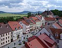
Bad Brueckenau
( ⊙ )
50.309444444444 9.7905555555556 |
city
|
BY
|
KG
|
-
|
6,462
|
Kuppenrhön
- Brückenauer Kuppenrhön
|
Headquarters of VG Bad Brückenau without being a member,
ex-district town of the Bad Brückenau district ,
Staatsbad Brückenau
|

|
Bad Hersfeld
( ⊙ ) - Kathus - Sorga50.368333333333 9.7077777777778
|
County seat
|
HE
|
MR
|
-
|
29,944
|
Fulda-Haune-Tafelland
- Buchenau plateau
|
Worth seeing old town ,
health resort
|

|
Bad Kissingen
( ⊙ ) - Albertshausen - Bad Kissingen - Garitz - Poppenroth50.199722222222 10.076388888889
|
Great county seat
|
BY
|
KG
|
-
|
22,443
|
South Rhön
- Adelsberg Forest
- Schönau plateau
- Waizenbacher Südrhön
|
Historic city center ,
health resort
|

|
Bad Salzungen
( ⊙ ) - Hohleborn50.811666666667 10.233333333333
|
County seat
|
TH
|
WAK
|
EG for
- Leimbach
|
20.097
|
Salzunger Werrabergland
- Standtlengsfelder Hügelland
|
Health resort
|

|
Bastheim
( ⊙ )
50.4 10.2 |
local community
|
BY
|
NES
|
-
|
2,106
|
South Rhön
- Schönau plateau
|
Wechterswinkel Monastery
|
|
Birx
( ⊙ )
50.529444444444 10.046944444444 |
local community
|
TH
|
SM
|
VG Hohe Rhön
|
162
|
High Rhön
- Long Rhön
|
Dreiländereck : BY - HE - TH
|

|
Bischofsheim in the Rhön
( ⊙ )
50.401388888889 10.007222222222 |
city
|
BY
|
NES
|
-
|
4,822
|
Hohe Rhön
- Dammersfeldrücke
- Kreuzberg-Gruppe
- Eastern slope of the Langen Rhön
Südrhön
- Schönau plateau
|
Kreuzberg with monastery and transmitter Kreuzberg
|

|
Breitungen / Werra
( ⊙ ) - without a district in the natural area, but with extensive forest areas50.756944444444 10.330277777778
|
local community
|
TH
|
SM
|
-
|
4,759
|
Kuppenrhön
- Vordere Rhön
Salzunger Werrabergland
- Stadtlengsfelder Hügelland
|
Pless ,
Breitungen Castle
|
|
Burghaun
( ⊙ )
50.696666666667 9.7252777777778 |
market
community
|
HE
|
FD
|
-
|
6.364
|
Fulda-Haune-Tafelland
- Hünstelder Basin
- Lower Haunetal
- Wehrda plateau
Kuppenrhön
- Milseburger Kuppenrhön
|
|

|
Burkardroth
( ⊙ )
50.271944444444 9.9894444444444 |
market
|
BY
|
KG
|
-
|
7,420
|
South Rhön
- Adelsberg Forest
|
Frauenroth Monastery
|

|
Buttlar
( ⊙ )
50.758888888889 9.9541666666667 |
local community
|
TH
|
WAK
|
EG: Geisa
|
1,259
|
Kuppenrhön
- Auersberger Kuppenrhön
- Middle Ulstertal
|
|

|
Dermbach
( ⊙ )
50.716388888889 10.119722222222 |
local community
|
TH
|
WAK
|
Ground floor for
- Empfershausen
- Oechsen
- Weilar
- Wiesenthal
|
7,313
|
Kuppenrhön
- Auersberger Kuppenrhön
- Middle Feldatal
Salzunger Werrabergland
- Stadtlengsfelder Hügelland
- Lower Feldatal
|
Ibengarten ,
Bernshäuser Kutte ,
Propstei Zella ,
former mining industry
|

|
Dipperz
( ⊙ ) - Altenrain - Armenhof - Dörmbach - Finkenhain - Friesenhausen - Kohlgrund - Wolferts50.543333333333 9.7966666666667
|
local community
|
HE
|
FD
|
-
|
3,499
|
Kuppenrhön
- Milseburger Kuppenrhön
- Western Rhön foreland
|
|
|
Ebersburg
( ⊙ )50.452777777778 9.7936111111111
|
local community
|
HE
|
FD
|
-
|
4,637
|
Kuppenrhön
- Milseburger Kuppenrhön
- Western Rhön foreland
|
|

|
Ehrenberg (Rhön)
( ⊙ )50.506944444444 10.003055555556
|
local community
|
HE
|
FD
|
-
|
2,564
|
Hohe Rhön
- Upper Ulstertal
Kuppenrhön
- Milseburger Kuppenrhön
- Middle Ulstertal
|
Red moor
|

|
Eichenzell
( ⊙ ) - Büchenberg - Döllbach - Eichenzell - Lütter - Rönshausen - Welkers50.493888888889 9.6972222222222
|
local community
|
HE
|
FD
|
-
|
11,023
|
Kuppenrhön
- Western Rhön foreland
|
Fasanerie Castle
|
|
Pus field
( ⊙ )
50.761666666667 9.7972222222222 |
market
community
|
HE
|
FD
|
-
|
7,021
|
Fulda-Haune-Tafelland
- Buchenau plateau
Kuppenrhön
- Soisberger Kuppenrhön
|
Hessian skittles
|

|
Empfertshausen
( ⊙ )
50.666666666667 10.099722222222 |
local community
|
TH
|
WAK
|
EG: Dermbach
|
546
|
Kuppenrhön
- Auersberger Kuppenrhön
|
|
|
Erbenhausen
( ⊙ )
50.566666666667 10.15 |
local community
|
TH
|
SM
|
VG Hohe Rhön
|
559
|
Kuppenrhön
- Auersberger Kuppenrhön
- Vordere Rhön
|
|
|
Fladungen
( ⊙ )
50.521111111111 10.145277777778 |
city
|
BY
|
NES
|
VG Fladungen
|
2.212
|
Hohe Rhön
- eastern fall of the Langen Rhön
Kuppenrhön
- eastern Rhön foreland
|
Northernmost town in Bavaria,
Franconian Open Air Museum Fladungen ,
Black Moor
|

|
Frankenheim / Rhön
( ⊙ )
50.544166666667 10.065833333333 |
local community
|
TH
|
SM
|
VG Hohe Rhön
|
1,077
|
High Rhön
- Long Rhön
|
Highest village in the Rhön
|

|
Friedewald (Hesse)
( ⊙ )50.883055555556 9.8602777777778
|
local community
|
HE
|
MR
|
-
|
2,449
|
Kuppenrhön
- Soisberger Kuppenrhön
|
|

|
Friedelshausen
( ⊙ )
50.658055555556 10.237222222222 |
local community
|
TH
|
SM
|
VG Wasungen-Amt Sand
|
312
|
Kuppenrhön
- Vordere Rhön
Salzunger Werrabergland
- Stadtlengsfelder Hügelland
|
|
|
Geisa
( ⊙ )
50.714166666667 9.9497222222222 |
city
|
TH
|
WAK
|
EG for
- Buttlar
- Gerstengrund
- Schleid
|
4,767
|
Kuppenrhön
- Auersberger Kuppenrhön
- Middle Ulstertal
- Soisberger Kuppenrhön
|
Point Alpha
|
|
Gemünden am Main
( ⊙ ) - Adelsberg - Gemünden - Seifriedsburg50.521111111111 10.145277777778
|
city
|
BY
|
MSP
|
-
|
10,039
|
South Rhön
- Gemünden-Zeitlofser Wald ,
- Waizenbacher Südrhön
|
Headquarters of the VG Gemünden am Main , without being a member,
ex-district town of the district Gemünden am Main , city of
three rivers (Main, Franconian Saale, Sinn),
railway junction ,
namesake of the Gemünden-Zeitlofser Wald natural area
|

|
Geroda (Lower Franconia)
( ⊙ )
50.283055555556 9.9 |
market
|
BY
|
KG
|
VG Bad Brückenau
|
799
|
High Rhön
- Black Mountains
Kuppenrhön
- Brückenauer Kuppenrhön
South Rhön
- Adelsberg Forest
|
|
|
Gersfeld (Rhön)
( ⊙ )
50.45 9.9202777777778 |
city
|
HE
|
FD
|
-
|
5,460
|
Hohe Rhön
- Dammersfeldrücke
- Wasserkuppenrhön
Kuppenrhön
- Milseburger Kuppenrhön
|
Gersfeld Wildlife Park ,
secret capital of the Rhön
|

|
Barley ground
( ⊙ )
50.7 May 10 |
local community
|
TH
|
WAK
|
EG: Geisa
|
67
|
Kuppenrhön
- Auersberger Kuppenrhön
|
In terms of population, the smallest independent municipality in the Rhön
|
|
Grabfeld
( ⊙ ) - Bauerbach - Berkach - Bibra - Jüchsen - Nordheim - Queienfeld - Rentwertshausen - Schwickershausen - Wölfershausen - Wolfmannshausen50.458611111111 10.4725
|
local community
|
TH
|
SM
|
-
|
5,632
|
Werra-Gäuplatten
- Bibraer Sattel
- Mellrichstädter Gäu
|
Presence of Friedrich Schiller in 1782/83 in the Bauerbach district
|

|
Graefendorf
( ⊙ )
50.121944444444 9.7391666666667 |
local community
|
BY
|
MSP
|
VG Gemünden am Main
|
1,351
|
South Rhön
- Gemünden-Zeitlofser Wald ,
- Waizenbacher Südrhön
|
Bridge pillar of the Reichsautobahn 46
|
|
Hammelburg
( ⊙ ) - Feuerthal - Morlesau - Obererthal - Untererthal50.115 9.8902777777778
|
city
|
BY
|
KG
|
-
|
11,023
|
Südrhön
- Erthaler Kalkberge
- Waizenbacher Südrhön
|
Ex-county seat of county Hammelburg ,
Truppenübungsplatz Hammelburg
|

|
Hauneck
( ⊙ )50.830277777778 9.7144444444444
|
local community
|
HE
|
MR
|
-
|
3,182
|
Fulda-Haune-Tafelland
- Buchenau plateau
- Lower Haunetal
|
|

|
Haunetal
( ⊙ )50.768611111111 9.6941666666667
|
local community
|
HE
|
MR
|
-
|
2,900
|
Fulda-Haune-Tafelland
- Buchenau plateau
- Lower Haunetal
- Wehrda plateau
|
|

|
Hausen (Rhön)
( ⊙ )
50.505555555556 10125 |
local community
|
BY
|
NES
|
VG Fladungen
|
675
|
High Rhon
- Long Rhön
- Ostabfall Lange Rhoen
Kuppenrhön
- Eastern Rhön foreland
|
Hauensteinberg race ,
Rother Kuppe
|

|
Herring (Werra)
( ⊙ ) - Bengendorf - Herfa50.887222222222 10.005555555556
|
city
|
HE
|
MR
|
-
|
7.153
|
Fulda-Werra-Bergland
- Seulingswald
|
Mining
|

|
Hilders
( ⊙ )50.571388888889 10
|
local community
|
HE
|
FD
|
-
|
4,656
|
Kuppenrhön
- Auersberger Kuppenrhön
- Milseburger Kuppenrhön
- Middle Ulstertal
|
|

|
Hofbieber
( ⊙ )50.587222222222 9.8377777777778
|
local community
|
HE
|
FD
|
-
|
6,082
|
Kuppenrhön
- Milseburger Kuppenrhön
- Western Rhön foreland
|
Milseburg
|

|
Hohenroda
( ⊙ )50.807777777778 9.9227777777778
|
local community
|
HE
|
MR
|
-
|
3,042
|
Fulda-Werra-Bergland
- Seulingswald
Kuppenrhön
- Soisberger Kuppenrhön
|
|
|
Hohenroth
( ⊙ ) - Windshausen50.313888888889 10.174444444444
|
local community
|
BY
|
NES
|
VG Bad Neustadt an der Saale
|
3,621
|
South Rhön
- Schönau plateau
|
|

|
Hünfeld
( ⊙ )
50.673333333333 9.7661111111111 |
city
|
HE
|
FD
|
-
|
16,616
|
Fulda-Haune-Tafelland
- Hünstelder Basin
- Wehrda plateau
Kuppenrhön
- Milseburger Kuppenrhön
- Soisberger Kuppenrhön
|
Ex-district town of the district of Hünfeld ,
Bonifatiuskloster (Hünfeld)
|

|
Kalbach
( ⊙ ) - Eichenried - Heubach - Oberkalbach - Uttrichshausen - Veitsteinbach50.424166666667 9.6519444444444
|
local community
|
HE
|
FD
|
-
|
6,378
|
Kuppenrhön
- Brückenauer Kuppenrhön
- Hessian ridge
- Western Rhön foreland
|
Kalbachtunnel , Landrückentunnel
|

|
Kaltennordheim
( ⊙ )
50.626388888889 10.158611111111 |
city
|
TH
|
SM
|
VG Hohe Rhön
|
5,802
|
Kuppenrhön
- Auersberger Kuppenrhön
- Middle Feldatal
- Vordere Rhön
- Eastern Rhön foreland
|
|

|
Karsbach
( ⊙ ) - Heßdorf - Höllrich - Karsbach50.042222222222 9.7861111111111
|
local community
|
BY
|
MSP
|
VG Gemünden am Main
|
1,721
|
Südrhön
- Waizenbacher Südrhön
|
|
|
Krayenberg community
( ⊙ ) - Dietlas50.836111111111 10.086388888889
|
local community
|
TH
|
WAK
|
-
|
5.105
|
Salzunger Werrabergland
- Lower Feldatal
|
Merkers Adventure Mine
|

|
Künzell
( ⊙ ) - Dassen - Dietershausen50.539444444444 9.7083333333333
|
local community
|
HE
|
FD
|
-
|
16,724
|
Kuppenrhön
- Western Rhön foreland
|
|

|
Ludwigsau
( ⊙ ) - Meckbach50.928055555556 9.6766666666667
|
local community
|
HE
|
FD
|
-
|
5.514
|
Fulda-Werra-Bergland
- Seulingswald
|
|

|
Mehmels
( ⊙ )
50.633611111111 10.334444444444 |
local community
|
TH
|
SM
|
VG Wasungen-Amt Sand
|
340
|
Salzunger Werrabergland
- Stadtlengsfelder Hügelland
|
|
|
Meiningen
( ⊙ ) - Drei 30acker - Einödhausen - Henneberg - Herpf - Stepfershausen - Träbes - Unterharles50.567777777778 10.415555555556
|
County seat
|
TH
|
SM
|
Ground floor for
- Rippershausen
- Sülzfeld
- Untermaßfeld
|
24,796
|
Kuppenrhön
- Eastern Rhön foreland
Werra-Gäuplatten
- Drei 30acker-Sülzfelder Rhön roofing
|
Former state capital ,
Meininger Theater ,
Goetz-Höhle ,
OT Henneberg: Ancestral seat of the Counts of Henneberg ,
former border crossing Eußenhausen-Meiningen
|

|
Mellrichstadt
( ⊙ ) - Eußenhausen - Frickenhausen - Mellrichstadt - Mühlfeld50.428333333333 10.302222222222
|
city
|
BY
|
NES
|
VG Mellrichstadt
|
5,551
|
Werra-Gäuplatten
- Mellrichstädter Gäu
|
Ex-district town of the Mellrichstadt district ,
former Bundeswehr barracks ,
Frickenhäuser See ,
former border crossing Eußenhausen-Meiningen
|

|
Moths
( ⊙ )
50.394444444444 9.7727777777778 |
local community
|
BY
|
KG
|
-
|
1,665
|
Kuppenrhön
- Brückenauer Kuppenrhön
|
Big hood
|
|
Neuhof (near Fulda)
( ⊙ ) - Hattenhof50.452777777778 9.6158333333333
|
local community
|
HE
|
FD
|
-
|
10,830
|
Kuppenrhön
- Western Rhön foreland
|
Monte Kali
|

|
Niederaula
( ⊙ ) - Hilperhausen50.800555555556 9,605
|
market
community
|
HE
|
MR
|
-
|
5,333
|
Fulda-Haune-Tafelland
- Wehrda plateau
|
|

|
Nordheim vor der Rhoen
( ⊙ )
50.477777777778 10.183888888889 |
local community
|
BY
|
NES
|
VG Fladungen
|
1.110
|
Kuppenrhön
- Eastern Rhön foreland
|
|

|
Nüsttal
( ⊙ )
50.63 9.8486111111111 |
local community
|
HE
|
FD
|
-
|
2,832
|
Kuppenrhön
- Milseburg Kuppenrhön
|
|

|
Oberelsbach
( ⊙ )
50.440277777778 10.120833333333 |
market
|
BY
|
NES
|
-
|
2,678
|
Hohe Rhön
- Lange Rhön
- eastern slope of the Langen Rhön
Südrhön
- Schönau plateau
Werra-Gäuplatten
- Mellrichstädter Gäu
|
Heidelstein with transmitter Heidelstein ,
Gangolfsberg ,
Haus der Lange Rhön
|
|
Oberleichtersbach
( ⊙ )
50.274722222222 9805 |
local community
|
BY
|
KG
|
VG Bad Brückenau
|
2,072
|
Kuppenrhön
- Brückenauer Kuppenrhön
South Rhön
- Adelsberg Forest
|
Dreistelzberg
|
|
Top litter
( ⊙ )
50.477777777778 10.285833333333 |
local community
|
BY
|
NES
|
VG Mellrichstadt
|
1,492
|
Werra-Gäuplatten
- Mellrichstädter Gäu
|
|
|
Oberthulba
( ⊙ )
50.198611111111 9.9616666666667 |
market
|
BY
|
KG
|
-
|
5,054
|
Südrhön
- Waizenbacher Südrhön
|
Michael's Chapel
|

|
Oberweid
( ⊙ )
50.590555555556 10.063888888889 |
local community
|
TH
|
SM
|
VG Hohe Rhön
|
497
|
Kuppenrhön
- Auersberger Kuppenrhön
|
|
|
Oxen
( ⊙ )
50.7445 10.066 |
local community
|
TH
|
WAK
|
EG: Dermbach
|
597
|
Kuppenrhön
- Auersberger Kuppenrhön
Salzunger Werrabergland
- Stadtlengsfelder Hügelland
|
former mining
|

|
Ostheim
( ⊙ )
50.458333333333 10.231944444444 |
city
|
BY
|
NES
|
VG Ostheim in front of the Rhön
|
3,305
|
Hohe Rhön
- Eastern slope of the Langen Rhön
Kuppenrhön
- Eastern Rhön foreland
Werra-Gäuplatten
- Mellrichstädter Gäu | former exclave of Thuringia ,
Ostheim fortified church
|

|
Petersberg
( ⊙ ) - Haunedorf - Marnach - Steinau - Steinhaus50.566666666667 9.7166666666667
|
local community
|
HE
|
FD
|
-
|
16.052
|
Fulda-Haune-Tafelland
- Upper Haunetal
|
Grave of Saint Lioba , Haunetalsperre
|
|
Philippsthal (Werra)
( ⊙ ) - Gethsemane - Röhrigshof - Untersteurode50.841111111111 10.005277777778
|
market
community
|
HE
|
MR
|
-
|
7,021
|
Fulda-Werra-Bergland
- Seulingswald
|
Mining
|

|
Poppenhausen (Wasserkuppe)
( ⊙ )
50.488333333333 9.8691666666667 |
local community
|
HE
|
FD
|
-
|
2,662
|
Hohe Rhön
- Wasserkuppenrhön
Kuppenrhön
- Milseburger Kuppenrhön
|
Wasserkuppe , stone wall
|

|
Rasdorf
( ⊙ )
50.716666666667 9.8977777777778 |
local community
|
HE
|
FD
|
-
|
1,554
|
Kuppenrhön
- Milseburger Kuppenrhön
- Soisberger Kuppenrhön
|
Point Alpha
|

|
Rhönblick
( ⊙ )
50.5625 10.264722222222 |
local community
|
TH
|
SM
|
-
|
2,655
|
Kuppenrhön
- Eastern Rhön foreland
- Vordere Rhön
Werra-Gäuplatten
- Drei 30acker-Sülzfelder Rhön roofing
|
Hutsburg ,
Gebaberg
|

|
Riedenberg
( ⊙ )
50.319722222222 9.8622222222222 |
local community
|
BY
|
KG
|
VG Bad Brückenau
|
994
|
High Rhön
- Black Mountains
Kuppenrhön
- Brückenauer Kuppenrhön
|
|
|
Rippershausen
( ⊙ )
50.605555555556 10.349166666667 |
local community
|
TH
|
SM
|
EG: Meiningen
|
821
|
Salzunger Werrabergland
- Stadtlengsfelder Hügelland
|
|
|
Ritschenhausen
( ⊙ )
50.510833333333 10.431388888889 |
local community
|
TH
|
SM
|
VG Dolmar salt bridge
|
328
|
Werra-Gäuplatten
- Bibraer Saddle
|
Important railway junction
|

|
Pink
( ⊙ )
50.712222222222 10.25 |
local community
|
TH
|
SM
|
-
|
Invalid metadata key 16.066.048
|
Salzunger Werrabergland
- Stadtlengsfelder Hügelland
|
|
|
Rossdorf
( ⊙ )
50.702777777778 10.214444444444 |
local community
|
TH
|
SM
|
-
|
606
|
Kuppenrhön
- Vordere Rhön
Salzunger Werrabergland
- Stadtlengsfelder Hügelland
|
|
|
Sandberg
( ⊙ )
50.3475 10.007777777778 |
local community
|
BY
|
NES
|
-
|
2,391
|
Hohe Rhön
- Kreuzberg Group
South Rhön
- Adelsberg Forest
- Schönau Plateau
|
|

|
Schenklengsfeld
( ⊙ )
50.818333333333 9.8441666666667 |
local community
|
HE
|
MR
|
-
|
4,348
|
Kuppenrhön
- Soisberger Kuppenrhön
Fulda-Haune-Tafelland
- Buchenau plateau
|
Oldest tree in Germany
|
|
Schleid
( ⊙ )
50.7 9.9666666666667 |
local community
|
TH
|
WAK
|
EG: Geisa
|
1,019
|
Kuppenrhön
- Auersberger Kuppenrhön
- Middle Ulstertal
|
|
|
Schlüchtern
( ⊙ ) - Breitenbach - Gundhelm - Hutten - monastery courtyards50.347222222222 9.5255555555556
|
city
|
HE
|
MKK
|
-
|
15,894
|
Kuppenrhön
- Hessian ridge
|
|
|
Schmalkalden
( ⊙ ) - Helmers50.721388888889 10.451111111111
|
city
|
TH
|
SM
|
-
|
19,647
|
Salzunger Werrabergland
- Stadtlengsfelder Hügelland
|
Reign of Schmalkalden
|
|
Schönau an der Brend
( ⊙ )
50.380555555556 10.104722222222 |
local community
|
BY
|
NES
|
VG Bad Neustadt an der Saale
|
1,231
|
South Rhön
- Schönau plateau
|
|
|
Schondra
( ⊙ )
50.269166666667 9.8613888888889 |
market
|
BY
|
KG
|
VG Bad Brückenau
|
1,703
|
South Rhön
- Adelsberg Forest
|
|
|
Schwallungen
( ⊙ ) - Eckardts - Schwarzbach - Zillbach50.6925 10.3575
|
local community
|
TH
|
SM
|
VG Wasungen-Amt Sand
|
2,269
|
Salzunger Hügelland
- Stadtlengsfelder Hügelland
|
|

|
Sinntal
( ⊙ ) - Oberzell - Schwarzenfels - Züntersbach50.305555555556 9.6797222222222
|
local community
|
HE
|
MKK
|
-
|
8,856
|
Kuppenrhön
- Brückenauer Kuppenrhön
|
|

|
Sondheim vor der Rhoen
( ⊙ )
50.465 10.156666666667 |
local community
|
BY
|
NES
|
VG Ostheim in front of the Rhön
|
921
|
Kuppenrhön
- Eastern Rhön foreland
|
former exclave of Thuringia
|
|
Stockheim (Lower Franconia)
( ⊙ )
50.458611111111 10.271666666667 |
local community
|
BY
|
NES
|
VG Mellrichstadt
|
1,064
|
Werra-Gäuplatten
- Mellrichstädter Gäu
|
|
|
Sülzfeld
( ⊙ )
50.521666666667 10.359166666667 |
local community
|
TH
|
SM
|
EG: Meiningen
|
850
|
Werra-Gäuplatten
- Drei 30acker-Sülzfelder Rhön roofing
|
|

|
Tann (Rhön)
( ⊙ )
50.641944444444 10.022777777778 |
city
|
HE
|
FD
|
-
|
4,405
|
Kuppenrhön
- Auersberger Kuppenrhön
- Milseburger Kuppenrhön
- Middle Ulstertal
|
Tann Castle ,
Rhön Museum Village
|

|
Unterbreizbach
( ⊙ )
50.8175 9.9783333333333 |
local community
|
TH
|
WAK
|
-
|
3,417
|
Kuppenrhön
- Auersberger Kuppenrhön
Salzunger Werrabergland
- Lower Ulstertal
|
Mining
|

|
Vacha
( ⊙ ) - Martinroda - Völkershausen - Wölferbütt50.828888888889 10.021388888889
|
city
|
TH
|
WAK
|
-
|
5.125
|
Kuppenrhön
- Auersberger Kuppenrhön
Salzunger Werrabergland
- Stadtlengsfelder Hügelland
|
Öchsenberg ,
Werra bridge
|

|
Wartmannsroth
( ⊙ )
50.166388888889 9.7872222222222 |
local community
|
BY
|
KG
|
-
|
2.115
|
Südrhön
- Waizenbacher Südrhön
|
Waizenbach is the namesake of the Waizenbacher Südrhön natural area
|
|
Wasungen
( ⊙ ) - Hümpfershausen - Oepfershausen - Unterkatz - Wahns50.663055555556 10.359722222222
|
city
|
TH
|
SM
|
VG Wasungen-Amt Sand
|
5,498
|
Kuppenrhön
- Vordere Rhön
Salzunger Werrabergland
- Stadtlengsfelder Hügelland
|
|

|
Weilar
( ⊙ )
50.761388888889 10.155277777778 |
local community
|
TH
|
WAK
|
EG: Dermbach
|
846
|
Kuppenrhön
- Auersberger Kuppenrhön
Salzunger Werrabergland
- Lower Feldatal
|
Baier
|
|
Wiesenthal
( ⊙ )
50.7 10.166666666667 |
local community
|
TH
|
WAK
|
EG: Dermbach
|
743
|
Kuppenrhön
- Front Rhön
|
|

|
Wild spots
( ⊙ )
50.374166666667 9.91 |
market
|
BY
|
KG
|
-
|
2,869
|
Kuppenrhön
- Brückenauer Kuppenrhön
Hohe Rhön
- Dammersfeldrücke
- Kreuzberg Group
- Black Mountains
|
Wildflecken military training area ,
Maria Ehrenberg
|
|
Willmars
( ⊙ )
50.500277777778 10.242777777778 |
local community
|
BY
|
NES
|
VG Ostheim in front of the Rhön
|
581
|
Kuppenrhön
- Eastern Rhön foreland
|
|
|
Zeitlofs
( ⊙ )
50.260833333333 9.6722222222222 |
market
|
BY
|
KG
|
-
|
2,036
|
South Rhön
- Gemünden-Zeitlofser Forest
|
Namesake of the Gemünden-Zeitlofser Forest natural area
|
|


.jpg)


.jpg)


.jpg)


.JPG)


