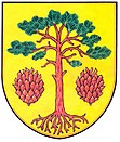
Bory (Czech Republic)
| Bory | ||||
|---|---|---|---|---|
|
||||
| Basic data | ||||
| State : |
|
|||
| Region : | Kraj Vysočina | |||
| District : | Žďár nad Sázavou | |||
| Area : | 1647 ha | |||
| Geographic location : | 49 ° 26 ' N , 16 ° 2' E | |||
| Height: | 598 m nm | |||
| Residents : | 790 (Jan. 1, 2019) | |||
| Postal code : | 594 61 | |||
| License plate : | J | |||
| traffic | ||||
| Street: | Radostín nad Oslavou - Vídeň | |||
| structure | ||||
| Status: | local community | |||
| Districts: | 3 | |||
| administration | ||||
| Mayor : | Josef Březka (as of 2018) | |||
| Address: | Bory 232 594 61 Bory |
|||
| Municipality number: | 595641 | |||
| Website : | www.bory.cz | |||
Bory (German Borry ) is a municipality in the Czech Republic . It is located eight kilometers north of Velké Meziříčí and belongs to the Okres Žďár nad Sázavou .
geography
Bory is located in the Moravian Bohemia-height corresponding Křižanovská vrchovina ( Krischanauer mountains ) the stream Babačka ( water stream ). The forest area of Borský les ( Borr Forest ) extends to the north . The Bukovec (579 m) rises in the northwest and the Holý vrch ( Naniwaberg ; 662 m) in the southwest . To the south is the Oslava dam Mostiště .
Neighboring towns are Laštovičky and Rousměrov in the north, Těšíkův Mlýn and Sklené nad Oslavou in the north-east, Radenice in the east, Cyrilov in the south-east, Vídeň in the south, Olší nad Oslavou in the south-west, Netín and Záseeveska in the west, and Krásněves and Kněevesž in the north-west.
history
The municipality of Bory was created on September 1, 1972 through the merger of the two villages Horní Bory and Dolní Bory.
Dolní Bory is the oldest part of the municipality and was first mentioned in 1336 under the name Brana Boemicalis ( Bohemian Brana ). In the second half of the 14th century the village was divided between the lords of Mostiště and Radostín . In 1366 Jan von Meziříčí bought the Radostín share and joined him in his rule Meziříčí . The other part was owned by Bohuň from Mostiště in 1370. In 1390 this part was also bought by the Meziříčí manor. In 1538 the name Dolní Bory was used for the first time .
Horní Bory, east of it, has been traceable since 1348 under the name Theutonicalis Kyenheyt ( German Kienheid ). The place name refers to the pine forest originally surrounding the village (Kien dialectal = pine). The German addition to the place name (Latin: Theutonicalis) indicates the original nationality of the residents. The village originally belonged to the Mostiště domain. Later the village was divided between the rule of Krisan and the Cistercian monastery Saar , which held the larger share. In the course of its history the place was also called Kynhayd and Horní Německý Bor . In 1678 Eleonore von Oppersdorff acquired the former monastic share with the estate of Gutwasser . From then on, Horní Bory belonged entirely to the Křižanov estate . In 1784 the manorial farm Horní Bory was parceled out and the family settlement Cyrillhof was created.
After the abolition of patrimonial in 1850, the political communities Dolní Bory and Horní Bory (with Cyrilov, Laštovičky , Radenice and Rousměrov ), both of which belonged to the Velké Meziříčí district . Horní Bory including its districts had 1058 inhabitants and in Dolní Bory there were 373. In 1887 Radenice and Rousměrov with Laštovičky formed their own communities.
At the beginning of 1961 the Okres Velké Meziříčí was dissolved and the communities assigned to the Okres Žďár nad Sázavou . In 1972 the two communities were united under the name Bory.
At Horní Bory there is a larger quarry, west of Dolní Bory feldspar was formerly mined. Bory is also known as a mineralogical site. a. known from tourmaline and lollingite . The community intends to set up a village and mineral museum.
Local division
The municipality Bory consists of the districts Cyrilov ( Cyrillhof ), Dolní Bory ( Lower Borry ) and Horní Bory ( Upper Borry ).
The municipality is divided into the cadastral districts of Dolní Bory and Horní Bory.
Attractions
- Church of St. Egidius in Dolní Bory, the late Romanesque building from the 2nd half of the 13th century was redesigned in Baroque style at the end of the 18th century
- Church of St. Martin in Horní Bory, originally Gothic building from 1250 to 1280
- Chapel of St. Cyril and Method in Cyrilov
- Natural monument Mrázkova louka, the marsh meadow is located north of Horní Bory on the road to Rousměrov in Borský les
- Rasůveň natural monument with remains of a primeval beech forest on the Bukovec mountain
- Atonement stone in Horní Bory
Web links
Individual evidence
- ↑ http://www.uir.cz/obec/595641/Bory
- ↑ Český statistický úřad - The population of the Czech municipalities as of January 1, 2019 (PDF; 7.4 MiB)
- ↑ L. Hošák, R. Šrámek, Místní jména na Moravě a ve Slezsku I, Academia, Praha 1970, II, Academia, Praha 1980th
- ↑ http://www.uir.cz/casti-obce-obec/595641/Obec-Bory
- ↑ http://www.uir.cz/katastralni-uzemi-obec/595641/Obec-Bory

