
Senoncourt-les-Maujouy
| Senoncourt-les-Maujouy | ||
|---|---|---|
|
||
| region | Grand Est | |
| Department | Meuse | |
| Arrondissement | Verdun | |
| Canton | Dieue-sur-Meuse | |
| Community association | Meuse-Voie Sacrée | |
| Coordinates | 49 ° 4 ′ N , 5 ° 20 ′ E | |
| height | 219-343 m | |
| surface | 14.94 km 2 | |
| Residents | 95 (January 1, 2017) | |
| Population density | 6 inhabitants / km 2 | |
| Post Code | 55220 | |
| INSEE code | 55482 | |

Senoncourt-les-Maujouy is a French commune with 95 inhabitants (as of January 1, 2017) in the Meuse department in the Grand Est region (before 2016: Lorraine ). The municipality belongs to the arrondissement of Verdun and the canton of Dieue-sur-Meuse (until 2015: canton of Souilly ).
geography
Senoncourt-les-Maujouy is about twelve kilometers south-southwest of Verdun . Senoncourt-les-Maujouy is surrounded by the neighboring communities of Landrecourt-Lempire in the north and north-west, Dugny-sur-Meuse in the north and north-east, Ancemont in the east, Souilly in the south and south-west and Lemmes in the west.
history
Senoncourt-les-Maujouy formed together with Lemmes , Osches and Vadelaincourt from 1973 to 1984 the municipality of Les Quatre-Vents .
Population development
| year | 1962 | 1968 | 1975 | 1982 | 1990 | 1999 | 2006 | 2011 | 2016 |
| Residents | 144 | 120 | 84 | 104 | 85 | 79 | 90 | 97 | 90 |
| Source: Cassini and INSEE | |||||||||
Attractions
- La Nativité-de-la-Bienheureuse-Vierge-Marie church
- French national cemetery

La Nativité-de-la-Bienheureuse-Vierge-Marie church
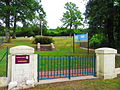
French national cemetery


literature
- Le Patrimoine des Communes de la Meuse. Flohic Editions, Volume 2, Paris 1999, ISBN 2-84234-074-4 , p. 899.