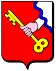
Assenoncourt
| Assenoncourt | ||
|---|---|---|

|
|
|
| region | Grand Est | |
| Department | Moselle | |
| Arrondissement | Sarrebourg-Château-Salins | |
| Canton | Sarrebourg | |
| Community association | Sarrebourg Moselle Sud | |
| Coordinates | 48 ° 46 ′ N , 6 ° 48 ′ E | |
| height | 210-253 m | |
| surface | 16.69 km 2 | |
| Residents | 116 (January 1, 2017) | |
| Population density | 7 inhabitants / km 2 | |
| Post Code | 57260 | |
| INSEE code | 57035 | |
Assenoncourt (German Essesdorf , 1940-44 Hesselsdorf ) is a French commune with 116 inhabitants (as of January 1, 2017) in the Moselle department in the Grand Est region (until 2015 Lorraine ). It belongs to the arrondissement of Sarrebourg-Château-Salins .
geography
Assenoncourt is located southeast of the Linderweiher ( Étang de Lindre ) and about 20 kilometers west of Sarrebourg at an altitude between 210 and 253 m above sea level. The municipality covers 16.69 km². The municipality is part of the Lorraine Regional Nature Park .
The district of Viller ( Weiler ), a little to the southwest, also belongs to the municipality .
history
The village was known as Essestroff in the 18th century and has belonged to France since 1766.
Population development
| year | 1962 | 1968 | 1975 | 1982 | 1990 | 1999 | 2007 | 2014 |
| Residents | 178 | 178 | 171 | 161 | 141 | 119 | 137 | 116 |
See also
Web links
Commons : Assenoncourt - collection of images, videos and audio files
