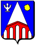
Hampont
| Hampont | ||
|---|---|---|

|
|
|
| region | Grand Est | |
| Department | Moselle | |
| Arrondissement | Sarrebourg-Château-Salins | |
| Canton | Le Saulnois | |
| Community association | Saulnois | |
| Coordinates | 48 ° 50 ′ N , 6 ° 35 ′ E | |
| height | 207-321 m | |
| surface | 11.23 km 2 | |
| Residents | 185 (January 1, 2017) | |
| Population density | 16 inhabitants / km 2 | |
| Post Code | 57170 | |
| INSEE code | 57290 | |
 St. Martin Church |
||
Hampont is a French commune with 185 inhabitants (as of January 1, 2017) in the Moselle department in the Grand Est region (until 2015 Lorraine ). It belongs to the arrondissement of Sarrebourg-Château-Salins .
Geographical location
The municipality of Hampont is located on the Kleine Seille in Saulnois , five kilometers northeast of Château-Salins , at an altitude of between 207 and 321 m above sea level. The 11.23 km² municipal area is part of the Lorraine Regional Nature Park .
history
The place was first mentioned in the 12th century as Hampons , then as Hudingen (1594).
The place was named Hudingen from 1915 to 1918 and the station was named Hudingen (Lorraine) . 1940-1944, during the German occupation of France in World War II , the place was called Hüdingen .
- Population development
| year | 1962 | 1968 | 1975 | 1982 | 1990 | 1999 | 2007 | 2015 |
| Residents | 242 | 240 | 226 | 228 | 223 | 212 | 208 | 190 |
people
The National Socialist and general of the Waffen SS Theodor Eicke (1892–1943) was born here as the eleventh child of a station master.
