Laneuveville-en-Saulnois
| Laneuveville-en-Saulnois | ||
|---|---|---|

|
|
|
| region | Grand Est | |
| Department | Moselle | |
| Arrondissement | Sarrebourg-Château-Salins | |
| Canton | Le Saulnois | |
| Community association | Saulnois | |
| Coordinates | 48 ° 52 ' N , 6 ° 26' E | |
| height | 255-342 m | |
| surface | 6.49 km 2 | |
| Residents | 303 (January 1, 2017) | |
| Population density | 47 inhabitants / km 2 | |
| Post Code | 57590 | |
| INSEE code | 57381 | |
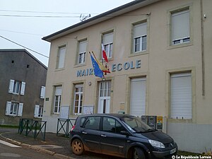
 Town hall and school building |
||
Laneuveville-en-Saulnois is a French commune with 303 inhabitants (as of January 1, 2017) in the Moselle department in the Grand Est region (until 2015 Lorraine ). It belongs to the arrondissement of Sarrebourg-Château-Salins .
geography
Laneuveville-en-Saulnois is located between Delme and Château-Salins in Saulnois at an altitude between 255 and 342 m above sea level, the mean height is 290 m. The municipality covers 6.49 km², and the population density is 35 people per km².
history
The village has belonged to France since 1661 and was incorporated into the neighboring Fonteny until 1826 . 1915-18 and 1940-44 it bore the Germanized name Neuheim .
Population development
| year | 1962 | 1968 | 1975 | 1982 | 1990 | 1999 | 2007 |
| Residents | 167 | 167 | 131 | 129 | 139 | 184 | 254 |
Web links
Commons : Laneuveville-en-Saulnois - collection of images, videos and audio files
