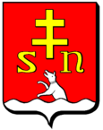
Munster (Moselle)
| Muenster | ||
|---|---|---|

|
|
|
| region | Grand Est | |
| Department | Moselle | |
| Arrondissement | Sarrebourg-Château-Salins | |
| Canton | Le Saulnois | |
| Community association | Saulnois | |
| Coordinates | 48 ° 55 ' N , 6 ° 54' E | |
| height | 217-248 m | |
| surface | 6.60 km 2 | |
| Residents | 249 (January 1, 2017) | |
| Population density | 38 inhabitants / km 2 | |
| Post Code | 57670 | |
| INSEE code | 57494 | |
 View of Munster from the southeast |
||
Munster (German Münster , Lorraine Minschder ) is a French commune with 249 inhabitants (as of January 1, 2017) in the Moselle department in the Grand Est region ( Lorraine until 2015 ). It belongs to the arrondissement of Sarrebourg-Château-Salins .
geography
Munster is located five kilometers southeast of Albestroff at an altitude of between 217 and 248 meters above sea level. The municipality covers 6.6 km². The place is surrounded by agricultural land and little forest. South of the village is the Neuf Étang, one of the many dammed ponds in the area. The municipality is crossed by the river Rode and its tributary Rose . Munster is located in the Lorraine Regional Nature Park .
history
Munster was looted in the Wars of Religion and the Thirty Years War , and many buildings were damaged or destroyed.
The village belonged to Albestroff from 1973 to 1983 .
Population development
| year | 1962 | 1968 | 1975 | 1982 | 1990 | 1999 | 2007 | 2015 |
| Residents | 238 | 238 | 227 | 243 | 230 | 197 | 212 | 254 |
Culture and sights
A landmark of the small community that is visible from afar is the eponymous "Münster" - the Saint-Nicolas collegiate church from the 13th century. The church was modernized in the 15th and 18th centuries.

