
Zugspitze
| Zugspitze | ||
|---|---|---|
 Zugspitze massif from the west (Zugspitze summit on the left) |
||
| height | 2962.06 m above sea level NHN | |
| location | Border Bavaria , Germany / Tyrol , Austria | |
| Mountains | Wetterstein Mountains , Eastern Alps | |
| Dominance | 25.8 km → Zwölferkogel | |
| Notch height | 1746 m ↓ Fernpass | |
| Coordinates | 47 ° 25 ′ 16 ″ N , 10 ° 59 ′ 11 ″ E | |
|
||
| rock | Wetterstein lime | |
| Age of the rock | Triad | |
| First ascent | August 27, 1820 by Josef Naus , Johann Georg Tauschl , Messgehilfe Maier | |
| Normal way | Reintal route | |
| particularities | Highest mountain in the German Alps as well as Bavaria and Germany , own zip code : 82475 Schneefernerhaus |
|
 Surroundings of the Zugspitze |
||

The Zugspitze is 2962 m above sea level. NHN the highest peak of the Wetterstein Mountains and at the same time Germany's highest mountain, which it shares with Austria .
The Zugspitze massif is located southwest of Garmisch-Partenkirchen in Bavaria and in the north of Tyrol . The border between Germany and Austria runs over its western summit . South of the mountain that includes Zugspitzplatt on a karst - plateau with numerous caves. On the flanks of the Zugspitze there are three of the total of five Bavarian glaciers : the Northern and Southern Schneeferner , both of which are seriously endangered, and the Höllentalferner .
The first named ascent of the Zugspitze was made in 1820 by the surveyor and then lieutenant in the Bavarian army Josef Naus , his assistant Maier and the mountain guide Johann Georg Tauschl. Today there are three normal routes to the summit: from the northeast from the Höllental , from the southeast from the Reintal and from the west over the Austrian Schneekar . With the Jubiläumsgrat one of the most famous ridge routes in the Eastern Alps leads to the Zugspitze.
Today the mountain is accessible with three mountain railways - the Tyrolean Zugspitzbahn , the Bavarian Zugspitzbahn and the Zugspitze cable car . In winter, several ski lifts also serve a ski area on the Zugspitzplatt. The Tiroler Zugspitzbahn and the Zugspitze cable car are cable cars. The Bavarian Zugspitzbahn is a cogwheel railway that runs on rails and mostly in tunnels to the Zugspitzplatt a few hundred meters below the Zugspitze, from where another cable car leads to the Zugspitze.
Surname
From the early 14th century, names from the Wetterstein Mountains began to be included in contracts and cards, which intensified in the 15th century. In 1536 a border treaty from 1500 was specified, in which the course of a "Schartten" was determined. In the 17th century the notch got the addition "now called Zugspüz" in the contract . The mentioned gap refers to a cut in the terrain at the summit of the Zugspitze and is used again and again in other sources. In the Middle Ages, "Scharte" was the common name for the Zugspitze.
The Zugspitze was first mentioned by name in 1590. A description of the border between the county of Werdenfels and Austria states that it runs “from the Zugspitz and over the Derle” and on to a Loisach bridge. Another border treaty said in 1656: "The highest Wetterstain or Zugspitz" . From the second half of the 18th century comes a map showing the Reintal in the county of Werdenfels . It depicts the Reintal from the Reintaler Hof to the Zugspitzplatt and contains prominent points in the area, details on the use of pastures and paths, including the path over the, at that time, much larger Schneeerner to the summit regions of the Zugspitze. A clear path to the summit cannot be seen on the map.
The name of the Zugspitze is probably derived from the "tracks" of the avalanches , which in winter descend from the upper areas of the massif into the valley and leave behind characteristic avalanche remains with stones and rubble. At Eibsee there are several parcels with the same name reference : Zug , Zuggasse , Zugstick , Zugmösel or Zugwankel . The Zugspitze was used as a name until the 19th century . In a map from 1836 it became the Zugspitze.
geography
Location and surroundings


With a height of 2962 meters (east summit), the Zugspitze is the highest mountain in the Zugspitze massif. This value according to the Amsterdam level is given as the official level by the State Office for Digitization, Broadband and Surveying . According to the Trieste level used in Austria, which is 27 cm lower , the same height is given. Originally, the Zugspitze had three peaks : east, middle and west peaks . The only one of them that has been preserved in its original form is the eastern summit, which lies entirely in Germany. The central summit fell victim to a cable car summit station in 1930. In 1938 the western summit was blown up in order to gain building space for a planned Wehrmacht flight control center . However, this was never built. Originally the height of the western summit was 2964 m.
The Zugspitze rises eleven kilometers southwest of Garmisch-Partenkirchen and almost six kilometers east of Ehrwald . The border between Germany and Austria runs over the western summit. The Zugspitze massif thus belongs to the German state of Bavaria and the Austrian Tyrol . The administrating municipalities are Grainau and Garmisch-Partenkirchen on the Bavarian side and Ehrwald on the Tyrolean side. To the west, the Zugspitze massif descends into the valley of the Loisach , which flows around the massif in an arc to the northeast, while the rivers Hammersbach and Partnach arise in the east . To the south, the Gaistal and the Leutascher Ache separate the Wetterstein Mountains from the Mieming chain . In the north is the Eibsee at the foot of the Zugspitze. The next higher mountain in the area is the Zwölferkogel ( 2988 m ) in the Stubai Alps , so that the dominance value for the Zugspitze is 25.8 km. The Parseierspitze ( 3036 m ) serves as the reference point for the height of the notch . To climb it from the Zugspitze, you have to descend to the Fernpass ( 1216 m ), so that the saddle height is 1746 m.
Zugspitze massif
The massif of the Zugspitze includes other peaks. To the south, the Zugspitzplatt is framed in an arc by the Zugspitzeck ( 2820 m ) and Snowernerkopf ( 2874 m ), the Wetterspitzen ( 2747 m ), the Wetterwandeck ( 2698 m ), the Plattspitzen ( 2679 m ) and the Gatterlköpf ( 2490 m ). The solid ends with the Gatterl ( 2024 m ), a notch for Hochwanner out. From the Zugspitze to the east, the Jubiläumsgrat runs in the direction of the Alpspitze and Hochblassen over the Höllentalspitzen . In a north-easterly direction, the short Riffelwandkamm runs over the Riffelwandspitzen ( 2626 m ) and the Riffelköpfe ( 2459 m ) to the Riffelscharte ( 2161 m ). From here the Waxensteinkamm runs over the Riffelspitzen to the Waxenstein .
Zugspitzplatt
The Platt (also Zugspitzplatt) is a plateau below the Zugspitz summit in a south and south-east direction at an altitude between 2000 and 2650 m. It forms the end of the Reintal and was created through weathering , karstification and glacial overprinting. The area contains round humps , sinkholes , carts or crags as a result of the ice ages. In addition, moraines have remained from various cold ages . The Platt was completely glaciated for the last time at the beginning of the 19th century . Today it consists of 52% rubble , 32% rock and 16%, especially in the middle and lower areas, of soils with vegetation.

Natural allocation
The Zugspitze belongs to the natural spatial main unit group Northern Limestone Eastern Alps (No. 93; part of the Northern Limestone Alps ), in the main unit Inntaler Riffkalkkette (933) and in the subunit Wetterstein Mountains (933.0) to the natural area Wettersteinketten (933.04).
Adjacent natural areas clockwise are: The landscape falls to the northeast into the natural area Höllental (933.01) through which the Hammersbach flows and to the east into the natural area Reintal (933.02) through which the Partnach flows . To the south it leads over to the Wetterspitzen in order to drop from there into the part of Obere Leutasch (930.320) belonging to the natural area Leutasch (930.32) . To the southwest to the west it falls directly into the natural area Ehrwalder Becken ( Lermooser Becken ; 930.22), which belongs in the main unit basin and valley floor between the main groups of the Northern Limestone Eastern Alps (930) to the sub-unit Fernpass-Loisachtaler basin and valley floors (930.2) . To the northwest, the landscape drops into the natural area of the north-west Wetterstein base ( Törlenplatte ; 933.00) on the Hohen Egg and the bollard heads . To the north it descends to the Eibseeplatte (930.250) near the Eibsee and to the northeast, among other things, over the Waxenstein to the southern Werdenfelser Mittelgebirge (930.251), which are both parts of the natural area Werdenfelser Mittelgebirge (930.25).
climate
From a climatic point of view, the Zugspitze lies in the moderate climatic zone and in the area of the west wind zone . As the first high orographic obstacle to these westerly winds in the Alps, the Zugspitze is particularly exposed to weather events. This leads to the "northern damming of the Alps", which damms up the humid air masses and ensures intensive precipitation. On the other hand, the Zugspitze also has a shielding function for parts of the Alps to the south. The foehn weather, which occurs 60 days a year in the region, counteracts the northern dam. Dry and warm air masses flow from south to north. They can cause exceptionally high temperatures in winter. However, there is still frost on the Zugspitze for an average of 310 days.
For the normal period between 1961 and 1990, the annual average precipitation on the Zugspitze was 2003.1 mm , the wettest month was April with 199 mm, and October with the lowest rainfall was 108.8 mm. The average temperature in this normal period was -4.8 degrees Celsius , with July and August being the warmest at 2.2 ° C and February being the coldest at -11.4 ° C. On average, the sun shone for 1846.3 hours a year during the normal period, October was the sunniest with 188.8 hours and December was the sunniest with 116.1 hours. In 2009 the Zugspitze was the coldest place in Germany with an annual mean of −4.2 ° C , according to the weather report of the German Meteorological Service .
The lowest measured temperature on the Zugspitze on February 14, 1940 was −35.6 ° C. July 5, 1957 brought the highest; its value was 17.9 ° C. A gust of wind on June 12, 1985 reached 335 km / h, the highest wind speed measured on the Zugspitze. The highest measured snow depth was 7.80 m on April 26, 1980.
| Zugspitze | ||||||||||||||||||||||||||||||||||||||||||||||||
|---|---|---|---|---|---|---|---|---|---|---|---|---|---|---|---|---|---|---|---|---|---|---|---|---|---|---|---|---|---|---|---|---|---|---|---|---|---|---|---|---|---|---|---|---|---|---|---|---|
| Climate diagram | ||||||||||||||||||||||||||||||||||||||||||||||||
| ||||||||||||||||||||||||||||||||||||||||||||||||
|
Average monthly temperatures and precipitation for Zugspitze
Source: wetterkontor.de , German Weather Service
|
||||||||||||||||||||||||||||||||||||||||||||||||||||||||||||||||||||||||||||||||||||||||||||||||||||||||||||||||||||||||||||||||||||||||||||||||||||||||||||||||||||||||||||||||||||
geology
All mountain-forming layers consist of sediments from the Mesozoic Era that were originally deposited on the sea floor. The base of the mountain consists of shell limestone layers, the upper area is formed by Wetterstein limestone . With steep walls up to 800 m high, Wetterstein limestone from the Upper Triassic forms the walls, ridges, towers and the summit rock of the mountains. Due to the frequent occurrence of marine calcareous algae in the Wetterstein Limestone, it can be assumed that this rock was once formed in a lagoon. The color of the rock varies between gray-white and light gray to speckled. Lead and zinc ores are contained in several places . These mineral resources were 1827 to 1918 in Höllentalbahn by mining won. The dark gray, almost horizontal layers of shell limestone, partly overgrown with grass, stretch from the foot of the Großer Riffelwandspitze to the Ehrwalder Köpf. If you take a look at the north face of the Zugspitze, you can see that the mountain range originally consisted of two mountains that were pushed one on top of the other.

In a prehistoric landslide around 3750 years ago, around 200 million cubic meters of rock from the Bavarian Schneekar broke off against the Eibsee floor. The rock masses deposited in the valley floor contain significantly more material than seems to be missing at the eruption site. Geologists therefore suspect that the event also caused an original, higher summit structure to descend into the valley. Therefore, the Zugspitze could have been a three-thousand-meter peak in geological terms .
glacier
In the Zugspitze massif there are three of the five German glaciers, in addition to the Höllentalferner the southern and northern snowerners .
Höllentalferner

The Höllentalferner lies northeast of the Zugspitze in a cirque below the Jubiläumsgrat in the south and the Riffelwandspitzen in the west and north. It is exposed to the northeast . The nutrient area is formed by a hollow in which large amounts of avalanche snow collect. To the south, the Jubiläumsgrat seals off the glacier from direct sunlight. These circumstances meant that the glacier suffered only a relatively small loss of area between 1981 and 2006. The Höllentalferner had its modern highest level around 1820 with a size of 47 ha . After that it continuously lost its area until between 1950 and 1981 it increased again by 3.1 ha to 30.2 ha. From then until 2006 the glacier lost 5.5 hectares and was only 24.7 hectares in size. Its highest point was in 2006 at 2569 and its lowest at 2203 m.
Schneeerner


Northern Schneeerner
To the south-west of the Zugspitze, between Zugspitzeck and Schneefernerkopf, there is the northern snowerner, which is exposed to the east. With an area of 27.9 hectares (2013), it is the largest German glacier, but at the end of the 19th century it still comprised 103 hectares. Around the year 1820 the entire Zugspitzplatt was glaciated, of this Plattgletscher only the northern and southern snowerners are left. Despite the lack of shade, the reason for the relatively constant development of the northern Schneeerner area in recent years is the favorable nature of the terrain . It leads to the glacier losing or gaining in thickness rather than in area. In the more recent past, the glacier has also been artificially nourished by the ski area operators by pushing large amounts of snow onto the glacier with snow groomers in order to extend the ski season. In 1993, a start was also made to cover the northern snow farmer with plastic tarpaulins in the summer to protect it from direct sunlight. However, this undertaking was abandoned by the Bavarian Zugspitzbahn in 2013. The northern snow farmer had its last peak in 1979, when it measured 40.9 hectares. By 2006 its area had decreased to 30.7 hectares. The highest point was at 2789 m and the lowest at 2558 m. By 2013 it shrank further to 27.9 ha.
Southern Schneeerner
The southern Schneeferner is framed by the weather peaks and the Wetterwandeck . It is also a remnant of the large Platt glacier . It is controversial whether the southern snowerner can still be classified as a glacier. The southern snow farmer also had its last peak in 1979 when it covered an area of 31.7 ha. However, it decreased to 3.4 hectares by 2015. The highest point of the glacier was at 2641 m and the lowest at 2557 m.
Permafrost
The decline in permafrost is a global problem. The Zugspitze is not excluded from this either. There is an old supply tunnel at the Zugspitze. 30 years ago the tunnel was completely iced over. However, a team of researchers from the University of Bonn found that there is not much left of the meter-thick layers of ice. Measurements using sound waves and electrical conductivity allowed scientists to come to the same result: there is only a little permafrost left in the rock of the Zugspitze.

The rocks of such mighty mountains are held together by the ice in the crevices and crevices. If this melts, parts of it can break off. It is believed that this caused a landslide on the Zugspitze 3,700 years ago .
An early warning system was therefore created in August 2007. At the summit of the Zugspitze, a 60 meter long tunnel with a diameter of 12 centimeters was created in a north-south direction. This should regularly provide information about how much ice there is in the summit area.
caves
Below the Zugspitzplatt, chemical weathering processes have created a large number of caves and shafts in the Wetterstein limestone . In the 1930s the number of caves was estimated at 300; The first research there was in 1931. By 1955 62 caves were known, by 1960 47 more were discovered. Larger explorations took place in 1935, 1936 and between 1955 and 1968. During an expedition in 1958, the Finkenschacht was discovered, the deepest cave of the Zugspitze to date. It is 131 m deep, 260 m long and meets a watercourse.
nature
flora

The flora is not particularly varied due to the soil conditions, but the flora is particularly colorful on the Schachen, on the Tieferer Wies near Ehrwald, in the Höllen, Gais and Leutasch valleys.
The shady and humid north of the massif, such as the Wetterstein Forest , is one of the most species-rich areas of the Zugspitze. The mountain pine reaches heights of over 1800 m. The forests below consist mainly of spruce and fir , but honeysuckle , woodruff , single berry , meadow rue and speedwell are also found here. On less heavily overgrown places bloom Black Columbine , Alpenrebe , Blauer- and Yellow Eisenhut , weather thistle , aster bellidiastrum , gold cinquefoil , Saxifraga rotundifolia , wall hawkweed , mountain mint and alpine forget-me-not . On the rocky soils of the mountain forest, cinquefoil , sticky sage , butterbur , alpine rose , Turk's union , orchid and fly ragweed thrive ; especially in Höllental, in Grainau and at the Eibsee the lily of the valley and the daphne .
Towards the south the picture changes into larches - (mainly at the Ehrwalder Alm, in the Gais and Leutasch valleys) and pine forests and into a mixed forest of beech and sycamore . Mountain pines also grow there at higher altitudes up to over 2000 meters.
Linden , birch , mountain ash , juniper and yew are relatively rare in the entire Zugspitze region . The most diverse types of mosses , which often completely overgrow exposed limestone cliffs in the forests, are very numerous.
Blueberries , cranberries and lingonberries are limited to dry spots . In sheltered locations standing lady's slipper . Below the wax stones you can find fields with raspberries and occasionally wild strawberries . The alpine poppy and opposed saxifrage thrive up to a great height . In the scree there are light and horn herbs as well as white silver arum , alpine herb and musk saxifrage . After the snow has melted, dark stonecrop and snow gentian sprout first, and their seeds begin to germinate as early as autumn. The famous alpine flowers edelweiss , gentian and rarely the cyclamen also bloom on the Zugspitze.
fauna

The chamois habitat is in the rocks around the Zugspitze . The marmot is common on the south side of the massif . At the summit of the Zugspitze, there is mainly the alpine chough , which is attracted to feeding people. The area of the mountain hare and the dormouse is a little deeper . Occurring alpine birds are also golden eagles , ptarmigan , snow sparrow , alpine lark and mountain finch . The rock swallow , from which the Schwalbenwand on the Kreuzeck owes its name, is also frequently encountered. The valley of Mittenwald and Seefeld, as well as the Fernpass, are bird migration routes.
The mountain lizard and the black alpine salamander , also called "Bergmandl", live in rocky terrain and can usually be seen climbing mountains after a rain shower. On the west and south side of the Zugspitze mountain are mainly in July and August as butterflies Apollo butterfly , alpine Perlmutter, Bluebird , Spanner , Mohren- and skipper observed. The forests around the Zugspitze are home to red deer , squirrels , weasels , capercaillie , hazel grouse and black grouse . Glacier fleas and tardigrades live on the glaciers .
Protected areas
To extend to the summit of the Zugspitze parts of the protected landscape Wettersteinplatz area including Latsch belt near Mittenwald ( CDDA , reported in 1976; -No 395,756th 85.8919 square kilometers in size). Up to the summit region zoom, parts of the pull fauna Habitats -region Wettersteingebirge (FFH No. 8532-371.; 42.5691 sq km) and up to only the interior Höllentalspitze zoom those of the nature reserve Schachen and Reintal (CDDA no. 20723; 1970; 39.6502 km²) and the bird sanctuary Schachen and Reintal (VSG no. 8532-471; 39.6564 km²).
Summit cross
.jpg)
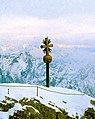
A summit cross has stood on the Zugspitze since 1851 . The driving force behind the erection of a cross on the summit was Pastor Christoph Ott. In his capacity as a meteorological observer on the Hohe Peißenberg , he saw the Zugspitze from a distance and was annoyed that “the first prince of the Bavarian mountain world raised his head bare and unadorned in the blue skies, waiting until he felt patriotic and courageous Determination would take it upon himself to decorate his head with dignity. ” He then organized an expedition for August 11th to 13th, 1851 with the aim of erecting a summit cross on the Zugspitze. Through the Partnach Gorge and the Reintal , 28 porters reached the Zugspitze under the guidance of forester Karl Kiendl. The undertaking costing 610 guilders and 37 cruisers was successful. As a result, a 28-piece, 14- foot (4.7 m ) high, gold-plated iron cross stood on the west summit. Pastor Ott himself did not climb the Zugspitze until 1854. After 37 years the cross was damaged by numerous lightning strikes; In addition, the mounts were badly damaged. In the winter of 1881/1882 it was therefore brought down into the valley for the first time and renovated. On August 25, 1882, seven mountain guides and 15 porters brought the cross back up. Because a barrack-like accommodation had meanwhile been built on the west summit, the men placed the cross on the east summit, which was then only the second highest
This relocation of the summit cross is probably the background of a legend according to which Emperor Franz Joseph I of Austria in 1854, on the occasion of his marriage to Elisabeth of Austria-Hungary ("Sisi"), gave the eastern part of the Zugspitze summit to his cousin Ludwig (at that time he was still not a king and only 9 years old). In fact, the (eastern) summit, which has been on Bavarian or Freisingian territory for over 500 years, was never given away, only the summit cross was moved. The boundary between Werdenfels and Tyrol on the Zugspitze, which was laid down in the Karwendel Treaty of 1766, was confirmed by the boundary adjustment treaty between Bavaria and Tyrol in 1844 and has not been changed since then.
After the transfer, the cross remained in its new place for almost 111 years until it was dismantled again on August 18, 1993. This time the damage came not only from the weather, but also from American soldiers who shot the cross at the end of the war in 1945. Because the summit cross could no longer be repaired, a replica true to the original was made. After two months, the cog railway transported the new Cross on October 12 to Zugspitzplatt from where it with the helicopter was flown to the summit. The original summit cross can be seen in the Werdenfels Museum in Garmisch-Partenkirchen. The new cross is 4.88 m high. It was renovated and re-gilded in 2009 for 15,000 euros and has been back on the east summit since April 22, 2009. During the construction work on the new Eibsee cable car (2015-2017) the summit cross was damaged when the construction crane was de-iced. When the crane swiveled, a chain cut off one of the three-part golden rays, which, however, was recovered by mountain guides. On October 17, 2017, the cross was dismantled and taken down to the valley by cable car to be repaired in a locksmith's shop in Eschenlohe. It was reinstalled in December 2017. On the night of March 7, 2019, one of the four elements of the halo was torn off by a storm. An employee of the Zugspitzbahn was able to recover the missing piece.
In 2012 a Muslim prayer house was built on the summit. At the same time, a photo of the summit without the summit cross was published in the new advertising brochure. The selection of images was criticized by the Bavarian churches as a denial of the religious roots of the country and a misplaced ingratiation to the Muslim guests.

Reconstruction in 1882. Illustration from the gazebo
The old summit cross in March 1979

The damaged new cross: the rays are missing at the bottom right (October 2017)
_b_661.jpg)


timeline
.jpg)

On March 19, 1922, the pilot Franz Hailer caused a sensation when he landed an airplane on the Zugspitze for the first time. The Rumpler CI double-decker aircraft equipped with skids landed on the Schneeerner, 50 m below the summit. On April 29, 1927, Ernst Udet took off on the Schneeerner in a glider and reached Lermoos after a 25-minute flight . The plane, dismantled into individual parts, was transported to the Zugspitze by cable car. In the winter of 1931/32 a post office for the then Reichspost was set up on the Zugspitze. It still exists today in the Sonn Alpin restaurant with the address: 82475 Zugspitze . Four years after the glider took off, the first balloon launch from the Zugspitze succeeded in 1931 .
In April 1933 the mountain was occupied by 24 SA men who hoisted a swastika flag on the tower of the weather station . A month later, SA and SS men formed up on the Schneeferner in the form of a swastika. On April 20, 1945, the US Air Force dropped bombs over the Zugspitze, which destroyed the valley station of the Tiroler Zugspitzbahn and damaged the Kammhotel. After the end of the war, the Allies confiscated the Zugspitzbahn and the Schneefernerhaus. In 1948, Deutsche Post put a radio relay system into operation on the summit.
In September 1948 Hans Zimmer had a 130 m long high rope stretched across the 1000 m deep gorge between the east and west peaks to the tower building of the cable car. Siegward Bach , who later repeated this risk like Gisela Lenort, undertook the rope run in bad weather . Two members of the Traber (artist family) rode the same route in 1953 on a tightrope with a motorcycle.
Since 1953, takes place on the Gatterl annually Gatterlmesse instead. The occasion is the commemoration of the avalanche death of four Bavarian border police officers in 1952 and of all those who died in an accident in the Zugspitz area.
In 1962 a fire destroyed the Kammhotel at the mountain station of the Tyrolean Zugspitzbahn. The earthquake in Friuli in 1976 had a particularly strong effect on the Zugspitze; the meteorologist on duty feared the observation tower could collapse. A chapel was donated on the Zugspitzplatt in 1981 , which the Archbishop of Munich and Freising at the time, Josef Ratzinger , consecrated to the Visitation of Mary in October . On March 25th, an ATM was installed in the summit station, but it has since been dismantled. In 1995 a 450 m² exhibition space was opened on the summit, in which artists present their works alternately every six months. Also in 1995, border traffic between Germany and Austria was opened at the summit.
The Zugspitze Extreme Mountain Run has been held every year since 2000 . It caused a lot of media coverage in July 2008 when two participants died of exhaustion and hypothermia after a summer fall in the weather .
At the end of August 2009, the Swiss Freddy Nock balanced on the rope of the Zugspitz glacier cable car from the Zugspitzplatt to the summit. He covered the 995 m long and up to 56% steep route (difference in altitude: 348 m) unsecured in 50 minutes. On August 20, 2011, Nock balanced again over the rope of the Zugspitz glacier lift, but this time he did without a balancing aid.
Alpinism
First ascent

The first documented ascent of the Zugspitze was made on August 27, 1820 by Lieutenant Josef Naus and the mountain guide Johann Georg Tauschl together with Naus' acolyte and officer boy Maier. On July 21st, Naus had already explored the route through the Reintal to the northern snowerner. The lieutenant was in the Werdenfelser Land as part of a surveying order from the Royal Bavarian Topographical Bureau for the Atlas of Bavaria . As a group, the three climbed up to the shepherds' accommodation at Angerhütte on August 26th, together with Captain Jetze and Lieutenant Antlischek . On August 27 at four in the morning, the three first climbers set off for the Zugspitzplatt and Zugspitzgipfel. From the Schneeerner they tried to reach the west summit via the west ridge. The first attempt failed, the second was successful. They finally reached the western summit at 11:45 a.m., where they left a mountain stick with a cloth as a sign of their presence . A thunderstorm and snowfall let the first climbers descend quickly. They returned to the shepherds' hut at around 3 a.m. on August 28th. The mountain guide Tauschl received a wage of two guilders and 42 kreuzers.
Based on a map found in the archive of the German Alpine Club (DAV), there are new assumptions about the first ascent of the Zugspitze. In September 2006, a historical map, probably from the first half of the 18th century, which was mentioned early in books about the Zugspitze but had been lost since 1945, was found in the DAV archive. There is a trail over the Zugspitzplatt to the summit and on the other side back down to the Eibsee. A table of times in the legend of this map from the 18th century describes the route "ybers blath uf Zugspitze" and gives a realistic duration of 8.5 hours, so that it is assumed that the summit could have been climbed before 1820. However, this assumption is controversial. Kurt Brunner and Thomas Horst from the Chair of Cartography and Topography at the University of the Federal Armed Forces in Munich published a scientific publication in the specialist magazine for map history Cartographica Helvetica (issue 35, 2007), which came to the following conclusion: “The map of the Reintal that was found is thus in no way proof of an early first ascent of the Zugspitze. "
The historian Thomas Linder believes that shepherds or hunters have advanced at least as far as the summit regions. It is also conceivable that smugglers used routes over the Zugspitz summit. As early as 1804, cartographic recordings for the county of Werdenfels were made in the area . There are speculations that the electoral engineer-geographer Alois von Coulon could have reached the summit in the course of this work . Since Coulon worked for the Topographical Bureau , it is extremely unlikely that the ascent would not have been noticed there.
Development history

In 1823 Simon Resch and the "Schaf-Toni" reached the eastern summit for the first time. The second ascent of the east summit on September 18, 1834, was also achieved by Simon Resch with his son Johann and the mountain guide Johann Barth. Since Resch's first ascent had been doubted, this time a fire was lit on the summit. On September 27, the third ascent of the eastern summit was made by the royal forest assistants Franz Oberst and Schwepfinger together with Johann Barth. Colonel erected a flagpole with the Bavaria flag on the summit, which was visible from the valley.
The first ascent from Austria was made in August 1837. The surveyors Joseph Feuerstein and Joseph Sonnweber climbed from Ehrwald to the west summit and left a signal pole with their initials there.
The western summit was climbed for the third time on September 10, 1843 by the shepherd Peter Pfeifer. He explored the path for a group of eight mountaineers who later reached the summit on behalf of Bavaria's Crown Princess Marie . She had the path checked for her own ascent of the Zugspitze.
Further milestones:
- On September 22nd, 1853, Karoline Pitzner was the first woman to stand on the Zugspitze.
- The first crossing between the west and east summits was achieved in 1857 by the Munich Härtringer and the mountain guide Joseph Ostler.
- The Irish brothers Trench and the English Cluster succeeded on July 8, 1871, under the leadership of the brothers Joseph and Joseph Sonnweber, in climbing the western summit through the Austrian Snow Car .
- The path through the Höllental to the Zugspitze was walked for the first time on September 26, 1876 by Franz Tillmetz, Franz Johannes with the guides Johann and Joseph Dengg.
- The first winter ascent of the western summit took place on January 7, 1882, the climbers were Ferdinand Kilger, Heinrich Schwaiger, Josef and Heinrich Zametzer and Alois Zott.
- On June 29, 1895, Hans Gazert and Friedrich Voelcker climbed from the Eibsee through the Bavarian Schneekar to the summit.
- The entire length of the Jubilee Ridge was first climbed by Ferdinand Henning on September 2, 1897 .
The number of climbs on the Zugspitze rose sharply every year. While the summit was climbed 22 times in 1854, there had been 1,600 climbs by 1899. Before a cable car was built in 1926, there were more than 10,000.
Normal routes
Zugspitzplatt via Reintal or Gatterl

The easiest of the normal routes leads through the Reintal and is the route of the first to climb. At the same time, it is also the longest ascent. The starting point is the ski stadium ( 730 m ) in Garmisch-Partenkirchen . The path leads through the Partnach Gorge along the Partnach to the Bockhütte ( 1052 m ), where the Reintal begins. Above the Partnach, which seeps away in between, the path leads to the Reintalangerhütte ( 1370 m ). Up to that point the ascent is relatively flat, but becomes steeper afterwards. From the hut it goes through the Brunntal up to the Knorrhütte ( 2051 m ), which is on the eastern edge of the Zugspitzplatt. The variant from Ehrwald via the Gaistal and the Gatterl also meets the Reintalweg here. The route now leads over the Zugspitzplatt in the direction of Nördlicher Schneeferner. Above the Sonn-Alpin station, the insured part of the ascent to the Zugspitze summit begins at point 2815 . A total of 2232 vertical meters have to be overcome on the tour , the pure walking time is between eight and ten hours.
Hell Valley


In Hammersbach ( 758 m ) the ascent begins over the Höllental , along the Hammersbach . The path through the Höllentalklamm was built between 1902 and 1905. Twelve tunnels with a length of 288 meters were created in the 1026 m long gorge. Another 569 m path was blasted out of the rock as a half profile, while 120 m run on footbridges and 49 m over scree. The construction costs totaled 57,000 marks . Every year around 60,000 people cross the gorge. The gorge can also be bypassed on the Stangensteig . The Höllentalangerhütte ( 1381 m ) follows the gorge , after which the Höllentalanger is crossed. Above it you cross the board with steel pins in a rock wall . Over the green hump it goes to the Höllentalferner. The glacier is usually in the summer aper so for his crossing crampons are necessary. The edge gap causes even greater difficulties, however , since the ice is moving further and further away from the rock as it melts. After the Ferner, a via ferrata leads to the summit of the Zugspitze. On this tour, 2204 meters of altitude have to be overcome, which takes between seven and eight hours. There is also the option of taking the Riffelsteig from the Eibsee to the Höllental route. Over the Riffelscharte , the path meets the route in front of the board .
Snow car
A third ascent leads over the Tyrolean Schneekar . Starting points are the Eibsee ( 950 m ) or Ehrwald ( 1000 m ) or the valley station of the Ehrwalder Almbahn ( 1220 m ). The two paths meet above the Gamskar . Then it goes on to the Wiener Neustädter hut ( 2209 m ) and through the Schneekar , at the end of which a via ferrata begins. In the course of this, the stopper , a natural leaching cavity , is climbed. The path then meets the insured passages of the Reintal climb. In eight hours, at least 2012 vertical meters have to be overcome.
Jubilee ridge

One of the most famous ridge routes in the Eastern Alps is the Jubiläumsgrat , which runs from the Zugspitze to the east and over the Inner ( 2737 m ), Middle ( 2740 m ) and Outer Höllentalspitze ( 2716 m ) and the Vollkarspitze ( 2630 m ) to Hochblassen ( 2707 m) ) leads. Before that, the route branches off towards the Grießkarscharte ( 2463 m ) and the Alpspitze ( 2628 m ). The ridge was partially insured with wire ropes by the Munich DAV section between 1909 and 1915. Originally the tour was called Jubiläumsweg , after a tragic rescue operation in 1979, the name Jubiläumsgrat replaced this misleading and simplicity suggestion name. During the tour, which is not a pure via ferrata, uninsured passages have to be mastered again and again, which correspond to the lower III. Level of difficulty . The key point for climbing is a smooth channel (III-). The via ferrata key point ( D ) is located in the area of the Vollkarspitze . The difficulties on the approximately eight kilometer long climbing route are around I and II as well as B. Normally, the ascent can be mastered in one day in summer. The Höllengrathütte ( 2684 m ), a bivouac box, stands between the middle and outer Höllentalspitze . It is mostly used for winter ascents, where the tour is divided into two sections. The tour can also be approached from the Knorrhütte via the Brunntal ridge and joins the route in the area of the Inner Höllentalspitze.
Accommodations
There are numerous mountain huts in the Zugspitze area . In the Höllental, the Höllentalangerhütte ( 1381 m ) with 60 beds and 46 mattresses is a base. Accommodation in the Reintal is the Reintalangerhütte ( 1370 m ) with 90 beds and on the edge of the Zugspitzplatt the Knorrhütte ( 2051 m ) with 108 beds . In 1855 the Knorrhütte was the first hut in the entire Wetterstein Mountains. All huts are open from May to October, depending on the weather. Directly on the Zugspitze there are two more huts: the Wiener Neustädter hut and the Münchner Haus . The Schneeernerhaus , a former hotel and restaurant, is now a research station and no longer offers overnight accommodation for guests.
Wiener Neustädter Hut

The Wiener Neustädter Hut ( 2209 m ) was the first hut on the Zugspitze to be built in 1884. It serves as a base for the via ferrata through the Austrian Schneekar, which was opened in 1879 . The hut is located on the western edge of the Kars and is below the Tiroler Zugspitzbahn. Run by the Austrian Tourist Club, it offers 34 mountaineers overnight accommodation from July to October.
Munich house
.jpg)
Accommodation has been located just below the western summit since 1883. At that time, the Munich Alpine Club section built a wooden hut with space for twelve people. Although a further touristic development of the summit was also criticized, as a result more and more members demanded the construction of a larger hut. So the Munich house ( 2959 m ) was finally built. First, in 1896, a 200 square meter building site was blasted into the rock. The mountain hut, which was built by September 19, 1897, cost 36,615 marks. It was provided with a 13-mile telephone line and a three-mile lightning rod . In the years 1911 to 1914 the hut was expanded and got its current appearance. It offers 30 beds for overnight stays and is open from May to October. An average of 2000 people spend the night there each year, plus day tourists.
Schneeernerhaus
The Schneeernerhaus ( 2,656 m ) was initially the station of the Bavarian Zugspitzbahn from 1930 . The attached hotel was inaugurated in June 1931 . After the war, the US forces confiscated the house as a Recreation Facility . It was only opened and renovated in 1952, and it reopened in December of the same year. On May 15, 1965, there was a serious avalanche accident. The avalanche had broken up above the house and swept across the sun terrace. 10 people lost their lives and 21 were seriously injured. At the end of the 1980s, the station was relocated and the hotel and restaurant operations were discontinued in January 1992. Between 1993 and 1997 it was extensively converted into a research station, which was put into operation in 1996. During the work, a fire broke out in 1994 that completely destroyed the fifth floor and the attic.
Skiing

There has been a ski area on the Zugspitzplatt since 1949 , currently operated by the Bayerische Zugspitzbahn Bergbahn AG at an altitude of 2000 to 2720 m . Skiers can reach it via the cable cars from Ehrwald and Eibsee or by cog railway. A large cable car takes winter sports enthusiasts from the Zugspitz summit stations of the cable cars to the Sonnalpin station , where the only restaurants in the area are located.
The skiers are transported by six lifts across the Platt. There are two chairlifts and four drag lifts , two of which are operated as parallel drag lifts , i.e. with two systems of the same length running next to each other. The six lifts together have a possible transport capacity of 9040 people per hour. The six-seater chairlifts with 2200 people each have the largest capacity. In total, the transport systems are 6380 meters long and overcome an altitude difference of 1545 m. The Weißes Tal T-bar lift overcomes the greatest difference in altitude at 350 m. The area consists of 12 ski slopes with medium difficulty (red) and easy difficulty (blue). In addition, with a total slope length of around 20 kilometers, including 13 km of medium difficulty. The longest slope is the Super G with 2.9 km and 500 m difference in altitude. In addition, there was a fun park until winter 2011/12 and the opportunity to practice the use of avalanche search devices .
The route from Ehrwald over the Gatterl is particularly important for ski tourers . The south-facing descent from the Schneeernerkopf to Ehrwald, known as the "New World", is an extremely difficult and dangerous steep descent, with inclines of up to 40 degrees as well as a rappelling point .
Lanes

Tyrolean Zugspitzbahn
The first cable car into the Zugspitze massif was the Tyrolean Zugspitzbahn . In 1923 the Austrian Zugspitzbahn AG was founded in Reutte , which in 1924 was granted a concession to build a cable car from Ehrwald to the Zugspitzeck. After 14 months of construction, the railway was completed by July 1926 and a hotel called the Kammhotel was built. The run ended at 2805 meters, so that the summit could not be reached directly with it. A tunnel was necessary to transport skiers to the Zugspitzplatt. It was built between 1927 and 1929 and was 700 meters long. In 1937 Bayerische Zugspitzbahn AG took over a 99 percent majority in Österreichische AG. In the same year the tunnel was extended to the Schneefernerhaus. After the war the cable car was expropriated as German property abroad and returned to Austrian ownership. On May 15, 1964, a summit cable car was opened to connect the Austrian terminus with the summit.
In July 1991 the construction of the new cable car from Ehrwald to the summit was completed. It is 3.6 kilometers long and leads from Ehrwald-Obermoos ( 1225 m ) over three supports to the Zugspitze ( 2950 m ). In February 2003, a fire in the valley station severely damaged the railway. It was able to reopen in August of the same year.

Bavarian Zugspitzbahn

After the construction of the Jungfrau Railway on the Jungfraujoch began in 1896 and the Gornergrat Railway opened in Switzerland in 1898, there were also initial plans for a technical development of the Zugspitze. Prince Regent Luitpold of Bavaria rejected a first request in 1899 because he saw "no need for traffic" . Planning permission for such a railway was granted for the first time in 1914, but it failed because of the First World War . Another license was granted in 1925, but it expired.
On April 1, 1928, a consortium with a capital of five million Reichsmarks received approval for the construction of a railway between Garmisch-Partenkirchen over the Eibsee up to the Zugspitze, called the Bayerische Zugspitzbahn . The completion was planned for the beginning of the Oberammergau Passion Play in 1930. In order to be able to keep to this tight construction period, the Zugspitze tunnel was not only drilled from below, but also driven from above and with the help of windows I , III , IV and 0 in the north wall. Through these artificial wall openings, the workers were supplied with the necessary material by auxiliary cable cars. A total of up to 2500 workers moved 85,000 cubic meters of earth and 160,000 cubic meters of rock. They used almost 198 tons of explosives in the process. Ten people lost their lives during the construction work. The tunnel breakthrough to the Zugspitzplatt was made on February 8th. The cable car opened on July 8, 1930, and the Hotel Schneefernerhaus at Zugspitzplatt train station opened on January 20, 1931, like the summit cable car. The cable car was expanded into a large gondola lift in 1977 and modernized again in 1992.
In 1950 a connecting cable car was built between Schneeernerhaus and Zugspitzplatt, which was renewed in 1966. Between 1985 and 1988 the terminus was moved down so that it has been in the middle of the ski area ever since. Between Garmisch ( 705 m ) and Grainau ( 751 m ), the train runs as a friction track and then as a cogwheel train to the terminus at Gletscher-Bahnhof ( 2588 m ). The route is 19 km long, of which 4.4 km run through the Zugspitz tunnel. A journey takes about 45 minutes. The Zugspitz Glacier Railway leads from the train station to the summit. There were collisions on the railway line in 1999 and 2000 in which several people were injured.
Eibsee cable car
.jpg)
The first plans for a cable car from the Eibsee to the Zugspitze existed as early as 1909 with the approval for project planning, which was extended in 1911. However, the project initially failed due to funding. In 1960 the Bayerische Zugspitzbahn AG received the concession for the Eibsee cable car . By December 1962, a 4500 m long cable car was built between the Eibsee ( 1000 m ) and the summit. It ran over two 65 and 85 meter high supports and overcame 2000 meters of altitude. The slope was up to 46 degrees. During the maiden voyage on December 1, 1962, a blockage of the electronic braking system led to the opening being canceled. The cabin with the guests of honor got stuck in the middle of the route. Rope problems during storms meant that the railway could only start operating on May 15, 1963. In 1973 the upper support was badly damaged by an avalanche.
In 2017, the old cable car was replaced by the current, more powerful cable car. The last scheduled trip of the previous cable car took place on April 2, 2017. On December 21, 2017, the new Zugspitze cable car went into operation.
research
Zugspitze weather station

From July 1899 to July 1900, a meteorological observatory , the Royal Bavarian Meteorological High Station Zugspitze , was added to the Munich house and inaugurated on July 19, 1900. The first weather observer at the mountain weather station was the future Antarctic explorer Josef Enzensperger , who wintered up there for seven months. The observatory has been operated by the German Weather Service since November 11, 1952 . Since it was commissioned, there have been almost complete weather observations from the Zugspitze. The only interruption in the series of measurements occurred after the Second World War between May 5 and August 9, 1945. The station, which is operated 24 hours a day, provides 24 hourly weather reports with temperature , air pressure , radiation, wind speed and the type and degree of cloudiness . Precipitation is measured every six hours and extreme temperatures, soil conditions and snow depth are recorded every twelve hours . An autograph measures the daily sunshine duration .
The weather station has been part of the integrated measurement and information system for monitoring environmental radioactivity ( IMIS ) of the German Weather Service since 1994 . With these measurements, increased cesium -137 values are measured every winter , because more and more radioactively contaminated wood is burned. This radioactivity is still the result of the Chernobyl disaster , although the values are harmless. When a capsule with cesium 137 was accidentally burned in a Spanish steelworks in 1998 , the values of 0.000022 Becquerel exceeded the normal value for the only time so far.
In addition to the weather station operated by the German Weather Service (DWD), an observation facility at the summit also collects data for research projects at the Institute for Meteorology and Climate Research - Atmospheric Environmental Research (IMK-IFU) of the Karlsruhe Institute of Technology (KIT). There they deal with the influence of human activities on the chemical composition of the earth's atmosphere. The Zugspitze is also part of the Global Atmosphere Watch program, which measures climate-relevant substances in the atmosphere around the world. For this purpose, a spectrometer was installed on the roof of the summit station , which determines the thickness of the earth's atmosphere layers.
Schneeernerhaus


After the closure of the Hotel Schneefernerhaus and its renovation (1993–1997) to become an environmental research station, Schneefernerhaus (UFS), various institutions began their research in 1996. The station can be reached all year round with the cable cars or with a special trip to the old station with the cogwheel train. The basic equipment comes from funds from the Federal Ministry of Research and the German Federal Environment Foundation . As long-term tenants in the UFS, the German Weather Service is busy with meteorology and radiological measurements and the Federal Environment Agency with air-chemical measurements. Most recently (as of 2009) the following research projects took place: The UFS was working on a project in which atmospheric measurement data from satellites were tested for their usability. The German Aerospace Center and the German Remote Sensing Data Center are involved in a global network that is intended to enable early detection of climate signals in the upper layers of the air. At an altitude of 87 kilometers, the mesopause , the so-called airglow is measured using an infrared spectrometer . Another project is the measurement of climate-relevant trace substances in the troposphere . The Karlsruhe Institute of Technology dealt with the vertical distribution of water vapor in the atmosphere at the Schneefernerhaus, which is measured with LIDAR . In addition, regional climate scenarios are calculated that allow an assessment of the long-term water availability.
The Meteorological Institute of the Ludwig Maximilians University Munich (LMU) deals with the analysis of clouds and snow for climate and weather forecasting. With a microwave - radiometer , the liquid content is determined by clouds. Several institutes are working on a project that will use remote sensing to determine the microphysical properties of snow. The Free University of Berlin is researching the scattering properties of aerosols , which mainly occur in layers of air up to 3000 meters, which is why the Schneeernerhaus is a suitable research location . The research focus of the Helmholtz Center Munich is cosmic radiation and its effect on the climate. Masaryk University is working on a method for taking samples from the troposphere for the purpose of determining the organic pollutants it contains . The LMU and the Bavarian State Office for the Environment monitor Bavaria seismologically from the Schneefernerhaus . The medical department of the Technical University of Munich studies the effects of the high mountain climate on allergies . The LMU forensic medicine institute deals with the effects of air pressure and climate at altitude on the determination of breath alcohol .
Zugspitze transmitter systems

Radio and television programs are broadcast from the Zugspitze in addition to radio links . On the tower of the meteorological station of the German Weather Service, Germany's is highest amateur radio - relay station .
literature
- Bernd Ritschel, Tom Duration: Fascinating Zugspitze . Bruckmann, Munich 2007, ISBN 978-3-7654-4550-7
- Heinrich Schott: The Zugspitze - peaks of technology, triumphs and tragedies . Süddeutscher Verlag, Munich 1987, ISBN 978-3-7991-6338-5
- Toni Hiebeler : Zugspitze - From the first ascent to today . Mosaik, Munich 1985, ISBN 978-3-88199-216-9
- Fritz Schmitt: Alpine monograph: Wetterstein - valleys, ridges, walls . Bergverlag Rother, Ottobrunn 1979, ISBN 978-3-7633-7134-1
cards
- Kompass hiking, biking and ski tour map: Sheet 25 Zugspitze, Mieminger chain (1: 50,000). Rum / Innsbruck 2008, ISBN 978-3-85491-026-8
- Bavarian Land Surveying Office: Topographic map sheet 8531/8631: Zugspitze (1: 25,000). 2007, ISBN 978-3-86038-316-2
- German Alpine Club: Alpine Club Card 4/2 - Wetterstein and Mieminger Mountains Center (1: 25,000). 5th edition. Alpenvereinsverlag, Munich 2007, ISBN 978-3-928777-20-9
Filmography
- The Zugspitze - mountain of contrasts . Wolfgang Thaler, 2007
- Summit storm . Bernd Fischerauer, 2006: Feature film about the first ascent in 1820
- The daring - a winter season on the Zugspitze . Birgit Meißner, 2004: Five-part documentation from different perspectives about a winter on and on the Zugspitze
Web links
- Zugspitze on GeoFinder.ch
- Zugspitze on Peakbagger.com (English)
- Reintal Route , on sueddeutsche.de
- Jubiläumsgrat , ALPIN tour book, on alpin.de
- ZUGSPITZE 360 ° , via the Höllental route to the Zugspitze
Remarks
- ↑ a b The reference point on the Acherkogel, which is often mentioned in the literature, is a few meters further away.
- ↑ Johann Georg Tauschl is also repeatedly referred to as Deuschl . Ritschel / Dauer describe this as an unexplained error. Hiebeler calls Josef Naus' Tauschl entry in the diary a mistake.
Individual evidence
- ↑ Geological map of Bavaria with explanations (1: 500,000). Bavarian Geological State Office, 1998.
- ↑ a b customer information 3/2009. (PDF; 1.1 MB) State Office for Surveying and Geoinformation Bavaria , September 2009, p. 2 , accessed on April 25, 2013 .
- ^ Otto Ammann , Conrad von Gruenewaldt , Robert Otzen: Bergbahnen . Springer-Verlag, 1930, ISBN 978-3-662-41300-5 , p. 117.
- ↑ Cost estimate for “Oesterreichische Zugspitzbahn A-.G. in foundation ”of September 6, 1924. Ercl.net, October 12, 2008, archived from the original on July 30, 2012 ; accessed on August 15, 2019 .
- ↑ a b c Johannes Haslauer: "Only for very experienced climbers". Pre-alpine approaches to the Wetterstein Mountains and the Zugspitze . In: Walter Theil (Hrsg.): Alpenvereinsjahrbuch - Berg 2010 . Volume 134. Alpenvereinsverlag, Munich 2009, p. 163, ISBN 978-3-937530-50-5
- ↑ a b c Fritz Schmitt: Alpine monograph: Wetterstein - valleys, ridges, walls . Bergverlag Rother, Ottobrunn 1979, p. 58.
- ↑ a b Kurt Brunner, Thomas Horst: A map of the Zugspitz area (18th century) and the confusion around the first ascent. In: Cartographica Helvetica - Issue 35 . 2007, pp. 3-7.
- ↑ Toni Hiebeler: Zugspitze - From the first ascent to today . Mosaik, Munich 1985, p. 252.
- ↑ Toni Hiebeler: Zugspitze - From the first ascent to today . Mosaik, Munich 1985, p. 25
- ^ Wolfgang Leonhard: Mountain tours - numbers and facts. (No longer available online.) Archived from the original on October 19, 2014 ; accessed on December 1, 2013 .
- ↑ Zugspitze on Peakbagger.com (English)
- ^ Richard Goedeke : Alpinist collecting games - Which summits are the main goals? In: Walter Theil (Hrsg.): Alpenvereinsjahrbuch - Berg 2005 . Volume 129. Alpenvereinsverlag, Munich 2004, p. 315, ISBN 978-3-937530-04-8
- ↑ a b c d Alpine Club Map 4/2 - Wetterstein and Mieminger Mountains Center (1: 25,000). 5th edition. Alpenvereinsverlag, Munich 2007
- ^ Hubert Engelbrecht: Zugspitzplatt and plateau framing. Retrieved August 13, 2009 .
- ^ Hansjörg Dongus : Geographical land survey: The natural space units on sheet 188/194 Kaufbeuren / Mittenwald. Federal Institute for Regional Studies, Bad Godesberg 1993. → Online map (PDF; 6.4 MB)
- ↑ a b c Climate data: mean values 1961–1990. (ZIP / Exel) German Weather Service, accessed on August 9, 2009 .
- ↑ Mechthild Henneke: Weather extremes in Germany 2009 . In: Südkurier from April 28, 2010.
- ↑ Zugspitze mountain weather station. (PDF; 1.00 MB) 4th edition. In: dwd.de. Deutscher Wetterdienst , 2014, p. 4 , accessed on April 5, 2017 .
- ↑ a b Bernd Ritschel, Tom Duration: Fascinating Zugspitze . Bruckmann, Munich 2007, p. 75 ff.
- ^ Stephan Beulke: Alpine Club Guide Wetterstein . 4th edition. Bergverlag Rother , Munich 1996, pp. 20 ff, ISBN 978-3-7633-1119-4 .
- ↑ Spiegel Online from June 26, 2018: Rockslide in the Bronze Age - Zugspitze used to be a three-thousand-meter peak
- ↑ The Eibsee landslide. Retrieved July 3, 2020 .
- ↑ Wilfried Hagg: Höllentalferner. Bavarian glaciers, archived from the original on April 6, 2010 ; Retrieved August 8, 2009 .
- ↑ Wilfried Hagg: Area and heights of the Höllentalferner. Bavarian glaciers, archived from the original on September 13, 2009 ; Retrieved August 8, 2009 .
- ↑ a b c Zugspitz Glacier: BZB gives up the fight , from May 29, 2013 merkur.de , accessed on October 4, 2015, on merkur.de
- ↑ Wilfried Hagg: Northern snow farmer. Bavarian Glacier, accessed August 19, 2013 .
- ^ Max Hägler: Pavement for the glacier. taz.de, accessed on August 8, 2009 .
- ↑ Wilfried Hagg: Area and heights of the northern snow remote. Bavarian Glacier, accessed August 19, 2013 .
- ↑ Wilfried Hagg: Southern snow farmer. Bavarian glaciers, archived from the original on April 6, 2010 ; Retrieved August 8, 2009 .
- ↑ Wilfried Hagg: Area and heights of the southern snow remote. Bavarian Glaciers, accessed October 4, 2015 .
- ↑ Samuel Schneider: Hike to the Zugspitze. Retrieved June 29, 2015 .
- ↑ Heinrich Schott: The Zugspitze - peaks of technology, triumphs and tragedies . Süddeutscher Verlag, Munich 1987, p. 136 ff.
- ^ Franz Lindenmayr: Landscape and caves of the Zugspitzplatt. Retrieved August 13, 2009 .
- ↑ Helmut Pfanzelt: Alpine Club Guide Wetterstein . Bergverlag Rudolf Rother, Munich 1966, p. 19, ISBN 3-7633-1113-0 .
- ↑ Helmut Pfanzelt: Alpine Club Guide Wetterstein . Bergverlag Rudolf Rother, Munich 1966, p. 22, ISBN 3-7633-1113-0 .
- ↑ Heinrich Schott: The Zugspitze - peaks of technology, triumphs and tragedies . Süddeutscher Verlag, Munich 1987, p. 116 ff.
- ↑ Map services of the Federal Agency for Nature Conservation ( information )
- ↑ Bernd Ritschel, Tom Duration: Fascinating Zugspitze . Bruckmann, Munich 2007, p. 35
- ↑ Christoph Ott: The Zugspitze Expedition to erect a gold-plated iron cylinder cross on the highest western Zugspitze gable on August 11, 12 and 13, 1851. Munich 1851 (digital copy; PDF; 7.6 MB)
- ↑ The Zugspitze - Olymp of the Alps in: Kronen Zeitung from June 1, 2014 / EX Krone-Bunt
- ↑ Michael Hiermanseder, Heinz König: The Zugspitze - The highest point of the Austrian-German state border as an example of the increasing importance of high mountain border surveying over the centuries. In: Mitteilungen des DVW-Bayern eV , Volume 71, Issue 1, 2019, pp. 29–52.
- ↑ Michael Hiermanseder / Heinz König: The Zugspitze: The highest point of the Austrian-German state border and the increasing importance of high mountain border surveying . In: Hanke / Weinold (Ed.): 20th International Geodetic Week Obergurgl 2019 . tape 20 . Wichmann, Berlin 2019, ISBN 978-3-87907-659-8 , pp. 347 ( uibk.ac.at [PDF; accessed on February 17, 2019]).
- ↑ Bernd Ritschel, Tom Duration: Fascinating Zugspitze . Bruckmann, Munich 2007, p. 35ff.
- ↑ Highest mountain in Germany: Zugspitze has a summit cross again. Spiegel Online, April 22, 2009, accessed August 19, 2013 .
- ↑ Summit cross damaged - Three mountain guides discovered a piece of metal in the rock face. Kreisbote, May 31, 2017.
- ↑ Bayerischer Rundfunk: Restored to the summit: Zugspitze gets its cross back | BR.de . December 6, 2017 ( br.de [accessed September 9, 2019]).
- ↑ https://www.merkur.de/lokales/garmisch-partenkirchen/garmisch-partenkirchen-ort28711/sehen-vom-kaputten-gipfelkreuz-8792798.html
- ↑ https://www.bild.de/regional/muenchen/muenchen-aktuell/garmisch-partenkirchen-gipfelkreuz-der-zugspitze-beschaedigt-60556658.bild.html
- ↑ The world : Zugspitze. Summit cross hidden from Arab tourists , August 30, 2012, accessed on August 31, 2012
- ↑ The Berliner Illustrirte Zeitung used the landing as the lead story for its 14th edition from the beginning of April 1922 and wrote: “The journey started from Schleissheim-Munich. The landing on the Schneeferner took place below the Munich house two hours later. The planes flew around in the clouds for half an hour until they found the landing site that Captain Hailer recognized as possible. Then the landing was perfectly smooth; the flight train could have risen again, had it not been for a change in the weather, which brought large amounts of snow and completely covered the plane and let it sink in. The meteorologist at the Zugspitze Station, Dr. Annesser, the airmen had asked by telephone what they should bring. Dr. Annesser had fresh meat, which he had not eaten for a long time, and ordered mustard and was now not a little happy when the planes arrived happily at him with the meat they had ordered. "
- ↑ A man walks through the air. In: spiegel.de. Der Spiegel , June 19, 1948.
- ^ Gatterlmesse 2009. Tiroler Zugspitzbahn, archived from the original on April 25, 2015 ; Retrieved October 23, 2009 .
- ↑ Heinrich Schott: The Zugspitze - peaks of technology, triumphs and tragedies . Süddeutscher Verlag, Munich 1987, p. 200
- ↑ a b Bernd Ritschel, Tom Duration: Fascinating Zugspitze . Bruckmann, Munich 2007, p. 116 ff.
- ↑ Two dead in extreme mountain run - public prosecutor investigates Zugspitz drama. sueddeutsche.de, accessed on December 9, 2018 .
- ↑ World record on the Zugspitze - high wire artist walks on a steel cable gondola. rp-online.de, August 21, 2011, accessed December 9, 2018 .
- ↑ Bernd Ritschel, Tom Duration: Fascinating Zugspitze . Bruckmann, Munich 2007, p. 9 ff.
- ↑ No evidence of an early first ascent of the Zugspitz , FAZ , September 19, 2006, accessed on October 4, 2015
- ↑ Bernd Ritschel, Tom Duration: Fascinating Zugspitze . Bruckmann, Munich 2007, p. 9
- ↑ Bernd Ritschel, Tom Duration: Fascinating Zugspitze . Bruckmann, Munich 2007, p. 10
- ↑ Thomas Lindner: "ybers blath ufn zugspitz" - old Reintal map with route to the Zugspitze rediscovered. In: DAV Panorama 5/2006, p. 88 f (PDF; 1.39 MB)
- ↑ Bernd Ritschel, Tom Duration: Fascinating Zugspitze . Bruckmann, Munich 2007, p. 16
- ↑ Otto Abs: Medical Councilor Dr. Hans Gazert died at the age of 91. In: Polarforschung , vol. 32 (1962) issue 1/2, p. 163.
- ↑ Bernd Ritschel, Tom Duration: Fascinating Zugspitze . Bruckmann, Munich 2007, p. 16 ff.
- ↑ Bernd Ritschel, Tom Duration: Fascinating Zugspitze . Bruckmann, Munich 2007, p. 113 f.
- ↑ Peter Schwarz: The construction of the Höllentalklammweg 1902 to 1905 . In: Walter Theil (Hrsg.): Alpenvereinsjahrbuch - Berg 2009 . Volume 133. Alpenvereinsverlag, Munich 2008, pp. 252ff, ISBN 978-3-937530-29-1 .
- ↑ Bernd Ritschel, Tom Duration: Fascinating Zugspitze . Bruckmann, Munich 2007, p. 113.
- ↑ Bernd Ritschel, Tom Duration: Fascinating Zugspitze . Bruckmann, Munich 2007, p. 114.
- ↑ Heinrich Schott: The Zugspitze - peaks of technology, triumphs and tragedies . Süddeutscher Verlag, Munich 1987, p. 188.
- ↑ Tour book: Jubiläumsgrat Zugspitze. bergstieg.com, accessed December 11, 2018 .
- ↑ Bernd Ritschel, Tom Duration: Fascinating Zugspitze . Bruckmann, Munich 2007, p. 89 ff.
- ↑ Bernd Ritschel, Tom Duration: Fascinating Zugspitze . Bruckmann, Munich 2007, p. 69 ff.
- ^ Off for Funpark in the Zugspitze Glacier Ski Area (Welt Online), from August 14, 2012, accessed on August 14, 2012, on welt.de
- ↑ Ski lifts on the Zugspitzplatt. (PDF) Bayerische Zugspitzbahn Bergbahn AG, archived from the original on October 11, 2006 ; Retrieved August 9, 2009 .
- ↑ Interactive slope map. Bayerische Zugspitzbahn Bergbahn AG, archived from the original on October 20, 2013 ; Retrieved August 9, 2009 .
- ↑ ALPIN deep snow days 2009: medium difficulty tours (Tour 7: Gatterl). (PDF; 2.6 MB) ALPIN , accessed on October 31, 2009 .
- ↑ Ski route: New World. summitpost.org, accessed October 31, 2009 .
- ↑ Heinrich Schott: The Zugspitze - peaks of technology, triumphs and tragedies . Süddeutscher Verlag, Munich 1987, p. 68 ff.
- ↑ Bernd Ritschel, Tom Duration: Fascinating Zugspitze . Bruckmann, Munich 2007, p. 44.
- ↑ a b Bernd Ritschel, Tom Duration: Fascinating Zugspitze . Bruckmann, Munich 2007, p. 43ff.
- ↑ Heinrich Schott: The Zugspitze - peaks of technology, triumphs and tragedies . Süddeutscher Verlag, Munich 1987, p. 173 ff.
- ↑ Rüdiger Köhn: Zugspitze Mit Gaudi zum Gipfel , Frankfurter Allgemeine Zeitung, August 8, 2015, ISSN 0174-4909, accessed on March 17, 2016, on faz.net
- ↑ Communications from DMG, Issue 3/2000 ( Memento from October 25, 2014 in the Internet Archive ) (German Meteorological Society), accessed on January 19, 2016, at archive.org
- ↑ Zugspitze mountain weather station. (PDF; 1.00 MB) 4th edition. In: dwd.de. Deutscher Wetterdienst , 2014, p. 3 , accessed on April 5, 2017 .
- ↑ Joachim Hoffmann: … IFU is moving to the Karlsruhe Research Center. uni-protocol.de, accessed on August 14, 2009 .
- ^ Research Facilities - Infrastructure and About the Institute . In: imk-ifu.kit.edu . Institute of Meteorology and Climate Research - Atmospheric Environmental Research (IMK-IFU) of the Karlsruhe Institute of Technology (KIT), accessed and received on April 4, 2017 (English).
- ↑ Overview of current research and work priorities , in Umweltforschungsstation Schneefernerhaus , Center for Altitude and Climate Research in Bavaria, Ed. Umweltforschungsstation Schneefernerhaus (PDF; 208 KB), accessed March 17, 2016
- ↑ DB0ZU on the Zugspitze 2962 m , accessed on January 6, 2013, from db0zu.org
Elbow (northernmost point) | Rickelsbüller Koog (northernmost mainland point) | Neißeaue (easternmost point) | Haldenwanger Eck (southernmost point) | Isenbruch (westernmost point) | Zugspitze (highest point) | Neuendorf-Sachsenbande (deepest point of land) | Hemmelsdorfer See (lowest point) | Funtensee (Kaltepol) | Center of Germany (ambiguous)