
Bingen am Rhein
| coat of arms | Germany map | |
|---|---|---|

|
Coordinates: 49 ° 58 ' N , 7 ° 54' E |
|
| Basic data | ||
| State : | Rhineland-Palatinate | |
| County : | Mainz-Bingen | |
| Height : | 89 m above sea level NHN | |
| Area : | 37.73 km 2 | |
| Residents: | 25,899 (Dec. 31, 2019) | |
| Population density : | 686 inhabitants per km 2 | |
| Postal code : | 55411 | |
| Primaries : | 06721, 06725 | |
| License plate : | MZ , BIN | |
| Community key : | 07 3 39 005 | |
| LOCODE : | YOUR AM | |
| City structure: | 8 districts | |
City administration address : |
Klopp Castle 55411 Bingen am Rhein |
|
| Website : | ||
| Lord Mayor : | Thomas Feser ( CDU ) | |
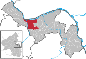
| Location of the city of Bingen am Rhein in the Mainz-Bingen district | ||
  |
||


Bingen am Rhein is a large town in the Mainz-Bingen district in Rhineland-Palatinate . The original name of the settlement was Bingium, Celtic word possibly for "hole in the rock", name for the shoal behind the mouse tower, known as Binger Loch . Bingen was the starting point for Ausoniusstrasse , a Roman military road that connected the city with Trier . Bingen is known, among other things, for the story of the Binger Mouse Tower , in which the Archbishop of Mainz Hatto was supposedly eaten by mice . In 2008, Bingen hosted the third Rhineland-Palatinate state horticultural show after Kaiserslautern and Trier.
geography
location
Bingen is located immediately southeast of the knee of the Rhine at the Binger Wald , which rises to the west of the city. To the north, on the other side of the Rhine, rises up the Rheingau Mountains with the upstream Niederwald near Rüdesheim as the southwestern cornerstone of the Taunus . The Upper Rhine ends in Bingen with the tributary of the Nahe . The Middle Rhine begins here with the district of Bingerbrück .
The Rhineland-Palatinate state capital Mainz is about 25 kilometers east of Bingen, Koblenz is about 50 kilometers northwest of the city.
The UNESCO World Heritage Site Upper Middle Rhine Valley includes the entire city of Bingen, although the main part is in Rheinhessen . The Rochusberg is almost completely enclosed by the urban area.
Neighboring communities
On the right bank of the Rhine opposite Bingen is the Hessian town of Rüdesheim am Rhein in the Rheingau-Taunus district . The following other neighboring cities and communities join in clockwise direction - all on the left bank of the Rhine : Ingelheim , Gau-Algesheim , Ockenheim , Appenheim , Aspisheim , Horrweiler , Gensingen , Grolsheim , Laubenheim , Münster-Sarmsheim , Weiler , Trechtingshausen .
City structure
Bingen am Rhein is divided into eight districts:
| district | surface | Residents |
|---|---|---|
| Bingen city | 8.68 km² | 7,751 |
| Bingen-Bingerbrück | 3.51 km² | 3,239 |
| Bingen-Büdesheim | 9.12 km² | 7,482 |
| Bingen-Dietersheim | 4.16 km² | 1,935 |
| Bingen-Dromersheim | 3.23 km² | 1,529 |
| Bingen-Gaulsheim | 2.92 km² | 1.105 |
| Bingen-Kempten | 3.20 km² | 1,951 |
| Bingen-Sponsheim | 2.91 km² | 1,648 |
Residents of Bingen am Rhein, as of May 1, 2019

climate
The mean annual precipitation is only 500–550 mm and is thus in the lower fifth of the values recorded in Germany - lower values are recorded at 14% of the measuring stations of the German Weather Service . The driest month is February, with the most rainfall in June. In June there is 1.5 times more rainfall than in February. Precipitation varies only minimally and is extremely evenly distributed over the year - only one percent of the measuring stations register lower seasonal fluctuations .
history

Panorama by Jakob Becker 1833


The area of today's Bingen was settled in ancient times due to its convenient location at the confluence of the Nahe and Rhine rivers and at the entrance of the Rhine into the narrow valley. The village name is the first time in the form "Bingium" in the work of the Roman writer Tacitus (early 2nd century) in the context of the Batavian testified and the urindogermanische root "bhengo-m" (town on the refraction of the river) is recycled. There was probably already a Celtic settlement on site. After the Roman conquest, Roman troops were stationed at the site and built a wood and earth fort. A wooden bridge was built over the Nahe, over which the Roman Rhine Valley Road ran and the remains of which were dendrochronologically dated to the year 77 AD. The Christian community of Bingen is proven to be in the 4th or 5th century; The basilica of St. Martin may have emerged from the church built at that time . Two Christian tombstones from the 5th and 6th centuries have been preserved, that of a Mauricia (walled in the crypt of St. Martin) and that of a priest named Aetherius (found east of the city in the ancient burial ground, today in the Basilica of St. Martin) .

After the fall of the Upper German-Raetian Limes , the city became a Franconian royal estate in the fifth century and was donated to Archbishop Willigis of Mainz in 983 by the Veronese donation from Otto II . Under Otto III. came the Binger Kammerforst. Under Willigis, the stone Drusus Bridge was built a little further up .


The Binger strived for independence again and again, which in 1165 led to the destruction in disputes between the Archbishop of Mainz and the Kaiser. In the 13th century Bingen was a member of the Rhenish Association of Cities . The construction of Klopp Castle in the middle of the 13th century can also be seen in this context. One last attempt was the unsuccessful participation in the Peasants' War in 1525. The Mainz Cathedral Chapter acquired the city in two halves in 1424 and 1438 from the Archbishop . Bingen remained under its administration until the end of the 18th century. Like many cities in the valley, Bingen suffered from several city fires and wars.
After French revolutionary troops occupied the left bank of the Rhine in 1794 , the city belonged to the French Donnersberg department from 1798 to 1814 and was the chief town ( chief lieu ) of the canton of Bingen . In 1816, after the Congress of Vienna , the city came to the Grand Duchy of Hesse , the current district of Bingerbrück to the Rhine Province of the Kingdom of Prussia . This made it a border town until the German Empire was founded in 1871. Since 1835, Bingen was also the seat of the Bingen district .
In 1929 Büdesheim was incorporated into a district of Bingen; Dietersheim, Gaulsheim and Kempten followed in 1939.
On November 10, 1938, the New Synagogue , built in 1905, was set on fire by SA men and Nazi supporters. It burned down to the surrounding walls. During World War II , Bingen was repeatedly targeted by USAAF air strikes . Above all, the marshalling yard in the Bingerbrück district was attacked. On September 13, 1944, a crew member of an American bomber who had previously been shot down was shot dead by a member of the SA on the street. At the end of the war in 1945, US Army troops moved into the city.
On June 7, 1969, the previously independent community of Bingerbrück with 3655 inhabitants was incorporated. On January 1, 1970, at their request, the state government raised the city of Bingen to a large district city . On April 22, 1972 the municipalities Dromersheim (1221 E.) and Sponsheim (665 E.) followed. The city has had the addition of "am Rhein" to its name since July 1, 1982.
For the State Garden Show 2008 in Bingen, the Rhine facilities in the city underwent extensive modernization.
Population development
The development of the number of inhabitants in relation to today's urban area of Bingen am Rhein; the values from 1871 to 1987 are based on censuses:
|
|

politics
City council
The city council in Bingen am Rhein consists of 36 honorary council members, who were elected in a personalized proportional representation in the local elections on May 26, 2019 , and the full-time Lord Mayor as chairman.
The distribution of seats in the city council:
| choice | SPD | CDU | GREEN | FDP | FWG | LEFT | total |
|---|---|---|---|---|---|---|---|
| 2019 | 11 | 11 | 6th | 3 | 3 | 2 | 36 seats |
| 2014 | 12 | 16 | 4th | 2 | 2 | - | 36 seats |
| 2009 | 10 | 16 | 4th | 4th | 2 | - | 36 seats |
| 2004 | 10 | 18th | 3 | 3 | 2 | - | 36 seats |
- FWG = Free Voting Group Bingen e. V.
Coalition in the city council
After the local elections on May 26, 2019 , the SPD , Bündnis 90 / Die Grünen and FDP announced a coalition in the Bingen city council that has existed since then.
Lord Mayor and City Council
In the Mayor elections on April 22, 2012, Thomas Feser ( CDU ) obtained an absolute majority of the votes with 51.78%. He was sworn in on May 29 at a city council meeting. On November 24, 2019, Feser was re-elected for a second term.
In addition to the Lord Mayor, the Bingen city council includes the mayor Ulrich Mönch ( CDU ), the 1st alderman Sebastian Hamann ( SPD ), the 2nd alderman Jens Voll ( Bündnis 90 / Die Grünen ) and the 3rd alderman Peter Eich ( FDP ) on.
coat of arms

|
|
Blazon : "In blue on an overgrown green shield foot a silver Roman rider with a golden helmet with a plume, tunic, boots and gold-sheathed, silver-tipped, red sword scabbard, on a striding, gold-hoofed and red-bridled, silver horse, dividing his red rider's cloak with a silver sword, Kneeling in front of him is a pleading, silver man with his left arm on a crutch in natural colors with a red ribbon over his right shoulder, a gold skirt and black-laced gold trousers, in the upper right corner a red label with a silver six-spoke wheel the edge of the shield a golden battlement wall with five towers. " |
| Reasons for the coat of arms: The rider is Saint Martin , the label is the Mainz wheel . |
Town twinning
- Hitchin , North Hertfordshire , since 1958
- Nuits-Saint-Georges , Burgundy , since 1960
- Prizren , Kosovo , since 1968
- Venarey-les-Laumes , Burgundy, since 1967 ( originally with Bingerbrück, taken over by Bingen in 1969 )
- Anamur , Turkey , since 2011
- Kutná Hora , Czech Republic , since 2011

Attractions


- Binger mouse tower
- former collegiate basilica of St. Martin from the 15th century with Romanesque crypt
- Parish church of St. Gordianus and Epimachus in Dietersheim
- Klopp Castle
- Rochus Chapel
- Drusus Bridge with Romanesque bridge chapel
- Old Rhine crane
- Oat box (after 1689) with the Stefan George Museum
- Puricellipalais - Empire building from 1780 (see: Franziska Puricelli )
- “Old cemetery” from the 19th century with a Napoleonic monument
- Jewish cemetery , laid out in the 16th century, a protected cultural monument
- Historical museum on the river - Hildegard von Bingen
- Villa Sachsen, state winery and cultural center of Sōka Gakkai International in Germany
- Roman villa rustica in the Binger Forest
- Rheinauen European reserve
- technical cultural monument equestrian signal box Bingerbrück
- A new concept is opened with the Frankfurt / Rhein-Main cultural region . The aim is to link industrial buildings along the 160 kilometers between Miltenberg and Bingen to form an adventure route through the industrial age in southern Germany , while a local route of industrial culture describes the industrial monuments in Bingen. A total of 700 buildings have already been scientifically recorded.
Economy and Infrastructure
| Largest wine-growing communities in the growing area |
Rank according to vineyard area (within RLP) |
Planted vineyards in 2017 |
Grape varieties | |
|---|---|---|---|---|
| White wine | red wine | |||
| Ha | % | |||
|
|
26,617 | 61 | 29 | |
| Worms | 3 | 1,564 | 63 | 37 |
| Westhofen | 7th | 787 | 75 | 25th |
| Alzey | 8th | 778 | 63 | 27 |
| Nierstein | 9 | 742 | 77 | 23 |
| Alsheim | 10 | 707 | 63 | 27 |
| Bechtheim | 11 | 660 | 73 | 27 |
| Flörsheim-Dalsheim | 12 | 646 | 68 | 32 |
| Ingelheim am Rhein | 13 | 642 | 51 | 49 |
| Bingen am Rhein | 15th | 566 | 74 | 26th |
| Saulheim | 16 | 523 | 76 | 24 |
| Source: Leaflet Viticulture 2018. State Statistical Office Rhineland-Palatinate, Bad Ems, May 2018 | ||||
The region is economically shaped by viticulture, especially since four wine-growing regions ( Rheinhessen , Mittelrhein , Nahe and Rheingau ) meet in Bingen . The city is also the namesake for the area of Bingen in wine law.
Other industries that had previously settled in Bingen due to the port have migrated over the years. Today's service industries are mainly located in the industrial area (motorway exit Bingen-Ost / Kempten / industrial area) and in the Scharlachberg business park.
Tourism also plays an important role.
Local businesses
- Regional company Aldi Süd
- Löwen Entertainment - formerly NSM-Löwen GmbH
- GEWA labels
- OC Oerlikon Germany GmbH
- Carl Graeger sparkling wine house
- Deer Kendermann
- Rheinberg winery
- Binderer St. Ursula
- SWK Bank
- Viprinet , manufacturer of multichannel routers
- PLATINUM GmbH & Co. KG , manufacturer of dog food
- Bingen-Rüdesheimer Fahrgastschiffahrt e. G.
- Globus Holding GmbH & Co.KG with its central logistics warehouse in Bingen-Ost
traffic
Rail transport
There are several train stations and stops in the urban area of Bingen am Rhein .
The Bingen (Rhein) Hauptbahnhof station is located in the Bingerbrück district and used to be called Bingerbrück . The Nahetalbahn route in the direction of Bad Kreuznach and Idar-Oberstein ends at this station ; the left Rhine route between Mainz and Cologne runs through the train station. All local trains on these two routes stop at the main station, and the main station is also a stop for individual IC and EC trains.
The Bingen-Stadt train station - formerly Bingen (Rhein) train station - is located two kilometers east of the Nahe, directly opposite the historic harbor crane . Only the local rail transport stops here, but it has better connections to the city's public bus transport .
The emergence of two train stations is historical, as today's Bingen main train station used to be a Prussian border train station, while the city train station belonged to the Hessian Ludwig Railway .
There is also a stop in Bingen-Gaulsheim, which is only used by the regional train line RB 26 between Mainz and Cologne.
The Drususbrücke stops on the Bingen Hbf – Bad Kreuznach line and the Bingen-Kempten and Büdesheim-Dromersheim stops on the Alzey – Bingen Stadt line are no longer served.
From 1906 there was a partly as a small railway , partly as a tram licensed operation, which was called AG Binger branch lines . The lines connected the city's train station, Bingerbrück train station and Büdesheim . A year later the route from Büdesheim to Dietersheim was extended. The connection to Bingerbrück was given up in 1922, and the rest of the service stopped on October 22, 1955.
In 1915, after a long planning period, the 1175 meter long Hindenburg Bridge was opened over the Rhine. It connected Bingen with the right stretch of the Rhine near Rüdesheim. It was not rebuilt after it was destroyed in World War II.
Road traffic
Bingen is in close proximity to the highways 60 and 61 , which are connected by the federal highway 9 . At the beginning of the 19th century the Route de Charlemagne , today's L 419, was laid out.
Transportation
City buses run on seven lines in Bingen. There are also four special school bus routes and one calling line. The bus lines are operated by Stadtwerke Bingen am Rhein .
Shipping

Only passenger traffic is important. The freight port is abandoned. The former winter harbor is now a marina.
There are piers for the Cologne-Düsseldorfer , Bingen-Rüdesheimer passenger shipping and the Rössler line. The Rhine ferry Bingen – Rüdesheim offers a permanent connection with the neighboring town of Rüdesheim am Rhein as a passenger ferry and as a motor vehicle ferry . (see list of Rhine ferries ).
Bingen was a pilot station until the end of the 1970s .
Biking and hiking trails
As the gateway to the Upper Middle Rhine Valley UNESCO World Heritage Site , Bingen is connected by various cycling and hiking trails . The Rhine and Nahe cycle paths meet in the Rhine -Nahe triangle near Bingen; The Hiwwel route also leads from here through the Rheinhessen hill country to Worms .
Bingen is also a hub in the Rhineland-Palatinate network of hiking trails. Both the Soonwaldsteig and the RheinBurgenWeg, the counterpart to the Rheinsteig on the left bank of the Rhine , have their start and end points here.
Public facilities
The city administration is u. a. at Klopp Castle , next to Bingen is the headquarters of the Bingen-Alzey tax office and the seat of the Rhein-Nahe municipal administration .
education
- Technical University of Bingen
- Stefan-George-Gymnasium
- Hildegardis School, Catholic private school of the Diocese of Mainz
- Rochus Realschule plus
- Realschule plus on the Scharlachberg
- vocational school in Bingen
- Rhein-Nahe special school
- Bingen City Library
- Community College
- music school

Kulturufer Bingen
State Garden Show Bingen 2008

For the Rhineland-Palatinate State Horticultural Show from April 18 to October 19, 2008, the banks of the Rhine between the car ferry pier and the former tracks in Bingerbrück at the main train station (formerly Bingerbrück station) were completely redesigned.
The event was carried out along the banks of the Rhine over a length of 2.8 km and 24 hectares of exhibition space. With 1.3 million visitors, the expected number of at least 600,000 people was significantly exceeded. The three sub-areas are still fenced, but accessible free of charge.
Reuse
The former site of the State Garden Show Bingen 2008 has been marketed as Kulturufer Bingen since the beginning of 2010 . The aim of the Kulturufers Bingen is to establish the place with its scenic, architectural, horticultural and cultural attractions as a destination for cultural travelers. The Kulturufer Bingen consists of the parts of the area Hafenpark / Gartenstadt, Hindenburglage, Rhein-Nahe-Eck and Park am Mäuseturm.
In the Hafenpark / Gartenstadt area are u. a. to find the partnership gardens, the industrial crane and the Japanese cherry orchard. The old Rhine crane from 1487 stands at the transition to the Hindenburg complex.
The Hindenburg complex is a listed park with old trees. There you will find the former customs office, the English rose garden, the “Rheinkahn” playground, the vinotheque, the poets' cabinets and the pier.
In the Rhein-Nahe-Eck section is the Rheintal-Kongress-Zentrum, the Museum am Strom with the departments “Hildegard von Bingen”, “Roman Medical Set”, “Rhine Romanticism” and “City History”, and the Hildegarten.
The park at the Mäuseturm offers large lawns, sports fields, a skater track, the adventure playground "Rhine to Play", the signal box Mensch | Natur | Technik as well as various event areas.
The cultural events take place every year from Easter to the end of September. The highlight is the Kulturuferfest on the first Sunday in July.

Regular events

- Wine festival - with a duration of eleven days, the longest wine festival on the Rhine
- Binger Sektfest on the Bgm.-Neff-Platz
- Bingen swingt - International Jazz Festival
- Binger Open Air Festival - alternative festival
- Breakpoint (2003–2010) - one of the largest events on the demo scene worldwide
- Night of Seduction - Wine Festival in the Vines
- Rhine in Flames Bingen - seven fireworks between Trechtingshausen and Bingen am Rhein
- Kulturuferfest
- Rochusfest - Rochusoktav, church festival with a folk character, pilgrimage of the diocese of Mainz
- Hildegard autumn
- Recharge im Park am Mäuseturm - event with electronic music, since 2015; (three to four times a year)
Personalities


Personalities related to the city
- Berta von Bingen (7th / 8th century), saint of the Catholic Church
- Hildegard von Bingen (1098–1179), abbess and author , mystic , writer , musician and healer . The Binger girls' school (grammar school and vocational school), the Hildegardis school ("Higa") was named after her. Hildegard is traditionally considered a popular saint. It was officially included in the Catholic Church's calendar of saints on May 10, 2012; Remembrance day is September 17th.
- Bartholomäus Holzhauser (1613–1658), Catholic priest , founder of the order, pastor and dean of Bingen. He died in Bingen in the name of holiness; his grave and funerary monument are preserved in St. Martin's Basilica ; a memorial bust is placed in the Munich Hall of Fame .
- Juda Mehler (died 1659 in Bingen), rabbi and author
- Valentin Schaefer (1887–1952), policeman and politician (center, CDU), mayor of Bingen
- Jan Schlaudraff (born July 18, 1983 in Waldbröl), soccer player, grew up in Bingen
sons and daughters of the town
- Andreas Joseph Schnaubert (1750–1825), legal scholar
- Joseph Albrecht von Ittner (1754–1825), writer, lawyer and diplomat
- Siegmund Geisenheimer (1775–1828), businessman and socially committed authorized signatory of the Frankfurt banking house M. A. Rothschild & Sons
- Hubert Auer (1780–1836), prince-bishop delegate for Brandenburg and Pomerania, provost of St. Hedwig's Church in Berlin, canon of Breslau and provost of Trier
- Philipp von Foltz (1805–1877), painter
- Eberhard Soherr (1812–1887), member of the Hessian state parliament and mayor of Bingen
- Ferdinand Allmann (1828–1912), Mayor of Bingen and member of the state estates of the Grand Duchy of Hesse
- Heinrich Brück (1831–1903), Bishop of Mainz
- Johann Baptist Hilsdorf (born May 6, 1835 - July 11, 1918), photographer and father of Theodor and Jacob Hilsdorf
- Karl Johann Brilmayer (1843–1905), Catholic priest, author and local historian from the Rhine-Hesse region
- Joseph Jonas (1845–1921), steel manufacturer and Lord Mayor of Sheffield
- Heinrich Wendelin Soherr (1863–1929), member of the Hessian state parliament and vice president of the state parliament
- Alice Bensheimer (1864–1935), politician and women's rights activist
- Jakob Karl Ernst Halm (1866–1944), German-British astronomer
- Stefan George (1868–1933), poet
- Theodor Hilsdorf (1868–1944), photographer
- Carl Friedberg (1872–1955), pianist and music teacher
- Jacob Hilsdorf (1872–1916), photographer
- Pankraz Blank (1882–1961), member of the state parliament
- Saladin Schmitt (1883–1951), theater scholar, director and artistic director
- Wilhelm Mayer-Gross (1889–1961), psychiatrist and university professor
- Anton Trapp (1893–1967), politician (CDU), honorary citizen of Bingen am Rhein
- Sepp Christmann (1895–1977), sports teacher and trainer
- Otto Kraemer (1900–1986), mechanical engineer and full professor at the Technical University of Karlsruhe
- Max Richter (1900–1983) geologist and paleontologist, professor at the Free University of Berlin
- August Weimer (1908–1980), trade unionist and Christian Democratic politician, Member of the Bundestag
- Josef Augstein (1909–1984), lawyer
- Adolf Geßner (1909–1988), art historian and entrepreneur
- Anton Philipp Brück (1913–1984), priest, professor, prelate and author; Honorary citizen of the city of Bingen
- Lioba Munz OSB (1913–1997), artist and nun
- Rolf Schwarz-Schütte (1920–2019), entrepreneur and patron
- Peter Riethe (1921–2020), professor of dentistry
- Jakob Schadt (1921–1995), politician (SPD), Member of the Bundestag and honorary citizen of the city of Bingen
- Günter Duffrer (1922–2011), lecturer at the Episcopal Seminary, diocesan praeses of the church choirs in the diocese of Mainz
- Claire Marienfeld (* 1940), Christian Democratic politician, former defense commissioner of the Bundestag
- Karl-Heinz Kamp (* 1946), soccer player and coach
- Bernd Jochen Hilberath (* 1948), theologian and university professor
- Mary Roos (* 1949), pop singer and actress
- Monika Böss (* 1950), writer
- Peter Walter (1950–2019), Roman Catholic priest, theologian and dogmatist
- Tina York (* 1954), pop singer
- Peter Frey (* 1957), journalist
- Rüdiger Heins (* 1957), author
- Thomas Kling (1957-2005), poet
- Ansgar Franz (* 1959), Catholic theologian, professor of liturgical science
- Matthias Bork (* 1962), German-Canadian artist
- Josef Maria Klumb (* 1962), German musician
- Frank Schröder (* 1964), singer and actor
- Daniel Walta (* 1977), director and screenwriter
- Dajan Šimac (* 1982), football player
- Christa Stipp (* 1990), meteorologist and presenter
- Suat Serdar (* 1997), German-Turkish soccer player
- Tobias Krick (* 1998), volleyball player
literature
in alphabetical order by authors / editors
- Hans Berkessel, Hedwig Brüchert, Wolfgang Dobras, Ralph Erbar , Frank Teske (eds.): Light of Exile. Evidence of Jewish life in Mainz and Bingen . Mainz 2016, ISBN 978-3-945751-69-5 .
- Dieter Krienke: Cultural monuments in Rhineland-Palatinate. Volume 18.1: Mainz-Bingen district: towns of Bingen and Ingelheim, Budenheim community, Gau-Algesheim, Heidesheim, Rhine-Nahe and Sprendlingen-Gensingen ( monument topography Federal Republic of Germany ). Wernersche Verlagsgesellschaft, Worms 2007, ISBN 978-3-88462-231-5 , pp. 62–212 (overview of the history of the city of Bingen on pp. 62–74).
- Landesgartenschau Bingen 2008 GmbH (Hrsg.): R (h) einschauen! State garden show in Bingen . Verlag Matthias Ess, Bad Kreuznach 2008, ISBN 978-3-935516-48-8 .
- Scholl, Johannes: Annales Bingenses, that is Chronick or time register of the time-old instead of Bingen am Rhein . Mainz 1853 ( digitized version ).
- City of Bingen (ed.): From the sacrificial place to the garden city. 7500 years of history on the banks of the Rhine in Bingen . Verlag Matthias Ess, Bad Kreuznach 2008, ISBN 978-3-935516-47-1
Web links
- Official website of the city of Bingen am Rhein
- Historical information about Bingen at regionalgeschichte.net
- Historical information about Dietersheim at regionalgeschichte.net
- Link catalog on the subject of Bingen am Rhein at curlie.org (formerly DMOZ )
- Literature about Bingen am Rhein in the Rhineland-Palatinate State Bibliography
Individual evidence
- ↑ State Statistical Office of Rhineland-Palatinate - population status 2019, districts, communities, association communities ( help on this ).
- ↑ [1] Current population of the city of Bingen
- ↑ Precipitation distribution. (No longer available online.) In: lfu.rlp.de. State Office for the Environment, Rhineland-Palatinate, archived from the original on September 2, 2016 ; accessed on August 31, 2016 .
- ^ Precipitation: Mean values 1981-2010 , German Weather Service
- ↑ Overview of annual values in Bingen , German Weather Service, on wetterdienst.de
- ^ Dieter Krienke: Cultural monuments in Rhineland-Palatinate. Volume 18.1: Mainz-Bingen district: towns of Bingen and Ingelheim, Budenheim community, Gau-Algesheim, Heidesheim, Rhine-Nahe and Sprendlingen-Gensingen ( monument topography Federal Republic of Germany ). Wernersche Verlagsgesellschaft, Worms 2007, ISBN 978-3-88462-231-5 , p. 62.
- ↑ Kurt Böhner : Bingen in the early Middle Ages. In: Guide to Prehistoric and Protohistoric Monuments. Volume 12: Northern Rheinhessen. Ingelheim, Bingen, Bad Kreuznach, Alzey, Oppenheim. Philipp von Zabern, Mainz 1969, pp. 130-135, here pp. 130-132.
- ↑ Heinrich Gottfried Philipp Gengler: Regesten and documents on the constitutional and legal history of German cities in the Middle Ages , Erlangen 1863, p. 224 .
- ↑ Jörg Friedrich: The fire. Germany in the bombing war 1940–1945 . 2nd Edition. Propylaea, Berlin 2002, ISBN 3-549-07165-5 .
- ↑ Report on swr.de
- ↑ State ordinance on the declaration of the cities of Andernach, Bingen and Lahnstein as a large city belonging to the district of December 9, 1969 .
- ↑ Official municipality directory 2006 ( Memento from December 22, 2017 in the Internet Archive ) (= State Statistical Office Rhineland-Palatinate [Hrsg.]: Statistical volumes . Volume 393 ). Bad Ems March 2006, p. 171 (PDF; 2.6 MB). Info: An up-to-date directory ( 2016 ) is available, but in the section "Territorial changes - Territorial administrative reform" it does not give any population figures.
- ↑ Official municipality directory (= State Statistical Office of Rhineland-Palatinate [Hrsg.]: Statistical volumes . Volume 407 ). Bad Ems February 2016, p. 186 (PDF; 2.8 MB).
- ↑ State Statistical Office Rhineland-Palatinate - regional data .
- ^ The Regional Returning Officer Rhineland-Palatinate: Local elections 2019, city and municipal council elections .
- ↑ Traffic light coalition in Bingen perfect. July 29, 2019, accessed August 9, 2019 .
- ^ Election to the mayor. In: bingen.de. Retrieved September 7, 2016 .
- ↑ Thomas Feser remains Lord Mayor of Bingen
- ^ Bingen City Council has elected councilors. In: Allgemeine–zeitung.de. Retrieved September 8, 2019 .
- ^ Frankfurt / Rhein-Main cultural region: Route of industrial culture
- ↑ Bingen-Rüdesheimer
- ↑ M. Kochems, D. Höltge: trams and light rail in Germany. Volume 12 Rhineland-Palatinate / Saarland , EK-Verlag, Freiburg 2011, pp. 20–33, ISBN 978-3-88255-393-2 .
- ↑ Technical University of Bingen: The FH becomes the Technical University of Bingen. (No longer available online.) Archived from the original on July 26, 2016 ; Retrieved July 26, 2016 .
- ↑ page Kulturufer Bingen .
- ↑ Hildegard von Bingen in the calendar of saints , ORDEN online, May 11, 2012.
- ^ Johann Baptist Hilsdorf - the first photographer in Bingen on fotoplatz.stereographie.de

Appenheim | Aspisheim | Bacharach | Badenheim | Bingen am Rhein | Bodenheim | Breitscheid (Hunsrück) | Bubenheim (Rheinhessen) | Budenheim | Dalheim (Rheinhessen) | Dexheim | Dienheim | Dolgesheim | Dorn-Dürkheim | Eimsheim | Engelstadt | Essenheim | Friesenheim (Rheinhessen) | Gau-Algesheim | Gau-Bischofsheim | Gensingen | Grolsheim | Guntersblum | Hahnheim | Harxheim | Hillesheim (Rheinhessen) | Horrweiler | Ingelheim am Rhein | Youth home in Rheinhessen | Klein-Winternheim | Koengernheim | Loerzweiler | Ludwigshöhe | Manubach | Mommenheim (Rheinhessen) | Münster-Sarmsheim | Neck home | Nieder-Hilbersheim | Nieder-Olm | Niederheimbach | Nierstein | Ober-Hilbersheim | Ober-Olm | Oberdiebach | Oberheimbach | Ockenheim | Oppenheim | Sankt Johann (Rheinhessen) | Schwabenheim an der Selz | Selzen | Sörgenloch | Jumpers | Stadecken-Elsheim | Trechtingshausen | Uelversheim | Undenheim | Waldalgesheim | Hamlet near Bingen | Weinolsheim | Welgesheim | Wintersheim | Wolfsheim | Home of Wrath | Zotzenheim