
Freyung-Grafenau district
| coat of arms | Germany map |
|---|---|

|

Coordinates: 48 ° 50 ' N , 13 ° 31' E |
| Basic data | |
| State : | Bavaria |
| Administrative region : | Lower Bavaria |
| Administrative headquarters : | Freyung |
| Area : | 984.15 km 2 |
| Residents: | 78,362 (Dec. 31, 2019) |
| Population density : | 80 inhabitants per km 2 |
| License plate : | FRG, GRA, WOS |
| Circle key : | 09 2 72 |
| NUTS : | DE225 |
| Circle structure: | 25 municipalities |
| Address of the district administration: |
Grafenauer Str. 44 94078 Freyung |
| Website : | |
| District Administrator : | Sebastian Gruber ( CSU ) |
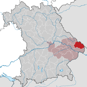
| Location of the Freyung-Grafenau district in Bavaria | |
  |
|


The Freyung-Grafenau district is the easternmost district in Bavaria. It is located in the administrative district of Lower Bavaria and borders the Czech Republic in the northeast, Austria in the southeast and three districts of Lower Bavaria from southwest to northwest .
geography
location
The district is located in the Bavarian Forest and has about 60% forest. Its highest point is the Great Rachel (1453 m), the second highest mountain in the entire Bavarian Forest. Not far from the Rachel rises the Ilz , which flows through the western district area in a southerly direction and flows into the Danube in Passau .
Neighboring areas
Neighboring districts or administrative areas are the Czech districts of Klatovy (Klattau) ( Pilsen district ) as well as Prachatice (Prachatitz) and Český Krumlov (both district of South Bohemia ) in the north and east, the Austrian district of Rohrbach ( Upper Austria ) in the south-east and the District of Passau , in the west the district of Deggendorf and in the northwest of the district of Regen .
history
Until 1800
As in many low mountain ranges in southern Germany, the real history of the area of today's Freyung-Grafenau district begins with settlement in the Middle Ages . Contrary to the widespread opinion that the Bavarian Forest has been inhabited since the Stone Age or at the latest since the Celts , this cannot be proven archaeologically. Silex fragments and potsherds found in many places testify to the presence of people in prehistoric times, but there are no reliable indications of permanent settlements. Since the Middle Ages, many fragments of flint ( flint ) were brought to the fields to fertilize the fields with lime. The numerous finds of stone and bronze axes indicate the custom of keeping such axes ("thunderbolts") as a magic defense against lightning in exposed locations in houses and stables. For this purpose they were traded from far away and some of them were sold by peddlers. What is certain is that trade routes in the direction of Bohemia led through the Bavarian Forest early on. In the Middle Ages, mainly salt was transported to Bohemia on the trade routes. These so-called “ Golden Steige ” were one of the most important trade routes in southern Germany until the early modern era.
Until the 11th century, the so-called "North Forest", i.e. the area between the Danube, Rachel and Dreisessel, was considered a royal estate . In 1010 the area east of the Ilz was donated as clearing land to the monastery of Niedernburg in Passau, with which it fell to the Passau bishops at the turn of the 13th century.
The Passau prince-bishops were very interested in reclaiming this densely forested region, which had previously been sparsely populated, and therefore promoted clearing and settlement work. This is reflected in numerous place names that end in -reut (clearing). The borders to the neighbors Bavaria, Austria and the Czech Republic were controversial for centuries. It was only under Prince Bishop Cardinal Leopold Ernst Graf von Firmian in 1767 that the boundaries to Bohemia could be made binding. This bishop also succeeded in buying back the Austrian rulership of Rannariedl , which had been pledged since the 15th century, with the area of the Seven Künischen Villages .
For a long time the main town of the compartment was the Waldkirchen market , which was located directly on one of the main paths along the Golden Steige.
The prince-bishop's castles Fürsteneck and Wolfstein , both built around 1200 under Prince-Bishop Wolfger von Erla to secure the national borders, became seats of the prince-bishop's nursing courts in the 14th century, which also included the Perlesreut and Freyung markets. Waldkirchen, on the other hand, was able to maintain a special legal position. The market was the only place in the region to be fortified with a curtain wall in 1460–1470. Remnants of this wall are still there today.
With the secularization of 1803, the Passau bishopric was dissolved and initially fell to the Grand Duchy of Salzburg-Tuscany . Shortly afterwards in 1806 this area fell to the newly founded Kingdom of Bavaria .
The area west of the Ilz, originally also Königsland, had been part of the Formbach county of Windberg since 1000 . When the Formbachers died out around 1180, the area fell to the Counts of Andechs-Meranien , from whom it acquired the Passau Monastery in 1207. Passau divided the county and in the same year gave the land on the upper reaches of the Ilz with the Bärnstein Castle to the Halsern as a fief. They founded the Schönberg market in the 13th century and assigned individual goods and clearing areas to their own servants.
In 1375 the Counts of Hals died out. The main heir was Landgrave Johann von Leuchtenberg , who had the Grafenau market built 'in the Asang', a clearing and fire clearance . At his instigation and advocacy, Emperor Charles IV granted the still young market town rights in 1376. In 1396 the Leuchtenberger donated the St. Oswald monastery . It was located on a trade route later called 'Gulden Straß', which first led from Passau-Hals, partly from Vilshofen via Grafenau to western Bohemia. In 1417 the Leuchtenbergers sold their offices in Ranfels and Bärnstein with the town of Grafenau and the Schönberg market to the Ortenburgers , from whom they acquired the Bavarian dukes in 1438. They allocated the Grafenauer Land to their Straubing Rent Office and appointed care judges in the Bärnstein and Dießenstein castles .
The inhabitants of the Wolfsteiner and Grafenauer Lands went their separate ways for centuries in terms of territorial history. The people have long remained aware of the old border between “Bavaria” and “diocese”. In common, however, they always had a pronounced love for their forest and a working life that was mainly characterized by agriculture, livestock farming and forest work as well as employment in forest glassworks since the 15th century, planned use of wood with wood drift (since the 18th century) and wood processing or processing. In the 19th century, the railways and new roads finally reached the woodland, connected it with the world and ushered in a modest industrialization.
District Offices
From 1862 until the 20th century, the current district of Freyung-Grafenau consisted of the two district offices of Wolfstein and Grafenau .
Counties
On January 1, 1939, the designation district was introduced as everywhere else in the German Reich . The district offices became Grafenau and Wolfstein.
The first summer visitors discovered the Bavarian Forest as early as the middle of the 19th century. But it wasn't until the Bavarian Forest National Park was founded in 1970 that tourism increased significantly in the Wolfstein and Grafenau districts. Today it is one of the most important industries in the region.
Efforts to simplify the administration of the district offices of the lower Bavarian Forest already existed in the last century. In 1959, a merger of the Grafenau and Wolfstein districts was discussed for the first time. Ten years later, the planning of the “municipal reorganization” began in Bavaria.
Freyung-Grafenau district
After the approval of the state parliament, the Bavarian state government ordered the amalgamation of the Grafenau and Wolfstein districts on July 1, 1972 to form the new Freyung district. On June 11, 1972, the population elected the 50 new district councilors as well as the previous district administrator of the Altlandkreis Wolfstein, Franz Schumertl, as the new district administrator.
On October 27, 1972, the district council of the new district decided in its third public meeting in Grafenau with 33 to 15 votes on the new district name Freyung-Grafenau proposed by the CSU parliamentary group. The name change came into effect on May 1, 1973. The town of Freyung, previously the seat of the Wolfstein district administration, was designated as the seat of the district administration.
With the opening of the Iron Curtain in the direction of the Czech Republic in 1989, the district moved from the border to a more central position. Shortly thereafter, the neighboring Šumava National Park was founded, which together with the Bavarian Forest National Park forms one of the largest forest areas in Europe. The transit connection between Germany and the Czech Republic through the district also increased significantly. Since the Czech Republic joined the EU in 2004 and border controls were abolished in 2007, economic ties have risen sharply.
As a result of an electoral district reform in 2003, the district lost its directly elected member of parliament. A large part of the district area was combined with the district of Regen to form one constituency, the south-eastern part was assigned to the district of Passau-Ost . The directly elected member of the Regen, Freyung-Grafenau constituency has been Helmut Brunner since then . In the legislative period from 2003 to 2008, Helga Weinberger moved into the state parliament via the CSU district list. In 2008, the former district administrator Alexander Muthmann was elected to the state parliament via the free voter district list.
Population development
From 1988 to 2008, the Freyung-Grafenau district grew by around 4,000 inhabitants or around 5%. Since 2002 the trend towards a high of approx. 82,500 inhabitants. Between 1988 and 2018 the district grew from 75,941 to 78,355 by 2,414 inhabitants or 3.2%. In most municipalities, the growth of the 1990s could not be sustained and has fallen continuously since the 2000s. The following figures refer to the territorial status on May 25, 1987.
| Population development | ||||||||||||||
|---|---|---|---|---|---|---|---|---|---|---|---|---|---|---|
| year | 1840 | 1900 | 1939 | 1950 | 1961 | 1970 | 1987 | 1991 | 1995 | 2000 | 2005 | 2010 | 2015 | |
| Residents | 40,717 | 48.294 | 57,292 | 75,499 | 67,870 | 72.402 | 75,564 | 79,782 | 81,861 | 82,434 | 81,582 | 79.293 | 78.122 | |
politics
District council
In the last five district council elections, the results led to the following allocation of seats:
| Party / list | 2020 | 2014 | 2008 | 2002 | 1996 | |
| CSU | 21st | 22nd | 21st | 22nd | 24 | |
| SPD | 6th | 8th | 9 | 10 | 13 | |
| CWG-FW | 7th | 9 | 9 | 8th | 6th | |
| FW | 6th | 6th | 6th | 6th | 5 | |
| BP | 4th | 4th | 3 | 4th | 3 | |
| JWU | 4th | 5 | 5 | 4th | 4th | |
| ödp | 2 | 3 | 2 | 3 | 2 | |
| GREEN | 4th | 3 | 2 | 2 | 3 | |
| REP | - | - | 1 | 1 | - | |
| FDP | 2 | - | 2 | - | - | |
| AfD | 4th | - | - | - | - | |
| ' Total | 60 | 60 | 60 | 60 | 60 |
District administrators
- July 1, 1972-30. April 1990: Franz Schumertl ( SPD )
- May 1, 1990-30. April 2002: Alfons Urban ( CSU )
- May 1, 2002–30. April 2008: Alexander Muthmann ( FWG and CWG)
- May 1, 2008–30. April 2014: Ludwig Lankl (CSU)
- Since May 1, 2014: Sebastian Gruber (CSU)
coat of arms
|
|
Blazon : "In silver with a bent blue-silver diagonally roughened tip in front a left-facing black soaring bear, behind a soaring red wolf ." |
Communities


(Residents on December 31, 2019)
Other communities
|
Unregulated areas (156.32 km²)
|
Economy and Infrastructure
Sedlbauer AG ( Grafenau / electronics ), AMF ( Grafenau / mineral fibers), Karl Bachl GmbH & Co.KG ( Röhrnbach / construction company ), Knaus Tabbert ( Jandelsbrunn / caravan ), Parat Automotive AG ( Neureichenau ), DUMPS electronic (Röhrnbach / electronics) , Zambelli (Röhrnbach / Dachsysteme), Bolta ( Saunstein near Schönberg / Industrieprofile), Sesotec GmbH (Saunstein near Schönberg / Metallsuchsysteme & Stoffseparation), Garhammer fashion house ( Waldkirchen ), Gedore (Waldkirchen / tools)
In the Future Atlas 2016 , the Freyung-Grafenau district was ranked 307 out of 402 districts, municipal associations and independent cities in Germany, making it one of the regions with “future risks”. According to the study, it offers the fourth worst future prospects of all districts in Bavaria. In the 2019 edition, it improved to 206th place out of 401.
tourism
One of the most important economic sectors in this rural area at the former Iron Curtain is tourism, which was previously promoted by tourist associations, an association of municipalities, tourism associations and landlords. Today the district, the municipalities and several advertising associations support tourism development directly. Like all neighbors in the Bavarian Forest, the district is represented in the Ostbayern Tourism Association (TVO). The main attraction for visitors is Germany's first national park, the Bavarian Forest National Park , which makes up a large part of the northern district area and extends into the neighboring district of Regen.
traffic
Supraregional roads
- There are three main roads running through the Freyung-Grafenau district:
- B 12 (north-south direction from Passau , past Freyung towards the Czech Republic , transition to the R4 to Prague)
- B 85 (north-south direction from Regen coming past Schönberg bei Grafenau to Passau )
- B 533 (west-east direction from Hengersberg near Deggendorf to Schönberg, from there to Grafenau common route with the B 85 and further to Freyung )
- In addition, there are several state roads that connect the district with the highways.
County roads
Railway lines
The Zwiesel – Grafenau railway is the only rail link in the district that has been in continuous operation. It serves the Spiegelau and Grafenau stations, as well as the Klingenbrunn , Großarmschlag and Rosenau stops every two hours.
Until 1982 the Ilz Valley Railway Passau - Waldkirchen - Freyung was still used for passenger transport. After this line was closed in 2005, it was used for leisure traffic from 16./17. Back in operation in July 2011.
From her branched off in Waldkirchen the railway line Waldkirchen – Haidmühle to Haidmühle , which led from there over the border into the Czech Volary . This was interrupted after the Second World War and gradually dismantled. Since 2001 it has been completely converted into a cycle path on the German side. The Czech section still leads directly to the border at Nové Údolí (Neuthal) near Haidmühle.
Local public transport
The district is served by the district's buses (5 concessionaires and their subcontractors). There are also city bus routes in the three cities. Then there are the tourist-oriented hedgehog buses .
The Bayerwald-Ticket is valid on most of the bus and train lines in the district . The guest card is also valid as the “ GUTi ” ticket corresponding to the Bayerwald ticket in some sections of the route.
Airfields
- In Elsenthal near Eberhardsreuth west of Grafenau, south of Schönberg is the sports airfield " Elsenthal-Grafenau " (ICAO identification EDNF)
education
Vocational school :
- Waldkirchen State Vocational School
Gymnasiums :
- Freyung High School
- Johannes Gutenberg High School Waldkirchen (JGG)
- Landgraf-Leuchtenberg-Gymnasium Grafenau (LLG)
Technical college :
- State technical college Waldkirchen
Special schools :
- Caritas School St. Elisabeth Freyung
Private support center, specialization in intellectual development
- Don Bosco School Grafenau
Special educational support center with a focus on learning, intellectual development and language
- School in the Erlenhain Waldkirchen
Support center with a focus on emotional and social development, learning and language
Realschulen :
- Freyung secondary school
- Grafenau secondary school
Adult Education Center :
- VHS Freyung-Grafenau, based in Grafenau
health care
Clinics at the Goldenen Steig gGmbH:
- Freyung District Hospital
- Grafenau District Hospital
- Waldkirchen Health Center
Bavarian Red Cross , Freyung-Grafenau District Association:
- District Office Freyung
- Ambulance stations in Freyung, Grafenau, Waldkirchen, Neureichenau, Schönberg and Schöfweg
Social Service Society of the Bavarian Red Cross GmbH
- Senior living in Grafenau
media
The only daily local newspaper in the district is the Passauer Neue Presse with its local section F, which appears under the titles Grafenauer Anzeiger (Altlandkreis Grafenau) and Passauer Neue Presse (Altlandkreis Wolfstein).
In addition, with “the new week” as a whole, the “Bayerwald Wochenblatt” in the western and “Am Sonntag” in the eastern district, three free advertising papers appear every week with reports from the district.
In addition, the Ostbayern studio of Bayerischer Rundfunk, the local radio UnserRadio and the local television station TRP1 report from the district.
Protected areas
There are eight nature reserves , six landscape protection areas , 13 FFH areas and at least 55 geotopes designated by the Bavarian State Office for the Environment (as of August 2016) in the district.
See also
- List of nature reserves in the Freyung-Grafenau district
- List of landscape protection areas in the Freyung-Grafenau district
- List of FFH areas in the Freyung-Grafenau district
- List of geotopes in the Freyung-Grafenau district
License Plate
When the new district was formed, the distinctive signs GRA (Grafenau) and WOS (Wolfstein), introduced on July 1, 1956, were assigned. These were replaced on August 5, 1974 by the new distinctive sign FRG, which is still valid today . Since July 10, 2013, the distinctive signs GRA and WOS are again available for the Freyung-Grafenau district.
Others
From 1989 to 2010 the district was home to the television series Forsthaus Falkenau , which played in the fictional town of Küblach in the Freyung-Grafenau district.
literature
- Wolfstein district (ed.): The Wolfstein district . Freyung 1968.
- District Freyung-Grafenau (Hrsg.): The district Freyung-Grafenau . Freyung 1982.
- Christian Binder: History of the Freyung-Grafenau District . Freyung-Grafenau district archive, Freyung 2006.
- Paul Praxl : History of the Freyung-Grafenau district. District archive Freyung-Grafenau, Freyung o. J.
Web links
- Official website of the district
- Literature from and about the Freyung-Grafenau district in the catalog of the German National Library
- Entry on the coat of arms of the Freyung-Grafenau district in the database of the House of Bavarian History
Individual evidence
- ↑ "Data 2" sheet, Statistical Report A1200C 202041 Population of the municipalities, districts and administrative districts 1st quarter 2020 (population based on the 2011 census) ( help ).
- ^ Wilhelm Volkert (ed.): Handbook of Bavarian offices, communities and courts 1799–1980 . CH Beck, Munich 1983, ISBN 3-406-09669-7 , p. 97 .
- ↑ Freyung-Grafenau district, election of the 2020 district council, overall result
- ↑ Entry on the coat of arms of the Freyung-Grafenau district in the database of the House of Bavarian History , accessed on September 4, 2017 .
- ↑ "Data 2" sheet, Statistical Report A1200C 202041 Population of the municipalities, districts and administrative districts 1st quarter 2020 (population based on the 2011 census) ( help ).
- ↑ Future Atlas 2016. (No longer available online.) Archived from the original on October 2, 2017 ; accessed on March 23, 2018 . Info: The archive link was inserted automatically and has not yet been checked. Please check the original and archive link according to the instructions and then remove this notice.
- ↑ PROGNOS future atlas. Handelsblatt, accessed on December 10, 2019 .
Districts:
Aichach-Friedberg |
Altötting |
Amberg-Sulzbach |
Ansbach |
Aschaffenburg |
Augsburg |
Bad Kissingen |
Bad Toelz-Wolfratshausen |
Bamberg |
Bayreuth |
Berchtesgadener Land |
Cham |
Coburg |
Dachau |
Deggendorf |
Dillingen on the Danube |
Dingolfing-Landau |
Danube Ries |
Ebersberg |
Eichstätt |
Erding |
Erlangen-Höchstadt |
Forchheim |
Freising |
Freyung-Grafenau |
Fürstenfeldbruck |
Fürth |
Garmisch-Partenkirchen |
Gunzburg |
Hatred Mountains |
Yard |
Kelheim |
Kitzingen |
Kronach |
Kulmbach |
Landsberg am Lech |
Landshut |
Lichtenfels |
Lindau (Lake Constance) |
Main-Spessart |
Miesbach |
Miltenberg |
Mühldorf am Inn |
Munich |
Neuburg-Schrobenhausen |
Neumarkt in the Upper Palatinate |
Neustadt an der Aisch-Bad Windsheim |
Neustadt an der Waldnaab |
Neu-Ulm |
Nuremberg Country |
Oberallgäu |
Ostallgäu |
Passau |
Pfaffenhofen an der Ilm |
Rain |
Regensburg |
Rhön-Grabfeld |
Rosenheim |
Roth |
Rottal-Inn |
Schwandorf |
Schweinfurt |
Starnberg |
Straubing Arch |
Tirschenreuth |
Traunstein |
Unterallgäu |
Weilheim-Schongau |
Weißenburg-Gunzenhausen |
Wunsiedel in the Fichtel Mountains |
Wurzburg
Independent cities:
Amberg |
Ansbach |
Aschaffenburg |
Augsburg |
Bamberg |
Bayreuth |
Coburg |
Erlangen |
Fürth |
Hof (Saale) |
Ingolstadt |
Kaufbeuren |
Kempten (Allgäu) |
Landshut |
Memmingen |
Munich |
Nuremberg |
Passau |
Regensburg |
Rosenheim |
Schwabach |
Schweinfurt |
Straubing |
Willows in the Upper Palatinate |
Wurzburg