Insming
| Insming | ||
|---|---|---|

|
|
|
| region | Grand Est | |
| Department | Moselle | |
| Arrondissement | Sarrebourg-Château-Salins | |
| Canton | Le Saulnois | |
| Community association | Saulnois | |
| Coordinates | 48 ° 57 ' N , 6 ° 52' E | |
| height | 215-273 m | |
| surface | 7.21 km 2 | |
| Residents | 584 (January 1, 2017) | |
| Population density | 81 inhabitants / km 2 | |
| Post Code | 57670 | |
| INSEE code | 57346 | |
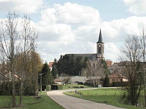
 View of Insming with the Saint-Clément church |
||
Insming (German Insmingen ) is a French commune with 584 inhabitants (as of January 1, 2017) in the Moselle department in the Grand Est region (until 2015 Lorraine ). It belongs to the arrondissement of Sarrebourg-Château-Salins .
geography
Insming is located three kilometers northeast of Albestroff at an altitude between 215 and 273 m above sea level. The municipality covers 7.21 km².
history
The village was first mentioned in the 8th century and has belonged to the Duchy of Lorraine, which was part of the Holy Roman Empire , since the Middle Ages . The Duchy was ceded to France by the Treaty of Vienna in 1766. After the Peace of Frankfurt , Insming had to be ceded to the German Reich in 1871. Until the end of the First World War, Insming belonged to the realm of Alsace-Lorraine . After the Peace Treaty of Versailles , Insming returned to France. During the Second World War, the place was under German administration from 1940 to 1944. From 1973 to 1984 Insming was part of the Albestroff community .
See also: Insming Jewish Community .
Population development
| year | 1962 | 1968 | 1975 | 1982 | 1990 | 1999 | 2007 |
| Residents | 573 | 574 | 547 | 585 | 631 | 607 | 594 |


