Panga (Saaremaa)
Coordinates: 58 ° 34 ' N , 22 ° 18' E

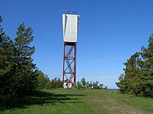
Beacon at Panga
Panga (German Pank ) is a village ( Estonian küla ) on the largest Estonian island Saaremaa . It belongs to the rural community Saaremaa (until 2017: rural community Mustjala ) in the Saare district .
Population and location
The village has 24 inhabitants (as of December 31, 2011). It is located directly on the Baltic Sea , 37 kilometers northwest of the island's capital Kuressaare .
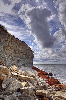
The up to 21 meters high cliff offers a wide view over the sea.
literature
- Baltic historical local dictionary. Part 1: Estonia (including Northern Livonia) (= sources and studies on Baltic history. Volume 8/1). Started by Hans Feldmann . Published by Heinz von zur Mühlen . Edited by Gertrud Westermann . Böhlau, Cologne / Vienna 1985, ISBN 3-412-07183-8 , p. 429.
Web links
Commons : Hochufer bei Panga - Collection of pictures, videos and audio files
- Entry in Eesti Entsüklopeedia (online version)
- Description ( eestigiid.ee )

