
Karpas
| Karpas | ||
 The east end of the Karpas Peninsula in northeastern Cyprus, NASA satellite image, 2009 |
||
| Geographical location | ||
|
||
| Coordinates | 35 ° 32 ' N , 34 ° 17' E | |
| Waters 1 | Mediterranean Sea | |
| length | 80 km | |
| width | 10 km | |
| surface | 898 km² | |
 View from Cape Apostolos Andreas to the northeast |
||

The Karpas ( Greek Καρπασία Karpasía , Turkish Karpaz , more rarely Kırpaşa ), also Karpass , is a peninsula of almost 900 km² and at least 80 km long in the northeast of the Mediterranean island of Cyprus . It forms the easternmost part of the Kyrenia Mountains . Its eastern tip is the Cape Apostolos Andreas , which is preceded by the uninhabited islands of clothing ("keys").
The peninsula had just under 24,000 inhabitants in 2016. The most important city is Rizokarpaso or Dipkarpaz , as it is called in the Greek or Turkish language. There are also more than 40 villages. Cattle breeding (sheep and goats) and the cultivation of carob , today mainly for the cosmetics industry, were the most important branches of the economy alongside the cultivation of grain and the extraction of olive oil , wine , fruits and nuts. At times the cultivation of tobacco and silk as well as cotton production were of considerable importance. These agricultural branches of the economy have since been overtaken by tourism and the construction industry.
The earliest evidence of human presence is a rural settlement on the peninsula, which dates back to 8400 BC. BC originated. In the Bronze Age , the trade in its copper made Cyprus an influential political center, which led to the emergence of Galinoporni-Vasili , a major center of power, on the Karpas , and the construction of fortifications as a result. However, Cyprus was able to gain independence from the 3rd century BC. Only for a short time.
Long before that, colonization by Greeks began, who culturally and linguistically superimposed the previous population in a process that was not yet understood, with the Eteocyprian language disappearing. A number of other ethnic groups joined the Greeks. After the Greco-Roman epoch, the Orthodox Byzantium on the one hand and the Islamic great powers of the Umayyads and Abbasids on the other possibly divided the island until 965. In 1185 Cyprus made itself independent of Byzantium for a few years, one with Kantara on the Karpas the most powerful castles arose. Cyprus went to the Catholic Crusaders in 1191 , who massively fortified the Karpas, but whose population remained largely Orthodox, apart from the Maronites who fled there . The French-speaking crusaders, against whose linguistic influence the Greek increasingly prevailed, followed in 1489 Venice as mistress of the island. In 1570/71 the Karpas and the island came to the Sunni Ottoman Empire , which for the first time led to the immigration of Turks , but also of members of other ethnic groups of the multi-ethnic state. Great Britain followed as a colonial power in 1878 and 1914 , which granted the island independence in 1960. In the meantime, the more religiously based conflicts had become more ethnically based, with the Karpas remaining a Greek Orthodox stronghold. The Apostolos Andreas Monastery has long been the island's most important pilgrimage site .
North Anatolian soldiers, civil servants and settlers came to the peninsula in particular from 1974 after Turkey occupied the northern part of Cyprus in response to an attempt to join Greece ( Enosis ). Since then, the Greeks and Maronites have almost completely left the peninsula. Since 1983 the Karpas has belonged to the internationally unrecognized Turkish Republic of Northern Cyprus . Cultural heritage is threatened, initially by violence, then by neglect, although efforts to preserve it have increased recently.
The beaches of the Karpas are important resting places for endangered sea turtles ( Caretta caretta and Chelonia mydas ). About ten species of bats live on the peninsula , more than twenty species of mammals and numerous bird species have been identified. The Karpas National Park with its forests is also of ecological importance. The coastal fringes, which offer space for extremely rare species, are now being researched more intensively; this leads to conflicts with the tourist construction and usage projects, which are mostly backed by foreign investors.
Surname
The peninsula appears in the literature with minor deviations as Karpas or Karpass , Karpaz or Kırpaşa , in the sources of the Middle Ages also as Carpas or Καρπασ. This name goes back to the ancient city of Karpasia (Καρπασία), whose name was extended to the peninsula. Possibly the city was again named after the locally common name for a north wind.
geography
Extension and Limits


The peninsula covers an area of 898 km², which is politically divided into five municipalities of the İskele district , which belongs to the internationally unrecognized Turkish Republic of Northern Cyprus . Formally, the Karpas still forms part of the Famagusta district of the Republic of Cyprus .
The municipalities in question are İskele , Mehmetçik , Büyükkonuk , Yeni Erenköy and Dipkarpaz , as well as Tatlısu , which in the eyes of Northern Cyprus belongs to the Gazimağusa district , in those of the Republic of Cyprus to the Famagusta district. In Greek, the main places in the districts are Trikomo, Galatia, Komi Kepir, Yialousa and Rizokarpaso. Because of the unresolved political and ethnic language situation since 1974, the place names are listed in two languages, unless current organizational or historical contexts are explicitly focused. Tatlısu was attached to the İskele district at its own request, which also includes 35 villages, five of which are on the Mesaoria plain. In the north-west is the district border at Esentepe / Agios Amvrosios ( Girne district ), in the west and south-west Geçitkale / Lefkoniko and Yeniboğaziçi / Agios Sergios (Famagusta / Gazimağusa). The traditional entrance to the peninsula is Boğaz (also Bogazi), while in the south it borders on the Mesaoria plain, where İskele is the center of the district.
In the east are the nine uninhabited islands of clothing (Zafer adaları), which include Dalmonaris, Kila, Lefkonisos and Skaloudia, then the group of islands around Kordylia and some rocks.
Geology and landscape

The Karpas Peninsula represents one of the four segments of the Kyrenia Mountains , which are usually divided into the western, central, eastern and Karpas ranges. The approximately 160 km long mountain range west of Melounda / Mallıdağ is also called Pentadactylos and emerged from a series of sedimentary deposits between the Permian and Middle Miocene (beginning almost 300 million years ago), which in turn resulted from the collision of the African and Eurasian plates. While the African plate drifts northward at one millimeter per year, the Anatolian plate drifts westward about twenty times as fast.
Although barely half as high as the Troodos Mountains , the Karpas is very rugged. The oldest rocks come from the Permian, when the area was on the edge of Gondwana , and are known as the Kantara Formation, named after the castle of the same name in the west of the Karpas Peninsula. They occur mainly on the said peninsula in the form of olistolites of different sizes (foreign rock). Large parts of the mountain range, like the mountains of Cyprus as a whole, consist of ophiolites , i.e. oceanic rock that has been subject to strong uplifts, but above all of limestone . In addition, there are ultramafic , plutonic rocks, i.e. those of igneous origin that often have high metal contents, such as copper , which was mainly mined around the Troodos Mountains. On the Karpas, numerous north-south folds and the easy erosibility of the sandy Kythrea flysch resulted in a rough, rugged landscape, sometimes with considerable drought.
Since both the part of Pangea , which is now Africa, and the part which is now Europe, were further south, the Tethys region had a predominantly tropical to subtropical climate. The collision with the African plate, which changed its direction of motion from east to north about 191 million years ago, created steep mountains in the Kerynea Zone 20 to 10 million years ago that are metamorphic and composed of complex limestone blocks, thick fly blows, and limited amounts igneous rock . The change of direction of the African continent in connection with the opening of the Neo- Tethys led to a subduction process and in the Cretaceous to a rotation of the south by 60 ° counterclockwise until the subduction ended at the southern Troodos. At the same time, the mountain range that emerged from the Tethys Ocean was pushed north towards the Kyrenia Mountains , which were part of the Eurasian plate, while the Mesaoria plain was still under water. In the Miocene , another subduction began in the south; In the late Pliocene , today's parts of the island were superposed on each other.
A comparatively short-term land connection with Anatolia in the period 5.9 to 5.4 million years ago cannot be ruled out, when the Mediterranean largely dried out and new land animals reached the island (see flora and fauna). Cyprus has been an island for at least five million years.

Massive reductions in sea level were the growth of the ice during the cold periods of the Quaternary triggered. Accordingly, there have been significant fluctuations in sea levels over the last 125,000 years. Marine deposits at heights between 3 and 22 m above sea level have also been discovered on the coasts of the Karpas. Some of the marl are remnants of marine gastropods , as Persististrombus latus of the family of conch , Bursa granularis of the superfamily of tonnoidea or Conus ermineus that no longer exists in the Mediterranean. They are indicators for the oxygen isotope level 5e of the Mediterranean and document an elevation of 15.5 m in the last 125,000 years. The island has been raised by a maximum of 1.2 to 1.5 m since the early Holocene , but the sea level varied by 40 to 50 m. The water above the impenetrable marl of the Pliocene is still drinking water today. The founders of the Neolithic settlement Akanthou-Arkosykos apparently recognized the advantages of such a spring.
To this day, the landscape is not only characterized by rugged mountains, but also by over 100 watercourses, most of which are only a few kilometers long (see list of watercourses on the Karpas Peninsula ).
climate

The climate is Mediterranean . The weather on the peninsula is moderately cool and rainy in winter, but hot and dry in summer, with the highest temperatures in July and August. The average daily temperature at Yenierenköy then reaches 29 ° C, while in winter it is 12 ° C. The average annual precipitation is between 455 and 506 mm at the Yenierenköy meteorological station. Most of the rain falls in December and January, the driest month is August, but June and October are also often very dry. In winter, north and north-westerly winds prevail, in summer, however, those from the south and south-east.
The eastern part of the Kyrenia Mountains on the Karpas Peninsula is much less affected by the drying night winds than the south side of the Troodos. Overall, however, like Cyprus and the entire Mediterranean region, the region is suffering from increasing drought. With more than 100 reservoirs, Cyprus has the largest number of dams per unit area. However, studies on tree rings indicate that since 1756 there has been an average drought every five years and two to six year dry phases in the clusters 1806–1824, 1915–1934 and 1986–2000. In 2003 the annual rainfall at the Yenierenköy station was around 700 mm. However, even within the peninsula, the precipitation is distributed unevenly. According to studies between 1996 and 1999, Dipkarpaz fell the most rain. However, the water shortage is often due to inadequate pipeline systems, outdated technologies and diversion of water as well as the resulting overuse, which in turn leads to the soil becoming too salty. In addition, there is no evidence of a decrease in the total amount of rain for the Karpas, but the average amount of rain increased from 1979 to 2009 in September, while it decreased in March.
Flora and fauna

The Karpas is biologically one of the most important regions of Cyprus, so the peninsula was declared a separate environmental protection area in 1997. Cyprus is still the most densely wooded island in the Mediterranean, but the original vegetation has often been replaced by cultivated plants. The geotectonic evolution of the island has also not yet been clarified enough to enable an appropriate biogeographical reconstruction. Questions about the arrival of species on the island or questions about local evolution remained almost unanswered for a long time (as of 2013). With the investigation of the mitochondrial DNA of Ablepharus budaki from the skink family , then that of the European snake- eye lizard Ophisops elegans and the lizard species Acanthodactylus schreiberi , and finally the adder species Telescopus fallax and the frog species Pelophylax bedriagae and Hyla savignyi , a first chronophylogenetic work could be presented. It proved that colonization began in the Miocene and extended into the Pliocene and Pleistocene . It turned out that "old" colonizers who arrived in the transition between Miocene and Pliocene, ie more than 5 million years ago, either reached the island via a land bridge or via a transmarine expansion, whereas the "younger" colonizers only reached the island across sea and from the Middle East. The "young" colonizers were entered by humans.
Mostly cypress trees grow on the Karpas peninsula , but also junipers and pines . In the meantime, bougainvillea and prickly pear cactus , the pomegranate tree and the hibiscus are thriving , followed by the carob tree , then the real caper bush, and the bay and mulberry trees . In addition, the sea onion is used as well as the olive tree .


Many plant species have been discovered in recent decades and proved their location in Cyprus, such as the Star knapweed ( Centaurea calcitrapa subsp. Angusticeps ) or Woolly safflower , various Allium , such as Allium rubrovittatum or Allium willeanum , to rush species such as Juncus heldreichianus , Juncus subulatus or Juncus hybridus , but also reeds ( Phragmites frutescens ). 45 orchid species thrive in Cyprus alone , of which there are around 30 in the north, including Dactylorhiza Romana , Orchis Anatolica (Anatolian orchid), Orchis Italica ( Italian orchid ) and Orchis Papilonacea from the orchid genus . The management plan for the beaches on the South Karpas identified four endemic species, namely Bosea cypria from the subfamily Amaranthoideae , then Onopordum cyprium (a species of donkey thistle ), which is widespread in South Karpas and only exists in Cyprus, and finally Teucrium micropoidoides and the rare Teucrium karpasiticum from the genus Germander . In the Karpas National Park alone, exactly 274 plant species from 57 families were registered in a study between 2009 and 2010. The endemic tulip species Tulipa cypria was recorded in 2017 at Ayios Symeon (Avtepe), but its taxonomic status has not yet been proven; in Northern Cyprus it has been under protection since 1997.
Kolokassia or Kolokaz, otherwise better known as taro , dominated the kitchen until the 20th century , but was largely supplanted by the potato . The starchy rhizomes were probably introduced by Arab settlers or by Maronites , but only appear in the sources from 1573, more precisely in Stefano Lusignan's (1537–1590) chronicle, which appeared in Bologna in 1573 . Around 27 wild plant species are still used today for food, above all an asparagus species known as 'ayrelli' and Cynara cornigera .

Cyprus, which has been isolated for at least 5 million years, was an area where island dwarfing species such as Phanourios minor , a small species of hippopotamus, or the pygmy elephant ( Elephas cypriotes ) have been identified. They disappeared, although that need not be the cause, when the first humans appeared on the island.
Only two studies of the mammal species were published by 1990, namely by Dorothea Bate (1903) and by Friederike Spitzenberger (1978/79). Bate identified 15 species of mammals, and Spitzenberger 20, including six or eleven species of bats .

Peter Boye et al. were able to detect a total of 16 species in 1990, today 22 are known. Which was very early Egyptian fruit bat been proven the kind that is still the most common and is tangible in two places on the Karpas, later the Kuhl's pipistrelle , the second most common type, which is also demonstrated in six places in the Karpas, such as the church of Panagia Chrysiotissa of Afendrika. Then there are the small and large horseshoe bat (the former only in the west of the Karpas), then the Blasius horseshoe bat . In Cyprus, but not on the Karpas, the long-winged bat and the great mouse- eared bat , along with the little mouse -eared bat (in western Karpas), and finally a single specimen of the Meheley horseshoe bat , plus the rather dubious long-footed bat . The Alpine bat occurs in the west of the Karpas, but the broad-winged bat only further west , whereas the related coastal bat ( Eptesicus anatolicus ) is found on the Karpas. The little noctule was found in Troodos, there are also great noctule (uncertain) and giant noctule in Troodos. In 1990 Boyce added the Mediterranean horseshoe bat , but without specifying the location, which remains questionable, the fringed bat (in western Karpas) and the gray long-eared bat . In 2001 the ciliate bat came from a mine in Troodos at an altitude of over 1600 m and finally the mosquito bat , the latter is the easternmost find, but possibly represents a subspecies ( Pipistrellus pygmaeus cyprius ). The Balkan long-eared bat has only been found in the west and north-west of the island, as has the European bulldog bat . A total of 22 bat species are known on the island today, almost half of which were also found on the Karpas. Genetic studies have shown a closer relationship to European species than to those from the Levant , so that an earlier and a later migration are assumed here.
According to the Management Plan for South Karpaz Beaches SEPA ( SEPA stands for “Special Environmentally Protected Area”) of 2010, specimens of the critically endangered Mediterranean monk seal and representatives of the only flying fox in Europe, the Nile flying fox, were found very rarely .

Several hundred donkeys , released during and after the civil war of 1974, live in the east of the peninsula , the number of which was estimated at 300 to 400 in 1997. A study from 2005 came to more than double the number. The area in which they live was initially fenced off in vain and declared a protected area without further measures.
.jpg)
The Chelonia mydas , known as green sea turtle or green sea turtle, occurs mainly on the coasts of the Karpas, but also the loggerhead turtle . These are the two species of turtle found in the Mediterranean. At Girne, the females have been protected on the Alagadi beaches in early summer since 1994 by cordoning off the beaches and protecting the clutches at night. The stocks recover there to some extent. In 2011, a total of 965 loggerhead sea turtle nests were registered in Northern Cyprus (the south plays practically no role here), the population of which has stabilized from 2000 to 3000 females. In addition, 44 Chelonia clutches more than ever before were counted; It is assumed that there are 300 to 400 females who are extremely local (in contrast to the loggerhead sea turtle). About a third of the population is looking for moorings on the Karpas; In Cyprus, the beaches of Alagadi and Ronnas Bay on the Karpas are preferred from the end of May to July.
The avifauna has hardly been studied so far. The Bonelli's eagle is spotted in the mountains from time to time, while the steppe harrier regularly winters on the Karpas. Of endemic species, the find sheds warbler and Oenanthe cypriaca from the family of flycatchers . There are large numbers of species such as the European roller , the blue cuckoo and various species from the shrike family .

.jpg)
On the Ronnas, a river near the east end of the peninsula, there is a natural wetland of great importance, part of which is part of the Karpaz Special Environmentally Protected Area (SEPA) . There are rare species such as water mint and Nigella ciliaris from the genus of black cumin . In addition, 32 bird species have been registered in the river system.
Of butterfly species were found: Large White , Artogeia rapae , Cleopatra butterfly , painted lady , orange tip and pumilio Gegenes , a rare species of the family of the skipper and six other species. In view of the rich population, the Karpas is particularly worthy of protection, especially since the population in Europe collapsed by 31% between 2000 and 2010. Cyprus so far 53 butterfly species are known, including three endemic, which were also found on the Karpas, namely the Cyprus quite frequent Maniola cypricola , a species that mainly Centaurea hyalolepis from the kind of knapweed needs, which is found primarily in field borders , then Hipparchia cypriensis and Glaucopsyche paphos . The most common on the Karpas in 2006 were Maniola cypricola , Matt-piebald Brown Dickkopf and Painted Lady ; eleven species were found.
Extremely rare animal species live directly on the coast, as was shown in 1997 and 1998 at four stations on the Karpas, when six species and five subspecies from four families of injection worms could be detected. They belonged to the families of the Golfingiidae, Phascolionidae, Phascolosomatidae and the Aspidosiphonidae. Four species alone were recorded for the first time in the eastern Mediterranean at depths of up to 600 m, namely Nephasoma (Nephasoma) constrictum and three species from the Phascolosomatidae family: Phascolosoma (Phascolosoma) scolops , agassizii agassizii and stephensoni . Also of the species Buthus kunti from the family of the Buthidae , the largest scorpion family , two of the three specimens in Cyprus have been found in the east of the Karpas peninsula.
Three amphibians and 24 reptiles have been identified in Cyprus, most of which also occur on the Karpas. They were examined as early as the 1880s. Phoenicolacerta troodica is an endemic lizard species, Hierophis cypriensis an endemic snake species; on the Karpas comes at the same time Levante Otter ago. There are also a number of endemic subspecies.
population
In 2010, almost 23,400 people lived on the Karpas Peninsula, which corresponds to a population density of 26 inhabitants / km², while this average was 78 in the Turkish Republic of Northern Cyprus and around 120 on the island as a whole. The population was also uneven across the six municipalities distributed. While İskele had 7,613 inhabitants in 2010, Yenierenköy was 5,693, Mehmetçik was 3,381, Büyükkonuk was 2,885 and Dipkarpaz was 2,398. In addition, there is the 6th administrative unit, Tatlısu, with 1,379 inhabitants. Overall, the population forms 9% of the population of the Turkish Republic of Northern Cyprus and little more than one-fiftieth of the population of the whole of Cyprus. The peninsula's slow growth, which in 1921 already had 21,776 inhabitants, has been around for a century. While the Karpas showed the highest growth rate in the census of 1881, 1891 and 1901 with an increase from 12,186 over 15,168 to 18,200 inhabitants in the Famagusta district - this corresponded to an increase of almost 50% within 20 years - this fell in the following decades drastically. In 1911 there were 19,919 inhabitants. However, in 1891 some villages such as Akanthou or Davlos were added to the subdistrict (Nahieh) Karpas, which had still belonged to Mesaoria in the 1881 census.
The proportion of the male population was 51.6% in 2010, that of the female 48.4%. About 70% of the population were 15 to 64 years old, 22.5% under 15, 9.5% are older than 64. The population growth has been 2.4% per year to date, with natural growth only 0.9 % was. The younger generation often migrate due to a lack of economic opportunities.
Religion and language
According to the 1960 census, 20,150 Greeks and 5,778 Turks lived on the Karpas. In the course of the Cyprus crisis , until 1975, the majority of the Greeks, almost all of whom belonged to the Greek Orthodox Church , fled to the south of the island, while most of the Turks, also almost without exception Sunnis or followers of other Islamic denominations, fled north. The largest Greek Orthodox community, Rizokarpaso, had perhaps 250 members in 2015. Today the Sunnis make up the majority of the population on the peninsula. The Maronites, who have lived on the peninsula for a long time, were subsumed under “Greeks” in the censuses and are therefore difficult to pin down.
While in 1881 2,454 Muslims reported Greek as their mother tongue, which corresponded to 5% of the Turkish group, in 1946 there were only 1,080 "Turks" who usually spoke Greek. As recently as 1960, 29% of Turks said they had mastered Greek as a second language. Today almost all residents speak Turkish, Greek is only spoken by the Greek minority.
history
In 2007 Erhan Öztepe listed exactly 60 archaeological sites, which provide large parts of the basis for the written history of Northern Cyprus. The history of the Karpas goes back around 10,500 years.
Mesolithic: hunters and gatherers from Anatolia (around 9600 BC)
Around 9600 BC The oldest human traces were dated to Cyprus, although the hand ax of Kholetria-Ortos in the southwest of the island was interpreted as an Acheuléen tool. The residents of Akrotiri were hunters and gatherers who brought wild boars from Anatolia to herd them on the southern tip of the island. So far, no remains of this culture have been discovered on the Karpas, which is much closer to Anatolia. The distance between the mainland coast and the next point on the Karpas Peninsula, which was about 70 km, was an enormous obstacle. Even if the sea level was 130 m lower during the last Ice Age maximum than it is today, in decreased During this time the distance only went from 70 to 63 km. However, at this low water level, an island that is now below sea level appeared, so that first a distance of 45 and then 18 km had to be overcome. Nevertheless, it is certain that from the 9th millennium BC onwards There was regular boat traffic with the Levant and Anatolia, which in turn was a prerequisite for the Neolithic migration movements.
Neolithic: fishermen and farmers (from 8400 BC), immigration of ceramists (4500 BC)
The oldest site in Northern Cyprus is Akanthou-Arkosykos (Turkish: Tatlısu-Çiftlikdüzü) on the western edge of the Karpas Peninsula, whose artifacts date back to 8400 BC. Go back BC. This means that there is a gap of over a thousand years between the Mesolithic and the first Neolithic. In contrast to the finds in the south of the island, these already belong to a Neolithic culture, i.e. not an appropriating, but a productive culture. A settlement measuring 400 by 70 meters was excavated from at least six round houses with terrazzo or rubble floors . In addition, the remains of a boat and fishing rods were found, as well as obsidian in large quantities and shells. In addition to fish and meat, wild lentils , barley , olives and almonds were among the staple foods. The rural settlers kept goats, sheep, pigs and cattle, as well as fallow deer , dogs and foxes. Sheep and Dama dama mesopotamica , of which early remains were also found on the Karpas, namely at Cap Andreas, were only found around 8000 BC. Introduced in BC, the Mesopotamian game later became pure game. Whether the settlers came from the Levant and brought agriculture with them, as from around 8300 BC. In Kissonerga-Mylouthkia in the southwest of Cyprus is unclear.
.JPG)
Another, around 5600 BC. The settlement of the pre-ceramic Neolithic , dated to the 3rd century BC, was discovered in Kastros on the southern slope of Cape Apostolos Andreas on the eastern tip of the Karpas in 1969 and excavated between 1970 and 1973. After the Turkish invasion in 1974, further investigations were no longer possible, and in 2005 the settlement was destroyed. It had the typical development of round and rounded houses for the time and nestled itself in the slope, which was shaped like a natural theater round, which was in front of a plateau of 1700 m² settlement area. The houses were about 2.50 x 2.80 m on average and offered around 5.00–6.80 m² of living space. Three burials were salvaged. The inhabitants of this small settlement lived primarily on seafood and fish.
It is unclear when the ceramic Neolithic began in Cyprus, since ceramics between 5100 and 4500 BC. BC is only represented by three finds, two of which come from Aghios Epiktitos Vrysi near Kyrenia . The settlements of the newly immigrated ceramists, who from 4500 BC Populated western Cyprus and the Karpas peninsula, found themselves on the coast and on fortified hills. Important sites are the Sotira carpets , which gave the Sotira culture its name , and the aforementioned Ayios Epiktitos-Vrysi. Sotira with its 47 buildings was abandoned at the beginning of the 4th millennium. In Ayios Epiktitos-Vrysi there were pit houses up to six meters deep , as well as in Philia-Drakos, Troulli (in the buffer zone between Northern Cyprus and the Republic of Cyprus) and Chirokitia . In contrast to the round houses of the Akeramiker who had previously inhabited the island, the houses of the ceramic phase were rectangular, albeit with rounded corners. Ceramic research indicates that there was a clear difference between the groups in the north and those in the south.
Gap (3900–2000 BC), Late Bronze Age: centers of rulership, regional styles and pottery wheel

From the Copper Age (around 3900-2500 BC), no sites are known on the Karpas Peninsula, which is probably due to a lack of research. The same applies to the Bronze Age, which usually dates from 3000 to about 1180 BC. And its early phase, the Philia culture (approx. 2500–2000 BC), which is represented on the entire island, only not on the Karpas. In any case, hunting declined and cattle breeding, especially goats and pigs, increased. Stock-keeping was also expanded and distribution centers for a ruling class can be made probable, with the settlements being divided into three at the end of the Late Copper Age. In addition, an ideological change of direction in the funeral customs is emerging, which was possibly connected with the increased importation of goods, as well as the emergence of corresponding central locations.
In the transition phase to the Late Bronze Age , important settlements such as Enkomi (around 1700 to 1050 BC), Toumba tou Skourou near Morfou , and Hala Sultan Tekke in the district emerged on the island, which, according to Strabo, was never under a single rule until the Ptolemies Larnaka and Kourion west of Limassol. Whether one of these centers of power succeeded in ruling the entire island is unclear, but there are indications of clashes between the centers of the north and those of the south-east in the late Bronze Age.

For the trade routes of the production centers, especially for the export of copper, control over the Karpas Peninsula was of considerable importance. There, in this context, was created around 1500 BC. The fortress of Nitovikla , which was built in the 4th century BC , was a center where taxes in kind were collected and distributed, but which could also have been a refuge. There is also the late Bronze Age settlement of Ayios Iakovos (Altınova) in the west of the peninsula. To the northeast of it, one kilometer north of Phlamoudi , on the hill called Vounari , was a sanctuary that was examined from 1970 to 1973, possibly with an associated palace complex, which was built during the Middle and Late Bronze Age from around 1650 to 1350 BC. Was used. Altogether, of the 22 fortresses known in Cyprus from the middle of the 2nd millennium up to 2008, six were on the Karpas alone. In addition to Nitovikla, Phlamoudi-Vounari was of great importance. There is still a Hellenistic cave near Vounari, from which stones were cut, as well as the late Bronze Age site Phlamoudi-Melissa, which is the larger site, which is within sight. Like Melissa, Phlamoudhi was from about 1800 BC onwards. In use and lasted until the Late Cypriot IIA , i.e. until the early 14th century BC. BC, while Melissa was only around 1200 BC. Was destroyed by an earthquake. Pottery to Enkomi was exported via Vounari, as evidenced by the oldest Cypriot seals . The other four festivals were Lythragkomi-Troullia , Davlos-Pyrgos , Agios Thyrsos-Vikla and Rizokarpaso-Sylla .
A ceramic style of its own developed on the peninsula in the late Bronze Age, which practically formed a red-on-white region. Important excavation sites on the peninsula in connection with this commodity are: Galinoporni (Cave I), Paleoskoutella and Nitovikla, which are close to each other on the south coast far to the east, and Ayios Iacovos in the hinterland. A white style had already developed there in the Middle Bronze Age between 1750 and 1550 BC. A regional style developed that was widespread throughout the east of the island. At least since then, ceramics have been made on the potter's wheel . The most important sites are Agios Iakovos , Akanthou - Rombos , Phlamoudi -Melissa, Kantara and Ayios Theodoros Petra-Stiti in the west and Arkades, Agios Thyrsos - Vikla and Galinoporni further in the east of the Karpas.
Claudia Glatz assumes that Enkomi was founded by residents of the Mesaoria plain and the Karpas peninsula. Paleoskoutella (also Korovia Paleoskoutella) was surmounted by a very large tumulus (a type of construction that can otherwise only be verified in Enkomi and one other place), around which about 20 smaller burial mounds rose over stone boxes at regular intervals . The remains of fourteen dead who were buried at the same time were found in the grave under the said tumulus. Apparently, after some time, their bones were collected from the smaller tumuli, fleshed out and then buried again, which can otherwise only be documented on the Karpas in Ayios Iakovos and is more known from Palestine.
Many of the settlements were established between 1300 and 1100 BC. Destroyed, whereas Enkomi, which was also destroyed at the beginning of the 12th century, only after the earthquake of 1075 BC. Around 1050 was finally abandoned in favor of Salamis . Because of its size, the city was identified by research with the Alašija named in the sources, who was on a par with Egypt and the Hittite Empire because it prospered through its copper production.
Archaic period (750–321 BC): Kingdom of Salamis, Chelones-Rani, Assyrians and Egyptians


In the Cyprus-Archaic period (around 750–321 BC), when there were several kingdoms on the island, apparently only their capitals were fortified. Therefore, the places on the peninsula were not equipped with walls, one can see from Chelones-Rani on the south coast, around 5 km southeast of Rizokarpaso, which in the north of Cyprus is only to be joined by Pyla-Vikla between Idalion and Kition .
These fortifications, maintained by the seven and later ten kingdoms of the island, certainly hung with the establishment of a temporary supremacy over the island by the Assyrians (from 709 BC), then by the Egyptians (around 560 to 545 BC). ) and finally the Persian Achaemenids together. The Karpas is usually attributed to the Kingdom of Salamis, although no fortified borders are detectable between the kingdoms, in contrast to the clear demarcations of power in Greece. A strong Phoenician influence can be proven for salamis.
Antiquity
Greek mythology, Karpasia

In Greek myth , Teukros , the son of Telamon from the island of Salamis , landed on the Achaian beach on the north coast of the Karpas after he had been banished by his father in the Trojan War because of the unrevened death of his half-brother Ajax . From here he crossed the peninsula and founded - about 70 stadiums or 13.5 kilometers away - in the large bay that adjoins the Karpas to the south, the city of Salamis, named after his homeland . The Achaian beach was located between Aphrodision and Karpasia in ancient times .
The most important place in antiquity was this Karpasia , after which the peninsula got its name. This city also traced its roots back to mythical times and was, according to Hellanikos , a historian of the 5th century BC. BC, founded by Pygmalion , the Cypriot king and great artist. Herodotus was the first to claim a colonization from Argolida .
But there are doubts about this early Hellenization , which later historians asserted to the present day, because the analogies in the finds were evidently drawn prematurely. It was believed that the four Homeric horse sacrifices in the graves of Salamis, in which horse bones were also found, could be recognized. However, the horses in Salamis were apparently stoned while they were killed and burned at Homer's. What is more serious, however, is that the oldest horse sacrifices in Cyprus belong to the Bronze Age (2300–1900 BC), while they appear more frequently in Greece, especially in the Late Helladic (1550–1060 BC) and usually pull war chariots. So the special role of the horse probably arose in the Middle East, as is shown by finds from Urartu and sources from the Assyrian Empire .
Persian supremacy, independence (until 331 BC)

It is undisputed that there was a Hellenization between the 7th and 4th centuries, especially since the island was increasingly involved in the fight against Persia. During the Ionian Rebellion , between 499 and 497 BC, arose. BC next to the Greeks of Asia Minor also the Cypriots against Persian rule. Herodotus (Historien 5, 110 ff.) Reports: When a Persian army under Artybas was sent from Cilicia to Cyprus and marched against Salamis, the kings of the island requested Ionian help. The auxiliary fleet sailed around the Karpas ("the keys of Cyprus") to Salamis. The Ionians refused to fight on land but offered to guard the sea. So while they were delivering a sea battle to the Phoenicians allied with the Persians, the Cypriots fought on land, but were defeated. Thereupon the Ionian fleet withdrew. Nevertheless, the balance of power between the kingdoms remained unstable. According to a bronze plaque found in Idalion, the royal seat was conquered by Persia and Kition, mostly between 478 and 445 BC. Is set.
In Salamis and thus on the Karpas, the Phoenician Abdemon came to the throne, who, according to Isocrates , is said to have overthrown the Teucrids . He was in turn no later than 411 BC. . Chr by the fleeing Evagoras I. overthrown. Since the Persians stood in the way of his ambition to occupy the entire island, he made himself largely independent through an uprising (391-380 / 379 BC). His successors from the Teukrid dynasty once again navigated between the Greek Poleis and the Persian Empire, but Pnytagoras (around 360–332 / 331), who had overthrown his Persian-friendly predecessor, supported Alexander of Macedonia in the conquest of the Persian Empire.
Alexander, Hellenistic empires, Ptolemaic rule (until 58 BC)

With the fighting between the successors of Alexander the Great († 323 BC), who did not conquer the island, many of the older cities were abandoned and new fortresses and ports were built. In addition, a network of secondary centers was created, which, even if they were small, were secured with a wall. Whole chains of fortresses and isolated towers were also built.
In the winter of 317/316 BC BC Antigonus I. Monophthalmos , one of Alexander's military leaders, allied himself with Kition, Lapthos, Marion and Keryneia, while his Egyptian rival Ptolemaios was already in 321 BC. With Salamis, Paphos and other kingdoms. Between 315 and 309 the two great empires fought for the island. The victor Ptolemy subordinated Cyprus to the loyal King Nikokreon of Salamis, but regarded the island as his outpost in the battle for Syria.
Demetrios Poliorketes , the son of Antigonus, landed during his attack on the island ruled by Ptolemy and four Cypriot kings in 307 BC. BC before Karpasia and built a camp fortified with palisades on the beach. To draw against Salamis, he had, according to Diodorus first the far east of the Karpas located Karpasia and a little further to the northeast lies, even from Nonnos in Dionysiaka mentioned Urania occupy that were probably common seal off access to Salamis unable or Demetrios could have stabbed in the back. Despite his victory over the Ptolemies in the sea battle of Salamis , the island ultimately remained from 294 BC. A part of Ptolemaic Egypt, whose fleet was equipped with Cypriot crews and whose ships were built from wood from the island. Nea Paphos became the capital of the island and Karpasia, at the other end, was garrisoned .
Between 221 and 116 BC The north coast became the target of increasing piracy, which had already increased sharply after the Seleucids reached Cilicia , but especially after their defeat against Rome in the Battle of Magnesia . When Ptolemy VIII was in exile on the island, he had the fortifications reinforced again.
An inscription by a certain Phanocles, son of Nikolaos, proves the status of Karpasia as a polis . Terence Bruce Mitford identified it with Agios Phílon (Ayfilon) on the west coast. Ayfilon is also equated with Aphrodision, which Mitford is located in the area of Yialousa (Yeni Erenköy).
The rural territories of the Karpas sometimes, if not regularly, belonged to the chora of a main town , at least in Ptolemaic times . This is evidenced by an inscription found near Karpasia, which tells of the consecration of a statue for a hegemon Sophanes, which was donated by the treasurer ( ὁ ταμίας ) and all the peasants of his court ( οἱ πανοίκιοι γεωργοὶ ). This type of administration, otherwise known from Asia Minor, attests for the first time to similar institutions for Cyprus and the Karpas.
Part of the Roman Empire, prosperity and unfortified cities, Christianization


Karpasia was already connected in antiquity by roads with Cape Dinaretum, westward with Keryneia (today Girne) and Salamis, and southward across the peninsula with the core area of the island. A road also connected the north bank with the south on the western edge of the peninsula. Milestones from the time of Emperors Titus and Constantius II occupy the road between Salamis and Karpasia. This city in turn emerged as a bishopric in the 4th century when Archbishop Epiphanios of Salamis appointed a Philo to the office. Leontios Machairas also names Synesios and Sosicrates as bishops.
In Roman times no fortifications were built, on the contrary, the walls fell into disrepair. However, this only applied to the time after the end of the Cilician piracy, which still fought Augustus with colonies , and which handed Cyprus over to the Senate. Only under Trajan were a legion and a cohort temporarily assigned there. Only in late antiquity was the city of Karpasia fortified on the Karpas, as was the neighboring Aphendrika .
Only 30 stadia away from Karpasia and the Carpathian Islands off the city was the city of Chelones, mentioned by Strabo , on the south side of the peninsula . The place could have served as the southern port of Karpasia by moving the ships between the cities over the country to ride around the dangerous Cape Dinaretum (now Cape Apostolos Andreas ) with its upstream, dress these islands should be avoided. According to Strabo, there was a temple of Aphrodite Akraia on the extreme point of the Karpas . On an inscription from Rizokarpaso attributed to the time of the emperors Antoninus Pius or Septimius Severus , an Emmidoros vows to offer part of his harvest to Aphrodite Akraia, but to reserve the usus fructus for himself and his male offspring. In the event of no heir, however, the land should fall to the goddess.

The Christianization is said to have already taken place by Paul of Tarsus and his pupil Barnabas , but this process only appears in the sources from 325 onwards . The island church was under the patriarch of Antioch , but in 488 it was released from this dependency and autocephalous by the emperor Zenon after the discovery of the tomb of Barnabas . This resulted in increased construction activity on the Karpas, especially since the nearby Salamis under the name Konstantia had meanwhile replaced Paphos as the capital.
Kalokairos rebellion (333), earthquakes (365, 378), fortifications
A change took place from 333, when the praeses Kalokairos, who had been sent to rebuild Salamis, which had been destroyed by an earthquake, tried to make himself independent. More severe earthquakes followed between 365 and 378, so the cities had to be rebuilt as far as possible. Since Constantine they received city walls again. Yet another long period of relative peace followed, and Cyprus was also excluded from the Emperor Justinian's fortification program . However, Emperor Maurikios had 3,500 Armenians brought to the island of Platanion on the Mesaoria plain as guards .
After 500 the situation for Cyprus became more uncertain again, in 536 the island was therefore detached from the prefecture of Oriens , in which it had represented a province, and placed under its own quaestor exercitus . A naval attack by the Persians in 619 is only known from hagiographic sources. Before the 7th century, the island's population was estimated at 60,000 to 75,000. In the middle of the 7th century, the port of Karpasia was heavily fortified due to the rapid advance of the Islamic Arabs.
Byzantine-Umayyad condominium (649–965): deportations, evacuation of the coastline


In 649, the archon or praeses provinciae signed a contract with the naval commander and later caliph Muʿāwiya I , who attacked northern Cyprus and allegedly took over 100,000 prisoners. After disputes over the resulting condominium, Muʿāwiya established a garrison on the island, which remained stationed until 683. In 659 Byzantium concluded a new treaty with the caliph, and in 685 another, which was renewed three years later. The island has been demilitarized, and tax revenues may be shared. After another war, which Emperor Justinian II had triggered in 692 by the forced resettlement of the inhabitants of Cyprus to Nea Justinianopolis on the Marmara Sea , whereby the Cypriots could not return until 698, an agreement was reached under Theodosius III. back to the status quo. Refugees from Syria have now also been able to return to Cyprus.

At the same time, numerous Maronites immigrated from 686 , again from 938. The number of their villages grew to 60 by the end of the 12th century.
Despite the occasional fighting, the island enjoyed a long period of peace based on these treaties. But the uncertainty at sea drove many Cypriots into the mountains. Karpasia, which was a bishopric around 400, was destroyed by Saracen pirates in 806, although it had built a city wall around the northern part of the city as early as the middle of the 7th century. The inhabitants settled inland, with which Rizokarpaso was created.
In 743, 806 and 912 there were Arab raids in connection with deportations because the treaty had been broken. Bishop Demetrios of Kythrea was able to free the prisoners by traveling to Baghdad . Under Basil I , the entire island was occupied for seven years and even a theme was set up, as Constantine VII noted in his De Thematibus . In 910 a massacre was wrought among the Arabs during a Byzantine attack. But the fortifications that Byzantium had built were then torn down again and their previous condition restored.
.JPG)
As the iconoclasm was kept away from the island, in contrast to the rest of the Byzantine Empire, important pictorial representations have been preserved in the churches of the Karpas. In 771, image-friendly monks were even banished to the island. Two early Byzantine churches at Rizokarpaso have been restored, similar to the ruined city of Aphendrika, where there are three churches, including the Panagia Chrysiotissa . At this time, however, churches such as the Panagia Kanakaria in Lythrangomi (Boltaşlı) could also be restored. There was an inscription from the 9th century that mentions Solomon, the Patriarch of Jerusalem (860–865).
Byzantium (965–1185): expulsion of Muslims, fortifications, uprisings
Niketas Chalkutzes conquered Cyprus in 965 under Emperor Nikephoros II . All Muslims were expelled from the conquered areas. The capital became the inland Leukosia ( Nicosia ), so that the Karpas was sidelined and was more of military importance. The construction of the fortress Kantara , which still stands at an altitude of 550 to 600 m, probably began around 967.
Against the Seljuks , who conquered Asia Minor, Alexios I operated the expansion of the fortifications, especially in the north of the island. So the castle of Kyrenia was expanded, in the Pentadaktylos St. Hilarion , Buffavento and above all Kantara , whose name goes back to an Arabic word (kandak, 'stone bridge') of Maronite origin, were built or reinforced.
In 1043 there was a tax revolt, around 1063 Cyprus had to help finance the walls around a Christian quarter in Jerusalem . In 1092/94 insurgents occupied Crete and Cyprus, with Rapsomates being the leader of the Cypriot uprising. Johannes Dukas took Kerynia without major resistance and was able to suppress the uprising that had been directed against the harsh tax regime of Constantinople, but also had its cause in the dispute between church and state in the judiciary, as the report of Bishop Nikolaos Muzalon shows.
Crusades (from 1096/98): economic boom, paralysis through piracy, independence (1184–1191)


In 1098 Cyprus first came into conflict between the Crusaders , especially the Normans , who had conquered southern Italy , and Constantinople . The island was sacked by troops of the Bishop of Pisa who had set out in support of the Crusaders.
Nevertheless, Cyprus experienced an enormous economic boom due to the Crusades, its population is estimated at up to 100,000. Sugar has played a significant role since the 10th century, and rye, wheat, olive oil and meat were important export goods in the 11th century . Wood and copper also remained important. In 1126 the Venetians received a trade treaty for Cyprus from the emperor, and in 1148 trading establishments were established there. In 1153 and 1161 and 1158, however, crusaders and Egyptians again plundered the island.
Konstantin Manasses established as early as 1161 that the island had partially lost its external contacts due to piracy. In 1170 and 1181 an earthquake destroyed many cities, in 1176 an epidemic raged.
The island experienced a short period of independence from 1184 onwards. Isaak Komnenos was crowned basileus in 1185 after the fall of the Komnen dynasty in Constantinople . In 1191, however, the English King Richard the Lionheart conquered the island; after the siege of Kantara Castle on the Karpas, the emperor surrendered near Cape St. Andrew . In May 1192 Richard sold Cyprus to Guido von Lusignan , the fleeing king of Jerusalem . At the end of the 12th century there were about 760 to 850 villages on the island.
Reign of the Lusignan (1192–1489)
.JPG)
The House of Lusignan enfeoffed exclusively Catholics, including 300 knights and 200 non-noble horsemen (sergeants), while the vast majority of the population remained Orthodox and did not speak French. Occasionally Greek nobles were knighted, but only when they had converted. All religious groups on the island, including Jews who can be traced back to the mid-12th century, had their own courts of justice and their own law. Finally, various orders were added which, like the Templars , who had their headquarters on the island from 1291, received extensive land holdings. One of their castles was Gastria on the western edge of the Karpas. When the order was dissolved in 1312, the Johanniter inherited their land.
In view of the tense relationship between the Catholic and Greek Orthodox Churches since the schism of 1054 at the latest, the Latin rule also led to disputes on the island. In order to prevent too many young men from escaping the feudal burdens by becoming priests or monks, the Latin clergy took resolutions on October 20, 1220 to prevent the influx of the clergy. In addition, between 1218 and 1222 two bishops who opposed submission to Rome were driven out. When a Dominican named Andreas visited the Panagia Kantariotissa monastery near Davlos on the Karpas Peninsula, a dispute arose over the question of unleavened bread. The Archbishop of Nicosia put Pope Gregory IX. aware of the fact that the 13 monks should be treated as heretics . Andreas - in the midst of the chaos of the war between the Ibelin and Kaiser Friedrich II. - the monks were handed over to execution. They were burned off Nicosia. On the other hand, they were venerated as martyrs by the Orthodox Church.
After the attempt by Emperor Frederick to conquer the island (1228–1232), his army, defeated on July 14, 1229, withdrew towards Karpas and established itself at Kantara Castle. Under Gauvain de Cheneche, then Philippe Chenard, it withstood the long siege until June 15, 1232. The castle later served as a refuge, but often mainly as a summer residence for the Lusignan. King Hugo IV retired there when the plague raged in 1348 , which returned in 1351.
With the conquest of the last crusader states by the Mamluks , especially after the conquest of Jerusalem (1267) and Tripoli (1291), but also since 1224, numerous Maronites ("Syrians") fled again to the island, which was used as a settlement area in the north including the Karpas Peninsula preferred. However, the information about up to 80,000 Maronites on the island will be difficult to substantiate. After all, they lived in about 60 villages between 1224 and 1350, around 1448 in 72 villages and represented the second largest ethnic-religious group. From 1316 they had their own archbishop ( Archeparchy of Cyprus ). In addition, their mother tongue, Arabic , has become one of the island’s office languages. The most important settlement on the peninsula was Gastria , but this was also assumed for Komi Kepir or Gialousa. Their bishop resided in Attalia (or Tala) in the Middle Ages, but the associated monastery of Agios Georgios cannot be localized more precisely. In addition, the Orthodox diocese continued in Karpasia, which was one of the four Orthodox suffragan dioceses in Cyprus, as evidenced by a papal bull from 1260.
In addition to the Maronites, Nestorians , Jacobites and Melkites , Arabic-speaking Orthodox Christians, who at times formed the third largest denomination after Orthodox and Latins , tens of thousands of Armenians also emerged from 1322 after the Kingdom of Lesser Armenia had also been conquered by the Mamluks, and again in 1335 the island. Armenians had lived on the island since the 6th century, but unlike the Maronites, these groups preferred the urban milieu of Famagusta.


It was only in the last century of the Lusignan rule that Greek seems to have asserted itself more and more against French in the upper class.
During this time, more and more Venetians settled on the island. Marco Cornaro was one of the largest landowners on the island. He was considered to be the “sugar king”, with the majority being exported to Venice. Marin Sanudo writes that so much sugar comes from Cyprus that the Christians would stop buying it from the Saracens, and according to Francesco Balducci Pegolotti , who knew the island well, the best sugar in the world came from there (as polvere di zucchero or Granulated sugar ). In addition to the southwest of the island, the area around Akanthou and Kanakaria also played an important role. But in 1373 their opponents, the Genoese , conquered the island and King Peter II fled to the northeast, where he established himself in Kantara. From this region and the area around Kyrenia, where there were also two massive fortresses, the Lusignan was able to recapture the island.
This could not stop the economic decline, which was intensified again by piracy. Under King James I , Kantara was vastly expanded to protect the northeast from another invasion. A permanent garrison was set up, which was supplied with water from an enormous cistern . There were also a number of watchtowers in the east of the castle. When the Mameluks conquered Nicosia in 1426, the fire at the royal palace also destroyed the entire archive . Therefore, a considerable part of the historiography is based on external sources, the Cypriot holdings are small and widely scattered, but there are copies of local documents, reports by envoys and the local Bailò in the Venice State Archives , but also in Rome, Paris , London and Turin .
Venetian rule (1489–1571)

Even in the run-up to the occupation of Cyprus by Venice, the Senate had direct access to the island's resources, especially salt and grain, in 1477 and concentrated the salt trade exclusively on Venice. With grain, beginning in 1478, every unnecessary grain soon had to be brought to Venice. In 1489, Turkish pirates plundered the Karpas Peninsula with six ships and killed 37 residents. In the process, Kantara Castle gradually lost its value for the Venetians in view of the changes in fortification technology . In 1519 the fortress was already considered inadequate and after 1562 it sank into insignificance, similar to the castles further to the west.
Venetian inspectors already controlled the island at the time of Caterina Cornaro , from 1489 they also dominated the feudal system. The Venetian Nicolo Giustinian (Tempignan) became the (third) Comte du Carpas in 1511 through his marriage to Charlotte Perez Fabrice ( dame de Carpas ; † 1526), daughter of the titular count of Jaffa and Carpas Jean Perez Fabrice . In Venetian times, places outside the peninsula also belonged to this Comté. His son Mathieu was followed by his son Mathieu, who in turn was succeeded by his brother Angelo (Ange). In 1544, the title holder took the second highest rank on the island, after the Baron of Jaffa and before the Baron of Rocca .
The Karpas had already been made Comté on March 4, 1472 by the Lusignan king James II to reward the Spaniard Juan Perez Fabrice for his services, who died on October 24, 1474, leaving a widow with four children . On the orders of Queen Caterina Cornaro - Jacob II had also died in 1474 - he was followed not by one of his sons, but by his cousin Giorgio Contarini . Luis Perez, Juan's son, died in Venice in 1511 without ever having challenged the Contarini for their property. However, his sister Charlotte, who married Nicolas Giustiniani, gave him the opportunity to legally dispute over the Karpas's property. This process was central to the transition of the island from the hands of the Queen to those of the Republic of Venice .
The social structure in rural Karpas changed considerably in the transition from the late Byzantium to the Lusignan to the Venetians with regard to statehood and vassalage, but the majority of the population remained in the status of an almost indissoluble bond to the land. These country people were referred to as villanus or villain , servus or pagus , but also parico (from the Greek πάροικος), and were legally between the slaves and the free country people, the francomati or contadini . In doing so, servus emphasized the personal lack of freedom, thus a closeness to slavery, pagus connected the person concerned with the work on the land, villanus emphasized the bond with the soil; the parico, however, had the prospect of freeing itself from the dependence on the landlord and the ties to the soil. As the Ottoman pressure on the Venetian colony grew, the Venetian Senate tried to induce the noble families to stop demonstrating their provocative lifestyle excessively to the impoverished rural population. Under Giacobus Diassorinos, rural residents revolted against Venice and tried to hand over the island to the Sultan because they had been cruelly and badly treated. In 1561 Venice reduced the taxes of the parici who had worked for more than 25 years and abolished them entirely for those over 60, and they also received inheritance rights. But lack of money soon caused the administrators to burden them with new burdens. Representatives of the 70,000 parici they say (with a population that has doubled to 190,000 since the beginning of Venetian rule) were able to file a complaint directly in Venice for the first time in August 1569; they pointed out that countless country people fled to the Turks. To prevent this, Venice declared all parici free on July 2, 1570 , but numerous villages sided with the Turkish side, who promised them freedom.
Against this background, locust plagues hit the Karpas to the greatest extent, because the affluent regions recovered more quickly and accordingly quickly decreased their defensive measures, especially the collection of eggs. The country people were also burdened with these tasks in addition to their feudal burdens - in 1516 almost 2.5 million liters of locust eggs were collected. If the plague reappeared, it hit the impoverished areas in the east, primarily the Karpas, as the governor of Famagusta complained in 1550. But in 1559 the plague disappeared, perhaps as a result of the extremely heavy winter rains of 1555–1558.
Overall, the Karpas was next to the Mesaoria the most livestock area of the island, as a pratico of the 16th century noted, a report to be drawn up every four years on the conditions of the inhabitants on the island, overviews, which, however, were only produced irregularly and by no means nationwide. Such reporting tradition goes back to Byzantine times. Venice was represented by a bailo or civitano , which must have come from the "old" Cypriot family, while the particularly important positions in Cyprus were occupied exclusively by Venetians. The government, with its administration and courts of law, sat in Nicosia, while the Capitano with his military duties resided in Famagusta, which increasingly divided the island into two. Many residents of Nicosia, where pogroms often broke out at Easter, moved to Famagusta in 1510, which was home to numerous religious minorities. Many of the Jews expelled from Spain in 1492 sought refuge in Cyprus, so the Venetian administration intervened with regulations. In 1563 there were 25 Jewish families in Famagusta, where practically all Jews on the island lived. In 1568, the number of Jews living in their own ghetto in the south of the city is estimated at 150 to 200, with a population of perhaps 8,000. When the capitano Leonardo Venier got into a dispute with Nicosia in 1536 , he unceremoniously blocked the supply from the north, so that there were complaints about conditions like a siege. The capitano Andrea Dandolo (1545–1547) denied Nicosia legal access to the Karpas and the adjacent plains, and accused the administrators of the capital of wanting to deprive him of the important supply areas. In addition, he forbade the local feudatari to obtain cattle or grain from their estates. He charged the local farmers high fees for bringing their grain to the mills.
The translator Jotino Provosto, a Greek nobleman, became very important for the contacts with the Turks. He traveled to Cairo at the time of governor Pietro Balbi (1503–1505) to negotiate compensation for 40 subjects of the Mamluks who had been killed on the Karpas. According to his information, he had succeeded in reducing the initially requested amount from 26,000 ducats to 400. In June 1556 a fleet sailed from Rhodes, which the Ottomans had conquered in 1522, to Famagusta and demanded the "usual" silk dresses as tribute, as had been paid to the Mamluks, as well as 400 zecchino , which the local capitano refused. The ships then went to Cape Andreas, from where they attacked 40 people armed with arquebuses . The residents of Rizokarpaso accepted with relief the offer of Provveditore generale Bernardo Sagredo from 1563 to move them to a casal Agridi. Also in 1564 there was an incident with a Turkish ship. Usually Venice offered compensation in such cases.
Ottoman rule (1571–1878)
Conquest and Turkish immigration
In 1570 an Ottoman fleet of 360 galleys landed and conquered the island under Lala Mustafa Pascha until 1571, which was ruled from the capital Constantinople (Ḳusṭanṭīniyye) until 1878 . After the division into 16 sub-provinces, settlers were sent to the depopulated island, mainly from southern Anatolia , including Yörüken , Christians and Jews; the neighboring Anatolian regions even belonged to the province of Kibris . Already in September 1571 a Ferman decided that certain craftsmen should be brought to the island.
At the same time, the dominance of the Latin over the Orthodox Church was lifted in 1575, which in turn became a kind of core of the Ottoman administration. Until 1573, when Venice and Constantinople made peace, the majority of the Catholics left the island, the rest of them probably converted mostly to Islam, worked in the administration, as translators or in the church hierarchy. In contrast, Archbishop Timotheus (1572–1587) asked the Spanish king to conquer the island in 1587 . He claimed that 65,000 Christians on the island were ready to stand up against the 6,000 Ottoman occupation. He was not believed, but the refugees received material support. When a Tuscan pirate fleet actually attacked Famagusta in 1607, Don Pedro Téllez-Girón y Velasco waited in vain for the rebellious Greeks. Nevertheless, two years later Archbishop Christodoulos I again promised 30,000 Greeks against 8,000 Turks, which the Spanish State Council considered to be devoid of any foundation. The same cleric wrote similar letters to Savoy in 1609, 1611, 1617 and 1632. The last letter of this kind was sent in 1668.
.jpg)
The Sultan and Lala Mustafa Pascha ensured the establishment of large pious foundations (evkaf, Sing .: vakf ) from September 15, 1570 under the direction of the Kıbrıs Türk Vakıflar İdaresi, which still exist today . For this purpose, churches were first converted into mosques, the first being the cathedral in Nicosia, which was now called Aya Sofya Camii and received the largest vakf , for which the largest part of the Latin possessions was confiscated. Part of these possessions belonging to the Sultan were sold in favor of the state treasury. However, the foundation lost most of the land, especially in the 17th century. Most evkaf went back to military leaders of the time of the conquest. In 1611 there were 16, three went back to the Sultan, and 13 more were added, plus Valide Sultan vakf, founded in 1633 . Also Tekken or simple islanders could set up such a charitable foundation that has been registered with the local Kadi. On this basis, baths, schools, mills or aqueducts, bridges or trading yards were built.
The second largest vakf was established by Lala Mustafa, a foundation that owned large areas of land around Morfou . The foundation of Emine Hatun, Haydar Pasha's daughter, encompassed extensive lands in the same area, the income of which in turn went to the vakf , from which clothes and food were provided for the Mevlevihane. Greek women who married Turkish men also had the right to set up a foundation, the management of which was often entrusted to their daughters or granddaughters. The largest vakf on the Karpas was the Umurga (Aphendrika) Çiftlik with land holdings of 12,086 dönüm à 1,337.8 m², i.e. over 1,600 hectares. Its owner, the Hala Sultan Tekke , also lost it soon, at the latest in British times Ownership of the churches Ayias Trias as well as Ayias Synesios and Archangelos in Rizokarpaso and finally to private owners.
Drastic population decline
The seat of government was Lefkosia, as the Turks now called Nicosia . Sinan Pasha had a census carried out that counted 150,000 men and 30,000 Ottoman soldiers. The only place on the island that could claim to be a city was Famagusta with its 6000 to 6500 inhabitants, while Kyrenia only had 600 to 800 inhabitants.
Karpas (Rizokarpaso) was one of the richest and largest places in Cyprus in 1572. Its population is estimated at 1475 to 1500, as shown by tax lists. At that time there were 102 unmarried and 297 married men in the village. However, Karpas was not a city because it had no urban functions, but was a farming village with a strong emphasis on cereal cultivation. 37% of its tax revenue came from wheat cultivation , 19% from barley - and 11% from the year's lentil yield . The barley and wheat yields were the same, but the price of wheat was twice as high. Another 5% of the tax revenue was levied on sheep and 1% on wine. This prosperity aroused desires, because all the villages on the island were used to support the troops, such as the Janissaries , and the administration. A fee of 10,000 piastres was collected for the sanjaks of Paphos and Famagusta , which appeared as nizami in 1839 , although the two sanjaks had been dissolved in 1640. The levy was u. a. levied on cotton, silk and wine.

The first Ottoman census determined 800 or 850 villages on the island, with perhaps 200,000 inhabitants. By 1600 that number had slumped to 120,000. The population reached its lowest point around 1740 when it was 95,000. The number of Maronites who complained in Rome in 1625 that the Orthodox Cypriots were taking over their churches had fallen even more drastically to 7,000 to 8,000 due to massacres. In 1596 there were only 4,000 in 19 villages, which were mainly in the north-west of Cyprus.
Attempts at catholicization, uprisings, temporary economic decline
A Francesco Locatello , who claimed in 1629 that one of his sons had married the Pasha's daughter and that she had become a Catholic, called for the appointment of a Catholic bishop and raised hopes in Rome that the island would be catholized, especially as Christodoulos and three other bishops allegedly prepared to do so were converting. In fact, Pietro Vespa became bishop in Paphos, who traveled all over the island, but against whom the Maronites protested soon. When the pasha (since 1640 there was only one instead of three), who had been warned by the Franciscans about the Spanish “spy”, demanded a high fee to support the diocese, the enthusiasm evaporated. Vespa held out until 1655, but was then inherited by a Franciscan. The bishops, many of whom went back to the elites of the Venetian era, apparently retained their inclination towards the two major Catholic powers of the Mediterranean, a connection that only dissolved with Archbishop Ilarion Kigalas (1674–1678). Now the island elites relied much more on the exercise of power in local contexts and the economic use of the local resources and tax revenues, especially since the island was part of the Eyalets of the Aegean Islands (Cezayir) from 1660 to 1703 . The island moved far away from the center of power, which was reflected in surveys such as that of Mehmed Ağa Boyacıoğlu , who ruled the island for five, maybe even seven years before 1690. At the same time, with the Ottoman conquest of Crete, any Catholic power was too far away to even consider an intervention in Cyprus.

The onset of economic decline was due to the type of use and thus the administration by the Ottoman Empire, because in 1703 the entire island was transferred to the Grand Vizier . Between 1712 and 1741, Cyprus was also a place of exile for insubordinate tribes. The looting of the island finally took on such forms under the Grand Vizier İbrahim Pasha that the Sultan withdrew the island from him in 1745. In 1784 it was briefly added to Cezayir again, then again until 1785 to become a regular large province, an Eyâlet. Abu Bekr Pasha (1746–1748) promoted the local economy by planting mulberry trees and vines. The low point of the economic situation was reached under the Muhassil Chil Osman Agha, who from 1764 increased the taxes drastically in order to recoup the fortune that had cost him the purchase of the post. A riot cost him his life; as a punishment, every Christian should pay 14 piastres and every Muslim 7 piastres . On the other hand, the Turks rose up in 1765 under the fortress commander of Kyrenia, Khalil Agha, who was executed in 1766. Despite these experiences, the leasing of the island that had been assigned to the Grand Vizier was not stopped until 1785. While there were only 564 villages in 1777, their number rose again to 605 by 1862. 118 of them were Muslim, 239 mixed and 248 Christian.
In Cyprus there were uprisings in the 19th century, which now led to greater hostilities between Turks and Greeks, which was due to the increasing influence of the bishops, and with the fact that many Orthodox were now looking hopefully to Russia , as the French consul stated expanded his empire at the expense of the Ottomans. For example, a troop of Turks arose under a soldier known as Altiparmak ('Six Fingers'), whom he had promised to free them from the “yoke of Christians” and to kill the four bishops. In mid-May 1806 he brought 70 or 80 men to the Karpas, where other men joined them. They murdered Christians and plundered monasteries and churches until 500 Turkish soldiers defeated the marauders. In 1837 it was reported that Muslims even sponsored Christian children. In addition, the same author reports on the piracy that still hit the Karpas Peninsula in particular.
Since the Ottomans used the Millet system , in which the non-Muslims had to pay taxes, but were able to operate more economically than under the Venetians, the Orthodox Church was able to renovate and rebuild its churches. In rural areas, such as on the Karpas, z. B. in Rizokarpaso, the church equipped with Hellenistic, Byzantine and Gothic elements, a development that had already taken place in the cities in the 14th and 15th centuries.
When Greece became independent in 1821, the Sublime Porte had the Christian groups on the island disarmed as a precaution. This was all the more explosive as Egypt had largely made itself independent under Muhammad Ali and had Cyprus occupied from April 18, 1822 to 1829. By 1826, Muhammad Ali succeeded in subjugating Greece to a large extent, but the Ottoman-Egyptian fleet was defeated in the Battle of Navarino in 1827. Nevertheless, Muhammad Ali occupied Cyprus again from 1833 to 1840. In 1831, during a brief period of rest in this fierce fighting, a first census was carried out to determine the tax force. This shows that 45,365 men inhabited the island, of whom 29,788 were non-Muslims and 15,585 were Muslims. With a total population of around 90,000, the proportion of Muslims is likely to have been lower, if one follows the assessment of some travelers of the epoch that the Orthodox Church, as responsible for tax collection, counted its communities smaller.
There were uprisings there, including in July 1833 on the Karpas the “monk's uprising”. Its leader was a Joannikios who had also participated in the Greek uprising and had returned to Cyprus in 1828. When he got into an argument with a neighbor and was about to be arrested, he fled to the protection of the French dragoman Jean Francois Alexiano Guillois . When two uprisings broke out on the island in 1833, he took the opportunity and agreed with the likewise rebellious “Imam”, who ruled Paphos for three months , in order to attempt an attack on the capital. On July 14, 1833, he sailed to Bogaz with perhaps 40 Albanians . Then he set up his headquarters in Trikomo and promised the Greeks of the Karpas the support of France. But soon he had to flee to Larnaka with 16 Albanians in the hope of finding shelter in a consulate. Trikomo and Bogaz were deserted after the uprising. Shortly afterwards, the uprising of the “Imam” also collapsed after Muhammad Ali and the Sublime Porte had come to an agreement.
Due to the weakening of the Ottoman Empire and the economic decline, the administration largely collapsed. Towards the end of Ottoman rule, the irregularly paid troops consisted of barely more than 400 men who had to survive without payment at the expense of the residents.
Reorganization as a province, signs of economic recovery
In 1870 Cyprus was raised to a province ( Mutasarrıf ) and the Karpas became one of its 18 districts (Kazas). The pasha appointed the kaymakame to preside over the kazas. These in turn appointed the Muhtare , the village chief. This system was adopted by the British from 1878 , apart from reducing the number of Kazas to six and renaming the Kaymakame to District Commissioners .
As early as around 1850 there were signs of recovery, with the population rising to 186,173 by the first census in 1881. 45,458 Turks were counted among them. In 1874 there were 44,000 Muslims and 100,000 Orthodox on the island, and almost only Orthodox on the Karpas Peninsula. There, villagers started digging up antiques and selling them.

A few travel reports provide us with partial information about the conditions on the Karpas, but always with specific English cultural expectations. The main criterion was the separation of culture and nature, as well as their economically oriented utilization. Alexander Drummond , British consul in Aleppo , traveled through Cyprus in 1745 and 1750 and also visited the Karpas. Initially disappointed with the island, he got increasingly enthusiastic: Rosala was "surrounded with corn-fields, gardens, gentle swells, pretty tufts of trees, and a natural fence of little hills". He also reports on "Komatougalou" (today Koma tou Yialou ), "which is prettily situated, and the fields are well laid out near the sea".
The orientalist Paul Schröder , who worked as dragoman and consul for the German government in Constantinople and Beirut , also visited Cyprus in 1870 and 1873. In 1873, he reports that it has not rained enough on the island for six years, so many Cypriots are emigrating. At Yialousa he registered well-cultivated and fertile land, but at Selenia he found mainly bushes "which the inhabitants call forests and where wild goats live". On his onward journey to Rizokarpaso, he discovered that this place was again a prosperous village, with pleasant, blond residents who lived from silk farming, cotton and cattle breeding.
The antique collector Hamilton Lang came to a similar conclusion in 1870 with a view to the improvement of the situation , who stated that the situation had improved significantly in the last two decades. This can also be seen on the Karpas, where in Rizokarpaso the church of Agios Sinesios was greatly expanded and Gothicized in the 1870s; Agios Thyrsos , also referred to as a medieval church in some travel guides, is a historical building from this period of relative prosperity.
But the heavy defeat of the Ottomans against Russia in 1878 meant that thousands of Circassians who had fled had to be resettled. In March 1878 600 of them were to be brought to Cyprus, but 3000 of them ended up on the Karpas. They mutinied and the captain had let the ship drive onto a rock. Due to the protests of the residents, the men were soon removed from the region.
British colonial rule (1878-1960)
_p010_AGRICULTURAL_MAP_detail.png)

London , which gained control of the island in a treaty with Constantinople, set up a high commission under Sir Garnet Wolseley , against which the resistance of the Greeks under Archbishop Sophronios III. judged. The opposition led by him and disappointed by the British sought to join Greece, the Enosis . One of the reasons was the postulated settlement of the island by Greeks in prehistoric times, as Herodotus (5.113) had already claimed. Based on written sources, WH Engel adopted this claim in 1841, which was also followed by linguistic work. At a time when Roman civilization, including the arts in particular, seemed to lag far behind that of Greece, the investigation of the Hellenization of large areas as early as possible gained respect among archaeologists. It was Thomas Backhouse Sandwith who not only created a relative chronology , but also applied: "Salamis was a Greek colony and the arts were introduced from Greece herself", for whom Salamis was a Greek colony and introduced the arts from Greece itself had been. Ideologically, this tied the island even more closely to Greece, which became the motherland of Cyprus, both ethnically and culturally. The politician Wolseley, on the other hand, who circumnavigated the Karpas only once, saw archaeological sites and cultural assets as one of the most important means of economic recovery on the island. Primarily for this reason he advocated corresponding excavations. He also had the allegedly American Vice Consul Alessandro Palma di Cesnola arrested, who carried out robbery excavations in Cyprus between 1876 and 1879 . He had also brought pottery out of the country from the western Karpas, as well as from ancient Karpas, where he stayed again in 1888. As Ohnefalsch Richter , who initiated the Journal of Cyprian Studies, stated in the American Journal of Archeology and of the History of the Fine Arts in 1889, the Karpas had still largely escaped the robbery graves, even if there were antiques sales as a result of chance finds.
London had a census carried out every ten years between 1881 and 1931, then again in 1946 and 1960. From 1891, details are available for every village. The old division into six districts and 15 nahiyé continued until 1946. The population rose by 208% between 1881 and 1960, from 186,173 to 573,566, making it the fastest growing of the Mediterranean islands by far. The proportion of Turks fell from 24.4 to 18.3%. The number of Maronites grew from 830 in 1881 to 1130 ten years later, in 1946 it was 2083, 1960 2752. It was only after 1946 that urbanization increased. At the same time the number of British grew to almost 21,000.
Until 1902 there was only one mukhtar in mixed villages. Now, however, the district commissioner was able to designate an additional Mukhtar for the ethnic groups; this was finally planned from 1907 as soon as such a group comprised more than 30 people. Until 1923, the Mukhtar and his advisors, the Azas, were elected by the villagers. Smaller groups could easily lose their representative if their number fell below 30. This in turn weakened the smallest groups on the basis of racial ideas, which encouraged a definition and ethnicization as well as a stronger “segregation”. On the Karpas, the Turkish population declined in the villages such as Akanthou and Melanarga . While 50 Turks lived in Akanthou in 1901, there were only eight in 1931 and none in 1960. In contrast, there were 58 Turks living in Melananrga in 1946, who were evacuated from the village in 1958, as happened permanently in 14 other villages and temporarily in 12 others. A similar development can also be seen west of the Karpas. Villages were now either Turkish or Greek, at least less and less mixed or even of an unknown composition. After all, each resident had to assign himself to one of the groups, which made the Maronites largely invisible because they were now considered "Greeks".
At the beginning of the First World War, Great Britain occupied the island, an annexation to which the Republic of Turkey , the legal successor to the Ottoman Empire, agreed retrospectively in the 1923 Peace Treaty of Lausanne . Until then, Cyprus was still formally part of the Ottoman Empire. In 1916 Great Britain, in dire need of soldiers, established the Cypriot Mule corps . Around 15,000 Cypriots were recruited. In 1911 there were still 214,280 Greek Orthodox on the island, 56,428 Muslims, 1,073 Maronites, 815 Roman Catholics, 549 Gregorians, 397 members of the Church of England , 193 Jews, and finally 25 or 12 Presbyterians and Wesleyans out of a total of 274,108. But the census is imprecise, as the villages of Kormakitis, Asomatos, Karpasha and Agia Marina alone housed 1,133 Maronites. The proportion of Muslims in the Cypriot Legion was not significantly less than that of the Orthodox. 1,570 of 9,119 counted Corps members were from the District Famagusta. Most of them came from rural areas, where up to 14.3% of the male population committed themselves, in Yialousa it was 9.8%, in Rizokarpasso 5.8% and in Trikomo 8.2%. There, the authorities found even before the First World War, emigration to North America was particularly high. The Legion d'Orient , which was established in October 1916 under the command of Louis Romieu , had its headquarters around Monarga , a village with 35 Muslim residents. It existed until February 1919, over 4,000 Armenians were trained there, a third of them came from the USA. From 1919 she served as the Armenian Legion in Anatolia. The Armenians repeatedly came into conflict with the locals, Greeks and Turks, for example in Agios Elias or Trikomo. The main cause was “improper behavior”, often under the influence of alcohol, but also mutual aversion. In one case, the clash between the male residents of the village of Lefkoniko and large parts of the legion, which was already beginning to mount its bayonets, could only be prevented with great difficulty. After all, the first telephone connection was established across the entire peninsula in 1917, as this was the way to report the appearance of ships or submarines to Famagusta.
After an uprising led by the bishops against colonial rule in October 1931, no more metropolitan could be elected because London mistrusted these church leaders; the Bishop of Kitium had already expressed his hope of annexation to Greece in 1878. The state parliament has now been dissolved, nationalists and communists arrested - the latter had attacked a police station in Famagusta, some plantations and forest stations had been set on fire - and seven Cypriots were killed. Court rulings ranged from fines to five years in prison against 2,606 Cypriots. At the same time, Turkish Kemalists had been active in the north since 1926. Local elections were only held in 1943 and in 1947 an archbishop ( Makarios II ) could be re-elected. In 1950 almost all Cypriots voted to join Greece, but this was due to the fact that the votes were often held in churches and after church services. At the same time, the emigration of Turks from Greek villages and, conversely, that of Greeks from Turkish villages continued to increase, with ghettoization taking place within the cities. In 1960 Turks lived in the six cities and in 278 of the 620 villages, in 121 they made up more than 95% of the population; 64% of the island's Turks lived in these villages. On the Karpas the Turkish population was concentrated in some Greek villages in 1960, such as Agios Andronikos / Yeşilköy with its 434 Turkish inhabitants and 771 Greek ones , or in Büyükkonuk (289/654), Eptakomi / Yedikonuk (233/738), Lythrangomi / Boltaşlı (105/170) or Boğaztepe / Monarga (57/18), but they increasingly lived in places almost or entirely inhabited by Turks such as Mehmetçik / Galatia , where 1270 Turks lived, Kaleburnu / Galinoporni (836) or Balalan / Platanissos (386) .
With the British colonial rule, a new industry, tourism, slowly established itself on the island and the Karpas Peninsula . In 1895 Camille Enlart examined the Kantara Castle, and in 1914 restoration work began on the complex, which was to be opened to visitors. In 1934 a law placed the coasts of the Karpas under protection, mainly to prevent development. A law to protect historic buildings followed the next year and one to revitalize rural areas in 1938. In 1946 the regulation that still exists today was created, according to which state land that had been acquired by individuals remained in their hands, while unused land was passed into state hands.
The silk production, which was already highly developed under the Ottomans, was of the highest quality, especially around Kythraea. Cotton was grown there in exactly the same way as in the surrounding villages "Dali, Nisson, Solea, Karavas and Lapithos", as reported in the 1906 Cyprus Agricultural Journal .
However, in the 1930s and during World War II, malaria was widespread across the peninsula, as was the rest of Cyprus. The colonial government made a first attempt to eradicate the disease in 1946 on the Karpas and adjacent areas, on an area totaling 1150 to 1300 km². Together with a protection zone west of the peninsula, there were 65 villages in a total area of 2000 km², in which first DDT (40,000 l), which was partly discontinued because of its catastrophic side effects, then Paris green was used in “blitz” treatments. Vehicles that reached the Karpas were sprayed with DDT, but this was abandoned in October due to the lack of a legal basis.
Finally, illiteracy , which varied among the Greek and Turkish Cypriots, fell significantly from 1946 to 1960. While it was still 42 and 55% for the two ethnic groups in 1946, it fell within 14 years to 30 and 38% respectively.
Cyprus independence, civil war
The British colony of Cyprus gained independence on August 16, 1960 on the basis of the Zurich Agreement between Great Britain, Greece and Turkey. The Greek- and Turkish-speaking ethnic groups were given equal rights. Archbishop Makarios III became the first president . elected. But a constitutional amendment that endangered the equality of the ethnic groups led to intense tensions. Almost 100,000 Turkish Cypriots fled primarily to Great Britain - today more Turkish Cypriots live there than in Cyprus - on the Greek side there were 165,000.
.jpg)
The civil war was ended by the deployment of UN troops - 6,238 soldiers in June 1964 - and an armistice was concluded on August 10, 1964. Almost a hundred Turkish villages had been temporarily evacuated, 25,000 refugees were counted, the Greeks left Lefka and Ambelikou . The Armenians had already been expelled from the old town of Nicosia in March 1964. A total of 270 mosques, shrines and other places of worship were desecrated.
In 1968 there were 114,518 Turks on the island, which was 18.4% of the population. In 1887 there were considerably fewer, namely 47,926 Turks. But Greek was still widespread among the Turks for a long time, and many Greeks also spoke Turkish. This began to change from around 1963, when the language groups separated more clearly. The trigger was the "Bloody Christmas of 1963" , in the course of which around 1000 Turkish and at least 200 Greek Cypriots died.
Belonging to the two groups now defined as 'peoples' thus long depended on language and religion, was often based on self-declaration, but did not depend on ethnic or even genetic affiliation. In 1847 Kambyli counted seven Maronite families, in 1901 there were 151 inhabitants, of which 141 were “Turks”, most of them Maronites who had converted to Islam. In 1881, 2,454 Muslims in the Greek language were identified, or 5% of the Turkish group, in 1946 only 1,080 “Turks” who usually spoke Greek. As recently as 1960, 29% of Turks said they had mastered Greek as a second language. In 1970 Turks no longer lived in 278 of the 620 villages in Cyprus, but only in a little more than half, namely 140. A chain of enclaves stabilized between the Mesaoria plain and the Karpas to Galinoporni / Kaleburnu.
The Karpas, which was on the eastern edge of this enclave chain, was inhabited mainly by Greeks as early as 1960. According to this year's census, the 20,150 Greeks and 5,778 Turks were distributed very unevenly over the 40 villages of the Karpas:

Overall, an emigration movement took place between 1960 and 1974, with those who remained in the Karpas increasingly moving to those villages where their ethnic group was already in the majority. By 1973 the population of Rizokarpaso decreased accordingly to 2,626, whereby not a single Turk lived in the village, that of Yialousa to 2,460, that of Trikomo rose to 2323, that of Agia Trias to 1212. At the same time, that of Akanthou fell to 1294 that of Koma tou Gialou to 818. But also the predominantly or exclusively Turkish-inhabited villages lost some of their inhabitants, such as Mehmetçik, whose population declined to 1184. Others, like Kaleburnu, Balalan or Altınova grew to 902, 415 and 391 inhabitants respectively. Where the respective group constituted the minority, it sometimes disappeared completely.
As early as 1965, the poverty researcher Prodromos Panayiotopoulos stated that the Turkish population of Cyprus was forced to live on only 1.6% of the island's land mass, and that they largely depended on Turkey's aid. The Cypriot Turks were controlled internally by the Turkish Resistance Organization (TMT), which was partly financed by illegal antiques trade, and externally by Greek extremists. For their part, the inhabitants were forced by increasing poverty to steal antiquities in order to sell them to the TMT, which organized the trade. But this was also driven by attempts to save individual artifacts, such as the archbishop.
Flight of the Greeks and Maronites, massacres, immigration from Anatolia
.JPG)
.jpg)
In 1974 the Greek military junta overthrew the president and tried to annex Cyprus to Greece. Then Turkey occupied the north of the island including the Karpas Peninsula, which was largely cordoned off, so that the Greek refugee movement slowed down. In 1979, the vast majority of the 1500 or so Greeks of the extreme north lived there. As a result, Rizokarpaso remained the largest Greek municipality in the northern part of the island, with a population of 1,996 in 1975. By October 1976, the number of Greek Cypriots there had fallen to 1,664, in May 1980 there were only 1,002. In 2015, their number was estimated at 250. A total of 26,000 people fled south during the first phase of the Turkish occupation by August 3, 1974, and a further 170,000 in the second phase by August 22. In turn, 40,000 Turks fled north from the south. During the second phase, the Karpas was cut off from the rest of Cyprus.
When the Turkish army marched on the Karpas, mass graves were discovered there in three places on September 2, 1974. The massacre of Maratha, Santalaris and Aloda of a total of 126 Turks was perpetrated on August 14, 1974 by members of the radical break-off EOKA-B from EOKA , the 'national organization of Cypriot fighters'. The massacre on the western edge of the Karpas, the largest massacre of the civil war against Turkish Cypriots, is still the occasion for an annual memorial day.
From 1976/77 settlers from Anatolia came to the region. They came from Ağrı , Muş and Bulanık in the east, then from the districts of Akkuş , Çarşamba , Akçaabat , Sürmene , Araklı as well as Trabzon and other areas on the Black Sea as well as from the province of Adana as well as from Mersin , Kahramanmaraş and finally the province of Karaman . After the 2006 census, Rizokarpaso had 1,935 inhabitants again.
In 1999 the Greeks and Maronites complained to the UN that the isolated members of their communities on the Karpas Peninsula suffered from restrictions on freedom of movement and violations of human rights despite the intervention of the world organization. The way in which the population groups were recorded, as it had been in use since the beginning of British colonial rule, made the Maronites almost invisible, because they were counted as "Greeks". For example, a Maronite family of four lived in Monarga , on the western edge of the Karpas, until they fled in 1974, and they never appeared in the censuses.
But there were also resettlements within Northern Cyprus, with around 700 Cypriot Turks from Erenköy / Kokkina , which was converted into a military base, were brought to Yialousa, whose name was changed to Yeni Erenköy and whose Greek population had fled.
Over 40% of the agricultural area of Cyprus was in Turkish hands at the end of the war. This was primarily the Mesaoria plain, the granary of Cyprus, then the tobacco-growing area on the Karpas and the basin between Morfou and Kyrenia with its citrus plantations.
Turkish Republic of Northern Cyprus (since 1983)


The northern part of the island has formed the Turkish Republic of Northern Cyprus, which has only been recognized internationally by Turkey since 1983 . 162,000 Greek Cypriots were expelled or fled from the now occupied part of Cyprus, a small minority remained on the Karpas peninsula, especially in Rizokarpaso, as did some Maronites . As a result, Turkish islanders had to leave their home in the south. At the same time they became a minority of 89,000 inhabitants in the north, because Ankara settled an estimated 160,000 Turkish settlers in the north in addition to the 43,000 soldiers. The first census of the newly founded republic in 2006 showed a population of 265,100. The de jure population had increased from 188,662 to 256,644 between 1996 and 2006, with the number of citizens of the state only increasing from 164,460 to 178,031 between 1996 and 2006; of these, only 147,405 were born in Cyprus. In 120,031 both parents were from the island, in 132,635 father or mother.
In 2004, the government passed resolutions to protect the peninsula. It had already passed an environmental protection law in 1989, which was followed in 2004 by a cabinet decision specifically for the Karpas Peninsula, whose cultural and natural resources are to be protected; from June 2006 this also applied to Bafra. The coastal fringes, the forest and agricultural areas including flora and fauna, the Andreas monastery and archaeological sites were therefore particularly worthy of protection. There were considerable conflicts when, for example, the road between Dipkarpaz and the Andreas Monastery was to be widened in order to facilitate the access to a techno festival planned on the Golden Beach in the east of the peninsula. Umut Akcil, the head of the national park, saw this as an imminent threat to the natural heritage of the Karpas.
In Rizokarpaso, the largest town on the peninsula, unresolved property issues have been hindering investments since 1974, just like the coexistence of Greeks and Turks. The Greeks, who make up around 10% of the population, are partially funded by the United Nations on the basis of agreements on the protection of minorities, which happens in the local Greek coffee house. The scattered settlement has hardly any urban character and is only subdivided by the monuments, especially the churches Ayios Theodoros and Ayios Sinesious as well as the Archangel Michael Church and the Dip Karpaz Mosque. There are also a few public buildings and a market hall.
In 2014 the European Court of Human Rights ruled that Turkey had to pay for reparations to the relatives of those missing from 1974 as well as for the formation of the Greek enclaves on the Karpas in the amount of 123 million dollars. Ankara refused, however. The Turkish Foreign Minister also rejected the 60 million euros imposed on the Maronites on the Karpas Peninsula. In 2016, renewed attempts at reunification failed, this time under the umbrella of the EU. Negotiators were Nikos Anastasiadis and Mustafa Akıncı , the former attached particular importance to the region around Morfou, Akinci imagined the transfer of the Karpas instead. Turkey still maintains 35,000 soldiers in northern Cyprus.
economy
The island's agricultural land has been shrinking rapidly for some time. In 1995 there were 200,500 ha, in 2010 it was only 133,400 ha. The north lacks the possibility of exporting to countries other than Turkey.
While cereals are often grown in the plains of Cyprus, olives, wine, fruits and nuts tend to thrive on the Karpas Peninsula. However, grain is also harvested in the southwest of the Karpas and there especially in the plains. 18% of the land on the island as a whole is irrigated (as of 2012). Olive trees can be found on the Karpas Peninsula mainly in the southwest and near the St. Andrew's Cape, where reforestation with the original species was carried out.
The most important economic factor is now tourism, which initially concentrated on Kyrenia and Famagusta, then also covered large parts of the coastline. The municipalities themselves should be the most important bases for this travel. This has to do with the fact that nature on the Karpas is still relatively unspoiled and the rural structures are intact to traditional. However, a study from 2012 showed that there are significant differences between settlers and long-time residents because of this branch of the economy, which can be traced back to different interests. Locals tend more towards forms of ecotourism, as a study on Büyükkonuk , a village with 800 inhabitants, showed. Büyükkonuk is the first village that the responsible ministry designated as an eco-tourism village. In a former oil mill, 45 women are now working on traditional fabrics, there are three hostels and solar systems are operated. In contrast, the dominance of non-Cypriot investors is unmistakable, especially in the Bafra project in the far west of the peninsula, where a dozen five-star hotels are to be built. A separate recreation management system should help to counteract the undesirable side effects of tourism in connection with climate change and the seasonal fluctuations in visitor numbers.
environment

The coastal edge of the Karpas Peninsula is subject to considerable pressure from use by settlement, pollution, oil exploration, illegal building, tourism and the lack of influence from the environmental authorities, which also lacks expertise. It is also subordinate to the Ministry of Tourism. An integrated management system of Küstensaums is, you do not see a few approaches from before 1960 down, so the coast and neglected applies.
With a view to the British colonial era, Sarah Elizabeth Harris was able to demonstrate in her dissertation that the colonial rulers wrongly believed that the forests were unregulated public property and were therefore subject to severe degradation. In addition, with a lack of understanding of Mediterranean ecology, they concluded that shepherds and farmers must be spatially separated from one another. The intensification of agriculture also led to considerable ecological damage, as did the ideas of forest management brought with them from their northern home island, plus the idea of wanting to restore the forests to their imagined original state. Land that had been spun off from the state forests was basically no longer protected against forest iniquities , which led the survey teams to mark anything that even remotely looked like forest as worthy of protection, even if there was no tree there . From 1910 to 1911 alone there were 960 complaints about these demarcations in the Karpas. The Mudir ( Müdür ) of the Karpas had to reclaim his private property.
traffic

In 2010 there were eleven transport companies on the peninsula. Public transport exists in Gazimağusa, all other places are supplied by private companies by bus and dolmuş . The main routes for overland transport are Gazimağusa-Yeni Erenköy-Dipkarpaz, Lefkoşa-İskele-Yeni Erenköy, Tatlısu-Girne / Lefkoşa and from Ercan Airport to the Bafra tourism region, where buses from the airport and the Artemis Hotel also run.
Until the late 20th century, the Karpas Peninsula was only connected to the rest of Cyprus by a few highways. This includes an improved west-east connection from Lefkoşa / Ercan airfield to İskele, which leads via Serdarlı and Geçitkale and on to Yeni Erenköy to Dipkarpaz. Girne ( Kyrenia ) is connected to this main axis via Tatlısu-Büyükkonuk Street. Gazimağusa is connected to İskele to the north by a well-developed coastal road, an expansion which, however, led to discussions about environmental compatibility.
Culture
Dealing with cultural heritage

While the south was able to generate considerable income through tourism, which is mainly based on cultural heritage, this is largely neglected in the north. At the same time, the governments watched inactive for a long time as the cultural heritage of the other ethnic group was destroyed. In the north, for example, 133 Greek churches were destroyed, 77 were converted into mosques (which in part secured their existence) and a further 33 were used for other purposes. In 2013 only six churches were used by their parishes on the Karpas, they were all looked after by a single priest. In the south, on the other hand, the authorities watched idly as mosques were looted and homes were destroyed. There at least 29 of the 115 mosques were completely destroyed, while 19 of the 505 churches were completely destroyed. However, the churches in the north have been much more heavily damaged and looted. After all, 15 mosques have now been restored - but Muslims from Northern Cyprus are not allowed to visit the four mosques that are still functioning.

According to the Republic of Cyprus, of the 520 Orthodox and Armenian churches in the north, only 244 knew what had become of them in 2016. 68 of them were converted into mosques, 100 partially destroyed or looted, 14 were taken over by the army, 11 were used as stables or barns. A total of 15,000 icons are missing. Although there were also individual acts overall, the art theft was organized by Aydin Dikmen from Munich , whose contacts went back well into the time before 1974. In 1989, an Indianapolis court demanded the return of several 6th century mosaics stolen by Dikmen's men. Dikmen was imprisoned, 8,000 works were discovered, but he was released after a year and the art treasures remained in Munich. Their value was estimated at 30 million euros.
In addition to places of worship, archaeological sites were not spared, but the most effective factor over 40 years after the open conflict is neglect. A Turkish team of experts visited the area as early as mid-September 1974 and requested an inventory of the cultural assets, as well as a senior archaeologist to protect the cultural assets; a month later, a UNESCO commission , which in February 1975 sent Jacques Dalibard to Cyprus, called for something similar . But his 120-page report was never published.
Protection laws were passed in the north in 1975 and 1994, but the authorities are still too weakly equipped to put a stop to the theft of art in particular. With funds from the European Union and Evkaf , a non-profit Muslim organization, the first restoration projects were carried out, initially in Famagusta. As early as 1980, restorers from the north and the south cooperated. Between 1998 and 2005, the invested United States Agency for International Development 67 million US dollars in bi-communal projects, including the Hala Sultan Tekke and the Apostolos Andreas Monastery Rizokarpaso, a project supported by the development program of the United Nations and the United Nations Office for Project Services support has been. In 2013 the Turkish Republic of Northern Cyprus provided 5 million euros for the restoration of the monastery. But here, too, the unclear ownership situation is hindering progress. Correspondingly, Archbishop Chrysostomos II declared that he was not a "giver", as it was called in a UN document, but the owner of the monastery.
The Karpas is badly affected by these predominantly destructive forces. The website Greek Cypriot & Turkish Cypriot Religious buildings Built before 1974 lists 105 places of worship in the Famagusta district alone.

In Davlos / Kaplıca the church of Agios Georgios was desecrated, but remained undamaged while the cemetery was devastated; Outside the village, the chapel of Agios Sozomenos was stripped of its doors and windows, and the altar was destroyed. In Ardana / Ardahan, Agios Georgios was desecrated, while the chapel of Agios Demetrios was emptied. The church of Agios Georgios in Flamoudi / Mersinlik was converted into a mosque, while the cemetery and chapel were completely destroyed. In Gerani / Yerani , Agios Georgios was converted into a mosque, the Panagia Evangelistria chapel was desecrated, as was Agia Katerina and its cemetery, which were later completely destroyed. But such lists give hardly any idea how the conversion into mosques came about. Agios Polychronios in Melanarga / Adaçay was converted into a mosque sometime between 2001 and 2007, as the local community was looking for a replacement for its destroyed mosque. The architecture was well cared for during this time, in other places it was even the only way to protect the buildings from destruction. In 2009 it was decided to build a new mosque there, which can hardly be interpreted superficially as a mere will to Turkicise.
education
The only kindergarten is in İskele.
On the peninsula, as in all of Cyprus, schooling is compulsory . About 60% of the pupils attend a secondary school, 37% of those over 18 years of age attend a higher school in the sense of professional institutions.
In Koma tou Gialou / Kumyalı there is a vocational school, in which 161 students were prepared in 2010 for the areas of tourism, electronics, mechanical engineering, motor vehicles, furniture construction and decoration, information technology and 'child development'. The İskele Commercial School housed 30 students. A university education can be completed as the closest training facility at the Eastern Mediterranean University of Famagusta.
Museums, libraries, tradition
.jpg)
.jpg)
In Trikomo / İskele there is an icon museum in the Panagia Theotokos church (12th century). With the Minia Cyprus Museum , a miniature museum on the history of Cyprus was opened in the courtyard of the church of Tatlısu in 2015, where mainly Ottoman and Turkish buildings are exhibited as miniatures, such as the Gönendere, the Hala Sultans, the Arab Ahmet, the Selimiye and Sinirestu Mosques. There is also the town house of Derviş Paşa from 1807 (he published the first Turkish-language newspaper in Cyprus with Zaman in 1891), the Büyük Han (North Nicosia), the Tatlısu Hourup department store and the Tatlısu waterwheel. In addition, the amphitheater of Salamis and the Venetian column (also from Salamis), which is now in North Nicosia, then the Apostolos Andreas Monastery, as well as the St. Barnabas Monastery near Famagusta, and finally the gate and castle of Kyrenia . There is little connection to the Karpas.
The larger parishes have a library , although in 2010 the Internet access was the worst in Dipkarpaz. The villages were not connected to the internet. In İskele and Yeni Erenköy there are cultural centers where mainly theatrical performances take place. At that time the only theater on the peninsula was built in Büyükkonuk. In 1974, 36 of the 107 public libraries were in the north, plus 194 school libraries, but most of them were looted or destroyed.
Dipkarpaz benefits especially from Turkish and Greek traditions that are reflected in the old town. For this purpose, old village houses have been restored since 2000, where the style and building materials are based on local traditions. Then there is the Karpas National Park. There are also village bazaars in Büyükkonuk and Yeni Erenköy. There is also an international folk and dance festival.
There is no museum of its own that presents the cultural treasures of the region, which has been inhabited for more than ten millennia.
Sports
All municipalities have football pitches, some also have basketball courts. İskele and Yeni Erenköy offer indoor sports halls and there is a tennis court in the district center. In the places more frequented by tourists, such as Boğaz or Bafra, there are other sports facilities.
literature
Sources and source editions
A large part of the sources essential for the Lusignan period was destroyed in 1426 when the Mamluks destroyed the royal palace in Nicosia. For this reason, historical research relies on holdings in Venice and Genoa, Paris and London, but also in Turin. The sources for the Venetian period are much more favorable, even if the holdings of the law firms in Nicosia and Famagusta were destroyed during the Ottoman conquest. The holdings in the Venice State Archives and in the Biblioteca Marciana are all the more of central importance for the period up to 1571, and in some cases afterwards as well.
archeology
- Samuel Andrew Hardy: Interrogating Archaeological Ethics in Conflict Zones: Cultural Heritage Work in Cyprus , Diss., University of Sussex, 2010, p. 112 ( online , PDF)
- Matthew Harpster: The 2008 Maritime Heritage Assessment Survey along the Karpaz Peninsula, Cyprus , in: International Journal of Nautical Archeology 39 (2010) 295–309 (the first study since Jeremy Green).
- Erhan Öztepe: Karpaz Yarımadası Arkeolojik Yerleşimleri , in: Anadolu 33 (2007) 143–164 (lists 60 sites that are located on the peninsula). ( online , PDF)
- Jeremy Green: Cape Andreas Expedition 1969 , Report-Department of Maritime Archeology, Western Australian Museum, No. 270. ( online , PDF).
History and politics, ethnicities
- Eugen Oberhummer : Karpasia. In: Paulys Realencyclopadie der classischen Antiquity Science (RE). Volume X, 2, Stuttgart 1919, Sp. 1996-1999 ( digitized version ).
- Tønnes Bekker-Nielsen: The roads of the Karpas Peninsula , in: Tønnes Bekker-Nielsen: The Roads of Ancient Cyprus , Museum Tusculanum Press, 2004, pp. 159–171.
- Louis de Mas Latrie : Les comtes de Carpas , in: Bibliothèque de l'École des Chartes 41 (1880) 375–392.
- Alexander-Michael Hadjilyra: The Maronites of Cyprus (PDF) o. O., o. J.
- Emile Y. Kolodny: Une comunauté insulaire en Méditerranée orinentale: les Turcs de Chypre , in: Revue de geographie de Lyon 46.1 (1971) 5-56. ( online )
- Karpaz area. Local Development Strategy , EU Aid Program for the Turkish Cypriot Community, Nicosia, December 14, 2010.
- Pınar Uluçay: A critical evaluation of the town planning law of Northern Cyprus in line with the European spatial development perspective , Thesis (Ph.D.) at the Eastern Mediterranean University, Faculty of Architecture, 2013. online (PDF).
- Birol Ali Yesilada: Social Progress and Political Development in the Turkish Republic of Northern Cyprus , in: The Cyprus Review 1,2 (1989) 91-112.
- Clement Henry Dodd (Ed.): The Political Social and Economic Development of Northern Cyprus , The Eothen Press, Huntingdon 1993.
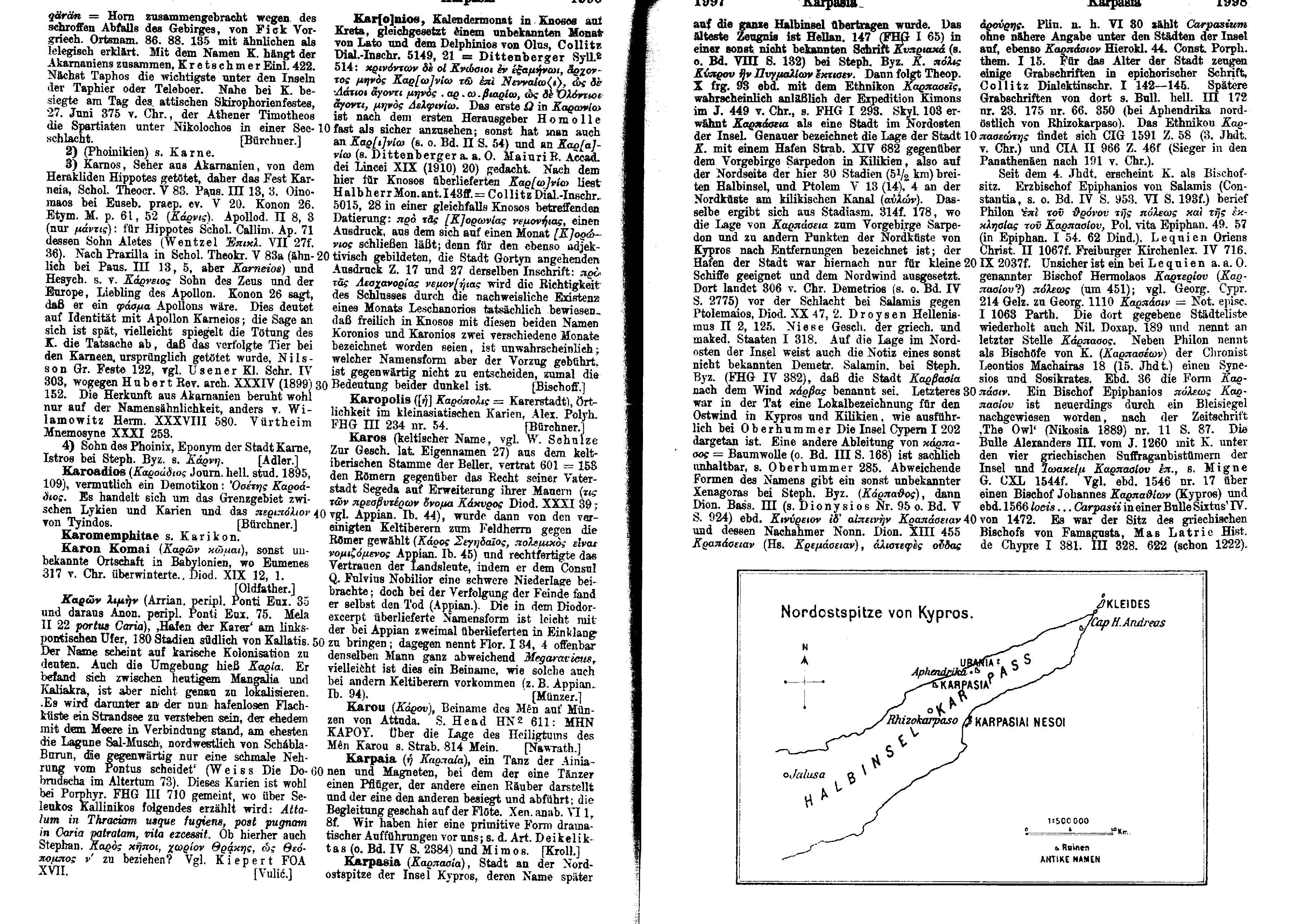
Monuments, architecture
- Jutta Dresken-Weiland: The church "Agia Solomoni" near Komi tou Gialou: Wall painting in Cyprus from the time of the iconoclasm , in: Sabine Rogge, Marie-Elisabeth Mitsou, Johannes G. Deckers (ed.): Contributions to the cultural history of Cyprus from the Late antiquity to modern times. Symposium, Munich, 12.-13. July 2002 , Waxmann, 2005, pp. 41-63.
- Marko Kiessel, Asu Tozan: Orthodox Church Architecture in the northern districts of Cyprus from the mid-19th century to 1974 , in: Prostor 22,2 (2014) 161–173. online (PDF).
- Şebnem Önal Hoşkara, Naciye Doratlı: A Critical Evaluation of the Issue of Conservation of Cultural Heritage in North Cyprus , in: Cyprus Review 24.1 (2012) 849–872. online (PDF)
geology
- Pentadaktylos , Geological Survey Department, Republic of Cyprus
- Gillian A. McCay, Alastair HF Robertson: Upper Miocene - Pleistocene deformation of the Girne (Kyrenia) Range and Dar Dere (Ovgos) lineaments, northern Cyprus: role in collision and tectonic escape in the easternmost Mediterranean region , in: AHF Robertson, Osman Parlak, Ulvi Can Ünlügenç (Ed.): Geological Development of Anatolia and the Easternmost Mediterranean Region , Geological Society of London, London 2013, pp. 420–445.
Flora and fauna
- Wayne J. Fuller, Ján Šeffer, Burak Ali Çiçek, Ozge Özden, G. Eroglu, C. Cara, O. Dogan: Management Plan for South Karpaz Beaches SEPA , Nicosia 2010. ( online , PDF)
- Şaban Güvenç, Şule Öztürk: Lichens in the North-East regions of Cyprus , in: Journal of Botanical Taxonomy and Geobotany 110,5-6 (1999) 455-463.
- Petr Benda, Vladimír Hanák, Ivan Horáček, Pavel Hulva, Radek Lučak, Manuel Ruedi: Bats (Mammalia: Chiroptera) of the Eastern Mediterranean. Part 5. Bat fauna of Cyprus: review of records with confirmation of six species new for the island and description of a new subspecies , in: Acta Soc. Zool. Bohem. 71 (2007) 71-130.
Web links
- TRNC Planning Organization, or Devlet Planlama Örgütü (English and Turkish)
- Cyprus 2012 , herpetofauna of Europe
- Christian Monuments of Cyprus (PDF) Map of Northern Cyprus with all Christian monuments
- Andrekos Varnava: The Maronite Community of Cyprus: Past, Present and Future , in: maronitedaily, September 24, 2007
- The Karpaz Peninsula , travel guide
Remarks
- ↑ The figures vary between 43 miles (David Miller: Richard the Lionheart ) and 100 km; there is some uncertainty with regard to the western border.
- ↑ Eugen Oberhummer : Karpasia. In: Paulys Realencyclopadie der classischen Antiquity Science (RE). Volume X, 2, Stuttgart 1919, Sp. 1996-1999.
- ↑ This and the following from Karpaz area. Local Development Strategy , Nicosia 2010, here: p. 5.
- ↑ Ioannis Nikolaou Vogiatzakis, Gloria Pungetti, Antoinette M. Mannion (ed.): Mediterranean Iceland Landscapes. Natural and Cultural Approaches , Springer Science & Business Media, 2008, Table 4.4, p. 69.
- ↑ Alastair HF Robertson, Tim C. Kinnaird: Structural development of the central Kyrenia Range (north Cyprus) in its regional setting in the eastern Mediterranean region , in: International Journal of Earth Sciences 105.1 (2016) 417–437.
- ↑ As defined in the Encyclopedia Britannica .
- ↑ Youssi Mart, William Ryan: The tectonics of Cyprus Arc: a model of complex continental collision , in: EGS - AGU - EUG Joint Assembly, Abstracts from the meeting held in Nice, France, 6 - 11 April 2003 .
- ↑ Ioannis Panayides: Cyprus , in: Rosemary G. Gillespie, David A. Clague (ed.) Encyclopedia of Iceland , University of California Press, 2009, p.212.
- ↑ Zomenia Zomeni, Adriana Bruggeman: Soil Resources of Cyprus , in: Yusuf Yigini, Panos Panagos, Luca Montanarella (ed.): Soil Resources of Mediterranean and Caucasus Countries Extension of the European Soil Database , European Commission Joint Research Center Institute for Environment and Sustainability, 2013, p. 40 online (PDF).
- ↑ France Lagroix, Graham J. Borradaile: Tectonics of the circum-Troodos sedimentary cover of Cyprus, from rock magnetic and structural observations, in: Journal of Structural Geology 22 (2000) 453-469, here: p 453 f. ( online , PDF).
- ↑ Petr Benda, Vladimír Hanák, Ivan Horáček, Pavel Hulva, Radek Lučak, Manuel Ruedi: Bats (Mammalia: Chiroptera) of the Eastern Mediterranean. Part 5. Bat fauna of Cyprus: review of records with confirmationofsixspeciesnew for the island and description of a new subspecies , in: Acta Soc. Zool. Bohem 71 (2007) 71–130, here: p. 72. Cf. Messinische Salinitätskrise .
- ↑ Ehud Galili, Muge Şevketoğlu, Amos Salamon, Dov Zviely, Henk K. Mienis, Baruch Rosen, Shimon Moshkovitz: Late Quaternary beach deposits and archaeological relicts on the coasts of Cyprus, and the possible implications of sea-level changes and tectonics on the early populations , in: Geological Society, London, Special Publications 411 (2016) 179-218.
- ^ Karpaz area. Local Development Strategy , Nicosia 2010, p. 5.
- ↑ Jim FP Galvin: Nocturnal mountain winds in Cyprus - an observational study , in: Meteorological Applications 22.3 (2015) 348-359 ( online ).
- ↑ List of dams in Cyprus (English and Greek).
- ↑ After Salih Gucel, Costas Kadis, Özge Özden, Iris Charalambidou, Conor Linstead, Wayne Fuller, Constantinos Kounniams, Minir Öztürk: Assessment of biodiversity differences between natural and artificial wetlands in Cyprus , in: Pak. J. Bot 44 (2012) 213-224, Special Issue online (PDF).
- ↑ Carol Griggs, Charlotte Pearson, Sturt W. Manning, Brita Lorentzen: A 250-year annual precipitation reconstruction and drought assessment for Cyprus from Pinus brutia Ten. tree-rings , in: International Journal of Climatology 34.8 (2014) 2702-2714.
- ↑ Wayne J. Fuller, Ján Šeffer, Burak Ali Çiçek, Ozge Özden, G. Eroglu, C. Cara, O. Dogan: Management Plan for South Karpaz Beaches SEPA , Nicosia 2010, p. 7 f.
- ↑ Elkiran Gozen, Aysen Turkman: Water Scarcity Impacts On Northern Cyprus And Alternative Mitigation Strategies , in: Jiaguo Qi, Kyle T. Evered (Ed.): Environmental Problems of Central Asia and their Economic, Social and Security Impacts , Part III, Springer 2008, pp. 241-250.
- ↑ Rahme Seyhun, Bertuğ Akıntuğ: Trend Analysis of Rainfall in North Cyprus , in: Ibrahim Dincer, Can Ozgur Colpan, Fethi Kadioglu (eds.): Causes, Impacts and Solutions to Global Warming , Springer, 2013, pp. 169–181.
- ↑ Nikos Poulakakis, Paschalia Kapli, Afroditi Kardamaki, Eirini Skourtanioti, Bayram Göcmen, Çetin Ilgaz, Yusuf Kumlutaş, Aziz Avci, Petros Lymberakis: Comparative phylogeography of six herpetofauna species in Cyprus: late Miocene to Pleistocene routes , in: Journalization : Biological routes to Pleistocene Linnean Society 108.3 (2013) 619-635.
- ^ Sarah Elizabeth Harris: Colonial Forestry and Environmental History. British Policies in Cyprus, 1878-1960 , University of Texas at Austin, 2007, p. 343.
- ↑ Ralf Hand: Supplementary notes to the flora of Cyprus V , in: Willdenowia 36,2 (2006) 761-809, here: pp. 781, 798-799 ( BioOne ).
- ↑ Wayne J. Fuller, Ján Šeffer, Burak Ali Çiçek, Ozge Özden, G. Eroglu, C. Cara, O. Dogan: Management Plan for South Karpaz Beaches SEPA , Nicosia 2010, p. 13.
- ↑ Fatoş Şekercíler, Osman Ketenoğglu: Flora of North Dunes of Karpaz National Park (Cyprus) , in: Biological Diversity and Conservation 4.2 (2011) 189–203.
- ↑ A. Trias-Blasi, S. Gücel, Ö. Özden: Current distribution and conservation status reassessment of the Cyprus Tulip (Tulipa cypria: Liliaceae), new data from northern Cyprus , in: Plant Biosystems (2016), p. 2 ( online , PDF).
- ↑ Kolokaz , Travel Guide to Northern Cyprus.
- ↑ Stefano Lusignano: Chorograffia et breve historia universale dell'Isola de Cipro principiando al tempo di Noè per in sino al 1572 , Alessandro Benacci, Bologna 1573 ( digitized version ).
- ↑ Nihat Yilmaz, Turgut Alas, Kazım Abak, Salih Gucel, F. KayaYildirim: Wild edible plants of North Cyprus and their traditional use , in: Acta Hortic. 960, V Balkan Symposium on Vegetables and Potatoes (2012) 129-133.
- ↑ Petr Benda, Vladimír Hanák, Ivan Horáček, Pavel Hulva, Radek Lučak, Manuel Ruedi: Bats (Mammalia: Chiroptera) of the Eastern Mediterranean. Part 5. Bat fauna of Cyprus: review of records with confirmationofsixspeciesnew for the island and description of a new subspecies , in: Acta Soc. Zool. Bohem 71 (2007) 71-130, here: p. 72.
- ↑ Peter Boye, Bärbel Pott-Dorfer, Karsten Dörfer, Andreas Demetropoulos: New records of bats (Chiroptera) from Cyprus and notes on their biology , in: Myotis 28 (1990) 93-100.
- ↑ Petr Benda, Vladimír Hanák, Ivan Horáček, Pavel Hulva, Radek Lučak, Manuel Ruedi: Bats (Mammalia: Chiroptera) of the Eastern Mediterranean. Part 5. Bat fauna of Cyprus: review of records with confirmationofsixspeciesnew for the island and description of a new subspecies , in: Acta Soc. Zool. Bohem 71 (2007) 71-130, here: p. 77.
- ↑ Wayne J. Fuller, Ján Šeffer, Burak Ali Çiçek, Ozge Özden, G. Eroglu, C. Cara, O. Dogan: Management Plan for South Karpaz Beaches SEPA , Nicosia 2010, p. 15.
- ↑ Richard G. Hamrick, Tahir Pirgalioglu, Serife Gunduz, John P. Carroll: Feral donkey Equus asinus populations on the Karpaz peninsula, Cyprus , in: European Journal of Wildlife Research 51 (2005) 108-116.
- ↑ Sonja Kastilan: Turtles in Northern Cyprus. Behind the garden fence on the beach , in: Frankfurter Allgemeine Wissen, September 10, 2012.
- ↑ Damla Beton, Robin Snape, Barış Saydam: Status and ecology of the Bonelli's Eagle, Aquila fasciatus, in the Pentadaktylos Mountain Range, Cyprus (Aves: Falconiformes) , in: Zoology in the Middle East 59.2 (2013) 123-130 .
- ↑ This and the following according to Salih Gucel, Costas Kadis, Özge Özden, Iris Charalambidou, Conor Linstead, Wayne Fuller, Constantinos Kounniams, Minir Öztürk: Assessment of biodiversity differences between natural and artificial wetlands in Cyprus , in: Pak. J. Bot 44 (2012) 213-224, Special Issue, esp. P. 217 (table) online (PDF).
- ↑ Özge Özden: Habitat preferences of butterflies (Papilionoidea) in the Karpaz Peninsula, Cyprus , in: Nota lepid. 36.1 (2012) 57-64, here: p. 58 ( online , PDF).
- ↑ Özge Özden: Habitat preferences of butterflies (Papilionoidea) in the Karpaz Peninsula, Cyprus , in: Nota lepid. 36.1 (2012) 57-64, here: Tab. 2, p. 61.
- ↑ Sermin Açik, G. Vantsetti Murina, Melih Ertan Çinar, Zeki Ergen: Sipunculans from the coast of northern Cyprus (eastern Mediterranean Sea) (PDF) in Zootaxa 1077 (2005) pp. 1–23.
- ↑ Ersen Aydın Yağmur, Halil Koç, Wilson R. Lourenço: A new species of Buthus Leach, 1815 from Cyprus (Scorpiones, Buthidae) , in: Zookeys 115 (2011) 27-38.
- ↑ Bayram Göçmen, Nazım Kaşot, Mehmet Zülfü Yildiz, Istvan Sas, Bahadır Akman, Deniz Yalçınkaya, Salih Gücel: Results of the Herpetological Trips to Northern Cyprus , in: North-Western Journal of Zoology 4.1 (2008) 139–149, here: p. 140.
- ^ Karpaz area. Local Development Strategy , Nicosia 2010, here: p. 5.
- ^ Karpaz area. Local Development Strategy , Nicosia 2010, pp. 6-8.
- ↑ Michael JK Walsh: City of Empires. Ottoman and British Famagusta , Cambridge Scholars Publishing, 2015, p. 174.
- ^ Karpaz area. Local Development Strategy , Nicosia 2010, p. 9.
- ^ Routes of Displacement and Resettlement / Famagusta .
- ↑ Emile Y. Kolodny: Une comunauté insulaire en Méditerranée orinentale: les Turcs de Chypre , in: Revue de géographie de Lyon Année 46.1 (1971) 5–56, here: p. 15.
- ↑ Emile Y. Kolodny: Une comunauté insulaire en Méditerranée orinentale: les Turcs de Chypre , in: Revue de géographie de Lyon Année 46.1 (1971) 5–56, here: p. 16.
- ↑ Erhan Öztepe: Karpaz Yarımadası Arkeolojik Yerleşimleri , in: Anadolu 33 (2007) 143-164.
- ↑ Thomas F. Strasser, Curtis Runnels, Claudio Vita-Finzi: A possible Palaeolithic hand ax from Cyprus , in: Antiquity 350 (April 2016).
- ↑ Steve O. Held: Colonization cycles on Cyprus 1: The biogeographic and paleontological foundations of early prehistoric settlement . Reports of the Department of Antiquities, Cyprus (Nicosia) (1989) 7-28.
- ↑ Mücke Şevketoğlu: Early Settlements and Procurement of Raw Materials - New Evidence Based on Research at Akanthou-Arkosykos (Tatlısu-Çiftlikdüzü), Northern Cyprus , in: Türkiye Bilimler Akademisi arkeoloji dergisi 11 (2008) 63–72.
- ↑ Jean-Denis Vigne, Julie Daujat, Hervé Monchot: First Introduction and Early Exploitation of the Persian Fallow Deer on Cyprus (8000–6000 cal. Bc) , in: International Journal of Osteoarchaeology (October 2015)
- ↑ Then Danielle Stordeur asked : De la vallée de l'Euphrate à Chypre? A la découverte d'indices de relations au Néolithique , in Jean Guilaine, Alain Le Brun (ed.): Le Néolithique de Chypre (actes du colloque international de Nicosie, 17–19 May 2001) , École française d'Athènes, Athens 2003 , Pp. 353-371.
- ^ Alain Le Brun: Cap Andreas - Kastros (Chypre). Quelques résultats de la campagne de 1973 , in: Paléorient 3.1 (1975) 305-310.
- ^ A. Bernard Knapp: The Archeology of Cyprus. From Earliest Prehistory Through the Bronze Age , Cambridge University Press, 2013, p. 507.
- ↑ Paul Croft: Herds lost in time: Animal remains from the 1969-1970 excavation seasons at the ceramic-neolithic settlement of Philia-Drakos site A, Cyprus , in: Diane Bolger, Louise C. Maguire (ed.): The Development of Pre-State Communities in the Ancient Near East. Studies in Honor of Edgar Peltenburg , Oxbow Books, 2010, chap. 16.
- ↑ Ceramic Neolithic (Sotira culture) - 4,500 - 4,000 BC ( Memento of the original from March 4, 2016 in the Internet Archive ) Info: The archive link was inserted automatically and has not yet been checked. Please check the original and archive link according to the instructions and then remove this notice. .
- ↑ Doron Boness, Joanne Clarke, Yuval Goren : Ceramic Neolithic pottery in Cyprus - origin, technology and possible implications for social structure and identity , in: Levant 47,3 (2015) 233-254.
- ↑ Müge Şevketogl̆u: Archaeological field survey of the Neolithic and Chalcolithic settlement sites in Kyrenia District, North Cyprus. Systematic surface collection and the interpretation of artefact scatters , J. and E. Hedges, Oxford 2000, p. 116. Cf. Kissonerga-Mosphilia from the Mosphilia period.
- ↑ For example, Eric Orlin (ed.): Routledge Encyclopedia of Ancient Mediterranean Religions , Routledge, 2015 starts with this epoch (p. 149).
- ^ Diane L. Bolger: Early Red Polished Ware and the Origin of the "Philia Culture" , in: Jane A. Barlow, Diane. L. Bolger, Barbara Kling (Eds.): Cypriot Ceramics: Reading the Prehistoric Record , University of Pennsylvania Museum of Archeology, 1991, pp. 29-36.
- ↑ Monika Lucas: Figurine e pendenti cruciformi del periodo Calcolitico a Cipro: una proposta di classificazione , tesi di laurea, Venice 2013, pp. 19-22.
- ↑ Maria Iacovou: Historically Elusive and Internally Fragile Iceland polities: The Intricacies of Cyprus's Political Geography in the Iron Age , in: Bulletin of the American Schools of Oriental Research 370 (November, 2013), pp 15-47, here: p 15 .
- ^ Hector Catling : Observations on the archaeological survey in the area of Philamoudhi, Cyprus . Report of the Department of Antiquities, Cyprus 1973, pp. 107-115 and Ders .: The Philamoudhi Survey again . Report of the Department of Antiquities, Cyprus 1976, pp. 29-34, finally Joanna S. Smith, Despo Pilides, Jay Stratton Noller, Allan S. Gilbert, Mara T. Horowitz, Kyle L. Killian, Nancy M. Dammann, Robert S. Merrillees: Views from Phlamoudhi, Cyprus , in: The Annual of the American Schools of Oriental Research 63 (2008) i-iii, v, vii-xiii, 1-13, 15-29, 31-43, 45-85 , 87-97, 99-135, 137-145.
- ↑ Louise Steel: Cyprus , in: Eric H. Cline (ed.): The Oxford Handbook of the Bronze Age Aegean (approx. 3000-1000 BC) , Oxford University Press, 2010, pp. 804-819, here: pp. 809
- ^ Gunnel Hult : Nitovikla Reconsidered , Stockholm 1992.
- ^ Paul Åström : Excavations at Kalopsidha and Ayios Iakovos in Cyprus , P. Åström, Lund 1966.
- ↑ Selma MS Al-Radi: Phlamoudhi Vounari. A Sanctuary Site in Cyprus (= Studies in Mediterranean Archeology , Volume 65), P. Åströms, Göteborg 1983; Mara T. Horowitz: Phlamoudi Vounari: A Multi-function site in Cyprus , in: Joanna S. Smith (Ed.): Views from Phlamoudhi, Cyprus (= Annual of the American School of Oriental Research , Volume 63). Boston in Massachusetts 2008, pp. 69-85.
- ↑ Phlamoudhi Archaeological Project of Columbia University .
- ↑ Mara Horowitz: Monumentality and Social Transformation at Late Bronze Age Phlamoudhi-Vounari, Cyprus , PhD Thesis, Columbia University, 2007.
- ^ Temporal classification of Middle Cypriot III according to Margreet L. Steiner, Ann E. Killebrew (Ed.): The Oxford Handbook of the Archeology of the Levant. C. 8000-332 BCE , Oxford University Press, 2013, p. 56.
- ↑ Joanna Smith: Bringing Old Excavations to Life , in: Near Eastern Archeology 71,1–2 (2008) 30–40, here: p. 34.
- ↑ Edgar Peltenburg: Nitovikla and Tell el-Burak: Cypriot mid-second millennium BC forts in a Levantine context , in: Report of the Department of Antiquities, Cyprus 2008 , Nicosia 2008, pp. 145–157, here: pp. 145 f .
- ^ Gordon Campbell: The Grove Encyclopedia of Classical Art and Architecture , Oxford University Press, 2007, p. 348.
- ^ Claudia Glatz: Plain Pottery Traditions of the Eastern Mediterranean and Near East. Production, Use, and Social Significance , Left Coast Press, 2015, pp. 121, 123.
- ↑ Kathryn Eriksson: Red Lustrous Wheelmade Ware: A Product of Late Bronze Age Cyprus , in: Jane A. Barlow, Diane. L. Bolger, Barbara Kling (Eds.): Cypriot Ceramics. Reading the Prehistoric Record , University of Pennsylvania Museum of Archeology, 1991, pp. 81–96, here: p. 84.
- ^ Claudia Glatz: Plain Pottery Traditions of the Eastern Mediterranean and Near East. Production, Use, and Social Significance , Left Coast Press, 2015, p. 129.
- ↑ Priscilla Keswani: Mortuary Ritual and Society in Bronze Age Cyprus , Equinox, 2004, pp. 47-49.
- ^ A. Bernard Knapp : The Archeology of Cyprus. From Earliest Prehistory Through the Bronze Age , Cambridge University Press, 2013, p. 474; Trudy Ring, Robert M. Salkin, Sharon La Boda (Eds.): International Dictionary of Historic Places , Vol. 3: Southern Europe , Taylor & Francis, 1995, p. 146.
- ^ "Les villes de la péninsule du Karpass ne semblent pas avoir été protégées par une enceinte" ('the cities of the Karpas peninsula do not seem to have been protected by a wall') Claire Balandier also adopted: La défense des territoires à Chypre de l'époque archaïque aux invasions arabes (VIIIe s. av. n.è. - VIIe s. de n.è.) , in: Dialogues d'Histoire Ancienne 28.1 (2002) 175–206, here: p 183 .
- ^ Chelones, Cyprus , in: Richard Stillwell, William L. MacDonald, Marian Holland McAllister, Stillwell, Richard, MacDonald, William L., McAlister, Marian Holland (Eds.): The Princeton Encyclopedia of Classical Sites ( online ); abandoned after the first raids by the Saracens in 647.
- ^ Claire Balandier: Fortifications and defense in Cyprus from the Archaic to the Hellenistic period ( online ).
- ↑ Velleius Paterculus , Historia Romana 1,1,1; Strabo 14,6,3.
- ↑ Hellanikos with Stephanos of Byzantium sv Καρπασία
- ↑ Travel guides in particular still tend to do so. One of them claims: "During the Hellenization of Cyprus, Achaean settlers ... settled in the 12th century." (Baedeker Travel Guide Cyprus, 2013, p. 211). In the 1982 yearbook of the Geographical Society of Hanover it is stated succinctly that “the Hellenization of Cyprus continued in the 15th and 16th centuries BC. Chr. ”(P. 38).
- ↑ In 2002 Natasha Leriou: Constructing an Archaeological Narrative: The Hellenization of Cyprus , in: Stanford Journal of Archeology 1 (2002) 1–32 ( online ) shed light on the origins of the Hellenization thesis .
- ↑ Agata Mirva-Montoya: Learning from dead animals: horse sacrifice in ancient Salamis and the Hellenization of Cyprus , in: Jay Johnston, Fiona Probyn-Rapsey (ed.): Animal death , Sydney University Press, 2013, pp. 169-188 .
- ^ Isocratis sermo de regno ad Nicoclem regem. Bartholomei Facii Orationes , digitized.
- ↑ Evangelos Alexiou: The Euagoras of Isocrates. A commentary , de Gruyter, 2010, p. 98.
- ↑ Claire Balandier: La défense des territoires à Chypre de l'époque archaïque aux invasions arabes (VIIIe s. Av. N.è. - VIIe s. De n.è.) , in: Dialogues d'Histoire Ancienne 28.1 ( 2002) 175–206, here: p. 190 f.
- ↑ Nonnos, Dionysaika 13,452.
- ↑ Diodorus 20,47,2.
- ↑ Claire Balandier: La défense des territoires à Chypre de l'époque archaïque aux invasions arabes (VIIIe s. Av. N.è. - VIIe s. De n.è.) , in: Dialogues d'Histoire Ancienne 28.1 ( 2002) 175–206, here: pp. 195 f.
- ^ Terence Bruce Mitford , K. Nikolaou: An Inscription from Karpasia in Cyprus . In: Journal of Hellenic Studies . Volume 77/2, 1957, pp. 313-314. The inscription was discovered by the archeology student K. Nikolaou 200 m southwest of the church Agios Phílon, which in turn was 3 km north of Rizokarpaso , in the former center of Karpasia.
- ↑ Agios Philon
- ^ Terence Bruce Mitford: Further Contributions to the Epigraphy of Cyprus , in: American Journal of Archeology 65/2 (1961), p. 93.
- ↑ SEG 20.317
- ^ Roger S. Bagnall : The Administration of the Ptolemaic Possessions Outside Egypt , Brill, Leiden 1976, p. 74.
- ↑ Eugen Oberhummer : Karpasia. In: Paulys Realencyclopadie der classischen Antiquity Science (RE). Volume X, 2, Stuttgart 1919, Sp. 1996-1999.
- ↑ Claire Balandier: La défense des territoires à Chypre de l'époque archaïque aux invasions arabes (VIIIe s. Av. N.è. - VIIe s. De n.è.) , in: Dialogues d'Histoire Ancienne 28.1 ( 2002) 175–206, here: p. 200.
- ↑ Strabo 14,6,3.
- ↑ Kyriakos Nicolaou: Chelones Cyprus . In: Richard Stillwell et al. a. (Ed.): The Princeton Encyclopedia of Classical Sites. Princeton University Press, Princeton NJ 1976, ISBN 0-691-03542-3 .
- ↑ Strabon , Geographika 15,682.
- ^ Terence Bruce Mitford: Further Contributions to the Epigraphy of Cyprus , in: American Journal of Archeology 65/2 (1961) 93–151, here: p. 125.
- ↑ Claire Balandier: La défense des territoires à Chypre de l'époque archaïque aux invasions arabes (VIIIe s. Av. N.è. - VIIe s. De n.è.) , in: Dialogues d'Histoire Ancienne 28.1 ( 2002) 175–206, here: p. 203.
- ↑ Lexikon des Mittelalters 9, Stuttgart 1999, p. 738.
- ↑ Claire Balandier: La défense des territoires à Chypre de l'époque archaïque aux invasions arabes (VIIIe s. Av. N.è. - VIIe s. De n.è.) , in: Dialogues d'Histoire Ancienne 28.1 ( 2002) 175–206, here: p. 203 f.
- ↑ This attack is documented by an inscription from the year 655 in the restored basilica of Soloi, so it affected the north of the island. The inscription tells of 120,000 prisoners for the year 649 and another 50,000 for 650 (Anthony Bryer, GS Georghallides: The Sweet Land of Cyprus. Papers given at the twenty-fifth jubilee Spring Symposium of Byzantine Studies, Birmingham, March 1991 , Cyprus Research Center, 1993, p. 10).
- ↑ Doubts about the character of a condominium expressed u. a. Michael A. Köhler : Alliances and treaties between Frankish and Islamic rulers in the Middle East. A study of coexistence between states from the 12th to the 13th century , de Gruyter, 1991, p. 423, on this note 190. Condominiums were common practice between the Crusader and Muslim states from the early 12th century to 1285.
- ↑ Farid Mirbagheri: Historical Dictionary of Cyprus , Scarecrow, 2009, p. 108.
- ↑ Agostino Pertusi (ed.): Constantino Porfirogenito: De Thematibus , Biblioteca Apostolica Vaticana, Città del Vaticano 1952, p. 81.
- ^ Arthur Hubert Stanley Megaw: Byzantine architecture and decoration in Cyprus. Metropolitan or provincial? in: Dumbarton Oaks Papers 28 (1974) 59-80, here: p. 79.
- ↑ Sabine Rogge, Michael Grünbart (Ed.): Medieval Cyprus. A Place of Cultural Encounter , Waxmann, Münster 2015, p. 132. Moshe Gil : A History of Palestine, 634-1099 , Cambridge University Press, 1997, reprint 2010, p. 455, but dates his term of office to the period from 855 to 860.
- ↑ Nicolas Morelle: The Castle of Kantara - a key to the evolution of active defense in the 13th century between the Eastern and the Western Worlds Nicolas Morelle The Castle of Kantara , in: The Castle Studies Group journal, Castle Studies Group, 2014, p 292-318, here: p. 296.
- ↑ Nicolas Morelle: The Castle of Kantara - a key to the evolution of active defense in the 13th century between the Eastern and the Western Worlds Nicolas Morelle The Castle of Kantara , in: The Castle Studies Group journal, Castle Studies Group, 2014, p 292-318, here: pp. 293 and 296 ( online , PDF).
- ^ Moshe Gil : A History of Palestine, 634-1099 , Cambridge University Press, 1997, p. 408.
- ↑ Dieter Reinsch (Ed.): Anna Komnene. Alexias , Walter de Gruyter, 2001, pp. 296-298.
- ↑ Lexikon des Mittelalters 9, Stuttgart 1999, column 740.
- ↑ Peter Schreiner : Manasses, Konstantinos . In: Lexikon des Mittelalters VI, Sp. 184.
- ↑ Chares Demetriou: Big Structures, Social Boundaries, and Identity in Cyprus, 1400–1700 , in: American Behavioral Scientist 51 (2008), p. 1481.
- ↑ The Kaphrasin living in Cyprus were considered heretics by the Orthodox Jews, cf. Lukasz Burkiewicz: The Cypriot Jews under the Venetian Rule (1489-1571) . In: Scripta Judaica Cracoviensia . tape 6 , 2008, p. 49–61 , here p. 50 (English, online [accessed March 3, 2020]).
- ^ Catia Galatariotou: The Making of a Saint. The Life, Times and Sanctification of Neophytos the Recluse , Cambridge University Press, 2004, p. 235.
- ↑ On the relationship between Orthodox and Latins in the Lusignan period, cf. Miltiades B. Efthimiou: Greeks and Latins on Cyprus in the Thirteenth Century , Hellenic College Press, 1987.
- ^ William M. Johnston, Christopher Kleinhenz (eds.): Encyclopedia of Monasticism , Fitzroy Dearborn, 2000 and Routledge, 2015, p. 348.
- ^ Nicolas Morelle: The Castle of Kantara - a key to the evolution of active defense in the 13th century between the Eastern and the Western Worlds Nicolas Morelle The Castle of Kantara , in: The Castle Studies Group journal, Castle Studies Group (2014) 292 -318, here: p. 296 and Peter W. Edbury: The Kingdom of Cyprus and the Crusades 1191-1374 , Cambridge University Press, 1991, p. 61.
- ^ Ian Robertson: Cyprus , Benn, London 1981, p. 153.
- ^ K. Scott Parker: Cyprus and the Oriental Christians in the time of Peter I de Lusignan (1359-69) , p. 1 ( academia.edu ).
- ↑ Rosella Dorigo: Literary innovation in modern Arabic literature. Schools and journals: proceedings of the IV Emtar Congress (Venice 21-24 April 1999) , Herder, 2000, p. 223.
- ^ Archdale King: The Rites of Eastern Christendom , Gorgias Press, 2007, p. 225.
- ^ "The Maronites were not only concentrated in Famagusta, and in fact their primary settlements were in the Kyrenia Mountains and the Karpas Peninsula", quoted from Andrekos Varnava: The Maronite Community of Cyprus: Past, Present and Future , in: Maronite daily, September 24, 2007. The following after this post.
- ↑ Eugen Oberhummer : Karpasia. In: Paulys Realencyclopadie der classischen Antiquity Science (RE). Volume X, 2, Stuttgart 1919, Sp. 1996-1999.
- ↑ At least since 1222, strengthened from 1260 and 1291.
- ^ K. Scott Parker: Peter I de Lusignan, the Crusade of 1365, and the Oriental Christians of Cyprus and the Mamluk Sultanate , in: Sabine Rogge, Michael Grünbart (eds.): Medieval Cyprus. A Place of Cultural Encounter , Waxmann, 2015, pp. 53–71, here: p. 55.
- ^ Heinrich Kretschmayr : History of Venice , Vol. 2, Gotha 1920, p. 451.
- ↑ ed. Evans, p. 364 f.
- ↑ p. 185 f.
- ↑ Evangelia Skoufari: Cipro veneziana (1473-1571). Istituzioni e culturenel regno della Serenissima , Viella, Rome 2011, pp. 31-37 (section Fonti ) ( academia.edu ).
- ^ Benjamin Arbel : A fresh look at the Venetian Protectorate of Cyprus (1474-89) , in: Candida Syndikus, Sabine Rogge (ed.): Caterina Cornaro. Last Queen of Cyprus and Daughter of Venice - Ultima regina di Cipro e figlia di Venezia , Waxmann, 2013, pp. 213-229.
- ↑ Eric Solsten: Cyprus, a country study , Library of Congress, 1996, p. 17.
- ↑ Nicolas Morelle: The Castle of Kantara - a key to the evolution of active defense in the 13th century between the Eastern and the Western Worlds Nicolas Morelle The Castle of Kantara , in: The Castle Studies Group journal, Castle Studies Group, 2014, p . 292-318, here: p. 300.
- ↑ Bibliotheque de l'école des chartes revue d'érudition consacrée spécialement a l'étude du moyen-age , Vol. 41, Librairie Droz, Paris 1880, pp. 388-390.
- ↑ Louis de Mas Latrie : Les comtes du Carpas , in: Bibliothèque de l'Ècole des Chartes 41.1 (1880) 375–392, here: p. 376 and 378 ( online ). His children were excluded "pro perfidia qua contra nos usus est Johannes Petrus" (quoted from Ders., P. 389.)
- ↑ On the question of slavery with a view to the Christian population, cf. Aysu Dincer: 'Enslaving Christians': Greek slaves in late medieval Cyprus , in: Mediterranean Historical Review 31 (2016) 1–19.
- ↑ Katerina V. korre: human bondage: The ultimate changes in the social status of Parici in Venetian Cyprus (1560-1571) , in Iosif Hadjikyriako, Mia Gaia Trentin (ed.): Cypriot Cultural Details. Proceedings of the 10th Annual Meeting of Young Researchers in Cypriot Archeology , Oxbow, 2015, pp. 197–208, here: p. 197.
- ↑ Katerina V. korre: human bondage: The ultimate changes in the social status of Parici in Venetian Cyprus (1560-1571) , in Iosif Hadjikyriako, Mia Gaia Trentin (ed.): Cypriot Cultural Details. Proceedings of the 10th Annual Meeting of Young Researchers in Cypriot Archeology , Oxbow, 2015, pp. 197–208, here: p. 205.
- ↑ Benjamin Arbel : Roots of poverty and sources of richness in Cyprus under Venetian rule , in: A. Chryssa Maltezou (ed.): Πλούσιοι καί Φτωχοί στην Κοινωνία της Ελληνολατινικής Ανατολής - Ricchi e nella società poveri dell'Oriente Greco Latino , The Hellenic Institute , Venice 1998, pp. 351-360, here: p. 359.
- ↑ Katerina V. korre: human bondage: The ultimate changes in the social status of Parici in Venetian Cyprus (1560-1571) , in Iosif Hadjikyriako, Mia Gaia Trentin (ed.): Cypriot Cultural Details. Proceedings of the 10th Annual Meeting of Young Researchers in Cypriot Archeology , Oxbow, 2015, pp. 197–208, here: p. 207.
- ^ Benjamin Arbel : Sauterelles et mentalités: le cas de la Chypre vénitienne , in: Annales 44.5 (1989) 1057-1074, here: pp. 1064-1066.
- ^ The reports from 1560 to 1563 relating to Karpas and Mesaria are in the Venice State Archives (Senato, Dispacci, filza 2, November 25, 1560, December 22 and 30, 1563).
- ↑ Evangelia Skoufari: Il Regno della Repubblica: continuità istituzionali e scambi interculturali a Cipro durante la dominazione veneziana (1473–1570) , Diss., Padua 2008, p. 55 and note 156.
- ↑ Lukasz Burkiewicz: The Cypriot Jews under the Venetian Rule (1489-1571) , in: Scripta Judaica Cracoviensia 6 (2008) 49-61, here: pp. 51-53. In 1554 about 50 editions of the Talmud were publicly burned.
- ↑ Evangelia Skoufari: Il Regno della Repubblica: continuità istituzionali e scambi interculturali a Cipro durante la dominazione veneziana (1473–1570) , Diss., Padua 2008, p. 82.
- ↑ Evangelia Skoufari: Il Regno della Repubblica: continuità istituzionali e scambi interculturali a Cipro durante la dominazione veneziana (1473-1570) , Diss., Padua 2008, p. 83 f.
- ↑ Evangelia Skoufari: Il Regno della Repubblica: continuità istituzionali e scambi interculturali a Cipro durante la dominazione veneziana (1473–1570) , Diss., Padua 2008, p. 139. Provosto was allowed to close his business on the island for a year before he went into lifelong exile for the murder of his wife and her lover ( Venice State Archives , Senato Mar, reg. 16, c. 134 r ).
- ↑ Evangelia Skoufari: Il Regno della Repubblica: continuità istituzionali e scambi interculturali a Cipro durante la dominazione veneziana (1473-1570) , Diss., Padua 2008, p. 220.
- ↑ This and the following from George Hill : A History of Cyprus , Vol. 4, Cambridge University Press 2010, pp. 1ff.
- ↑ Euphrosyne Rizopoulou Egoumenidou: Traditional Craftsmen in Cyprus during the Period of Ottoman Rule through Lists of Property of Decreased Persons , in: Michalis N. Michael, Matthias Kappler, Eftihios Gavrielhier (ed.): Ottoman Cyprus. A Collection of Studies on History and Culture , Otto Harrassowitz, 2009, pp. 231-258, here: pp. 233 f.
- ^ Hikmet Özdemir: Ottoman Administration in Cyprus , in: The Journal of Ottoman Studies 20 (2000) 119–142, here: p. 122 f.
- ↑ Marios Hadjianastasis: Between the Porte and the Lion: Identity, Politics and Opportunism in Seventeenth Century Cyprus , in: Marios Hadjianastasis (ed.): Frontiers of the Ottoman Imagination. Studies in Honor of Rhoads Murphey , Brill, pp. 139–167, here: p. 148.
- ↑ Marios Hadjianastasis: Between the Porte and the Lion: Identity, Politics and Opportunism in Seventeenth Century Cyprus , in: Marios Hadjianastasis (ed.): Frontiers of the Ottoman Imagination. Studies in Honor of Rhoads Murphey , Brill, pp. 139–167, here: p. 149. The Cypriot nobleman Giovanni Santa Maura, who assumed there were 52,000 to 62,000 rebels, provided similar figures.
- ↑ Marios Hadjianastasis: Between the Porte and the Lion: Identity, Politics and Opportunism in Seventeenth Century Cyprus , in: Marios Hadjianastasis (ed.): Frontiers of the Ottoman Imagination. Studies in Honor of Rhoads Murphey , Brill, pp. 139–167, here: p. 152.
- ↑ This and the following according to Netice Yıldız: The Vakf Institution in Ottoman Cyprus , in: Michalis N. Michael, Eftihios Gavriel, Matthias Kappler (ed.): Ottoman Cyprus. A Collection of Studies on History and Culture , Harrassowitz, 2009, pp. 117-160.
- ↑ Netice Yıldız: The Vakf Institution in Ottoman Cyprus , in: Michalis N. Michael, Eftihios Gavriel, Matthias Kappler (ed.): Ottoman Cyprus. A Collection of Studies on History and Culture , Harrassowitz, 2009, pp. 117–160, here: p. 150.
- ↑ Hikmet Özdemir: Ottoman Administration in Cyprus , in: The Journal of Ottoman Studies 20 (2000) 119–142, here: p. 124.
- ↑ Ronald Jennings: Christians and Muslims in Ottoman Cyprus and the Mediterranean World, 1571-1640 , NYU Press, 1993, p. 192 f.
- ↑ Ronald Jennings: Christians and Muslims in Ottoman Cyprus and the Mediterranean World, 1571-1640 , NYU Press, 1993, p. 262.
- ↑ George Hill: A History of Cyprus , Vol. 4, Cambridge University Press, 2010, pp. 11f., Note 6.
- ↑ Emile Y. Kolodny: Une comunauté insulaire en Méditerranée orinentale: les Turcs de Chypre , in: Revue de géographie de Lyon 46.1 (1971) 5–56, here: 17.
- ↑ Marios Hadjianastasis: Between the Porte and the Lion: Identity, Politics and Opportunism in Seventeenth Century Cyprus , in: Marios Hadjianastasis (ed.): Frontiers of the Ottoman Imagination. Studies in Honor of Rhoads Murphey , Brill, pp. 139–167, here: p. 153.
- ↑ Marios Hadjianastasis: Between the Porte and the Lion: Identity, Politics and Opportunism in Seventeenth Century Cyprus , in: Marios Hadjianastasis (ed.): Frontiers of the Ottoman Imagination. Studies in Honor of Rhoads Murphey , Brill, pp. 139–167, here: pp. 159 f.
- ↑ Marios Hadjianastasis: Crossing the line in the sand: regional officials, monopolization of state power and 'rebellion'. The case of Mehmed Ağa Boyacıoğlu in Cyprus, 1685–1690 , in: Turkish Historical Review 2.2 (2011) 155–176.
- ^ Klaus Kreiser : The Ottoman State , Oldenbourg, Munich 2008, p. 66.
- ↑ George Hill: A History of Cyprus , Volume 4, Cambridge University Press, 2010, pp. 80f.
- ↑ George Hill: A History of Cyprus , Cambridge University Press, 2010, p. 86 f.
- ↑ George Hill: A History of Cyprus , Cambridge University Press, 2010, p. 110.
- ^ Charles Fraser Beckingham: The Turks of Cyprus , in: Journal of the Royal Anthropological Institute of Great Britain and Ireland 87.2 (1957) 165-174, here: 173.
- ↑ Gözde Pırlanta: Hellenistic, Byzantine and Gothic Influences in Orthodox Churches Located in North Cyprus , thesis, Eastern Mediterranean University, Institute of Graduate Studies and Research, Dept. of Architecture, Famagusta 2014.
- ↑ Mete Hatay: Is the Turkish Cypriot Population Shrinking? An Overview of the Ethno-Demography of Cyprus in the Light of the Preliminary Results of the 2006 Turkish-Cypriot Census , p. 18 (see table on p. 19, online , PDF).
- ^ George Hill: A History of Cyprus , Cambridge University Press, 2010, p. 162.
- ↑ Not to be confused with the archbishop of the same name from 1840 to 1849.
- ↑ George Hill: A History of Cyprus , Cambridge University Press, 2010, pp. 164–166.
- ↑ In addition to the Karpas, these were: Larnaka, Limassol, Piscopi (Episkopi), Kilani, Avdimou, Paphos, Kouklia, Lefka, Morphou, Orini, Piliria, Kythrea, Lapithos, Kerinia (Kyrenia), Mesaurea and Famagusta (Jan Asmussen: “We were like brothers. “Coexistence and the emergence of conflicts in ethnically mixed villages in Cyprus , LIT Verlag Münster, 2001, p. 95, note 161).
- ↑ Emile Y. Kolodny: Une comunauté insulaire en Méditerranée orinentale: les Turcs de Chypre , in: Revue de géographie de Lyon Année 46.1 (1971) 5–56, here: p. 17.
- ↑ Klaus Kreiser: Der Ottmanische Staat , Oldenbourg, Munich 2008, p. Table 8, p. 234, here: p. 235.
- ^ Hans A. Pohlsander: Sources for the Memory of Cyprus. German texts: Turkish period (after 1800) , Greece and Cyprus Research Center, 2006, p. 262.
- ↑ This and the following from: Sarah Elizabeth Harris: Colonial Forestry and Environmental History. British Policies in Cyprus, 1878-1960 , University of Texas at Austin, 2007, p. 349.
- ↑ This and the following from: Sarah Elizabeth Harris: Colonial Forestry and Environmental History. British Policies in Cyprus, 1878-1960 , University of Texas at Austin, 2007, pp. 371-373.
- ↑ George Hill: A History of Cyprus , Vol. 4, Cambridge University Press, 2010, pp. 263f. See Lang: 'Reminiscences - archaeological research in Cyprus', in: Blackwood's Edinburgh Magazine 177 (1905) 622-639.
- ↑ Michele Bacci: Some Remarks on the Appropriation, Use, and Survival of Gothic Forms on Cyprus , in: Lynn Jones (Ed.): Byzantine Images and their Afterlives. Essays in Honor of Annemarie Weyl Carr , Routledge, 2014, pp. 145–168, here: p. 161.
- Jump up ↑ George Hill: A History of Cyprus , Vol. 4, Cambridge University Press, 2010, p. 262.
- ^ Wilhelm Heinrich Engel: Kypros. A monograph , G. Reimer, Berlin 1841.
- ↑ Thomas Backhouse Sandwith: On the different styles of pottery found in ancient tombs in the island of Cyprus , in: Archaeologia 45 (1877) 127–142.
- ^ Cyprus 1878. The journal of Sir Garnet Wolseley , Cultural Center of the Cyprus Popular Bank, 1992, p. 80.
- ↑ George Hill: A History of Cyprus , Vol. 4, Cambridge University Press, 2010, p. 608.
- ↑ George Hill: A History of Cyprus , Vol. 4, Cambridge University Press, 2010, p. 607.
- ↑ Elizabeth Goring: A mischievous pastime. Digging in Cyprus in the nineteenth century: with a catalog of the exhibition 'Aphrodite's Island: Art and Archeology of Ancient Cyprus' held in the Royal Museum of Scotland, Edinburgh from 14 April to 4 September 1988 , National Museums of Scotland in conjunction with the Bank of Cyprus Cultural Foundation, 1988, p. 57.
- ↑ American Journal of Archeology and of the History of the Fine Arts 4 (1889), p. 91 ( online ).
- ↑ Emile Y. Kolodny: Une comunauté insulaire en Méditerranée orinentale: les Turcs de Chypre , in: Revue de géographie de Lyon Année 46.1 (1971) 5–56, here: Tab. 19, p. 21.
- ↑ Emile Y. Kolodny: Une comunauté insulaire en Méditerranée orinentale: les Turcs de Chypre , in: Revue de géographie de Lyon Année 46.1 (1971) 5–56, here: p. 19.
- ↑ Jan Asmussen: "We were like brothers". Coexistence and the emergence of conflicts in ethnically mixed villages in Cyprus , LIT Verlag Münster, 2001, p. 96 f.
- ↑ Emile Y. Kolodny: Une comunauté insulaire en Méditerranée orinentale: les Turcs de Chypre , in: Revue de géographie de Lyon 46.1 (1971) 5–56, here: p. 35.
- ↑ Andrekos Varnava: Recruitment and Volunteerism for the Cypriot MuleCorps, 1916-1919. Pushed or Pulled? , in: Itinerario 38,3 (December 2014) 79–101, here: pp. 84–86 ( academia.edu ).
- ↑ Michael JK Walsh: City of Empires. Ottoman and British Famagusta , Cambridge Scholars Publishing, 2015, p. 178.
- ↑ Michael JK Walsh: City of Empires. Ottoman and British Famagusta , Cambridge Scholars Publishing, 2015, pp. 191–197.
- ↑ Michael JK Walsh: City of Empires. Ottoman and British Famagusta , Cambridge Scholars Publishing, 2015, p. 200.
- ↑ Alexis Rappas: Cyprus in the 1930s. British colonial rule and the roots of the Cyprus conflict , Tauris, 2014, pp. 1-4.
- ↑ Alexis Rappas: Cyprus in the 1930s. British colonial rule and the roots of the Cyprus conflict , Tauris, 2014, p. 95.
- ↑ Emile Y. Kolodny: Une comunauté insulaire en Méditerranée orinentale: les Turcs de Chypre , in: Revue de géographie de Lyon Année 46.1 (1971) 5–56, here: p. 36.
- ↑ Camille Enlart : L'art gothique et la renaissance en Chypre , 2 vols., Paris 1899.
- ^ Nicolas Morelle: The Castle of Kantara - a key to the evolution of active defense in the 13th century between the Eastern and the Western Worlds Nicolas Morelle The Castle of Kantara , in: The Castle Studies Group journal, Castle Studies Group (2014) 292 –318, here: p. 300.
- ↑ Pınar Uluçay: A critical evaluation of the town planning law of Northern Cyprus in line with the European spatial development perspective , Thesis (Ph.D.) at the Eastern Mediterranean University, Faculty of Architecture, 2013, p. 118.
- ^ Cyprus Agricultural Journal. A Quarterly Review of the Agriculture and Industry of Cyprus, Vol. 1–6 (1906), p. 78. However, there was a lack of skilled workers to ensure further processing at a competitive level (p. 561).
- ^ Report of the World Health Organization , October 31, 1947.
- ↑ Emile Y. Kolodny: Une comunauté insulaire en Méditerranée orinentale: les Turcs de Chypre , in: Revue de géographie de Lyon Année 46.1 (1971) 5–56, here: p. 51f.
- ↑ Cyprus - The parameters of the problem and the solution. Greek Embassy in Berlin and Ankara hopes for new Cyprus negotiations , in: Spiegel Online, December 12, 2006.
- ↑ Emile Y. Kolodny: Une comunauté insulaire en Méditerranée orinentale: les Turcs de Chypre , in: Revue de géographie de Lyon Année 46.1 (1971) 5–56, here: p. 39.
- ↑ Michael Stephen: Why is Cyprus divided? , Report to the British Parliament or the Select Committee on Foreign Affairs of September 30, 2004.
- ↑ Emile Y. Kolodny: Une comunauté insulaire en Méditerranée orinentale: les Turcs de Chypre , in: Revue de géographie de Lyon Année 46.1 (1971) 5–56, here: pp. 7 and 11.
- ↑ Emile Y. Kolodny: Une comunauté insulaire en Méditerranée orinentale: les Turcs de Chypre , in: Revue de géographie de Lyon Année 46.1 (1971) 5–56, here: p. 11.
- ↑ Ewiger Kisenfeld , in: Die Zeit, Dossier, 2002.
- ↑ Emile Y. Kolodny: Une comunauté insulaire en Méditerranée orinentale: les Turcs de Chypre , in: Revue de géographie de Lyon 46.1 (1971) 5–56, here: p. 15.
- ↑ Emile Y. Kolodny: Une comunauté insulaire en Méditerranée orinentale: les Turcs de Chypre , in: Revue de géographie de Lyon 46.1 (1971) 5–56, here: p. 16.
- ↑ Emile Y. Kolodny: Une comunauté insulaire en Méditerranée orinentale: les Turcs de Chypre , in: Revue de géographie de Lyon 46.1 (1971) 5–56, here: p. 49.
- ^ Routes of Displacement and Resettlement / Famagusta .
- ^ Prodromos Panayiotopoulos: Cyprus: The developmental state in crisis , in: Capital and Class 57 (1995) 13–53, here: p. 23.
- ^ Samuel Andrew Hardy: Interrogating Archaeological Ethics in Conflict Zones: Cultural Heritage Work in Cyprus , Diss., University of Sussex, 2010, p. 112 ( online , PDF).
- ↑ Countries of the World and Their Leaders Yearbook , Gale Research Company, 1981, p. 415.
- ↑ Chapter 1 - Displacement of persons ( Memento of the original from March 4, 2016 in the Internet Archive ) Info: The archive link was inserted automatically and has not yet been checked. Please check the original and archive link according to the instructions and then remove this notice. , European Commission of Human Rights - Cyprus v. Turkey - Commission Report, July 10, 1976.
- ↑ Elizabeth Anne Davis: Archive, Evidence, Memory, Dream: Documentary Films on Cyprus , in: Costas Constandinides, Yiannis Papadakis (ed.): Cypriot Cinemas. Memory, Conflict, and Identity in the Margins of Europe , Bloomsbury Publishing, 2014, pp. 31–59, here: p. 46.
- ^ Paul Sant Cassia: Bodies of Evidence: Burial, Memory, and the Recovery of Missing Persons in Cyprus , Berghahn Books, 2005, p. 237.
- ^ Rizokarpaso , Internal Displacement in Cyprus, website of the PRIO Cyprus Center.
- ^ Resolution of February 11, 1999 .
- ↑ Yonca Hurol, Guita Farivarsadri: Reading Trails and Inscriptions Around an Old Bus-house in Monarga, North-Cyprus , in: Max O. Stephenson jun., Laura Zanotti (ed.): Building Walls and Dissolving Borders. The Challenges of Alterity, Community and Securitizing Space , Routledge, 2013, 2nd ed. 2016, pp. 155–174, here: p. 155.
- ^ Kokkina , Internal Displacement in Cyprus. Mapping the Consequences of Civil and Military Strife.
- ↑ Jeanette Choisi: Roots and Structures of the Cyprus Conflict, 1878 to 1990. Ideological nationalism and the assertion of power in the calculation of competing elites , Steiner, 1993, p. 346.
- ↑ Embassy of the Republic of Cyprus in Berlin ( Memento of the original from February 1, 2016 in the Internet Archive ) Info: The archive link was automatically inserted and not yet checked. Please check the original and archive link according to the instructions and then remove this notice. .
- ↑ The exact number was not given by the Turkish government. Cyprus: Destruction of Cultural Property in the Northern Part of Cyprus and Violations of International Law , ed. The Law Library of Congress, Global Legal Research Center, April 2009, p. 5 ( online , PDF).
- ↑ Mete Hatay: Is the Turkish Cypriot Population Shrinking? An Overview of the Ethno-Demography of Cyprus in the Light of the Preliminary Results of the 2006 Turkish-Cypriot Census , Oslo 2007, p. 29 ( online , PDF).
- ↑ Pınar Uluçay: A critical evaluation of the town planning law of Northern Cyprus in line with the European spatial development perspective , Thesis (Ph.D.) at the Eastern Mediterranean University, Faculty of Architecture, 2013 p. 123 f.
- ↑ Pınar Uluçay: A critical evaluation of the town planning law of Northern Cyprus in line with the European spatial development perspective , Thesis (Ph.D.) at the Eastern Mediterranean University, Faculty of Architecture, 2013 p. 146.
- ↑ Archis Interventions Cyprus (PDF).
- ^ Despite ruling, Turkey won't pay damages to Cyprus ( Memento September 1, 2016 in the Internet Archive ), Middle East Institute.
- ↑ Füsun Türkmen, Emre Öktem: Major rulings of the European Court of Human Rights on Cyprus: the impact of politics , in: Mediterranean Politics (2016), p. 18 ( online , PDF).
- ↑ Cyprus solution closer than ever , in: Die Tageszeitung, November 6, 2016.
- Jump up hope for a reunification of Cyprus , in: Süddeutsche Zeitung, November 22, 2016.
- ↑ Zomenia Zomeni, Adriana Bruggeman: Soil Resources of Cyprus , in: Yusuf Yigini, Panos Panagos, Luca Montanarella (Ed.): Soil Resources of Mediterranean and Caucasus Countries Extension of the European Soil Database , European Commission Joint Research Center Institute for Environment and Sustainability, 2013, p. 42.
- ^ Douglas Lockhart: Tourism in Northern Cyprus: Patterns, Policies and Prospects , in: Tourism Management 15 (1994) 370–379.
- ↑ For details cf. Esra Gunsoy, Kevin Hannam: Conflicting Perspectives of Residents in the Karpaz Region of Northern Cyprus towards Tourism Development , in: Tourism Planning & Development 9.3 (2012) 309-320.
- ↑ Zuhal Kaynakçı Elinç, Ayşegül Cengiz, Hakan Elinç, İbrahim Şahin: Ecotourism in Büyükkonuk, North Cyprus , in: Inönü University Journal of Art and Design 1 (2011) 277–286.
- ^ Murray Stewart, Diana Darke: North Cyprus , Guilford, Connecticut 2015, p. 173.
- ↑ Hossein GT Olya, Habib Alipour: Developing a climate-based recreation management system for a mediterranean island , in: Fresenius Environmental Bulletin 24, 11c (2015) 4125-4141 ( online , PDF).
- ↑ Sarvenaz Safavi: Sustainable Governance of Coastal Zone - Apathy or Commitment: Evidence from North Cyprus (TRNC) , Master of Science in Tourism Management. Thesis, Eastern Mediterranean University, Gazimağusa 2012 online (PDF).
- ^ Sarah Elizabeth Harris: Colonial Forestry and Environmental History. British Policies in Cyprus, 1878-1960 , University of Texas at Austin, 2007.
- ^ Sarah Elizabeth Harris: Colonial Forestry and Environmental History. British Policies in Cyprus, 1878-1960 , University of Texas at Austin, 2007, p. 139.
- ^ Sarah Elizabeth Harris: Colonial Forestry and Environmental History. British Policies in Cyprus, 1878-1960 , University of Texas at Austin, 2007, p. 215.
- ↑ Sophocles Hadjisavvas recently provided an overview: Perishing Heritage: The Case of the Occupied Part of Cyprus , in: Journal of Eastern Mediterranean Archeology and Heritage Studies 3.2 (2015) 128–140.
- ↑ Kevin Boyle, Juliet Sheen: Freedom of Religion and Belief. A World Report , Routledge, 2013, p. 291.
- ^ Samuel Andrew Hardy: Interrogating Archaeological Ethics in Conflict Zones: Cultural Heritage Work in Cyprus , Diss., University of Sussex, 2010, p. 88 ( online , PDF).
- ^ Cultural Heritage of Cyprus .
- ^ Mark Rose: From Cyprus to Munich , Archeology, April 20, 1998.
- ^ John H. Stubbs, Emily G. Makaš: Architectural Conservation in Europe and the Americas , John Wiley & Sons, 2011, section Cyprus on pp. 349–354.
- ↑ “We are not donors - we are owners”: says Archbishop , in: LGC News. Online News for North Cyprus, January 11, 2013.
- ^ Churches in the Famagusta District .
- ^ Samuel Andrew Hardy: Interrogating Archaeological Ethics in Conflict Zones: Cultural Heritage Work in Cyprus , Diss., University of Sussex, 2010, p. 96 f ( online , PDF).
- ↑ If one can trust the inscription (as noted in Kibris. Northern Cyprus Monthly 11 (2003), p. 15); since 1988 ethnographic museum.
- ↑ Minia Cyprus Museum was opened in Tatlısu , Information Office of the Turkish Republic of Northern Cyprus, July 20, 2015.
- ^ Cultural Heritage of Cyprus .
- ↑ More on the sources of the 15th and 16th centuries in Evangelia Skoufari (ed.): Cipro veneziana (1473-1571). Istituzioni e culture nel regno della Serenissima , Viella, Rome 2011 pp. 31–37.