
District of Euskirchen
| coat of arms | Germany map |
|---|---|

|

Coordinates: 50 ° 40 ′ N , 6 ° 47 ′ E |
| Basic data | |
| State : | North Rhine-Westphalia |
| Administrative region : | Cologne |
| Regional association : | Rhineland |
| Administrative headquarters : | Euskirchen |
| Area : | 1,248.73 km 2 |
| Residents: | 193,656 (Dec. 31, 2019) |
| Population density : | 155 inhabitants per km 2 |
| License plate : | EU, SLE |
| Circle key : | 05 3 66 |
| NUTS : | DEA28 |
| Circle structure: | 11 municipalities |
| Address of the district administration: |
Jülicher Ring 32 53879 Euskirchen |
| Website : | |
| District Administrator : | Günter Rosenke ( independent ) |
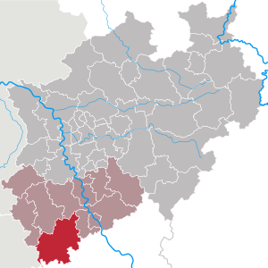
| Location of the Euskirchen district in North Rhine-Westphalia | |
  |
|
The Euskirchen district is a regional authority in the extreme southwest of the state of North Rhine-Westphalia with 193,656 inhabitants (December 31, 2019). The administrative seat is the eponymous district town of Euskirchen .
geography
location
The district is located in the southwest of North Rhine-Westphalia on the border with Rhineland-Palatinate and the Kingdom of Belgium . South of the district of Kehr , which belongs to Hellenthal , on the Losheimer Landgraben (not to be confused with the Losheimergraben ) is the southernmost point of North Rhine-Westphalia.
In the north of the 1,248.86 km² district area on the southern part of the Cologne Bay are the Zülpicher Börde and the foothills of the Ville , which the approximate borderline follows from the northwest to the southeast. In the west, the border runs along the Rureifel up to the Zitterwald and along the Our valley and the Schnee-Eifel . To the south is the Upper Kylltal as well as the beginnings of the Ahr Mountains and most of the Münstereifel Forest .
The northern district in the area of the cities of Euskirchen and Zülpich as well as the municipality of Weilerswist is characterized by large flat land areas that are mainly used for agriculture . The southern part is determined by the elevations of the Eifel with large forest areas that take up a total of 36.1% of the total area.
The Euskirchen district has a maximum extension of 47 km in north-south direction. The northernmost point is located south of Brühl in Forst Ville between the federal motorway 553 and the L 194, the southernmost, which is also the southernmost in the state of North Rhine-Westphalia, is, as mentioned above, on the border with Rhineland-Palatinate in the area of Hellenthal community. In the east-west direction, the district extends over a maximum of 42 km. The westernmost point is near the Oleftalsperre near Hellenthal on the border with Belgium, on Rocherather Strasse, which runs through the area of the Elsenborn military training area on the Belgian side . The easternmost point is in the Münstereifeler Wald, near the Rheinbacher district Todenfeld and the local community Berg in the Verbandsgemeinde Altenahr .
The highest point is at 690 m above sea level. NHN on the White Stone near Udenbreth , the lowest at 108 m above sea level. NHN near Kühlseggen Castle in the community of Weilerswist .
Waters
Almost 14 km² of the district consist of water, which corresponds to about 1.1% of the total area. Most of it is in the Eifel region . While the number of running waters is very high, there are no natural lakes .
Rivers and streams
Numerous headwaters of streams and rivers as well as watersheds can be found mainly in the high elevations of the Eifel . The four most important rivers that flow through the district, Erft , Ahr , Kyll and Urft, arise in the district of Euskirchen . While the Erft and Ahr flow directly into the Rhine , the Kyll first drains into the Moselle and the Urft into the Rur , which flows into the Maas .
Lakes and dams
All significant still waters have been artificially created. The reservoirs were built from the beginning of the 20th century to the 1970s as dams for water extraction and power generation or as flood retention basins . The two lakes in Zülpich date from the 1970s and by the lignite - opencast emerged. Some of the bodies of water are designed as a recreational area for recreational activities such as bathing or water sports lakes.
| Surname | location | Storage space | surface | use |
|---|---|---|---|---|
| Urfttalsperre | Schleiden-Gemünd | 45.51 million m³ | 230 ha | Flood protection, low water increase, energy generation |
| Olef dam | Hellenthal | 19.3 million m³ | 110 ha | Flood protection Low water increase Drinking and service water generation Energy generation |
| Zülpich water sports lake | Zülpich | 85 ha | Water sports and swimming lake | |
| Füssenich nature conservation lake (Neffelsee) | Zülpich-Füssenich / Geich | 70 ha | Conservation lake | |
| Kronenburger See | Dahlem-Kronenburg | 2.7 million m³ | 27 ha | Flood protection water sports and swimming lake |
| Steinbachtalsperre | Euskirchen-Kirchheim | 1.06 million m³ | 14.6 ha | Low water increase in service water production |
| Freilinger See (Weilerbach dam) | Blankenheim-Freilingen | 0.73 million m³ | 9 ha | Water sports and swimming lake |
| Madbachtalsperre | Euskirchen-Kirchheim | 68,500 m³ | Industrial water production |
Circle structure

The district of Euskirchen is made up of five cities and six municipalities . Euskirchen and Mechernich are considered to be middle district towns , as their population numbers are between 25,000 and 60,000. Geographically and topographically, Euskirchen, Zülpich and Weilerswist are assigned to the Cologne Bay, the remaining communities belong to the Eifel.
(In brackets the population figures as of December 31, 2019)
|
Other communities
|
Neighboring areas
The Euskirchen district borders on four districts in North Rhine-Westphalia , three districts in Rhineland-Palatinate and the Kingdom of Belgium. The total length of the district boundary is 290 km.
It borders, starting in the west, on the urban region of Aachen and on the districts of Düren , Rhein-Erft-Kreis and Rhein-Sieg-Kreis (all in North Rhine-Westphalia) as well as the districts of Ahrweiler , Vulkaneifel and Eifelkreis Bitburg-Prüm , to the the common border is only around 1.5 km long (all in Rhineland-Palatinate). In the southwest and west is the Arrondissement Verviers ( Province of Liège ) in Belgium, to which the border runs for 28 km almost entirely along the federal highway 265 .
history

The Euskirchen district from 1816 to 1932
The Euskirchen district in its original form was established on May 1, 1816 as the Lechenich district from the mayor's offices of Enzen , Erp , Euskirchen , Frauenberg , Friesheim , Gymnich , Kommern , Lechenich , Liblar , Lommersum , Nemmenich , Satzvey , Sinzenich , Wachendorf , Weilerswist , Wichterich and Zülpich (today parts of the cities of Erftstadt, Euskirchen, Zülpich and the community of Weilerswist) were incorporated. It belonged to the administrative district of Cöln , with which it was initially assigned to the Prussian province of Jülich-Kleve-Berg and from 1822 to the Rhine province . On February 17, 1827, the name was changed to "District Euskirchen" and the district office was relocated from Lechenich to Euskirchen.
In 1845, the municipal code for the Rhine Province gave all places that had their own households the status of a municipality. Euskirchen and Zülpich were given the Rhenish Town Code in 1856 . At the same time, the community Billig left the mayor of Euskirchen and moved to the mayor of Wachendorf. The community of Bessenich left the mayor's office in Zülpich and moved to the mayor's office in Nemmenich. The district of Euskirchen covered an area of 366 km² and was divided into 17 mayor's offices with a total of 48 communities:
| Mayorry | Parishes (1885) |
|---|---|
| Enzen | Enzen , Linzenich-Lövenich , Schwerfen , Ülpenich |
| Erp | Dorweiler , Erp , Pingsheim |
| Euskirchen | Euskirchen (city) |
| Frauenberg | Dürscheven , Elsig , Euenheim , Frauenberg |
| Friesheim | Borr , Friesheim , Niederberg |
| Gymnich | Dirmerzheim , Gymnich |
| Kommern | Kommern |
| Lechenich | Lechenich |
| Liblar | Bliesheim , Kierdorf , Liblar |
| Lommersum | Lommersum |
| Nemmenich | Bessenich , Nemmenich , Oberelvenich , Rövenich , hamlets on the plain |
| Satzvey | Obergartzem , Satzvey-Firmenich , Wißkirchen |
| Sinzenich | Hoven-Floren , Langendorf , Merzenich , Sinzenich |
| Guard Village | Antweiler , Billig , Eschweiler , Kalkar , Lessenich-Rißdorf , Wachendorf , hamlets on the mountains , Weingarten-Rheder |
| Weilerswist | Großvernich , Metternich , Weilerswist |
| Important | Important |
| Zülpich | Zülpich (city) |
The community of Hoven-Floren was incorporated into the city of Zülpich in 1922. As in the entire Rhine Province, the district mayor's offices were transferred to offices in 1927 .
The Euskirchen district from 1932 to 1971
On October 1, 1932, the Euskirchen district was significantly enlarged for the first time and now covered an area of 586 km². From the dissolved Rheinbach district , the city of Münstereifel , the Kuchenheim department , the Münstereifel-Land department and the communities of Esch , Müggenhausen and Straßfeld were incorporated into the Euskirchen district. On January 1, 1939, the district was renamed "Euskirchen District" and on August 23, 1946 the district became part of the newly founded state of North Rhine-Westphalia . The municipality of Esch was renamed Dom-Esch in 1954 and the city of Münstereifel has been called Bad Münstereifel since 1967 . In 1968 the district had the following administrative structure:
In 1969, the law on the reorganization of the district of Euskirchen resulted in a comprehensive reform of the community, in which all offices of the district were dissolved:
- Zülpich was merged with the municipalities of the offices of Sinzenich and Zülpich-Land as well as Dürscheven, Enzen, Linzenich-Lövenich and Ülpenich to form a new city of Zülpich.
- The municipalities of the offices of Friesheim, Gymnich, Lechenich and Liblar as well as the municipality of Wissersheim from the Düren district were merged to form the new city of Erftstadt .
- A new community of Weilerswist was formed from the municipalities of the Weilerswist-Lommersum office.
- Euskirchen was merged with the municipalities of the offices of Frauenberg (without Dürscheven) and Kuchenheim (without Straßfeld) as well as the municipalities Billig, Kreuzweingarten-Rheder and Wißkirchen to form a new city of Euskirchen.
- Bad Münstereifel, the municipalities of the Münstereifel-Land office, the municipalities of Eschweiler and Kalkar and the municipalities of Hohn and Nöthen from the Schleiden district were merged to form a new town of Bad Münstereifel.
- The municipalities of Antweiler, Kommern, Lessenich-Rißdorf, Obergartzem, Satzvey-Firmenich, Schwerfen, Wachendorf and Weiler am Berge were merged to form the new municipality of Veytal .
- Straßfeld came to the municipality of Swisttal in the Rhein-Sieg district and thus left the Euskirchen district.
The Euskirchen district since 1972
With the Aachen Law of December 14, 1971, the Euskirchen district was again enlarged on January 1, 1972 and now covered an area of 1,383 km². The towns of Schleiden and Mechernich and the communities of Hellenthal , Kall , Nettersheim , Dahlem and Blankenheim were incorporated into the Euskirchen district from the disbanded Schleiden district. At the same time, the municipality of Veytal, with the exception of the district of Schwerfen, which came to the city of Zülpich, was incorporated into the municipality (today the city) of Mechernich. The district left the district of the Cologne Administrative Court and was assigned to the Aachen Administrative Court.
With the Cologne Act of November 5, 1974, the Euskirchen district was given its current shape. On January 1, 1975, the city of Erftstadt was largely reclassified from the Euskirchen district to the newly founded Erftkreis (now the Rhein-Erft district ). The Erftstadt districts of Dorweiler, Pingsheim and Wissersheim came to the municipality of Nörvenich in the Düren district . The area of the district was reduced to 1,249 km².

Population development
|
|
|
politics
District Administrator
The district administrator of the Euskirchen district has been Günter Rosenke ( CDU , non-party since 2009) in his fourth term since 1994 , who has held his office full-time since 1999 and is thus also head of the district administration and the district police authority. In the last district election on September 27, 2015, he was confirmed as an independent candidate with 59.7% of the valid votes in a runoff election.
The first deputy district administrator is Markus Ramers (SPD), the second deputy district administrator is Sabine Dirhold (CDU). Manfred Poth is the general representative.
Former district administrators
- 1827–1830: Friedrich Wilhelm Bilefeldt
- 1830–1832: Hermann Müller (by order)
- 1832: Wilhelm von Ehrenberg (by order)
- 1832–1874: Johann Peter Schroeder
- 1874–1876: Bernhard von der Heydt (provisional)
- 1876–1906: Joseph von Ayx
- 1906–1907: Karl von Hartmann-Krey (provisional)
- 1907–1929: Karl Kaufmann
- 1914–1916: Viktor von Solemacher-Antweiler (substitute)
- 1916–1918: Günther Reitzenstein (substitute)
- 1929–1933: Paul Mertens
- 1933–1939: Helmut Groeger
- 1939–1941: Otto Erich Hansen
- 1941–1945: Ernst August Bardenheuer
- April 7, 1945 - October 29, 1945: Anton Metternich
- October 29, 1945 - October 30, 1946: Friedrich Kreusch
- October 30, 1946 - November 8, 1948: Anton Metternich
- November 8, 1948 - November 15, 1956: Heinrich August Metzler , CDU
- November 15, 1956 - July 1, 1976: Rudi Blass , CDU
- October 27, 1976 - November 2, 1994: Josef Linden , CDU
District council
The district council regularly has 46 members. However, in the local elections on May 25, 2014, it increased to 56 seats due to overhang and compensatory mandates. The turnout was 51.4%.
| Political party | be right | percent | Mandates |
|---|---|---|---|
| CDU | 33,616 | 42.17 | 24 |
| SPD | 20,212 | 25.35 | 14th |
| Green | 7,684 | 9.64 | 5 |
| FDP | 6,575 | 8.25 | 5 |
| UWV | 4,528 | 5.68 | 3 |
| AfD | 4.017 | 5.04 | 3 |
| left | 3,092 | 3.88 | 2 |
As in the previous electoral term, the CDU and SPD have formed a coalition in the district council since 2014.
Coats of arms, official seals and banners
The district president of Cologne approved the following coat of arms for the district of Euskirchen on October 31, 1973:
|
|
Blazon : “Quartered; in field 1 in red three two-to-one golden (yellow) roses; in field 2 in gold (yellow) a red armored and tongued black lion; in field 3 in silver (white) a continuous black bar cross; in field 4 a three-pronged golden (yellow) zigzag bar in red. " |
| Justification of the coat of arms: The coat of arms is a modified form of the coat of arms of the old district of Schleiden . It shows the coat of arms of the Duchy of Arenberg in field 1, the coat of arms of the Duchy of Jülich in field 2, the coat of arms of the Electorate of Cologne in field 3 and the coat of arms of the County of Manderscheid in confused colors. |
The district has official seals that show "Kreis" at the top and "Euskirchen" at the bottom, as well as the district coat of arms in the seal circle.
The circle carries a banner . It is red and gold (yellow) striped lengthways in a ratio of 1: 1, with the coat of arms in the square silver (white) banner head.
In addition, the district of Euskirchen uses the following logo: The word "Kreis" in dark blue letters with a turquoise semicircle above and below that, also in blue, the lettering "Euskirchen" (in capitals ) over a turquoise, stylized plane that merges into mountainous terrain. Underneath is the slogan "Simply feel good!" In blue letters.
Culture and sights
See: List of museums in the Euskirchen district
Jewish cemeteries
27 Jewish cemeteries are documented for the Euskirchen district : in Bad Münstereifel (3), in Euskirchen (10), in Hellenthal (2), in Kall (1), in Mechernich (5), in Schleiden (2), in Weilerswist ( 2) and in Zülpich (2). They are cultural monuments that are worth protecting - stone witnesses to formerly existing Jewish communities and a lively Jewish community life up to the 1930s.
Buildings
In the western part of the district, especially on the border with Belgium, there are significant ruins and preserved structures of the former Siegfried Line .
There are two radio telescopes to be admired in the urban area of Bad Münstereifel. The 25 m astropeiler on the Stockert (mountain) , the first radio telescope in Germany and an industrial monument since 1999. The Effelsberg radio telescope , with a diameter of 100 m, the largest fully articulated radio telescope in Europe and the second largest in the world.
Economy and Infrastructure
In the Future Atlas 2016 , the district of Euskirchen was ranked 274 out of 402 districts, municipal associations and independent cities in Germany and is therefore one of the regions with a “balanced risk-opportunity mix” for the future.
traffic

Rail transport
The development with railway lines began in 1864 when the Rheinische Eisenbahn-Gesellschaft opened a line from Düren to the district town of Euskirchen. From here the route was continued into the Eifel between 1865 and 1870, while the direct connection from Cologne was not completed until 1875.
The Prussian State Railways also built railways to Bonn (1880) and Bad Münstereifel (1890) from the Euskirchen junction. In addition, the following branch lines left the Eifel route :
- 1884: Kall - Hellenthal
- 1912: Jünkerath - Losheim - Weywertz and
- 1912/13: Blankenheim Wald - Ahrdorf - Dümpelfeld with connection Ahrdorf - Lissendorf
The Euskirchener Kreisbahnen opened up some areas off the main lines in 1895 with the narrow-gauge railways Euskirchen - Mülheim-Wichterich - Liblar and Mülheim-Wichterich - Zülpich - Satzvey - Arloff.
In Zülpich Stadt there had been a connection to the Düren - Zülpich - Embken line of the Düren district railway since 1909/11 .
The railways eventually comprised a network of 214 km in length. Of this, only 84 km are left for passenger traffic today, after numerous (secondary) routes were closed.
Today, the city of Euskirchen with its train station is the central rail transport hub in the district. This is where the following routes meet:
- Bördebahn ( Euskirchen - Zülpich - Düren , only freight and seasonal traffic)
- Voreifelbahn (KBS 475, Euskirchen - Meckenheim - Bonn )
- Eifel route (KBS 474, Cologne - Weilerswist - Euskirchen - Mechernich - Kall - Nettersheim - Blankenheim (Wald) - Dahlem - Trier )
- Erft Valley Railway (KBS 475, Euskirchen - Bad Münstereifel )
In addition, there is a museum train service on the Oleftalbahn Kall - Schleiden - Hellenthal on Sundays and public holidays .
Public transport


The district of Euskirchen is a member of the Verkehrsverbund Rhein-Sieg (VRS), the local public transport is carried out by the following transport companies:
- Regionalverkehr Köln GmbH
- Bus traffic Rhineland (BVR)
- Karl Schäfer Omnibusreisen GmbH
- Stadtverkehr Euskirchen GmbH (SVE)
The license holder and the responsible party is
Since January 7, 2002, a large part of the public transport outside of densely populated areas (such as the city of Euskirchen and the Schleidener Tal) has been carried out as a taxi bus . The lines are served by taxis every hour, however, the passenger must register by telephone no later than 30 minutes, in the case of Schäfer Reisen 60 minutes, before the scheduled departure. After only the normal fare (VRS tariff) had to be paid for the TaxiBus at the beginning, a small surcharge has been levied for several years. Since then, the TaxiBus has been marketed under the name TaxiBusPlus in the Euskirchen district . Normal buses continue to be used on high-demand journeys such as during rush hour , and special “ school bus routes” are used for school transport .
Streets
The most important road connection in the Euskirchen district and for a large part of the Eifel is the A1 . The so-called Eifel motorway was built in 1977 with the 16.9 km long section from the Bliesheim motorway junction via the Euskirchen junction (110) to Wißkirchen (111). In 1981 the 8.5 km long section to Bad Münstereifel / Mechernich (112) was completed and in the following year the remaining 13.4 km with a connection at Nettersheim (113) to the current end of the motorway at Blankenheim (114). The missing section up to the southern section of the A1 near Daun is listed as an urgent requirement in the Federal Transport Infrastructure Plan 2003, so that the continuation can be expected. The A 61 has also been running in the north of the district since 1970 with the Weilerswist junction (25).
In the 1970s, two more highways were planned in the district area. The A 545 should lead from Aachen via Schleiden and Kall to the A 1 near Nettersheim. Until the 1990s there were plans for the A 56 from the Dutch border near Heinsberg via Düren, Zülpich, Euskirchen to Bonn . At Euskirchen, extensive preliminary work has already been done, such as B. the motorway junction Euskirchen, which is now part of the double junction of the same name .
Numerous federal highways also run through the district . The most important is the B 51 , which is heavily used in Euskirchen as well as in the southern area from Blankenheim, since it has to take up the traffic of the unfinished A1 there. The B 56 between Zülpich and Euskirchen on the route of the planned A 56 has been expanded as a motor vehicle and is to be extended as a northern bypass from Euskirchen. The B 258 runs from Mayen via Blankenheim and Schleiden through the Eifel National Park to Aachen. The B 265 also runs through the national park from Cologne via Zülpich, Schleiden and Hellenthal to Prüm, which runs around 28 km along the border with Belgium, and the B 266 from Simmerath via Schleiden, Mechernich and Euskirchen to Linz am Rhein . The B 421 begins at the Losheim district of Hellenthal and initially crosses the border between North Rhine-Westphalia and Rhineland-Palatinate several times and leads to Kirn in the Bad Kreuznach district in Rhineland-Palatinate. The B 477 , which begins in Neuss , leads in the district via Zülpich and Mechernich to Nettersheim- Tondorf , where it ends.
Companies
The corporate structure is characterized by medium-sized companies. The largest companies based in the district are the Peter Greven Group in Iversheim and Papstar in Kall. Larger companies with locations in the Euskirchen district include Miele , Pfeifer & Langen and Procter & Gamble in Euskirchen, Albis Plastic in Zülpich and Eaton Industries in Zingsheim .
The north-east of the district with its convenient location on the motorways 1 and 61 is an important logistics location with logistics centers from dm , DSV and Galeria Kaufhof in Weilerswist and from DHL and Schenker in Euskirchen.
License Plate
On July 1, 1956, the Euskirchen district was assigned the distinctive EU mark when the license plates that are still valid today were introduced .
Until the 1990s, vehicles from the old district of Schleiden received license plates with the letter pairs DA to EZ and the numbers from 100 to 999.
It is still issued today. Since February 20, 2013, in connection with the license plate liberalization , the distinguishing sign SLE (Schleiden) has also been available.
Others
- The legendary world of the Euskirchen district is populated by numerous werewolves and women. a. a reminder of the numerous wolf packs that haunted the area between the Eifel and Erft until the beginning of the 19th century.
- Sparkasse see Kreissparkasse Euskirchen
literature
- Hans-Dieter Arntz : End of the war - through the Voreifel to the Rhine . Helios-Verlag, Aachen 2007, ISBN 978-3-938208-61-8 .
- Hans-Dieter Arntz: persecution of Jews and help to escape in the German-Belgian border area . Kümpel-Verlag, Euskirchen 1990, ISBN 3-9800787-6-0 .
- Hans-Dieter Arntz: Judaica - Jews in the Voreifel . Kümpel-Verlag, Euskirchen 1983, ISBN 3-9800787-0-1 (3rd edition 1986).
Web links
- Website of the Euskirchen district
- Literature from and about the Euskirchen district in the catalog of the German National Library
Individual evidence
- ↑ Population of the municipalities of North Rhine-Westphalia on December 31, 2019 - update of the population based on the census of May 9, 2011. State Office for Information and Technology North Rhine-Westphalia (IT.NRW), accessed on June 17, 2020 . ( Help on this )
- ↑ Population of the municipalities of North Rhine-Westphalia on December 31, 2019 - update of the population based on the census of May 9, 2011. State Office for Information and Technology North Rhine-Westphalia (IT.NRW), accessed on June 17, 2020 . ( Help on this )
- ↑ Municipal Code for the Rhine Province 1845, §1
- ↑ Official Gazette for the Cologne District 1856, p. 353.
- ^ Community encyclopedia for the Kingdom of Prussia 1885, p. 128.
- ↑ Statistical Yearbook for the Federal Republic of Germany 1975
- ↑ a b Federal Statistical Office (ed.): Historical municipality register for the Federal Republic of Germany. Name, border and key number changes in municipalities, counties and administrative districts from May 27, 1970 to December 31, 1982 . W. Kohlhammer, Stuttgart / Mainz 1983, ISBN 3-17-003263-1 , p. 300 f .
- ^ Federal Statistical Office (ed.): Historical municipality directory for the Federal Republic of Germany. Name, border and key number changes in municipalities, counties and administrative districts from May 27, 1970 to December 31, 1982 . W. Kohlhammer, Stuttgart / Mainz 1983, ISBN 3-17-003263-1 , p. 309 .
- ↑ a b Contributions to the statistics of the Königl. Prussian Rhineland. 1829, p. 22 , accessed November 11, 2014 .
- ↑ a b Community encyclopedia for the Kingdom of Prussia 1885, p. 244.
- ↑ a b c d e f g Michael Rademacher: German administrative history from the unification of the empire in 1871 to the reunification in 1990. euskirchen.html. (Online material for the dissertation, Osnabrück 2006).
- ↑ Statistical Yearbook for the Federal Republic of Germany 1972
- ↑ Statistical Yearbook for the Federal Republic of Germany 1981
- ↑ a b c d e State database NRW
- ↑ Municipal elections 2014. Municipal data center Niederrhein, accessed on September 29, 2014 .
- ↑ rundschau-online.de
- ↑ Coat of arms of the district and the municipalities in the Euskirchen district . District of Euskirchen / District Archives. March 2005. Retrieved March 25, 2019.
- ^ Claudia Pohl: North Rhine - List according to today's administrative structure - Cologne district. District of Euskirchen. In: Overview of all projects for the documentation of Jewish grave inscriptions in the area of the Federal Republic of Germany. North Rhine-Westphalia. December 2002, accessed November 25, 2013 .
- ↑ Future Atlas 2016. (No longer available online.) Archived from the original on October 2, 2017 ; accessed on March 23, 2018 . Info: The archive link was inserted automatically and has not yet been checked. Please check the original and archive link according to the instructions and then remove this notice.

Independent cities: Aachen | Bielefeld | Bochum | Bonn | Bottrop | Dortmund | Duisburg | Düsseldorf | Food | Gelsenkirchen | Hagen | Hamm | Herne | Cologne | Krefeld | Leverkusen | Mönchengladbach | Mülheim an der Ruhr | Munster | Oberhausen | Remscheid | Solingen | Wuppertal
Districts and city regions: City region Aachen | Borken district | Coesfeld district | District of Düren | Ennepe-Ruhr district | District of Euskirchen | District of Gütersloh | District of Heinsberg | Herford district | Hochsauerlandkreis | District of Höxter | District of Kleve | Circle lip | Märkischer Kreis | District of Mettmann | District of Minden-Lübbecke | Oberbergischer Kreis | District of Olpe | Paderborn district | Recklinghausen district | Rhein-Erft district | Rheinisch-Bergischer Kreis | Rhein-Kreis Neuss | Rhein-Sieg-Kreis | District of Siegen-Wittgenstein | District of Soest | District of Steinfurt | District of Unna | District of Viersen | District of Warendorf | Wesel district