Havel
The Havel [ ˈhaːfl̩ ] is a flowing body of water in northeast Germany and, with a length of 334 kilometers, it is the longest right-hand tributary of the Elbe . The direct distance between the source and the mouth is only 94 kilometers. The Havel rises in Mecklenburg-Western Pomerania , flows through Brandenburg , Berlin and Saxony-Anhalt and flows into the Elbe on the border between Brandenburg and Saxony-Anhalt. 285 river kilometers run in Brandenburg. It flows first through numerous small lakes in a south-easterly, then in a south, west and finally in a north-west direction. The difference in height is only 40.6 meters. With an average of 103 cubic meters per second, the Havel has the third largest volume of water among the tributaries of the Elbe, after Moldau (150 m³ / s) and Saale (117 m³ / s). Most of the river is navigable. Weirs and locks regulate the depth and flow of the water almost throughout the entire course . Despite the expansion into a waterway, the Havel has a considerable storage capacity thanks to the numerous natural lakes through which it flows and maintains the water level even during longer dry periods. Dangerously high water levels are rare and are mostly triggered by the Elbe floods in the lower reaches of the Havel. Several side canals shorten the waterway for inland shipping .
The Havel has several inland delta in its course . By branching into several branches and tributaries, it forms an inland delta in the urban area of Brandenburg an der Havel , Rathenow and between Havel and Gülper Havel .
The largest tributary of the Havel is the Spree , which carries more than twice as much water at its mouth as the Havel (38 m³ / s compared to 15 m³ / s) and also exceeds it in length at 380 km (Havellength at the Spree mouth approx . 180 km).
2004, Havel was the natural friends of Germany and the German Angling Association for River Landscape of the Year chosen. The river has been accompanied by the Havel cycle path since 2009 .
Surname
The name of the Havel ( Sorbian Habola ) is said to come from the pre-Slavic , Germanic settlement phase and thus belong to the oldest layer of territorial designations in the area of the state of Brandenburg and the city of Berlin , derived from the Germanic Habula . It is etymologically related to Hafen and Haff . The root word Haf denotes a bay or bulge. According to this interpretation, the naming coincides with the shape of the Havel as a river with many bays. Earthen, bulbous ceramics are still referred to today as the “harbor”, mainly in southern German, Swiss and Austrian-speaking areas.
River course
Upper Havel


The Havel rises in the Mecklenburg Lake District . The Diekenbruch near Ankershagen in the north-east of the Müritz National Park is now considered the source area . The historic source lake of the Havel, however, is the Bornsee , which drains into the Trinnensee and further into the Mühlensee . From the Mühlensee the historical course of the Havel is south through the Diekenbruch. In the 14th or 15th century, monks probably built a dam between Mühlensee and Diekenbruch and channeled the Havel water through an artificial puncture into the Mühlenbach in order to be able to supply a mill with more reliable water. As a result, the watershed between the North Sea and the Baltic Sea was artificially shifted slightly to the south and is no longer defined by the Pomeranian main terminal moraine in the area of the Havel spring, but officially by the dam at Diekenbruch. However, the dam, which is piled up on the boggy subsoil, does not completely seal the Mühlensee against the Diekenbruch, so that the historical source of the Havel continues to drain slightly into the river system of the Elbe. Since 2007, part of the seepage water has been brought to the surface in a small, artificially contained spring pot and defined as the Havel spring.
The first lakes through which the Havel flows are the Dambecker and Röth lakes. Here the Havel is still a ditch-like river. From the Käbelicksee near Kratzeburg it is already three to four meters wide and is a popular paddling water . Between the following Granziner and Pagelsee lakes , the Havel is a wild water stream forced into a narrow channel. Driving on the stream is not permitted in this section. A lorry connection is available for the land transport of the boats . The Pagelsee is followed by the Zotzensee , Jäthensee and Useriner See . The course of the Havel river between these lakes is already partially canal-like. From the Useriner See, 12 km from its source, the Havel is a navigable river up to 10 m wide. The first lock on the Havel, the Zwenzow lock, is located at Großer Labussee . From here on, motorized boats can be used on the Havel. It follows the Quassower Havel and the Woblitzsee near Wesenberg . About the opening into the Woblitzsee from north -chamber duct and Zierker lake is the Havel Neustrelitz , the former state capital of Mecklenburg-Strelitz , connected. From the Woblitzsee on, the Havel, including the Kammer Canal, is developed as an Upper Havel waterway with several barrages . In Mecklenburg it still touches the Drewensee and the Wangnitzsee and flows through the Small and Large Priepertsee as well as the Ellbogensee and the Ziernsee . Already in the state of Brandenburg it touches the Menowsee and flows through the Röblinsee and Baalensee.
On the eastern edge of the town of Fürstenberg, the Havel brushes against the Schwedtsee and, behind Fürstenberg, reaches the Stolpsee near the Himmelpfort monastery ruins . 15 km south of it, north of Zehdenick , a lot of clay used to be mined in its lowland (now a tourist brickworks park ). From there to Berlin-Spandau, the Havel flows through the natural area of the Zehdenick-Spandau Havel lowlands . To transport fuel and bricks, the Voss Canal was built from Zehdenick south to Liebenwalde in 1880–1882 , next to which the old Havel under the name of Schnelle Havel has been preserved as a strongly meandering and non-navigable river. The main part of the Havel water from Zehdenick flows through the Voss Canal and Malzer Canal and has fed the crest of the Oder-Havel Canal since 1914 ; The Havel water flows south of Oranienburg back to the Havel bed via the Lehnitz canal. Immediately south of Liebenwalde, the “ Langer Trödel ” canal , a section of the Finow Canal , a predecessor of the Oder-Havel Canal, branches off from the Voss Canal to the east in the direction of the Oder . The Malzer Canal, the extension of the Voss Canal to the south, meets the Oder-Havel Canal south of Liebenwalde. The Malzer Canal is the northern remnant of a canal from Malz, back then as a connection to the “Lange Trödel”; the majority of the Malzer Canal merged into the Oder-Havel Canal in 1914.
After leaving the Eberswalder Glacial Valley, the Schnelle Havel flows parallel to the Oder-Havel Canal to the confluence of the remaining southern section of the Malzer Canal on the northern edge of Friedrichsthal. From here to the former Sachsenhausen lock it is known as the Friedrichsthaler Havel, then as the Oranienburger Havel to Hohen Neuendorf , then as the Spandauer Havel to the mouth of the Spree. Behind Hennigsdorf , on Nieder Neuendorfer See , the Havel Canal branches off to the west from the Havel , laid out in 1951/52 by the GDR to circumnavigate West Berlin ; it flows back into the Havel at Paretz together with the Sacrow-Paretz Canal .

Middle Havel

From the northwest corner of Berlin through Potsdam and below the city of Brandenburg , the Havel flows through a long chain of lakes, some of which are quite large. Other lakes have a connection to the river through smaller or artificial bodies of water. In many places near Potsdam the lakes are surrounded by wooded moraine hills. Near Brandenburg, they are mainly in a flat valley in which there are only island-like moraine hills. Between Hennigsdorf and Spandau these are the Niederneuendorfer, Tegel and Spandau lakes. Across from the Großer Wall island , the Berlin-Spandau shipping canal branches off in a south-easterly direction. Below the Spandau lock opposite the old town of Spandau, the Spree flows into the Havel. From here on, the Havel, together with some canals, forms the Lower Havel waterway until it flows into the Elbe . Shortly after the mouth of the Spree, the Havel passes the Tiefwerder Wiesen , Berlin's last natural floodplain and pike spawning area. Then come the Große Wannsee , the Pfaueninsel and the Jungfernsee , from which the Sacrow-Paretz Canal branches off to the west . Between Wannsee and Tiefem See there is a small chain of lakes east of the Glienicker Forest. The lakes between Tiefwerder and Glienicke (Kleinen Wannsee, Pohlesee and Stölpchensee) are called the Havel chain of lakes. The Teltow Canal , which has a connection to the Dahme in southeast Berlin and via the Britzer connection canal to the Spree , goes through its best-known link, the Griebnitzsee .
From the Jungfernsee to the Göttinsee, an approximately 29-kilometer-long section of the Potsdamer Havel is called. It is short-circuited by the Sacrow-Paretz Canal and therefore only a third to half of the Havel water flows through it.
At the Göttinsee flow into the Havel: the Havel Canal and the Sacrow-Paretz Canal , through which most of the cargo shipping shortens the great Potsdam Havel curve , the Potsdam Havel . Then the Havel flows westward in meanders . It branches out between Ketzin / Havel and the Trebelsee as well as in Brandenburg , whose cathedral is on an island. A good kilometer before the Brandenburg suburban lock, the Havel forms an inland delta in which the Brandenburg City Canal branches off in a south-westerly direction as a natural course of the river and access to the city lock. In the wider urban area of Brandenburg the river branches further. After 4.1 kilometers, the city canal flows back into the Brandenburg Niederhavel . The Brandenburg City Canal is also the inlet to the inner-city regulatory structures of the Brandenburg barrage. To the right branch off from it: the Stimmingsarche with weir to the Kleiner Beetzsee and with the tributary Krakauer Havel, followed by the three former mill arms Altstädtischer Streng , Domstreng and Neustadtischer Streng (also Näthewinde) with passages to the Brandenburg Niederhavel. The Beetzsee flows in from the north just below the Vorstadtschleuse ; At the same point, the Silokanal branches off to the west and the Havel, known here as the Brandenburger Niederhavel, continues to flow to the southwest and flows into the Breitlingsee after about seven kilometers . Between Brandenburg and its district of Plaue, the Havel flows through the Plauer See , which, together with the Quenz , Breitling and Möser lakes , forms a single large lake with many bays and islands. The Elbe-Havel Canal branches off from the Plauer See and runs through the Großer Wendsee towards Magdeburg .
Lower Havel

From the Plauer See the Havel flows sometimes more northerly, sometimes more westwards along the Pritzerber See and the towns of Premnitz and Rathenow in the direction of the Havelberg . As far as the border with Saxony-Anhalt , the course of the river belongs to the Westhavelland nature park , the largest nature park in the state of Brandenburg, which stretches from the Beetzsee over the Rhin and to the nature reserve Untere Havel Süd , in the south more sandy hills ("Ländchen") in the north more characterized by damp lowlands ( "Luchen" ).
In the urban area of Rathenow, the Havel forms another inland delta through ramifications. North of Rathenow are just east of the river Hohennauener See with a connection to the Havel. After a further branching after the Gülper Havel branch , the river again forms an inland delta, in the area of which the Rhin joins the Havel from the right, shortly after it has taken up the Gülper Havel below the Gülper See . The course of the national border indicates how winding the river once was. After the confluence of the Dosse , the Havel in Saxony-Anhalt reaches the town of Havelberg, which lies on the edge of the Elbe.
Since the Lower Havel has a lower gradient than the Elbe , the Gnevsdorf receiving water was created at the beginning of the 20th century . This canal makes it possible to channel the water of the Havel only ten kilometers downstream from the natural confluence with the Elbe. As a result, the mean water level of the Havel at Havelberg is now below that of the Elbe. A lock channel enables shipping to overcome this difference in height. In the event of threatening Elbe floods, the Havelniederung can be flooded as a polder for flood protection for the Elbe.
Havelpolder
The Havel polders are six spatially separated floodplains in front of the mouth of the Havel into the Elbe. In the event of a flood in the Havel, these can be flooded in order to protect localities on the not diked lower reaches of the Havel, especially when the weirs to the Elbe are closed.
On Sunday, June 9, 2013 from 1 p.m., the weir to the Elbe, which had already been flooded, was opened piece by piece at Neuwerben , so that, as in 2002, Elbe water flooded up the Havel into the Havel polder. This should reduce the Elbe level downstream by 30 cm, which the level in Wittenberge also shows. The polders are subject to the Stendal / Saxony-Anhalt water authority.
Inland wetland
The protected Lower Havel Lowlands, together with the neighboring Luch landscapes Rhinluch , Havelländisches Luch , Dossebruch and Jäglitz Lowlands, form the largest contiguous inland wetland in western Central Europe .
Based on this closeness to nature, the restoration of the Havel began in 2005 . The actors are the Federal Agency for Nature Conservation (BfN), the states of Brandenburg and Saxony-Anhalt and the Nature Conservation Union (NABU). Over the next few decades, the body of water should regain its original shape (extensive floodplains, curvier river course, extensive waiver of bank reinforcements). Rare bird species will benefit, but also otters, beavers and river lampreys.
history

The history and economic development of Brandenburg are closely linked to the Havel. At the time of the Slavic settlement, the Havel and Nuthe formed the border between the Hevellern , who settled in the Zauche and Havelland , and the Sprewanen on the eastern side. Where long-distance trade routes crossed the Havel, the Slavs had castles and solid wooden bridges in Plaue (now part of Brandenburg), Brandenburg (Cathedral Island), Potsdam (the Long Bridge) and Spandau (finds on the castle wall).
The German settlement of the Havelland was preceded by more than two centuries of armed conflicts: 928/929 the German King Heinrich I conquered Brennabor and defeated the Hevellers. His son Otto I the Great (Roman Emperor from 962) founded the Nordmark in 937 . With the Great Slav uprising of 983, the country east of the Elbe first became independent again. The Ascanian Albrecht the Bear began the new conquest in 1134, from 1157 as margrave . After his victory over the Heveller in Spandau in 1157, the immigration of Germans into the Mark Brandenburg began . At the Jürgenlanke Havel Bay , the Schildhorn memorial commemorates the Schildhorn legend and the victory of Albrecht.
With the medieval colonization, the importance of the Havel as a transport route increased, as the region increasingly exported bulk goods such as grain and wood. In this heyday of trade and commerce, however, a conflict of use arose between transport and energy generation. To operate mills, dams were built in Spandau, Brandenburg and Rathenow, which shipping had to pass by means of flood channels and simple locks. The mill jam in Brandenburg raised the water level upstream to Spandau. It is possible that these mill jams transformed older, Slavic cultivated land into wetlands again . For a long time, fishing was an important economic factor in the region .
The Thirty Years War reduced the population of cities like Potsdam and Rathenow to a fraction of their original population.
From the 18th century until the GDR era, wetlands were systematically drained . With the rise of Brandenburg-Prussia to the leading power in Germany and the Prussian kings to German emperors, the Havelland became the capital region. The summer residence Potsdam became the “Prussian Versailles ”, surrounded by palace parks, model estates and stately hunts. Even in small villages there were stucco-decorated houses and one or the other “Byzantine” village church (for example the Heilandskirche at the Port of Sacrow ) next to the simple peasant cottages . The needs of the capital turned the area around Werder and Ketzin / Havel into a fruit-growing area. And north of Zehdenick on the upper Havel and near Deetz , Ketzin and Glindow on the middle Havel, large clay pits and brickworks were built.
shipping
As a federal waterway , the Havel is included in the Obere Havel waterway from the Useriner See (Zwenzow lock) to Zehdenick. From Zehdenick to Oranienburg, the Havel water flows through the artificial river beds of the Upper Havel waterway, Voss Canal and Malzer Canal, and on through the Oder-Havel Canal to the natural river bed of the Havel south of Oranienburg. From there to the mouth of the Spree, the lower part of the developed Oranienburger Havel and from Hohen Neuendorf the Spandauer Havel to the mouth of the Spree form sections of the Havel-Oder waterway . The Friedrichsthaler Havel and the upper part of the Oranienburger Havel belong to the old Havel-Oder waterway, which is no longer passable. From the mouth of the Spree to the mouth of the Havel in the Elbe, the Havel forms the Lower Havel waterway , including the Sacrow-Paretz Canal and the Silokanal.
Planned expansion of the Lower Havel waterway
The " German Unity Transport Project No. 17 " envisaged the expansion of 280 km of waterways on the Wolfsburg-Magdeburg-Berlin route. The entire affected section should be dredged to a depth of 4 m and, depending on the bank profile, to 42–55 m (in curves up to 72 m) water level width. This should enable push convoys 180 m long, 11.40 m wide and 2.80 m unloading depth, according to inland waterway classification Vb, to sail. The Havel would be affected by these expansion measures in its central area from the confluence of the Havel Canal and the Sacrow-Paretz Canal near Paretz to the Silo Canal in Brandenburg an der Havel . Currently, in accordance with the Inland Waterways Ordinance , Chapter 22 Lower Havel Waterway and Havel Canal , for the area from km 20.00 to km 66.70 (from the mouth of the Spree), vehicles and units (push convoys and coupled vehicles) are 125 m long and 9 m wide or 156 m long and 8.25 m wide.
The Havel was chosen as the third river to Germany's river landscape of the year for 2004/05 . The award ceremony should also be understood as a protest against the planned expansion of the Havel, which would seriously damage the river landscape. Since 1992, an alliance against the expansion of the Havel from over 30 organizations has been campaigning for the preservation of the natural diversity and beauty of the river.
Tributaries and sewer connections


From the source downstream:
- Chamber canal
- Raft ditch
- Wesenberger Schleusenkanal (parallel shipping route)
- Schwaanhavel
- Müritz-Havel waterway
- Godendorfer Mühlenbach-Hegensteinfließ
- Lychener waters , in the lower Woblitz
- Kramsbeek
- Templiner waters , in the lower reaches Templiner water
- Tornowfliess
- Wentow Canal (Wentow Waters)
- Welsengraben (near Mildenberg)
- Voss Canal , today the main river of the Havel
- Schnell Havel , old run from Zehdenick to Oranienburg
- Hundebuschgraben (via Voss Canal near Zehdenick)
- Outlet duct (from Voss Canal)
- Döllnfließ (via Voss Canal near Bischofswerder)
- Long junk (via Malzer Canal)
- Flow ditch (near Oranienburg-Friedrichsthal)
- Malzer Canal (at Malz)
- Oranienburger Kanal , from the Schnellen Havel near Sachsenhausen to the main stream near Pinnow (Hohen Neuendorf)
- Ruppiner Canal (via Oranienburger Canal and Canal Cross Oranienburg )
- Oder-Havel Canal (south of Oranienburg)
- Briese (over the Alte Oranienburger Havel near Hohen Neuendorf)
- Velten branch canal
- Havel Canal (direction of flow from Nieder Neuendorfer See (Havel) to Sacrow-Paretz Canal near Paretz in the Havel)
- Tegeler Fließ (from Tegeler See )
- Teufelsseekanal
- Aalemann Canal
- Berlin-Spandauer Schifffahrtskanal (parallel to the Spree, up to the Plötzensee lock also known as the Hohenzollern Canal )
- Spandau north harbor
- Spree
- Griebnitz Canal (GDR until 1951, FRG until 1992: Prinz-Friedrich-Leopold-Kanal )
- Großer Graben (via Krampnitzsee and Lehnitzsee)
- Sacrow-Paretz Canal (main hydrological stream of the Havel), abbreviation of the Potsdam Havel arch from Jungfernsee to (self-dammed) Göttinsee
- Teltow Canal (via Griebnitzsee and Glienicker Lake ), including residual feeds from the Bäke
- Old and New Ride, the two arms of the Havel that border the Friendship Island in Potsdam .
- Nuthe
- City Canal (confluence with the Neustädter Havel Bay in Potsdam)
- Schafgraben in Potsdam
- Wentorfgraben between Petziensee and Schwielowsee
- Fercher Mühlenfließ (confluence with the Schwielowsee)
- Strenggraben (from Glindowsee , see also Strengbrücke )
- Joke
- Emster (via Krumme Havel)
- Brandenburg city canal
- Silokanal (parallel canal in the city of Brandenburg to Quenzsee )
- Plane with its tributary Temnitz (via Breitlingsee )
- Buckau with its tributaries Riembach , Strepenbach and Verlorenwasser (via Breitlingsee)
- Elbe-Havel Canal (via Großer Wendsee)
- Woltersdorfer Altkanal (formerly Plauer Canal, over Großer Wendsee)
- Stremme (at Milow)
- Rathenower Stremme (near Rathenow)
- Rhin (western mouth of the Rhin across the Hohennauener See and Hohennauener Canal)
- Rhin (Alter Rhin across the Gülper See )
- Old cans
- New cans
- New Jäglitz
- Havelberger Schleusenkanal (to the Elbe)
- Gnevsdorfer receiving water
places
From the source downstream:
|
|
|
The locks of the Havel
Over the centuries, various barrages were installed along the Havel and its tributaries . In the Middle Ages this was mostly done in cities and with the intention of harnessing water power to power mills . Examples of this are the barrages in Oranienburg, Brandenburg and Rathenow. These barrages led to conflicts with shipping, whose routes were relocated. At that time, however, shipping was the only way to transport large quantities of bulk goods over long distances. The Havel was already an important waterway. The conflict of interest was resolved by building the first locks in the course of the Havel.
Later on, more barrages were built. Unlike the medieval Mühlenstaue, weirs were supposed to make individual sections of the Havel navigable by damming them up. This particularly affected the area of the Upper Havel, which naturally had a too narrow and flat bed there. The majority of the Havel weirs below the city of Brandenburg were built as part of measures to improve flood protection.
The built barrages were and are overcome with different lock structures. In some cases, large structures with tow locks over a hundred meters long and not far from these a few meters long and manually operated barge locks were built. In recent years there has been a move towards operating individual locks from a distance using radio signals.
Havel ferries
Ferry connections across the Havel have been known since the Middle Ages. The majority was later replaced by bridge structures. Due to the lake-like width of the Havel in many places, the swampy bank areas, for economic considerations, for nature conservation or tourism reasons, some ferry connections have remained up to the present day. In the area of the Lower Havel within Berlin, the connections F 10 via the Großer Wannsee and a ferry to the Pfaueninsel still exist today .
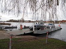
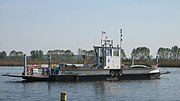
The former is operated by the Berliner Verkehrsbetriebe and is used by the passenger ship-like Wannsee . The connection to the Pfaueninsel is operated by a car ferry that can transport several cars and 150 people. The carriage ferry to the Pfaueninsel is a free-moving ferry. In addition, a car ferry crosses the Havel between Spandau-Hakenfelde and the Reinickendorfer district of Tegelort. In the state of Brandenburg there are other ferry connections such as in Potsdam between the Ufer auf dem Kiewitt and Hermannswerder as a pure passenger ferry with bicycles. This is operated by the Potsdam transport company. Car ferries still operate in Caputh (Tussy II), in Ketzin (Charlotte), in the city of Brandenburg ( Neuendorf ferry ) and in Havelsee ( Pritzerbe ferry ).
Havel fishing
The fishery has a millennia-long tradition on the Havel. For example, Upper Paleolithic to Mesolithic bony fishhooks have been found near Pritzerbe . Even in the 21st century, the Havel is fished intensively over long distances commercially. For example, there are still several professional fishermen in Brandenburg an der Havel, Plaue, Briest and Pritzerbe . The Havel fish caught, such as pikeperch and European eel , are prepared or unprepared freely sold and are part of traditional Brandenburg cuisine . In order to preserve the eel population, glass eels caught in the sea are released .
Trivia
In January 2012, a previously unnamed valley on Mars was given the name "Havel Vallis". On the occasion of the Federal Garden Show 2015 , Marian Lux composed a symphony for the Havel. It was premiered on June 13, 2015 at the Borsig estate in Groß Behnitz as part of the Havelländische Musikfestspiele.
photos
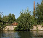
Former brickworks IV in Zehdenick
Congestion-regulated Havel between Oranienburg and Hennigsdorf
Babelsberg Castle in the park of the same name
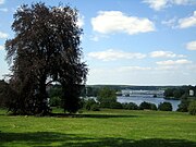
View from the Babelsberg Park to the Glienicke Bridge over the Havel
The "New Ride" in Potsdam on the Friendship Island
Caputh ferry on the Potsdam Havel
Ketzin cable ferry on the Havel
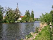
View of Havelberg
See also
literature
- Manfred Reschke: The Havel. Nature and culture between Müritz and Havelberg . Trescher Verlag, Berlin 2012. ISBN 978-3-89794-206-6 .
- Hans-Joachim Uhlemann: Berlin and the Märkische waterways . DSV-Verlag, Hamburg 1994. ISBN 3-88412-204-5 .
- Beloved home Havelland . In: Spandauer Zeitung , 1936.
- The Havel, our home river . In: Spandauer Zeitung , 1936.
cards
- Folke Stender (editor): Sportschifffahrtskarten inland 1 . Nautical publication publishing company. ISBN 3-926376-10-4 .
- Author collective W. Ciesla, H. Czesienski, W. Schlomm, K. Senzel, D. Weidner: Shipping maps of the inland waterways of the German Democratic Republic 1: 10,000, Volume 3 . Publisher: Waterway Authority of the GDR, Berlin 1988.
- Cycle touring and hiking map with zigzag folding Havel cycle path with leaflet. Publishing house Dr. Andreas Barthel, ISBN 978-3-89591-172-9 .
Web links
- Blue ribbon - The Lower Havel
- BfN renaturation of the Lower Havel
- Nabu Renaturation of the Lower Havel
- Wildlife of the Lower Havel
- Havel lock side
- The historical source of the Havel
Individual evidence
- ↑ According to the DTK10 , the sources of the Havel are above the Middelsee (63.6 m above sea level ). The beginning of the middle spring water, in the DTK25 still marked as (the) Havel spring, is very close above the 65 m line
- ↑ Elbe water profile , Plan flood prevention Dresden , 2010, p. 3. dresden.de (PDF; 7.5 MB)
- ↑ a b Michael Bergemann: Complete list of flowing waters in the Elbe catchment area . Authority for the Environment and Energy, Hamburg July 1, 2015 ( fgg-elbe.de [PDF; 802 kB ; accessed on November 29, 2015]). ; In this source, the contradicting value of the Havelberg-Stadt water level near the mouth of the river, which is 24,297 km², is also noted with a question mark . This also results in the deviating values of the area runoff (Mq).
- ^ German Hydrological Yearbook Elbe Region, Part II 1999 Brandenburg State Environment Agency, p. 99, accessed on November 3, 2018, at: lugv.brandenburg.de (PDF, German, location in the yearbook not indicated with "above the mouth", but with "below the mouth of the Spree, left", hence the position of the level (2, 7 km odM) from the total length of the Lower Havel waterway (148 km) minus the location of the water level (145.3 km below the Spree estuary, left).
- ↑ Norbert Stein: Gülper Havel should flow again. In: maz-online.de . November 28, 2016, accessed August 26, 2020 .
- ↑ The source of the Havel. Private website
- ↑ Norbert Stein: Gülper Havel should flow again. In: maz-online.de . November 28, 2016, accessed August 26, 2020 .
- ↑ Jörg Kluge u. a .: Land unter - The chronicle of the floods on the Elbe and Havel in pictures .
- ↑ Flood protection: Havel polder create space for the Elbe flood . lugv.brandenburg.de; accessed March 13, 2014
- ↑ Winfried Schich: The Havel as a waterway in the Middle Ages (PDF; 299 kB)
- ↑ a b c Federal Waterways and Shipping Administration (PDF)
- ^ Reichsverkehrsblatt A 1936 p. 31
- ↑ Sebastian children and Haik Thomas Porada (ed.): Brandenburg an der Havel and surroundings. 2006, p. 90.
- ↑ Over two million glass eels released in Berlin waters. In: berlin.de . March 7, 2019, accessed March 17, 2019 .
- ↑ International Astronomical Union (WGPSN)

