
Victory (river)

The Sieg is a 155.2 km long right tributary of the Rhine in North Rhine-Westphalia (NW) and Rhineland-Palatinate (RP). It rises in the Rothaargebirge and flows into the Rhine between Bonn and Niederkassel .
It is a silicate low mountain range river . The mean gradient of the river , measured between Eitorf (NW) and Betzdorf (RP), is 0.15%. The catchment area of the Sieg (see below) covers 2,856.9 km², and the mean discharge is around 53 m³ / s at the mouth.
Surname
The river name Sieg has no relation to Sieg als Triumph, but is derived from the Celtic word “Sikkere”, which means “fast river” (related to the Celtic name of the Seine ). It is not entirely clear whether the name of the Sugambrer tribe is related (however, Sugambrer and Ubier probably lived in the vicinity of Siegerland in prehistoric times).
geography
course
Source of victory

The victory rises in Westphalia in the (historical) Siegerland in the southern part of the Rothaargebirge . The Siegquelle , which was renatured in 2013, is located on the Ederkopf-Lahnkopf ridge around 3.5 km northeast of Walpersdorf , a district of Netphen , and around 575 m (as the crow flies ) west of Großenbach , one of Bad Laasphe ; about 350 m east of the at about 603 m above sea level. NHN lying source runs the border of both cities. Towards the southeast, the wooded landscape rises to the approx. 400 m distant summit of a 650.7 m high elevation in the Jägerhain parcel .
The Eisenstraße ( Landesstraße 722 ; Lützel - Lahnhof ) runs a few meters west of the Siegquelle and crosses the L 719 (Großenbach-Walpersdorf) 170 meters further northwest at an altitude of 596.2 m . There is a parking lot less than 100 m east of the intersection and about 1 km (as the crow flies) to the northwest rises the Aukopf ( 644.9 m ), at the southwestern foot of which the Ahornbach not only has one of the uppermost tributaries of the Sieg , but also the watershed of Sieg, Lahn and Eder meet. The Rothaarsteig leads directly past the Siegquelle .
Neighboring sources
The Lahn rises about 2.5 km south of the Siegquelle and the Eder 3 km north-west .
Upper course
.JPG)

The catchment area of the upper reaches of the Sieg is almost identical to the natural Siegerland , but contains in particular the peripheral areas of the Rothaargebirge in the north and east.
The upper course of the Sieg near the source and its first major tributaries run in a fan shape through the Siegerland red-haired foothills and are absorbed by the upper Sieg , which arches the ridges flanking the ridge. Some sources of the uppermost tributaries of the Sieg are also located in the north-east adjoining Ederkopf-Lahnkopf-Ridge (Rothaargebirge) in the immediate vicinity of the watersheds of the Eder and Lahn as well as the headwaters of both rivers near the source. After a short course towards the southwest, with the Sieg including the Kütschenlangenbach (above Walpersdorf ), the Sindernbach (in Walpersdorf ), the Altwiesenbach (in Grissenbach ) and the Grissenbach (in Grissenbach), the Sieg flanked from the left-hand tributary of the Werthenbach initially, assuming its northwest direction, the southwest edge of the Rothaar Vorhöhen, to turn to the west after the left-hand inflow of Obernau and Netphe and to assume the provisionally final southwest direction after the inflow of the Dreisbach . At the Weidenau gauge , the Sieg has an average discharge ( MQ ) of 2.46 m³ / s.
After 22.5 km, the Sieg in Weidenau flows into the Ferndorfbach , which more than doubles its catchment area from 134 to 290 km² and its discharge by 3.28 m³ / s. The Ferndorf winds from the east, its right tributary Littfe from the west around the extreme west of the Rothaargebirge at Hohem Wald ( 656.2 m ) and its southern foothills Kindelsberg ( 618.1 m ) as well as the directly adjoining Hilchenbacher Winkel .
The following 11.4 km around the urban area of Siegen feeds the Sieg predominantly from the core winner country, whereby the sources of the longer left tributaries Weiß and Eisernbach as well as their upper tributaries on the Kalteiche and its northeastern, ridge-like extension Kalteiche (with Haincher Höhe) in extreme southwest of the Rothaargebirge, in the immediate vicinity of the source near the upper course of the Dill . The catchment area increases again by around 50% to 446 km², while the runoff rises by around 40% to 8.00 m³ (Niederschelden gauge) .
Immediately after the Eisernbach flows in from the left and the small Schelderbach near Niederschelden , the Sieg, at the same time as the border with Rhineland-Palatinate , breaks through a bar of gable forest and Hellerbergland . In the immediate vicinity of the river valley, the Niederschelden-Betzdorfer Siegtal , the Giebelberg ( 527.8 m ; state border) and the Pfannenberg ( 499.2 m ; NW) and the Windhahn ( 517.2 m ; RP) rise up to the right.
After the Asdorf flows into Kirchen (Sieg) from the right and the Heller from the left in Betzdorf , the Siegerland will be left. Thanks to tributaries of the Heller, which itself sprang from the cold ponds, water from the Hohe Westerwald in particular has now flowed to the Sieg. The catchment area increases by 321 km² - of which the Heller 204 alone accounts for - to 761 km², the discharge is now 16.3 m³ / s (Betzdorf gauge) , so it has increased, especially due to Heller (3.82 m³ / s) and Asdorf, more than doubled.
Middle course


From the wedge-shaped Mittelieg-Bergland around the river course to the west , which the Sieg flows through in its middle course, its course, apart from numerous loops, shows almost continuously towards the west to the mouth. The northern part of the above Bergland is almost identical to the right catchment area of the Mittelieg, while on the left side there is also a lot of water from the Westerwald.
In the Morsbacher Bergland on the right , the fan system of the Wisser Bach brings with it a large part of the inflowing water; in the Nisterbergland on the left , the Elbbach and above all the Nister , the second longest and longest tributary on the left with a length of over 60 km, also bring water from the High Westerwald. After the tributary of the small Seelbach near Hamm (Sieg) , which runs entirely in the Nisterbergland, the Sieg has increased its catchment area by a further 527 km² over a length of 25.5 km to a total of 1288 km². After a short section as a border river, the valley of the Sieg is now completely in North Rhine-Westphalia again.
In the following 48.6 km to just above the Bröl estuary, the Sieg in the catchment area increases by just 254 km² to now 1542 km² and, like the discharge (27.2 m³ / s, at the Eitorf gauge ), it has just once reached slightly more than half of its mouth value, with about 40% of the inflow of the mean victory coming from the Nister (4.3 m³ / s). This is not least due to the small north-south latitude of Nutscheid (in the north) and Leuscheid (in the south). While the right-hand Nutscheid again pretty much represents the right-hand catchment area, the Leuscheid is even larger in area than the left-hand Sieg catchment area of this section. The Irsenbach crosses the ridge from the Altenkirchen plateau in the Niederwesterwald , which adjoins it to the south , but various rivers that arise in the south of the Leuscheid drain to the Wied . In the further course of the Sieg, the Rosbach, the Gierzhagener Bach (below Rosbach ), the Westertbach (between Rosbach and Schladern), the Trimbach, the Kaltbach (below Hoppengarten ), the Dehlenbach and the Ottersbach (near Halft ) flow on the right and the left Igelsbach (below Herchen ), the Kesselbach and the Mühlenbach.
Structural measures
In 1860 the middle course of the Sieg was severely straightened. During the construction of the Victory Route and the expansion of the accompanying state road 333 , many victory arches were cut off in order to save bridges. This is how the Siegfall in Schladern was created . In contrast to the partially canalised Sieg, the oxbow lakes offered rich biotopes . Rocky steep slopes were also created, which provided a home for other plant species. The alternation of steep slopes with the flat hills opposite offers a varied landscape in the middle reaches.
Lower course

From around Hennef , where the Bröl flows in from the right and the Hanfbach from the left , the valley of the Sieg widens noticeably. On the left is the flat Pleiser Hügelland, on the right the Bergische Plateaus , which flatten out significantly from the confluence of the Wahnbach into the Wahner Heide .
In Siegburg is the last military victory. At this weir branches off the Siegburger Mühlengraben , which runs through the city and meets the Sieg again shortly before the Agger confluence. On the left, the Sieg flows just below the Pleisbach, which brings the last of the water from Niederwesterwald and Siebengebirge . Around half of the increase in discharge from 7.7 m³ / s from 27.2 to 34.9 m³ / s comes from the Bröl, namely 3.8 m³ / s.

The Agger , coming from the northeast, flows into Troisdorf , which is the main river of the southern Bergisches Land with 17.2 m³ / s alone, a third of the Siegwasser (52.8 m³ / s at the Menden gauge (Sankt Augustin), directly below the Agger estuary ) contributed.
muzzle

The ultimately approximately from the southeast zoom flowing victory opens at the north-western end of Geislar (nördlichster district Bonn ), directly south-west of Bergheim (südwestlichster district Troisdorf ) and south of Mondorf (südlichster district low-Kassel ) after a total of 558 m in height difference to about 45 m height in the Rhine coming from roughly the same direction ; the city limits of Bonn, Troisdorf and Niederkassel meet at the mouth of the Sieg. Between Bonn and Troisdorf the Sieg initially flows about 1.5 km parallel to the Rhine before it flows into it. There it marks the final transition from the Middle Rhine to the Lower Rhine .
The estuary of the Sieg is one of the last largely natural estuaries of the Rhine. Therefore, the "Siegaue" at the mouth was placed under nature protection in 1986 ; the Siegaue and Sieg Mouth nature reserve was created . The protected area enjoys protection status according to the Fauna-Flora-Habitat Directive of the European Union.
The headland between Sieg and the Rhine, called Kemper Werth , used to be an island and was also called "Pfaffenmütze". In 1777 Kurköln, together with the Duchy of Berg, had the mouth of the Sieg straightened in order to better protect its surrounding lands from flooding, so that the Sieg met the Rhine at almost right angles.
Due to the changed current, the Sieg now dumped the debris it had carried with it in the Rhine or did so in its own bed when the water level was high, which led to the bed becoming flattened. When the water levels were high, this in turn led to the breakout of the Sieg out of their bed, which can still be seen today on the dead estuary below Troisdorf-Bergheim. In 1852 the government had a dam built between the island and the “mainland” in order to force the Sieg to return to their old bed.
Catchment area
The Sieg drains the natural spatial main units of the Süderbergland (its southwest) and, to a lesser extent, the Westerwald (its north). Historic landscapes in the catchment area are the regions of Siegerland (practically complete), Bergisches Land (roughly the southern half) and Westerwald (of which a little less than the two other main rivers Lahn and Wied ).
The drainage takes place over the Rhine to the North Sea .
Its catchment area, about 60 km in north-south direction and around 85 km in east-west direction, covers 2,856.9 km² ; thereof 2,184.6 km² are in North Rhine-Westphalia and 672.3 km² in Rhineland-Palatinate .
In view of this, the mean discharge (MQ) of 52.8 m³ / s is quite high and about as large as that of the Lahn, which has a catchment area that is more than twice as large . This is based u. a. also from uphill rain , which comes from the location on the windward side of the Rothaargebirge.
The catchment area of the Upper Sieg is determined by forestry and industry. About two thirds of the area is forested and about 16% of the area is built up. The agricultural areas in which grassland predominates have a share of 18%.
Around 251,000 people live in the area of Untere Sieg . It is predominantly rural - about 40% of the area is arable or grassland. Around 38% of the area, especially in the source area, is forested and around 18% of the area is built on.
Tributaries
The tributaries of the Sieg with a catchment area of at least 10 km² are sorted downstream:
For comparison, the values of the victory cuts are highlighted in blue.
| Surname | page | Length (km) |
EZG (km²) |
Discharge ( MQ ) (m³ / s) |
section | Headwaters |
Natural space |
Places (downstream) (*: estuary) |
DGKZ |
|---|---|---|---|---|---|---|---|---|---|
| Werthenbach | Left | 9.7 | 27.7 | Top win 1 | Ederkopf-Lahnkopf back | 333.0 | Deuz * | 272-12 | |
| Obernau | right | 6.3 | 14.9 | Top win 1 | Siegerland Red-haired Vorhöhen | 331.? | Netphen * | 272-134 | |
| Netphe | right | 10.8 | 17.2 | Top win 1 | Ederkopf-Lahnkopf back | 333.0 | Netphen * | 272-136 | |
| Dreisbach | right | 14.3 | 26.1 | Top win 1 | Siegerland Red-haired Vorhöhen | 331.? | Dreis-Tiefenbach * | 272-138 | |
| Top win 1 | not applicable | 22.5 | 134.2 | 2.46 | Top win 2 | Ederkopf-Lahnkopf back | Netphen , Weidenau * | 272 | |
| Ferndorfbach | right | 24.3 | 153.2 | 3.28 | Top win 2 | western Rothaargebirge | 333.? | Hilchenbach , Kreuztal , Weidenau * | 272-14 |
| Top win 2 | not applicable | 22.5 | 290.6 | 5.74 | Top win 3 | + western Rothaar Mountains | Weidenau * | 272 | |
| White | Left | 18.3 | 71.5 | Top win 3 | Cold oak (with Haincher Höhe) | 333.0 | Wilgersdorf , Siegen * | 272-16 | |
| Alche | right | 11.5 | 23.6 | Top win 3 | Freudenberger Bergland | 331.? | Alchen , Seelbach , Siegen * | 272-174 | |
| Eisernbach | Left | 13.4 | 25.0 | Top win 3 | Cold oak (with Haincher Höhe) | 333.0 | Wilnsdorf , Eisern , Eiserfeld * | 272-176 | |
| Gosenbach | right | 3.3 | 11.5 | Top win 3 | Freudenberger Bergland | 331.? | Gosenbach , Niederschelden * | 272-178 | |
| Top win 3 | not applicable | 33.9 | 446.21 | 8.00 | Top win 4 | + Core Siegerland + cold oak (with Haincher Höhe) | Siegen , Niederschelden * | 272 | |
| Asdorf | right | 20.7 | 77.8 | Top win 4 | Freudenberger Bergland | 331.? | Freudenberg , Niederfischbach , Kirchen (Sieg) * | 272-18 | |
| Brighter | Left | 30.2 | 204.2 | 3.82 | Top win 4 | Cold oak (with Haincher Höhe) | 333.0 | Burbach , Neunkirchen , Herdorf , Betzdorf * | 272-2 |
| Top win 4 | not applicable | 57.4 | 761.3 | 16.3 | Middle victory 1 | + High Westerwald | Mudersbach , Brachbach , Kirchen , Betzdorf * | 272 | |
| Elbbach | Left | 21.9 | 54.1 | Middle victory 1 | Neunkhausen-Weitefeld Plateau | 322.1 | Knowledge * | 272-36 | |
| Knowing Bach | right | 25.9 | 130.0 | Middle victory 1 | Morsbacher Bergland | 330.2 | Morsbach , knowledge * | 272-38 | |
| Nest | Left | 63.8 | 246.0 | 4.30 | Middle victory 1 | Westerwald basalt plateau | 322.0 | Knowledge-Nisterbrück * | 272-4 |
| Holper Bach | right | 14.4 | 30.7 | Middle victory 1 | Morsbacher Bergland | 330.2 | Holpe | 272-52 | |
| Seelbach | Left | 8.2 | 19.3 | Middle victory 1 | Nisterbergland | 333.0 | Hamm (victory) | 272-534 | |
| Middle victory 1 | not applicable | 82.9 | 1287.5 | Middle win 2 | + Oberwesterwald , + MS-BL | Knowledge , Hamm (victory) * | 272 | ||
| Irsenbach | Left | 12.0 | 36.9 | Middle win 2 | Altenkirchen plateau | 324.8 | Oberirsen , Imhausen * | 272-54 | |
| Gierzhagener Bach | right | 10.1 | 18.0 | Middle win 2 | Morsbacher Bergland | 330.2 | Windeck * | 272-56 | |
| Ottersbach | right | 6.8 | 11.5 | Middle win 2 | Nutscheid | 330.2 | 272-578 | ||
| Eipbach | Left | 10.1 | 23.8 | Middle win 2 | Asbach plateau | 324.8 | Eitorf * | 272-58 | |
| Krabach | Left | 10.2 | 19.8 | Middle win 2 | Asbach plateau | 324.8 | 272-596 | ||
| Middle win 2 | not applicable | 131.5 | 1542.4 | 27.2 | Win 1 | + Niederwesterwald | Windeck , Eitorf | 272 | |
| Bröl | right | 45.1 | 212.7 | 3.8 | Win 1 | Morsbacher Bergland | 330.2 | Waldbröl | 272-6 |
| Hanfbach | Left | 19.0 | 51.5 | Win 1 | Asbach plateau | 324.8 | Hennef * | 272-72 | |
| Wahnbach | right | 29.4 | 73.4 | Win 1 | Heckberg Forest | 339.? | Much | 272-74 | |
| Pleisbach | Left | 24.3 | 89.8 | Win 1 | Rheinwesterwälder volcanic ridges | 324.7 | Saint Augustine * | 272-78 | |
| Win 1 | not applicable | 145.5 | 2008.0 | 34.9 | Win 1 | + Pleiser hill country , + Bergische plateau | Hennef (Sieg) , Sankt Augustin , Siegburg * | 272 | |
| Agger | right | 69.5 | 816.2 | 17.2 | Underneath 2 | Oberaggerbergland | 339.? | Bergneustadt , Engelskirchen , Overath , Siegburg * | 272-8 |
| Underneath 2 | not applicable | 155.2 | 2856.9 | 52.8 | Rhine | + Mountainous region of the Upper Agger and Wiehl | Bonn * | 272 |
Reservoirs in the catchment area of the Sieg
The most important reservoirs in the Sieg catchment area are:
| Surname | page | Area ( ha ) |
Height ( m above sea level ) |
section |
Natural spatial main unit |
ISIN digit |
Dammed rivers |
|---|---|---|---|---|---|---|---|
| Obernautalsperre | right | 86 | 370 | Top win 1 | Siegerland | 331 | Obernau , Nauholzbach (→ Obernau) |
| Breitenbach dam | right | 58 | 370 | Top win 2 | Siegerland | 331 | Breitenbach (→ Ferndorf ) |
| Wahnbach dam | right | 200 | 124 | Win 1 | Bergische plateaus | 338 | Wahnbach |
| Wiehltalsperre | right | 220 | 292 | Underneath 2 | Mountainous region of the Upper Agger and Wiehl | 339 | Wiehl (→ Agger) , Streesharthbach (→ Agger → Wiehl) |
| Aggertalsperre | right | 120 | 284 | Underneath 2 | Mountainous region of the Upper Agger and Wiehl | 339 | Agger , Genkel (→ Agger) , Rengse (→ Agger) |
| Genkeltalsperre | right | 64 | 327 | Underneath 2 | Mountainous region of the Upper Agger and Wiehl | 339 | Genkel (→ Agger) |
Localities
The larger neighboring municipalities (more than 3000 inhabitants) on the Sieg are:
- Netphen ( Walpersdorf ; source)
- Wins
- Mudersbach
- Churches
- Betzdorf
- Knowledge
- Hamm
- Windeck
- Eitorf
- Hennef (victory)
- Siegburg
- Saint Augustine
- Bonn ( Geislar ; estuary)
- Troisdorf ( Bergheim ; estuary)
- Niederkassel ( Mondorf ; estuary)
Flood
Almost every year there are floods on the Sieg, during which the normal water level mean Sieg rises from 0.5 m to up to 4 m or even above. One of the most catastrophic floods was the flood of 1909 , in which many bridges across the river Sieg were torn away. However, due to the generous meadows and floodplains on the bank, the floods hardly harm the villages. When these areas are flooded, traffic routes along the river become partially unusable; there has already been at least one death. Canoeing is not allowed, as is the case at low tide.
Geology of the Siegtal

rocks
The Sieg flows in the Rhenish Slate Mountains , which is part of the German low mountain range . From the source at Jägerhain in the Rothaargebirge it flows through the following natural spatial units (4th order) in an east-west direction: the Siegerland , the Mittelieg-Bergland and the Cologne-Bonn-Rhine plain . It touches the Westerwald to the south , the Bergisches Land to the north and the Lower Middle Rhine region to the west . It flows through from the source to Hennef Paleozoic basement and there emerges from the mountains. From Hennef to the confluence with the Rhine near Mondorf, it flows through the tertiary and quaternary sediments of the Siegburg Bay (southeastern part of the Lower Rhine Bay).
The Siegerland and the Mittelieg-Bergland emerged from Lower Devonian sediments (418 to 405 million years ago), which were folded in a Variscan way in the Carboniferous (385 to 296 million years ago) . The geological layers strike in a south-west-north-east direction (Ore Mountains). These layers are divided into the Gedinne, Siegener and Ems stages. However, the victory only flows in the Siegener stage, which consists mainly of slate, gray wacke and sandstone. Individual isolated tertiary basalt peaks can be found near Siegen , Betzdorf and Eitorf near the Siegtal and form foothills of the Westerwald further south with its young basalt deposits. In the Mittelieg-Bergland two mountain ranges delimit the Siegtal: the Leuscheid in the south and the Nudscheid in the north. Both are made of resistant greywacke and quartzite from the Ems level.
In the Siegburg Bay area, the Sieg flows through tertiary and quaternary gravel. The structure of these strata corresponds in formation and thickness to the strata on the Siebengebirge. From top to bottom there are layers of kieseloolite, layers of lignite (clays, sands and young leaf coal), trachyte tuffs of various thicknesses and quartz and clay sediment layers, as well as deeply weathered Lower Devonian rock of the basement. There are thicknesses of up to 200 m.
In the Quaternary, the Rhine and Sieg cut their way into the tertiary strata, but also formed scree layers. These are in turn covered by loess, drifting sand and young alluvial clay.
tectonics
The main structural lines of the Siegtal are the Siegener Hauptsattel and the Morsbach – Müsener – Saddle further north. These frame the Mitteliegtal and were created by the Variscan fold tectonics.
The fracture tectonics of the Siegburg Bay is dated to the turn of the Oligocene / Miocene (about 24 million years before today). The basement has sunk deep here as a result of several tectonic faults. Flood borders can be found u. a. on the Kaldauen – Hennef – Uthweiler line, as well as along the Pleistals, which represents the eastern border of the Siebengebirgsgraben. North of the Siegburg Bay, the Devonian rock has sunk in a staggered manner towards the southwest. In addition, there is the younger and relatively small-scale fragmentation of the Pleiser hill country.
In the middle course of the Sieg there is another tertiary fault, which runs on the Weyerbusch – Herchen line and, in its continuation to the north, also runs through the western Nutscheid. In the Röcklingen to Stromberg section, the Sieg follows the course of this fracture zone. The Siegbogen in Herchen is an exception. (The section is particularly easy to understand today, as the parallel road L 333 in this area, as well as the side road "Im Kaltbach" follow this break.)
Volcanism
Overall, the Siegtal cannot be described as a volcanic area. However, there are foothills of the surrounding volcanic areas of Westerwald and Siebengebirge . Individual isolated Miocene basalt knolls can be found at Siegen , Betzdorf and Eitorf near the Siegtal and form foothills of the Westerwald.
The Michaelsberg in the Siegburg Bay, which with a height of 118.4 m protrudes about 40 m above its surroundings, was also created, like the Wolsberge, by a volcanic intrusion into the Variscan basement around the turn of the Oligocene / Miocene. It is to be regarded as the northern foothills of the Siebengebirge intrusions. Contrary to the basaltic peaks of the Siebengebirge, the Michaelsberg consists mainly of basalt tuff. Due to its greater resistance, it was clearly dissected out by the erosion.
River terraces

As in the Middle Rhine Valley, there is a system of river terraces in the Siegtal that arose from tectonic activity and fluctuations in the water flow. These fluctuations were caused by different water resources in the glacials (arid conditions, little water, therefore sedimentation ) or interglacials (humid conditions, a lot of water, therefore deep erosion ).
A wide area at a height of 260 to 280 m is considered to be the Pliocene valley floor of the "Ur-Sieg". This level accompanies the victories in their course throughout the middle victory run. Down to the recent river bed there is a sequence of around 11 terrace levels (T11 – T1), T11 being the top terrace and T1 the lowest. Overall, they form a height difference of around 200 m.
The recent valley floor of the Sieg is sunk around 2 to 7 m into the T2 terrace. Under the current course of the river and the adjoining floodplain clay is the T1 terrace, which was also created in the Würm glacial period . This is evidenced by the interlocking with periglacial debris on the valley edge. Whether this terrace corresponds to the younger lower terrace (jNT) of the Rhine has not yet been proven.
The T2 terrace is located in the Siegburg Bay and morphologically connects to the older Lower Terrace (ÄNT) of the Rhine. This shows sediments from the terminal moraines of the Alpine foothills, the Black Forest and the Vosges of the Würm glacial period. Accordingly, the T2 terrace of victory was created between 115,000 and 10,000 years ago.
The T3 terrace was built parallel to the lower middle terrace (uMT) of the Rhine and is dated to the Riss glaciation about 230,000 to 130,000 years ago today. Terrace T4 was built in the Mindel glacial period - that is, in the period 475,000 to 370,000 years ago today - and is at a level on Rodderberg near Eitorf.
The terraces T5 and T6 can be assigned to the younger and older main terrace (jHT and ÄHT) of the Rhine. Because of its thickness and extent, T5 probably includes not only the Günz but also the Danube glaciation and the Waal warm period and thus an origin from around 540,000 to 1,400,000 years ago. T6 is attributed to the Beaver Glaciation - that is, it originated around 2,200,000 years ago.
The terraces T7 to T9 as well as T10 and T11 are not clearly dated. However, there is some evidence that it originated in the Pliocene . First of all, they are above T5 and T6. In addition, the gravel sediment in T7 has significantly more hard pebbles such as quartz and quartzite than T6. This indicates a longer weathering effect and more advanced erosion of less weather-resistant rocks and thus an earlier formation. At the same time, the terrace T7 cuts into the old weathered area of the "Ur-Sieg", which was hollowed in the area of the lower Sieg in the Pliocene. T7 must therefore be younger than this indentation.
There is no dating for terrace T8. It must also have originated in the Pliocene. The T9 terrace was also dated to the Pliocene, because it is found under the base area of Miocene basalts in the Eitorf area. In addition, the Pliocene quartz gravel of the “Ur- Hanfbach ” flows into this terrace.
Finally, T10 and T11 can also be assigned to the Pliocene. However, they do not owe their formation to changing climatic conditions, but to tectonic uplift periods.
Circulating mountains
In addition to the river terraces, the surrounding mountains are a typical morphological appearance of the Siegtal. The former also contribute to the dating of the formation of the surrounding mountains. Because the abandoned oxbow lakes of the Sieg still show the flow level of the Sieg that prevailed when a meander became a circulating mountain.
Probably the oldest in the Siegtal is the Umlaufberg von Brachbach on the upper course of the Sieg on the south-eastern bank. Its summit is at a height of 276 to 280 m and forms a remnant of the T7 terrace (late Pliocene). Rocks from the Lower Devonian Mountains spread out on the flat surface. The Umlauftal forms a level of the T6 terrace, which is now covered by thick loess loam and debris. This valley tour must have been given up immediately after the T6 period at the end of the beaver ice period , because the T5 terrace is only found in the current valley.
Another Umlaufberg can be found near Steckenstein , a district of Mittelhof near Wissen on the south-southeast bank of the Sieg. The mountain also has the level of the T7 terrace on its surface. Here the T6 terrace forms the abandoned oxbow lake at a height of 212 m - the next younger terrace T5 is located a few meters lower in today's Siegtal. It is assumed that a tectonic fault near Niederhövels of around 20 m was decisive for the fact that the spur neck of this former meander sank with it and could thus be easily cut by the Sieg.
The Umlaufberg von Schladern is special in that it was created artificially. This was done in order to be able to lead the new railway on the victory route in a more straight line through the Siegtal. The old victory loop was cut off by blowing up a new, shorter river bed for the Sieg. The 4 m high Siegfall is still located here today . Because of this artificial creation, terraces T4 to T1 are found on the side of the oxbow lake. The Umlaufberg also has the T4 level on its summit region, but it is heavily covered by clay. This course of the river therefore originates from the Minde Ice Age about 400,000 years ago. The oxbow lake has not yet fallen completely dry, because Siegwasser can still penetrate in the southeast. In addition, various springs and a stream continue to bring in water. Some areas of water are still open. The siltation of this noose is therefore well advanced, but not complete. Therefore, today it offers a good visual impression of the formation of a circulation valley, which normally dates back thousands of years.
The Umlaufberg von Dreisel is probably the most impressive in the Siegtal. It is located directly south of the Sieg bend from Dreisel towards Helpenstell . The Umlaufberg with its summit at 182.6 m height has gravel from the T5 terrace. The slope down to the Umlauftal valley has an intermediate level that can also be classified as part of the long period of origin of T5. The former Umlauftal lies west of Dreisel at the level of T4 at a height of 125 m . In the middle of this T4 terrace there is an eroded rock rib, the origin of which has not been conclusively clarified. Today it is covered with clay - so it cannot be seen with the naked eye. The Dreiseler Meander was created in the T5 period. The deepening occurred unevenly with the creation of intermediate levels. When a T3 terrace was deepened into the graveled T4 terrace, the spur neck was broken and the meander cut off.
The area east of Dattenfeld is on a 10 m loess clay covered T4 terrace. The river gravel of the Min Ice Age victory come to light on the road to Dreisel. To the north of Dattenfeld - also identified as the T4 terrace - lies the summit of the Umlaufberg von Dattenfeld at 138 m , which is slightly stretched in a west-east direction. The spur neck was broken in the west, where the Sieg still flows today. The Umlauftal has T3 gravel. This morphology is an expression of the fact that the Sieg in the Minde Ice Age (T4) created a wide valley floor in the area of Dattenfeld through its meander. It cut the T3 terrace into this during the crack ice age. With the deepening of the T2 terrace in the early Würm Ice Age, the river valley of the Umlaufberg was also cut off.
nature and environment
natural reserve


The lower reaches of the Sieg from the reentry on the border between Rhineland-Palatinate and North Rhine-Westphalia to the mouth of the Sieg has been declared a nature reserve Siegaue and mouth of the Sieg since 1986 . Adjacent oxbow lakes are also protected, for example at Hennef-Dondorf and Windeck-Dreisel. The North Rhine-Westphalia migratory fish program has existed since 1998 , in which the course of the river was made more accessible by fish ladders at weirs , gravel areas were created and earlier migratory fish species such as salmon , allis shad and sea trout are reintroduced. The Sieg became the model water of the migratory fish program, where more returnees were counted than in all other rivers in Germany combined. For a self-sustaining population, however, around 3% must return and in the Sieg this number is only 0.5 to 0.7%, so that millions of salmon fry from Denmark or Ireland still have to be used. In 2019, a 113 cm long fish was found at one of the migratory fish control stations as the largest salmon return.
flora
The vegetation of the Siegufer changes in the course of the river. The upper course is characterized by dense, shady forests, under which only a sparse layer of herbs can develop. The middle course is characterized by a rapid change between forests and swamp meadows. These in particular find marsh marigold , marsh iris , but also the neophytes hogweed , Himalayan balsam , the goldenrod and Japanese knotweed again. The lower course is characterized by meadows, poplars and alder hives. Reed , bulrush and cane grass are typical plants of this vegetation zone.
fauna
As a result of industrialization, the Sieg polluted rapidly. At the upper victory it was partly dead before the First World War . There were several large fish deaths. The Krages company in Etzbach alone caused five of them. It was only in 1986 that the danger could be eliminated there by clearing the pond with the highly toxic waste.
In the meantime, the Sieg has developed into one of the rivers rich in fish in Germany. 36 species of fish live there, including salmon that have been reintroduced. Caused by this abundance of fish, gray herons and cormorants have settled and have established large colonies.
- Mussels : several types
- Cancer : noble cancer and the imported cancers Galician cancer , signal cancer and Kamberkrebs
- Fish : 36 species, u. a. Brown trout , rainbow trout , salmon , eel , pike , catfish , asp , snake , minnow , gudgeon , loach , tailor , bullhead , scheldegroppe , brook loach , river perch , ruff , bitterling , bleak , hazel , roach (roach), grayling , barbel , bream , Common bream , chub , carp , crucian carp , nose , burbot , rudd , tench and pikeperch . The largest catfish recently caught was eight feet in length and weighed 156 pounds (70.8 kg).
- Lamprey / Bricken: sea lamprey , river lamprey , brook lamprey
The following species exist in the vicinity of the backwaters, Siegauen, riparian meadows and forests:
- Amphibians / Anura: palmate newt , alpine newt , salamander , toad , natterjack toad , toad and frog
- Reptiles / reptiles: grass snake , smooth snake , forest lizard , sand lizard , slow worm
- Dragonflies : 21 species, u. a. Blue feather dragonfly , blue-green damsel , common wedge damsel , large blue arrow , banded demoiselle , reed hunter
- Butterflies : 40 tag types, including dusky large blue , Taubenschwänzchen , White Admiral , Admiral , Apollo butterfly , swallowtail , orange tip , Landkärtchen , C-Falter , Painted Lady , Big and Small tortoiseshell , peacock , fritillary , Speckled Wood , Meadow Brown , Small Copper , Brimstone , Small Cabbage White , Large Cabbage White , Purple Moth
-
Birds : u. a. Gray Heron , Black Stork , Sand Martin , marsh warbler , wagtail , marsh tit , reed bunting , little ringed plover , red-backed shrike , Kingfisher , Dipper , oriole , red kite , goshawk , buzzard , woodpecker
- Owls : eagle owl , long-eared owl , short-eared owl , tawny owl , barn owl
- Waterfowl : Cormorant , grebes , goldeneye , pochard , tufted duck , pochard , as seasonal guests still Mergansers , teal and widgeon , as invasive species Canada goose , Egyptian Geese and mandarin duck .
- Bats : 16 species, u. a. Pipistrelle , Noctule , lesser horseshoe bat , common pipistrelle , greater mouse-eared , Natterer's bat , Bechstein's bat , brown long-eared
- Insect eater : u. a. Wood shrew , European mole , hedgehog
- Rodents : u. a. Muskrat , earth vole , dormouse
Gallery, flora and fauna:
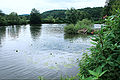
The victory at Hennef- Stein with yellow pond roses

A female of the rare dragonfly species Common Keiljungfer at the Sieg

Gray herons have been seen very often at the Sieg for several years


traffic

A few meters west of the Siegquelle in the Rothaargebirge runs the Eisenstrasse ( Landesstrasse 722 ), which connects the towns of Lützel and Lahnhof close to the source .
The federal highway 62 runs through Netphen and Siegen and only in Siegen the B 54 (see also Hüttentalstrasse ) along the river; there the victory on the Siegtalbrücke is bridged by the federal motorway 45 (Sauerland line) . Later the B 62 runs parallel to the river through Mudersbach , Kirchen , Betzdorf and Wissen . After that, the B 256 runs along the Sieg, for example through Windeck , to which the L 333 connects, which runs through Eitorf to Hennef , to pass under the B 478 shortly before .
From Hennef to the mouth of the Sieg near Mondorf are the A 560 , the B 8 , the A 3 , the B 484 , the A 59 and the A 565 roads accompanying or crossing the river (one after the other ) . The last victory near the estuary on crossing road is the L 269. In parallel to this road runs between Schwarzrheindorf and Bergheim the victory ferry cyclists and pedestrians across the river.
freetime and recreation
hike
The Rothaarsteig runs past the Siegquelle . The Natursteig Sieg leads along some sections of the Sieg . At Deuz , in Siegen and at Freusburger Mühle , the river crosses the European long-distance hiking trail E1 .
Swimming and water sports
The Sieg was designated as an FFH area within the framework of the European ecological protection system "Natura 2000". The use of the Sieg with canoes, kayaks, dinghies and rowing boats is regulated. It is not permitted to sail on the Sieg if the water level is not high enough. The level in Betzdorf must be at least 55 cm, that in Eitorf 30 cm. Rafts, model ships, etc. are generally not permitted. Entering the riverside regions and swimming is only permitted in recreational areas near the water.
The best known water sports club active at the Sieg is the Siegburg Rowing Club , founded in 1910 , which has produced numerous Olympic and world champions.
Trivia
An entry in the Guinness Book of Records as the most impossible message in a bottle was given to a wine bottle in 1998, which Christine Klinkhammer threw into Sieg as a message in a bottle at Hennef's in 1993 and was found in Falmouth ( Maine , USA ) in 1996 .
literature
- Heinz-Josef Gramsch: The development of the Siegtal in the Younger Tertiary and the Quaternary . Paderborn / Schöningh, 1978
References and comments
- ↑ a b letters 603 m on the wall at the Siegquelle, which existed until the beginning of 2013
- ↑ a b c d e f g h i j k Topographical Information Management, Cologne District Government, Department GEObasis NRW ( information )
- ↑ Value of the Menden level in relation to the entire catchment area (arithmetically 53.40 m³ / s, due to the low mean discharge ( MQ ) near the mouth of the river, it is closer to 53.1 m³ / s)
- ↑ a b c d Sieg level values in: General description (characteristics) of the Sieg river basin district in accordance with Article 5 and Annex II ( Memento from March 6, 2014 in the Internet Archive ) (inventory of NRW ) , as of July 2004, on archive.org ( PDF; 1.21 MB), from sieg.nrw.de
- ↑ a b Drains: Menden gauge , ( Menden ) (PDF; 246.81 kB)
- ↑ Surface water and groundwater sub-catchment area Rhine / Sieg NRW , management plan 2016-2021 - profiles of the planning units in the sub-catchment area Rhine / Sieg NRW
- ↑ Rhineland-Palatinate Water Management Authority , data via GeoExplorer
- ↑ Natural area codes shortened to one decimal place for sorting reasons!
- ↑ For a better overview and sorting downstream, a hyphen has been inserted for each river in the water code number (GKZ) after the number "272", which stands for victory .
- ↑ The Holper Bach is occasionally also called Bruchhauser Bach after its source brook / upper course .
- ↑ Overview of the Eitorf water level , accessed on February 23, 2017, on hochwasser-rlp.de
- ↑ Two-year-old dies in a sewer pipe , accessed on February 23, 2017, on t-online.de
- ^ Umlaufberg in Brachbach: Geological map, sheet 5113 ( ⊙ )
- ↑ Umlaufberg near Mittelhof-Steckenstein (near knowledge): Geological map sheet 5212, knowledge
- ^ Umlaufberg between Windeck-Dreisel and -Helpenstell: Geological map sheet 5311, Weyerbusch ( ⊙ )
- ^ Lecture at the control station for migratory fish at Buisdorf weir by Klaus Weisser
- ↑ Rhein-Sieg-Anzeiger v. October 21, 2019, p. 24, Stefan Villinger: The record is set
- ↑ The wastewater pollution of victory from the industrial age to today , on asv-menden-1973.de
- ↑ Great Nister Crayfish Project. ARGE Nister, April 30, 2012, accessed on February 8, 2016 .
- ↑ Record in Eitorf - angler catches big catfish . In: Rhein-Sieg-Rundschau . August 25, 2014, p. 33 ( online [accessed August 27, 2014]).
- ↑ bathing in and canoeing to win and Agger ( Memento of 28 September 2007 at the Internet Archive ), on rhein-sieg-kreis.de
Web links
- ... implementation of the European Water Framework Directive (WFD) in the sub- catchment area Sieg , on sieg.nrw.de
- Gauge values, catchment area and groundwater of the Sieg: General description (characteristics) of the Sieg river basin district in accordance with Article 5 and Appendix II ( Memento from March 6, 2014 in the Internet Archive ) (inventory of NRW ) , as of July 2004, on archive.org (PDF; 1.21 MB), from sieg.nrw.de
- Profile Sieg , auf russgebiete.nrw.de (PDF; 2.14 MB)
- Map / aerial photo of the Sieg river system with natural areas and mountains / placemarks ( Google Earth required)
- Pictures from the center of the Siegtal