Outrebois
| Outrebois | ||
|---|---|---|
|
|
||
| region | Hauts-de-France | |
| Department | Somme | |
| Arrondissement | Amiens | |
| Canton | Doullens | |
| Community association | Territoire North Picardy | |
| Coordinates | 50 ° 11 ′ N , 2 ° 15 ′ E | |
| height | 42-130 m | |
| surface | 9.57 km 2 | |
| Residents | 312 (January 1, 2017) | |
| Population density | 33 inhabitants / km 2 | |
| Post Code | 80600 | |
| INSEE code | 80614 | |
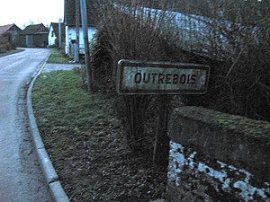
 Entrance to Petit Occoches |
||
Outrebois ( Picard : Otérbou ) is a northern French municipality with 312 inhabitants (at January 1, 2017) in the department of Somme in the region of Hauts-de-France . The municipality is located in the Arrondissement of Amiens , is part of the Communauté de communes du Territoire Nord Picardie and belongs to the canton of Doullens .
geography
The community is located in the valley of the Authie River, around eight kilometers west of Doullens . Outrebois to the hamlet of Le Quesnel and the opposite part Occoches located Petit Occoches.
history
For a long time, the Outrebois domain was part of the Notre-Dame de Paris cathedral . In 1899 a watermill was still in operation.
Residents
| 1962 | 1968 | 1975 | 1982 | 1990 | 1999 | 2006 | 2011 |
|---|---|---|---|---|---|---|---|
| 305 | 298 | 297 | 252 | 251 | 253 | 248 | 315 |
administration
Mayor ( maire ) has been Emmanuel Maréchal since 2001.
Attractions
- Saint-Séverin church [1]
- Chapel of the Seven Sorrows of the Virgin Mary [2]
- Castle on the hill north of the village
Web links
Commons : Outrebois - collection of images, videos and audio files
