
Villers-Campsart
| Villers-Campsart | ||
|---|---|---|
|
||
| region | Hauts-de-France | |
| Department | Somme | |
| Arrondissement | Amiens | |
| Canton | Poix-de-Picardy | |
| Community association | Somme Sud-Ouest | |
| Coordinates | 49 ° 52 ′ N , 1 ° 50 ′ E | |
| height | 128-176 m | |
| surface | 4.45 km 2 | |
| Residents | 152 (January 1, 2017) | |
| Population density | 34 inhabitants / km 2 | |
| Post Code | 80140 | |
| INSEE code | 80800 | |
 Town hall (mairie) |
||

Villers-Campsart ( Picard : Viler-Campsart ) is a French municipality with 152 inhabitants (at January 1, 2017) in the department of Somme in the region of Hauts-de-France . It belongs to the Arrondissement of Amiens and the canton of Poix-de-Picardie .
geography
Villers-Campsart is located on the chalk plateau of the Vimeu landscape around six kilometers west-northwest of Hornoy-le-Bourg and 30 kilometers west of Amiens . The district of Campsart is north of the community center.
Residents
| 1962 | 1968 | 1975 | 1982 | 1990 | 1999 | 2006 | 2011 |
|---|---|---|---|---|---|---|---|
| 165 | 163 | 160 | 121 | 148 | 156 | 154 | 134 |
Attractions
- The Nativité-de-la-Vierge church, registered as a Monument historique since 1926 ( Base Mérimée PA00116264). [1]

Notre-Dame-de-la-Nativité church

Chapel behind the church
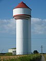
Water tower
.JPG)
.JPG)
.JPG)
Web links
Commons : Villers-Campsart - collection of images, videos and audio files