Saleux
| Saleux | ||
|---|---|---|
|
|
||
| region | Hauts-de-France | |
| Department | Somme | |
| Arrondissement | Amiens | |
| Canton | Amiens-7 | |
| Community association | Amiens metropolis | |
| Coordinates | 49 ° 52 ' N , 2 ° 14' E | |
| height | 30-116 m | |
| surface | 8.02 km 2 | |
| Residents | 2,846 (January 1, 2017) | |
| Population density | 355 inhabitants / km 2 | |
| Post Code | 80480 | |
| INSEE code | 80724 | |
| Website | http://www.ville-saleux.fr/ | |
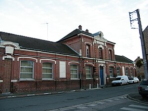
 Town hall and school building |
||
Saleux is a northern French municipality with 2846 inhabitants (at January 1, 2017) in the department of Somme in the region of Hauts-de-France . The municipality is located in the arrondissement of Amiens , is part of the Communauté d'agglomération Amiens Métropole and belongs to the canton of Amiens-7 .
geography
The community in the Amiénois southwest of Amiens is mainly on the left (western) bank of the Selle ; the municipal area extends over the Westast the Route A29 addition, the Route A16 (a connection point) to the Ostast the Route A29; the Péage de Dury toll booth is in the Saleux area. The municipality of Salouël is located between Amiens and Saleux . The Amiens - Rouen railway also runs through the municipality; she owns a train station there.
Toponymy and History
The name of the community is traced back to the river Selle through which it flows .
There was a Gallo-Roman cemetery in Saleux . The rural community turned into an industrial suburb of Amiens around 1830.
| 1962 | 1968 | 1975 | 1982 | 1990 | 1999 | 2006 | 2010 |
|---|---|---|---|---|---|---|---|
| 1,289 | 1,429 | 1,856 | 2,069 | 2,488 | 2,493 | 2,390 | 2,410 |
administration
Mayor ( maire ) has been Ernest Candela since 2008.
Parish partnership
- Mögglingen , Baden-Württemberg, Germany
Attractions
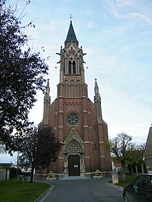
- Parish church of Saint-Fuscien by Victor Louis Delefortrie and others from the third quarter of the 19th century
Personalities
- Numa Auguez (1847–1903), opera singer, born here.

