Bouchon
| Bouchon | ||
|---|---|---|

|
|
|
| region | Hauts-de-France | |
| Department | Somme | |
| Arrondissement | Amiens | |
| Canton | Flixecourt | |
| Community association | Nièvre et Somme | |
| Coordinates | 50 ° 2 ′ N , 2 ° 2 ′ E | |
| height | 15-105 m | |
| surface | 4.60 km 2 | |
| Residents | 155 (January 1, 2017) | |
| Population density | 34 inhabitants / km 2 | |
| Post Code | 80830 | |
| INSEE code | 80117 | |
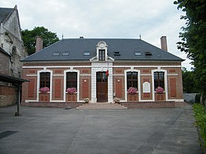
 Bouchon Town Hall |
||
Bouchon is a northern French municipality with 155 inhabitants (at January 1, 2017) in the department of Somme in the region of Hauts-de-France . The municipality is located in the arrondissement of Amiens and belongs to the canton of Flixecourt .
geography
Bouchon is about six kilometers southeast of Ailly-le-Haut-Clocher and west of L'Étoile . The municipality lies to the right of the Somme , but has no share in the riparian zone. It extends north over the A16 autoroute to the ruins of the Moulin de Mouflers mill .
history
A prehistoric site from the La Tène period was discovered during the construction of the A16 autoroute .
Residents
| 1962 | 1968 | 1975 | 1982 | 1990 | 1999 | 2006 | 2011 |
|---|---|---|---|---|---|---|---|
| 166 | 129 | 145 | 163 | 135 | 140 | 150 | 151 |
Attractions
- Saint-Pierre church with a Gothic tower
Web links
Commons : Bouchon (Somme) - Collection of images, videos and audio files

