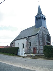
Mouflières
| Mouflières | ||
|---|---|---|
|
|
||
| region | Hauts-de-France | |
| Department | Somme | |
| Arrondissement | Amiens | |
| Canton | Poix-de-Picardy | |
| Community association | Somme Sud-Ouest | |
| Coordinates | 49 ° 55 ' N , 1 ° 45' E | |
| height | 114-152 m | |
| surface | 2.76 km 2 | |
| Residents | 86 (January 1, 2017) | |
| Population density | 31 inhabitants / km 2 | |
| Post Code | 80140 | |
| INSEE code | 80575 | |
 Mouflières Town Hall |
||
Mouflières ( Picard : Monfliére ) is a northern French municipality with 86 inhabitants (at January 1, 2017) in the department of Somme in the region of Hauts-de-France . The municipality is located in the Arrondissement of Amiens (since 2009) and is part of the Communauté de communes Somme Sud-Ouest and the canton of Poix-de-Picardie .
geography
The agricultural community is located in the Vimeu countryside around 4 km south of Oisemont off the D25 from Oisemont to Senarpont , which borders the community in the west. From Mouflières a dry valley starts in the direction of Airaines .
Toponymy and History
The place is mentioned in 1208 as Mofliers. From 1801 it was called Moustieres.
In 1171 Gérard de Préaux sold his land in Mouflières to the Cistercian monastery Valloires . Since 1184 there was a Templar settlement , which developed into a small ball in the third quarter of the 13th century .
Residents
| 1962 | 1968 | 1975 | 1982 | 1990 | 1999 | 2006 | 2011 |
|---|---|---|---|---|---|---|---|
| 85 | 90 | 96 | 86 | 74 | 71 | 88 | 98 |
Attractions
- Saint-Nicolas church with a wooden statue of St. Nicholas (classified as a monument historique ) from the 18th century, a copper candlestick and paintings of St. Nicholas and John the Elder. T.
Individual evidence
- ↑ http://www.culture.gouv.fr/public/mistral/palsri_fr?ACTION=CHERCHER&FIELD_1=REF&VALUE_1=PM80000939

