Sentelie
| Sentelie | ||
|---|---|---|
|
|
||
| region | Hauts-de-France | |
| Department | Somme | |
| Arrondissement | Amiens | |
| Canton | Ailly-sur-Noye | |
| Community association | Somme Sud-Ouest | |
| Coordinates | 49 ° 44 ' N , 2 ° 2' E | |
| height | 122-187 m | |
| surface | 5.53 km 2 | |
| Residents | 208 (January 1, 2017) | |
| Population density | 38 inhabitants / km 2 | |
| Post Code | 80160 | |
| INSEE code | 80734 | |
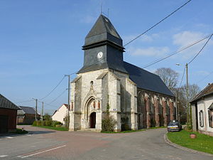
 Saint-Nicolas church |
||
Sentelie ( Picard : Chindlie ) is a northern French municipality with 208 inhabitants (at January 1, 2017) in the department of Somme in the region of Hauts-de-France . The municipality is located in the arrondissement of Amiens and belongs to the canton of Ailly-sur-Noye .
geography
The municipality on the border with the Oise department is about ten kilometers west of Conty on the hills between the river Évoissons and the flowing stream Parquets .
history
The medieval rule, divided into two fiefs , was under the Catellanei of Conty .
Residents
| 1962 | 1968 | 1975 | 1982 | 1990 | 1999 | 2006 | 2011 |
|---|---|---|---|---|---|---|---|
| 238 | 210 | 196 | 176 | 190 | 215 | 210 | 205 |
administration
Mayor ( maire ) has been Patrick Magnier since 2001.
Attractions
- Saint-Nicolas church from the 15th and 16th centuries
- former pilgrimage chapel Saint-Lambert (16th century) in the cemetery south of the village, registered as a monument historique in 1926 ( Base Mérimée PA00116254)
Web links
Commons : Sentelie - collection of images, videos and audio files


