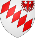
Glisy
| Glisy | ||
|---|---|---|

|
|
|
| region | Hauts-de-France | |
| Department | Somme | |
| Arrondissement | Amiens | |
| Canton | Amiens-4 | |
| Community association | Amiens metropolis | |
| Coordinates | 49 ° 53 ' N , 2 ° 24' E | |
| height | 22-117 m | |
| surface | 12.44 km 2 | |
| Residents | 771 (January 1, 2017) | |
| Population density | 62 inhabitants / km 2 | |
| Post Code | 80440 | |
| INSEE code | 80379 | |
| Website | http://www.ville-blangy-tronville.fr/ | |
 Saint-Léger church |
||
Glisy ( Picard : Glisu) is a northern French municipality with 771 inhabitants (at January 1, 2017) in the department of Somme in the region of Hauts-de-France . The municipality is located in the arrondissement of Amiens , is part of the Communauté d'agglomération Amiens Métropole and belongs to the canton of Amiens-4 .
geography
Glisy is located in the Amiénois south of the swampy Somme around eight kilometers east of Amiens and eight kilometers southwest of Corbie . The municipal area, traversed by the former Route nationale 29 and the Amiens-Laon railway line (with the Blangy-Glisy stop in Blangy-Tronville, which is no longer served), extends to the A29 autoroute . There is an industrial area south of the D1029. Amiens-Glisy Airport (Aérodrome d'Amiens-Glisy), which was used by the German Air Force during World War II, is located in the area of Glisy .
history
There was a Gallo-Roman villa in Glisy. There were also Merovingian found items.
| 1962 | 1968 | 1975 | 1982 | 1990 | 1999 | 2006 | 2010 |
|---|---|---|---|---|---|---|---|
| 355 | 370 | 451 | 532 | 499 | 483 | 561 | 570 |
Attractions
- Saint-Léger church
