
Leopoldstadt
|
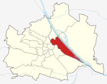
Leopoldstadt II. Viennese district |
|
|---|---|
| coat of arms | map |
 |
 .svg) |
| Geographic location : | 48 ° 13 ' N , 16 ° 25' E |
| Surface: | 19.24 km² |
| Residents: | 105,848 (January 1, 2020) |
| Population density : | 5501 inhabitants / km² |
| Postal code : | 1020 |
| Address of the district office: |
Karmelitergasse 9 1020 Vienna |
| Website: | www.wien.gv.at |
| politics | |
| District Head : | Uschi Lichtenegger ( Greens ) |
|
District council election 2015 |
A total of 60 seats |
The Leopoldstadt is the second since 1850 Viennese district . It is named after Emperor Leopold I. In Leopoldstadt is the Prater with the Vienna Ferris wheel , which is one of the city's landmarks.
geography
location
The 2nd district is on the island between the Danube and the Danube Canal and borders with the latter on the 1st district. The bank area of the Danube Canal above Ulrichgasse belongs to the outer zone of the World Heritage Site Historic Center of Vienna . The districts 3, 9, 11 and 20 as well as the 22nd district on the other side of the Danube border the Leopoldstadt. The Prater takes up most of the 2nd district .
District parts
- Original district scope
The Leopoldstadt district was made up of the suburbs Leopoldstadt , Jägerzeile , Brigittenau , Zwischenbrücken and Kaisermühlen in 1850 and originally comprised the entire island formed by the Danube and Danube Canal. The eastern district and until 1904 city limits ran roughly in the center line of the then main river of the Danube , the later Old Danube . The district ranged from Brigittaspitz (or Brigittenauer Sporn), the branch of the Danube Canal from the Danube River, to the Praterspitz, where the Danube Canal flows into the Danube.
The Danube regulation , completed in 1875, did not change anything at the district boundaries for the time being; the Bruckhaufen and Kaisermühlen were no longer on the island, but on the left bank of the new main stream. The creation of the 21st district in 1905 through incorporations east of the 2nd district did not affect the district boundaries for the time being.
With 2,990 houses (= 9.5%) out of a total of 32,524 houses in all 19 districts, Leopoldstadt was the district with the most houses in 1899, followed by Hietzing in its area at that time with 2,882 houses. The 2nd district was also the most populous.
Outsourcing from the 2nd district
The district area was reduced in size from 1900:
- In 1900 Brigittenau and the northern part were separated from the 2nd district by intermediate bridges at the request of the local politicians and constituted as the 20th district. In contrast to the current situation, its border on the Danube River ran on the right bank ( Handelskai ). The river itself and the area on the left bank remained from the Brigittaspitz downstream in the 2nd district. The Leopoldstadt thus lost its rank as the most populous district, but remained by far the most populous district with 141,007 (= 8.5%) of 1,662,269 inhabitants in Vienna. How densely the historical Leopoldstadt was inhabited can be seen if you add the 71,153 inhabitants (= 4.3%) of the new 20th district: every eighth Viennese lived in the two districts together.
- On February 19, 1924, the northeast border between the 2nd and 20th districts on Innstrasse was extended across the Danube to the Old Danube. (As noted in the Vienna State Law, bridges were planned over both bodies of water on this line.) The Bruckhaufen, located on the left bank of the Danube north of this line (today the area between the northern workers' beach bandstrasse, Donauturmstrasse and Am Bruckhaufen) was now part of the 21st district.
- On October 15, 1938, in the course of the creation of NS- Groß-Wien , Kaisermühlen, the last part of the Leopoldstadt district on the left bank of the Danube, was separated from it and made the 21st district. This also affected the current areas of Donaupark , Donau City , UNO-City , workers' beach and the Alte Donau lido, as well as the westernmost part of the Gänsehäufel . (In 1954, Kaisermühlen became part of the 22nd district .)
The population in the 20th district has increased since the separation from the 2nd, the population density in the 2nd district has declined - also because of the expulsion and murder of the Jewish Leopoldstadt residents. Today the 2nd district comprises 4.6% of the area of Vienna and 5.6% of its population.
Grätzl (district)
In the popular sense, there are also distinct neighborhoods with their own character, so-called Grätzl , such as the Karmeliterviertel , Stuwerviertel , Nordbahnviertel , Alliedviertel and Pratercottage . Counted clockwise, the following quarters of the 2nd district border the Augarten more or less directly : Volkertviertel , Afrikanerviertel , Karmeliterviertel and Rembrandtviertel .
Furthermore, the Prater (the Wurstelprater amusement park and the landscape protection area), the adjacent Vienna Exhibition Center and the Freudenauer Hafen (winter harbor) in the southeastern part of the island also belong to the 2nd district.
As the Vienna History Wiki records, the quarter between Nordbahnstrasse and Heinestrasse has been called the Nordbahnviertel for many decades; according to today's understanding, this corresponds to the Allied Quarter and the Volkertviertel . Since around 2010, Nordbahnviertel has been the name for an emerging residential area with office buildings on the extensive grounds of the separated Nordbahnhof ; Rudolf Bednar Park and the adjacent residential buildings have already been completed, Bruno-Marek-Allee with Rothschildplatz are still under construction.
The district bordered by Praterstrasse, Taborstrasse and Heinestrasse has appeared as an African quarter since the 2000s. In the Grätzl there are the Große Mohrengasse, the Kleine Mohrengasse and the Afrikanergasse. The unofficial name refers to the historical street names given, not to those who live in this quarter today.
Statistical counting districts
A statistical breakdown of the district area exists in the census districts in which the census districts of the municipality are summarized. The nine counting districts in Leopoldstadt are Nordbahnhof, Am Tabor, Augartenviertel , Taborstraße , Praterstraße , Oberer Prater, Expositionstraße , Unterer Prater and Praterlände.
coat of arms
The district coat of arms of Leopoldstadt has been made up of three parts since Brigittenau left the 2nd district in 1900, which symbolize the former independent communities that make up the district:
- The holy Leopold in the upper left ( heraldic : upper right) part symbolizes the historic Leopold city, the former Lower Werd, the area between Augarten, Taborstraße , Praterstraße and the Danube Canal . He is dressed in a blue skirt and a red coat trimmed with hermelin , on his head he wears the Austrian ducal hat. In his hands he holds the banner of the Archduchy of Austria under the Enns and a model of a church that symbolizes the patronage of the Leopoldstadt parish church .
- The upper right (heraldic: upper left) coat of arms represents the Jägerzeile district , the area east of today's Praterstraße and the Praterstern . It shows the silver Hubertus deer on a green meadow. The deer wears twelve-ended, golden antlers , in the middle of which a golden cross protrudes. As a symbol of hunting, the stag stands for the earlier importance of the Prater and the Danube floodplains as a hunting area.
- The lower part of the coat of arms stands for the intermediate bridges district . It shows a red tongue on a silver background, surrounded by a golden halo adorned with five five-pointed golden stars. The coat of arms symbolizes St. John Nepomuk , the patron saint of bridges, and stands for the area originally located between several branches of the Danube and their bridges, which since the Danube regulation 1870–1875 has been northeast of the North Station (today: Vienna Praterstern Station ) between the Reichsbrücke and the Nordbahnbrücke extends (and has been part of the 20th district since 1900).
history
The Lower Bec

The beginning of the settlement can be dated to the time around 1300. The mention of a bridge to Unteren Werd ( werd , Middle High German for island ) at the city's Rotenturmtor dates from 1368 (the only one until 1782!). In the 15th century, the city of Vienna acquired property and farms here. The settlement was built in the floodplain, which previously served mainly as pastureland: for the livestock of the residents of Vienna as well as for cattle imported from Hungary or in transit (around 1500 50,000 were driven to Austria per year, some of which were driven on to southern Germany) and horses; the city received grazing money for it. The harvested hay was fed to draft animals, and timber and firewood for the city was obtained from the Lower Werd.
Until 1450, the area between Hollandstrasse, Taborstrasse (which at that time was still called Kremser Strasse for a long time) and Praterstrasse was built up; The largest part of the Lower Werd was still floodplain forest, crossed by many branches of the Danube , the course of which could change significantly due to floods. In 1439 the first multi-part yoke bridge over the Danube and its side arms was built at today's Gaußplatz.
In 1529, the bridges were destroyed in the course of the first Turkish siege of Vienna, and the Lower Werd was occupied by the Ottoman army. In the area of today's Rotensterngasse and Große Sperlgasse, citizens settled who had lost their houses as a result of the subsequent renovation of the city wall . Breweries were built in 1530 and 1536 (the brewery on today's Malzgasse existed until 1846).
From 1569, Emperor Maximilian II allowed his woodworkers and gamekeepers to settle in Unteren Werd, initially in the Venediger Au , then on the right on the road from the city to the Prater . From this the suburb of Jägerzeile developed south of today's Praterstrasse (in the section Czerningasse – Praterstern).
In 1614 the Brothers of Mercy , who were called to Vienna, founded their monastery with an attached religious hospital , which still exists today. In 1621 the Carmelites settled . Shortly before, in 1614, Emperor Mathias had called the Hospital Order of the Brothers of Mercy of St. John of God to Vienna. Construction of the church and hospital began in 1622 and was supported by a letter of foundation from Emperor Ferdinand II in 1624. The hospital on the lower Taborstrasse, which at that time was an important long-distance connection to the north, still exists today; it is the oldest hospital in town. The Carmelite Church not far from there was an imperial foundation (Ferdinand II, 1623) and also part of the Habsburgs' counter-Reformation monastery offensive. The two churches set distinctive structural accents on this section of the street.
"Mazzesinsel" and first Leopoldstadt
In 1624 Emperor Ferdinand II banned the Jewish Viennese from the city and assigned them the Unteren Werd as a residential area. This was anchored in a contract between the Jewish community and the Bürgerspital in 1626, in which the area “Auf der Baumlos Haide” was defined as follows (today's name): Kleine Pfarrgasse – Große Schiffgasse – Krummbaumgasse – Karmelitergasse– Taborstraße . Some of the houses from that time still exist today, e.g. B. the Pabsthaus (Haidgasse 6, named after a long-time owner family) as well as the two neighboring houses in the Große Sperlgasse, the Haus Zum Sieg (Haidgasse 8, named after the victory of Archduke Charles in the Battle of Aspern) and the Haus Zum golden Hasel in the Große Pfarrgasse 19, which dates back to the year of the portal inscription (1736).
1669/70 were the Jews of Leopold I , at the urging of his Spanish wife and the Vienna magistrate also sold here , many of them found in what is now Burgenland recording where under the protection of the Hungarian magnate family Esterházy the seven communities emerged. In 1670 the emperor laid the foundation stone for a church consecrated to Saint Leopold in 1671 , after the synagogue, which had only been built a few years earlier, was burned down by the Viennese. Since then, the Untere Werd has been named after the Emperor Leopoldstadt , a name that passed from this relatively small area to the entire district in 1850. In 1679 there was a devastating plague epidemic. In 1683, the Leopoldstadt was devastated by the besiegers during the second Turkish siege of Vienna and rebuilt in the following years. From 1722–1724, the Leopold Church was rebuilt according to plans by Anton Ospel.

Despite all the repression up to the Nazi era, Jews repeatedly returned to this area of the city, which is convenient for trade and commerce and close to educational institutions. The quarter's nickname, Mazzesinsel, is derived from the numerous matzo bakers who made the unleavened bread at the time of the Jewish festivals. Until the Holocaust , the Jewish population made up a considerable part of the population of the 2nd district. The demarcation by the Karmeliterkloster is still visible today on the basis of a short historical part of the wall between Karmelitergasse and Tandelmarktgasse (visible in the inner courtyards of Tandelmarktgasse 8 and Karmelitergasse 24). Even today, Jewish Viennese live in this district again.
Prater and Augarten
In 1645 Swedes besieged the city during the Thirty Years War . After their departure a chapel was built dedicated to Saint Brigitta of Sweden. The name Brigittenau for the area previously known as Schottenau is derived from this. (The northern part of the 2nd district became a separate district in 1900 with the name Brigittenau.)
In 1537 the Roman-German King and later Emperor Ferdinand I had the Prater-Hauptallee built, which has not been interrupted by the haystack water since 1867. In 1560 the Prater was fenced in as an imperial hunting area, and entry by unauthorized persons was prohibited. In 1704 Leopold I had a castle built in Augarten, while Charles VI. From 1712, Jean Trehet designed the park in the Baroque style that has been preserved to this day.
In 1766, Emperor Joseph II , as co-regent Maria Theresa in the Habsburg monarchy, made the Prater, a very large area, accessible to the general public; the "Wurstelprater" (officially Volksprater from 1786) was created. In 1775 the emperor made the Augarten , in whose Josefsstöckel (a simple, single storey building) he liked to spend the summer and from where Pope Pius VI. In 1782 the Viennese blessed, also accessible: A place of amusement dedicated to all people, by their treasurer. (Dedication above the main gate). A dead straight avenue runs about 6 km from the Augarten to the Lusthaus (rebuilt in 1783 by Isidore Canevale ) in the Prater meadows (interrupted twice by the Heustadlwasser, an arm of the Danube, until 1867; today the street Klanggasse, Heinestraße, Praterstern and Hauptallee); since 1963 there has been a general driving ban on Hauptallee. In 1782 Mozart gave concerts in the Augarten. The son of the same name of Anton Grassalkovics , the Hungarian "finance minister" Maria Theresa, set up his residence in Vienna as prince from 1789 opposite the main entrance to the Augarten (and thus Emperor Joseph II's summer residence). In 1803 Beethoven gave concerts in the Augarten.
1721–1723, the oldest barracks in Vienna, the Leopoldstädter Reiterkaserne or Kavalleriekaserne, was built on an area between Oberer Donaustraße 17 and Oberer Augartenstraße , because the residents had become too troublesome to bill soldiers in private apartments. It was demolished in 1863-1865. The Hammerbrot factory was later located on this site .
In 1744, 1787, 1830 and 1862 the Leopoldstadt suffered from very large floods and floods. The flood of 1830 was dealt with by Franz Grillparzer in his novella “Der arme Spielmann”. (There is a marking of the water level from 1830 on the inside of the Augarten main gate, Obere Augartenstraße 1.)
In 1781 the Leopoldstädter Theater was opened in Jägerzeile (today Praterstrasse 31) , where Nestroy and Raimund (1824 premiere “The Barometer Maker on the Magic Island”) worked. In 1838 it was sold to the theater director Carl Carl and continued as the Carltheater , since 1847 in a new building.
Leopoldstadt is becoming a big city

In 1807 the entertainment establishment Sperl (today: Kleine Sperlgasse) was opened, where Josef Lanner and Johann Strauss (father) (the father of the “Waltz King” gave his last public concert here in the year of his death in 1849) often performed. The pub, which was initially popular with high society and later popular with the people, did not finally have to close until 1873 and was demolished. (In that year Sigmund Freud graduated from the grammar school that is now named after him , at that time in Taborstrasse, which moved into its new building in 1877 on the former Sperl site.)
In 1809 French army units camped in the Prater; Napoleon I stayed in Vienna for over five months. In 1814, on the "Prager Reichsstrasse " (today Alliiertenstrasse / Am Tabor), which crossed the Danube on several bridges, Emperor Franz I. the two monarchs Tsar Alexander I and King Friedrich Wilhelm III, allied with Austria . received by Prussia and led into the city through Praterstrasse to the Congress of Vienna .
In 1819 the Erste Österreichische Spar-Casse (today Erste Bank ) was founded in the vicarage of the Leopoldskirche , the first such institute in the Austrian Empire.
In 1839 the first north station was built near Praterstern for the Kaiser-Ferdinands-Nordbahn , the first steam railway line of the Danube monarchy, opened in 1837 in the first section (Floridsdorf - Deutsch-Wagram) ; it connected Vienna with the industrial areas in Moravia and Silesia . The train station, which was soon expanded or rebuilt in a representative manner, was the most important in Vienna until 1918.

1841–1846 the church of St. John of Nepomuk in Praterstrasse was replaced by a new building. The "Odeon" existed from 1845–1848 (see theater). In the revolutionary year of 1848 bloody battles took place in today's Praterstrasse between revolutionaries and imperial troops under Field Marshal Windischgrätz . The German MP Robert Blum was shot dead by imperial soldiers in Brigittenau .
In 1850 Leopoldstadt, Jägerzeile, Prater, Brigittenau, Kaisermühlen and a few other localities, thus the entire area between the then main river of the Danube and the Danube Canal, were incorporated into Vienna as the 2nd district, Leopoldstadt. The new Tempelgasse synagogue was opened in 1858 . After the Viennese regulation of the Danube in 1870–1875, numerous industrial companies settled on the banks of the Danube next to the river port ; the Kaisermühlen district - on the outer edge of which the Gänsehäufel outdoor swimming pool was built around 1900 on the Old Danube - was now on the other bank of the new main river. In the course of the bank expansion, the Erzherzog-Karl-Platz was built, which has been called Mexikoplatz since 1956 ( see “Connection” ). The huge Kaiser-Franz-Joseph-Jubilee Church , consecrated in 1913, today called Franz-von-Assisi-Kirche , was built there to commemorate the Emperor's 50th anniversary in government 1848–1898 .
The newly acquired building land on the right bank of the Danube was also used to build a new district. Part of the fireworks corn (today's Stuwerviertel ) between exhibition street , Lassallestrasse and Danube as well as the area between Nordbahnhof and Danube were projected as a new district "Donaustadt" and built up almost completely by the beginning of the 20th century. Since the name Donaustadt was apparently not used by the population and other Grätzlnames were formed instead, it was chosen in 1954 as the name for the new 22nd district.
In 1855 a lower secondary school was founded in Weintraubengasse, today the Bundesrealgymnasium Vereinsgasse , which moved to its final location in Vereinsgasse in 1876. Your best-known student was Arnold Schönberg . In 1864 a grammar school was established at Taborstrasse 24 . Sigmund Freud attended the institute from 1865–1872 and graduated here in 1873 with honors. The school moved to Kleine Sperlgasse in 1877. Julius Tandler graduated from high school in 1889 , Viktor Frankl graduated here in 1924 . In 1937 78% of the students were Jewish, in 1939 none were any more. In 1946 the grammar school was run in Vereinsgasse, since 1967 in Wohlmutstraße and has been called Sigmund-Freud-Gymnasium since 1989 .
In 1867, in what was then Dianabad , near Taborstrasse on the Danube Canal, the world premiere of the waltz “ On the beautiful blue Danube ” by Johann Strauss (son) , which Strauss had composed in his apartment on Praterstrasse. In 1868 the horse tramway drove through Praterstrasse and Lasallestrasse for the first time (replaced in 1901 by the "Electric" one). In 1873, the “Roman Baths” opened in Kleine Stadtgutgasse 9 near the Nordbahnhof , at that time the largest and most luxurious steam and swimming pool in the world.
In the same year was six months long, the Vienna Prater with 53,000 exhibitors 2.3 km² World Expo held (her central building, the Rotunda , burned in 1937 from a part of the exhibition area was 1921 Exhibition Center ); A few days after its opening, there was a stock market crash ( Gründerkrach ) in Austria, which had a major impact on the success of the exhibition and brought about the end of political liberalism .
In 1876 the Kronprinz-Rudolf- Brücke, forerunner of today's Reichsbrücke , was opened; Until 1889 a bridge toll had to be paid. In 1886 the Tegetthoff memorial (architecture: Karl von Hasenauer , sculpture: Carl Kundmann ) was unveiled on the Praterstern in honor of the victorious admiral. In the same year, the first flower parade was held in Hauptallee, initiated by Princess Pauline von Metternich .
In the last decades of the 19th century, the so-called Pratercottage was built between the Prater and the Danube Canal (Böcklinstrasse, Rustenschacherallee and the surrounding area) , an area with upper-class villas and residential buildings. From 1909 to August 17, 1969, tram line 80 ( Rotundenbrücke [then Sophienbrücke] - Lusthaus ) served as line 181 on racing days to the Freudenau racecourse near the Lusthaus , where there were waiting tracks for over 100 trains . (The tracks gave way to the construction of the directional carriageway leading to the city on the A4 Ostautobahn .)
In the Zirkusgasse there was the building of the circus Renz from 1854 to 1957 . The residential complex built later on the property near Odeongasse extending to Weintraubengasse is called "Renzhof"; a nightspot on the corner of Zirkusgasse / Novaragasse also used the name Renz.
In 1892, for example, where the park called Venediger Au is located today , the Big Circus Busch was opened on the exhibition street (converted into a cinema in 1920, destroyed in 1945). 1894–1899 Otto Wagner built the Nussdorf weir and lock system (since 1900 in the 20th district), 1904–1908 the Kaiserbadschleuse in the Danube Canal , whose “Schützenhaus” (at Schiffamtsgasse) has been preserved. (A contactor is a movable part of a defense system; the weir fields were kept in the rifle house when the weir was not needed.)
In 1897 the Wiener Riesenrad was opened at the Praterstern between exhibition street and Hauptallee , soon a landmark of the Prater, the Leopoldstadt and all of Vienna. The Wurstelprater experienced its most successful period in the twenty years before the beginning of the First World War. Leopoldstadt had become by far the most populous district of what was then Vienna (which almost only extended to the right bank of the Danube). The northern part of the island was separated in 1900 as the 20th district, Brigittenau , at the request of the local authority .
From 1890 to 1966 there was the Engerthstrasse steam power station at Engerthstrasse 199 as the second fossil fuel-powered municipal power station alongside the Simmering power station .
Vienna's first electric tram line has been running in the 2nd district since January 28, 1897 , since 1907 and to this day line 5 (Praterstern – Mariahilfer Straße, Wallgasse), which connected four of Vienna's six terminal stations ( Nordbahnhof , Nordwestbahnhof , Franz-Josefs-Bahnhof) , Westbahnhof ). From 1899–1902, the Freudenauer Hafen or Winterhafen , today Vienna's most important port facility , was built in the southernmost part of Leopoldstadt .
In 1913 the new Dianabad (the second of that name) was opened. The luxurious building on the Danube Canal combined a wave pool indoor swimming pool, a sports pool indoor swimming pool, steam and tub baths with a hotel, restaurant, coffee house and row of shops. Another bathing option was the Roman bath in Kleine Stadtgutgasse. It was opened in 1873 and closed after the Second World War.
1918-1945

During the time of Red Vienna , the private Carltheater had to close for good in 1929 (it was badly damaged by bombs in 1944 and demolished in 1951). The Prater Stadium (today: Ernst Happel Stadium ) was built between 1928 and 1931, and it held up to 92,000 visitors (today around 50,000) and in 1931 it was the venue for a “Workers' Olympics”. The "Gänsehäufel" lido, which was partly part of the 2nd district at the time, was generously expanded. In the autumn of 1933, Chancellor Engelbert Dollfuss , who was already ruling in an authoritarian manner, held a speech in front of his supporters at the Krieau trotting course , which has gone down in contemporary history as a trotting course speech, in which he clearly rejected democracy for the future of Austria. The stadium later became the venue for mass rallies by the dictatorial “ corporate state ”.
In the “Civil War” or “February Uprising” in 1934, the Goethehof , a “community building” in Kaisermühlen, was fired at with artillery from the Volkswehrplatz (today: Mexikoplatz) across the Danube. In 1937 the rotunda burned down after a short circuit. In the same year the new Reichsbrücke , the Chain Bridge, which collapsed in 1976, was opened.
The terror of non- Jews against Jewish Viennese , which began on March 12, 1938, changed the population structure of the district very disadvantageously and led to an irreversible loss of culture. On 9/10 November 1938 the Great Temple in Tempelgasse 3–5, the so-called Schiffschul (Große Schiffgasse 8), the synagogue in Pazmanitengasse (between Heinestraße and Großer Stadtgutgasse) and prayer houses in Leopoldsgasse and Schrottgießergasse were set on fire by the fire department not deleted and subsequently removed.
Jewish citizens from other parts of the city were later crammed into overcrowded apartments in the 2nd district until they were deported. The majority of the total of more than 66,000 Austrian Shoah victims were ordered to four Nazi assembly camps before deportation and from there they were taken "to the east" (mostly synonymous with death, murder), initially on trucks through the city center Aspangbahnhof or Nordbahnhof. These collective camps were located in Kleine Sperlgasse 2a, Castellezgasse 35 and two warehouses in Malzgasse 7 and 16.
On April 12, 1945, a few hours before Vienna was liberated, nine Jews who had survived until then were murdered in Förstergasse near Untere Augartenstrasse.

Since 2006, the path of remembrance through Leopoldstadt, sponsored by the city, has been remembering this dark side of Vienna's history with many commemorative plaques.
In October 1938, the Kaisermühlen district was converted into the 21st district of Floridsdorf in the course of the establishment of NS- Groß-Wien . (Today Kaisermühlen belongs to the 22nd district.) Plans to lead Schottenring and Stubenring each by a dead straight extension to Handelskai on the Danube and to demolish the densely built-up area of the 2nd district between these two new streets in favor of a huge parade ground, were not realized due to war reasons. (The realization of these plans would have completely eliminated the Jewish residential area.)
In 1944/45, two Viennese flak towers were built in Augarten ; they exist as memorials to this day.
After the Second World War
In mid-April 1945 the Red Army drove out the last of the Nazi troops. The Reichsbrücke was called the Red Army Bridge until July 18, 1956 . Until the State Treaty of 1955, the 2nd district belonged to the Soviet sector of Vienna; In 1954, Albern , bordering the southern tip of Leopoldstadt on the other side of the Danube Canal - part of the 11th district since January 1, 1956 - with its Danube port was transferred to the 2nd district for reasons of occupation (Soviet sector!).
In the years after the Second World War , the 2nd district formed a strong contrast to the elegant city (by which the 1st district was and is meant in such contexts). The social structure was predominantly petty-bourgeois. From the 1960s onwards, more and more immigrants came to Vienna and settled in the 2nd district; since the 1970s, and increasingly since the mid-1990s, there were also Jewish immigrants, above all from the Soviet Union and its successor states. As a result, the Jewish tradition of the district was or will be linked - albeit on a much smaller scale than before 1938.
In 1970 the Prater Bridge with the adjoining section of the southeast bypass was opened to cross the Prater, a new connection between the districts on the left of the Danube and on the right of the Danube Canal. This meant that car traffic entered a section of the green Prater that had been quiet until then.
On August 1, 1976, the Reichsbrücke, a chain bridge, opened in 1937, collapsed at 4:30 a.m. Emergency bridges were put into operation for trams on October 16, and for motor vehicles on December 21, 1976.
In 1980 the Zwi-Perez-Chajes-Schule of the Israelitische Kultusgemeinde Vienna was (re) opened in the Scherzergasse near Augarten at a historic Jewish school location . It has been located in Simon-Wiesenthal -Gasse 3 near the stadium, adjacent to the Hakoah sports field , since 2008 ; After decades of efforts, the sports club got back parts of the area that had been used until 1938.
present

From 1992 to 1998 the Freudenau power plant was built across the Danube, and in 2000 the “Marina Wien” sports boat harbor (Handelskai 343) was built.
In 1999, on Rabbiner-Schneerson-Platz 1 (Augarten, corner of Rauscherstraße / Nordwestbahnstraße ), the Lauder-Chabad-Campus, largely financed by the Ronald S. Lauder Foundation , was opened according to the plans of architect Adolf Krischanitz , the Jewish education of the kindergarten up to the upper level secondary school.
In 2001 the Leopoldstadt District Court was re-established, which is also responsible for Brigittenau (20th district).
From 2001 to 2004 the City of Vienna built the new halls of the Messe Wien including the congress center. The first major congress (26,000 participants) took place there in autumn 2003. In 2004, renovation and adaptation of the Ernst Happel Stadium (the Prater Stadium) began for the 2008 UEFA European Football Championship, the final of which took place here on June 29, 2008.
Before the European Championship, the U2 underground line was extended in 2008 from Schottenring via Praterstern to the Stadion underground station ; the four new underground stations Taborstraße , Messe-Prater , Krieau and Stadion and a new part of the Praterstern underground station were built in the 2nd district . In 2010, the U2 was extended over the Danube to the 22nd district, with the new Donaumarina subway station being built in the 2nd district . Various new buildings were built along the stretch of the line near the Danube, including the school campus of the Zwi-Perez-Chajes-Schule, which was previously operated near Augarten , and the neighboring sports field of SC Hakoah Vienna , which was located here in the interwar period (both on Simon-Wiesenthal-Gasse), and until 2010 the new headquarters of the trade union federation (ÖGB) .
In the summer of 2013, the Vienna University of Economics and Business , previously operated in the 9th district, relocated to the new WU campus , which is located on the southern part of the historic exhibition center. In 2015, to the west of the new WU campus, the new Sigmund Freud University building was opened and its forecourt was renamed Freudplatz on this occasion .
The district bordered by Praterstrasse, Taborstrasse and Heinestrasse appeared to be the African Quarter in the 2010s. In the Grätzl there are the Große Mohrengasse, the Kleine Mohrengasse and the Afrikanergasse. The unofficial name refers to the historical street names listed, not to the people living in the area today.
In 2020 the British author Tom Stoppard brought out his play called Leopoldstadt . It tells the story of a Jewish family in Vienna from the turn of the century to the 1950s . Daniel Kehlmann is in discussion as a translator into German .
traffic
Praterstern

The most important traffic junction is the Praterstern , from whose roundabout seven main streets start (clockwise: Nordbahnstraße , Lassallestraße , Expositionstraße , Prater-Hauptallee , Franzensbrückenstraße , Praterstraße and Heinestraße). From a bird's eye view, the square takes on the shape of a star. Here is the Wien Praterstern train station , one of the most important train stations in Vienna for local and regional traffic .
In 1954/1955 the Praterstern was completely rebuilt. The larger roundabout that still exists today was created; the Tegetthoff monument, the landmark of the square, completed in 1886, no longer forms the focal point around which the tram lines circle. The connecting track no longer circles the square, but runs like a diameter; the new train station started operations in 1959, and there has been rapid transit operation since 1962 . In 1981 the Praterstern station of the U1 underground line was opened, which today runs over the Danube to Vienna Leopoldau station on the northern line. The Praterstern was rebuilt after 2000, after hardly any investments had been made in the design and maintenance of the square since the 1960s. The new station building was opened in 2008; In the same year, the U2 underground line was extended from Schottenring via Praterstern to the stadium (today it runs over the Danube to Aspern ).
Train
Since 1962 the Praterstern is a station of the S-Bahn - main line Meidling - Floridsdorf with trains going to Gänserndorf ( north line ) and Stockerau or Hollabrunn ( north west line ); today there are also trains in the direction of Mistelbach and Laa an der Thaya ( Laaer Ostbahn ), Wiener Neustadt ( Südbahn ) and Wolfsthal ( Pressburger Bahn ). North of the Praterstern station, the railway line belonging to the Northern Railway crosses the northern part of the district in a longitudinal direction (see Northern Railway District ); south of the station, the line belonging to the connecting railway turns towards the Danube Canal and the 3rd district .
In the area of the Prater, the Laaer Ostbahn (with the S80 S-Bahn line) crosses Leopoldstadt and, after the Wien Praterkai station, crosses the Danube on the Stadlauer Bridge .
Subway
The expansion of the subway , which reached the district in 1979 with the opening of the Nestroyplatz station on the U1 line, provided further significant impetus . The underground line U1 crosses the district coming from the center along the axis Praterstraße - Praterstern - Lassallestraße - Reichsbrücke towards the northeast bank of the Danube. The Praterstern underground station went into operation in 1981. Collapse (1976) and the subsequent reconstruction of the Reichsbrücke across the Danube ensured that the planned extension of the U1 line to Kagran was completed in 1982 (much earlier than originally planned). It crosses the Danube in the basement of the new Reichsbrücke.
For the European Football Championship in June 2008, the U2 line was extended from the Schottenring via the Praterstern (where it crosses the U1 and the Schnellbahn) to the Ernst Happel Stadium . The line cuts through the district diagonally and serves the Prater, the trade fair and the stadium. In 2010 it was extended over the already existing Donaustadtbrücke to Stadlau and to Aspernstraße in the 22nd district, and since October 2013 to Seestadt.
Streets
Large road connections cross the elongated 2nd district almost at right angles ( Praterstrasse - Praterstern - Lassallestrasse - Reichsbrücke towards Deutsch-Wagram ) as well as the southeast bypass in the Prater area (see below). They carry the traffic between the right bank (as far as the Danube is concerned) and the left bank districts of Vienna, which has increased enormously in recent decades. The entrance to the airport motorway (A4 Ostautobahn) on the Leopoldstadt bank of the Danube Canal in the south-eastern part of the district, towards the 20th district ( Brigittenau ) extended by Untere and Obere Donaustraße, and the Danube through the entire 2nd and 20th district run in the longitudinal direction of the district . Handelskai accompanying the right bank of the district , which connects the five Danube road bridges in Vienna and connects to the 19th district (in the north) and the 11th district (in the south) via Danube Canal bridges.
1969–1972, as part of the construction of the “ Wiener Südosttangente ”, the A23 city motorway, a new crossing of the green Prater and the Prater Bridge were built, which connects the 3rd and 22nd districts across the 2nd district. The A23 has developed into the busiest road in Austria.
Shipping and port
_-_Containerterminal.JPG)
At the southeastern end of the 2nd district , where the Danube Canal joins the Danube, is Vienna's Danube port for freight traffic, the Freudenauer Hafen (winter port) . In 1958 the Freudenauer Hafenbrücke was opened as a road bridge from the 2nd to the 11th district. In and around the port, all types of goods are handled by truck , wagon and ship ; a new, greatly enlarged container terminal was opened in 2008. The Donauuferbahn , which opens up the port, runs along the Danube ; since 2009, it has formed a bypass of the city area on the right bank for the first time since 1945 (see: Winterhafenbrücke ).
Next to the port, just upstream of its entrance, is the Freudenau power plant, named after the neighboring part of the district, which was completed in 1998 .
In order to avoid wasting time through the power station locks, the departure point of the fast catamaran to Bratislava , the Twin City Liner , is not on the Danube land at the Reichsbrücke, where other passenger traffic is handled, but at Franz-Josefs-Kai on Danube Canal, where a new, architecturally remarkable station building was built in the 1st district by 2010. The border between the 1st and 2nd district runs there exactly on the "waterfront". The ship stops in the 2nd district, the bollards and other facilities on the quay are in the 1st district.
bridges
Bridges have always been a very important topic for the 2nd district, which is located on an island. Here is a chronology of the bridge construction (dates: year of completion; unless otherwise stated, bridges over the Danube Canal; the connections given by the bridges with today's names, starting with the Leopoldstädter Ufer; only bridges in today's area of the 2nd district):
- Middle Ages: Schlagbrücke, mentioned in a document in 1368 (actually "Schlachtbrücke"), until 1782 the only permanent connection between the walled city and the Danube Islands, 1819: first Ferdinandsbrücke at the same place (Taborstrasse - 1., Schwedenplatz), since 1919 called Schwedenbrücke
- 1782: first Weißgerberbrücke, rebuilt 1801–1803 as Franzensbrücke at the same location (Franzensbrückenstraße - 3rd, Radetzkystraße )
- 1782: first Augarten bridge (Untere Augartenstraße - 1./9., Maria-Theresien-Straße), rebuilt several times, a. a. 1873, 1931, 1946
- 1811: Rasumofsky Bridge (demolished in 1819), 1824–1825: Sophien Bridge rebuilt at the same location (Wittelsbachstrasse - 3rd, Rasumofskygasse), since 1919 Rotunda Bridge
- 1859: first connecting railway bridge ("Schnellbahnbrücke", Wien Praterstern station - 3rd, Wien Mitte station)
- 1863–1864: first Aspern Bridge (Aspernbrückengasse - 1st, Julius-Raab-Platz, Ringstrasse, Franz-Josefs-Kai)
- 1870: Ostbahnbrücke with pedestrian walkway (Schnellbahn station Praterkai - 11th, Schnellbahn station Haidestrasse)
- 1872: Ostbahnbrücke over the Danube, called Stadlauer Brücke since 1925 (Schnellbahn station Praterkai - 22nd, Schnellbahn station Lobau)
- 1876: Kaiser-Joseph-Brücke, 1919 Schlachthausbrücke, 1937 called Stadionbrücke (Stadionallee, Schüttelstrasse - 3rd, Schlachthausgasse)
- 1876: Kronprinz-Rudolfs-Brücke over the Danube, called Reichsbrücke since 1919 , replaced by new buildings in 1937 and after collapse (1976) in 1980 (Lassallestrasse, Vorgartenstrasse subway station - 22., Wagramer Strasse and A22 Donauuferautobahn, U-Bahn- Station Kaisermühlen / Vienna International Center)
- 1880: Donauländebahn bridge , destroyed in 1945, rebuilt in 2008/2009 as a winter harbor bridge at the same location (Donauuferbahn - 11th, Donauländebahn)
- 1886: first Stephanie Bridge , Salztor Bridge since 1919 , not existing 1945–1960 (Hollandstrasse - 1., Salztorgasse)
- 1906: first Marienbrücke (Lilienbrunngasse near Gredlerstraße - 1., Schwedenplatz)
- 1910: Gasworks footbridge, since 1900 only for pipelines, becomes usable for pedestrians (Kanalwächterhausweg - 3rd, Erdbergstraße)
- 1927: Old Brigittabrücke is supposedly transferred to the location of today's Freudenauer Hafenbrücke ; Process not visible in historical bridge lists (Lehmann), therefore possibly not implemented.
- 1958: Freudenauer Hafenbrücke (Freudenauer Hafenstrasse - 11., Zinnergasse, Alberner Hafenzufahrtsstrasse)
- 1960: Salztorbrücke (see 1886)
- 1971: Erdberger Brücke , motorway bridge in the course of the A23 Südosttangente (junction Vienna Prater - 3rd / 11th, junction Landstrasse)
- 1972: Prater Bridge , motorway bridge over the Danube on the A23 Südosttangente (exit Handelskai - 22nd, Kaisermühlen junction)
- 1975: Cable-stayed bridge for the A4 Ost Autobahn ("Flughafenautobahn"), lane in the direction of the city center, near the Freudenau race course (Vienna Prater junction - 11th, Vienna Simmeringer Haide exit)
- 1983: Rossauer Brücke , until then no bridge location (Rembrandtstrasse - 9., Türkenstrasse)
- 1991: Siemens-Nixdorf-Steg (Obere Donaustraße - 9th, Rossauer Lände)
- 1997: Donaustadtbrücke over the Danube (until 2006 bus bridge, since 2010 part of the underground line U2 towards 22., Stadlau and Aspern)
- 1998: The Freudenau power plant also functions as a pedestrian and cyclist bridge (Praterspitzstrasse - 22nd, Danube Island).
- 2003: Erdberger Steg (Schüttelstrasse, Friedensgasse - 3rd, Erdberger Lände, Haidingergasse)
- 2008: Winterhafenbrücke - see 1880
- 2011: Seitenhafenbrücke (Seitenhafenstraße - 11., 11. Haidequerstraße)
Culture and sights


.JPG)
Attractions
-
Prater
- Ferris wheel
- Madame Tussauds
- Pleasure house
- Liliputbahn
- Vienna planetarium
- Pratermuseum (Vienna Museum)
-
Augarten
- Porcelain Manufactory Augarten
- Vienna Boys' Choir
- Augarten Contemporary (operated by Belvedere )
- Gustinus Ambrosi Museum (detto)
- Johann Strauss Museum (Vienna Museum)
- Augarten Bridge
- Agricultural product exchange, today Odeon (see below)
- Leopold Church
- "Mexico Church"
- Tegetthoff monument
- Vienna Crime Museum
- District Museum Leopoldstadt
Museums
In Leopoldstadt, the district museum is particularly dedicated to the arts. The focus is therefore on the Theater in der Leopoldstadt , the Carl Theater , the Leopoldstadt Theater , the Prater and the Jewish Ghetto. The Circus & Clown Museum presents the history of clowns, artists and the circus. The exhibition of the Museum of the Blind shows the development of teaching and learning aids for teaching the blind and Braille. The Vienna Crime Museum , connected with the Museum of the Vienna State Police Directorate , brings the visitor closer to the history of the judiciary and police as well as criminality from the late Middle Ages.
Two important museums in Vienna have branches in Leopoldstadt. The Wien Museum (the former Historical Museum of the City of Vienna) operates the Pratermuseum next to the Ferris wheel and enables a visit to the apartment of the "Waltz King" Johann Strauss in Praterstrasse. The Belvedere also has two branches in the 2nd district: Augarten Contemporary (contemporary art) and the neighboring Gustinus Ambrosi Museum . The Augarten porcelain manufactory regularly exhibits porcelain in the foyer of the palace.
theatre
See also: Leopoldstädter Theater , Carltheater (until 1929)
In the large hall of the former agricultural product exchange (Taborstrasse 10), the Serapionstheater team led by Erwin Piplits and Ulrike Kaufmann, with the support of the city administration, set up the “Odeon” until 1988, a flexible theater space of considerable dimensions. The Serapionsensemble and other artists perform here. The name is reminiscent of the "Odeon", which opened in 1845 and burned down in 1848, at that time the largest dance hall in Vienna, seating several thousand people (dance floor 4,641 square meters), in the area of today's Odeongasse, in the district behind the product exchange.
At the end of 2012 , the Vienna Boys' Choir opened a concert and multi-purpose hall with 400 seats under the name MuTh (acronym for music and theater) on the so-called Augartenspitz at the corner of Obere Augartenstraße / Castellezgasse near the Taborstraße subway station on the U2 line .
Cinema and open-air cinema
As a traditional theater district, Leopoldstadt had numerous cinemas in the middle of the 20th century. As a result of the spread of television in Austria from the late 1950s, the cinema died out in the 1960s, which also affected the 2nd district. Little by little, Leopoldstadt cinemas were closed, and today there is not a single regular cinema in the district. Even the UCI multi-room cinema on Lassallestrasse, which opened in 1999, was closed three years later due to poor occupancy.
Former cinemas, in order of closure:
- Stern (Rotensterngasse 7a), –1962
- Adria (Am Tabor 22), –1964
- Diana ( Praterstrasse 25), –1968
- Luna ( Taborstrasse 69), –1971
- Planetarium Studio 2 (Oswald-Thomas-Platz 1, at the planetarium ), –1972
- Augarten (Malzgasse 2), –1973
- Nestroy (Nestroyplatz, in Nestroyhof , at Praterstrasse 34), –1975
- Wohlmut (Wohlmutstrasse 15–17), –1979
- Filmpalast ( Prater , next to the Ferris wheel ), –1981 (burned down); Before that it was called Comedy Theater , Comedy Theater , Leopoldstadt Volkskino and Tegethoff
- Helios ( Taborstrasse 36), –1983
- Münstedt Kino Palast (Prater), –1984
- Panorama Center 1-3 ( Praterstern , in the Schnellbahn viaduct), –1993; first multi-room cinema in Vienna.
- Tabor ( Taborstrasse 8A), -1996
- Prater Nonstop (Prater), -1997; Sex cinema
- UCI (Lassallestrasse 7a), -2002; Multi-room cinema opened in 1999
However, this development is offset by an increasing demand for open-air cinema in summer, since the beginning of the 1990s the film festival has been taking place every summer in front of the Vienna City Hall on the Vienna City Hall Square . There are currently three annual summer outdoor cinemas in the 2nd district:
- Cinema like never before (Augartenspitz, Obere Augartenstraße 1)
- Prater Film Festival (Kaiserwiese in front of the ferris wheel)
- Summer cinema grandstand Krieau ( Trabrennbahn Krieau )
The cinema under the stars took place every summer from 1996 to 2008 at the Flakturm in Augarten; since 2009 it has been using a new location on Karlsplatz (1st / 4th district).
The Austrian Film Archive has established itself in Augarten (Obere Augartenstrasse 1), which shows historical films and conducts scientific research here and in the Metrokino (1st district).
Educational institutions

- Vienna University of Economics and Business , World Trade Square 1 (formerly the exhibition center)
- Sigmund Freud University , Freudplatz 1 (formerly the exhibition center)
- Sigmund-Freud-Gymnasium , Wohlmutstrasse 3
- Bundesrealgymnasium Vereinsgasse 21–23 (extension of Lessinggasse before opening)
- Bundesgymnasium and Bundesrealgymnasium Zirkusgasse 48 ("Sophiengymnasium")
- Sperlgymnasium, Kleine Sperlgasse 2c
- Campus Gertrude Fröhlich-Sandner, Ernst-Melchior-Gasse 9 ( Nordbahnviertel )
- Lauder-Chabad-Campus, Rabbiner-Schneerson-Platz 1 ( Augarten )
- Zwi-Perez-Chajes-School , Simon-Wiesenthal-Gasse 3
- Danube International School (private school with public rights), Josef-Gall-Gasse 2
- University of Applied Sciences of the BFI Vienna
Elementary and secondary schools were, in accordance with compulsory education, at least to be set up by the city administration. In the second half of the 19th century, today's Sigmund-Freud-Gymnasium was established as a communal institution, later the state also took over this branch of education here. Also due to the educational obsession of the Jewish Viennese, several AHS locations were required in the 2nd district even before 1900 . There have also been private higher schools in the district since the 1980s. In 2013 the university of economics moved to the Prater.
economy

In the 2nd district there are corporate headquarters of the following companies, among others: A1 Telekom Austria , IBM Austria, Publishing Group News , Siemens Nixdorf , insurance group Uniqa , Raiffeisen Austria and ING Direktbank Austria.
On the area in the Prater, known as the exhibition center since 1921, the former world exhibition site, after 1945 the Vienna International Fair (WIM) held well-attended spring and autumn fairs for decades, some of which took on a folk festival character. Important companies had set up their own pavilions for this purpose, for example the ORF and companies from the then nationalized industry. Mannesmann erected a metal lattice tower with a blue silhouette at night (without any other apparent function). In the 1980s the attractiveness of general seasonal fairs began to wane; Wiener Messe AG lacked a convincing future concept. The area turned out to be much too big for regular use.
In 2004 the new Messe Wien (with congress center) opened on part of the former exhibition grounds in the Prater , a 190 million euro investment by the city administration. Two underground stations open up the exhibition center. On another part of the site, following a decision made in 2007, the new site of the Vienna University of Economics and Business was completed in 2013 .
In the area of Messe Wien, on the Danube, on the subway and in the business district of the district, larger hotels have settled; one of the latest examples is the Uniqa hotel and commercial building with the Sofitel Vienna or So / Vienna hotel, built at the end of 2010 at the corner of Taborstrasse / Praterstrasse on the Danube Canal based on a design by Jean Nouvel . Immediately next to Messe Wien and the U2 line, "Viertel Zwei" was completed in 2010, a new district with mixed use (Vorgartenstrasse / corner of Trabrennstrasse, Olympiaplatz and exhibition street / Perspektivstrasse).
From 1991 to 2014 the Vienna Tourist Board, the municipal marketing agency for Vienna's tourism industry, had its seat at Oberen Augartenstrasse 40 .
Sports
In the Prater are the Ernst Happel Stadium , in which the final of the European Football Championship 2008 was held on June 29, 2008 , the Ferry Dusika Radstadion and the Stadionbad , which is also used for international competitions. Equestrian sport has a long tradition here: The Prater-Hauptallee has its entire length of 4.4 km and its own riding alley next to the main road. In the Prater meadows are the Krieau harness racing track , the Freudenau horse racing track and various horse stables with riding arenas. In addition to the horse racing track, there is an 18-hole golf course run by the Vienna Golf Club, where horse racing tracks sometimes run across the course.
Marina Wien , a marina for sport and leisure boats, is located between the Reichsbrücke and Praterbrücke .
The sports clubs FS Elektra Wien , SC Hakoah Wien , Vienna Cricket and Football Club and Wiener AC have their own seats in the 2nd district.
The Viennese hockey stadium, the home of HC Wien and AHTC Wien , is also located on Prater-Hauptallee . The ÖHV usually plays its international matches there.
urban planning
According to the urban development plan 2005 of the Vienna city administration, the following development areas are located in the 2nd district:
- Danube Canal (development of the attractiveness of the "waterfront" for living, working and leisure)
- Nordbahnhof area (new residential area)
- Danube ("water edge")
- Prater / Messe / Krieau (new quarter 2 between the exhibition center and the stadium on the U2 underground line)
Danube Canal

Because of the artillery duels in the Battle of Vienna in 1945 in the 2nd district, there are hardly any historical buildings left on the Danube Canal . On the canal - the IBM house (see illustration, Mediatower, Uniqa Tower ) - and ( Uniqa hotel and business building by Jean Nouvel at the corner of Taborstrasse / Praterstrasse), large, sometimes spectacular new buildings are being built, in front of which the immediate bank zone with bars and promenade is more attractive should be made. Otto Wagner's "Schützenhaus" (Schützenhaus), which is part of the historic Kaiserbadschleuse at Schiffamtsgasse, is run by the " Flex " disco (1st district, bank of the Danube Canal by the Ringturm ) as "Kaiserbad Flex".
Nordbahnviertel
The huge Nordbahnhof area along Lassallestrasse has been reduced in size by residential and office buildings since the 1980s and is now being built as a whole with a new district (the Nordbahnviertel ), as the old freight station there was no longer needed by the ÖBB . In 2008, the 31,000 square meter Rudolf Bednar Park (named after the district chairman 1977–1984) was opened on the part of the site near Vorgartenstrasse and Haussteinstrasse , around which new residential buildings and the Gertrude-Fröhlich-Sandner campus were created. The Austria Campus , where, among other things, Bank Austria has its new corporate headquarters, is largely completed. The previously known as Northern Railway Quarter area between Nordbahnstraße, Heine Street and Tabor Road received the name Allied quarter and Volkert quarter .
Prater, fair, Krieau

In 2010/2011, the area planned under the working title Viertel 2 at the Krieau underground station (U2), to the east of Messe Wien , was completed. Six office and residential buildings have been built here, including a hotel. Among the users are the companies OMV and Unilever . There is an artificial lake between the buildings.
The area of Messe Wien is bounded in the north and northeast by the route of the U2. Between this route and the Vorgartenstraße running parallel to the Danube river, offices, a hotel and a residential tower were built on an area of 15,400 m² by 2013.
Population and social affairs
Population development
Source: Statistics.at

Population development
The Leopoldstadt district had 68,442 inhabitants in 1869. By opening up new residential areas, the population more than doubled to 162,442 people by 1910 and the district was temporarily the most populous of Vienna around 1890, only Ottakring had more inhabitants from 1900, and from 1934 also Favoriten . After the collapse of Austria-Hungary, the population decreased by around 11% and then continued to decline. In the 1930s and 1940s, the displacement and murder of the Jewish population resulted in a high population loss, as the Jews in Leopoldstadt had the highest proportion of the population in any Viennese district. After the Second World War, the population continued to decline in the district, but less than in other inner-city districts. From the 1990s, the annual population loss slowed. Since 2001, the number of inhabitants has started to increase slightly again in line with the Vienna-wide trend and at the beginning of 2015 was 101,505.
Population structure
In 2011, the age structure of the Leopoldstadt population hardly or only slightly deviated from the Viennese average. The number of children under 15 was 14.8%, slightly above the Vienna average of 14.4%. The proportion of the population between 15 and 64 years was 61.6% (Vienna: 64.1%). The proportion of the population aged 65 or over was 15.5%, below the Viennese figure of 16.9%. The gender distribution in the district was 48.7% men and 51.3% women, the number of married Leopoldstadters in 2001 was 39.2% compared to 41.2% below the average in Vienna.
Origin and language
The proportion of foreign residents in the district was 29.7 in 2014 (Vienna: 24.2%), and compared to 2001 (24.7%), as in the entire federal state, it shows an upward trend. The highest proportion of foreigners in 2014 was made up of citizens from Serbia with 5.0% of the district population . Another 2.8% were German , 2.7% Turkish , 2.2% Polish , 1.5% Romanian and 1.1% Bosnian citizens. In 2014, 41.9% of the Leopoldstadt population was not born in Austria.
religion
The religious beliefs of the population in the Leopoldstadt district deviated strongly from the average in Vienna in the 2001 census, in particular due to the higher proportion of immigrants, while religious minorities such as Jews and Muslims are more strongly represented. In 2001 only 42.3% of residents stated that they belonged to the Roman Catholic Church (Vienna: 49.2%).
There are nine Roman Catholic parishes on the territory of the municipality, seven of which belong to City Deanery 2/20 and two to City Deanery 3 . 9.4% of the residents were of the Islamic faith, 8.7% belonged to the Orthodox Church and 4.7% were Protestant .
Leopoldstadt, the district that was the center of Jewish life in Vienna before the expulsion of the Jews until 1938 , was also the district with the second highest proportion of people of Jewish faith in the last count . At 3.1%, which corresponds to fewer than 3,000 people, the proportion is significantly lower than it was before - in 1923 the Jewish community made up 38.5 percent of the population of Leopoldstadt.
24.1% of the district population did not belong to any religious community, 8.8% stated no or another religion.
Religious building in Leopoldstadt

_Innenansicht.JPG)

- Evangelical Church of the Transfiguration AB Am Tabor
- Franz von Assisi or Jubilee Church
- Peace stupa on the Danube opposite to port access road 469, on city maps as a Buddhist Peace Pagoda recorded
- Johannes Nepomuk Chapel (Am Tabor)
- Johann Nepomuk Church
- Carmelite Church
- Monastery Church of the Brothers of Mercy
- Leopold's Church , the location of the New Synagogue until 1670
- Leopoldstädter Tempel (largely destroyed in 1938)
- Maria Green
- Mormon Church
- Mother of God Church in Augarten
- Machstrasse parish church
- Parish Church Am Schüttel
- Parish church on the Tabor
- Polish school (destroyed in 1938)
- Schanzelkapelle
- Schiffschul (destroyed in 1938, rebuilt in another building in 1955)
- Serbian Orthodox Church for the Resurrection of Christ
- Turkish temple (destroyed in 1938)
health
In addition to numerous doctors from various specialties resident in the district, the Barmherzigen Brüder Hospital has existed in Leopoldstadt since the 17th century , in which everyone is traditionally treated without regard to the person or health insurance (Dr. Karl Renner Prize 1960). The hospital has a very good reputation.
The former Leopoldstadt Children's Hospital was converted into a home for apprentices and has served as the Martha Frühwirt Center for medical self-help groups since 1986. Martha Frühwirt was named after Martha Frühwirt, who founded the Vienna Regional Association of women self-help after cancer in 1979 .
politics
| District chairman since 1945 | |
|---|---|
| Hermann Nieser (SPÖ) | IV / 1945 – V / 1945 |
| Heinrich Hackenberg (SPÖ) | V / 1945 – VII / 1945 |
| Josef Vunetich (SPÖ) | VII / 1945-1946 |
| Emil Mayer (SPÖ) | 1946-1949 |
| Hubert Hladej (SPÖ) | 1949-1977 |
| Rudolf Bednar (SPÖ) | 1977-1984 |
| Heinz Weißmann (SPÖ) | 1984-1999 |
| Gerhard Kubik (SPÖ) | 1999-2013 |
| Karlheinz Hora (SPÖ) | 2013-2016 |
| Uschi Lichtenegger (Greens) | since 2016 |
For decades, the SPÖ dominated the Leopoldstadt district. After the Second World War, the social security manager and SPÖ club chairman in parliament, Robert Uhlir , was district chairman of the SPÖ Leopoldstadt from 1948 to 1970. His long-term deputy was the Vienna City Councilor Kurt Heller . The SPÖ education spokeswoman for the 1960s, Stella Klein-Löw , was also a member of the SPÖ Leopoldstadt board. Brigitte Ederer was the most famous politician in Leopoldstadt in the 1990s .
Until the 1990s, the SPÖ's share of the vote was around an absolute majority. Due to the rapid rise of the FPÖ in the 1990s, the SPÖ lost massive votes to the right-wing spectrum. In 1996 the FPÖ reached its peak value with 29.51%, the SPÖ simultaneously slipped below the 40% mark. The ÖVP , traditionally weak in Leopoldstadt , only achieved 13.54% of the vote.
The trend was reversed in the 2001 district council elections. The SPÖ profited from the heavy losses of the FPÖ and reached 46.66%, the FPÖ lost almost 10% and came to 19.81%. While the ÖVP could hardly increase with 13.90%, the Greens outstripped the ÖVP in the district for the first time and came to 15.51%. The Greens also benefited from the decline of the LIF , which only achieved one mandate.
In the 2005 district council elections , the Greens finally made it to second place and for the first time provided the district chairman's deputy. The FPÖ lost heavily, the LIF lost its mandate. For this, the KPÖ was able to move into the district representation with a mandate, which it also succeeded in the neighboring district of Landstrasse .
In the 2010 district council election, the SPÖ suffered massive losses of 6.2% and achieved its second-worst result to date with 42.3%. The FPÖ was able to gain 7.6% at the same time and overtook the Greens with 21.0% and a lead of only 36 votes, who thus had to surrender the claim to the district chairman's deputy back to the FPÖ. With a plus of 1.2%, the Greens had a share of the vote of 20.8%, the ÖVP fell with a minus of 3.6% to 11.1% and thus their worst result so far. The KPÖ grew by 0.6% and, as in 2005, achieved a mandate of 2.5%.
In 2013, district chairman Gerhard Kubik changed to the local council, district chairman until 2016 was the previous local councilor, Karlheinz Hora , on April 9, 2013 .
In the 2015 local elections , the Greens in second place gave them a lead of 21 votes over the FPÖ. According to Section 61b of the Vienna City Constitution, the post of deputy district chairman belongs to the second largest party. On June 13, 2016, the Constitutional Court found the gap of 21 votes to be too small, taking into account possible irregularities, and ordered the election to be repeated in the 2nd district. This took place on September 18, 2016 and ended with the Greens and their top candidate Ursula Lichtenegger in first place (35%) the political supremacy of the SPÖ Leopoldstadt, which has been accustomed since 1945 (now 28%). The reason for the surprise victory of the Greens was the sharp drop in voter turnout and, at the same time, good mobilization of the Greens voters.
After the district director 1977 to 1984, Rudolf Bednar (1920 to 2003), was the new northern runway quarter of Rudolf Bednar Park named.
District partnerships
-
 In 2007 the Vienna district of Leopoldstadt and the New York district of Brooklyn entered into a district partnership.
Personalities

- Basilio Calafati (1800–1878), magician and showman
- Elias Canetti (1905-1994), writer
- Otto Erich Deutsch (1883–1967), musicologist
- Carl Djerassi (1923–2015), chemist and writer
- Brigitte Ederer (* 1956), politician
- Bernd Fasching (* 1955), painter and sculptor
- Viktor Frankl (1905–1997), neurologist and psychiatrist
- Sigmund Freud (1856–1939), doctor and psychologist
- Karl Goldmark (1830–1915), composer and violinist
- Theodor Herzl (1860–1904), journalist
- Ludwig Hirsch (1946–2011), songwriter and actor
- Fritz Kreisler (1875–1962), composer and violinist
- Lise Meitner (1878–1968), physicist
- Robert Menasse (* 1954), writer
- Richard Neutra (1892–1970), architect
- Johann Nestroy (1801–1862), actor and playwright
- Alfred Polgar (1873–1955), writer
- Arthur Schnitzler (1862–1931), writer
- Arnold Schönberg (1874–1951), composer
- Jura Soyfer (1912–1939), writer
- Max Steiner (1888–1971), composer
- Johann Strauss (son) (1825–1899), composer
- Johann Strauss (father) (1804–1849), composer
- Billy Wilder (1906–2002), director and screenwriter
- Alexander von Zemlinsky (1871–1942), composer
See also
- List of street names in Vienna / Leopoldstadt
- Historical topographical names in the 2nd district of Vienna
Movies
- My Leopoldstadt ; Documentation by Chico Klein, Austria 2015
literature
- Ruth Beckermann : The Mazzesinsel - Jews in Vienna's Leopoldstadt 1918–38 . Löcker Verlag, Vienna 1984, ISBN 3-85409-068-4 .
- Gertrude Brinek (ed.): Leopoldstadt: stories of a contradicting love . Science Press, Vienna 1999, ISBN 3-900574-13-8 .
- Felix Czeike : Viennese district culture guide: II. Leopoldstadt . Jugend und Volk, Vienna 1980, ISBN 3-7141-6225-9 .
- Werner Hanak, Mechtild Widrich (ed.): Vienna II. Leopoldstadt. The other local lore . Brandstätter, Vienna 1999, ISBN 3-85447-684-1 .
- Evelyn Klein, Gustav Glaser: Periphery in the city. The Vienna Nordbahnhofviertel - insights, explorations, analyzes . Studienverlag, Innsbruck 2006, ISBN 3-7065-4189-0 .
- Christine Klusacek, Kurt Stimmer: Leopoldstadt. An island in the middle of the city. Mohl, Vienna 1978, ISBN 3-900272-29-8 .
- Ute Georgeacopol-Winischhofer: From workhouse to large-scale industry: a contribution to the history of the development of industrial construction in Vienna from the beginnings to after the First World War with special consideration of Leopoldstadt (= dissertations from the Vienna University of Technology , Volume 72). Österreichischer Kunst- und Kulturverlag, Vienna 1998, ISBN 3-85437-120-9 (dissertation TU Vienna 1995, 236 pages).
Web links
- Leopoldstadt on wien.gv.at
- Entry on Leopoldstadt in the Austria Forum (in the AEIOU Austria Lexicon )
- Planning in the Prater / Nordbahnhof area
- Siglinde Bolbecher: Leopoldstadt (PDF; 68 kB)
Individual evidence
- ↑ Statistics Austria - Population at the beginning of 2002–2020 by municipalities (area status 01/01/2020)
- ↑ District council elections 2015
- ↑ Lehmanns Allgemeine Wohnungs-Anzeiger , Vienna 1900, Volume 1, Section I (street directory), p. 37 (= p. 101 of Volume 1)
- ↑ Lehmanns Allgemeine Wohnungs-Anzeiger , Vienna 1902, Volume 1, Section I (street directory), p. 39 (= p. 102 of Volume 1)
- ↑ LGBl. No. 22/1924 (= p. 33)
- ↑ Study surrounding Augarten - Kultur.Park.Augarten. , Vienna 2003, p. 13
- ^ Nordbahnviertel in the Vienna History Wiki of the City of Vienna
- ^ Felix Czeike: Historical Lexicon Vienna. Volume 4: Le-Ro. Kremayr & Scheriau, Vienna 1995, ISBN 3-218-00546-9 , p. 38.
- ↑ a b c d Josef König (Ed.): District Museum Leopoldstadt . In: Wiener Geschichtsblätter , supplement 4/2007; Association for the History of the City of Vienna, Vienna 2007, p. 36.
- ↑ Christoph Sonnlechner: The “ecological footprint” of Vienna in the late Middle Ages - an approximation . In: Ferdinand Opll, Christoph Sonnlechner: European Cities in the Middle Ages (Susanne Claudine Pils: Research and Contributions to Vienna City History , Volume 52), Studienverlag, Innsbruck 2010, ISBN 978-3-7065-4856-4 , p. 360 f.
- ↑ Dehio II-IX & XX, p. 1
- ↑ a b Josef König (Ed.): District Museum Leopoldstadt . In: Wiener Geschichtsblätter , supplement 4/2007; Association for the History of the City of Vienna, Vienna 2007, p. 37.
- ^ History of the Jews in Burgenland , website regiowiki.at, accessed on February 8, 2015
- ^ Brigitte Hamann: Hitler's Vienna - Apprenticeship Years of a Dictator , Piper-Verlag, Munich 1996, 2nd edition. 2010, ISBN 978-3-492-22653-0 , p. 467.
- ^ Felix Czeike: Historical Lexicon Vienna. Volume 4: Le-Ro. Kremayr & Scheriau, Vienna 1995, ISBN 3-218-00546-9 , p. 26.
- ↑ Josef König (Ed.): District Museum Leopoldstadt . In: Wiener Geschichtsblätter , supplement 4/2007; Association for the History of the City of Vienna, Vienna 2007, p. 39.
- ^ Felix Czeike: Viennese district culture guide , volume 2, Leopoldstadt; Jugend und Volk, Vienna 1980, ISBN 3-7141-6225-9 , p. 34.
- ^ Felix Czeike: Historical Lexicon Vienna. Volume 4: Le-Ro. Kremayr & Scheriau, Vienna 1995, ISBN 3-218-00546-9 , p. 39.
- ↑ Felix Czeike (Ed.): Historisches Lexikon Wien , Volume 5, Kremayr & Scheriau, Vienna 1997, ISBN 3-218-00547-7 , p. 264.
- ↑ Josef König (Ed.): District Museum Leopoldstadt . In: Wiener Geschichtsblätter , supplement 4/2007; Association for the History of the City of Vienna, Vienna 2007, p. 41.
- ^ Meyers Konversationslexikon 1885-1892
- ^ Wiener Zeitung - And Vienna grew across the Danube
- ↑ Matura protocol since 2005 in the Austrian State Archives
- ^ Walter Jahn: History of the Sigmund-Freud-Gymnasium , Vienna 2005
- ↑ cf. Heimito von Doderer : The Slunj Waterfalls , novel no. 7/1, Biederstein-Verlag, Munich 1963.
- ↑ Dr. Walter Krobot, Josef Otto Slezak, Hans Sternhart: Tram in Vienna - the day before yesterday and the day after tomorrow , Verlag Josef Otto Slezak, Vienna 1972, ISBN 3-900134-00-6 , p. 330.
- ^ Felix Czeike: Viennese district culture guide , volume 2, Leopoldstadt; Jugend und Volk, Vienna 1980, ISBN 3-7141-6225-9 , p. 61.
- ↑ Josef König (Ed.): District Museum Leopoldstadt . In: Wiener Geschichtsblätter , supplement 4/2007; Association for the History of the City of Vienna, Vienna 2007, p. 44.
- ↑ Dieter J. Hecht, Michaela Raggam-Blesch, Heidemarie Uhl (Ed.): Last Places - The Vienna Collection Camps and the Deportations 1941/42. ISBN 978385476-592-9
- ^ Felix Czeike: Viennese district culture guide , volume 2, Leopoldstadt; Jugend und Volk, Vienna 1980, ISBN 3-7141-6225-9 , p. 11.
- ↑ Path of Remembrance through Leopoldstadt (with illustrations and map)
- ^ Ordinance of the Mayor of the City of Vienna on the division of the area of the City of Vienna into districts of October 15, 1938
- ↑ Josef König (Ed.): District Museum Leopoldstadt . In: Wiener Geschichtsblätter , supplement 4/2007; Association for the History of the City of Vienna, Vienna 2007, p. 49.
- ↑ Is my piece of snow from yesterday? , Interview with Tessa Szyszkowitz, London, in: Profil weekly newspaper , Vienna, No. 7, February 9, 2020, p. 79 f.
- ^ Office for Vienna Theater Research - cinemas in the 2nd district
- ↑ Cinema under the stars
- ↑ wien.at , Mitteilungsblatt der Stadt Wien, Issue 9/2009, p. 7.
- ↑ Census of May 15, 2001. Final resident population and number of citizens (with population development since 1869). District of Vienna: Vienna 2., Leopoldstadt , on Statistics.at (PDF, 12 kB).
- ↑ a b Statistics Austria 1 (PDF; 10 kB) Statistics Austria 2 (PDF; 11 kB) 2001 census.
- ↑ Register census 2011
- ↑ Vienna in Numbers 2014 ( Memento of the original from October 6, 2014 in the Internet Archive ) Info: The archive link was inserted automatically and has not yet been checked. Please check the original and archive link according to the instructions and then remove this notice. (PDF).
- ↑ Foreign origin 2014 Statistics Austria ( memento of the original from October 6, 2014 in the Internet Archive ) Info: The archive link was automatically inserted and not yet checked. Please check the original and archive link according to the instructions and then remove this notice.
- ↑ Foreign citizenship 2014 Statistics Austria ( Memento of the original from October 6, 2014 in the Internet Archive ) Info: The archive link was inserted automatically and has not yet been checked. Please check the original and archive link according to the instructions and then remove this notice.
- ↑ Entry on Leopoldstadt in the Austria Forum (in the AEIOU Austria Lexicon )
- ↑ wien.gv.at
- ^ Decision of the Constitutional Court of June 13, 2016 (WI 22 / 2015-27)
- ↑ Repetition of the 2015 district representative elections in the 2nd district of Vienna. In: wien.gv.at. City of Vienna, accessed on September 14, 2016 .
- ↑ diepresse.com
- ↑ My Leopold City. In: orf.at. Retrieved July 29, 2015
Remarks
-
↑ One of the longest-standing areas (3.85 hectares ) in the Danube city that has not been parceled out and has been undeveloped was Dürnkrut-Platz , which stretches over two streets between Engerthstrasse and Vorgartenstrasse and Weschelstrasse and Haussteinstrasse. The traffic area officially existed from 1899 to 1922. - See: Felix Czeike (among others): Dürnkrutplatz (2) in the Vienna History Wiki of the City of Vienna, accessed on October 17, 2017. From autumn 1904 to 1922, parts of the square were owned by Vienna, which was founded in 1892 Used in cricket and football club . - See: Felix Czeike (et al.): Cricketer in the Vienna History Wiki of the City of Vienna, accessed on October 17, 2017.
1., Inner City | 2., Leopoldstadt | 3rd, highway | 4., Wieden | 5th, Margareten | 6., Mariahilf | 7., new building | 8., Josefstadt | 9., Alsergrund | 10., Favorites | 11., Simmering | 12., Meidling | 13., Hietzing | 14., Penzing | 15., Rudolfsheim-Fünfhaus | 16., Ottakring | 17th, Hernals | 18., Währing | 19., Döbling | 20th, Brigittenau | 21., Floridsdorf | 22., Donaustadt | 23rd, Liesing