
Hebalm
| Hebalm | |||
|---|---|---|---|
 The Hebalmstraße crosses the Koralm under the protection of the forest. |
|||
| Compass direction | north | south | |
| Pass height | 1420 m above sea level A. | ||
| state | Carinthia | Styria | |
| Watershed | Lavant | Lassnitz | |
| Valley locations | Preitenegg | Frauental on the Laßnitz | |
| expansion | Hebalmstrasse (L606 / L136) | ||
| Map (Styria) | |||
|
|||
| Coordinates | 46 ° 54 '46 " N , 15 ° 1' 50" E | ||

The Hebalm is an alpine pasture and forest area in Austria on the border between Styria and Carinthia . It forms a road crossing over the Koralpe .


geography

General
The Hebalm lies on the ridge of the northern Koralpe . This mountain range is a north-south running ridge in the southeast of the Alps . It has no pronounced summit profiles, but rather calm and gentle mountain shapes. The highest peaks do not protrude significantly above the main ridge. Because of its flat surface, the Hebalm area was also known as the plate.
The Hebalm was never an administrative unit. It has no clearly defined boundaries. The area is about 13 km². In the north are the Forstgut Hebalm, the Freiländer Alm and the Filzmoos , in the south the two fabric huts with the lake Eben . In the west is the Hebalm ski area , in the east the Hebalm shelter (Rehbockhütte) and the ski area of the Klug tow lifts .
The Hebalm is located in three political districts and four municipalities:
- The Hebalm is in the district of Deutschlandsberg in the municipality of Deutschlandsberg . The eastern part in the cadastral municipality of Klosterwinkel and a small part in the southeast in the former municipality of Osterwitz . The Freiländer Alm and Stocker Alm as well as the Hebalmschutzhaus with the Klug ski lifts are located in the Deutschlandsberg district.
- The Voitsberg district comprises the north-western part of the Hebalm in the communities of Hirschegg-Pack (district Packwinkel) and Edelschrott (district Modriach ). In the Voitsberg district are the Hebalm chapel, the forester's house Hebalm, the former Grandner Alm and the Hebalm ski area.
- The Wolfsberg district comprises the western part of Carinthia in the Preitenegg municipality . In the Wolfsberg district lie the western slopes of the Lubach-Kogel, the Kampele-Kogel and a small part to the west of the See Eben .
The ridge of the Koralm turns from the north-west to the south at the Hebalm. To the northeast, later to the east, a side ridge of the Koralm runs from the Münzer Kogel over the Schrogen-Tor, the Reinischkogel and the Mothil-Tor / the Absetzwirt to the Rosenkogel towards Bad Gams and Stainz .
The state border between Styria and Carinthia runs on the Koralpen main ridge . In the Hebalm area, this border follows the ridge from the Klement Kogel in the northwest over the Lubach-Kogel to the Kampele-Kogel and on to the lake Eben in the south.
The Hebalm is located in the southwest of the Pack – Reinischkogel – Rosenkogel nature reserve . East of the Freiländer Almhütte is the former natural monument Birkenkögerl .

climate
The Hebalm and the Koralpe lie in the lee of the Alps . Weather influences from the west, as they are predominant in the rest of Austria ( west wind zone ), also dominate on the Hebalm, but are weaker. The Koralpe is one of the areas with the highest average wind speeds and frequency of storms in Austria. In their area the influences of two climatic zones ( subtropics - temperate latitudes ) meet. The climate is influenced by the Mediterranean area . It is milder than in the northern regions of the same altitude in Austria and in comparison has longer periods of good weather ( sunshine duration ). Disturbance fronts that trigger rain in Austria when the weather is westerly often do not reach the Hebalm or only at a reduced rate.
Rain in summer usually falls in the form of thunderstorms or downpours / heavy rain, which pass quickly but can be very violent. When strong disruption fronts pass through, short snow showers can be expected on the Hebalm even in midsummer. The sunshine phases cause clear, cloudless nights, in which it can be very cool even in summer. Since the Hebalm is far away from settlements and the exposure to light sources is low, the conditions for observing astronomical objects can be good on such nights .
The Hebalm is one of the areas in Austria with the highest number of thunderstorm days per year (over 50 days with thunderstorms). Hail is relatively common. The climate of the area is called a relatively strong stimulating climate . The Koralpen area in which the Hebalm is located is a separate climatic region.
Mountain crossing

The Hebalm offers a mountain passage over the Koralm. This crossing is used by the Hebalmstraße (Styrian Landesstraße 606 / Carinthian L136 ), a mountain road from Frauental on the Laßnitz to Packer Straße (B70) at the Gasthof Hebalm.

The road connection provides a short route from the Deutschlandsberg district to the Pack motorway junction of the A 2 southern motorway .
The route makes it possible that on the Carinthian side there is no need to drive over a steep, winding route into the Lavant Valley to reach the motorway: this is possible via the Hebalmstraße within a few minutes via the B 70. The route runs largely in the forest and is protected from snowdrifts and storms in winter. The highest point of the road crossing is at 1420 m above sea level . The road is marked on the official maps as an important secondary connection.
The next crossing over the Koralm to the north is the Pack , to the south the Weinebene . Up until the 18th century, a road branched off at the Hebalm chapel to the south-east across the Lake Eben towards Wolfsberg in Carinthia.
The road crossing on the Almhöhe has been asphalted since around 1965. The road used to be number 180 and until it was expanded in the 1960s, it was a challenge for drivers of the time. It had steep inclines, tight curves and courtyard drives. Animals on the street, missing banquets, but also gates that could be opened / closed manually at the mountain pastures were to be expected.
In 1860 the Hebalmstraße was the only district road over the Koralmzug south of the Pack.
Center of the Hebalm area


Until the beginning of the 20th century, the center of the Hebalm was the area around the Hebalm chapel, the forester's house and the old Hebalm stable (stable). This is where the transport routes from the Lavant Valley, from the Pack and from West Styria met, and the Hebalmkirtage days were held there. The area to the west of it, at the catering establishments of the Hebalm ski area (former Steinbauerwirt, Fichtenhof, etc.) was not yet included in the Hebalm, but in the former municipality of Pack, district Packwinkel-Schattseite.
With the construction of the Hebalm shelter around 1930, the center shifted to the east. The Kirtage were held at this shelter, the old stable fell into disrepair. The Hebalm chapel and forester's house, in the vicinity of which there was also less space, got out of the way. The alpine farming shifted to the Freiländer Almhütte, where a new, large alpine stable was built.
With the establishment of the Hebalm ski center of the Order of Malta in the years after 1970, the Hebalm received a second center in the north-west. There is one of the starting points of the cross-country ski trails that run through the entire Hebalm area. Another entry point is at the forester's house.
geology
The Koralm, on which the Hebalm lies, is an uplifted part of the mountain, a pult plaice . The mountain range only got its present rough shape in the last part of the mountain formation of the Alps about 20 million years ago. The north-south extension of the mountain range, across the course of the Alps, can also be attributed to this ( “continental flood tectonics” ).
The subsoil of the Hebalm consists essentially of gneiss mica schist . Kampelekogel, Laurakogel and parts of the ridge to the south to Lake Eben are designated as garnet mica schist.
Crystals of the gemstone garnet and the minerals staurolite and thistle can be found in this rock . Some of these minerals also become accessible in landslides or after work in the field (forest road construction, etc.). The occurrence of hornblende , quartz , feldspar , garnet and mica have been documented several times in the specialist literature.
The Hebalm is known for "... remarkable finds of rock crystal and smoky quartz ". Several quartz passages were opened at a road construction site on Hebalmstrasse south of Blochriegels . In one of them were to chlorite - and plagioclase - joint planes small anatase crystals and rutile and brookite found.
In some places quartz veins occur as pegmatite . On the southern slope of the Bloch bar with eclogite (Eklogitamphibolit) the densest of all silicate rocks , which on the surface receptive to find is. The summit of the Schwarzkogel also consists of this rock.

Like the entire Koralm, the ridge has been thoroughly geologically investigated. The slab gneisses of the area around the Hebalm are a key rock for discussing the formation of the mountains.
The rock of the Hebalm area is much older than its current form. The rock belongs to the Central Eastern Alpine Crystalline . The eclogite of the Schwarzkogel summit is estimated to be up to half a billion years. Its development begins with the Cambrian . Some layers ( sediments with a young Precambrian sedimentation age) are about 800 million years old.
The rocks of the Koralm and thus the Hebalm area document the time before the formation of the Alps : With their slates, they show similarities to the Bohemian mass north of the Alps. It is a relatively rigid old rock block that continues as a Pannonian mass into the underground of the Hungarian plain. It is partially overlaid by other rock masses, but can still be found about 30 km east of Radkersburg at a depth of over 4 km below the surface of the earth.
In some places there are small quarries where material for building forest roads and buildings was extracted. One of these breaks is a few hundred meters southwest of the Hebalm Chapel.
Old functions have been retained in the name

Name part "Heb-"
The name comes from the reloading (reloading) of wagon loads at a border: farmers and other subjects who had to carry out transports until the 19th century (e.g. as robot services for their own manor ) could or were allowed to use them Did not always drive across the manorial or state border because they would have had to pay taxes and securities to leave the territory of their manorial or this was prohibited at all.

It was for this reason at the highest points of the roads, not far from the "Land Francesco finen" (borders) "built ... focusing on their own lifting and leg-site, by then the Steyerischen teamsters, but the Carinthian have provided from there the carts." ( Rectification version of the Schwanberg rule, around 1750.) In some cases, amounts of money ( customs , tolls ) could also have to be paid if these were not already collected at the foot of the pass road.
The Hebalm was also called "Freyländer Hebstatt", "Höbalben", "Hubstatt". Place names at the height of the Koralmzug, which read on "‑eben (e)", are also derived from earlier transfer stations, such as Weineben or See Eben .
Indications that the name had something to do with the Greek goddess Hebe or with the consumption of beverages do not apply. Likewise, no derivatives of personal names.
The Hebalm was one of several pass roads on the edge of the Graz Basin in Styria that bore this name. Other places, which were called Hebalm, are on the Gleinalm and on the Stubalm .
Until the middle of the 17th century, the routes from Styria to the Hebalm and on to Carinthia were part of a "network of wine routes" and important trade routes, e.g. B. for salt or products made of iron.
In the Middle Ages, "heber" was a profession that dealt with the unloading and loading of goods. Names that contain the word "Absetz", such as "Hube an der Absetz" (name of the first farm southeast of the Hebalm in the Rettenbach valley , vlg. Nikljosl) or "Absetzwirt" (near the Rosenkogel) are also reminiscent of earlier transport routes (unloading the Freight or depositing carried loads at least for the duration of a rest).
The name of the mountain “Gfallkogel” in the north of the Hebalm is also said to be due to the collection of fees (previously called “slope”). The path from the Hebalm to Modriach leads past this Kogel, but the word slope can also be due to weather damage ( wind break , snow break ) in the forest.

Name part "Stock-"
The word can mean stopping (stopping, pausing) in a (transport, travel) movement, felling trees (stomping down, sitting on the stick), the trunk of a tree or the (walking) stick with which animals are driven . There is no evidence as to whether one of these meanings was mainly decisive for the naming.
Name part "-alm" or "-alpe"
The form “-alm” is used in everyday life. This also applies to the Koralpe , on whose back the Hebalm lies. The form -alm is also available in legal regulations, there is no “clearly correct” and therefore preferable variant.
origin
The word means a pasture on or on a mountain, a mountain pasture .
The word “Alm”, like the mountain name “Alb” or “Alpen”, is said to go back to a pre-Indo-European alb for mountain. This word is said to have been merged or mixed with the syllable alb (us) -weiß ("folk etymologically connected") early on, but has nothing to do with it. The subsidiary form "Alm" should be since the 15./16. Century through adaptation of "alb (e) n" (for a pasture on the mountain). Evidence for this derivation of the name is the name of the Hebalm in the map of Styria by Georg Matthäus Vischer from 1678: North of the Freiländer Alm there is the name “Deiggitsch Alben” (after the catchment area of the Teigitsch , a tributary of the Kainach ).

With regard to the word “Alpe”, the linguistic point of view was that “Alps” came from ancient times and that it was a “learned refreshment”. The word “Alpe” would be the singular, invented much later, “a pure paper form”. The word is said to have been considered Celtic in ancient times. The root of the language on which it is based should also appear in alimony, i.e. have a relationship to the area of nutrition (here: of cattle).
Use of "Hebalpe" and "Hebalm"
Both spellings were used side by side on a map. The spelling can also switch between two generations of revisions (revisions) of the same map series: The forester's house in the area is once known as “Fh. Hebalpe ", in the following generation of maps as" Fh. Hebalm ". The changes in the spelling of even official cards are evidence of the uncertainty of the spelling. The variant "Hebalm" is used more often than "Hebalpe".

Some maps restrict the word "Hebalm" to the ski area of the Order of Malta in the northwest of the entire Hebalm area, whereby the entire area remains unmarked.
The entire length of the road that runs through the area is called Hebalmstrasse .
The land register uses the form “Freiländer Alpe” for the registration of the agricultural community.
“Hebalm, Hebalpe” referred to various things
Names in the Hebalm area were sometimes used for various buildings and areas. The ambiguous use of names triggers errors when working with different map requirements and can cause information to indicate the wrong direction, name the wrong ski area or misinterpret documents.
Around 1900 the northern slope of the Kampele Kogel was called "Stocker Alm", this name appears on the maps as an alternative to "Hebalm" (see table sheet). The forester's house was labeled WH, that is, as an inn.

Until around 1930 (only) the old center at the forester's house was named: Forsthaus "Heb.A". (see picture of the then current official map).
This representation was retained in the map correction in 1940. However, the Hebalm shelter is recorded there for the first time, still without a name.
The 1969 map revision of the official map uses “Hebalpe” next to the forester's house for the area from the old center via the Grandner Alm to north of the Münzerkogel in the area of Modriachwinkel. The name is the largest on this map.
The 1976 map revision of this map series uses “Hebalpe” for the area of the Grandner Alm and the Gfallkogel north of the Freiländer Almhütte. The forester's house is named “Fh. Hebalm ". The name is on this map edition in the area called "Revier Hebalm" of the Order of Malta. The name is in the area that was called "Stocker Alm" around 1900.
The continuation of this map in 1991 is “Hebalm” on the one hand for the name of the ski area of the same name and on the other hand for the refuge (Rehbockhütte) as “Wh. Hebalm ". The forester's house no longer bears a name. This practice is also found in cards from private publishers.
The continuation of the map in 1998 uses "Hebalm" only to denote the ski area of the same name. The name "Rehbockhtt." Is on the shelter.
The changes in the naming attest to the development with which the original meaning of the syllable "Heb-" was forgotten: Forest and ski areas were only given this name later, when the original meaning of the word as a loading and unloading station was already forgotten or at least at least was faded.

history
From the 13th to the middle of the 19th century, the Hebalm, along with the Freiländer Alm, belonged to the Freiland monastery of Admont Monastery, like the former communities of Kloster and Freiland . This alp was part of the estate ("predium"), which "... lay between the two rivers that are called " Losnitz " , [...] to the limits of the Bamberg property ..." and with a document dated January 6, 1203 Admont Abbey had been handed over. In the Middle Ages, the bishopric of Bamberg in Carinthia owned not only its possessions around Villach but also estates in the upper Lavant valley , which reached in the western Hebalm area in the municipality of Preitenegg as far as the border with Styria.
Like the other crossings over the Koralpe, the Hebalm area was badly affected by the measures taken to prevent the spread of the plague . Guarded road and locking up were (Verhackungen, at the national borders barricades erected) that prevented the people and goods to and from Carinthia and should thus impede the spread of the disease.
At the end of the Second World War , the Hebalm belonged to the area of operations of partisans from what was then Yugoslavia . There were conflicts between the partisan group and residents of a camp of the Reich Labor Service in St. Oswald in Freiland and police stations in Deutschlandsberg. On April 10, 1945, by order of the Deutschlandsberg district leader Hugo Suette, 18 people, including the doctor Ludwig Mooslechner , who had been accused of supporting the partisans, were shot and buried below the Bloch bar . Five partisans were caught on March 25th and executed on April 1st in the St. Oswald camp. As a result of these events, the partisan murder trial in Graz took place in July 1946 .
environment
Wetlands

There are two large wetlands on the Hebalm. They lie on transitions between mountain heights, are difficult to reach and largely in their natural state:
The water-impermeable subsoil made of crystalline rock causes a number of other small wounds .
Lakes
There are several lakes on the Hebalm. Except for one, they are artificially created.
- The small lake in the See-Eben is the only naturally formed lake. It is a high bog or the last remnant of an earlier, later silted up, larger lake.

- There is a small reservoir on the Freiländer Alm, southeast of the Freiländer Almhütte. This is where the water for the power station is collected, which supplies the alpine hut and its outbuildings with electricity.
- The lake on the Stocker Alm to the east below the Hebalm shelter (Rehbockhütte) has to supply the snow cannons of the Klug lifts with water in winter and is also a fire water pond for the buildings near the Hebalm shelter.
- The lake west of the Hebalm ski area of the Order of Malta is also designed for snow cannons and as a fire water pond. It is also known as the Hebalmsee.

Flora and vegetation
The area of the Hebalm lies in the montane altitude level , the mountain forest level .
Forest
The Hebalm is largely covered with forest. These forest areas are largely pure spruce stands where they are based on the replanting (recultivation) of former alpine pastures (e.g. on the former Grandner Alm). The natural forest is a mixed forest , which is dominated by spruce in the coniferous wood , but also contains European larches and, more rarely, Scots pines and silver firs . There are small numbers of silver birch trees , maples , common ash and red beech trees in the forests .
The stocks of beeches have been scientifically examined. This tree species only grows in a few, small-scale locations on the Hebalm. However, beeches would be part of the natural vegetation of the Hebalm. The nevertheless low occurrence ofBeech is traced back to the historical use of the forest. Charcoal and potash were the basic materials for glass production in the Koralm area in the 17th and 18th centuries. 2400 kg of wood were required for 1 kg of glass, 97% of it in the form of potash and 3% for heat generation. Beech wood did not give a good yield of charcoal , but it was preferred for the production of potash (ash burning ) . Both of these led to the population of this tree species being reduced:

In areas where charcoal was produced, the beech stocks were pushed back in favor of trees from whose wood more charcoal could be obtained. Wherever the more easily transportable potash was produced, (red) beech wood was preferably burned to ashes. This was the case in areas with poor road connections, as is the case for the Hebalm away from the old roads.
The largest forest owner is the Ligist forest estate. This forest estate was created in 1928. Near-natural forestry is carried out in it.
Plants in the grassland
The meadows and pastures are the characteristic plant communities for the lime-free, largely poor soil: Bürstling meadows are common, as is the heather known as " Erika ". The dwarf birches by the lake Eben were interpreted as the remnants of an occurrence of this plant that used to run over the entire Hebalm.

Blackberries , granten and various types of edible mushrooms such as chanterelles and boletus (male mushrooms) grow on the Hebalm . The collecting and recycling of these products brings a widespread additional income.
Crocus flower
In the first days of spring, thousands of blooming crocus plants (Crocus albiflorus) cover large areas of the Hebalm with a bluish sheen for a few days. The crocus meadows on the Hebalm are an occasion for excursions.
fauna
In summer, the Freiländer Alm is characterized by the cattle that roam the area in small groups. Fleckvieh is the most common breed of cattle on the Freiländer Alm. In 1950, this breed replaced the Murbodner cattle , which had previously dominated . In 1954, over 80% of the total number of cattle belonged to the Murbodners.

Roe deer , red deer (stags) and chamois are the most common wild animals in the Hebalm area. The fox is a common predatory game . The large contiguous forest areas around the Schwarzkogel and in the river valleys are home to many species of birds, including grouse (capercaillie).
The Hebalm comprises several hunting grounds , such as the Freiländer Alm.
Floors

The soils on the Hebalm are rocky brown earths made of crystalline slate as medium to poor grassland with almost all types of water supply up to pseudogley .
Arable use does not make sense because of the altitude. But it is said to have taken place until the 17th century. Low-nutrient tendrils on which Bürstling meadows are located are also widespread .
In the wooded areas of the Hebalm, vegetation residues that are difficult to decompose, such as needle litter, form the unfavorable humus form raw humus .
At the Freiländer Almhütte there is a soil protection point (DLX 30) according to the Styrian Agricultural Soil Protection Act. In the years 1986-2006 a network of over 1000 investigation centers was created in Styria, from whose soil samples the soils are examined for general properties, nutrient and pollutant contents, etc. From this, pollution, erosion and soil compaction are assessed. The project is carried out by the Department for Soil and Plant Analysis of the Agricultural Research Center.
Infrastructure
Alpine pastures on the Hebalm
The alpine pastures are getting smaller
At the beginning of the 20th century, the alpine pastures of the Hebalm were more than twice as large as a hundred years later. The largest alpine pasture of the time, the Grandner Alm, but also a number of other areas, have become forest. Field names such as Ochsenhalt, Kamperlehalt, Rößlwald, Kühroan, Lubachhalt, Münzerhalt, Rößlofen are evidence of the much more intensive use of the Hebalm area as pasture for cattle. There is only one area of the Hebalm that is actually operated as an alpine pasture: the Freiländer Alm. The forest area here also increased significantly in the second half of the 20th century.

The advance of the forest is due to the changed economic structure. Animal husbandry on alpine pastures has declined sharply since the middle of the 20th century. As early as 1951 to 1977 in the northern part of the Koralm between Hebalm and Pack approx. 600 pasture units of NKG normal cow grass ( cattle stock of 500 kg live weight = one livestock unit over 100 days of grazing) were withdrawn from alpine farming. That is around five times the annual population of the Freiländer Alm in the years after 2000. The reason for this is the migration from the rural area and the more intensive management of the remaining farms: Areas of former farms can be used as pastures in the local area, improved pasture organization makes it possible to forego less productive alpine pastures.
The advance of the forest is documented in the records of the cadastre and the land surveys , in the aerial photographs of the Federal Office for Metrology and Surveying (BEV) in Vienna, in scientific and local studies.
Freiland Alm
The Freiländer Alm forms the northeast part of the Hebalm area. It is about 3 km² in size and consists of about 1 km² of alpine pastures, 1.85 km² of forest and other areas (Filzmoos, the reservoir, the property of the alpine hut including the stable and path connections).
The Alm preserves the name of the historically coherent "free country" , which was exempt from some obligations towards the sovereign because it belonged to the Admont Abbey . From the 1930s the center of the Hebalm alpine pasture moved here. It is still supplied by the Freiländer Alm farmers' community , which is made up of 35 farms from Kloster , Freiland and Osterwitz .
Stocker Alm
The Stocker Alm is located south of the Freiländer Alm. It is approx. 0.3 km² in size. Economically, this small alpine pasture is run as part of the Freiländer Alm.
At the end of the 19th century, the name "Stocker Alm" was used for the much larger alpine pasture area on the northern slope of the Kampele Kogel (see picture: Mes table sheet) or as a synonym for the Hebalm. This area was part of the Grandner Alm in the 20th century.
Grandner Alm
The Grandner Alm north of the Freiländer Alm was abandoned in the first half of the 20th century and has been a forest area ever since. With about 4.2 km² it was the largest alpine pasture in the Hebalm area. In the past, the area of this alpine pasture was referred to as the Hebalm on some maps. The area has belonged to the "Forstgut Hebalm" of the Order of Malta since 1928.

The Grandner Alm is part of the "Gülten in the Pack and Modriach". This name refers to a 6.4 km² large estate in the west of the Hebalm. It is included in the title of the land register deposit. This property was entered in the Landtafel of Styria. The possession of such a “landtäflichen property” was reserved for nobles and other members of the respective estates and conveyed political rights and obligations (Landstandschaft) in the then Duchy of Styria up to the 19th century. A valid was the right of a land authority against their subjects to money, natural goods or work. These rights were also called land rights. They also included the taxes to the respective sovereigns - also named valid.
The name is derived from a small homestead (a "hut") called "Grandner" or "Grantner". The word “Grand” is “… a clearly bair.-Austrian. word, ... “ for a trough or (water) container. The word can also mean (coarse) sand or gravel or (coarse) flour. There is no evidence that this word refers to the “granten” (lingonberries) that are common in the area.
The Stering-Bach, which is marked on old maps in the area of the Grandner Alm, forms with the name a proof of clearing work. “Sterring” is an old word for the tree stump that remains after it has been felled.
Buildings on the Hebalm
Hebalm Chapel

The Hebalm chapel is located on the Hebalmstrasse opposite the forester's house on the Hebalm.
Forsthaus Hebalm
This building (formerly a hunting lodge for the guests of the landowner, the Order of Malta ) is only rarely and temporarily used. In 2006 it received a new roof covering made of wood shingles . This makes this house next to the Hebalm Chapel (diagonally opposite) one of the last clapboard buildings in the area.
There is an entry point to the cross-country ski trails at the forester's house . All parts of the Hebalm, both ski areas and the Hebalm shelter can be reached via these trails in winter.
Schutzhaus Freiländeralm (Rehbockhütte, Hebalmschutzhaus, Almhaus)

The house was built around 1930 at the intersection of Hebalmstrasse with the paths to the north to the Freiländer Alm and to the south to the Stocker Alm and the Stoffhütte. Originally it had the function of a shelter for the visitors of the Alm, z. B. Farmers looking after their cattle. It is 1365 m above sea level . The client was the Freiländer Alm farming community, which leased the inn and later sold the house. It was connected to the public power grid around 1970.
In the parlance of the area, the house is also referred to as the Alm "house" after its original function as a shelter. The head office of the supervisors (“Almhalter”) of the Freiländer Alm, located approx. 1.5 kilometers to the east, is then referred to as “Alm“ hut ”or“ Freiländerhütte ”.
In summer the house is one of the bases for hikers on the ridge of the Koralm, in winter for those who use the nearby ski area of the Klug lifts.
The north-south long-distance hiking trail does not touch the house, but runs a few hundred meters west of the Koralm ridge. There is no overnight accommodation.
Until 2015 the Hebalmkirtag was held around the house twice a year .
From June 15, 1962, the house was the seat of a post office (from 1972 as a seasonal post office from June 1 to September 15, from 1984 onwards, after the Klug lifts were set up, also with winter operation). From April 9, 1988, the post office was supposed to be open all year round, but it was closed shortly afterwards on June 20, 1989.
Outdoor alpine hut
The buildings of this hut are the headquarters of the Almhalter on the Freiländer Alm. They are supplied with energy by a small power station with the reservoir below.
Old and New Cloth Hut
The fabric hut was originally a shepherd's house of the then fabric or Franzbaueralm. A restaurant has been maintained there since 1889. Since about 1990 it has only been open rarely (on winter weekends for cross-country skiers). The (old) cloth hut was the accommodation of an alpine club and was run as a refuge until the lease expired in 1976. Whether the old cloth hut is the second restaurant that was built in 1834 in the vicinity of the Hebalm chapel is suspected, but has not been proven. The house built later (new cloth hut) serves as a residential building. See-Eben is a few hundred meters west of the cloth huts .
See-Eben viewing platform
In the spring of 2008, a small wooden observation tower was erected on the northern edge of the See-Eben , offering a view of the high moor. This platform can be reached via the old road connection from the forester's house Hebalm to the south.
Steinbauerwirt
This inn was located in the northern part of the Hebalm area on the border with Carinthia. His building burned down on the night of April 24, 1998. The operation was rebuilt as part of the catering operations of the Hebalm ski center (currently Gasthof Fichtenhof and Hebalm Stub'n).
Traffic relations
The Hebalm cannot be reached by public transport. In the winter months the ski areas are served by charter buses from Graz and Klagenfurt . The next petrol station is on Packer Straße in the village of Pack.
Cell phone reception is not possible in all areas. There are no public telephones in the area. The nearest mailboxes are in St. Oswald in Freiland in the former municipality of Kloster and in Preitenegg on Packer Straße .
Reporting points for Alpine accidents are located at the Rehbockhütte inn (Hebalm shelter) and at the Hebalm ski center. The eastern area of the Hebalm belongs to the area of the Schwanberg local office , the area in the west to the Voitsberg local office of the Austrian mountain rescue service . This local office has two bases in the Hebalm ski area on ski weekends.
There are overnight accommodations in holiday apartments at the Hebalm ski area.
Skiing and orienteering on the Hebalm
There are ski areas on the Hebalm. Cross-country skiing is possible in the area in winter . The operation of the cross-country ski trail is ensured even after the skiing area of the Order of Malta is closed through cooperation with the communities of Preitenegg and Hirschegg-Pack. A well-tended parallel and skating track is available over 8 km. Start and finish are at the restaurant on the Hebalm lake.
Klug lifts on the Hebalm
This ski area is located at the Hebalm shelter (Rehbockhütte) and is run by the Klug family. Lichtenegger from Rettenbach operated. It uses 2 high-wire tow lifts and a low-wire button lift. At its upper end is a small hut (Gipfl-Hitt'n), which provides small food and drinks - there is a piste taxi for guests who cannot wait to get to the hut in time for the party. This lift system was built in 1968/69. A drag lift, which was located on the southern slope of the Blochriegels from 1970 , was dismantled again after a few years and rebuilt parallel to the existing drag lift. The aisle of the lift route of this ski lift can still be seen in the vegetation.
Former Hebalm ski area of the Order of Malta
This area was in the northwest of the Hebalm. In 1971 the Order of Malta took over a ski lift, the Fuchslift . Several new plants were then built. The ski area was last operated with five tow lifts, a four-person chair lift and two children's practice slopes. It is not located in an alpine pasture area, but is in the area of the former Schriebl and Pöschl farms in the Hirschegg-Pack municipality, Packwinkel-Schattseite district at 1050 to 1400 m above sea level. The restaurants in this area on Hebalmstrasse were in the area of the former Steinbauerwirt inn . The ski area was mainly used by day visitors in the area from Klagenfurt to Graz, 100,000 day visitors on the ski slopes and 10,000 day visitors on the cross-country trails per winter season. The low snowfall in the years before 2015 no longer allowed economic operation. In April 2015 the end of the ski operation was announced. In the end, only 80 operating days were possible during the season; well over 100 days would have been necessary. Lift systems and other technical equipment should be used as quickly as possible, which made it seem unrealistic to continue the ski area by other operators.
On April 30, 2015, the last round of negotiations for the time being about the continuation by other interested parties failed. After an agreement on the purchase price and rent, the community of interests offered to save the Hebalm a six-figure amount as a down payment. The Order of Malta, as the owner of the lifts, requested payment or collateral by May 6th, but did not submit any business documents or an annual balance sheet. Further negotiations led to a preliminary agreement: The new operator should have bought the technical equipment and rented the site. As a result, the sales talks finally failed, systems that should have been covered by the contract were sold to other interested parties and removed at the end of September 2015.
Orienteering
Basis for orienteering on the Hebalm are two special maps:
- Freiländeralm (Kloster / Hebalm) 1: 15,000.
- Hebalm 1: 10,000 (for ski orienteering).
Hebalmkirtag

Hebalmkirtage were celebrations on the Hebalm until 2015. In 2016 these Kirtage no longer took place. Her dates in the summer of each year were connected with two Marian feasts, which are important in the neighboring parish of Osterwitz .

The word "Kirtag" has its origin in "Kirchweih (-tag)" .
- The first Hebalmkirtag took place on the first Sunday in July. This is the Sunday around the Catholic church festival of the Visitation of the Virgin Mary .
The earlier patronage of the Hebalm Chapel referred to this festival. This festival is celebrated in the German-speaking area on July 2nd. It was the patronage of the Osterwitz parish church until the 19th century. The first Hebalmkirtag is regarded as the consecration of the Hebalm chapel.
- The second Hebalmkirtag took place on the Sunday after the “Great Women's Day”, the feast of the Assumption (August 15th). Was that day a Sunday, then the Sunday after. The Feast of the Assumption is the largest church festival in the Osterwitz parish.

The Hebalmkirtag not only gave the village community of Kloster , in whose parish it was held, the opportunity to socialize.
He also held a cattle market until the 1980s. This market was one of the privileged markets, whose dates were protected from other markets held at the same time. The privilege was granted between 1853 and 1890.
A Hebalmkirtag began with the Holy Mass at the Hebalmkapelle - in the parish church of St. Oswald in Freiland in Kloster there is no service on this day. These masses are held even after the Kirtage has ended.

A car blessing will take place after the fair. When visiting the Kirtag, hikes to the Freiländer Almhütte were also undertaken or the cattle on the Alm were visited.
Souvenirs from the Kirtag to the family members who stayed at home were traditionally sweets such as gingerbread hearts, Turkish honey and coconut sticks, etc. or small everyday items and small toys. The Kirtag stands also offered items for the everyday needs of an alpine pasture (ropes, halters, chains, bells, knives, whetstones, etc.) and items of clothing.


The Hebalmkirtage has been taking place around the Hebalmschutzhaus since the 20th century. Before that, they were held closer to the Hebalm chapel and the forester's house near a stable building. This building, the "Alte Haltstall", was located southeast of the chapel on the old path from the Hebalm over the lake Eben into the Lavant valley.
When the weather was fine, up to a thousand people attended the Kirtage at the Almhaus.
On the Kirtag dates, there were also some Kirtag stands at the Freiländer Almhütte and music was played. A smaller, familiar Kirtag atmosphere arose at this hut, which was particularly appreciated by the locals.
Cathedral of the Forest
The Dom des Waldes is a forest clearing that is designed as a Land Art project .
The facility is located near the Hebalm ski area. It is not a building, but a specially designed or untouched area in a high forest.
The floor plan of the Milan Cathedral and its gates are reproduced there to scale. In this context, space is offered for social events such as concerts, readings and weddings, but also a relaxation room for reflection. The surrounding nature should remain untouched. The project is carried out by the municipality of Pack in collaboration with the artists Anne and Peter Knoll and the forest company of the Order of Malta.
Wind turbines
The Freiländer Alm is one of those areas in which wind turbines could be built according to the rules on spatial planning . It is designated as a suitable zone for smaller wind farms. The Freiländeralm wind farm with three 150-meter wind turbines was opened on Blochriegel in October 2014 . The zone also includes the area north of Alm and Filzmoos, so that a few more bikes can be added. In return, the entire main ridge of the Koralpe in the Hebealm area is a restricted zone as an important hiking area.
Language borders in the Hebalm area
In the Hebalm area, a few words are still known that are no longer used in other areas and that are reminiscent of the settlement of the area from the Bavarian language area .

"Granten" for lingonberries
The word "Granten" for lingonberries documents a language border within the Bavarian language area. The singular and plural are spoken in the same way: "a granten" or "granten go picking". This border is formed by the mountain range of the Koralm: cranberry is Middle Bavarian, Granten is South Bavarian. The word is seen as a document of a linguistic conservatism increasing from north to south and as a reminder of the settlement that first came from southern Germany. The Hebalm is part of a language border (dialect border). It belongs to the "coral barrier", which "intercepts the last Middle Bavarian forays into Upper and Western Styria."
Granten is an old word, it is a dialect variant in the Eastern Alps of "Grandenbeere" or "Grante".
Animal guidance calls wista - diwa
The direction in which an animal should go (while driving cattle, plowing, in front of the cart, pulling logs, etc.) is expressed by calls, the so-called carter calls. Often “hü” (left or straight ahead) and “hott” (right) are used for this.
In the Hebalm area the word “wist” (wista, wistaha) can be heard for “go to the left”: The call comes from the old Germanic, from winistar and is based on its word formation (double comparative on -is- and -tra-) and Meaning related to the Latin "sinister". The word goes back to the fact that in pre-Christian times the left side was valued more strongly. The leading call for “right” such as “diö” (düö, düwo, üüwa, iiwa etc.) is only found on the southern edge of Old Bavaria and indicates the Upper Bavarian origin of the earlier German settlement.
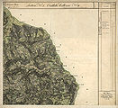
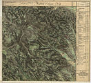
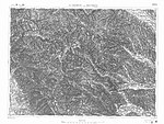
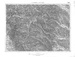
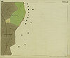
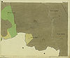
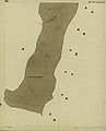
Historical maps
Historical maps are evidence of the use of the Hebalm area for alpine pastures and forest areas and for the traffic relationships in this area:
- Gray = forest, green = meadow, scrub, W. = willow, H = hat willow, light yellow (in these leaves from 1825 it is difficult to distinguish the color from the paper) = alpine pasture or less productive, darker yellow = arable land, brown = path parcels. Yellow buildings = wooden buildings, red buildings = stone buildings. JM = young maize, MH = medium wood, SH = pole wood, HS = high-stemmed, felling forest. Supplements up to the second half of the 19th century are shown in red.
- The Hebalm and its surroundings in regional photographs of the Austro-Hungarian monarchy
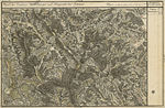
Core area of the Hebalm (bottom left, approx. 1789, Josephinische Landesaufnahme )

West of the Hebalm, in Preitenegg

Weineben and Speikkogel south

western, Styrian part, approx. 1835, Franziszeische Landesaufnahme
western, Carinthian part in Preitenegg
eastern part at Schwarzkogel

Styrian side of Weineben and Koralmzug
Special map of the francisco-josephine (3rd) land survey , depiction 1894, partially corrected until 28th XI. 1913

General map of Central Europe : Koralm , West Styria and Graz Basin, approx. 1893
Special card as of 17. IX. 37

Special map with reporting grid and forest imprint.jpg

Hebalm area 1877/78, recording sheet of the 3rd regional survey


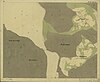
- Commercial areas in the Hebalm area around 1825 ( Franziszeischer Cadastre )

Pack : Stocker Alpe

Pack: Packwinkel district, Steinbauer
Oberpreitenegg : to the west of Lake Eben

Oberpreitenegg: Schreflhof and surroundings

Oberpreitenegg: border properties on the Hofhaltkogel southwest of the border to the former municipality of Pack
Oberpreitenegg: Schreflbach, inner and grave court yard
Oberpreitenegg: southern dreamer court

Osterwitz : end of the Rettenbach valley with the lake Eben

Osterwitz: south of the lake Eben, catchment area of the Stoffbach near Hof Steffelpeter
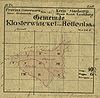
Sketch of the municipality of Kloster on the original file of the Franziszeischen cadastre.

Monastery sheet I: Title sheet (with Freiländer Alm)

Monastery sheet IV: Stocker Alm, southern Hebalm
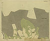
Monastery sheet V: Blochriegel, western Rettenbach

Monastery Blatt II: Freiländer Alm with Filzmoos
Monastery sheet VI: Wolfsriegel, Rometzen

Monastery sheet III: Albrecht and Reinisch

Monastery on sheet III: border to Edelschrott and Modriach


Web links
Individual evidence
- ↑ Franz Binder: Metamorphic rocks of the Koralpenostabhanges. Typewritten dissertation to obtain the doctoral degree at the Philosophical Faculty of the University of Vienna. Hochschulschrift, no publisher, Vienna 1966, no ISBN, pages 1 ff. Literature on mountains with a focus on geology on pages 110–114.
- ^ Atlas of Styria. Map sheet No. 8: Wilhelm Leitner: The surface forms of Styria. Graz 1964. Complete works published by: Akademische Druck- und Verlagsanstalt Graz 1953–1970.
- ↑ a b c Winter: Hebalm ski area
- ↑ Landscape protection area 2: Ordinance of the Styrian state government of May 25, 1981, stmk. State Law Gazette No. 37/1981 in the version of the correction (new map display) No. 64/1981. Map of the protected area in the Digital Atlas Styria. Before that, protection existed under the ordinance of June 12, 1956, LGBl. No. 35, for the protection of parts of the landscape and the landscape (Landscape Protection Ordinance 1956) in the version of the ordinances LGBl. No. 57/1958, 125/1961, 185/1969, 96/1970, 14/1974, 147/1974 and 30/1975, with regard to Annex 1 Z 2.
-
^ Andreas Exner : The forest companies of the Hebalm area, northern Koralpe, Styria. Joannea Botany No. 3/2002. Publication of the Department of Botany of the Styrian State Museum Joanneum , Graz, page 30 with further references to specialist literature on the climate of the area.
Provincial Environmental Information System (LUIS) of Styria: climatic regions C.2 Koralpe and B.4 eastern roofing of the Koralpe. - ^ Atlas of Styria. Rudolf Böhm: Road Network of the State of Styria. Map sheet No. 73. Graz 1964.
- ^ Fritz Pichler: The Styrian Hebalmen. In: Gerhard Pferschy (ed.): Settlement, power and economy. Festschrift Fritz Posch for his 70th birthday. Graz 1981, pages 165-175. Publications of the Steiermärkisches Landesarchiv Volume 12. Owner and publisher: Steiermärkisches Landesarchiv Graz. No ISBN. Here: Page 165: "... even after the Second World War a much blasphemed street, the condition of which had to drive away anyone who drove it ..." This "condition" was not least due to the last days of the war, in which the connection between thousands of civilians and the military was used on the retreat or the flight towards Carinthia before the approaching front.
- ^ Atlas on the history of the Styrian farming community. Manfred Straka: Streets and railways around 1860. Map No. 41. Graz 1972. With reference to FX Hlubek : A true picture of the Duchy of Styria. Gratz 1860. About this atlas: Scientific director: Fritz Posch . Cartographic director: Manfred Straka. Editor: Gerhard Pferschy. Publications of the Steiermärkischen Landesarchives volume 8. Academic printing and publishing house. Graz 1976. ISBN 3-201-01001-4 . The maps in this atlas are based on the “Atlas of Styria” and have different dates. The work emerged from the Styrian state exhibition in 1966, the map overviews shown there and the exhibition catalog: "The Styrian Farmer - Achievement and Fate from the Stone Age to the Present."
- ↑ Arthur Winkler-Hermaden a. a .: Scientific study results of the working group for geological-pedological investigations in the catchment area of the Laßnitz river in south-western Styria. Austrian Academy of Sciences, mathematical and natural science class, Dept. I, 149. Issue 7-10, pages 225-226. Vienna. Peter Beck-Mannagetta : About the geological structure of the Koralpe. In: G (ernot) Weissensteiner: Minerals of the Koralpe . 1. Special volume of the club magazine Die Eisenblüte . Association of Styrian Mineral Collectors, Graz 1979, page 6.
- ^ District topography. Helmut-Theobald Müller (ed.), Gernot Peter Obersteiner (overall scientific management): History and topography of the Deutschlandsberg district. Graz-Deutschlandsberg 2005. ISBN 3-901938-15-X . Styrian Provincial Archives and District Authority Deutschlandsberg 2005. In the series: Great historical regional studies of Styria. Founded by Fritz Posch †. Volume 3. First part, general part. Hartmut Hiden: Geology of the settlement area. Page 11.
- ↑ a b c Geological map of the Republic of Austria 1: 50,000. Published by the Federal Geological Institute Vienna (GBA). Sheet 188 Wolfsberg.
- ↑ G (ernot) Weissensteiner: Minerals of the Koralpe. 1. Special volume of the club magazine Die Eisenblüte . Association of Styrian Mineral Collectors, Graz 1979; also self-observation.
- ^ Eduard Hatle: The minerals of the Duchy of Styria. Verlag Leuschner and Lubensky, Graz 1885, page 110.
- ↑ Josef Taucher, Christine Elisabeth Hollerer: The minerals of the federal state of Styria in Austria. Two volumes with CD-ROM. Verlag Hollerer, Graz 2001, ISBN 3-9501422-0-7 . Volume 2, page 438 (with references to the individual publications).
- ^ Walter Postl: Mineralogicals on the subject of glass and coal. In: Paul W. Roth (ed.): Glass and coal. Catalog for the state exhibition in 1988 in Bärnbach / West Styria. Leykam Verlag, Graz 1988, ISBN 3-7011-7196-3 , page 13.
- ^ Gerhard Niedermayr, Walter Postl, Franz Walter: New Mineral Finds from Austria XXXII. In: Carinthia II. Communications from the Natural Science Association for Carinthia. 173/93. Year, Klagenfurt 1983, point 548, p. 356 ( PDF on ZOBODAT ).
- ^ Gerhard Niedermayr, Bernd Moser, Walter Postl, Franz Walter: New mineral finds from Austria XXXV. In: Carinthia II. Communications from the Natural Science Association for Carinthia. 176/96. Born 1986, Klagenfurt, point 642, page 540.
-
↑ Peter Beck-Mannagetta (1917–1998): The geology of the catchment area of the Laßnitz (West Styria) . In: Communications of the Alpine Geological Association, Volume 34, Vienna 1942, pages 1-37. Furthermore the multi-page bibliography of this author in his obituary: Mitteilungen der Österreichischen Geologische Gesellschaft No. 90 (1997). Vienna 1999, pages 207-212. ISSN 0251-7493 .
Geological map of the Republic of Austria 1: 50,000. Published by the Federal Geological Institute Vienna (GBA). Sheet 188 Wolfsberg.
On the influence on the formation of the Alps, division into crust wedges or parts at the beginning of the Carpathian Mountains and the Dinaric Mountains : Hans Georg Krenmayr, Albert Daurer (editor): Rocky Austria. A colorful geological history of Austria. Geologische Bundesanstalt, Vienna 1999, page 46. ISBN 3-85316-006-9 .
Further literature from Martin Kirchmayer, Peter Beck-Mannagetta: The Beck-Mannagetta'sche Gipfelmulde - degradation in the plate gneiss of the Koralpe, Styria, Austria. Self-published by the authors. Vienna 1990, no ISBN, pages 17–18. - ↑ Martin Kirchmayer, Peter Beck-Mannagetta: summit hollow. Brief summary at the beginning.
- ^ District topography. First volume, general part. Hartmut Hiden: Geology of the settlement area. Page 12.
- ↑ History of the development of Central Eastern Alpine Crystalline. Point 4.2.2.3. in: Helmut W. Flügel, Franz Neubauer: Steiermark. Explanations of the geological map of Styria 1: 200,000. In the series: Geology of the Austrian federal states in brief individual representations (federal state series). Vienna 1984, ISBN 3-900312-12-5 , pages 69-70.
- ^ Christof Exner: Introduction to the geology of Austria. Page 70 (English page 80, French page 88.) 4th part by: Peter Beck-Mannagetta, Rudolf Grill, Herwig Holzer and Siegmund Prey: Explanations on the geological and deposit map 1: 1,000,000 of Austria. 3. Edition. Geological Federal Institute Vienna 1990. ISBN 3-900312-70-2 .
- ↑ Helmut W. Flügel: Geological map of the pretertiary underground. In: Geological thematic maps of the Republic of Austria 1: 200,000. South Styrian Basin - South Burgenland threshold. Published by the Federal Geological Institute. Vienna 1988. Arthur Kröll, Albert Daurer (editor): Explanations of the maps of the pretertiary subsoil of the Styrian basin and the southern Burgenland threshold. ISBN 3-900312-65-6 . Together with relief map, aeromagnetic map and gravity map in a plastic envelope.
- ^ A b Carl Schmutz: Steyermärkisches Lexicon - Historisch-topographisches Lexicon von Steyermark. Printed by Andreas Kienreich Gratz in 1822. Zweyther Theil H – M, page 43 ( Schmutz, hist.-topogr. Lexicon 1822 in the Google book search).
- ↑ A version, tax version, tax rectification, etc. was the compilation of the possessions and rights of a manorial lordship, which had to be created in the context of Maria Theresa's tax reforms in the 18th century as the basis for tax collection (Theresian tax rectification): Heinrich Bartsch: The land table in their present Shape. A brief description of the legal provisions concerning the country table with explanatory examples for practice. Konegen publishing house. Vienna 1890. Quoted from the scan by the Max Planck Institute for European Legal History . Introduction page 1.
-
↑ Quoted from: Franz Pichler: Hebalmen. Page 168. Shorter version without footnotes in:
Franz Pichler: Die steirischen Hebalmen. In: Gerald Schöpfer (Ed.): People, coins, markets. Catalog of the Styrian State Exhibition Judenburg 1989. ISBN 3-900662-16-9 . Pp. 77-79. - ↑ a b Werner Tscherne : From Lonsperch to Deutschlandsberg. Verlag der Stadtgemeinde Deutschlandsberg. Printing: Simadruck Deutschlandsberg. No ISBN. Deutschlandsberg (no year, but according to the entry of the Austrian National Library :) 1990, page 97.
- ↑ Franz Pichler: Hebalmen. Page 171.
- ↑ Franz Pichler: Hebalmen. Page 167.
- ^ District topography. First volume, general part. Werner Tscherne: Commerce, trade and industry. Page 382.
- ^ N. Hardt: Koralpe and Hebalpe . In: Weststeirische Rundschau. April 8, 1967, ZDB -ID 2303595-X , page 1.
- ↑ Franz Pichler: Hebalmen. Pages 165–166 with explicit, clearly negative citation of the article by Hardt and the personal names Heppo, Eppo. Just as Koralm does not depend on the Greek figure of the Kore .
- ↑ Franz Pichler: Hebalmen. Page 165.
- ↑ South of the Gleinalmsattels between Rothmair Alm and Terenbach Alpe, where the paths from Übelbach and the valley of the Kainach meet. Pichler: Hebalmen. Pages 166-167.
- ↑ Hebstatt an der Piberalm (old Stubalmweg, south of Gaberl ). Pichler: Hebalmen. Page 166.
- ↑ Franz Pichler: Hebalmen. Page 168: Wine Route Network.
- ↑ Franz Pichler: Hebalmen , mentioned on page 170, the Judenburger Heber order of 24 May 1449th
- ^ Gerhard Fischer: Osterwitz. a miraculous place in the high pürg. Life, joy and suffering of an area and its inhabitants. Osterwitz 2002. Editor and publisher: Osterwitz community. Production: Simadruck Aigner & Weisi, Deutschlandsberg, no ISBN, page 335.
- ↑ Franz Pichler: Hebalmen. Page 170.
- ↑ Jakob and Wilhelm Grimm: German Dictionary . Volume 4 Forschel Follower. Leipzig 1878. Keyword “gradient” point 3 b). Column 2098, line 74. Reprint Deutscher Taschenbuch Verlag. Munich 1991. dtv 5945. ISBN 3-423-05945-1 . Structure quoted from: The digital Grimm - Electronic edition of the first processing. Version 12/04. Verlag Zweausendeins, Frankfurt am Main. Competence center for electronic cataloging and publication processes in the humanities at the University of Trier in conjunction with the Berlin-Brandenburg Academy of Sciences. ISBN 3-86150-628-9 .
- ↑ Oral communication from residents of the area, written sources not available.
- ↑ Jakob and Wilhelm Grimm: German Dictionary . Volume 4 Forschel Follower. Leipzig 1878. Keyword “gradient” point 1 a). Column 2096 line 56.
- ↑ Jakob and Wilhelm Grimm: German Dictionary . Volume 19 Stob Strollen. Leipzig 1957. Keyword "Stock" column 10 line 17 and "stocken" column 61 line 24.
- ↑ For example in the ordinance on the Koralm tunnel in the Koralm railway, Austrian Federal Law Gazette No. 47/2005.
- ↑ a b Duden Volume 7. The dictionary of origin. Etymology of the German language. 4th edition. Mannheim 2007, ISBN 3-411-04074-2 , page 30.
- ↑ Jakob and Wilhelm Grimm: German Dictionary . Volume 1 A ‑ beer whey. Leipzig 1854. Keyword “Albe”: Column 201 Z 1. Keyword “Alm”: Column 244, line 36.
- ^ Geographical information system GIS of the State of Styria within the framework of the Digital Atlas Styria. Select the map under Historical Maps "Vischer Map 1678".
- ↑ a b c Wilhelm Brandenstein: Review of Paul Zinsli, Grund and Grat. In: Österreichische Alpenzeitung No. 69 (1951), pages 28-29. Furthermore: The place names of the Rauriser valley. In: The nature lover. Issue 3/4 (1932), page 64. Both publications cited from: Fritz Freiherr Lochner von Hüttenbach: Wilhelm Brandenstein. Small name-based work. Academic printing and publishing company. Graz 1978, ISBN 3-201-01038-3 , pages 23-24 and page 84. A similar form in which ‑b‑ becomes ‑m‑ is represented there for Hilbe ‑ Hilm (sheltered, sunny location). The book review quoted concerns: Paul Zinsli; Reason and ridge. The mountains as reflected in the Swiss-German dialects. 352 pages. A. Francke publishing house. Bern 1944.
- ↑ a b c d Austrian map 1: 50,000: sheet 188 Wolfsberg. Recorded in 1959/60. Map revision 1976. Edited by the Federal Office for Metrology and Surveying (regional survey) in Vienna.
- ↑ a b c Austrian map 1: 50,000: sheet 188 Wolfsberg. Recorded in 1959/60. Complete map revision in 1969. Individual supplements in 1971. Edited by the Federal Office for Metrology and Surveying (Landesaufnahme) in Vienna.
- ↑ freytag & berndt hiking, cycling and leisure map WK 237: Saualpe, Lavanttal, Koralpe, region Schilcherheimat 1: 50,000. With leisure guide, GPS points and location register. ISBN 3-85084-322-X .
- ↑ a b Kompass hiking map 1: 50,000. Sheet 218 Koralpe Pack ‑ Soboth edition 01‑94. ISBN 3-87051-650-X .
- ^ Directory of state roads on the Styria traffic server .
- ↑ a b Land Register 61027 Klosterwinkel, District Court Deutschlandsberg, deposit number 19, as of November 2, 2007.
- ↑ a b Basis: k. u. k. Military Geography Institute, predecessor of the Federal Office for Metrology and Surveying (Land Survey) in Vienna: Map 1: 75,000. Zone 18 Col XII. Sheet 5254. D. Landsberg and Wolfsberg. According to drawing key 1894. Geripp: Oberlt. Kimlein. Terrain: Hptm. Pönisch.
- ↑ Provisional edition of the Austrian map 1: 50,000. Sheet 188 Wolfsberg. Published by the Federal Office for Metrology and Surveying (Landesaufnahme) Vienna. Map correction 1940, individual supplements 1954. Compared to its basis, the special map 1: 75,000, this map contains a number of changes, including details.
- ↑ a b c d e Waldbetriebe Ligist ( Memento of the original dated December 7, 2007 in the Internet Archive ) Info: The archive link was automatically inserted and not yet checked. Please check the original and archive link according to the instructions and then remove this notice. of the Grand Priory of Austria of the Sovereign Knights of Malta .
- ^ Austrian map 1: 50,000: sheet 188 Wolfsberg. Recorded in 1959/60. Map continuation 1991. Individual supplements 1993. Edited by the Federal Office for Metrology and Surveying (Landesaufnahme) in Vienna.
- ^ Austrian map 1: 50,000: sheet 188 Wolfsberg. Recorded in 1959, 1960. Map continuation 1998. Edited by the Federal Office for Metrology and Surveying (Landesaufnahme) in Vienna.
- ↑ Maximilian Riederer, Gunther Riedlsperger, Johann Tomaschek: Freiländer Ortschronik . Self-published by the community of Freiland near Deutschlandsberg in 1988, no ISBN, pages 34-35.
- ↑ Home Atlas of Styria. Edited in several deliveries and supplementary volume by the Historical Association for Styria with the support of the Historical State Commission for Styria . Graz 1946-1949. With printing permission from the British Military Government PWB Press- and Printing Section April 25, 1946. Self-published by the Historisches Verein für Steiermark. Sheet 27. Hans Pirchegger: The Eastern Alpine Countries around 1379.
- ↑ Herbert Kriegl: On the outbreak of the plague of 1712 and 1713, part 3. In: Weekly newspaper Weststeirische Rundschau , June 12, 2020. 93rd year No. 24, p. 6.
- ↑ Raimund Dürnwirth : The border barrier Carinthia to Styria in the plague years 1713-1716. In: Carinthia I . Communications from the history association for Carinthia. Edited by August v. Jaksch . 92nd year No. 3–4. ZDB -ID 1438-2 , ISSN 0008-6606 Klagenfurt 1902. p. 87.
- ↑ Herbert Blatnik: Contemporary witnesses remember the years 1938-1945 in Southwest Styria. 2nd Edition. Lerchhaus Verlag Eibiswald. December 2000, ISBN 3-901463-08-9 , page 242-243.
- ↑ Christian Fleck: Koralmpartisanen - About different careers of politically motivated resistance fighters. Ludwig Boltzmann Institute for Historical Social Science, materials on historical social science Volume 4. Verlag Böhlau. Vienna-Cologne 1986, ISBN 3-205-07078-X , pages 129-131.
- ↑ Andreas Exner: Potential natural distribution of the common beech ( Fagus sylvatica L.) in forest communities and on locations in the Hebalm area (northeastern Koralpe). With a plant-sociological overview of the most important types of vegetation on logs, forest-free wet and humid locations and rock corridors in the area. Diploma thesis for obtaining the master’s degree at the University of Vienna, Faculty of Science and Engineering. Vienna 2000.
- ^ Andreas Exner: European beech. Figure 1: Sketch of the location of concentrated beech deposits in the study area. (Map insert after page 4).
- ^ District topography. First volume, general part. Werner Tscherne: Commerce, trade and industry. Pages 383-385.
- ^ Paul W. Roth: Waldglashütten. In: Paul W. Roth (ed.): Glass and coal. Catalog for the state exhibition in 1988 in Bärnbach / West Styria. Leykam publishing house. Graz 1988, ISBN 3-7011-7196-3 , page 123.
- ^ Andreas Exner: European beech. Pages 41–42.
- ↑ Franz Pehr: Floristic from the Hebalpe on the Carinthian-Styrian border. In: Communications from the Natural Science Association for Styria . Volume 62, year 1926, pages 50–56, here: page 54. (PDF; 1.3 MB)
- ↑ Crocus blossom ( Memento of the original from March 4, 2016 in the Internet Archive ) Info: The archive link was inserted automatically and has not yet been checked. Please check the original and archive link according to the instructions and then remove this notice. ; Krokuswiese on the Freiländer Alm ( Memento of the original from March 4, 2016 in the Internet Archive ) Info: The archive link was inserted automatically and has not yet been checked. Please check the original and archive link according to the instructions and then remove this notice. ; Krokuswiese Freiländer Alm ( Memento of the original from March 4, 2016 in the Internet Archive ) Info: The archive link was inserted automatically and has not yet been checked. Please check the original and archive link according to the instructions and then remove this notice. .
- ^ Atlas of Styria. Wilhelm Wolf, Georg Litscher: The cattle breeds of Styria. Map sheet no. 56. Graz 1957. According to documents from the Styrian regional chamber for agriculture and forestry.
- ^ Gerhard Fischer: Osterwitz. Page 178.
- ↑ , Margarete Sekera, Heinrich Hacker (editor), Max Eisenhut (mapping): Austrian soil mapping. Explanations for the soil map 1: 25,000. Mapping area Deutschlandsberg (KB 24) . Published by the Federal Ministry of Agriculture and Forestry (Federal Agricultural and Chemical Research Institute, Soil Mapping and Soil Management). Vienna 1975, pages 150-158. As of 2007 under: Austrian soil mapping of the Federal Research and Training Center for Forests, Natural Hazards and Landscape - BFW, Federal Office for Forests.
- ^ Geographical Information System GIS of the State of Styria. Digital Atlas Styria. Soil protection program. Styria Soil Protection Act State Law Gazette No. 66/1987 with Soil Protection Program Ordinance LGBl. No. 87/1987. Agricultural server of the state of Styria (queried October 12, 2007).
- ^ Andreas Exner: European beech. Page 39.
- ↑ Werner Friedel: An alpine geography of the Koralpe. Inaugural dissertation to obtain the doctoral degree in philosophy at the natural science faculty of the Karl-Franzens University Graz. University publication, no publisher, Graz 1977, no ISBN, pages 245–247.
- ↑ Werner Friedel: Almgeographie. Page 30.
-
^ Günter Fiedler: The farmers at the upper settlement limit of the Styrian Koralpe. Typed dissertation to obtain the doctorate degree at the Karl-Franzens-Universität Graz. Graz 1967. University publication from two volumes (text part, picture part), no publisher, no ISBN.
Friedel: Alpine geography. Page 32 contains a - unfortunately already quite dark - photo of the south side of the Schwarzkogel with the Freiländer Alm from 1975. -
^ Gerhard Fischer: Osterwitz. Almwirtschaft pages 117–126. Lists of owners and farm descriptions on pages 295–421.
District topography, first part, general part: Gerhard Fischer: Bauerntum, agriculture and forestry. Almwirtschaft, pages 347-350. - ↑ Land register 61027 Klosterwinkel, District Court Deutschlandsberg, deposit number 19. Lot 166/1.
- ↑ Land register 63348 Pack, District Court Voitsberg, deposit number 418. Formerly deposit number 1141 of the Landtafel Steiermark.
- ^ Heinrich Bartsch: Country table. Introduction page 3.
- ↑ Jakob and Wilhelm Grimm: German Dictionary . Volume 8 Glibber-Graecist. Leipzig 1958. Keyword “²Grand”. Column 1851, line 28.
- ↑ Jakob and Wilhelm Grimm: German Dictionary . Volume 18 standing ‑ seated. Leipzig 1941. Column 2530 line 1.
- ↑ Richard Zimmerl: Permit, Deutschlandsberg. In: Die Briefmarken, Philatelic trade journal. Volume 43, September 1995, pages 18-27.
- ↑ From West Styrian Holt for 'Halt (e), Viehweide'. According to Claus Jürgen Hutterer, Walter Kainz, Eduard Walcher †: West Styrian Dictionary. Grammar and vocabulary according to subject groups. In the series: Writings on the German language in Austria . Volume 13/14. Edited by Peter Wiesinger. Böhlau publishing house. Vienna-Cologne-Graz 1987, ISBN 3-205-07321-5 , page 297.
- ^ Gerhard Fischer: Osterwitz. Page 257.
- ↑ Weekly newspaper “Weststeirische Rundschau” from September 17, 2010. Volume 83, No. 37. ZDB -ID 2303595-X , page 2.
- ↑ Herbert Kriegl: The Hebalm in its earlier meaning. About “illegal” church services, immoral events and “Bacchus festivals”. In: Weststeirische Rundschau. No. 38, volume 2016 (23 September 2016), 89th volume. ZDB -ID 2303595-X . Simadruck Aigner u. Weisi, Deutschlandsberg 2016, p. 5.
- ↑ Weststeirische Volkszeitung, 1st May 1998 edition. 94th year No. 18, ZDB -ID 2303593-6 , page 4.
- ↑ To the duty room ( page no longer available , search in web archives ) Info: The link was automatically marked as defective. Please check the link according to the instructions and then remove this notice. .
- ↑ Weekly newspaper "Weststeirische Rundschau" . November 27, 2015. Volume 88, No. 48. p. 14.
- ↑ Pictures ( Memento of the original from March 3, 2010 in the Internet Archive ) Info: The archive link was inserted automatically and has not yet been checked. Please check the original and archive link according to the instructions and then remove this notice. the ski area of the Klug lifts.
- ↑ 40 years of Klug-Lifte Hebalm-Freiländeralm. In: Weekly newspaper "Weststeirische Rundschau" from March 7, 2009. Volume 82, No. 10. ZDB -ID 2303595-X page 4.
- ↑ Irmgard Ruhdorfer: Strategic positioning in tourism: illustrated using the example of the Hebalm. Diploma thesis at the University of Graz, 2002. p. 52.
- ↑ Weststeirische Rundschau , April 17, 2015, Volume 88, No. 16. ZDB -ID 2303595-X , p. 5.
- ↑ Final end for the Hebalm ski area. ORF-Styria, May 1st, 2015.
- ↑ Hebalm ski area seems saved. ORF-Styria, May 29, 2015.
- ↑ Weststeirische Rundschau , September 4, 2015, Volume 88, No. 36. P. 7.
- ↑ Hebalm ski area: Sale and continuation probably finally failed. In: Kleine Zeitung , September 2, 2015.
- ↑ The Hebalm ski area is history according to the owners. ORF-Styria, August 27, 2015.
- ↑ Maltese ski lifts on Hebalm were removed. ORF Styria, September 24, 2015.
- ↑ Sheet No. 8530 A-1, published in 1980 by the Leibnitzer Athletics Club (Leibnitzer AC). Area survey by Volkmar Pötsch and Wolf Eberle. Card consultant Sepp Hartinger. Equidistance 5 m.
- ↑ Sheet No. A-St-468, published in 1997 by the Heeressportverband (HSV) Graz. Map drawing by Herwig Allwiger.
- ↑ Unfortunately the popular Hebalmkirtag no longer exists! Website of the Roebuck Hut. (accessed August 31, 2016).
- ↑ Gerhard Fischer. Osterwitz. Page 223.
- ^ Atlas on the history of the Styrian farming community. Gerhard Pferschy: The privileged cattle markets in the 19th century. Map No. 36. Graz 1975.
- ↑ Overview map of the EZ Freiländer Alm. ( Memento of the original dated December 4, 2013 in the Internet Archive ) Info: The archive link was inserted automatically and has not yet been checked. Please check the original and archive link according to the instructions and then remove this notice. raumplanung.steiermark.at (jpg, accessed on July 10, 2019).
- ^ Atlas on the history of the Styrian farming community. Peter Wiesinger: The dialects of Styria. Map No. 12, Part II: The Styrian dialects within the Bavarian-Austrian dialect area word geography . The words cranberries and granten are one of the examples on the card. The explanations on the "coral barrier" can be found in the explanations on this map sheet.
- ↑ Jakob and Wilhelm Grimm: German Dictionary . Volume 8 Glibber-Graecist. Leipzig 1958. Column 1854 Z 2 (grandenberry) and column 1883 Z 1 (Grante).
- ↑ Jakob and Wilhelm Grimm: German Dictionary . Volume 10 H-Juzen. Leipzig 1877. Column 1844, line 56 and column 1849, line 8.
- ^ Claus Jürgen Hutterer, Walter Kainz, Eduard Walcher †: West Styrian Dictionary. Grammar and vocabulary according to subject groups. In the series: Writings on the German language in Austria . Volume 13/14. Edited by Peter Wiesinger. Böhlau publishing house. Vienna-Cologne-Graz 1987, ISBN 3-205-07321-5 , page 338.
- ↑ Jakob and Wilhelm Grimm: German Dictionary . Volume 30 Wilb-Hyssop. Leipzig 1960. Keyword “²Wist”. Column 806 line 12.
- ↑ a b Atlas on the history of the Styrian farming community. Sepp Walter: rural transport. Map No. 40, Part II of Graz 1972: Carter calls for "left" and "right".
Ahorn • Alpl • Ammer • Annaberg • Arlberg • Ascher • Bieler • Birkfelder • Boding • Brenner • Buchauer • Buchener • Dientner • Dürrholzer • Eibegg • Erb • Eisental • Faschina • Feistritz • Fern • Filzen • Flattnitz • Flexen • Forsthof • Furka • Fuscher • Gaberl • Gaden wide • Gailberg • Gangleit • Geiseben • Gerichtsberg • Gerlos • Geschriebenstein • Goller • Grießen • Griffner • Large Kripp • Grubberg • Grünbacher • Gschuett • Hafner • Hahntenn • neck • Haselrast • Hebalm • stallion • Hengstl • Hiaslegg • Hirschegger • Hochegger • Hochrindl • Hochtannberg • Hochtor • Holzleiten • Iselsberg • Josefsberg • Kaiserauer • Cold Kuchl • Kartitscher • Katsch • Kernhofer • Kerschbaumer • Klachauer • Klamm • Klamml • Small Kripp • Klippitz • Klostertaler • Kraxen • Kreuth • Kreuzberg • Kühtai • Lahn • Lienbach • Loibl • Losen • Luft • Mendling • Michelbühel • Moarigraben • Nassfeld • Neumarkter • Niederalpl • Norberts • Nöring • Obdacher • Oberjoch • Och • Pack • Paulitsch • Perchauer • Pfaffen • Pfarralm • Pielachtaler • Piller • Plöcken • Pogusch • Pölshals • Pötschen • Präbichl • Prebersattel • Preiner • Pretal • Promau • Pyhrn • Radl • Radling • Radstädter • Radstatt • Rams • Raneck • Rechberg • Rieder • Rohrer • Sattler • Saurüssel • Schaida • Schanz • Scharflinger • Schiestel • Schober • Schönfeld • Schwarze Sau • Schwarzenbichl • Seeberg • Seefelder • Semmering • Kleiner Semmering • Sieggraben • Silzer • Soboth • Summer • Staller • Styrian Seeberg • Straßegg • Sölk • Thurn • Timmels • Triebener Tauern • Turracher • Origin • Wechsel • Weinebene • Weißenbacher • Wagrainer • Windische • Wurzen • Zellerrain