
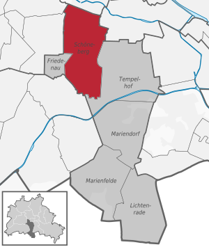
Berlin-Schöneberg
|
Schöneberg district of Berlin |
|
|---|---|
  |
|
| Coordinates | 52 ° 29 ′ 0 ″ N , 13 ° 22 ′ 0 ″ E |
| surface | 10.61 km² |
| Residents | 123,075 (Dec. 31, 2019) |
| Population density | 11,600 inhabitants / km² |
| Incorporation | Oct. 1, 1920 |
| Postcodes | 10777, 10779, 10781, 10783, 10787, 10789, 10823, 10825, 10827, 10829, 12157, 12159, 12161, 12169 |
| District number | 0701 |
| structure | |
| Administrative district | Tempelhof-Schöneberg |
| Locations | |
Schöneberg is a district in the Berlin district of Tempelhof-Schöneberg . Schöneberg was an independent town until 1920 and goes back to a medieval village in the area of today's main street . Between 1920 and the end of 2000 there was an independent district of Schöneberg , which in addition to the eponymous district also included the district of Friedenau . The Schöneberg district was merged with the former Tempelhof district on January 1, 2001 as part of an administrative reform . Since the Tempelhof district had more inhabitants and a larger area than the Schöneberg district, Tempelhof was put in the first position of the name when choosing the name for the newly formed Tempelhof-Schöneberg district.
geography
Schöneberg is a densely built inner-city district of Berlin and lies at the transition from the Berlin-Warsaw glacial valley to the Teltow plateau . The associated increase is noticeable in several places in the district, especially on the main street between Kleistpark U-Bahn station and Kaiser-Wilhelm-Platz . The eastern branch of a tributary of the glacial channel of the Grunewaldseenkette , which is clearly visible in the Rudolph-Wilde-Park, extends over the Schöneberg area . In the north Schöneberg borders on the Tiergarten district , in the east on Kreuzberg and Tempelhof , in the south on Steglitz , in the west on Friedenau and Wilmersdorf and in the northwest on Charlottenburg .
history
Foundation and name origin
Schöneberg was probably founded as a wide street village by German settlers in the first third of the 13th century . The core of Schöneberg's settlement lay along the main street between today's Dominicus and Akazien streets . The Schöneberg village church was on the north side of the street in the center of the village. The village was first mentioned in a document on November 3, 1264, when Margrave Otto III. donated five Hufen land in the village of Schöneberg ("villa Sconenberch") to the nunnery in Spandau .
Although Schöneberg lies on a slight elevation on the northern edge of the Teltow , the name probably does not go back to this "mountain", but is a so-called "desired name". In contrast to what was shown earlier, the German settlement in the east was not due to a population surplus pushing eastwards. In order to attract settlers for the purpose of building power, the locators advertised the villages to be founded and the like. a. with desired name. Place names with beautiful, light, green, rose, summer and rich in many variants are typical . A name transfer from the hometown of the newcomers is unlikely because the desired names were widespread.
In the Landbuch Karl IV. (1375) Schonenberge / Schonenberch / Schonenberg is mentioned with 50 hooves , two of which are parish hooves and one church hoof. The citizen Reiche (Ryke / Rike) from Cölln and his brother had ten duty-free hooves that they cultivate themselves, as did the Cölln citizen Parys with twelve hooves. The rights to taxes and services were heavily divided among numerous beneficiaries. Parys apparently had the most rights. There were 13 Kossäten courtyards and a pitcher .
In the years 1591, 1652 and 1721 a Setzschulze was mentioned, initially with four, later with three free hooves. In 1652 the land rule of the Spandau nunnery ended.
Schöneberg from 1700 to 1870


Around 1750, against the will of the Schönebergers , Frederick II had a second village built right next to Schöneberg for the settlement of Bohemian weavers . This was called Neu-Schöneberg and stretched along the main street to today's Grunewaldstraße . Only when retreating Russian troops burned Schöneberg on October 7, 1760 during the Seven Years' War did the German and Bohemian Schönebergers get closer than neighborly help was necessary to survive. But it was not until 1874 that Alt- and Neu-Schöneberg merged to form a community under Adolf Feurig .
The large field was an area east of today's Naumannstrasse , where farmers from Schöneberg grew potatoes and grain. It was bought by the Prussian military in 1828 . In 1830 a racecourse was built, but it had to give way to the railway in 1841.
In the middle of the 19th century, the city of Berlin expanded beyond its borders into the Schöneberg area. Despite protests from Schöneberg, by order of King Wilhelm I, the area up to the southern end of Potsdamer Strasse was incorporated into Berlin on January 1, 1861, and from then on formed the Schöneberg suburb . As a result of this measure, the population of Schöneberg fell from over 8,000 to 2,700.
Schöneberg in the German Empire
After the founding of the empire in 1871, the population of Schöneberg rose rapidly: in 1871 there were 4,555, in 1900 already 95,998 and in 1919 175,093. Many of the former Schöneberg farmers got rich by converting their fields into coveted building land and selling them. They were called the " farmers of millions ". Within a few decades, a village in the Brandenburg region turned into a large city.

On April 1, 1898, Schöneberg was granted the long-awaited town charter. Exactly one year later it left the district of Teltow as an urban district . In 1898, Rudolph Wilde mayor (since 1902 mayor ). Under Wilde there were initial plans for the construction of the Schöneberg town hall on the dry area of the Mühlenberg next to a swampy fen , which was drained a few years earlier and redesigned as a "city park". The engineers used the excavation from the excavation pits of the Schöneberg underground railway to drain the water . It was the first municipal subway ever to run with five stations between Nollendorfplatz and Innsbrucker Platz . This made Schöneberg the second city in Germany after Berlin to have an underground train. The subway was supposed to link the rapidly growing city and the Bavarian Quarter, which was specifically designed for a middle-class audience, and increase the attractiveness of Schöneberg. It was completed in 1910, the year Wildes died. Under Wilde's successor, Alexander Dominicus , the construction of the town hall was completed in 1914, after the city park had been completed two years earlier. The square in front of the town hall was named Rudolph-Wilde-Platz .
According to drafts by the long-standing city planning officer Paul Egeling , other important buildings were built between 1895 and 1914, including numerous schools, fire stations and administrative buildings as well as the Auguste Viktoria Hospital (AVK), which opened in 1906 .
In November 1910, the Berlin Sports Palace by the architect Hermann Dernburg was opened on Potsdamer Strasse , where the six-day races took place from 1911 . The hall was demolished in 1973.
City of Berlin-Schöneberg
Schöneberg lost a first part of the self-administration rights on April 1, 1912 with the introduction of the Greater Berlin Association , whose task was the uniform development of traffic, buildings and recreational areas in its area. From 1912 to 1920 the official name of the city was Berlin-Schöneberg.
Between the world wars

With the formation of Greater Berlin on October 1, 1920, Schöneberg lost its independence and from then on, together with Friedenau, formed the 11th Berlin administrative district "Schöneberg". The Berlin regional reform with effect from April 1, 1938 resulted in numerous straightening of the district boundaries as well as some major changes to the area. The entire area south of Kurfürstenstrasse now belonged to Schöneberg again - as it had before 1861. At the same time, the area between Nollendorfplatz and Nürnberger Straße , which had previously belonged to Charlottenburg, was incorporated into the Schöneberg district. From the Schöneberg area east of the Anhalter Bahn , the part to the north of the Ringbahn , which at the time extended to about Gontermannstrasse , came to Tempelhof in 1938.
Second World War
The Allied air raids in World War II severely damaged the north and west of Schöneberg in particular; around a third of the entire housing stock was lost. The infamous Sports Palace speech by Propaganda Minister Goebbels on February 18, 1943 , achieved historical fame . In the last days of April 1945, Schöneberg was captured by Red Army troops in the Battle of Berlin .
post war period

Schöneberg belonged to the American Sector of Berlin from 1945 to 1990 . In Rathaus Schöneberg had during the division of Berlin , the Berlin House of Representatives and the Senate of West Berlin located. In the town hall tower is the Liberty Bell , the funds raised from the civilian population of the United States was donated for Berlin. The town hall, the Rudolph-Wilde-Platz and the streets leading to it were the place of many rallies and the state visit of the US President John F. Kennedy . There he gave his speech on June 26, 1963 with the famous quote " I am a Berliner ". In his honor, Rudolph-Wilde-Platz was renamed 'John-F.-Kennedy-Platz' in the same year; the city park was then given the name Rudolph-Wilde-Park .

The Allied Control Council for all of Germany had its seat in the building of the Chamber Court in Heinrich-von-Kleist-Park . From May 8, 1945 until the founding of the two German states in 1949, this Control Council was the supreme government authority in Germany. The "Allied Aviation Security Center" was later housed there. Since the German reunification , the building has been used again for the highest courts in Berlin .
Since 1946 the radio programs of the RIAS Berlin (radio in the American sector) have been broadcast from Schöneberg . Initially as wire radio from the telegraph office in Winterfeldtstraße, from 1948 from the radio house in Kufsteiner Straße 69 on today's Hans-Rosenthal-Platz near Rudolph-Wilde-Park . Until 1990, this source of information was very important for the GDR population and the address was very well known. Today the program of Deutschlandradio Kultur is produced there. The house with the listed “RIAS” logo is visible from afar.

Until 1959, the German University of Politics was located on Badenschen Strasse in the immediate vicinity of Schöneberg Town Hall , but when it was integrated into the Otto Suhr Institute of the Free University of Berlin, it moved to Dahlem . The newly established Berlin University of Applied Sciences has had its headquarters there since 1971 .
More than 22,000 new apartments had been built by 1966. At the end of the 1970s, many old buildings along the Berlin-Potsdam railway were to give way to the planned expansion of the western bypass, which was prevented by the commitment of the local residents. At the beginning of the 1980s, the area around Winterfeldtplatz and Potsdamer Strasse was one of the main theaters of clashes between squatters and the Berlin police. Schöneberg currently has 123,075 inhabitants (as of December 30, 2019).
City quarters

Schöneberg is home to several city quarters and locations with a specific characteristic or history:
Southeast City West

In the metropolitan area around Wittenbergplatz and Tauentzienstrasse in the north-west of Schöneberg, upscale retail dominates, especially in Tauentzienstrasse, with numerous label stores and the KaDeWe as Germany's leading department store. The area is (like the adjacent parts of Tiergarten and Charlottenburg) part of Berlin City West . Most of the City West, however, belongs to Charlottenburg-Wilmersdorf.
The names 'Wittenbergplatz' and 'Tauentzienstrasse' are reminiscent of the Battle of Wittenberg under General von Tauentzien during the Napoleonic Wars of Liberation .
The area around KaDeWe between Nürnberger Straße and Nollendorfplatz was only assigned to the former Schöneberg district with the Berlin territorial reform on April 1, 1938 . Before that, it had belonged to the Charlottenburg district. The reason for this was the straightening of numerous district boundaries within Berlin.
Bavarian quarter
The Bavarian Quarter is in the west of Schöneberg . It was built during the term of office of the Schöneberg Lord Mayor Rudolph Wilde in the years before the First World War . Schöneberg left the development of the Bavarian Quarter to the Berlinische Bodengesellschaft, which was founded in 1890 by the entrepreneur Salomon Haberland and his son Georg . In its original state, elegant facades in the South German Renaissance style shaped the quarter, some of whose streets are named after Bavarian cities. Many prominent personalities like Albert Einstein lived here. The Bavarian Quarter was also known as “Jewish Switzerland” because of its high proportion of Jews . The persecution of Jews in Berlin in the Nazi era , the monument commemorates Places of Remembrance in the Bavarian Quarter , which is installed at 80 streetlights since 1,993th The Bavarian Quarter was badly damaged in the Second World War and has largely been rebuilt in the typical architectural style of the 1950s.

Preserved Gründerzeit development
New building in the style of the post-war years


Kielgan district

The Kielgan district north of Nollendorfplatz, which is only rudimentarily recognizable today, was characterized by several small cul-de-sacs and a development with country houses and town villas . After the severe war damage, only a few of the original buildings have survived today, including Villa Ahornstrasse 4, where the Croatian embassy is located.
Nollendorfkiez

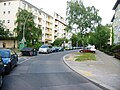
In the Nollendorfkiez around Fuggerstraße , Motzstraße and Nollendorfplatz there are numerous pubs, bars and shops that are mainly aimed at a homosexual audience. Every year on a weekend in June, the lesbian and gay " Motzstraßenfest " takes place in this part of Berlin . With a mixture of information stands for same-sex groups, show stages, as well as snack bars and sales stands, it now attracts thousands of visitors and has developed into a tourist attraction.
The area was already in the Roaring Twenties as a so-called gay village , a district that has a dense infrastructure and cultural offerings for homosexual and transgender people and in this way is intended to offer a non-discriminatory space for queer people. One of the first contemporary witness reports on this is the autobiographical novel Lebwohl, Berlin by the British author Christopher Isherwood , who lived for two and a half years at Nollendorfstrasse 17, where a large part of the plot of the book takes place. The novel was, among other things, the template for the musical Cabaret .
The area is characterized by partially completely preserved streets from the Wilhelminian era and imperial jewelery places such as Winterfeldtplatz or Viktoria-Luise-Platz .

Maassenstrasse at night
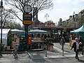
Weekly market on Winterfeldtplatz


Hauptstraße and Akazienkiez


The area of the main street between Dominicusstraße and Grunewaldstraße is the area of the former village of Schöneberg. The village character is barely recognizable. However, a few houses and in particular the Schöneberg village church are still reminiscent of the former village .
In the area of the former village of Alt-Schöneberg, the large concentration of churches and church community centers is striking. Immediately next to the Protestant village church is the Protestant Paul Gerhardt Church , behind it (facing Dominicusstrasse) the Catholic Church of St. Norbert . On the other side of the main street is the community center of the Baptists Schöneberg, as well as the building of the Immanuel Diakonie supported by the Baptists Schöneberg . The parishes of the churches mentioned work together within the framework of the “Kleine Ökumene Schöneberg”.
The main street is - like the Potsdamer Straße - a busy shopping street. One focus of shopping is in the Kaiser-Wilhelm-Platz area . It was redesigned in 2007 and equipped with a new fountain. In the square there is a memorial plaque for the victims of the concentration camps with the title “Places of horror that we must never forget” and the names of twelve concentration camps.
The Akazienkiez around Akazienstrasse , which branches off from the main street with Belziger Strasse, is a neighborhood with a slightly alternative flair and many small shops, pubs and cafes.
Together with Goltzstraße to the north and Winterfeldtplatz to the north (with the large weekly market ), the Akazienkiez forms a very vital counterpart with many cafés and pubs as well as craft shops. This neighborhood center extends in an easterly direction across Kaiser-Wilhelm-Platz to the Rote Insel .
Potsdamer Strasse
The city quarters on both sides of Potsdamer Straße belonged to the former Schöneberg suburb of Berlin until 1920 . The area of Schöneberger Vorstadt south of Kurfürstenstrasse is part of the Schöneberg district.
During the division of Berlin, especially since the construction of the Berlin Wall in 1961, the Schöneberg section of Potsdamer Strasse lost its importance as a shopping street. Businesspeople on Potsdamer Strasse, which was once important and became increasingly unattractive in the post-war period, are trying to improve its image as a shopping street.
In Potsdamer Straße 188-192 , the head office was located until end of August 2008 Berlin Transport Authority (BVG).
Red island

The Rote Insel has developed - including several railway lines - in the east of Schöneberg and traditionally has a politically “red” - that is, a more left - orientation of its working-class population. The former resident population of the 1930s and 1940s put up some considerable resistance to National Socialism . The Queen Luise Memorial Church from 1912 and the striking Schöneberg Gasometer are of architectural significance . As an architectural landmark, the industrial monument on today's EUREF Campus towers over the entire Red Island.
The Old Twelve Apostles Cemetery is one of the most important burial places in Berlin in terms of art and cultural history and is, among other things, the final resting place for Friedrich von Falz-Fein , the founder of the Askanija-Nowa nature reserve in Ukraine, which still exists today .
The east-west green corridor opened in 2012 with the central Alfred Lion footbridge connects the island across the tracks to Tempelhof and the Schöneberg loop to the park at Gleisdreieck .

Marlene Dietrich's birthplace in Leberstrasse

Julius-Leber-Brücke S-Bahn station at night

Urban gardening in the Inselgarten on the Red Island, 2016

.jpg)

Dominicus Street

On Martin-Luther- and Dominicus -Straße, the public administration dominates around John-F.-Kennedy-Platz with the district office, the Senate administrations for economy, energy and companies as well as justice ( Nordsternhaus ), at Heinrich-von-Kleist-Park , State Constitutional Court and Chamber Court .
Sachsendamm / Schöneberger lens
This area comprises the area between the Wannseebahn and the suburb of Tempelhof and between the Ringbahn and the southern city ring including the Schöneberg motorway junction . The site is dominated by commercial areas and roads . The Sachsendamm runs through the area as a dominant street. The area north of the Sachsendamm is also known as the "Schöneberger lens". It refers to the area of the expanding and then closing routes of the Ringbahn and the Sachsendamm.
There are commercial areas in Alboinstraße , Werzeit Weg , Naumannstraße and with Möbel Höffner on the site of the former cycling stadium. Large branches of Bauhaus and Ikea were established on the site of the former Reichsbahn repair shop in Berlin-Tempelhof (RAW Tempelhof) . The Südkreuz station , formerly Papestrasse station , which opened in 2006 , and the establishment of a community of interests for the property owners of the "Schöneberger Linse" are promoting the development of the "Schöneberger Linse" area.
Ceciliengärten settlement

Exemplary urban development can be seen in the Cecilien Gardens based on the urban quarter that was created in the 1920s and is now a listed building. The facade decoration of the building with the realistic depictions of everyday life and the traffic that was modern at the time as well as the formal language of the door designs make the Ceciliengärten a public open-air museum of Art Deco . The central square, designated as a horticultural monument, with the large fountain fountain , the small fox fountain by Max Esser and the two statues of women, The Morning and The Evening by the artist Georg Kolbe, complete the complex. The Japanese cherry trees, which bloom pink every year in April and May, form a handsome canopy of flowers over the street and compete with the city-famous Britz blossom.
Quarter around Grazer Platz
The area around Grazer Platz between the lines of the S-Bahn lines S1 ( Wannseebahn ) and S2 ( Anhalter Bahn ), as well as between the motorway ring road and the south-western district boundary of Schöneberg, is predominantly a residential area. Directly on Grazer Platz and Grazer Damm there is a settlement from the time of National Socialism . To the west of it is rental housing from the Wilhelminian era , to the east of the Grazer Damm settlement is an extensive allotment area . In the southernmost tip of the area near the Priesterweg S-Bahn station is the Insulaner green area with a planetarium and observatory .
South area

For the Schöneberg southern area between the Sachsendamm and the border with the Steglitz district , plans for extensive development already existed during the imperial era . However, these were not implemented; only the Priesterweg S-Bahn station was completed in 1928 . The largest contiguous allotment garden in Berlin to date was created on the undeveloped areas of the southern area . At the end of the 1930s, the settlement on Grazer Damm was built on the western edge of the southern area , an example of housing architecture during the National Socialist era . In the east of the southern area, the extensive facilities of the Tempelhof marshalling yard stretched along the Anhalter and Dresdener Bahn . After the Second World War, a large part of the railway system was shut down and gradually reclaimed by nature. The Schöneberger Südgelände Nature Park is located on these areas today . Hans-Baluschek-Park is located directly to the west of the Südkreuz - Priesterweg S-Bahn line .

In the west is the so-called Dürerkiez , also known as the Malerviertel , which the local media often mistakenly assigned to neighboring Friedenau , for example in the reports about the Nobel Prize winner for literature Herta Müller, who lives here . This is probably mainly due to the fact that the Friedenau S-Bahn station is located here and the actual district of Friedenau only begins a few streets further west. Generous bourgeois development from the turn of the 20th century prevails here .
South of the Prellerweg lies the Insulaner , a mountain of rubble that was piled up in the years after the Second World War . At its foot is the Planetarium at the Insulaner , which opened in 1965 , as well as the “Sommerbad am Insulaner” and at its summit the Wilhelm Foerster Observatory, which opened in 1963 .
Lindenhof settlement

The Lindenhof housing estate in the extreme southeast of Schöneberg is an example of cooperative housing construction in the 1920s. Its construction was significantly advanced by the social democratic Schöneberg city planning officer Martin Wagner . The settlement was supposed to combine the concept of cooperative self-help with urban planning borrowings from the garden city idea. The Martin-Wagner-Brücke over the Lindenhofsee is the only bridge in Schöneberg that crosses a body of water. In the neighborhood of the settlement are the garden monument Alboinplatz and the II. Municipal cemetery Eythstraße .
See also
- Rudolph-Wilde-Park - in detail on the development of Schöneberg and the construction of the Berlin subway at the beginning of the 20th century
- Alboinplatz - in detail on the natural monuments “Blanke Helle” and “Krummer Pfuhl” ( dead ice holes ) as well as the listed Lindenhof housing estate
- Wartburgplatz - in detail about the inner city green area
economy
In the district, small and medium-sized companies dominate in the areas of trade, services as well as the catering and hotel industries.
traffic
railroad
With the Südkreuz station, which opened in 2006 , Schöneberg has a direct connection to the long-distance and regional transport of Deutsche Bahn . The station is served by the ICE line Hamburg - Berlin - Leipzig - Munich , among others .
Train
Schöneberg is served by the Wannseebahn (line S1), the Dresdener Vorortbahn (line S2), the Anhalter Vorortbahn (line S25) and the Berlin Ringbahn (lines S41, S42, S46 and S47). Important junctions are the Schöneberg and Südkreuz S-Bahn stations .
Subway

Schöneberg is served by the underground lines U1 , U2 , U3 , U4 and U7 . The subway stations Wittenbergplatz and Nollendorfplatz are important hubs and also of particular architectural importance . The underground line U2 runs east of Nollendorfplatz as an elevated railway . The resulting required become House passage on Dennewitzplatz was up to the destruction of the "driven through" the house during World War II a highly regarded curiosity . The U4 line, which emerged from the Schöneberg subway , is entirely within the Schöneberg area. A special feature is the Rathaus Schöneberg underground station , which is above ground and has windows to the Rudolph-Wilde-Park .
Private transport
The city motorways A 100 (city ring) and A 103 (west bypass ) are connected to each other at the Schöneberg motorway junction . The A 100 crosses under Innsbrucker Platz in a 270 meter long tunnel to the west of the motorway junction . Other important traffic axes are the so-called " Generalszug " Tauentzienstrasse - Kleiststrasse - Bülowstrasse , the street An der Urania - Martin-Luther-Strasse - Dominicusstrasse - Sachsendamm as well as the Bundesstrasse 1 on the street Potsdamer Strasse - Hauptstrasse (- Dominicusstrasse - A 103).
The Hobrecht plan originally provided for a straight continuation of Bülowstrasse to the east. However, the railway facilities on the Gleisdreieck site expanded so quickly that the “general train” had to be moved south to cross the railway site under the Yorckbrücken . The resulting curve of Bülowstrasse, the “Bülowbogen”, gave the ARD television series Praxis Bülowbogen its name.
The widening and the extra-wide green strip in the intersection area on Urania / Lietzenburger Straße go back to plans for a motorway-like elevated road that have since been abandoned. As part of the " Inner City Plan ", there are considerations to redesign this area. Other relics of traffic planning from the post-war period can be found in Hohenstaufenstrasse and Pallasstrasse. According to a plan that has meanwhile been abandoned, this street should be expanded to consist of multiple lanes. For this purpose the house at Hohenstaufenstrasse 22 was also to be demolished; However, it is still on the planned route of Hohenstaufenstrasse and must be bypassed in a narrow curve. The northern underpass of the Pallasseum , which is not used by road traffic, also testifies to the unfinished expansion plans for Pallasstrasse .
Sports
The soccer club FC Internationale Berlin , based in Schöneberg, opposes the commercialization of the soccer game.
building
town hall
- Schöneberg Town Hall with the Liberty Bell on John-F.-Kennedy-Platz (formerly Rudolph-Wilde-Platz )
Churches


- Evangelical Apostle Paul Church on Grunewaldstrasse (1892–1894) by Franz Schwechten
- Evangelical Free Church Baptist Church on Hauptstrasse
- Evangelical village church Schöneberg on Hauptstrasse (1764–1766) by Johann Friedrich Lehmann
- Evangelical Queen Luise Memorial Church on Gustav-Müller-Platz on the Red Island (1910–1912) by F. Berger
- Evangelical Luther Church on Dennewitzplatz (1891–1894) by Johannes Otzen
- Evangelical Michaelskirche on Bessemerstraße (1955–1956)
- Evangelical Nathanael Church on Grazer Platz (1903) by Jürgen Kröger
- Evangelical Paul Gerhardt Church next to the village church (1958–1962) by Hermann Fehling and Daniel Gogel, in place of a destroyed previous building (1908–1910) by Richard Schultze
- Evangelical Silaskirche on Großgörschenstrasse
- Evangelical Church of Heilsbronnen on Heilbronner Strasse in the Bavarian Quarter (1911/1912) by Ernst Deneke
- Evangelical Twelve Apostles Church on Kurfürstenstrasse, designed by Friedrich August Stüler (1864), built by Hermann Blankenstein and Julius Emmerich (1871–1874)
- Roman Catholic St. Elisabeth Church on Kolonnenstrasse (1910/1911) by the Cologne cathedral builder Bernhard Hertel
- Roman Catholic St. Konrad Church on Rubensstrasse (1958) by architect Schaefers
- Roman Catholic St. Matthias Church on Winterfeldtplatz (1893–1896) by Engelbert Seibertz
- Roman Catholic St. Norbert Church on Dominicusstrasse (1913–1918) by Carl Kühn , extensively rebuilt (1958–1962) by Hermann Fehling , Daniel Gogel and Peter Pfankuch
- New Apostolic Church Berlin-Schöneberg in Erfurter Strasse on Innsbrucker Platz
Embassy building
- Croatian Embassy in Berlin at Ahornstrasse 4 (Villa Geisberg)
- Embassy of the Republic of Argentina at Kleiststrasse 23–26
Personalities
Personalities born in Schöneberg
- (sorted by year of birth)
- Otto Colosser (1878–1948), architect and politician ( Economic Party , DStP ), city councilor in Berlin, 1927/1928 member of the Prussian state parliament , member of the Reichstag from 1928 to 1932
- Martin Luserke (1880–1968), reform pedagogue, bard, theater maker, writer
- Wilhelm Furtwängler (1886–1954), conductor of the Berliner Philharmoniker , was born at Maaßenstraße 1 (memorial plaque)
- Erich Kuttner (1887–1942), journalist, author, member of the state parliament in Prussia , emigrant and resistance fighter against National Socialism
- Herman-Walther Frey (1888–1968), administrative lawyer, musicologist and art historian
- Nelly Sachs (1891–1970), writer, was born at Maaßenstraße 12 (memorial plaque)
- Werner Dehn (1889–1960), rower, bronze medal winner at the 1912 Summer Olympics
- Marlene Dietrich (1901–1992), actress, was born at Leberstrasse 65 and lived as a child at Potsdamer Strasse 116 (memorial plaques on each of the houses mentioned). Her grave is in the Schöneberg III cemetery .
- Arthur Georgi (1902–1970), publisher , bookseller , partner in Paul Parey Verlag and first chairman of the German Booksellers Association
- Wolfgang Langkau (1903–1991), officer, most recently in the rank of major general in the reserve of the Bundeswehr and member of the Federal Intelligence Service
- Hermann Ehlers (1904–1954), politician ( CDU ), President of the Bundestag , was born at Gotenstrasse 6 (memorial plaque)
- Karl Gaile (1905–1979), politician (KPD / SED), interbrigadist and diplomat
- Heinrich Wilhelmi (1906–2005), engineer and university professor, pioneer of computing, measurement, control and regulation technology
- Karl-Adolf Zenker (1907–1998), the naval officer, vice admiral of the German Navy, most recently inspector of the navy , was born on July 14, 1907 in Schöneberg
- Alfred Lion (1908–1987), founder of the New York jazz label Blue Note , was born at 22 Wielandstrasse
- Gisèle Freund (1908–2000), photographer and sociologist
- Rupprecht von Keller (1910–2003), diplomat
- Willi Stoph (1914–1999), politician ( SED ), a. a. President of the Council of Ministers of the GDR , was born in what was then Sedanstrasse (today: Leberstrasse)
- Heinz Spitzner (1916–1992), actor
- Oskar Kusch (1918–1944), first lieutenant at sea and commander of the U 154 submarine, executed as a critic of the Nazi regime
- Helmut Newton (1920–2004), photographer, born in Schöneberg, buried next to Marlene Dietrich . Memorial plaque on the house where he was born, Innsbrucker Straße 24
- Alfred Cardinal Bengsch (1921–1979), Catholic Bishop of Berlin, memorial plaque on the residential building at Tempelhofer Weg 26
- Liane Berkowitz (1923–1943), resistance fighter , lived at Viktoria-Luise-Platz 1, where a plaque commemorates her. Liane-Berkowitz-Platz in the neighboring district of Friedenau is named after her
- Peter Hartmann (1923–1984), linguist and university professor
- Hildegard Hendrichs (1923–2013), sculptor and painter of Christian sacred art
- Klaus Willerding (1923–1982), functionary, politician and diplomat
- Konrad von Rabenau (1924–2016), theologian, binding researcher and local politician
- Shlomo Shafir (1924–2013), originally Selimar Frenkel , journalist and editor-in-chief
- Siegfried Leibholz (1925–2005) secret service officer and major general
- Dieter Ranspach (1926–2017), actor and voice actor
- Ted Herold (* 1942), pop singer
- Hugo Egon Balder (* 1950), entertainers, grew up in the Semperstraße on
- Corinna Rohn (* 1969), building researcher
People who once or now lived in Schöneberg
- (in alphabetical order)


_Claire_Waldoff.JPG)
- Hans Baluschek , painter and graphic artist, lived in the studio tower in the Cecilien Gardens from 1929–1933 (memorial plaque on Semperstrasse 5)
- August Bebel , co-founder of the SPD (memorial plaque Hauptstrasse 97)
- Gottfried Benn , the doctor and poet lived 1937–1956 at Bozener Straße 20 in the Bavarian Quarter (memorial plaque)
- David Berger , author and editor-in-chief of the magazine Männer , has lived on Habsburgerstrasse since August 2012
- Eduard Bernstein , social democratic politician, city councilor and city councilor in Schöneberg, lived at Bozener Straße 18 (memorial plaque) from 1918 to 1932 and has his grave in the municipal cemetery in Eisackstraße
- David Bowie , British musician, lived at 155 Hauptstrasse from 1976–1978
- Rudolf Breitscheid , Social Democratic member of the Reichstag and Prussian Interior Minister, lived in the Bavarian Quarter, Haberlandstrasse 8a, in 1932/1933 (house destroyed, memorial stone in front of the new building)
- Ferruccio Busoni , the pianist and composer lived at Viktoria-Luise-Platz 11 (memorial plaque), his grave is in the Friedenauer Friedhof Schöneberg III
- Leonardo Conti , from 1939 “Reichsärzteführer”, lived in Kleiststrasse 37 from 1905 during his childhood and youth
- Nanna Conti , midwife, 1933–1945 “Reich midwife leader”, lived from 1905 to around 1937 at Kleiststrasse 37
- Albert Coppenrath , 1929–1941 pastor at the Catholic Church of St. Matthias
- Franz Czeminski , City Councilor
- Alexander Dominicus , Mayor of Schöneberg from 1911–1921
- Albert Einstein , the physicist and Nobel Prize winner lived in the Bavarian Quarter, Haberlandstrasse 5 (house destroyed, memorial stone (see picture) in front of the new building in the same place, today Haberlandstrasse 8) from 1918–1933
- Jeffrey Eugenides , writer
- Hans Fallada , writer, spent his childhood at Luitpoldstrasse 11 (the house no longer exists)
- Jörg Fauser , writer, lived at Goebenstrasse 10 from 1981–1984
- Fler , German rapper
- Edgar Froese , composer, musician, head of the music group Tangerine Dream , started his music career in Schwäbische Str.
- Clemens August Graf von Galen , bishop and cardinal (“The Lion of Münster”), lived 1906–1911 as a chaplain and from 1919–1929 as pastor of St. Matthias on Winterfeldtplatz (old rectory destroyed, memorial plaque on the church)
- Hermann Ganswindt , rocket pioneer
- Joachim Gauck , Federal President , lived on Nymphenburger Strasse until July 2012
- Sepp Herberger , football coach, lived at Bülowstrasse 89 from 1937 to 1944 until he was bombed there (memorial plaque)
- Georg Hermann , writer
- Theodor Heuss , liberal politician and later Federal President lived at Fregestraße 80 from 1918 to 1930 (memorial plaque)
- Leon Hirsch , bookseller, publisher and cabaret artist , had his last apartment before emigrating in 1933 at Bozener Straße 10
- Michael Hirschberg , lawyer and resistance fighter , lived at Winterfeldtstrasse 8 until his arrest in 1935 (memorial plaque)
- Karl Hofer , a plaque on the house at Grunewaldstrasse 44 reminds of the painter
- Arno Holz , poet, lived in the Bavarian Quarter, Stübbenstrasse 5 (memorial plaque),
- Christopher Isherwood , the English writer lived at Nollendorfstrasse 17 between 1930 and 1933 (memorial plaque, it incorrectly says that he lived on this street from 1929)
- Karl Kautsky , social democratic politician. A plaque commemorates him on Saarstrasse 14
- Joachim Kemmer , actor, cabaret artist and voice actor, Crellestraße 41 (memorial plaque)
- Friedrich Kiel , composer and teacher at the Stern Conservatory and the University of Music , lived in Potsdamer Strasse and was buried in the Old Twelve Apostles Cemetery
- Klaus Kinski , actor, lived at Wartburgstrasse 3
- Egon Erwin Kisch , journalist. The "mad reporter" lived in the 1920s in the house at Hohenstaufenstrasse 36 (memorial plaque)
- Erich Klausener , Catholic politician and resistance fighter, lived at Keithstraße 8 until he was murdered by the National Socialists (memorial plaque)
- Hildegard Knef , actress and singer, grew up on the Red Island on
- Else Lasker-Schüler , poet, lived at Motzstrasse 7
- Walter Leistikow , painter of the Berlin Secession , apartment and studio at Geisbergstrasse 33 (destroyed)
- Wilhelm Adolf Lette , founder of the Lette-Verein educational institute on Viktoria-Luise-Platz
- Friedrich Luft , popular theater critic ("voice of criticism"), grew up in Bundesallee 74 (then: Kaiserallee ) and later lived near Nollendorfplatz in Maienstraße 4 (memorial plaque).
- Rosa Luxemburg , socialist, author, lived at Cranachstrasse 58 from 1902 to 1911; In front of the building there is a memorial plaque on a district-owned garden plot
- Herta Müller , writer from the Banat and winner of the Nobel Prize for Literature , lives on Menzelstrasse in the Dürerkiez
- Friedrich Naumann , liberal politician, lived in Schöneberg (memorial plaque Naumannstrasse 24)
- Erwin Piscator , director, Piscator stage on Nollendorfplatz , now Metropol (memorial plaque)
- Iggy Pop , American musician, lived on High Street in the 1970s
- Walter Scheel , liberal politician and former Federal President , lived in Schöneberg until 2008
- Gerhard Seyfried , comic book artist and writer
- Renée Sintenis , sculptor and graphic artist. The house of her last apartment at Innsbrucker Straße 23a bears a memorial plaque
- Rudolf Steiner , the founder of anthroposophy lived and worked with his wife Marie von Sievers for 20 years at Motzstraße 30 (memorial plaque)
- Robert Uhrig , communist resistance fighter, lived at Wartburgstrasse 4 until his imprisonment in 1942 (memorial plaque)
- Claire Waldoff , chanson singer. The "Berolina des Chansons" lived 1919–1933 at Regensburger Strasse 33 (memorial plaque)
- Ernst Weiß , doctor and writer, lived at Luitpoldstrasse 34 (memorial plaque)
- Billy Wilder , director, lived at Viktoria-Luise-Platz 11 in his younger years (memorial plaque)
- Paul Zech , expressionist and combative writer, lived at Naumannstraße 78 from 1925 to 1933 (memorial plaque)
- Carl Zuckmayer , writer and playwright lived near the Schöneberg town hall in the city park, there is also a memorial plaque; the Carl-Zuckmayer-Brücke above the Rathaus Schöneberg underground station also bears his name (see: Rudolph-Wilde-Park )
Selection of personalities who are buried in the Old St. Matthew Cemetery at Großgörschenstraße 12
- Carl Bolle , owner of the dairy
- Max Bruch , composer
- Jacob Grimm , linguist and literary scholar and lawyer
- Wilhelm Grimm , linguist and literary scholar and fairy tale collector
- Gustav Robert Kirchhoff , physicist ( Kirchhoff's laws )
- Ovo Maltine , AIDS activist
- Rio Reiser , musician
- Rudolf Virchow , natural scientist
- Resistance fighters of July 20, 1944 , executed, buried, exhumed , cremated and subsequently scattered as a result:
See also
- List of streets and squares in Berlin-Schöneberg
- List of cultural monuments in Berlin-Schöneberg
- List of stumbling blocks in Berlin-Schöneberg
literature
- Werner Bethsold: Schöneberg, an area in Berlin . Berlin 1977. (photo documentation)
- Stefan Eggert: Walks in Schöneberg = Berlin reminiscences 78. Haude & Spener publishing house, Berlin 1997, ISBN 3-7759-0419-0 .
- Christian Simon: "It was in Schöneberg in May ..." Schöneberg through history. be.bra verlag, Berlin-Brandenburg 1998.
- Helmut Winz: It was in Schöneberg. From 700 years of Schöneberg history. Haupt & Puttkammer, Berlin 1964. (The title takes up the old street hit Das war in Schöneberg, in the month of May by Walter Kollo , when the place was still a destination for the petty bourgeois in Berlin.)
- Berliner Geschichtswerkstatt (Ed.): "That was a completely closed society here". The Lindenhof: A cooperative housing estate in the big city. Nishen Verlag, Berlin 1987, ISBN 3-88940-133-3 .
- Gudrun Blankenburg: The Bavarian Quarter in Berlin Schöneberg. Life in a history book. Hendrik Bäßler Verlag, Berlin 2012, ISBN 978-3-930388-60-8 .
Web links
- Schöneberg district newspaper with articles about the historic Schöneberg
- History of the village of Schöneberg ( Memento from March 25, 2014 in the Internet Archive )
- Picture gallery of Schöneberg places / squares
Individual evidence
- ↑ For example: Schönebeck, Schöneberg, Schöneiche, Schönerlinde, Schönfeld, Schönefelde, Schönermark, Schönfließ, Schönhausen, Schönholz, Schönow and Schönwalde. See desired and advertising names for today's Rosenhof senior citizens' residence .
- ↑ Brandenburgisches Namenbuch , Vol. 3: Die Ortnames des Teltow , Weimar 1972, p. 162.
- ↑ The Setzschulze is a Schulze appointed by the rulers .
- ↑ Lieselott Enders , Klaus Neitmann (ed.): Historisches Ortslexikon für Brandenburg: Teltow, Part 4, 2011, ISBN 978-3-941919-81-5 , p. 257 ( limited preview in the Google book search).
- ↑ a b Papestrasse history trail (PDF; 5.2 MB) Tempelhof-Schöneberg district office, 2006
- ↑ Ralf Schmiedecke: Berlin-Schöneberg: not just “like once in May” . Sutton-Verlag, Erfurt 2005, ISBN 978-3-89702-729-9 , p. 7 ( limited preview in the Google book search).
- ^ Friedrich Leyden: Greater Berlin. Geography of the cosmopolitan city. Hirt, Breslau 1933 (therein: Development of the population in the suburbs of Berlin. Pp. 207 ff.).
- ^ Rolf Jehke: Territorial changes in Germany and German administered areas 1874-1945. 2004, accessed June 15, 2008 .
- ↑ April 1 (1912) in daily facts of the Luisenstädtischer Bildungsverein (at the DHM ).
- ↑ Chronology of the house-to-house fighting in Berlin
- ↑ Salih Alexander Wolter: Is war or what? Queer Nation Building in Berlin-Schöneberg. June 15, 2012, accessed December 14, 2018 .
- ↑ siegessäule - queer Berlin - Home. www.siegessaeule.de, accessed on December 14, 2018 .
- ↑ The well is still growing. In: Berliner Zeitung , July 6, 2007.
- ↑ Development plan Schöneberger Südgelände , Hermann Jansen ; Architecture museum in the university library of the TU Berlin
- ↑ City map of Berlin . Verlag Karl Sanwald, 1927.
- ↑ A. Gruhn-Zimmermann: Architecture and building history of the Priesterweg S-Bahn station ( memento from July 24, 2012 in the web archive archive.today ). Architectural monuments in Berlin, 1989.
- ↑ Marina Naujoks: Off to Samoa! If it's not enough for the South Seas: The southern area. Schöneberg district newspaper, June 2006.
- ^ Nobel laureate Herta Müller lives in Friedenau. The district is popular with writers: the literary quarter . In: Berliner Zeitung . ( berliner-zeitung.de [accessed on November 5, 2016]).
- ↑ And again Friedenau . ( tagesspiegel.de [accessed on November 5, 2016]).
- ↑ Marina Naujoks: The Lindenhof, a refuge. In: Schöneberg district newspaper , September 2005.
- ↑ "Men" instead of "Theological" . In: Der Tagesspiegel , May 29, 2013.
- ^ Gudrun Blankenburg: The Bavarian Quarter in Berlin-Schöneberg. Life in a history book. Berlin 2010. Hendrik Bäßler Verlag, p. 46. ISBN 978-3-930388-60-8 .
- ↑ Federal President Gauck moves into Wulff's old home. In: The world . July 23, 2012, accessed June 26, 2013 .
- ↑ This is Joachim Gauck's Berlin neighborhood. In: Berliner Morgenpost . February 23, 2012, accessed March 19, 2012 .
- ↑ Biography of Klaus Kinski: Kinski's school days and early youth
- ↑ Alexandra Wenning: Walter Scheel leaves Berlin. In: BZ , October 6, 2008, accessed May 18, 2013
