
Chasing
| Chasing | ||
 Course of the Jagst with the neighboring river Kocher on the left from the source above Lauchheim to the confluence with the Neckar |
||
| Data | ||
| Water code | EN : 2388 | |
| location |
Southwest German step country
|
|
| River system | Rhine | |
| Drain over | Neckar → Rhine → North Sea | |
| source | in the eastern foothills of the Alb near the village of Walxheim von Unterschneidheim 48 ° 56 ′ 24 ″ N , 10 ° 18 ′ 48 ″ E |
|
| Source height | approx. 518 m above sea level NHN | |
| muzzle | near Bad Friedrichshall -Jagstfeld in the Neckar Coordinates: 49 ° 14 '1 " N , 9 ° 10' 43" E 49 ° 14 '1 " N , 9 ° 10' 43" E |
|
| Mouth height | 142.8 m above sea level NHN | |
| Height difference | approx. 375.2 m | |
| Bottom slope | approx. 2 ‰ | |
| length | 190.2 km | |
| Catchment area | 1836 km² | |
| Discharge at the Untergriesheim A Eo gauge : 1826 km² Location: 5.5 km above the mouth |
NNQ (07/03/1976) MNQ 1925–2009 MQ 1925–2009 Mq 1925–2009 MHQ 1925–2009 HHQ (12/21/1993) |
1.29 m³ / s 3.9 m³ / s 17.1 m³ / s 9.4 l / (s km²) 186 m³ / s 591 m³ / s |
| Left tributaries | Orrot , Speltach , Maulach , Sindelbach , others see below | |
| Right tributaries | Röhlinger Sechta , Rechenberger Rot , Reiglersbach , Gronach , Brettach , Ette , Erlenbach , Kessach , Seckach , Schefflenz , others see below | |
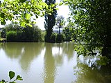
| Reservoirs flowed through | Stockmühle reservoir, Buch flood retention basin | |
| Medium-sized cities | Ellwangen , Crailsheim | |
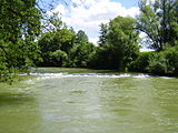
 The Jagst on its lower reaches. Wide rapids near Untergriesheim. |
||
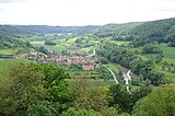
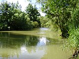
The Jagst is a low mountain range river in the north of Baden-Württemberg . Along with the Kocher and the Enz, it is one of the three largest tributaries of the Neckar . In terms of length, it takes first place among them with 190.2 kilometers on the named run. The valley of the Jagst, which has a decidedly rural character, especially on the middle reaches, is considered to be scenic. Leveling measures such as river expansion, straightening or land consolidation have changed the landscape on the middle and lower Jagst less than is often observed in river landscapes of rivers of comparable size. These properties make them of interest from a landscape conservation point of view. The diversity of plants, animals and biotope types as well as the relatively small proportion of settlement and traffic areas and the associated high development potential give the Jagst and its valley greater importance from a nature conservation perspective. Small and small towns, which have largely preserved a medieval to early modern cityscape, characterize the Jagsttal as well as numerous castles and palaces on the mountain spurs above the valley as well as the often quite frequent mills that line the river.
Surname
The name Jagst is first recorded in 768 as part of the crook Jagesgouwe ( Jagstgau ). In 1024 it was mentioned as Jagas , in 1371 as Jagst . The name is pre-Germanic, probably of Celtic origin, the final -t was only added in late Middle High German times. It is placed at the Indo-European word root * ieg- , which means ice . The Jagst would be the cold, icy river . The name was partly spelled Jaxt and Iaxt .
geography
The Jagst arises in the foreland of the Swabian Alb , passes the Frankenhöhe , digs into the Hohenlohe plain and flows through the Württemberg lowlands , where it finally flows into the Neckar after a 190.2 km stretch.
The course of the Jagst
The origins of the Jagst

The Jagst begins its course within the natural area foreland of the eastern Swabian Alb between the Swabian Alb in the south and Frankenhöhe in the north in the lower area of the rather flat Pfahlheim-Rattstädter Liasplatten , not too far this side of the eastern border of the state of Baden-Württemberg. The designated source of the river is about 518 m above sea level. NHN height in an open agricultural landscape, about 600 m southwest of Walxheim , a district of Unterschneidheim in the Ostalb district . There is a simple basin surrounded by a few trees, set in stone, from which very little water runs and which can dry up completely after a long period of drought. A few meters below the source is a pond from which water also occasionally escapes. Immediately below the Stockholzgraben flows from the right, which is already about two kilometers long and represents the farthest vein of the Jagst system. However, it does not have a distinct spring and also only carries water temporarily, but often significantly more than the Jagst draws from its official source. The Jagst begins its way as a thin trickle towards the southwest. Another source worth mentioning in this area is the moss fountain on the edge of the nun wood . The ditch that branches off from this flows into the Jagst from the right a few hundred meters below the source.
The Jagst, which drains towards the Rhine, rises very close to the European main watershed to the Danubian system. Water that runs off only a few hundred meters east of the spring reaches the Danube and the Black Sea via the Schneidheimer Sechta , the Eger and the Wörnitz .
The upper course

A few kilometers below its source, the young Jagst is dammed into a lake at the Stockmühle , which is a designated nature reserve. After flowing about ten kilometers to the southwest, it reaches Lauchheim at the foot of the Swabian Alb . There it swells up significantly due to the outflow from the Fuchsmühlenweiher and slowly turns to the northwest, a direction that it roughly maintains for the first half of its course. Kapfenburg Castle stands on a mountain spur of the Albtrauf above the Jagst valley . Below Westhausen it is dammed in the flood retention basin Buch , which with the Vorsee has about 30 hectares of water. In this area it comes closest to the twin river Kocher on its upper reaches (4.3 km distance). At the latest when the powerful Röhlinger Sechta has taken up , which roughly doubles its current catchment area, it can be called a small river . Shortly thereafter, she is now reaching into the the Swabian-Franconian Forest mountains counting Ellwanger Bergen , the city Ellwangen , the second largest of its banks, after which it the coniferous rich Virngrund traverses woods are. The Rechenberger Rot , the Orrot and the Reiglersbach near Stimpfach are among the numerous small tributaries that the Jagst is steadily growing here.
The valley of the Jagst is usually more spacious and less steep on the upper reaches than on the middle and lower and has little gradient here. Under these conditions, the Jagst has developed conspicuous river meanders . However, large sections of the run in this area have been straightened. Before Crailsheim , the largest city on the river, the valley widens to a large bay with steps at the transition to the Hohenloher and Haller levels .
The middle course


Below Crailsheim, the Jagst at the Heldenmühle reaches the shell limestone of the Hohenlohe plain . From here the character of the valley changes fundamentally. The river digs deep into the Hohenlohe plain and forms bizarre valley meanders . A section that is just over 8 km as the crow flies is traversed by it on a stretch of flow that is more than twice as long. Due to the higher gradient and the narrowness of the valley floor, the river can hardly develop meanders, the floodplain is extremely narrow. There is no valley road, the valley is too narrow for villages or towns. Only mills can be found here, which can only be reached from the plateau via steep slopes. Most of them are now closed, some of them are only reminiscent of the wall, remaining mill canals and weirs or old names. Mills were extremely frequent in this section, as the gradient of around three and a half per thousand is relatively large here. While the Jagstlauf is largely characterized by an alternation between calm and fast-flowing sections, you can find fast-flowing sections that are sometimes kilometers long. The Jagst throws itself in tight curves alternately on the right and left side impact slopes , which are particularly steep, difficult to access, partly rocky and accommodate numerous rare animal and plant species. In some places there are also larger rock faces, for example below the Barenhalder Mühle , near the Kernmühle or on the Baierlesstein and on the Bärenstein between the Heinzenmühle and Lobenhausen . In the area of the core mill , the Jagst has almost no floodplain, the steep impact slopes rise almost immediately. Further down the valley to about Lobenhausen, the floodplain only offers space for very narrow strips of forest or meadow; often the forest reaches down to the river on both sides. The usually very small height difference between the floodplain and the river in this area comes much closer to the natural state than the sometimes quite high bank slopes on the lower reaches. Above the Heinzenmühle flows the Gronach , which flows below the Gröninger Hammerschmiede through a gorge-like valley in the shell limestone. The 347 m long and 62 m high Jagsttalbrücke crosses the river near Wollmershausen . In the vicinity of the Bärenstein the Jagst forks into two large arms and forms one larger and several small islands.
From Lobenhausen there are again sections where the valley floor is so wide that there is again space for more agricultural use and sometimes also for small villages. The valley meanders are still quite bizarre. At Lobenhausen, Mistlau and Kirchberg an der Jagst , the Jagst has left behind striking surrounding mountains and high terraces after breaking through river bends . After it has passed Kirchberg, whose old town towers over the valley on a mountain spur, the valley meanders become a little wider, but the valley still only offers space for small villages. A continuous valley road only accompanies the river from Hessenau, below Leofels Castle . The Brettach , the second longest tributary, flows into Elpershofen . Here, 102 kilometers from the river mouth, the Jagst carries an annual average of 8.8 cubic meters of water per second.

In the following section, the gradient of the river is significantly lower, meadows and pastures characterize the valley, on the slopes there are small-structured fields, hedges and in the upper slope areas forests. The Jagst finally reaches Langenburg , which with its residential castle towers on a mountain spur above the valley, which has now dug itself more than 150 meters deep. Even after that, the Jagsttal retains its rural character and the landscape remains relatively richly structured. From around Eberbach, stone bars , witnesses to the former viticulture, are noticeably more common. The Ette flows below Mulfingen . Below Hohebach , where the stream of the same name and the trout stream flow and a four-arched stone bridge spans the river, the Jagst passes the St. Wendel zum Stein chapel . At the Dörzbach gauge, which is only a few meters downstream, the Jagst, 73 kilometers from its mouth, carries an annual average of 11.3 cubic meters of water per second. In this area, the Jagst begins its large curve to the west and later west-south-west and first reaches Dörzbach .
The lower course


Between Dörzbach and Westernhausen , for example , the valley of the Jagst is remarkably wide with still steep impact slopes. From Dörzbach onwards, viticulture also shapes the landscape on the sun-exposed southern slopes. Most of the vineyards have now been given up, but stone bars and small-plot terraces still bear witness to the extent of viticulture in earlier times. From here the Jagst succeeds in extending its catchment area far to the north. Between Klepsau and Krautheim it reaches its northernmost point at the mouth of the Horrenbach and flows from there to the southwest. Even before Krautheim there is a natural curiosity on the slope of the valley, the Growing Brook , also aptly called cow ass due to its shape . The small stream, which rises from tuff springs on the slope, grows as a stone channel through dying and calcifying moss remnants like on a dam. In Altkrautheim the Ginsbach flows from the left . At Marlach there is a larger rock face with a pronounced dry flora on the south-facing valley slope. The Sindelbach also flows here . It can have only a tenth of the water flow of the largest Jagst tributary, the Seckach, but is still the longest tributary on the left. In this area, the Jagst can, as an exception, extend its catchment area very far to the left towards the Kocher. The powerful Erlenbach flows from the right in Bieringen . Soon afterwards the Jagst in Schöntal Monastery passes the monastery complexes of the former Cistercian abbey and in Jagsthausen the Jagsthausen Castle (Götzenburg), before another water-rich stream flows into it in Widdern with the Kessach . The Hergstbach flows below the Ruchsener weir, the catchment area of which is not insignificant, but which is usually very arid. Finally, the Jagst flows through the town of Möckmühl , where it receives its largest tributary, the Seckach . Möckmühl Castle (another Götzenburg) stands on the mountain spur between the Jagst and Seckach valleys , below the historic old town. From Möckmühl, the Jagst loops become wider and the valley a little wider. From here, a section of the Frankenbahn runs in the valley , which connects Stuttgart with Würzburg. The Jagst passes Neudenau , another medieval town on its banks. Above Untergriesheim , the Jagst flows into the Schefflenz , the last major tributary, and shortly afterwards the Tiefenbach , the last permanently water-bearing tributary. At the Untergriesheim gauge, five kilometers from the estuary, the Jagst now has an annual mean of 18.6 cubic meters of water per second. At Jagstfeld, a district of the city of Bad Friedrichshall , the Jagst finally enters the Neckar Valley. It widens slightly and flows into the Neckar, a tributary of the Rhine coming from the southeast , opposite the Wimpfen monastery in the valley at 142.8 m . The silhouette of the former imperial city of Bad Wimpfen towers high above the Neckar .
Jagst and Kocher
The Kocher , which also rises on the Ostalb , flows to the left of it continuously more or less parallel to the Jagst. The two rivers often come very close. The parallel run on the lower reaches is particularly pronounced. At Jagsthausen the rivers come closer to 1.6 km, only to gain several times the distance afterwards. Shortly before Bad Friedrichshall, the rivers are only 1.3 km apart. The mouths are also only about two kilometers apart as the crow flies.
The Jagst and Kocher rivers, often referred to as twin rivers because of their striking synchronism, compete fiercely for water, both above and below ground; the deeper Kocher is more successful for almost the entire course. The Jagst is a little longer, but the Kocher has the larger catchment area and carries more water, but the close competition also means that it is relatively arid, considering its length. The valley of the Kocher is more densely populated, that of the Jagst, on the other hand, is more natural and richer in botanical and zoological rarities.
In the literature, the synchronization of Jagst and Kocher was often rather glorified, for example as a "playful game", "as if they wanted to catch each other", they were also described as "playful twins". In a Hohenlohe dialect poem from 1932, N. Landwehr, apparently also paying respect to the neighboring river to the south, formulates: “The cooker is too happy to slip / even closer to 'nou; he thinks: to such a rail Fraa / ghört aa en seemed Mou. "
Tributaries
The Jagst has only very small tributaries, the largest of which is the Seckach , which flows into Möckmühl , which is 28 kilometers long, has a catchment area of 261 km² and with around 2.5 m³ / s the largest mean water flow of all Jagst tributaries and which some already see as a river. Six of the Jagst tributaries are at least 20 kilometers long; the Röhlinger Sechta near Rainau - Schwabsberg is listed downstream together with the estuary , which makes the young Jagst stream into a river; the Brettach near Gerabronn - Elpershofen , its second largest tributary; the Erlenbach near Schöntal - Bieringen ; the kessach in rams ; the already mentioned Seckach in Möckmühl; the Schefflenz near Bad Friedrichshall - Untergriesheim . These six all flow to it from the right, as do the tributaries listed below with a length between 10 and 20 km: the Rechenberger Rot near Jagstzell - Schweighausen ; the Reiglersbach in Stimpfach ; the Gronach near Satteldorf - Bölgental ; the Rötelbach in Mulfingen - Eberbach ; the Ette at Mulfingen-Bachmühle; the Rissbach in Mulfingen- Ailringen ; the Hergstbach in Möckmühl- Ruchsen .
The larger of the left tributaries are the Orrot near Jagstzell -Schweighausen, the Speltach and the Maulach near Crailsheim -Jagstheim and, as the longest of these, the Sindelbach in Schöntal - Marlach . However, none of them even reaches a length of 14 km, i.e. half the Seckach.
Diagram with the tributaries of the Jagst (length from rounded 10 km)

cities and communes
The Jagst runs through an almost everywhere rural region with a very low population density for Baden-Württemberg conditions. Crailsheim (approx. 33,000 inhabitants) and Ellwangen (approx. 25,000 inhabitants) are still the two largest cities on the Jagst, followed by Bad Friedrichshall (approx. 19,000 inhabitants), of which, however, only the small district of Jagstfeld lies in the valley. With around 8,000 inhabitants, Möckmühl is the fourth largest city on the Jagst and the largest town on the entire 130 km long stretch of river between Crailsheim am Oberlauf and the confluence with the Neckar.
The Jagst flows through or touches the area of the following cities and municipalities:
| Commune | River length | comment |
|---|---|---|
| Unterschneidheim | 3 km | |
| Westhausen | 13 km | about half before and half after Lauchheim |
| Lauchheim | 4 km | |
| Rainau | 7 km | |
| Ellwangen | 9 km | |
| Jagstzell | 7 km | |
| Stimpfach | 4 km | |
| Frankenhardt | 3 km | only a small gusset on the right side |
| Crailsheim | 20 km | almost half only on the left |
| Satteldorf | 13 km | predominantly only on the right |
| Kirchberg | 14 km | |
| Ilshofen | 4 km | |
| Gerabronn | 4 km | |
| Langenburg | 10 km | |
| Mulfingen | 15 km | |
| Dörzbach | 6 km | |
| Krautheim | 11 km | |
| Schöntal | 15 km | |
| Jagsthausen | 8 kilometers | |
| Rams | 7 km | |
| Möckmühl | 11 km | |
| Neudenau | 13 km | |
| Bad friedrichshall | 8 kilometers | |
| Gundelsheim | 1 km | only right side |
| Offenau | about 1/2 km | only right side |
| Bad Wimpfen | about 1/4 km | only the left bank of the tip of the Jagst and Neckar estuary triangle |
Kilometers were regularly rounded to natural numbers. The sum clearly exceeds the total length of the river because of the stretches on which different municipalities lie on both sides.
Traffic routes
A railway line accompanies the Jagst between Lauchheim and Crailsheim. The Jagsttalbahn , a narrow-gauge railway , used to connect Möckmühl with Dörzbach. A section of the Frankenbahn runs through the Jagsttal between Möckmühl and Bad Friedrichshall-Jagstfeld .
The Jagsttalbahn stopped operating in 1988, the route, bridges and facilities are largely in good condition, but the tracks in the Möckmühl area were dismantled, they had to give way to the redesign of the Möckmühl station area, but above all to the expansion of the Kocher-Jagst cycle path . This accompanies the Jagst almost continuously. Numerous other cycle paths lead from it, including those through the Seckach and Kessach valleys.
Three motorways lead over the Jagst. On the upper reaches near Westhausen the A 7 crosses the young river on a 19 meter high bridge , on the middle reaches the A 6 in the area of the Gronach estuary between Crailsheim and Kirchberg on a 62 meter high bridge , on the lower reaches near Widdern the A 81 crosses on the 80 meters high Jagsttalbrücke the valley.
Catchment area and water supply
Special features of the catchment area and the lack of water in the Jagst
General information on the catchment area


The catchment area of the Jagst is 1836 km². In the southeast, between the Swabian Alb and Frankenhöhe, the border of the catchment area coincides with the European main watershed, which separates the outflow towards the Rhine and Danube here. For a river of its length, the area of the catchment area is unusually small. This explains in part why the river, despite its considerable length and not noticeably low rainfall, carries little water.
The catchment area of the Jagst remains relatively small because several other rivers compete very closely, including the Kocher mentioned above , which accompanies them on the left for almost their entire course. In between, the Bühler , a right tributary of the Kocher and the only larger flowing water that could form between the two so-called twin rivers, also takes on this role . The watershed is usually very close to the Jagst to the advantage of the Kocher. The situation on their right is less uniform, but even from here the Jagst only reach small tributaries. On the upper and middle reaches, Wörnitz and Tauber limit their catchment area to the east and northeast, but these two rivers remain below the dimensions of the Jagst up to their mouths. Only on its lower reaches, after the Tauber has moved northwards, the Jagst can extend its catchment area further north, here more powerful tributaries from the building land now reach their course.
Reasons for the imbalance between Kocher and Jagst
When looking at the catchment area, the water flow of the Jagst does not appear unusually low for a river of its type; but the lower water flow compared to the nearby stove is noticeable. Although its above-ground catchment area is only about 7% smaller than his, the Jagst still carries 29% less water than the Kocher (assessment period 1980–2003). The sources of the two rivers are very different. The cooker arises from two powerful karst springs in the Swabian Alb and begins its course very rich in water, while the beginnings of the Jagst lie outside the Alb, where it only begins to collect water from meager rivulets. Of greater importance for the overall water flow, however, are the losses due to seepage and the different amounts of precipitation in the catchment areas.
The Jagst loses considerable amounts of water through seepage. At comparable points, its river bed is well above that of the Kocher and Bühler and also higher than that of the Tauber in the east. In the lower reaches then the height differences disappear. One of the well-known infiltration points is at the Heldenmühle near Crailsheim, where the Jagst crosses a geological fault . In the past it lost even more water here than it does today; At the main infiltration points below the weir, a full 470 l / s or 97% sank with a closed weir canal and a water level of 83 cm in Crailsheim with an inflow of 480 l / s, with a higher water level of 108 cm it was still 560 l / s from 870 l / s l / s or almost two thirds of the inflow. During dry seasons, the river could break up into a series of pools. At the request of the millers, who had come together between Crailsheim and Klepsau , a drastic measure was taken shortly before the First World War by concreting the river bed at the main infiltration points.
There are other significant infiltration points in the sub-catchment area of the Brettach , the second largest tributary of the Jagst. The Weidenbach almost always sinks completely to the northwest of Wallhausen . Only with strong water flow does part of the water overcome the stream shrinkage around one and a half kilometers northwest of Wallhausen. Coloring tests showed that the lost water in the Bühler floodplain escapes again, i.e. in the catchment area of the digester. Another tributary of the Brettach, the Wiesenbach west of Hilgartshausen, also loses water through seepage, which emerges again in the Tauber catchment area. Of the total 180.5 km² catchment area of the Brettach, 41 km² drain underground into other catchment areas, but not completely when the water is strong.
The water that seeps away in the creek shrinkage of the Kreuzbach, only about 1 km away from the Heldenmühle, emerges again about 16 km further west-south-west in springs near Neunbronn in the Bühler floodplain , according to dye tests, after it had previously crossed the Jagstlauf underground .
Further infiltration points in the catchment area of the Jagst are to be assumed, presumably also on the lower reaches of Jagsthausen. However, the amount of water lost through seepage probably does not exceed the volume of 1 m³ / s.

Finally, in relation to the area, there is less rainfall than the Kocher in the catchment area of the Jagst. A large part of the precipitation-rich Swabian-Franconian Forest drains to the cooker. To the east of this, the Jagst has a small share in this low mountain range, but a considerable share in the franc height. Both areas are somewhat in the rain shadow of the western parts of the Swabian-Franconian Forest. Similarly, the Tauber lies in the east of the Jagst in the rain shadow of the Odenwald; measured against the catchment area, it also discharges little water. So the lower rainfall is also decisive for the water poverty of the Jagst.
Geological differences in the area of the catchment area
The runoff behavior of the Jagst on the upper and middle reaches on the one hand and on the lower reaches on the other is clearly different. The tributaries on the lower Jagst - in particular the "four big ones": Erlenbach, Kessach, Seckach and Schefflenz - supply it with much more constant water over the course of the year than those on the upper and middle reaches, so that extreme minima of the water flow in the lower reaches are weakened. At times the Seckach in Sennfeld even carries more water than the Jagst in Dörzbach. In these dry times, the Seckach usually still has half of its annual mean flow, while the Jagst in Dörzbach regularly has less than an eighth of its mean water flow; the Jagst can then often multiply its water flow in its lower reaches. These differences are already apparent in spring and become more and more evident by autumn. The reasons for this are, on the one hand, the higher silt and fine sand proportions in the catchment area of the lower Jagst, while the clay content is higher in the catchment area of the Jagst south of Dörzbach . Silt and fine sand soils store significantly more water and later release it gradually to the groundwater, while soils with a higher clay content make the runoff much more uneven. An additional reason is the more advanced karst formation in the catchment area of the lower Jagst, where the karst cavities are usually already in a state of silting .
Thanks to the abundant supply of water from the building land, the Jagst can, under certain conditions, carry more water than the Kocher, even for longer periods of time, because the catchment area of the Kocher includes areas with geological conditions similar to those on the upper and middle Jagst so that long-lasting low water situations can be observed somewhat more frequently on the stove. When it rains, however, the cooker usually rises significantly more than the Jagst, which can be observed regularly. Spring 2010 was an example of this: the powerful Jagst inflows from the building land kept the Jagst's water flow for many weeks at a level that the cooker could no longer achieve at this time of the year. While the Jagst showed little change in heavy rainfall, which then fell mainly on the Swabian-Franconian Forest, the drainage of the stove increased threefold, but sank again after two to three days under the Jagst.
Letters and kings on the water poverty of the Jagst
The water poverty of the Jagst has even found expression in the literature. Two hundred years ago, the satirist Karl Julius Weber scoffed at the Jagst in Dörzbach, saying that she often felt like Manzanares , and that one could walk over her with dry feet. At that time the mentioned infiltration point in Crailsheim was not yet filled with concrete. In his novella Eine Sommerreise , Ludwig Tieck wrote in 1834: "A very large and beautifully built bridge leads over the Jagst River, which was now so small that it contained almost no water."
A related curiosity is also known. On July 26, 1810, King Friedrich I of Württemberg visited the recently completed stone Jagstbrücke in Dörzbach-Hohebach , which had been built since 1808. Its completion was delayed not least by floods, its construction costs exploded to 73,267 fl. , Which had already caused displeasure with the king in advance. When the otherwise pompous king visited the bridge on July 26th, 1810, he was said to have got angry because one had crossed such a small stream with such an expensive bridge. The builder is said to have fled for fear of the king's wrath. Numerous bridges of lighter construction had previously been damaged or destroyed by the huge floods of the Jagst and by ice drift , most recently in 1799.
Since the above-mentioned infiltration point at the Crailsheimer Heldenmühle had not yet been filled with concrete, the river was probably even more miserable on the day of the visit than it is today at this time of the year.
Water flow and drainage behavior
| Level measuring point |
EZG ( km² ) |
Discharge ( MNQ ; m³ / s ) |
Discharge ( MQ ; m³ / s) |
Discharge ( HQ100 ; m³ / s) |
|---|---|---|---|---|
| Schwabsberg | 178 | 0.14 | 1.87 | 103 |
| Jagstzell | 329 | 0.63 | 3.35 | 159 |
| Elpershofen | 816 | 1.2 | 8.80 | 387 |
| Dörzbach | 1029 | 1.47 | 11.3 | 423 |
| Untergriesheim | 1826 | 3.9 | 18.6 | 525 |


Runoff regime, statistical runoff values
The Jagst's discharge regime corresponds to the pluvial type; its runoff is therefore determined by the ratio between precipitation and evapotranspiration , so that the Jagst - as is the rule in its climatic region - carries considerably more water despite higher summer precipitation in winter and spring.
At the Jagst gauge near Untergriesheim , about 5 km before the mouth and after all tributaries have been taken up, the annual mean flow between 1980 and 2003 was 18.60 m³ / s with a catchment area of 1826 km². Since the sometimes violent floods are included in this value, the flow rate is below this value for most of the year. The mean value of the lowest runoff is 3.90 m³ / s, the lowest value measured since 1980 was 2.05 m³ / s (September 5, 1991). Before 1980 there were often even values below 2 m³ / s; However, these values were subsequently modeled for Untergriesheim because the previous level for Untergriesheim was in Möckmühl until 1978.
The average low water runoff will likely decrease noticeably in the course of global warming . For the catchment areas of Jagst and Kocher, it was forecast that the average low water discharge (MNQ) will decrease “significantly” by the middle of the 21st century, that is, by 10 to 20 percent. For the rest of the Neckar catchment area, for the Tauber and for large parts of the Swabian Alb and the foothills of the Alb, only weak changes were forecast.
The mean value of 18.6 m³ / s should not hide the great variability of the individual annual mean values. Since the individual annual precipitation values deviate significantly from their common mean, the individual annual runoffs fluctuate even more strongly around their mean. It can therefore by no means be assumed that this value would be met more or less reliably in the individual years. In 2006, for example, the mean value was 14.2 m³ / s, in 2004 it was only 10.6 m³ / s. In 2003, despite the extreme summer, the mean value of 18.4 m³ / s was almost reached, as strong winter runoffs almost equal the extremely low summer runoffs compensated. The year 2000 hit the mean exactly.
Average monthly discharge of the Jagst (in m³ / s) at the Untergriesheim gauge,
survey period 1925–2006 (in contrast to the other average values mentioned)

Flood
| rank | time | Discharge [m³ / s] |
|---|---|---|
| 1 | Dec 21, 1993 | 593 |
| 2 | Oct 29, 1998 | 429 |
| 3 | Apr 14, 1994 | 408 |
| 4th | March 17, 1988 | 372 |
| 5 | Feb. 7, 1984 | 308 |
| 6/7 | Feb. 26, 1997 | 306 |
| 6/7 | March 21, 2002 | 306 |
| 8th | December 29, 1947 | 303 |
| 9 | Jan. 8, 2011 | 293 |
| 10 | Jan. 26, 1995 | 289 |
| 11 | Nov 10, 1927 | 284 |
When the tide is high , the Jagst regularly swells to form a mighty river. According to a statistical model, the water runoff is 183 m³ / s for a 2-year flood, 332 m³ / s for a 10-year flood, 390 m³ / s for a 20-year period, 467 m³ / s for a 50-year period and 100% -annual flood 525 m³ / s. The highest value was reached during the flood of the century on December 21, 1993 with 592 m³ / s. For example, there is an average discharge of the Oder of 574 m³ / s. In Untergriesheim the level reached 5.16 m, almost 4 m above the annual mean. The Seckach's contribution was particularly strong : it swelled so violently on that day that its water flow in Sennfeld exceeded the annual mean value of the Neckar in Mannheim . For Möckmühl this meant the highest water level since 1732. The event was part of the nationwide Christmas flood of 1993 .

The known discharges from the German Hydrological Yearbook can be found in the table opposite. It is striking that five of the seven highest documented runoff values have been measured since 1993.
Another source reports of further flood runoff, some of which deviate from the data known from the German Hydrological Yearbook. According to this, 424 m³ / s should have flowed on November 10, 1927, 461 m³ / s on December 29, 1947, 363 m³ / s in March 1963, 401 m³ / s on February 10, 1970, the value of December 21, 1993 is correct in accordance with the above, on April 13, 1994 383 m³ / s should have flowed and on October 29, 1998 467 m³ / s. All figures mentioned refer to Untergriesheim. How reliable this data is is unclear.
The 2002 flood marked the end of a decade of major flood events, which are clearly inferior to the most recent. At the beginning of March 2007 the Jagst in Untergriesheim reached a discharge value of 225 m³ / s, a comparable event followed in 2008. The storm depression Emma in 2008 led above all to flooding at Klingen and in small catchment areas. On December 7, 2010, the Jagst began to rise rapidly due to a thaw and heavy rainfall at the same time, and on the evening of December 9, at the Untergriesheim gauge, it reached a discharge value of 208 m³ / s. When, at the beginning of January 2011, with temperatures that were partly spring-like, the amount of snow, which had grown enormously for several weeks, quickly melted and at the same time moderate precipitation fell, resulting in an even greater flood. On January 8, 292.6 m³ / s were measured at the Untergriesheim gauge at 8:30 p.m. (level 420.4 cm). Only six days later the water flow rose again to up to 218.2 m³ / s.
The floods have repeatedly caused considerable damage in the neighboring communities, especially the one in December 1993. As a result, extensive flood protection measures were taken in some cases. The town of Möckmühl, for example, is said to have been protected against a Jagst flow of up to 597 m³ / s after the construction of dams, ramparts and devices for mobile sheet pile walls since 2007. In some municipalities, further flood protection measures are being planned.
Ur-Jagst and river reversal
The entire upper course and parts of the middle course of the Jagst originally flowed from north to south, i.e. opposite to the current direction of the river. In the early Miocene , before the meteorite impact in the Nördlinger Ries , the Jagst arose in the north of today's Hohenlohe district , flowed south through the area of today's cities Crailsheim and Nördlingen and flowed into the Wörnitz , a tributary of the Danube . In the late Miocene, after the impact event, Jagst, Kocher, Lein and Rems near Aalen drained into the Brenz , which flowed further south via Heidenheim an der Brenz towards the Danube. This direction of course persisted until the late Lower and early Middle Pleistocene . In the late Middle Pleistocene, in the Riss Ice Age , that is only about 300,000 to 150,000 years ago, the Jagst turned its direction of flow in the upper reaches from south to north and has since drained over the Neckar and Rhine into the North Sea.
Nature, landscape and the environment

The Jagsttal is relatively sparsely populated in most sections, measured against the population density of the country. The two smallest towns in Baden-Württemberg, Langenburg and Widdern, are located on and in the valley. Especially on the middle reaches, where it is narrowest and deepest, the Jagsttal shows a very rural picture.
Nature and landscape, floodplain condition , water quality and water structure quality are only in a moderate, but comparatively favorable condition.
Landscape image
The valley of the Jagst, like that of the nearby Kocher, is very scenic, especially for lovers of bike tours , and leads through the geologically interesting transition zone from the Swabian Alb to the low mountain ranges Spessart and Odenwald . In this part of the Triassic Swabian-Franconian plains , the Keuperberge and the shell limestone plateaus of the Hohenlohe Plain with their steeply cut river valleys shape the landscape.


Wherever the valley floor is in or under the Lower Muschelkalk , i.e. on most of the course of the river from Langenburg, a threefold structure of the slopes caused by the rock is typical for the Jagsttal. The Lower Muschelkalk is quite hard and resistant to erosion, accordingly there are steep impact slopes in the lower section of the slope, often wooded, which are locally referred to as glue . Above this, the slope is much flatter and mostly used for agriculture; The cause of the kink in the slope curve is the onset of the Middle Muschelkalk , which originally consisted of rock that was not very resistant to erosion, including, to a large extent, easily soluble evaporites (gypsum, rock salt). The rock salt is completely depleted, as is gypsum and anhydrite on the valley slopes. Of the 90 to 95 m thick Middle Muschelkalk near Heilbronn, only 30 to 40 m are left here. At the transition to the hard, mostly heavily banked Upper Muschelkalk , the slope curve at the top becomes steeper again.
The shady sides of the slopes are mostly wooded, on the sunny sides the numerous stone bars are characteristic, where viticulture is practiced, but above all was practiced. Viticulture used to be of much greater importance, today it is limited to a few areas between Dörzbach and Bad Friedrichshall, which belong to the major Kocherberg site in the Württemberg wine-growing region . Most of the vineyards are terraced and not land-adjusted. Due to the small parcels and steepness , the viticulture has declined a lot, slowly valuable biotopes have emerged on the abandoned vineyards, which contribute a large part to the aforementioned biological wealth.
These biotopes were created due to the loss of use and are threatened in many places by natural bush and forest cover, especially in the Heilbronn district , as little landscape maintenance is carried out there. Clearing new shrubbery and grazing are necessary to protect some populations in the long term.
Most of the floodplains are used for agriculture as grassland .
natural reserve
As in all of western Central Europe, primary (absolute) wilderness does not or hardly exist in the Jagsttal . The nature conservation significance is based on secondary (relative) wilderness, on remnants of old cultural landscapes as well as on the high development potential of many areas on which the restoration of more natural conditions ( renaturation ) are feasible or comparatively easy to carry out.
In the Jagsttal, remains of the old cultural landscape have been preserved to a large extent. Particularly in the steep slopes of the valley slopes, historical forms of use such as sheep grazing or small-parceled terraced viticulture have created special biotope types that have become rare today and are often characterized by a high level of biodiversity and a high number of rare or highly specialized species . Semi-arid grasslands and poor, lowland hay meadows are particularly important, as are orchards , dry grasslands and heaths. The stone bars and dry stone walls of the former vineyards with the hedges and field trees , which have recently spread due to the decreasing intensity of use , also form important biotopes. The large-scale wood succession on such areas in many places is of great nature conservation importance in terms of process protection, but at the same time also the subject of conflicting goals within nature conservation. In the valley meadows , agricultural use is mostly intensive. In most cases, high nutrient input through fertilization reduces the range of species; together with the use of pesticides , the water quality is also polluted. Nevertheless, there are also types of biotopes in the floodplain that are of particular nature conservation interest, such as poor, lowland hay meadows.
The nature conservation significance of the Jagsttal is largely based on areas created by historical forms of use. Areas or biotope types that were only very slightly influenced by human activities are rare in the Jagsttal - as almost everywhere in western Central Europe - and are very small and are or have been subject to certain impairments. There are no larger, near-natural floodplain landscapes; typical floodplain vegetation is mostly limited to narrow strips of wood along the river, which in sections can be referred to as gallery forest . The Jagst's flooding regime can only be described as near-natural to a limited extent. Only along some sections of the middle course between Crailsheim and Lobenhausen are larger floodplains in a relatively natural state. Overall, the condition of the hunting rams can only be described as moderate (see below). Nevertheless, the Jagst is one of the larger rivers in Germany that are significant in terms of nature conservation.
The river itself is also in poor condition. The river bed experienced narrowing and bank reinforcements, which are often not perceived as such by laypeople, not least because there are no reference ideas. Wherever the strength and direction of the current could develop a certain dynamic and lead to the formation of primary habitats, such as steep banks without vegetation, which the sand martin requires, for example , this possibility was usually prevented by bank reinforcements. This is particularly noticeable, for example, in the Wagrain-Lange Wiese-Stegbrühl nature reserve near Gommersdorf, where the Jagst flows in a large S-shaped curve through the wide floodplain. Exactly where the Jagst could develop a high dynamic, the banks are almost completely built with massive stone blocks to fix the river bed. The numerous weirs also play a major role, they change the runoff behavior and thus the flora and fauna and also represent migration obstacles for the zoobenthos (see below). Furthermore, oxbow lakes and side channels as well as larger gravel banks and relocation areas hardly exist on the Jagst . All of these things cause the river to be far from its potentially natural state. Nevertheless, there are only a few rivers of this size in Germany in a more favorable condition.
In summary, it can be stated that the Jagst, despite its deficits, is one of the near-natural larger rivers in Germany. The still missing ecological continuity (transverse structures), the limited river and floodplain dynamics as well as the water quality (see below), however, still represent major problems from a nature conservation point of view. The implementation of the European Water Framework Directive (WFD) is likely only with regard to the comparatively inexpensive production can remedy the ecological patency.
Because of their special relative importance, there are numerous protected areas in the Jagsttal and adjacent areas. With the exception of the localities, sections above Ellwangen and the area between Marlach and Schöntal, the Jagst flows entirely in protected landscape areas . Between Crailsheim and Kirchberg, the 923.5 hectare large contiguous nature and landscape protection area Jagsttal with side valleys between Crailsheim and Kirchberg has existed since 2003, which is supposed to protect the valley landscape from profound changes caused by agriculture, mining, traffic and urban sprawl.
Other nature reserves are:

- Stockmühle reservoir near Lippach . Upper Jagst reservoir with a storage and retention system. With its bank area as well as the adjacent meadows and forests, it is a supraregional important resting and breeding area for numerous endangered bird species.
- Buch near Westhausen . A damp biotope created by compensatory measures directly above the Rainau-Buch reservoir.
- Maple-linden forest near Hessenau . A former vineyard, now mixed forest on the northern slope of the Jagsttal.
- Heron dump Morstein above Kleinforst . Was a heron colony for centuries.
- Heron dump near Bächlingen . A gray heron colony on the steep slope opposite Bächlingen and Langenburg, which has been abandoned since 1996.
- Riedhölzle and Jagstaue near Mulfingen . Meadow landscape in the Jagsttal cut into the shell limestone opposite and down from the Ette estuary with hillside forests, groups of trees, hedges and creek trees. The landscape typical of the Jagsttal is an important feeding and breeding area for an endangered bird species.
- Heath on the Dünnersberg near Mulfingen. Right valley slope immediately after the Ette estuary. Juniper heath with poor grassland and dry hillside meadows, location of many protected plant and animal species.
- St. Wendel zum Stein near Dörzbach . Wooded valley slope with rock formations made of sintered limestone.
- Laibachsweinberg-Im Tal-Im Köchlein . Three individual areas on the slope of the secondary valleys near Klepsau that flow from the north . With dry steep slopes and diverse flora and fauna in the Lower Muschelkalk.
- Wagrain-Lange Wiese-Stegbrühl between Krautheim- Gommersdorf and Schöntal - Marlach . Jagst section with oxbow lake, rebound and slip slope, species-rich riparian wood and ash-rich swamp forest. Source outlets on the rebound slope.
- Stein across from Marlach. Typical steep slope in the Lower Muschelkalk for the Jagsttal, an almost vertical rock face that is inaccessible in places, and adjacent areas.
- Lache rock rock meadows near Schöntal. Backwater zone of the Jagst and rock face with spring areas.
- Hohenberg-Setz between Schöntal- Bieringen and Schöntal. Varied steep slope in the Upper Muschelkalk with sheep-grazed limestone grassland
In the course of the implementation of the European Habitats Directive , through which the member states were obliged to design a coherent network of protected areas in order to maintain or create their diversity of species and biotope types as well as their connectivity, almost the entire Jagst was converted into newly designated FFH areas integrated. In addition to the river itself, these areas also include extensive areas in the valley and on its slopes, in side valleys and in adjacent areas. They have the following names:
- FFH area Crailsheimer Hart and Reusenberg
- FFH area Jagst near Kirchberg and Brettach
- FFH area Jagsttal Langenburg-Mulfingen
- FFH area Jagsttal between Dörzbach and Krautheim
- FFH area Jagsttal near Schöntal and Klosterwald
- FFH area Untere Jagst and Unterer Kocher
The fact that the greater part of the land is privately owned makes it more difficult to implement the measures proposed in the FFH management plans. The implementation takes place here within the framework of contractual nature conservation (MEKA, landscape conservation guidelines, guidelines for near-natural forest management, etc.). In many cases, however, the funding amounts are not attractive enough from the landowner's point of view, so that many of the proposed measures are not implemented. In principle, however, all FFH areas are subject to a general ban on deterioration.
Large parts of the Jagst are part of the European bird sanctuary EU-SPA Jagst with side valleys . The European bird protection areas together with the FFH areas form the Natura 2000 network of protected areas .
Creature
fauna
Birds


Along the Jagst there are several breeding colonies of the gray heron in the woods on the steep valley slopes . Human disturbances have repeatedly caused the birds to relocate the colonies. At Morstein and Bächlingen there are now abandoned colony sites, some of which have been used for several centuries. The gray heron is quite common and can be seen regularly, often in troops. The dipper , which hunts for river fleas , small fish or worms underwater, is still relatively common .
The Jagst is an important refuge and distribution center for the kingfisher , not least because it offers him the steep banks necessary for breeding. The kingfisher populations of the Jagst are sources for the re-spread of the bird. The kingfisher also lives in some tributaries, such as the Kessach.
A pair of storks comes to breed in Dörzbach every year. In 2008 a pair of storks brooded on a chimney in Jagstheim for the first time in over 60 years in the upper Jagsttal . The brood was successful, two young birds flew out.
Other breeding birds at the Jagst are little grebe , great crested grebe , black-necked grebe , mute swan , ruddy shelduck , Greylag Goose , Common Teal , Garganey , Shoveler , Tufted Duck , Water Rail , Spotted Crake , coot , little ringed plover , lapwing , snipe , Wagtail , White Wagtail , Warbler , Reed Warbler , Beutelmeise , reed bunting and Common sandpiper .
The Stockmühle reservoir and the Buch flood retention basin on the upper reaches of the Jagst are of significant importance for bird life on the Jagst.
On the upper Jagst, the following birds that once bred there are extinct and did not immigrate again until 2009 (the year of the last record in brackets) Black stork (1886), pochard (1849), osprey (breeding bird near Kirchberg, extinct after 1849), Sand martin (2005), meadow pipit (1960) and reed warbler (1886).
Many other bird species can be found migrating along the Jagst.
insects
One occurrence of the little dragonfly can be found on the Jagst, and there are also populations of the common wedge damsel . Among the other dragonfly species , the shiny emerald dragonfly is also native here. Other rare encountered an der Jagst insect species are the alderfly Sialis nigripes , the mayflies Ecdyonurus insignis and Electrogena affinis , the beetles Elmis obscura , macrorhynchus quadrituberculatus and Stenelmis canaliculata and caddisflies Leptocerus interruptus , Hydroptila simulans and Hydroptila lotensis under which the latter at the Jagst her nationwide only occurrence.
The south-facing impact slopes of the Jagst Valley and many grassland locations are of certain importance for insects. One of the two occurrences of the Eastern Cricket in Germany is on the slopes between Dörzbach and Krautheim. On warm June days, in addition to the swallowtail, with a little luck and perseverance, the butterfly-like can also be discovered there. The critically endangered red-winged wasteland insect can be found here.
Mammals
Various bat species have been identified in the Jagsttal and have their roosts there. Among others are the Bechstein's bat , Serotine , pipistrelle and greater mouse-eared .
There are obviously beavers on the upper Jagst near Westhausen and on the middle course between Kirchberg and Mulfingen . They probably immigrated from the Danube area. In 2000 an animal was run over near Haßmersheim am Neckar. The place just a few kilometers below the Jagst estuary could be an indication that the beavers have already migrated through the Jagst over its entire length.
Reptiles
The sand lizard lives on the south-facing slopes, where the stone bars provide shelter. The smooth snake occurs in the Jagsttal. The grass snake can be seen in the river .
Fish and round mouths

In the summer of 2002, 30,530 fish were identified in 27 species in the Jagst. Of these, the sunfish , catfish , rainbow trout , pikeperch and gable were rated as alien to the location. Frequency of occurrence of fish species: cutter (42%), arbor (28%), loach (8%), roach (7%), gudgeon (5%); Chub , Barbe , eel , hazel , Koppe , Rudd and nose together 9%. There are also brook lamprey , bitterling , burbot and streamers . It should also be mentioned that the pike is native to the Jagst.
In 2010, an action plan for the reintroduction of grayling, supported by 16 fishing associations between the estuary and Langenburg, began . Over a period of four years, tens of thousands of young babies will be released. 75% of the costs, which amounted to around 7,000 euros in 2010 alone, are borne by the Stuttgart Regional Council. In preparation, gravel banks were created at Siglingen and Herbolzheim in recent years. The grayling, like the closely related salmon, was still at home in the Jagst around 1900, before numerous species of fish died out in the Jagst due to the water pollution, which was mainly due to two paper mills on the Seckach and a sugar factory in Züttlingen. It is hoped that the salmon will migrate back as soon as the existing obstacles to migration at the barrages on the lower Neckar have been removed.
Mussels and snails
Of the river mussels and pond mussels (Unionidae), the large river mussel ( Unio tumidus ) and the small river mussel or river mussel ( Unio crassus ) have been identified in the Jagst . At least on the lower Jagst, the housings can often be found in the river bed. Among the snails, the common boat snail should be mentioned.
Crayfish
The European crayfish occurs in the Jagst .
flora
The entire catchment area of the Jagst belongs to the deciduous forest area. Larger coniferous forest stands are basically to be classified as artificial. A large part of the forests can be assigned to the "woodruff beech forests" ( Galio Fagetes ) with corresponding ground vegetation. Because of their frequency, it will not be discussed in more detail, at least some typical species are mentioned: wood anemone , woodruff , great witchweed , common worm fern , arum , or the yellow anemone . The stinking hellebore meets here on the eastern edge of its main distribution area.


On some south-facing slopes in the middle and lower Jagsttal there is a typical flora adapted to drought in summer. A few examples should be mentioned: the silver thistle , the gold thistle , the rough elephant , the common pasque flower , the branchy grass lily , the cross gentian , the fringed gentian and the male orchid . When the orchid Jagsttal simply can military orchid apply that occurs in places, quite often, even several Ragwurzen occur, such as the bumblebee orchid or the Great Spider Orchid , as well Bocks-strap ends , the Epipactis helleborine or the White Waldvögelein . In Klepsau there is an occurrence of the willow-leaved ox-eye , which is otherwise quite common in the Swabian Alb. Field quail wheat or deer root hairline are somewhat more common . The lichen Fulgensia fulgens is a rarity . All in all, plants that love light, warmth and drought are a little rarer than in the nearby Taubertal , which houses some rarities that one looks for in vain on Jagst or Kocher.
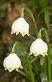
A stately colony of the oriental hellebore has settled as a neophyte in a forest. An occurrence of the spring knot flower is probably not autochthonous . The Pyrenean spoonbill is a specialty . It has the only locations in the north of Baden-Württemberg in the Jagst Valley. In the central Jagsttal, the yellow lady's slipper became extinct by the end of the 1980s at the latest, and the pale orchid was probably already extinct at the beginning of the 20th century , although it still has a location near the upper reaches.
Alluvial forest remnants are very rare and in small areas on the Jagst. The floodplain is mostly used as grassland . Lush trees along the banks are almost continuous, as expected, numerous, very difficult to determine willow species and their hybrids dominate here , including broken willow , white willow , purple willow , almond willow or ash willow and also the black alder . The unmistakable great nettle is probably the most common herbaceous plant in the bank zones . Interestingly, the widespread neophyte Indian balsam , which increasingly dominates the banks of our rivers and streams, is at least less common on the lower Jagst than on many other rivers.
In addition to numerous other plants, you can find calamus , yellow iris , cane grass , reeds , bitter-sweet nightshade or winged figwort , in addition to numerous other plants ; swamp sedge and slim sedge are very rare .
The river itself is rather poor in visible plants. The yellow pond rose grows in slowly flowing sections . The common pond rush grows far into the river in shallow areas . Probably comes pondweed before, sure, however, the Gnarled pondweed and some other pondweed species. Little is small duckweed to find rare lively and Myriophyllum spicatum . Among numerous other plants on the Jagst are the water cockfoot and arrowhead . There are algae of the genus Cladophora and the intestinal alga Enteromorpha intestinalis . A rich river plankton can develop on very slow stretches, for example in dammed areas .

Yellow pond rose

Ordinary pond rush

Field quail wheat
Spring knot flower, also called the Märzenbecher


Water quality
The water quality of the Jagst has to be assessed critically with regard to some criteria. Bathing in the river can in principle pose health risks. Nevertheless, the Jagst is one of the cleanest rivers of its size in Germany.
Biological water quality
According to its biological water quality, which evaluates a water body on the basis of its impairment by easily biodegradable substances and the associated lack of oxygen, the Jagst is rated as "moderately polluted" almost over its entire length (quality class II), it does not differ from the majority of the larger flowing waters in Baden-Württemberg, where essentially only the upper reaches of rivers and streams in the low mountain ranges such as the Black Forest or the Odenwald are cleaner.
Chemical water quality
The chemical water quality assesses a river based on its pollution with nutrients such as nitrate or phosphorus and the concentration of heavy metals such as cadmium , chromium , copper , mercury , nickel , lead or zinc in the sediments . With nitrate, the Jagst is "unpolluted to slightly contaminated" (I-II) on the first half of the upper reaches, "significantly contaminated" (II-III) on most of it and "heavily contaminated" on its last kilometers, e.g. from Züttlingen (III). The Jagst is “clearly burdened” with phosphorus over almost its entire length (II – III). With heavy metals, the Jagst is mostly "unpolluted to slightly contaminated" (I – II).
The minimum level of chemical water quality required in the EU Water Framework Directive is not achieved by Jagst. This is mainly due to the herbicide isoproturon , which in some years occurs in greatly increased concentrations in the Jagst, especially during the period of its use in agriculture. The limit values of the relevant environmental quality standards are then exceeded. In cybutryne ( antifouling ) occurred in 2014 and metolachlor (herbicide) in 2015 to exceed the environmental quality standard.
Even drugs , especially drugs azithromycin , bisoprolol , carbamazepine , diclofenac and sulfamethoxazole , can be detected in the Jagst. Such substances are mainly introduced from sewage treatment plants .
Fish deaths in August 2015

On August 22, 2015, there was a major fire in the Lobenhausen mill near Kirchberg , where fertilizers were stored improperly and in disregard of the necessary building permit. As a result of the extinguishing measures, large amounts of ammonium nitrate got into the Jagst during the night . The concentration of the substance, which is critical for fish, was exceeded by a factor of 200. Despite a large-scale operation by the fire brigade, THW , fishing clubs and volunteers, fish died. Almost 20 tons of fish perished. Experts assumed that the Jagst could be polluted for up to 120 km and that damage to the ecosystem could be expected over many years.
A year after the fish deaths, Environment Minister Franz Untersteller summed up that in the "area of the feed at that time on a section of ten kilometers, despite numerous measures, there are still hardly any fish to be found in the Jagst" and there are still far below "those with damaged gills". On February 13, 2018, by court settlement before the Ellwangen district court, complaining fishing clubs and fishing tenants were awarded € 230,000. Of this, the former mill owner pays € 200,000 and the city of Kirchberg € 30,000.
Water structure
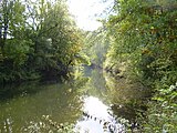
The Jagst is a river that runs through the cultural landscape and has been shaped by human presence for thousands of years. At most, it could only be described as a wild river in extremely small sections in the middle reaches. Nevertheless, the structure of the water is overall quite good compared to others. Only small areas between Crailsheim and Kirchberg have remained completely unchanged (see pictures in the geographical section) . For the greater part of its course, slightly, moderately or significantly changed sections follow one another in rapid succession. On the other hand, only very few and short areas are markedly or even very strongly changed. In the upper reaches from the source to a few kilometers downstream from Ellwangen, however, the Jagst has been severely straightened in parts; with a few exceptions, it has been very heavily or even completely changed on this stretch.

The weirs are of some importance for the structure of the water , and there are large numbers of them in almost the entire course and which often dammed the river for kilometers. There are 34 transverse structures on the last 115 kilometers of the river and it is estimated that around half of the stretch of the river is backlogged. As a result, once fast flowing sections have been transformed into calm, deep, slow flowing sections; Gravel banks , which are of great ecological importance, sank into the water. The backwater has a correspondingly large impact on the flora and fauna there: gravel banks can no longer fulfill their function as breeding and spawning habitats, and with them pioneering sites for plants have also disappeared. With slow flow speeds and water depths of up to six meters, a muddy bottom forms. Species like the yellow pond rose are favored, stocks of pond rush are displaced. The backwater-shaped sections, formerly part of the natural barbel region, now belong to the bream region (see fish region ) .

For several years now, great efforts have been made to limit the effects of the weirs. The fish ladders set up at the weirs did not encourage fish migration as much as hoped. Many of them have already been replaced with new fish ladders. In addition, the river was widened in places, spawning biotopes, islands and gravel banks were created. One of these floodplain biotopes can be found near Herbolzheim , another since the end of 2009 in Widdern .
The banks were often secured by throwing blocks or stones, especially below the weirs, but also elsewhere. These interventions are often not noticed by laypeople, as mostly untreated limestone lumps were used and these are usually quickly overgrown by the bank vegetation. However, they prevent side erosion and thus the natural “working” of the river. This also prevents the formation of so-called "kingfisher walls", i.e. steep banks in the floodplain clay, which not only the kingfisher needs, but also sand martins and small mammals, for example. The water structure had a considerable influence on the floodplain condition dealt with in the following subsection.
Outdoor condition

In the floodplain status report published for the first time in 2009 by the Federal Agency for Nature Conservation (BfN), in which the loss of floodplains and the condition of the recent floodplains were recorded along the left and right banks of 79 German rivers, the Jagst floodplains between their northernmost point at Krautheim and its mouth.
In order to determine the loss of floodplain, the morphological floodplain was first determined, i.e. H. the area that is characterized by more or less regular flooding and that would be accessible from floods today if there were no flood protection measures. Finally, the recent floodplain was determined, i.e. that part of the morphological floodplain that floods can reach today in the event of a statistical hundred-year flood. The loss of the floodplain is calculated from the comparison. It is relatively low on the Jagst, on most sections it is below 25%, which corresponds to the cheapest rating class.
In addition, the qualitative condition of the recent floodplain was assessed. Their morphodynamics (floodplain relief and floodplain waters), their hydrodynamics (runoff and flooding) as well as the vegetation and land use were of importance. In addition, a disadvantage was included in the evaluation if a section is characterized by backwater. In order to take into account the value of larger contiguous floodplain sections, a bonus for connectivity was given for such sections. For the overall evaluation, 5 classes were finally formed, which denote the degree of closeness to nature. The point of reference is the potentially natural state of the floodplain, which is not influenced by humans. Along the Jagst, the lion's share of the floodplain sections was assigned to condition class 3 (significantly changed). Individual sections were assigned to quality classes 2 (slightly changed) or 4 (greatly changed). No section was assigned to class 1 (very little changed). The share of this condition class in the assessed rivers was less than 1% across Germany. After all, no section of the Jagst was rated with condition class 5 (very strongly changed), to which 20% of the assessed floodplain sections nationwide were assigned. Jagst, Trebel and Peene are the only of the 79 assessed rivers without a section in class 5. Among the nine assessed rivers in which Baden-Württemberg participates - Rhine, Neckar, Danube , Iller , Main , Tauber, Jagst, Kocher and Enz - the Jagst performs best overall despite the only moderate condition of its floodplains.
leisure
Canoeing
The Jagst is very popular with canoeists and kayakers . From Jagstzell it is considered a hiking trail and from Crailsheim to around Langenburg it is a (in places moderately difficult) white water river . This leisure activity can be quite problematic, however, as it can cause massive disruption to animals and plants, depending on the number of boats. In addition, the ground contact of the boats and paddles affects the habitat of the animals living on the bottom of the water. A lack of experience with canoeists and inappropriate behavior exacerbate the problem. Therefore, numerous sections - including those that are very interesting for water sports enthusiasts and also the most untouched - are subject to significant restrictions, especially in the high season:
- District of Schwäbisch Hall , from weir Crailsheim Heldenmühle (river km 131.7) to weir Unterregenbach (near Langenburg, km 91.2), closed annually from June 1st to September 15th. In the rest of the time, voluntary self-restraint if the level is below 140 cm.
- Hohenlohekreis , from weir Unterregenbach (km 91.2) to Dörzbach (km 70.2), closed annually from February 15 to September 15.
- Hohenlohekreis, entire Jagst: closed at levels below 40 cm. If the level is below 60 cm (Dörzbach level), the section below the weir up to the re-confluence of the power station canal is not allowed.
- Heilbronn district , from the Widdern pedestrian bridge (km 33.7) to the Möckmühl bridge (km 26.0), closed every year from February 15 to September 15.
- Heilbronn district, from Neudenau weir (km 13.2) to its confluence with the Neckar (km 0.0), closed annually from February 15 to September 15.
- District of Heilbronn, entire Jagst: closed if the level is below 100 cm.
For more information see web links.
Hiking and biking
Other popular leisure activities in the Jagsttal are hiking , which is the best way to get familiar with the Jagsttal. Well-known hiking trails are, for example, the Jagst cultural hiking trail or the paths of silence . A route of the Jakobsweg also leads through the lower Jagsttal (Rothenburg ob der Tauber – Speyer). The Jagsttal is similarly popular for cyclists . First of all, the 340 kilometer long Kocher-Jagst cycle path should be mentioned . It runs almost in the entire Jagsttal, with the exception of the section above Lauchheim and some small sections where there is no path in the valley. Several side valleys are also home to signposted cycle paths, such as the Kessach, Schefflenz or Seckach valleys. There are also three rivers tours (Kocher-Jagst- Tauber and Kocher-Jagst- Bühler ).
Fishing
The Jagst is of great importance for the sport of fishing . Anglers are one of the most important interest groups on the river. Their role in nature conservation is ambivalent: On the one hand, they make a major contribution to environmental protection by regularly cleaning the river and the banks of rubbish. Furthermore, they take on maintenance work and urge, for example, that the natural biotopes be expanded and improved with the creation of fish ladders or spawning biotopes. On the other hand, fishing clubs are of course primarily interested in fishing, and where this is not compatible with nature conservation, they clearly put it aside. This can be seen in the stocking of fish species that are not appropriate to the location or in the dispute about how to deal with the competitor, the cormorant the angler, who has been waving passionately for years.
Sights and buildings
Castles and Palaces


Selection:
- Hohenbaldern Castle near Zöbingen, district of Unterschneidheim , a few kilometers east of the young Jagst
- Kapfenburg Castle above Lauchheim
- Castle above Ellwangen
- Burleswagen Castle in Burleswagen, district of Satteldorf
- Erkenbrechtshausen Castle in Erkenbrechtshausen, a district of Crailsheim , about one kilometer southwest of the Jagst
- Lobenhausen Castle , of which only small remains have been preserved
- Kirchberg Castle
- Hornberg Castle (Burg Hornberg, Hornburg) in Hornberg, opposite Kirchberg
- Leofels castle ruins
- Langenburg Castle , seat of the Hohenlohe-Langenburg family , with the Langenburg car museum.
- Morstein Castle near Ilshofen
- Buchenbach Castle near Mulfingen
- Bartenstein Castle in Bartenstein (see there) above the Ettetal , a few kilometers east of the Jagst
- The three castles of the municipality of Dörzbach : Eyb Castle, the castle of the Barons von Racknitz in the district of Laibach, a few kilometers north of the Jagst in the Laibachtal and the castle of the Freiherren von Palm in the Messbach district, a few kilometers south of the Jagst in the Messbachtal, a side valley of the Ginsbach Valley
- Krautheim Castle
- Aschhausen Castle in Aschhausen , a few kilometers north of the Jagst in the Erlenbachtal
- Ancestral seat of the Lords of Berlichingen in Berlichingen
- Jagsthausen Castle (also called Old Castle or Götzenburg ) owned by Götz von Berlichingen in Jagsthausen
- Red Castle in Jagsthausen
- White Castle in Jagsthausen
- Rossach Castle in Rossach, part of the Schöntal municipality , on the ridge between Jagst- and Kessachtal
- Möckmühl Castle
- Domeneck Castle near Züttlingen
- Assumstadt Castle in Züttlingen
- Heriboldesburg ruins in Herbolzheim
- Heuchlingen Castle between Bad Friedrichshall -Jagstfeld and Duttenberg

Historic cities
Selection:
- Old town of Bartenstein (Schrozberg)
- Old town of Kirchberg an der Jagst
- Old town of Langenburg
- Old town of Krautheim
- Old town of Möckmühl
- Old town of Neudenau
bridges


- Steinerne Jagstbrücke von Hohebach , built 1808–1810, described by Karl Julius Weber as "the most beautiful bridge in Württemberg"
In addition to the above-mentioned bridge in Hohebach, numerous other old stone arch bridges span the Jagst, for example in Kirchberg (built in 1779), in the hamlet of Eichenau, in Oberregenbach near Langenburg, in the Schöntal monastery, the first of the two bridges in Jagsthausen or the bridge built in 1763 in Olnhausen .
In the Jagsttal there are still several covered wooden bridges, one of them from 1821/22 in Unterregenbach , others are the Ockenauer Steg near Kirchberg and the Archenbrücke in Bächlingen (original 1793, destroyed in World War II, rebuilt in 1989/91).
Other cultural sights


- Roman remains on the Limes crossing near Rainau , such as the Limestor Dalkingen
- St. Vitus Basilica and Schönenberg Church in Ellwangen
- Hammer forge in Gröningen (see there), restored in 1982
- Anhäuser Wall , remnant of the former Anhausen Monastery, a little north of the Gronach Gorge in the municipality of Satteldorf
- Crypt under the church in Unterregenbach.
- Jewish cemetery in Hohebach
- St. Wendel zum Stein chapel near Dörzbach
- The relics of the Jagst Valley Railway between Dörzbach and Möckmühl
- Schöntal Monastery
- Berlichingen Jewish cemetery
- Gangolf Chapel near Neudenau
- Jewish cemetery Neudenau
- The Hohe Straße between Kocher and Jagst , part of a long-distance connection between Bad Wimpfen and Nuremberg that probably already existed in early Celtic times

Natural sights
Because of the variety of landscapes and the aesthetic charms of the Jagst Valley, only special individual objects should be mentioned here:
- Meander between Jagstzell and Jagstheim
- Devil's Blade west of Satteldorf
- Narrow valley in the Upper Muschelkalk and Gronach estuary below the Satteldorfer Kernmühle
- Baierlesstein and Bärenstein south and west of Bölgental
- Circumferential mountains from Lobenhausen , Mistlau and Kirchberg ("Sophienberg")
- Lime sinter terrace from St. Wendel zum Stein
- "Growing brook" near Krautheim, a stone channel
Trivia
Some of the Fiat 600 models built in Germany bore the name "NSU Fiat Jagst".
River course - picture gallery

View of the valley from the Leofels castle ruins
The Jagsttal near Bächlingen

Shortly after Heimhausen near Mulfingen after heavy winter precipitation

The Jagst near Dörzbach in the Hohenlohe district

View from Krautheim Castle. Here is the Jagst border between Baden and Württemberg

The wintry Jagst in Schöntal

Hunting impressions between Jagsthausen and Olnhausen

The Jagst near Olnhausen in cold January 2009

Scene near Olnhausen
The humble river in late summer between rams and rams
At the Ruchsener Wehr, a popular bathing place
Scene between Ruchsen and Möckmühl

Photo taken at the Alt-Herrensteg near Möckmühl.

between Möckmühl and Züttlingen

Below Assumstadt Castle in Züttlingen
Restless, hurried Jagst between Herbolzheim and Untergriesheim, where she has built a gravel bank overgrown with grasses and willow bushes.
Jagst near Untergriesheim between the Schefflenz and Tiefenbach estuaries

The Jagst flows towards the Neckar. The last meters of their 190.2 km long way

View from the opposite side of the Neckar


See also
References and comments
- ↑ a b c d Map services of the Federal Agency for Nature Conservation ( information )
- ↑ a b Search for : Expansion potential of hydropower up to 1,000 KW in the Neckar catchment area, taking into account ecological management goals , at the Ministry for the Environment, Climate and Energy in Baden-Württemberg, 2011, p. 8, accessed on December 14, 2014 (PDF, German; 1.87 MB).
- ↑ a b LUBW (2005): Biotopes in Baden-Württemberg: brooks, rivers and oxbow lakes , p. 21 (PDF; 2.88 MB)
- ^ German Hydrological Yearbook Rhine Region, Part I 2009 State Institute for Environment, Measurements and Nature Conservation Baden-Württemberg, p. 131, accessed on January 22, 2016 (PDF, German, 1.85 MB).
- ↑ The main hydrological line of the Kocher above Abtsgmünd , however, is not the Kocher upper course up to there, but the noticeably longer Lein that converges there there . When comparing the main strands, the Kocher - with a length of 201 kilometers - exceeds the Jagst by 11 km.
- ^ Dieter Berger: Geographical names in Germany . 2nd Edition. Dudenverlag, Mannheim ( inter alia) 1999. ISBN 3-411-06252-5 , p. 157 ( Duden-Taschenbücher. Volume 25).
- ↑ a b Bernhard H. Lott: The Jagst from the source to the mouth . Swiridoff Verlag (see section Literature )
- ↑ Carlheinz Gräter: Hohenloher Weinbrevier. Hohenloher printing and publishing house, Gerabronn, Crailsheim, 1974.
- ^ Bernhard H. Lott: The Jagst from the source to the mouth : "D'Jogscht", p. 160
- ↑ The length information comes from the information of the LUBW (Central Map Server) with the exception of the Röhlinger Sechta, the Ette and the Hergstbach (see there).
- ^ A b c d e German Hydrological Yearbook 2006, Rhine region part 1. (Assessment period at the Untergriesheim gauge 1925–2006).
- ↑ Hans Mattern: Das Jagsttal from Crailsheim to Dörzbach , p. 9 (see section literature )
- ↑ G. Wagner: From the earth and landscape history of our homeland. In: Heimatbuch Crailsheim , 1928, pp. 1-44.
- ↑ J. Zander: Hydrogeological investigations in the Muschelkalk Karst of North Württemberg (eastern Hohenlohe plain). Arb. Inst. Geol. Paleont. Univ. Stuttgart N.F. 70, 1973, pp. 87-182.
- ↑ a b Written information from the State Office for Geology, Raw Materials and Mining of the Freiburg Regional Council
- ^ H Mattern: The Jagsttal from Crailsheim to Dörzbach, pp. 8-10, 13 f., 120-137.
- ^ T. Simon, State Office for Geology, Raw Materials and Mining, written communication
- ↑ Hans Mattern: Das lower Jagsttal p. 185 (see section literature )
- ↑ Ludwig Tiecks Schriften , p. 95. (PDF; 14.2 MB).
- ↑ The Jagstbrücke zu Hohebach - Stronger than the forces of nature ( Memento of the original from October 9, 2007 in the Internet Archive ) Info: The archive link was inserted automatically and has not yet been checked. Please check the original and archive link according to the instructions and then remove this notice. Karl August Friedrich von Duttenhofer , on pfade-der-stille.de
- ↑ a b c d e f level data and runoff values of the flood forecast center of the LUBW (assessment period at the Untergriesheim gauge 1980–2003), on hvz.baden-wuerttemberg.de/
- ↑ Telephone information from LUBW.
- ↑ State Institute for the Environment, Measurements and Nature Conservation Baden-Württemberg, Environmental Data 2009 Baden-Württemberg , p. 116f.
- ↑ Unusual flood events on the Neckar and its tributaries ( Memento of the original from August 8, 2007 in the Internet Archive ) Info: The archive link has been inserted automatically and has not yet been checked. Please check the original and archive link according to the instructions and then remove this notice. , on ikone-online.de (PDF; 25.15 kB)
- ^ German Hydrological Yearbook 2007, Rhine area part 1.
- ↑ The date and value can be found in the German Hydrological Yearbook 2008 as soon as it appears.
- ↑ Annette Strasser: Reconstruction of former Danubian landscapes and Rhenish erosion over a period of one million years - a modeling and calculation using the example of two southern German river systems (dissertation) p. 34 (PDF; 48.2 MB)
- ↑ Profile of the nature reserve in the LUBW's list of protected areas
- ↑ a b c d e f g Scherfose, V. (edit.): Nationally significant areas for nature conservation. BfN series of publications on nature conservation and biological diversity , issue 43.
- ↑ Hans Mattern: The upper Jagsttal from the source to Crailsheim , p. 206 (see section literature )
- ↑ Hans Mattern: The upper Jagsttal from the source to Crailsheim (see section literature )
- ↑ Hans Wolf: Water birds of the upper Jagst , in: Hans Mattern, Das upper Jagsttal from the source to Crailsheim , p. 187f (see section literature )
- ↑ Publications for nature conservation and landscape management in Baden-Württemberg (from 1999) , on lubw.baden-wuerttemberg.de (PDF; 921.74 kB)
- ↑ The Bechstein bat - Myotis bechsteinii (Kuhl, 1817) ( Memento of the original from March 10, 2014 in the Internet Archive ) Info: The archive link was automatically inserted and not yet checked. Please check the original and archive link according to the instructions and then remove this notice. , Naturschutz-Info 2003, No. 3, on lubw.baden-wuerttemberg.de
- ↑ Westhausen Jagst (fourth tour) Biber-Schaden , on panoramio.com
- ↑ Jagst Biber Two confirmed occurrences in the central Jagsttal , on hege-kocher.de
- ↑ Beaver management in Baden-Württemberg newly regulated ( memento of the original from March 9, 2014 in the Internet Archive ) Info: The archive link was automatically inserted and not yet checked. Please check the original and archive link according to the instructions and then remove this notice. , Naturschutz-Info 2003, No. 3, on lubw.baden-wuerttemberg.de
- ↑ Fischerei in Baden-Württemberg , edition No. 3 for September 2010, p. 15.
- ↑ Large river mussel - Unio tumidus ( Memento of the original from December 14, 2014 in the Internet Archive ) Info: The archive link has been inserted automatically and has not yet been checked. Please check the original and archive link according to the instructions and then remove this notice. , on lubw.baden-wuerttemberg.de
- ↑ M. Pfeiffer (2009): Evidence of brook mussels (Unio crassus) in the Jagst. Writings on malacoology from the House of Nature. Issue 25. Cismar.
- ↑ Hans Mattern: Das lower Jagsttal , p. 64 (see section literature )
- ↑ Oral information from the District President of Stuttgart, Ref. 52.
- ↑ written information from LUBW
- ↑ a b Jens Sitarek: County Hall: drugs and toxins in the Jagst. In: swp.de . March 6, 2018, accessed September 26, 2019 .
- ↑ Jens Sitarek: Jagst report burdens mill operators, the fire brigade also made mistakes. In: Hohenloher Tagblatt (online). September 23, 2016, accessed December 19, 2017 .
- ^ District: Jagst not ecologically dead after chemical accident. Badische-zeitung.de, September 2, 2015, archived from the original on September 3, 2015 ; accessed on March 9, 2016 .
- ↑ dpa: Jagst tragedy: Experts expect more dead fish. In: Stimme.de. October 5, 2015, accessed October 6, 2015 .
- ↑ After the fire, the fish die. In: schwaebische.de. August 24, 2015, accessed August 27, 2015 .
- ^ After a major fire in the mill: Fish die in the Jagst. In: Stimme.de. August 25, 2015, accessed August 27, 2015 .
- ↑ Poison bubble reaches Hohenlohekreis. In: Landesschau aktuell. SWR, August 26, 2015, accessed on August 27, 2015 .
- ↑ Thomas Zimmermann, Jürgen Kümmerle, Christian Gleichauf: Desperate fight against the disaster in the Jagst. In: Stimme.de. August 27, 2015, accessed August 27, 2015 .
- ↑ After a misfortune a year ago: Jagst's condition is still not good , from August 18, 2016, on Stimme.de
- ↑ Jens Sitarek: Angler compensated after the hunting disaster. In: swp.de (Südwest Presse). February 13, 2018, accessed February 17, 2018 .
- ↑ State Institute for the Environment Baden-Württemberg (LUBW) ( information )
- ↑ Shore plant grows over the head of fishermen , Fischereiverein Heilbronn, on fv-heilbronn.de
- ↑ a b Fisch (eventual) Jegekonzept Jagst ( Memento of the original from November 18, 2008 in the Internet Archive ) Info: The archive link has been inserted automatically and has not yet been checked. Please check the original and archive link according to the instructions and then remove this notice. , at the Association for Fisheries and Water Protection in Baden-Württemberg eV , on vfg-bw.org (PDF file; 2.16 MB)
- ↑ BfN : Auenzustand - Nationwide recording and evaluation of the floodplains ( Memento of the original from January 30, 2010 in the Internet Archive ) Info: The archive link was inserted automatically and has not yet been checked. Please check the original and archive link according to the instructions and then remove this notice. , Auenzustandsbericht (can be sent as a brochure on request), at bfn.de
- ↑ Elpershofen gauge , at hvz.baden-wuerttemberg.de
- ↑ Dörzbach gauge , at hvz.baden-wuerttemberg.de
- ↑ Untergriesheim gauge , at hvz.baden-wuerttemberg.de
literature
- Hans Mattern : The upper Jagst valley from the source to Crailsheim. Baier BPB Verlag, Crailsheim 2009, ISBN 978-3-929233-82-7 .
- Hans Mattern: The Jagst Valley from Crailsheim to Dörzbach . Baier BPB Verlag, Crailsheim 1995, ISBN 3-929233-04-5 .
- Hans Mattern: The lower Jagsttal . Baier BPB Verlag, Crailsheim 2005, ISBN 3-929233-27-4 .
- Bernhard H. Lott: The Jagst from the source to the mouth . Swiridoff Verlag, Künzelsau 2000, ISBN 3-934350-25-9 .
Movie
- Picture book Germany : Along the Jagst. Documentation, 45 min., Film by Gerd Ries, production: SWR , first broadcast: April 10, 2005, table of contents
- The Jagst - from the source to the mouth . Documentation, 28:33 min., Film by Eckarth Palutke and Peter Lemke, on youtube.com
Web links
- Sub-processing area 48 - Jagst , on rp-stuttgart.de
- Hohenlohekreis Umweltamt , on Hohenlohekreis-umwelt.de
- Level map Baden-Württemberg flood forecast center (HVZ) Baden-Württemberg, on lubw.baden-wuerttemberg.de
- Jagst water temperatures at the Untergriesheim gauge , on lubw.baden-wuerttemberg.de
- Jagsttal , on jagsttal.de
- Kocher-Jagst-Radweg , Arbeitsgemeinschaft Kocher-Jagst-Radweg, on kocherjagst.de
- Jagst cultural hiking trail , at Hohenlohe.de