
Marburg-Biedenkopf district
| coat of arms | Germany map |
|---|---|

|

Coordinates: 50 ° 47 ' N , 8 ° 46' E |
| Basic data | |
| State : | Hesse |
| Administrative region : | to water |
| Administrative headquarters : | Marburg |
| Area : | 1,262.55 km 2 |
| Residents: | 247,084 (Dec. 31, 2019) |
| Population density : | 196 inhabitants per km 2 |
| License plate : | MR, BID |
| Circle key : | 06 5 34 |
| NUTS : | DE724 |
| Circle structure: | 22 municipalities |
| Address of the district administration: |
Im Lichtenholz 60 35043 Marburg |
| Website : | |
| District Administrator : | Kirsten Fründt ( SPD ) |
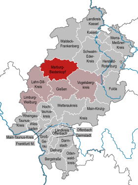
| Location of the Marburg-Biedenkopf district in Hesse | |
  |
|
The Marburg-Biedenkopf district is located in the Gießen administrative district in Central Hesse . It is characterized by a low mountain range with large forests and the river Lahn , which runs through the district from west to southeast.
The center of the district and its only regional center is the university town of Marburg with a good 70,000 inhabitants. Other important cities ( middle centers ) are the former district town of Biedenkopf and Gladenbach , both of which are in the west of the district, in the Hessian hinterland , as well as Kirchhain and the business location Stadtallendorf in the east district ( old district Kirchhain ).
geography
location
The district is in the north of the administrative district of Giessen. The district town is the regional center of Marburg . The district is about 76 kilometers wide in its largest west-east extension, and about 36 kilometers in north-south direction.
The highest mountain at 674 m is the bagpipe in the extreme (north) west near Biedenkopf . The highest point is the top of the 210 m high radio mast of the Biedenkopf transmitter , which, when added to the altitude of the location, results in a height of 868 m.
The lowest point at around 168 m is the Lahnaue between Fronhausen and Sichertshausen in the south of the district on the border with the Gießen district.
Land use
The area of the district can be broken down as follows. 14.3% or 17,996 ha are settlement and traffic areas, 55,489 ha or 43.9% of the area is used for agriculture. The forest area is 51,582 ha or 40.9%, 1,189 ha or 0.9% are bodies of water.
Neighboring areas
The district borders in a clockwise direction in the north, beginning with the districts of Waldeck-Frankenberg , Schwalm-Eder-Kreis , Vogelsbergkreis , Gießen and Lahn-Dill-Kreis (all in Hesse) and the district of Siegen-Wittgenstein (in North Rhine-Westphalia ).
Natural structure
.JPG)
The district lies at the junction of three low mountain range large landscapes. A valley basin running in north-south direction, which extends from the north of the district over the Wetschaft basin (Münchhausen, Wetter, Lahntal), after crossing the Lahn upper reaches into the Elnhausen-Michelbach basin (western Marburg districts) and Finally, in the south of the district area (Weimar and Fronhausen), the Gießen basin and thus the Lahn valley meet again and find its extension in it, separating the foothills of the Rhenish Slate Mountains in the west from the landscapes of the West Hessian mountain and sink region (main unit group 34) in the east .
The Upper Lahn Valley west of Sterzhausen, in turn, divides the Rhenish Slate Mountains foothills in an east-west direction into those of the Rothaar Mountains (main unit group 33 - Southern Mountains ) in the north-west and those of the (natural) Westerwald (32) in the west and south-west of the district.
The up to 674 m high foothills of the Rothaargebirge ( bagpipe plus foreheads ) occupy only smaller parts of the district in the northwest.

In contrast, the Gladenbacher Bergland , which is naturally part of the Westerwald and up to 578 m high , takes up almost the entire western half of the district. During the north-east from the hill country of Hungert around the 498 m high Rimberg is marked, the West will (just beyond the county border) from at Angelburg to 609 m high plateau of Bottenhorner plateaus dominated the north in the Breidenbacher reason gradually to Lahntal flattens out towards the south and merges into the somewhat less high customs beech ridge (up to 487 m). The latter part of the mountain range is framed to the east by the low-relief hill country of the Salzbödetal , which extends east to the Lahn.
In the eastern half of the district, which is part of the West Hessian Uplands, the ridges, which are largely made of red sandstone, only reach heights of around 400 m with a relief energy of around 200 m. In addition to the mountain ranges of Marburger ridge and Lahnbergen that border the Lahn valley near Marburg, this also includes the Burgwald in the north, the Upper Hessian threshold with the Neustädter Sattel in the east and the basalt-containing Lumda plateau in the south.
All of the mountain ranges mentioned (except for the Marburg Ridge) frame the large and completely unforested valley depression of the Amöneburg basin in a clockwise direction, with the striking basalt cone of the Amöneburg as the only notable elevation.
mountains
The most important mountains in the district as excursion destinations and vantage points are the 674 m high bagpipe in the Rothaargebirge foothills north of Biedenkopf, the 498 m high Rimberg in the Kuppenland near Dautphetal-Damshausen, the 538.7 m high Scheid (1 km east of Bottenhorn ) , the 498 m high Schönscheid , which belongs to the customs beech (natural area) southwest of Bad Endbach , the 454 m high Koppe on the eastern customs beech near Gladenbach-Erdhausen, the 387 m high Christenberg and Mellnau Castle in the western castle forest not far from Wetter, the 380 m high Burgholz north church grove on the upper Hessian Ridge, the 365 m high, singular in Amöneburg basin Amöneburg and the 380 m high Ortenberg with the Spiegelslustturm and the 370 m high Fraunberg on the Lahn mountains near Marburg.
Waters
,_first_snow_in_November_2015-11-22_(16).JPG)
Of the many bodies of water in the district, the Lahn is by far the largest body of water with a total length of 242 km. It flows through the district from the west to about the middle of the district area, to turn south at Marburg and to leave the district area at Sichertshausen. Almost all other waters flow into the Lahn and thus belong to the Rhine catchment area.
The northeastern part separated by the Neustädter Sattel is an exception . The Neustädter Sattel is part of the Rhine-Weser watershed, which is why the places on the other side of the district - which are exactly the districts of Neustadt - belong to the Weser catchment area. The only river worth mentioning is the Wiera , which flows from the left into the Schwalm , the most important tributary of the Eder .
In the north-west of the district near the bagpipe , the watershed to the Eder forms the exact boundary of the district, in the north, at the Wetschaft depression , the watershed runs close to the border, but only on the other side. In the west, the district border runs along the watershed between Lahn and Dill and thus largely following the historical border between the former Duchy of Nassau and the Grand Duchy of Hesse-Darmstadt.
The following rivers and streams from the Lahn river system are important for the district:
| Surname |
Inflow side |
Length [km] |
Catchment area [km²] |
Mouth height [m. ü. NN] |
next to rivers |
Important roads close to the river |
Communities |
|---|---|---|---|---|---|---|---|
| Lahn | not applicable | 242 | 5964 | s. u. | B 62 , B 3 | Biedenkopf, Dautphetal, Lahntal, Marburg, Weimar, Fronhausen | |
| Perf | right | 19.95 | 113.13 | 285 |
Gansbach , Diete |
B 253 (via Diete and Perf) | Bad Endbach, Steffenberg, Breidenbach, Biedenkopf; Gansbach : + Angelburg |
| Dautphe | right | 8.8 | 41.81 | 245 | B 453 | Dautphetal | |
| Wetschaft | Left | 29.0 | 196.21 | 192 | Treisbach | B 252 | Münchhausen, Wetter, Lahntal Treisbach : + northeastern districts of Biedenkopf |
| ohm | Left | 59.0 | 984 | 188 |
Small , Wohra |
B 62 (via Klein and Ohm), Landesstraße L3073 Kirchhain- Homberg , Wohra : Landesstraße L3073 Kirchhain- Gemünden |
Stadtallendorf, Amöneburg, Kirchhain, Cölbe; Wohra : + Wohratal, Rauschenberg |
| Allna | right | 19.1 | 92.02 | 172 | Oh | Gladenbach, Weimar, Marburg | |
| Wenkbach | right | 7.2 | 20.77 | 168 | - / - | Weimar | |
| Zwester Ohm | Left | 20.0 | 69 | 167 | State road L3048 Kirchhain-Fronhausen | Ebsdorfergrund, Fronhausen | |
| Salt flats | right | 27.6 | 137.85 | 154 | verse |
B 255 (only a short distance) Landesstraße L3048 (Gladenbach-Fronhausen) |
Bad Endbach, Gladenbach, Lohra, Fronhausen |
Between Kirchhain and Marburg, the retention basin of the largest Lahn tributary, the Ohm, has provided the city of Marburg with reliable flood protection so far ; in the west, the Perfstausee near Biedenkopf holds back larger amounts of water if necessary. In addition, in the area of the upper Lahn, for example between Lahntal -Caldern and Lahntal-Sterzhausen, measures for renaturation and preventive flood protection have been implemented as part of a research project.
climate
The annual mean rainfall in the Marburg area is around 600–700 mm, in the more mountainous western part of the district 850–1000 mm.
history
As part of the Hessian district reform , on July 1, 1974, the two districts of Marburg and Biedenkopf were merged together with the independent city of Marburg to form the new "District of Marburg-Biedenkopf". The city of Marburg was enlarged by its 18 (outer) districts , one of the seven special status cities in Hesse.
Apart from the merger, the following changes to district affiliations were made:
- The municipality of Schiffelbach in the old district of Marburg had already become a district of Gemünden (Wohra) in the Waldeck-Frankenberg district on January 1, 1974 .
- The communities of Roth and Simmersbach from the old district of Biedenkopf were spun off into the community of Eschenburg in the Dill district , which was then dissolved in the Lahn-Dill district in 1977 .
- The five sub-communities of the large community of Bischoffen moved to the district of Wetzlar , which was also dissolved in 1977 and passed into the Lahn-Dill district.
- The towns of Nordeck and Winnen , which were combined to form the municipality of Braunstein for only a few years , became districts of the town of Allendorf (Lumda) in the district of Gießen .
- The municipality of Mengsberg , formerly the district of Ziegenhain , was added to the newly formed district as a district of Neustadt .
- The hinterländische (until 1932 Kreis Biedenkopf ) Oberasphe , hitherto district Frankenberg that 1 January 1974 initially as a district of Battenberg the Waldeck-Frankenberg had been slammed, was after violent protests by the population for half a year later in the new greater community Munchausen of local district incorporated.
With the merger, two administrative areas that were 350 years separate and belong together from a historical point of view were reunited. The former district of Marburg and the district of Biedenkopf are also to be regarded as belonging together in natural areas.
The Marburg-Biedenkopf area was formerly the region with the most traditional costumes in Germany (e.g. Hinterland costumes , Marburg costumes).
History before 1974
In the course of history, today's district area belonged predominantly to the Landgraviate of Hesse , some areas also belonged to the Archbishopric Electorate of Mainz . When the state of Hessen was divided, the Marburg area became part of Hessen-Kassel , and the so-called hinterland (the offices of Battenberg , Blankenstein , Biedenkopf , Hatzfeld and Vöhl ) became part of Hessen-Darmstadt . Amöneburg in Electoral Mainz did not become part of Hessen-Kassel until 1803.
In 1821 the Electorate of Hessen- Kassel formed the districts of Marburg and Kirchhain . In the Grand Duchy of Hesse ( Darmstadt ), the districts of Battenberg (with Biedenkopf) and Gladenbach were created , which were combined to form the Biedenkopf district in 1832 . In 1866 Prussia annexed the Electorate of Hesse and the Duchy of Nassau , which it united to form the Province of Hesse-Nassau . At the same time, Prussia received the Biedenkopf district from the Grand Duchy of Hesse, so that all three districts became part of the Hesse-Nassau province. In 1929 the city of Marburg left the district of Marburg within the boundaries of today's core city (but still without Ockershausen , which was incorporated on January 1, 1931) and became a district . Three years later, in 1932, the Kirchhain district was merged with the Marburg district , and the Biedenkopf district was reorganized. It lost around 40% of its territory to the district of Frankenberg and the district of Wetzlar, which was simultaneously reclassified from the Rhine province to the province of Hesse-Nassau.
population
According to the Hessian State Statistical Office, 251,159 people lived in the Marburg-Biedenkopf district on September 30, 2008. The slight population decline that began around 2003 is therefore continuing.
The newly formed district had 232,632 inhabitants on July 1, 1974.

Religions
The oldest still existing religious community in the district is the Roman Catholic Church . Through Irish-Scottish monks in the seventh century and through Boniface and his students at the beginning of the eighth century, the Christian faith came to the eastern part of today's district through the churches near Amöneburg . In the western part, a baptistery in Breidenbach, which is said to have existed as early as the Bonifatic period, was the starting point for Christianization. As a result, many churches and monasteries emerged, from which small towns often developed. After the Reformation in 1524, Landgrave Philipp demanded a change of confession, which meant that the area was almost exclusively evangelical-Lutheran . Only a part of the eastern district, in addition to today's Amöneburg deanery, also three of the four Marburg districts on the other side of the Lahnberge, as pre-Reformation belonging to the Archdiocese of Mainz , is strongly Catholic. Historically, this also includes the Katzenberg enclave , which until 1866 belonged to the Kirchhain district and has since been incorporated into the Antrifttal community in the neighboring Vogelsberg district.
Jews were first mentioned in the area of today's district in 1273 in Amöneburg. During the plague years around 1350 and after deportation orders in 1524 and 1662, many Jews were forced to leave the area or change their confession. Before the National Socialists came to power, around 1,400 Jews lived in what is now the district. After 1933, the number of Jews in the district fell to zero due to emigration , emigration and deportation . Shortly after the end of the Second World War, around 250 Jews temporarily lived in what is now the district area, the number fell to 20 in the 1970s and has since increased to around 100 members in the Jewish community of Marburg.
The vast majority of the population in the district today is evangelical. The two largest groups within, in turn, are the Evangelical Church of Kurhessen-Waldeck with the church districts Kirchhain and Marburg in the Marburg district and the Evangelical Church in Hesse and Nassau with the deaneries Biedenkopf and Gladenbach in the provost of North Nassau . The Evangelical Church has existed in the district since its inception, as Landgrave Philipp introduced the Protestant faith in the Landgraviate after the Homberg Synod in 1526 .
Administration and politics


The district office is set up as an authority in Marburg-Cappel for the administration of the district . In addition, branch offices of the district are set up in the former district town of Biedenkopf and in Stadtallendorf . On the one hand, the District Office performs municipal tasks, but also tasks as a lower state administrative authority.
The district committee is the self-governing body of the district. It also prepares resolutions for the district council and forms commissions to carry out certain tasks. The district committee consists of 15 voluntary district councilors, who are elected from among the district council, and two full-time members. These are the district administrator and the first district councilor . While the first district councilor is also elected by the district council, the district administrator is directly elected by the residents of the district.
The district administrator and the first district member are each assigned a department. These consist of various departments , staff units , in-house companies and special-purpose associations .
District council
The district council is the municipal representative body at the district level. Detlef Ruffert (SPD) has been chairman of the Marburg-Biedenkopf district council since May 2011. A Jamaica coalition consisting of CDU , Bündnis 90 / Die Grünen and FDP ruled the district from 2001 to 2011 with the support of Free Voters . It was one of the first coalitions of this kind in Germany. After the local elections in 2011, the FDP left the coalition, so that since then a CDU / Bündnis90 / DIE GRÜNEN / Free voter coalition has governed the district.
The local elections on March 6, 2016 produced the following results, compared to previous local elections:
| Diagram showing the election results and the distribution of seats | |
|---|---|
|
District election in the Marburg-Biedenkopf district in 2016
% 40 30th 20th 10
0
35.0%
27.2%
12.5%
9.5%
6.5%
4.5%
3.9%
0.9%
n. k.
Gains and losses
compared to 2011
% p 14th 12 10 8th 6th 4th 2
0
-2 -4 -6 -8th -1.3 % p
-6.3 % p
+ 12.5 % p
-6.9 % p
+ 2.2 % p
+ 4.5 % p
+1.3 % p
-0.5 % p
-5.6 % p
|
|
| Nominations | % 2016 |
Seats 2016 |
% 2011 |
Seats 2011 |
% 2006 |
Seats 2006 |
% 2001 |
Seats 2001 |
|
|---|---|---|---|---|---|---|---|---|---|
| SPD | Social Democratic Party of Germany | 35.0 | 28 | 36.2 | 30th | 36.1 | 29 | 38.8 | 32 |
| CDU | Christian Democratic Union of Germany | 27.2 | 22nd | 33.5 | 27 | 39.6 | 32 | 38.3 | 31 |
| AFD | Alternative for Germany | 12.5 | 10 | - | - | - | - | - | - |
| GREEN | Alliance 90 / The Greens | 9.5 | 8th | 16.4 | 13 | 8.9 | 7th | 8.6 | 7th |
| THE LEFT. | THE LEFT. | 6.5 | 5 | 4.3 | 4th | 4.9 | 4th | 2.4 | 2 |
| FREE VOTERS | Free voters federal association | 4.5 | 4th | - | - | - | - | - | - |
| FDP | Free Democratic Party | 3.9 | 3 | 2.6 | 2 | 4.0 | 4th | 3.9 | 3 |
| PIRATES | Pirate Party Germany | 0.9 | 1 | 1.4 | 1 | - | - | - | - |
| FW | FWG / citizens for Marburg-Biedenkopf | - | - | 3.7 | 3 | 4.0 | 3 | 3.8 | 3 |
| REP | The Republicans | - | - | 1.6 | 1 | 2.5 | 2 | 3.7 | 3 |
| total | 100.0 | 81 | 100.0 | 81 | 100.0 | 81 | 100.0 | 81 | |
| Voter turnout in% | 48.7 | 50.0 | 47.3 | 55.6 | |||||
District Administrator
Kirsten Fründt has been the district administrator of the Marburg-Biedenkopf district since February 1, 2014 . She won on September 22, 2013 in the runoff election against Marian Zachow (CDU) with 60.6% of the vote. The turnout was 64.0%.
There have been five district administrators since the Marburg-Biedenkopf district was established. In 1974, the district administrator of the former Marburg district, Burghard Vilmar (SPD), took over the role of the newly created district on a provisional basis before Siegfried Sorge from the Free Voting Association took over the office in January 1975. He was succeeded in June 1981 by Christean Wagner (CDU), who was in office until July 1985. Kurt Kliem then headed the affairs of the district for eleven years, which was then replaced in 1996 by Robert Fischbach as the first directly elected candidate. In September 2007, District Administrator Robert Fischbach was re-elected in the first ballot for a third term until 2014.
Coat of arms, flag and banner
| Banner, coat of arms and flag | |

|
|

|
|
Blazon :
In blue the golden crowned and reinforced Hessian lion, divided ten times by silver and red, holding a silver shield with a continuous black cross in its paws (coat of arms awarded in 1930 and new on July 11, 1975).
Meaning:
The Hessian lion stands for the Landgraviate of Hesse or its successor states, to which the predominant district area belonged. The cross stands for the German Order of Knights , which had an important settlement in Marburg and to which numerous lands belonged.
Flag description: “The flag is quartered by red and white in a ratio of 2: 3 with the coat of arms on the crossing. The banner is quartered by red and white with the coat of arms on the crossing. "
Culture
Most of the district's cultural activities take place in close regional coordination with the university town of Marburg.
- Literature prize of the university town of Marburg and the Marburg-Biedenkopf district - 1980–2005 every two years
- Marburg-Biedenkopf artists' association
- Otto Ubbelohde Prize (donated in 1987 by the Marburg-Biedenkopf district; it has been awarded annually since then.)
- The Eckelshausen Music Days are an internationally recognized chamber music festival with topics that change every year. During the ten days, the individual events mainly take place in the Biedenkopf and Dautphetal areas. Individual artists, small groups and chamber orchestras perform.
- Biedenkopf Castle Festival
- Participation in the German Milling Day
- Participation in the " Open Monument Day "
- "Literature Parcours" and district art exhibition of the regionally based cultural workers, alternating annually at different locations
language
In addition to standard German, the dialect - the Platt - is also used in the district . The dialect belongs to Central Hesse , with the Hinterländer Platt being spoken predominantly in the western part of the district. In contrast, there is a mixed area with the Lower Hessian dialect in the (north) eastern part. After the dialect was mostly spoken as the first language until the 1960s, the dialect threatened to die out by the end of the 20th century. Increasing regional awareness, which is expressed, among other things, by the formation of dialect associations and their academic support at the Philipps University, are trying to counteract this.
Maintenance of tradition
The Marburg-Biedenkopf area was formerly the region with the most traditional costumes in Germany. In particular, women's costumes are very diverse. In the district a distinction is made between the hinterland costumes and the Marburg costumes . After the men's costumes went out of fashion in the middle of the 19th century, the wearing of women's costumes was frowned upon and partly prohibited for schoolchildren from the time of National Socialism. So the number steadily decreased. Today, especially in the villages, you can still find a few older women in traditional costumes. There are several traditional costume and traditional dance clubs in the district to maintain traditional costumes.
In some places so-called "Grenzgangfeste" are celebrated. The large cross-border festivals in the district take place every seven years in the towns of Biedenkopf , Buchenau , Goßfelden , Wetter and Wollmar . These festivals go back to the crossing of the district boundaries in the late Middle Ages.
Partnerships
- Huntingdonshire District ( UK )
This partnership has officially existed since July 1977; however, the foundations were laid in 1949 when the local youth welfare officer at the time organized a youth exchange.
- Charlottenburg-Wilmersdorf district of Berlin
- Kościerski County in Poland (since October 2000)
There are still friendly contacts with the German districts
as well as the Italian community
- Lüsen in South Tyrol
Economy and Infrastructure
The economic focus of the district are located in Marburg, where most of the service sector through the Philipps University and the successor companies of the former pharmaceutical company Behringwerke is represented in Stadtallendorf , where in addition to the iron foundry winter with Ferrero 's largest employer of the circle is located, as well as in the western part of the District in the city of Biedenkopf and the communities of Breidenbach and Dautphetal , which together are designated as a commercial focus. There and in Gladenbach-Erdhausen you can find some traditional and world-famous model and mold making factories. The municipalities of Bad Endbach , Gladenbach and Lohra jointly operate an intermunicipal business park (see main article Lahn-Dill area ).
The district also has a comparatively low unemployment rate.
In the Future Atlas 2016 , the Marburg-Biedenkopf district was ranked 200th out of 402 districts, municipal associations and independent cities in Germany, making it one of the regions with a “balanced risk-opportunity mix” for the future. In the 2019 edition, it was ranked 235 out of 401.
traffic
.JPG)
The entire area of the district is not crossed by any federal motorway . From the north-east, after the end of the A 49 near Borken (Hesse) (Schwalm-Eder district), the B 3 leads into the district area, which from Marburg to the south is expanded like a motorway via the Gießener Ring (A 485) connection to the A 45 ( Cologne , Dortmund or Frankfurt am Main ) and A 5 towards Frankfurt. In a south-westerly direction, the B 3 also offers a connection to the B 255 to Koblenz and the B 49 to Limburg . To the south-east, the B 62 leads from the A 5 from the Alsfeld exit (Vogelsbergkreis) into the district and to the northwest also in the direction of A 45.
Important and sometimes controversial traffic planning and problems mainly concern the further construction of the A 49, closing the gap on the A 4 between Siegen and the Hattenbacher Dreieck and the construction of bypass roads along the B 62 in the relatively narrow Lahn valley and the B 252.

The most important railway connection in the district is the route of the Main-Weser-Bahn Frankfurt – Gießen – Kassel with IC stop in Marburg alone . Regional express trains on the Frankfurt – Kassel route stop in Marburg, Kirchhain, Stadtallendorf and Neustadt. Single-track branch lines connect Marburg on the one hand with Frankenberg (the so-called Burgwaldbahn ) and on the other hand with Erndtebrück (Siegen-Wittgenstein district, North Rhine-Westphalia) via the Obere Lahntalbahn . From 1905 to 1972, the Marburg district operated its own railway line from the Marburg-Süd station to the Ebsdorfergrund to Dreihausen ( Marburger Kreisbahn ).
Local transport is organized by the Rhein-Main-Verkehrsverbund (RMV) in cooperation with the Regional Local Transport Association (RNV) Marburg-Biedenkopf . The transport company Mittelhessen was awarded the contract for the bundle of bus lines distributed in the district for the first time for the "LMR-Nordwest" area . The two line bundles "LMR-Nordost" and "LMR-West" were awarded in 2006.
The international airport Frankfurt am Main is about an hour's drive away, train connections with a change at Frankfurt (Main) Hauptbahnhof take about an hour and twenty minutes.
A small airfield is located in the Schönstadt district of Cölber , a special landing site in the Bottenhorn district of Bad Endbach.

The Lahntal Cycle Path, which is important for tourism and runs through the district in the Marburg-Gießener Lahntal, runs from north to south, an almost incline-free traffic connection, rated as an ADFC 4-star route, which is also important for everyday traffic in the region's cycle network .
The total length of the cycle route network is 1200 kilometers, of which around 450 km have been developed with signposting and cycle infrastructure. In 2015 there were network gaps of 20 km.
For other themed tourist routes (around 450 km) such as the Burgwald Cycle Path, Otto Ubbelohde Cycle Path or the Salzböder Cycle Path, see the Wikipedia article in the Hesse cycle route network .
Communities
Below is a list of all the municipalities in the district. Under "Altkreis" the municipalities are assigned to the three former districts of Biedenkopf (until 1974, west, Hessian hinterland ), Kirchhain (until 1932, east district ) and Marburg (central, before the incorporation of the Kirchhain district in 1932).
The population of the municipalities relates to December 31, 2019.


| place |
City rights since |
Centrality (regional plan Central Hesse) |
Central center s- area |
Number of districts |
Altkreis |
Residents (core town) |
Total population |
Area [km²] |
|---|---|---|---|---|---|---|---|---|
| Amöneburg | 11 ?? | Small center | Kirchhain | 5 | Kirchhain | 1,500 | 5047 | 43.95 |
| Angelburg (seat: Gönnern ) | not applicable | Sub-center * | Biedenkopf | 3 | Biedenkopf | 1,500 | 3555 | 16.72 |
| Bad Endbach | not applicable | Small center | Gladenbach | 8th | Biedenkopf | 2,300 | 7917 | 40.84 |
| Biedenkopf | 1254 | Middle center | Biedenkopf | 9 | Biedenkopf | 6,200 | 13,588 | 90.33 |
| Breidenbach | not applicable | Sub-center | Biedenkopf | 7th | Biedenkopf | 3,200 | 6690 | 44.83 |
| Cölbe | not applicable | Small center | Marburg | 6th | Marburg | 3,600 | 6666 | 26.66 |
| Dautphetal (seat: Dautphe ) | not applicable | Sub-center | Biedenkopf | 12 | Biedenkopf | 2,400 | 11,407 | 72.03 |
| Ebsdorfergrund (seat: Dreihausen ) | not applicable | Small center | Marburg | 11 | Marburg | 1,500 | 8963 | 72.89 |
| Fronhausen | not applicable | Small center | Marburg | 7th | Marburg | 2,300 | 4134 | 27.88 |
| Gladenbach | 1937 | Middle center | Gladenbach | 15th | Biedenkopf | 4,000 | 12,264 | 72.28 |
| Kirchhain | 1352 | Middle center | Kirchhain | 13 | Kirchhain | 7,700 | 16,290 | 90.92 |
| Lahntal (seat: Sterzhausen ) | not applicable | Small center | Marburg | 7th | Marburg | 2,000 | 6905 | 40.49 |
| Lohra | not applicable | Small center | Gladenbach | 10 | Marburg | 2,500 | 5407 | 49.18 |
|
Marburg ( university , special status and district town ) |
1222 | Upper center | Marburg | 19th | Marburg | 50,000 | 77.129 | 124.5 |
| Munchausen | not applicable | Small center | Marburg | 5 | Marburg | 1,200 | 3301 | 41.54 |
| Neustadt | 1270 | Sub-center | Stadtallendorf | 4th | Kirchhain | 6,700 | 9945 | 56.88 |
| Rauschenberg | 1266 | Small center | Kirchhain | 7th | Kirchhain | 2,200 | 4408 | 67.33 |
| Stadtallendorf | 1960 | Middle center | Stadtallendorf | 6th | Kirchhain | 16,900 | 21,391 | 78.29 |
| Steffenberg (seat: Niedereisenhausen ) | not applicable | Sub-center * | Biedenkopf | 6th | Biedenkopf | 1,200 | 3942 | 24.32 |
| Weimar (seat: Niederweimar ) | not applicable | Small center | Marburg | 12 | Marburg | 2,600 | 7167 | 47.05 |
| Weather | 1239 | Sub-center | Marburg | 10 | Marburg | 4,500 | 8803 | 104.56 |
| Wohratal (seat: Wohra ) | not applicable | Small center | Kirchhain | 4th | Kirchhain | 1,000 | 2165 | 30.66 |
(*): The sub-centers Steffenberg and Angelburg are designated as sub-centers with a need for cooperation (with each other and with the neighboring sub-center Breidenbach) and do not fully meet the criteria for sub-centers.
In addition to the cities listed above, the Stadtallendorf district of Schweinsberg (since 1332) and the Biedenkopfer district of Breidenstein (since 1398) also enjoy historical city rights .
Mid-center areas
Due to the prominent position of the regional center of Marburg, the middle center area of Marburg , which, with the exception of the municipality of Lohra, completely coincides with the old district of Marburg in its composition until 1932, is very extensively oriented towards the university town, with only the town of Wetter in the north being partially complete Has infrastructure.
Wetter, Ebsdorfergrund (in Heskem ) and Weimar (in Niederwalgern ) have larger comprehensive schools, but these have to get by without a grammar school upper level. H. the Abitur itself is only possible in the district town, which also has three relatively large vocational schools with a respective subject focus.
In the eastern district, the former district town of Kirchhain and the now more populous industrial town of Stadtallendorf, as medium-sized centers, partly share the tasks. While Kirchhain u. a. The seat of the secondary schools is (the city has both a vocational school and a comprehensive school with upper secondary school), Stadtallendorf has a branch of the district office . Both cities are relatively independent as shopping cities, but complement each other in more specific offers. Like Stadtallendorf, Neustadt also has a comprehensive school without a high school; In terms of other infrastructure, the city is halfway independent, but less equipped than the two medium-sized centers.
All other cities and communities in the eastern district are more of a village character, although Amöneburg has a private high school.
The west of the district ( Hessian hinterland ) is largely oriented towards the former district town of Biedenkopf as a middle center, although Dautphetal and Breidenbach in particular have the infrastructures of medium-sized small towns. Biedenkopf has u. a. through a grammar school, a vocational school and a branch of the district office.
In the south, the hinterland provides Gladenbach ., Not least due to its geographical isolation, the second agent is center It is much less influenced by industry, however, which houses Kneipp - Spas Gladenbach and Bad Endbach.
The Gladenbach Comprehensive School is the only school in the hinterland outside of Biedenkopf that offers the opportunity for a higher degree.
All in all, the catchment area of Gladenbach remains limited, while Biedenkopf z. Partly also (secondary) center functions for the northern district (Lahntal, Wetter), neighboring communities of the Lahn-Dill district ( Dietzhölztal , Eschenburg ) and the Waldeck-Frankenberg district ( Hatzfeld and partly Battenberg ) and, in a division of functions the neighboring Laasphe , also for the southeast of the Siegen-Wittgenstein district ( North Rhine-Westphalia ).
Regional associations
- The middle-center areas of Biedenkopf and Gladenbach are part of the region and the Lahn-Dill-Bergland nature reserve .
- The rural outskirts of Marburg (i.e. without the core city, Cappel, Wehrda and Marbach) together with Weimar, Fronhausen, Ebsdorfergrund and Amöneburg form the Marburger Land region .
- The north of the mid-center areas of Marburg (Lahntal, Wetter, Münchhausen, Cölbe) and Kirchhain (Kirchhain, Rauschenberg, Wohratal) are part of the Burgwald region (-Ederbergland) .
- The core city area of the regional center of Marburg (with Cappel, Wehrda and Marbach) and the middle center area of Stadtallendorf (including Neustadt) are not part of a separate regional association.
License Plate
On July 1, 1974, the district was assigned the MR distinguishing mark , which had been valid for the Marburg district since July 1, 1956 . It is still issued today.
Until the 1990s, vehicles from the old district of Biedenkopf received license plates with the letter pairs LA to MZ and TA to TZ and the numbers from 100 to 999.
Since January 2, 2013, the distinctive sign BID (Biedenkopf) has been available again.
see: License plate liberalization .
See also
literature
- Karl Huth : The district of Marburg-Biedenkopf, administrative, economic and social history . 2nd expanded edition. Ed .: District Committee of the Marburg-Biedenkopf District, Marburg 1984
- Karl Diefenbach: The district of Marburg, its development from courts, lords and offices up to the 20th century . 2nd Edition. Edited by the Institute for Historical Regional Studies of Hesse and Nassau, NG Elwert Verlag, Marburg 1963
- Ulrich Lennarz: The territorial history of the Hessian hinterland . Hessisches Landesamt für historical Landeskunde, NG Elwert'sche Verlagsbuchhandlung, Marburg 1973
- Ulrich Reuling : Historical local dictionary Biedenkopf, former County . Hessisches Landesamt für historical Landeskunde, NG Elwert Verlag, Marburg 1986
- Ulrich Reuling: Historical local dictionary Marburg, Former District and urban district . Hessisches Landesamt für historical Landeskunde, NG Elwert Verlag, Marburg 1979
- Hermann Ruttmann: Diversity of religions: using the example of religious communities in the Marburg-Biedenkopf district . ( REMID publication). diagonal-Verlag, Marburg 1995, ISBN 3-9802994-6-5
Web links
- Web presence of the Marburg-Biedenkopf district
- Marburg-Biedenkopf district. Historical local dictionary. In: Landesgeschichtliches Informationssystem Hessen (LAGIS).
- Link catalog on the topic of Marburg-Biedenkopf at curlie.org (formerly DMOZ )
Individual evidence
- ↑ Hessian State Statistical Office: Population status on December 31, 2019 (districts and urban districts as well as municipalities, population figures based on the 2011 census) ( help ).
- ↑ Environmental Atlas Hessen - Natural space maps and descriptions in the Environmental Atlas Hessen, Dr. Otto Klausing, Wiesbaden 1988
- ↑ BfN ( Memento of the original from December 19, 2012 in the Internet Archive ) Info: The archive link was inserted automatically and has not yet been checked. Please check the original and archive link according to the instructions and then remove this notice. - interactive map services and landscape profiles
- ↑ Environmental Atlas Hesse . In: Hessian State Office for Environment and Geology 2005, [1. February 2006]
- ^ Federal Statistical Office (ed.): Historical municipality directory for the Federal Republic of Germany. Name, border and key number changes in municipalities, counties and administrative districts from May 27, 1970 to December 31, 1982 . W. Kohlhammer, Stuttgart / Mainz 1983, ISBN 3-17-003263-1 , p. 414 .
- ↑ Law on the reorganization of the districts of Frankenberg and Waldeck of September 28, 1973 GVBl. I p. 359
- ↑ Law on the reorganization of the Biedenkopf and Marburg districts and the city of Marburg (Lahn) (GVBl. II 330-27) of March 12, 1974 . In: The Hessian Minister of the Interior (ed.): Law and Ordinance Gazette for the State of Hesse . 1974 No. 9 , p. 154 , § 8 ( online at the information system of the Hessian state parliament [PDF; 3.0 MB ]).
- ↑ As far as the borders are concerned, however, it should be noted that the district boundary between Marburg and Bauerbach ran differently than the current district boundary , so that the area of the Lahnberge, which today is nominally part of the core town, still belonged to Bauerbach in part (until 1964).
- ↑ Population in the administrative districts on September 30, 2008 and population processes in the 3rd quarter of 2008 ( Memento from November 18, 2012 in the Internet Archive )
- ↑ Ruttmann 1995, p. 40 f.
- ↑ www.marburg-biedenkopf.de → Politics → District organs → District committee → General ( Memento of the original from February 14, 2015 in the Internet Archive ) Info: The archive link was inserted automatically and has not yet been checked. Please check the original and archive link according to the instructions and then remove this notice.
- ↑ The division of the departments can be found in the department distribution plan (PDF; 23 kB) ( page no longer available , search in web archives ) Info: The link was automatically marked as defective. Please check the link according to the instructions and then remove this notice. , the administrative division in the administration organization chart (PDF; 35 kB) ( page no longer available , search in web archives ) Info: The link was automatically marked as defective. Please check the link according to the instructions and then remove this notice.
- ^ Marburger Rundschau, May 20, 2012
- ^ Hessian State Statistical Office: Results of the district elections of 2016 and 2011
- ^ Hessian State Statistical Office: Results of the district elections of 2011 and 2006
- ^ Hessian State Statistical Office: Results of the district elections of 2006 and 2001
- ^ Hessian State Statistical Office: Results of the district elections of 2001 and 1997
- ↑ The APPD won no seat in 2011, but 0.3% of the vote.
- ↑ The Animal Welfare Party and the NPD won no seats in 2001, but won 0.4% and 0.1% of the vote, respectively.
- ↑ Hessian State Statistical Office: direct elections in the Marburg-Biedenkopf district
- ↑ Marburg-Biedenkopf district: "The Otto Ubbelohde Prize and its guidelines" ( Memento from February 14, 2015 in the Internet Archive )
- ^ Dialekt im Hinterland eV
- ↑ Language in Hessen ( Memento from September 6, 2009 in the Internet Archive )
- ↑ 30 years partnership with the English District Huntingdonshire , press release LK MR-BID; October 2, 2007 ( Memento from May 14, 2011 in the Internet Archive )
- ↑ Overview of the partnerships ( memento of April 9, 2009 in the Internet Archive ) at www.marburg-biedenkopf.de - Almost four decades of friendship between the Marburg-Biedenkopf district and the municipality of Lüsen and the 25th anniversary of the partnership between the municipality of Steffenberg and Lüsen ( Memento from February 14, 2015 in the Internet Archive )
- ↑ Regional plan Central Hesse - Draft for the hearing in 2006, p. 66
- ↑ Zukunftsatlas 2016. Archived from the original ; accessed on March 23, 2018 .
- ↑ PROGNOS future atlas. Handelsblatt, accessed on December 10, 2019 .
- ↑ Cycle route network in the Marburg-Biedenkopf district (inventory) ( page no longer available , search in web archives ), marburg-biedenkopf.de, (PDF), accessed on February 23, 2016
- ↑ Bicycle traffic conference in the Marburg-Biedenkopf district with citizen participation on September 15, 2015 ( memento of February 23, 2016 in the Internet Archive ), accessed on February 23, 2016
- ↑ Hessian State Statistical Office: Population status on December 31, 2019 (districts and urban districts as well as municipalities, population figures based on the 2011 census) ( help ).
- ↑ a b Regional plan 2001 for Central Hesse (PDF; 1.9 MB) ( page no longer available , search in web archives ) Info: The link was automatically marked as defective. Please check the link according to the instructions and then remove this notice. (*: with need for cooperation)
- ^ Region and Nature Park Lahn-Dill-Bergland ( Memento from January 21, 2009 in the Internet Archive )
- ^ Marburger Land region
- ↑ Burgwald-Ederbergland region
Counties: Bergstrasse | Darmstadt-Dieburg | Fulda | Casting | Gross-Gerau | Hersfeld-Rotenburg | Hochtaunuskreis | Kassel (Country) | Lahn-Dill-Kreis | Limburg-Weilburg | Main-Kinzig-Kreis | Main-Taunus-Kreis | Marburg-Biedenkopf | Odenwaldkreis | Offenbach (State) | Rheingau-Taunus-Kreis | Schwalm-Eder district | Vogelsbergkreis | Waldeck-Frankenberg | Werra-Meißner district | Wetteraukreis
Independent cities: Darmstadt | Frankfurt am Main | Kassel | Offenbach am Main | Wiesbaden