
Water castle route
| Water castle route | |
|---|---|

|
|
| overall length | approx. 470 km |
| location | Eifel , Cologne Bay / North Rhine-Westphalia |
| map | |
| Link on map | |
| Places along the way | Aachen ( Bf ), Stolberg ( Bf ), Kreuzau ( Bf ), Düren ( Bf ), Nideggen ( Bf ), Heimbach ( Bf ), Mechernich ( Bf ), Zülpich , Euskirchen ( Bf ), Rheinbach ( Bf ), Meckenheim ( Bf ), Wachtberg , Bad Godesberg ( Bf ), Swisttal ( Bf ), Weilerswist ( Bf ), Erftstadt , Kerpen , Bergheim ( Bf ), Bedburg ( Bf ), Jülich ( Bf ), Aldenhoven , Eschweiler - Kinzweiler , Alsdorf ( Bf ), Herzogenrath ( Bf ), Würselen |
| Flooring | approx. 90% asphalt or concrete, approx. 5% water-bound surface , the rest natural paths |
| difficulty | Family route. Only rarely over 5% incline. |
| Traffic volume | low |
| Connection to | Green route , German football route NRW , two-country route , Kaiser route , Mittelland route (D4) , pilgrim route (D7) , RurUfer cycle path , valley route , Rhine cycle path , Erft cycle path |
| ADFC certification | 3 out of 5 stars |
| Website URL | www.die-wasserburgen-route.de |
The moated castle route is a cycle touring route that leads on an approximately 470 kilometer network of cycle paths along the edge of the Eifel and Cologne Bay through the region with the most moated castles in Europe. Alternative routes have been signposted along the route. This makes individual day and multi-day tours possible.
Characteristic
The moated castle route is designed as an approx. 470 km long circuit, whereby several sections can be covered on two alternative routes each. These then form local circuits that can be used for smaller tours. There are also signs that lead to objects of interest to tourists. The route runs largely on paved paths away from road traffic. The ADFC states that around 75% of the route is suitable for road bikes. The course of the route is largely without major gradients, only on the section Kreuzau - Euskirchen, which leads through the Rur valley, there are some steep gradients to be mastered. Alternatively, the shorter and flatter route via Zülpich can be chosen here.
The moated castle route as a big round
The description follows the circuit in an anti-clockwise direction and starts in Aachen .
Aachen - Kreuzau

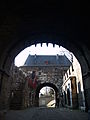
Marching Gate Aachen

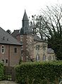
Provost church Kornelimünster

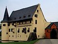
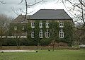
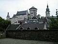
Stolberg Castle

Holzheim Castle

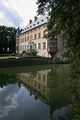
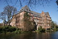
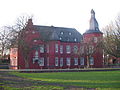
Merode Castle

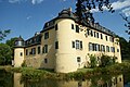
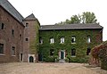
Burgau Castle


.JPG)

.JPG)
This section is approx. 52 km long and contains climbs totaling approx. 560 meters in altitude (not including the branch routes to sights).
The signs lead through the historic old town of Aachen. A branch line is shown to the marching gate on the outer Aachen city wall . In the so-called Frankenberg Quarter , another approx. 200 m long detour leads to Frankenberg Castle . The route leads through the districts of Hitfeld and Eich and after approx. 10 km Kornelimünster reaches the southeastern district of Aachen. It is located in the valley of the Inde , so that the route crosses a cut into the terrain with an altitude of approx. Kornelimünster has a historical old town with the former imperial abbey Kornelimünster from which the place emerged. The route then runs in an easterly direction and after another 10 km reaches Stolberg with its restored old town and castle (no moated castle). Here the "local round Aachen" leads in the direction of Würselen back to the city of Aachen. The "big round" runs from the Stolberg-Altstadt train station in a north-east direction through the villages of Hastenrath and Scherpenseel to Holzheim Castle . Up to this point, another 10 km have to be covered, with an ascent of approx. 1.5 km in length with approx. 5% gradient waiting for the cyclist. The route then runs through the village of Heistern and directly afterwards to the former Premonstratensian monastery Wenau . Only 600 meters later, there is a sign to the Laufenburg, approx. 1.6 km away . To get there, about 60 meters in altitude have to be mastered. From the junction to the next village Langerwehe it is a good three kilometers, with an ascent of approx. 40 meters in altitude, and then another approx. Two kilometers to Schloss Merode, which is located in the district of Langerwehe of the same name. It is considered one of the most beautiful moated castles of the Rhineland in the Renaissance style. After Kreuzau in the recreation area of the Rureifel it is now approx. 13 km, with only one notable slope (approx. 20 meters in altitude) in the Birgel district of Düren .
Kreuzau junction
In Kreuzau there is a connection to the Rurtalbahn in the direction of Düren. For the onward journey to Euskirchen, you can now choose the more demanding route through the Rur Valley, via Nideggen and Mechernich, with a length of 68 km and a gradient of 780 meters. Or you can use the only 33 km long and with 190 vertical meters also flatter route via Zülpich to Euskirchen. The two alternative routes together form the "Euskirchener Runde durch das Rurtal". The two routes only separate shortly after Kreuzau at the "Düren IX" car park. Before that, the Düren-Tuchmühle train station and Burgau Castle are passed. The origins of the castle, which was rebuilt in 1974, date back to the 13th century. From here an approx. 7 km long branch line to the city center or the train station of Düren is signposted. In the city there are still remains of the medieval city wall with the thick tower and the Grönjansturm . The most famous museum in town is the Leopold Hoesch Museum.
Kreuzau - Rurtal - Euskirchen

Nideggen Castle

Eicks moated castle

Satzvey Castle

Veynau Castle

Zievel Castle

Lower castle in Antweiler

Kirspenich Castle
Manor house of Langendorf Castle

Landesburg Zuelpich

The Kölntor in Zülpich


This alternative has a length of 68 km and gradients of 780 meters. (Without the branch lines to sights.)
After Kreuzau the route leads along the Rur to Obermaubach at the Rurstausee Obermaubach . From here on on the eastern bank of the reservoir and then on the banks of the Rur to the Nideggen-Brück train station, where about 16 km of the section are covered. There is the possibility to choose the route via Nideggen above the Rur, whereby approx. 6 km with 150 meters of altitude have to be covered or to continue along the Rur, which is the less strenuous variant with approx. 4 km and 51 meters of altitude . The old town of Nideggen consists of interesting half-timbered and red sandstone houses. From the central market square you can see the two defiant city gates, and after a ten minute walk you are at the gates of Nideggen Castle . In the evenings, the two alternative routes meet and run together with the RurUfer cycle path to Hausen . Here the route leaves the Rur valley and leads to Vlatten with the upper castle . A Carolingian royal palace founded in the 9th century with the parish church of St. Dionysius from the 12th century. When leaving the Rur valley, about 160 meters of altitude have to be overcome. The urban area of Mechernich begins behind Vlatten. The route leads through the districts of Berg , Floisdorf and Eicks with its late baroque moated castle in the district of Kommern . Kommern is known for its closed half-timbered ensemble in the historic town center. Tourist attractions are also the Rhenish Open Air Museum and the Rhineland Wildlife Park . The route continues along the Bleibach into the Firmenich district where Firmenich Castle is located. From here it is only two kilometers to Satzvey Castle in the district of the same name. From Satzvey there is a three-kilometer branch route to Veynau Castle signposted as a moated castle route. This largest castle complex in the Euskirchen district is one of the most impressive and important castles in the Rhineland. Right behind the Satzvey after the motorway bridge, Zievel Castle is on the left on the site of a golf course. The path continues to the Mechernich districts of Lessenich and Wachendorf . At the entrance to Wachendorf, there is an approximately one kilometer branch path to the Upper and Lower Castle of Antweiler . Behind Wachendorf there is an approx. One kilometer long ascent with approx. 40 meters of altitude and a subsequent approach to Iversheim, which belongs to the city of Bad Münstereifel. A Roman lime distillery can be visited at the entrance to the town in front of the railway line . From here you can use the signs for the Erft cycle path to visit the city center of Bad Münstereifel, which is approx. 4 km away. Bad Münstereifel has an almost completely preserved, restored town wall with a historic town center. The circular route now follows the Erft valley and leads via Arloff , past Kirspenich Castle in the district of the same name, to Hardtburg approx. 5 km away . From here it is now 7 km to the Euskirchen train station. Alternatively, you can turn off directly towards Rheinbach and Meckenheim and postpone the visit from Euskirchen to the return trip.
Kreuzau - Zuelpich - Euskirchen
This alternative is 33 km in length and has an incline of 190 meters in altitude. (Without the branch lines to sights.)
The section starts with an ascent of approx. 25 meters in altitude and then continues flat through Stockheim and Soller with its pilgrimage church. Their Lourdes grotto, built in the 19th century, which attracts many pilgrims in the octave of September . This is followed by the towns of Froitzheim and Juntersdorf , the latter already belonging to the town of Zülpich. The Juntersdorf moated castle is at the entrance to the village. The Langendorf district follows again with a moated castle, Langendorf Castle . The castle is one of the best preserved and most well-kept water castles in the Rhineland. After another three kilometers, you will reach Zülpich-Hoven , where the Marienborn monastery is located. In the former Cistercian monastery , the Cologne Cellite Cooperative founded in 1888 according to the rule of St. Augustinus , who set up the Marienborn hospitals here, a nursing home for psychiatric care of seriously mentally ill women. The Hovener hospital gained sad fame during the National Socialist era , when it was particularly affected by the Nazi legislation on racial hygiene and its enforcement. The Roman town of Zülpich follows immediately afterwards. Here you will find the Roman baths from the 2nd century, above which the Museum of Bathing Culture was built. The medieval city fortifications have been largely restored and have four well-preserved city gates. The Kurköln Landesburg Zülpich is part of the city fortifications . Euskirchen is reached after a further 12 km along the former Bördebahn .
Euskirchen junction
Euskirchen is easy to reach by train, as it is on the Eifel route Cologne - Trier. From here there are several local circular routes on the moated castle route . In the core town of Euskirchen there are some of the still preserved medieval town fortifications , the historic market and the Martinskirche as one of the oldest and most important buildings.
To get back to the “Big Round”, follow the moated castle route in the direction of Rheder, Hardtburg, Rheinbach.
Euskirchen - Wachtberg - Bonn Mehlem

Euskirchen, old market

Hexenturm in Rheinbach

Tomburg ruins on the Tomberg

Münchhausen castle ruins
Adendorf Castle

Odenhausen Castle in Berkum


This section is approx. 54 km long and has an incline of 473 meters. (Without the branch lines to sights.)
From the city of Euskirchen the route runs in the direction of the Rheder district and then up to Hardtburg, which is approx. 90 meters above sea level and is reached after approx. 8 km. The Hardtburg , which has hardly changed since the 14th century, makes the character of a medieval moated castle vivid even for the layman. Two kilometers later, the Niederkastenholz district is reached, where the Niederkastenholz Castle is located. Since the second half of the 11th century, the imperial abbey Kornelimünster has been attested as the landlord of the castle and the village of Niederkastenholz, which was under the protection of the Duke of Jülich. Today's appearance essentially corresponds to that of the 18th century. The main and outer bailey convey the image of a rural castle complex from the 18th century. Only one and a half kilometers later, the Flamersheim district is reached. Flamersheim Castle and a fire brigade museum are located there. Flamersheim Castle , located on the Flämmerbach, was first mentioned in 1358 and was rebuilt in the contemporary Baroque style at the end of the 18th century . Today it is surrounded by a large park, whose extensive moats and ponds emerged from the original moats. The fire brigade museum , created in 1992, offers an overview of the fire brigade history of the last hundred years. Just two kilometers later, the Euskirchen district of Schweinheim and with it Schweinheim Castle are reached. The former moated castle was a two-part castle complex surrounded by moats. In the 19th century the outer bailey was demolished except for a corner tower and small remains of the wall and then developed into a large agricultural homestead. Outside the village, about 1.2 kilometers later, Ringsheim Castle is reached. Only the ruins of the church in the castle park are left of the village of Ringsheim, which perished in the 17th century. In the 17th century the largely ruined castle was converted into a baroque palace. In the late 19th century, it became a country estate based on the English model. The route now leads past a number of agricultural properties and after about 7 km reaches the town of Rheinbach. The city offers a glass and carriage museum as well as the Rheinbacher Hexenturm . In the 17th century there was probably a witch's dungeon in it. It is part of the still preserved Rheinbach Castle . It was built in the 12th century and expanded more and more in the years that followed. Remains of the city fortifications are also in the immediate vicinity . In the medieval city center, other remains of the city fortifications can also be seen, for example the Wasemer tower and the Kallenturm . Rheinbach is on the route of the Voreifelbahn Euskirchen - Bonn. The route leaves the city and after approx. 4 km reaches the Rheinbach-Wormersdorf district . From here a more than one kilometer long cul-de-sac leads to the Tomburg castle ruins , which are located on an approx. 45 m high basalt dome. The castle, which was built around 900, was completely destroyed in 1473 in a dispute between the owners at the time and the Duke of Jülich. Two kilometers after Wormersdorf, the route reaches the Ersdorf district of Mechernich . The place is located on the "Rheinbach - Meckenheimer Lößplatte " and thus belongs to the fertile old settlement area of the northern Eifel foothills. Here you meet the village image formative closed traufständigen rows of houses along the streets with their built-up Hofzufahrten. The "Herrenhaus Burg Altendorf" is located in Ersdorf. The former moated castle from the 16th century is now owned by the city of Meckenheim and is used for cultural events. The route now leads over slightly undulating terrain, crosses the A 61 and A 565 highways near the Meckenheim junction and after about 6 km reaches the town of Adendorf, which belongs to the municipality of Wachtberg . Shortly before Adendorf you will pass the ruins of Münchhausen Castle . A two-kilometer cul-de-sac leads to Adendorf Castle and the Sommersberger Hof, a knight's seat from the 15th century. Adendorf Castle consists of a core castle surrounded by a moat with four corner towers and an outer castle consisting mainly of farm buildings. The core castle has been used as a residential building by the owner family von Loë since 1815. In recent years the castle has also been renovated with funds from the German Foundation for Monument Protection. Continuing through the municipality of Wachtberg with the villages of Klein-Villip, Holzem , the route now leads to the outskirts of Berkum , which is reached after a good 6 km via a slight incline (approx. 90 meters in altitude). Odenhausen Castle is located here . The castle, which is surrounded by a moat, has been renovated and is now privately owned. The route runs through further districts of Wachtberg towards the Rhine, which is reached after 11.5 km in Bonn-Mehlem . A depression in the landscape is crossed on this section, so that the vertical meters to be covered add up to approx. 135. After a kilometer on the bank, the Rhine ferry to Königswinter is reached. The Siebengebirgsmuseum can be visited there. In addition, the Drachenfels and the Drachenburg Castle invite you to visit with the help of the Drachenfelsbahn .
Bonn Mehlem - Euskirchen

Ruins of the Godesburg
Kottenforst station
Lüftelberg Castle

Miel Castle

Manor house of the Kleeburg


This section has a length of approx. 45 km and an incline of 303 meters. (Without the branch lines to sights.)
First, the route runs along the Rhine together with the Rhine Cycle Path to the ferry in Bonn-Bad Godesberg and then turns west to the train station. The branch to the branch line to Godesburg is reached about a kilometer further . By then, about 5 km of the section had been covered. It is approx. 600 m up to the castle, with 40 meters of altitude to be mastered. The castle was built in the 13th century and besieged and destroyed in 1583 by the troops of Elector Ernst von Bayern. In recent years, the Godesburg has been largely renovated and now houses a restaurant. From the keep you have a view of the Rhine Valley, the Siebengebirge and Bad Godesberg. Together with the Godesberger Bach, the route leaves the Bad Godesberg district of Bonn and crosses the villages of Pech , Villip and Villiprot , which are part of Wachtberg . After 8 km you leave the Godesberger Bach heading north. The route now leads through a forest area, crosses the A 565 motorway and after approx. 6 km reaches the Voreifelbahn railway line , which it crosses at the Kottenforst railway station . The listed, timber-framed three-storey station is a popular destination today. After another 2.5 km you will reach Meckenheim-Lüftelberg with its moated castle Lüftelberg . The current baroque form dates from the 18th century. The castle is privately owned and not open to the public. The route continues through Flerzheim and after about three kilometers reaches the junction to Müttinghoven Castle . The former knight's seat is now privately owned. The main building was renovated and the former moat was expanded into a pond. After about two more kilometers you will reach Morenhoven Castle . It is a typical Rhenish moated castle, consisting of a separate main and outer castle. Both were surrounded by moats. Only the moat around the manor house remains. The castle is located in the municipality of Swisttal of the same name . From Morenhoven, a two-kilometer branch path leads south to the moated castle Peppenhoven . The main route continues to Swifttal-Miel, which is reached after approx. 3.4 km. There is the baroque Miel Castle, which is now used by a golf club. Parts of the castle are open to the public. Passing the golf course, after four kilometers, the route reaches Swifttal-Odendorf with an 18th-century Zehnthof . Then it goes via Palmersheim to Euskirchen-Kuchenheim , about seven kilometers away. Here you will find the Rhenish Industrial Museum Cloth Factory Müller , which shows the work of a Rhenish full cloth factory with machinery from the early 20th century, and the Lower Kuchenheim Castle . A road cuts through the castle today. On one side the south wing of the outer bailey with the gatehouse from 1573, on the other the former manor house. Immediately after leaving the village, a 1.5 km long cul-de-sac leads north to Kleeburg . The moated castle has hardly changed its appearance for centuries. It consists of a relatively small manor house and a three-wing outer bailey. Both parts of the castle are surrounded by a moat and connected by a bridge. The 14th century castle is now used by a company. If you have already visited Euskirchen and want to stay on the big circuit, you can continue straight to Kleinbüllesheim after visiting the Kleeburg. Otherwise you will reach the stage destination, the main train station of Euskirchen, about four kilometers after Kuchenheim.
Euskirchen - Jülich

Great Kleinbüllesheim Castle

Kessenich Castle
The west tower of Bodenheim Castle

The "White Castle" Friesenheim
House of the castle Kühlseggen

Bailey of Buschfeld Castle

Gracht Castle - mansion

Lechenich State Castle

Konradsheim Castle

Gymnich Castle
Türnich Castle
House Mödrath

Loersfeld Castle

Hemmersbach Castle

Paffendorf Castle
Bedburg Castle

Hambach Castle

Castle Obbendorf


This section is about 84 km long and has a gradient of 240 meters. (Without the branch lines to sights.)
After the start, on the inner city side of the main train station in Euskirchen heading west, the route reaches the junction in north direction to Kleeburg and Kleinbüllesheim after approx. 3 km, immediately behind the Ratsheimer Hof . The moated castle route runs behind Euskirchen to Bedburg essentially together with the Erft cycle path . The Great Castle is located at the entrance to Kleinbüllesheim . In 1728 the medieval castle was demolished and a mansion was built. The water-protected complex consists of the late Gothic gate, the outer bailey with the farm buildings and the manor house. Großbüllesheim Castle is in the next town of Großbüllesheim , around 6 km after the start at the train station . The two-part former moated castle dates from the 14th century. Only the outer bailey remained as a manor. Past the train station on the Cologne-Trier Eifel line , the route leads to the immediately adjacent Wüschheim . At the end of the village, an approx. 2 km long cul-de-sac leads straight to Kessenich Castle , while the circular route turns right. Like the previous ones, this castle is still in the urban area of Euskirchen. The former two-part moated castle from the 14th century is still surrounded by a moat and consists of a manor house, simple farm buildings and the historic access road. The trail continues through the Erfttal and crosses after one kilometer, the Erft. At the bridge, a branch path leads to the nearby Bodenheim Castle . The castle dominates the town of Bodenheim, which belongs to the community of Weilerswist. It looks very old-fashioned, which can primarily be explained with the irregularly angled structure. The circular route has now left the urban area of Euskirchen and continues to follow the Erft to Weilerswist-Kleinvernich, approx. 6 km away . From here a 4 km long cul-de-sac leads to the Weißen Burg Friesheim . The moated castle used to be a knight's seat, the manor house of which was destroyed in World War II. The outer bailey is still partially preserved. One of the two round bastion towers has been restored. The castle is privately owned and can only be viewed from the outside. The two castles Klein-Vernich and Groß-Vernich are reached on the further circular route . Only remnants of the two castles have survived. After another 4 km in the Erft valley, the route leads to Kühlseggen Castle , which is on the right of the cycle path in the Erftauen. It is one of the most impressive moated castles in the region. The castle, first mentioned in the 14th century, was left to decay for a long time. It was not until 1962 that Max Freiherr von Eltz-Rübenach had the entire complex completely renovated and rebuilt so that it could be used as a private residence. The route continues along the Erft and after four kilometers reaches the junction to a castle, which is about one kilometer to the east. The castle bushveld is one of the oldest fortified moated castles of the Rhine Erft circle. It was mentioned in a document as early as 1170. The outer bailey, in which the apartments are now furnished, is still surrounded by a moat. Today's classicist impression that the mansion gives can be traced back to the fact that the building was "modernized and redesigned" between 1924 and 1926. Still along the Erft, the circular route reaches another eastern branch after 2 km, which takes you to Gracht Castle two kilometers away . It is considered one of the most impressive moated castles in the Cologne area. It consists of a two-part system with a three-wing outer bailey and a two-wing mansion. The public, listed, 9-hectare castle park with its old and in some cases exotic trees has been returned to its historical baroque state. The European School of Management and Technology is located in the castle . At the same point on the route, the path branches off to the left towards Erftstadt-Lechenich . Alternatively, the district can be bypassed straight ahead along the Erft. The old town of the district is reached after approx. 2.5 km. The Landesburg Lechenich , which is surrounded by a large park area, is also located here . Even as a ruin, the Landesburg gives an impression of its former importance as a strongly fortified administrative castle of the sovereign and illustrates the difference to the numerous aristocratic residences of the Rhein-Erft district. The moated castle route leaves Lechenich and after 1.5 km reaches Konradsheim Castle in the district of the same name. It is one of the few remaining late medieval castle complexes. The castle, which dates back to the 14th century, had already decayed in some parts until it was renovated through a series of construction measures in the course of the 20th century and brought into its current state. It is privately owned and parts of the castle are used as the clubhouse for the golf course adjoining the castle. The cycle route leads over the golf course back to Erft and after approx. 5 km reaches the left branch to Gymnich Castle, which is a good kilometer to the west. After extensive modernization, the castle was used as a guest house for the federal government until July 1990. In 2012, after the last owner went bankrupt, it is for sale. Continuing along the Erft, the route reaches the junction to Schloss Türnich after just under two kilometers , which is about 600 m to the east. The history of the castle can be traced back to the year 898. Today's late Baroque manor house dates from the middle of the 18th century. Caused by the lowering of the groundwater in the lignite mining, the castle is in a poor structural condition and threatens to break apart. The castle park is well worth seeing and is open to the public. After another three kilometers along the Erft, you will reach the eastern branch to Mödrath Castle . Only the so-called castle remains of Alt-Mödrath. The actual village was relocated due to the open- cast lignite mine Frechen in 1956, as it was in the mining area. The route remains at two kilometer intervals for castles and palaces. This time the junction goes west and after 1.8 km it reaches Loersfeld Castle . The castle was built in the 15th century and has been owned by the Barons von Fürstenberg since 1819 . Today there is a gourmet restaurant in the castle. After another 2.6 km along the Erft and crossing the A1 near the Kerpen motorway junction, you can decide to stay on the Erft or alternatively drive through Kerpen-Horrem . The Hemmersbach Castle is located there . The racing driver Wolfgang Graf Berghe von Trips lived on it . On the grounds in front of the castle there was a museum about his life and racing successes until 2011. The castle was given its current appearance by the Berghe von Trips family in the 19th century. After an eventful history, it is for sale today. After approx. 2 km on both routes, you come to the junction towards Schlenderhan Castle , which is approx. 3 km east of the circular route. The castle is best known for the Schlenderhan Stud, which is located there . The circuit further follows the Erfttal and reaches after about six kilometers, the administrative center of the Rhein-Erftstadt-circle , Bergheim . In the old town, the landmark of Bergheim is the Aachener Tor , buildings from the 17th to 19th centuries, including the historic town hall and the parish church of St. Remigius . Bergheim train station is on the Erftbahn line . The Zieverich Castle stood in the Zieverich district , where a children's home is now housed. About 3 km from the center of the circular route branches off from the circular route in a westerly direction to Paffendorf Castle in the Bergheim district of the same name. The castle was built in the 16th century and rebuilt in the neo-Gothic style in the mid-19th century . In the castle there is a permanent exhibition on the subject of " Rhenish lignite ". The information center is also the starting point for RWE Power's route to the Rhein-Erft district, which is around 30 kilometers long and where you can experience what you have read in reality.

The route now accompanies the Erft Cycle Path for the last few kilometers. Passing Bergheim-Glesch it is over five kilometers without castle and chateau before in Bedburg the Schloss Bedburg is achieved. The origins of the castle go back to the 12th century, when a castle belonging to the Lords of Bedburg was first mentioned. With its location in the marshy Erft lowland, the moated castle probably served to secure the Erft crossing. It was only through extensive renovations and additions that the castle changed over the course of time into a palace up to its present form. In Bedburg you leave the Erft and after 3 km you reach the historic old town of Bedburg-Kaster . The circular route now mainly leads through arable land, crosses the A 61 motorway and after 8.5 km reaches Bergheim-Kirchherten . The Grottenherten windmill is located here. The mill, built in 1831, is still functional today with its two grinding aisles. The route continues through agricultural areas into two districts of the municipality of Titz . In Rödingen she crosses the street Mühlenend, where the LVR-Kulturhaus Landsynagoge Rödingen is located. In Höllen the route reaches the edge of the Sophienhöhe . A recultivated waste dump from the Hambach opencast mine . Along the edge of the dump, Jülich-Stetternich is reached after 6.4 km . From here it is possible to make a detour to Hambach (approx. 4 km) and Niederzier (approx. 10 km) via the local Jülich circuit. Hambach Castle and Obbendorf Castle are located in the Hambach district of Niederzier , while the Niederzier moated castle is located in Niederzier . Continuing on the circular route, the Jülich train station is a good three kilometers away. In the city center of Euskirchen, the city museum in the so-called "thick tower", the Martinskirche and the old market are particularly worth seeing. From Jülich, an approx. 7.5 km long branch route to the castles Haus Overbach and Schloss Kellenberg is signposted as a moated castle route. The route leads through the Brückenkopfpark and the Koslar district . The so-called bridgehead is part of a fortress from Napoleonic times, which was built at the beginning of the 19th century. This was from the Renaissance originated Fortress Jülich involved. In the 13th century moated castle and manor house Overbach is now a high school. The current complex of Kellenberg Castle was built in the 15th and 16th centuries. it is privately owned by the construction and real estate company NRW .
Jülich - Aachen

Kellenberg Castle, Jülich

Linzenich Castle, Jülich

Bourheim Castle, Jülich
Engelsdorf Castle

Dürboslar Castle
Kinzweiler Castle
House Kambach, Kinzweiler
Alsdorf Castle

Rode Castle, Herzogenrath

Rahe Castle, Aachen

.jpg)


This section has a length of approx. 55 km and an incline of 459 meters. (Without the branch lines to sights.)
After approx. 5.5 km the cycle route reaches the Jülich-Bourheim district . There are two old aristocratic residences here: Linzenich Castle , which is partly in ruins, but whose outer bailey is still inhabited, and Bourheim Castle , a former moated castle. Today it is owned by the von Lünnick family. From here the route reaches Aldenhoven with the Ludwig Gall house after 3.5 km . Named after the well-known social reformer who was born in Aldenhoven in 1791, the house is one of the oldest buildings in the town. The Bergmannshaus Museum , a mining museum and information center for hard coal and lignite, is also located here. A 2.7 km long cul-de-sac to Engelsdorf Castle is signposted from the town center. The former moated castle was first mentioned in a document in 1080, destroyed and rebuilt several times. It was the family seat of the Lords of Engelsdorf. The artist couple Fernandez from Chile have owned the castle since 1989 and run a studio in it. At the end of the village, another branch path branches off to Dürboslar Castle, two kilometers to the north . The brick moated castle with a three-wing outer bailey was built in the 16th and 17th centuries. In the main castle there is an agricultural enterprise and in the outer castle there are workshops of ARW Modellbau GmbH. The cycle route then leaves Aldenhoven, crosses the Niedermerz district and follows a watercourse to Blausteinsee, approx. 6 km away . It was created in the northern urban area of Eschweiler as part of the recultivation of the former lignite opencast mine Zukunft by filling the remaining open pit with surface water and today serves as a recreational area for the surrounding cities. After another three kilometers along the lakeshore, the route reaches the outskirts of Dürwiß , a district of Eschweiler . After a drive of approx. 4.2 km through agricultural areas, you will reach Kinzweiler Castle , located in a wooded area, directly in front of the Eschweiler-Kinzweiler district . From the former moated castle only the main castle is preserved today. In the middle of the 18th century the castle got its present appearance. After frequent changes of ownership, the castle has been owned by five families since 1981, who divided it into several apartments. The baroque moated castle Haus Kambach is located in the village . It was the first building in the city to be listed as a historical monument in 1982 and has been used as a residential building, restaurant, bistro and golf home for the neighboring golf course between Kinzweiler and St. Jöris since 1992. The route now reaches the area in which the junction system adopted from Belgium and the Netherlands is used for cycle route signage. From junction 79 (Eschweiler) the route leads to junction 78 (Würselen) 2.9 km away. The route runs through the golf course and the village of Eschweiler-Sankt Jöris . At the beginning of the section there is a small incline of approx. 20 meters in altitude to master. Then it goes via junction 76 (Würselen) to junction 63 (Alsdorf), which is reached after 6.7 km. At the beginning, you continue through fields until you reach the wooded Broichbachtal with its zoo. From junction 63, you can take a detour through Alsdorf to Alsdorf Castle, 2.4 km away . The former Rhenish moated castle was transformed into today's palace complex in the 18th century. In 1935 the town of Alsdorf bought the castle and made it available to families as an apartment. Today the castle is used by the adult education center and the workers' welfare. Alsdorf is also home to the railing of the former Grube Anna hard coal mine . The remaining historical mine buildings such as the machine hall, the nave and the winding tower have been restored in an exemplary manner. In addition to visiting different parts of the company, the underground routes can also be visited on Sundays under the guidance of former miners. The circular route then continues through the Broichbachtal via junction 27 (Alsdorf) to junction 25 (Herzogenrath) 3.4 km away. On the way you pass the Zopp miners' settlement . It was laid out in 1936 and consisted of single-family houses with large gardens for self-sufficiency. Shortly before junction 25 you can take a detour to Herzogenrath (approx. 2 km). The border and customs castle Burg Rode , built around 1100, is located here . Between 1913 and 1978 the restored castle served as the town hall of Herzogenrath. Today the association "Burg Rode Herzogenrath eV" organizes regular events and offers guided tours. The circular route now leads south over junction 24 (Würselen) and after approx. Three kilometers and approx. 70 meters in altitude it reaches the junction to Wilhelmstein Castle above the Wurm valley , a tributary of the Rur . The castle ruin houses an open-air stage and is the venue for concerts, cabaret and cinema every year from May to September. The route crosses the Würselen-Bardenberg district before a descent over 45 meters altitude leads into the Wurmtal and after about 5 km you reach junction 9 (Würselen). Here the Wurmtal is left again, which gives the cyclist an increase in altitude of about 50 meters. With junction 8 (Aachen) the city limits of Aachen and after approx. 4 km the Schönau Palace in the Richterich district are reached. Most of the current buildings date from 1732. The castle was built on the foundation walls of a late medieval moated castle. Today it belongs to the city of Aachen and is used as a restaurant. The circular route then crosses the Laurensberg district and after approx. 2.8 km reaches Rahe Castle . The castle is a former manor complex built as a moated castle, which was converted into a representative, castle-like country residence in the 18th century, which is currently used as an upscale business center . On the last approx. 4 km long section to Aachen's old town there is an ascent of approx. 800 m in length and approx. 40 meters in altitude to overcome. The route leads past the Lousberg and through the grounds of the Rheinisch-Westfälische Technische Hochschule Aachen (RWTH) . The city of Aachen offers a number of sights. Among other things, the Aachen cathedral , the Aachen town hall , the so-called grass house on the fish market, the Löwenstein house on the market and the remains of the Aachen city fortifications.
Local circular routes on the moated castle route
Jülich
- At Jülich an approx. 24 km long circular route, with an ascent of approx. 30 meters above sea level, via Hambach, Niederzier and Altenburg. The route leads past the castles Wasserschloss Hambach , Burg Obbendorf and Wasserburg Niederzier . Jülich train station is ideal for traveling by train.
Aachen
- At Aachen an approx. 46 km long circular route, with approx. 460 vertical meters ascent on the entire route. It leads from Aachen via Kornelimünster, Stolberg, Würselen and Richterich back to Aachen. In addition to the sights of the city of Aachen, the old town of Stolberg and the market of Würselen with the parish church of St. Sebastian are passed. The Aachen-West and Stolberg train stations are ideal for traveling by train.
Euskirchen
Several local circular routes are possible from Euskirchen:
- An approx. 102 km long circular route over the Rur valley, with approx. 1,060 vertical meters ascent on the entire route. It leads from Euskirchen via Stotzheim, Iversheim, Wachendorf, Satzvey, Kommern, Eicks, Floisdorf, Vlatten into the Rurtal . There via Nideggen, Ober- and Untermaubach to Kreuzau. Here the route leaves the Rur Valley and continues via Stockheim and Langendorf to Zülpich and from there back to Euskirchen. Euskirchen train station is ideal for those arriving by train. The following sights are passed on this route:
- The Hardtburg and Veynau Castle in Euskirchen.
- In Mechernich the Satzvey Castle , the historic center of Kommern with its castle and the LVR open-air museum Kommern .
- Vlatten, a Carolingian royal palace founded in the 9th century with the parish church of St. Dionysius from the 12th century.
- In Nideggen, Nideggen Castle with the Castle Museum above the Rur Valley.
- Burgau Castle in the Niederau district of Düren.
- The parish church of Soller in the municipality of Vettweiß. Its Lourdes grotto, built in the 19th century, attracts many pilgrims in the octave of September .
- The "Roman city" Zülpich with its city wall, the Roman thermal baths and its churches.
- An approx. 70 km long circular route in the direction of Meckenheim, with approx. 415 vertical meters ascent on the entire route. It leads from Euskirchen via Rheder, Stolzheim and Niederkastenholz to Flamersheim, from there through Rheinbach, Wormersdorf, the Meckenheim district of Altendorf, the Wachtenberg districts of Adendorf and Villiprot, Lüftelberg, which belongs to Meckenheim, Flerzheim, Morenhoven, Miel, Odendorf back to the urban area of Euskirchen and through the districts of Palmersheim and Kuchenheim back to the starting point. Euskirchen and Rheinbach train stations are ideal for those arriving by train. An extension with the "Local Circuit Bonn" is easily possible, as it is directly adjacent. The following sights are passed on this route:
- The Hardt Castle , the Castle Lower Kastenholz , castle Flamersheim , castle Schweinheim , Burgring home and Kleeburg in Euskirchen.
- In Rheinbach, Rheinbach Castle with the Hexenturm, the Rheinbach Glass Museum and the Carriage Museum, as well as the Tomburg ruins above the Wormersdorf district .
- The Lüftelberg moated castle in the Meckenheim district of the same name.
- A moated castle on the outskirts of Morenhoven .
- Schloss Miel in the district Miel the municipality Swisttal .
- In the Euskirchen district of Kuchenheim there is the cloth factory Müller of the Rheinisches Industriemuseum and the Upper and Lower Kuchenheim Castle .
- The round tour of castles around Euskirchen is an approx. 45 km long route around Euskirchen that largely uses the signs for the moated castle route and visits the twelve castles in the city.
Bonn
The local circuit, starting in Bonn, is approx. 33 km long and has approx. 460 vertical meters of climbs. The Bonn-Bad Godesberg train station is an ideal entry point with a rail connection . The route leads from Bonn-Bad Godesberg via Niederbachem , Oberbachem and Berkum to Klein Villip. There she meets the eastern local circle around Euskirchen. Separates from this after about two kilometers in Villip . In a westerly direction, the path leads back to Bad Godesberg via Pech . The following sights are on the way:
- Königswinter can be reached by ferry, where the Siebengebirgsmuseum is located. In addition, the Drachenfels and the Drachenburg Castle invite you to visit with the help of the Drachenfelsbahn .
- The Godesburg on the Godesberg with a view of the Siebengebirge . For the driveway, about 40 meters in altitude must be overcome at 600 m.
Connecting cycle paths
- The green route leads over 370 km along the most beautiful natural areas between Beringen in Belgium, Heerlen in the Netherlands and Düren in Germany through what was once the largest coal mining area in Europe. It crosses the moated castle route in Aachen, Stolberg, Aldenhoven, Jülich and Düren.
- The German Football Route NRW runs 800 kilometers across North Rhine-Westphalia. So far it is the only adventure bike path in North Rhine-Westphalia that has been laid out under a popular and transnational theme. The "legend route of German football" opens up next to football cult locations like Veltins-Arena in Gelsenkirchen or Borusseum in Dortmund also the tourist highlights in NRW. It is connected to the moated castle route in Aachen, Düren and Kerpen. After Kornelimünster, the two routes run approx. 7 km together.
- The two-country route (2LR for short) meanders 270 km between Aachen and Nijmegen through the country on the Maas and Lower Rhine. As a "route with many faces", the 2LR offers a mix of nature and culture. It crosses the moated castle route in Aachen and Herzogenrath.
- The 480 km long Kaiser Route runs from Aachen to Paderborn and is named after Emperor Charlemagne , who resided in Aachen. The route is based on the presumed route that the imperial army took in 775 on its crusade into the Saxon territory . It crosses the moated castle route in Aachen, Eschweiler, Langerwehe, Düren, Erftstadt, Kerpen, Bergheim and Bedburg. From Aachen to shortly before Stolberg, both cycle routes run together over approx. 17 km.
- The 1,045 km long D-Route 4 ( Mittelland Route ) leads from Aachen via Bonn , Siegen , Erfurt , Jena and Chemnitz to Zittau . From Aachen to shortly before Stolberg, both cycle routes run together over approx. 17 km. Likewise, for about 15 km, on the Rur between Untermaubach and Hausen and for another 4 km between Kommern and Obergartzem . The two routes then meet again in Euskirchen and run from the Euskirchen district of Kuchenheim to Rheinbach for approx. 10 km together. In the municipality of Wachtberg , the two routes cross several times and for the last time they run together for about 4.5 km in Bad Godesberg on the banks of the Rhine.
- The 733 km long D-Route 7 ( pilgrim route ) leads from Aachen via Cologne , Düsseldorf , Duisburg , Münster , Osnabrück , Bremen and Hamburg to Flensburg . It runs between Aachen and Bonn together with D-Route 4 and thus has the same connection points to the Wasserburg-Route.
- The 180 km long RurUfer cycle path leads from the source of the Rur in the Belgian Ardennes to the Münden in the Maas in Roermond, the Netherlands . It runs together with the moated castle route between Kreuzau and Hausen (approx. 20 km), partly between Kreuzau and Düren and between Niederzier-Krauthausen and Jülich (approx. 7 km).
- The 265 km long cycle path network of the valley route opens up interesting tourist spots in North Rhine-Westphalia on a family-friendly route. There is a connection to the moated castle route at Hausen , in Kommern, Euskirchen, Weilerswist, Mechernich, Bad Münstereifel and Zülpich.
- The moated castle route runs a few kilometers over the Rhine cycle path near Bad Godesberg .
- The Erft cycle path runs along the Erft for around 110 kilometers . From the source in Nettersheim - Holzmülheim to the confluence with the Rhine in Neuss . It connects to the moated castle route in Bad Münstereinfel-Iversheim and in Euskirchen. Both cycle paths use the same route between Euskirchen and Burgheim .
Rail connection
There are rail connections almost along the entire route of the moated castle route (see also info box ). The order of the connections described in the following follows the "big round" described.
Aachen - Euskirchen
Aachen Central Station is the endpoint of the Aachen - Mönchengladbach , Aachen - Cologne and Aachen - Liège railway lines . The next connection is in Stolberg with the main train station and two other stops on the Aachen - Cologne route. Langerwehe follows on the same railway line. You can get to Kreuzau with the Rurtalbahn via the Düren - Heimbach line . Düren is in turn on the Aachen - Cologne railway line. In the Kreuzau - Hausen section, where the moated castle route follows the RurUfer cycle path, there are several stops on the Rur Valley Railway. The next connection option is then in Mechernich, on the Eifel line Cologne-Trier with the Mechernich-Satzvey station. A further 8 km in Bad Münstereifel-Iversheim there is a connection to the Erft Valley Railway between Euskirchen and Bad Münstereifel. On the way to Euskirchen there are four more stops on the Erft Valley Railway near the moated castle route. There is no rail connection on the alternative route Kreuzau - Zülpich - Euskirchen.
Euskirchen - Bonn - Euskirchen
The Euskirchen rail junction is connected to the Eifelbahn Cologne - Trier route, the Voreifelbahn to Bonn and the Erfttalbahn to Bad Münstereifel. On the further course of the moated castle route towards Bonn-Bad Godesberg one arrives at the Rheinbach train station on the Vordereifelbahn (Euskirchen - Bonn). After that, there is no longer a rail connection in front of the Bonn-Mehlem and Bonn-Bad Godesberg stations, which are on the left Rhine route Cologne-Mainz. On the way back to Euskirchen, the moated castle route crosses the Vordereifelbahn again at the Meckenheim-Kottenforst station, which is only served as a stop on demand on Sundays and public holidays , and at the Swisttal-Odendorf and Euskirchen-Kuchenheim stations.
Euskirchen - Jülich - Aachen
After Euskirchen, the moated castle route essentially follows the Erft cycle path. On the first section there is a connection to the Eifelbahn Cologne-Euskirchen-Trier via the stations Weilerswist-Derkum, Weilerswist. Later to the Erftbahn via the stations Horrem, Bergheim, Paffendorf, Glesch and Bedburg. From Horrem you can continue towards Aachen and Cologne and from Bedburg towards Cologne or Düsseldorf. The next rail connection option is only available again in Jülich, which is located on the Rur Valley Railway and from where there is a connection to the national rail network via Düren. Before Aachen there is another rail connection at the Euregiobahn stop “ Alsdorf-Annapark ” and the Herzogenrath train station on the Aachen - Mönchengladbach line .
Landscape culture and landmarks
The moated castle route leads through the Voreifel , touches the Rureifel and parts of the Cologne Bay . The route leads to the region with the greatest density of moated castles in Germany. Statistically, you come across a castle every three kilometers. However, many of the castles are privately owned and cannot be visited. The region between the cultural cities of Cologne, Bonn and Aachen also offers numerous sights worth seeing.
Aachen - Euskirchen

Aachen Cathedral, north facade

Aachen City Hall

Grass house Aachen
Ponttor Aachen

Historic center of Kornelimünster
Landmark of Stolberg, the castle

Vichtbach in Oberstolberg
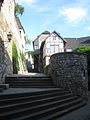
Old town of Stolberg

Obermaubach reservoir

The thick tower in Düren

Center of Kommern

Smithy in the open-air museum in Kommern


.jpg)


-
Aachen is located in the triangle between Germany, Belgium and the Netherlands, in the center of the Euregio Meuse-Rhine , in a valley basin open to the northeast, in which the tributaries of the Wurm collect and flow to the Rur . The urban area is therefore in the catchment area of the Meuse , directly on the northern edge of the slate mountains on the left bank of the Rhine ( Eifel ), about 30 km north of the High Fens . Culturally, it is one of the highlights of the route with its numerous sights. The most famous sights are:
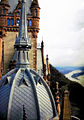
- The Aachen Cathedral was originally built as the palace chapel of Charlemagne built and is the landmark of the city. The ensemble of Cathedral and Cathedral Treasury was in 1978 the first German cultural monument and second world cultural monument World Heritage List of UNESCO added.
- The Gothic Aachen City Hall was built on the foundation walls of the palace auditorium of the Carolingian imperial palace in the 14th century. The coronation hall is on the first floor. Five frescoes by the Aachen artist Alfred Rethel adorn the walls, they show legendary scenes from the life of Charlemagne. On the ground floor, richly furnished rooms testify to the splendor of the free imperial city in the 17th and 18th centuries, when the town hall was converted into a baroque city palace. In 2008 and 2009 almost all of the town hall's premises were opened to the public.
- The so-called grass house is located on the fish market, the facade of which comes from the oldest town hall in the city and dates back to 1267.
- The Löwenstein house on the market was built around the same time as the Aachen town hall and was probably completed in 1345. Along with the cathedral and town hall, it is one of the few Gothic buildings that survived the great city fire of 1656.
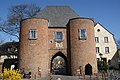
- Numerous remnants still bear witness to the Aachen city fortifications , which consisted of two wall rings and numerous towers . Two of the former 11 mighty city gates have been preserved. The Ponttor at the end of Pontstrasse is one of the few remaining medieval double gates in the Rhineland. The Marschiertor at the end of Franzstraße dates from 1257 and is one of the largest still preserved city gates in Western Europe.
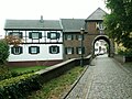
- The Aachen district Kornelimünster lies in the valley of the Inde and has a historic old town and the former imperial abbey Kornelimünster , from which the place emerged. Even today, town houses from the 17th and 18th centuries shape the appearance of Kornelimünster. The historic center from the Middle Ages has been almost completely preserved. The former imperial abbey, founded in 814, still consists of a successor building built in 1721, which found various uses after the secularization in 1802. Today it houses a permanent exhibition of contemporary art from North Rhine-Westphalia, which is presented in a late baroque ambience. The former abbey church and today's parish church of Kornelimünster is one of the most important buildings in Rhenish architecture and looks back on 1000 years of building history. Its foundation building was built in 814–817 AD and was consecrated in the presence of Ludwig the Pious. Until the dissolution of the monastery in 1802, the provost church was a monastery and pilgrimage church.
- The town of Stolberg is located in the Voreifel in a valley through which the Vichtbach flows. Stolberg's early industrialization brought pollution to the people in and around the city through sulfuric acid, slag and heavy metals. As part of the environmental protection program, numerous heaps were rehabilitated as secondary heavy metal emitters and have been renatured for local recreation or recultivated as commercial space. The old town of Stolberg goes back to the origins of the city and, together with Stolberg Castle, forms the historical city center. Over a hundred buildings are listed , and this is also where the city's oldest copper yards are located . The Museum Zinkhütter Hof documents the industrial history of Stolberg in a special way. The facility, originally built as a glassworks in the 1830s and operated until the 1850s, is a well-preserved ensemble of production hall, workers' apartments and administration villa from the early phase of German industrialization. Today, the permanent exhibition shows the Aachen needle production, the history of the materials brass and zinc and zinc smelting in the Eschweiler-Stolberg area . The timeline ranges from Roman times ( Hemmoorer bucket ) through the copper masters to structural change in the 19th century. In addition to the permanent exhibitions, there are changing special exhibitions of the fine arts and various topics from the history of technology.
- With Kreuzau , the Rur valley is reached, which the moated castle route follows to the village of Hausen . The recreation area of the Rureifel with the towns of Kreuzau, Untermaubach and Obermaubach at the Obermaubach reservoir is passed through.
- Düren is connected to the moated castle route via a branch line along the Rur. The city is called "The Gateway to the North Eifel". It is shaped by more than 1,300 years of eventful history and today's modern industry. The moated castle Burgau is located in the Burgau Forest on the edge of the Niederau district. In the city there are still remains of the medieval city wall with the thick tower and the Grönjansturm . The most famous museum in town is the Leopold Hoesch Museum. The building, erected in 1905 in neo-baroque style, shows changing exhibitions of contemporary art, including expressionist paintings. Since 1986 there are also works of art of international Biennale PaperArt to see. It cooperates with the neighboring paper museum.
- A variant of the route visits the city of Nideggen with its beautiful old town of half-timbered and red sandstone houses. From the central market square you can see the two defiant city gates. After a ten-minute walk, past the Romanesque parish church with one of the oldest preserved frescoes in Germany, you are at the gates of Nideggen Castle . From here, a variety of hiking trails opens up around the huge rock massifs over which the castle is built visible from afar. There are also several Eifel National Park facilities in the village .
- The Mechernich district of Kommern has the largest closed half-timbered ensemble in the Rhineland and Kommern Castle . There is also the State Museum for Folklore, the LVR open-air museum Kommern . With over 80 hectares it is one of the largest open-air museums in Europe and shows 65 historical buildings from the former Prussian Rhine province.
- The city of Bad Münstereifel is only touched by the moated castle route in the Iversheim district with its Roman lime kiln . The medieval city with its almost completely preserved and renovated city wall can be reached via a 4 km detour on the Erft cycle path. The Romanesque collegiate church of St. Chrysanthus and Daria , which was started around 1100 , the Romanesque house from 1167, the Windeckhaus with its elaborate carved facade and the town hall are particularly worth seeing.
- Zülpich is located in the Jülich-Zülpich Börde and is part of the Rhenish lignite mining area (lignite extraction in the Zülpich open-cast mine from 1953 to 1967). This is still reflected today in two artificial lakes: the Zülpich water sports lake and the Füssenich nature reserve lake . The city founded by the Romans with the name Tolbiacum has existed since the 1st century BC. The battle of Zülpich from the year 496 AD is a standing term in European historiography. Zülpich harbors a large number of historical cultural monuments, including the only German " Museum of Bathing Culture ". It was built on top of the Roman baths from the 2nd century. The medieval city fortifications have been largely restored and contain four well-preserved city gates. The Kurköln Landesburg Zülpich is part of the city fortifications .
Euskirchen - Bonn

St. Martin's Church, Euskirchen

Old town hall Euskirchen

Himmeroder Hof in Rheinbach

Half-timbered houses in Rheinbach

Drachenburg and Drachenfels castle ruins
Drachenburg - view of the Rhine


.jpg)


-
Euskirchen is located in the Zülpicher Börde on the northern edge of the Eifel . The partially built-up Veybach flows through the middle of the city center . The Erft flows through the entire urban area . The city offers the following attractions:
- The partially preserved medieval city fortifications with their gates and defense towers.
- The historic old market, which forms the end of the pedestrian zone.
- The Martinskirche is one of the oldest and most important buildings in the city center. It houses many interesting and valuable works of art, such as the Antwerp carved altar (1520–1530) and a Madonna, which is attributed to Tilman Riemenschneider (1460–1531). The cruciform vaulted first tower floor, open to the central nave, houses the baroque organ from 1717. The Martinskirche is the architectural landmark of the city.
- Part of the Rhenish Industrial Museum , the Müller cloth factory, is located in the eastern district of Kuchenheim . It shows the work of a Rhenish full cloth factory with machinery from the early 20th century.
- The city of Rheinbach is located in the Voreifel, mostly in the plain of the Cologne Bay. The Roman aqueduct from the Eifel to Cologne , also called the Roman Canal and built around 80 AD, led through what is now Rheinbach's urban area. The city offers a glass and carriage museum as well as the Rheinbacher Hexenturm. In the 17th century there was probably a witch's dungeon in it. It is part of the still preserved Rheinbach Castle. It was built in the 12th century and expanded more and more in the years that followed. The city wall is also in the immediate vicinity. In the medieval town center, other remains of the town fortifications can also be seen, for example the Wasemer and Kallenturm. The Himmeroder Hof , west of the castle, belonged to the Cistercian monastery Himmerod in the Eifel and is now home to the town's civic and cultural center, as well as the glass museum known as a special museum for Bohemian hollow glass . With the settlement of German glass refiners from Bohemia, who had to leave their homeland in 1947 as a result of World War II, Rheinbach became known as the "City of Glass".
- The Rhine ferry runs from Bonn-Mehlem to Königswinter . The city at the foot of the Siebengebirge with the Petersberg, which as the location of the federal guest house has often been the site of conferences of national and international importance. The slopes of the mountains in Königswinter have always been used for wine-growing. The vineyards are part of the Middle Rhine region and the Petersberg area . The Rheinsteig , the long-distance hiking trail on the right bank of the Rhine, opened in 2005, leads from Bonn over the Drachenfels to Wiesbaden . Königswinter offers access to Germany's most climbed mountain, the Drachenfels . With the castle ruins from the 12th century, supported by the cogwheel railway that has been in operation since 1883, this has played a decisive role in shaping Königswinter's name as a tourist destination. The cog railway has a stop at Drachenburg Castle . The castle-like property on the Drachenfels, the foundation stone of which was laid in 1882, was built in the record time of two years. It was built in the historical style as a representative residence for the stockbroker, banker and later Baron Stephan von Sarter (1833-1902). But he never lived in the castle.
Erfttal - Jülich
Aachen Gate in Bergheim

Old town hall in Bergheim

Agatha Gate in Kaster
Erft gate in Kaster

Witches Tower Jülich
House Overbach, Jülich


Between Euskirchen and Bedburg, the cycle route follows the Erft valley. The landscape of this area belongs to the Zülpicher Börde . The cycle path repeatedly comes into contact with the effects of the Rhenish lignite mining area .
- Erftstadt-Lechenich is the oldest part of Erftstadt , which was created in the course of the regional reform in North Rhine-Westphalia in 1969 . Erftstadt is located directly on the 880 km² Rhineland Nature Park ("Kottenforst-Ville" until 2005), whose many large and small lakes in the Ville owe their origin to lignite mining. In 1920 afforestation and recultivation began. Worth seeing in Lechenich are the old town center, the market square and the town fortifications . In 1306, the Archbishop of Cologne, Heinrich II of Virneburg, began building a new castle in the northeast corner of today's old town. The complementary high palace was built under Archbishops Walram von Jülich and Wilhelm von Gennep. The mighty castle complex and the moats that surround it formed a separate fortress within the fortified city. The Landesburg Lechenich often served as the residence of the Archbishops of Cologne in the 14th and first half of the 15th century.
- Bergheim is the district town of the Rhein-Erft district . Several districts of the community had to be relocated in favor of lignite mining. become. In the old town, the landmark of Bergheim is the Aachener Tor, buildings from the 17th to 19th centuries, including the historic town hall and the parish church of St. Remigius. Paffendorf Castle is located in the Bergheim district of the same name. The castle was built in the 16th century and rebuilt in the neo-Gothic style in the mid-19th century. In the castle there is a permanent exhibition on the subject of "Rhenish lignite". The information center is also the starting point for RWE Power's route to the Rhein-Erft district, which is around 30 kilometers long and where you can experience what you have read in reality.
- Bedburg-Kaster invites you to visit its historic old town. The settlement was formed around the castle in the 13th century. Kaster owes the fact that it was not, like some neighboring towns, included in the open-cast mine, thanks to its listed medieval buildings. In addition to the remains of the old city wall and the main castle, which was destroyed in 1648, there is the owl tower from 1370 and the winery from the 18th century, which has been restored several times . As well as a two-storey city gate made of brick, the Agathator or the Niederpforte, and on the opposite side of the closed medieval city, the Romanesque Erfttor made of brick.
- Rödingen has one of the few surviving regional synagogues in the Rhineland . The LVR-Kulturhaus Landsynagoge Rödingen presents here at Mühlenend No. 1 a permanent exhibition on the subject of “Jewish life in the Rhineland”. At the street High Street is the Jewish cemetery Rödingen . Between these sights there is a Roman matron stone on the corner of Hohe Straße and Grade Eiche .
- Jülich was 97% destroyed in an air raid by British bombers in 1944. Today it has one of the largest research institutions in Europe, the Jülich Research Center. The Jülich solar tower is also well known, and the Jülich Solar Institute at the Aachen University of Applied Sciences played a decisive role in its development as a solar thermal demonstration and test power plant . The city offers the two gates of the medieval city fortifications, the Aachen Gate and the Witches Tower . The citadel from the Renaissance with the Citadel Museum and the bridgehead park from the Napoleonic era are parts of the former Jülich fortress .
literature
- Dirk Holterman: The moated castle route: cycling in the Rhenish Bay. Bouvier Verlag, Bonn 2008, ISBN 978-3-416-03137-0 .
- ADFC regional map Eifel / Mosel. 1: 75,000. 1st edition. Bielefelder Verlag, 2006, ISBN 3-87073-391-8 .
Web links
- Official website of the moated castle route
- Moated castle route on www.eifel-blicke.de
- Moated castle route on www.nordeifel-tourismus.de
- The castle archive of the Rhenish Bay
swell
- Radroutenplaner.nrw.de . Accessed June 2017
Individual evidence
- ↑ Circular water castle route , on adfc-radtourismus.de, accessed on May 31, 2019
- ↑ ITB: ADFC awards quality bike routes and bike travel regions , on adfc.de, accessed on May 31, 2019
Coordinates: 50 ° 49 ′ 44 ″ N , 6 ° 54 ′ 44 ″ E