
North Sea
| North Sea | |
|---|---|
 |
|
| Art | Randmeer |
| ocean | Atlantic Ocean |
| location | Northwest Europe |
| Tributaries | Humber , Thames , Scheldt , Rhine , Ems , Elbe , Weser , Glomma , Drsameelva |
| Affiliated seas | via Kattegat to the Baltic Sea |
| Important islands | Great Britain , Shetland , Orkney , East / West / North Frisian Islands , Helgoland , Rømø , Stord , and many more |
| Cities on the shore | Calais , Bruges , Rotterdam , Wilhelmshaven , Bremerhaven , Esbjerg , Oslo , Bergen , Stavanger , Aberdeen , Edinburgh , Newcastle , Brighton , Southampton , and many more |
| Data | |
| area | 570,000 km² |
| volume | 54,000 km³ |
| Maximum depth | 700 m |
| Middle deep | 95 m |
 |
|
Coordinates: 56 ° N , 3 ° E
The North Sea (obsolete West Sea , German Sea ) is a marginal sea of the Atlantic Ocean . It is a shelf sea and is located in northwestern Europe. Except for the straits near the English Channel and the Skagerrak , it is bounded on three sides by land and opens up like a funnel to the north-eastern Atlantic. Around 80 million people live in a 150-kilometer area on the coast.
The North Sea itself is an important trade route and serves as a route from Central and Northern Europe to world markets. The southern North Sea, together with the bordering English Channel, is the most heavily used shipping region in the world. There are large oil and gas reserves under the sea floor , which have been produced since the 1970s. Commercial fishing has depleted the sea's fish stocks over the past few decades. Environmental changes also arise from the fact that wastewater from Northern Europe and parts of Central Europe flows into the sea either directly or via the bordering Baltic Sea.
geography
Position and extent
Most of the North Sea lies on the European continental shelf. The only exception is a narrow area of the northern North Sea off Norway. The North Sea is bordered by the island of Great Britain in the west and the northern and central European mainland with Norway (northeast), Denmark (east) as well as Germany (southeast), the Netherlands (south), Belgium and France (southwest).
In the southwest the North Sea passes through the Strait of Dover into the English Channel , in the east it has contact with the Baltic Sea via Skagerrak and Kattegat and to the north it opens up like a funnel to the European Arctic Ocean, which lies in the east of the North Atlantic .
In addition to the obvious borders through the coasts of the neighboring countries, the North Sea is delimited by an imaginary line from the Norwegian Lindesnes to the Danish Hanstholm in the direction of Skagerrak.
The International Hydrographic Organization defines the boundaries of the North Sea as follows:
In the southwest. A line connecting Walde Lighthouse ( France , 1 ° 55'E) and Leathercoat Point ( England , 51 ° 10'N).
In the north-west. From Dunnet Head (3 ° 22'W) in Scotland to Tor Ness (58 ° 47'N) on the Isle of Hoy , continue through this island to Kame of Hoy (58 ° 55'N) on to Breck Ness on Mainland (58 ° 58'N) through this island to Costa Head (3 ° 14'W) and to Inga Ness (59'17'N) on Westray , through Westray to Bow Head, to Mull Head (northern tip of Papa Westray ) on to Seal Skerry (northern tip of North Ronaldsay ) and further to Horse Island (southern tip of the Shetland Islands ).
In the North. From the northern tip (Fethaland Point) of the Mainland of the Shetland Islands across to Graveland Ness (60 ° 39'N) on the island of Yell , through Yell to Gloup Ness (1 ° 04'W) and across to Spoo Ness (60 ° 45 'N) on the island of Unst , through Unst to Herma Ness (60 ° 51'N), further to the SW Cape of the Rumblings and Muckle Flugga (60⁰51'N, 0⁰53'W), all of which are included in the North Sea; from there the meridian 0 ° 53 'west up to the latitude 61 ° 00' north and eastward along this latitude to the coast of Norway , so that the whole Viking Bank is included in the North Sea.
In the East. The western border of the Skagerrak [a line connecting Hanstholm (57⁰07'N, 8⁰36'E) and the Naze ( Lindesnes , 58⁰N, 7⁰E)].
The northern border to the Atlantic is less clear in terms of natural space. While the 4th edition of the Limits, which has been in the drafting stage for a long time, moves the northern boundary south to the parallel of 60⁰51'N, the boundary of the Oslo-Paris Agreement of 1962 runs a little further west and north along longitude 5 ° west and latitude 62 ° north at the height of the Norwegian Geirangerfjord .
The north-south extension is 1120 kilometers from 50 ° 56 'N to 62 ° N. The maximum latitude from east to west is 1001 kilometers from 4 ° 26' W to 9 ° 50 'E.
The area of the North Sea is around 575,000 square kilometers with an average depth of 94 meters, which results in a water volume of around 54,000 cubic kilometers.
structure

For fishing and weather forecasts such as the Seewetterdienstes Hamburg, the North Sea is international in various overseas territories divided:
Western North Sea from north to south:
- Viking (since 1955) - east of the Shetland Islands
- Forties - east of Scotland
- Dogger - is partly due to the Dogger Bank
- Southern Bight - Southwest North Sea
Eastern North Sea from north to south:
- Utsire ( Utsira , since 1984) - west of the Norwegian coast, divided into North Utsire and South Utsire
- Fisher ( Fischer , since 1955) - borders the Skagerrak to the west and the German Bight to the south
- Skagerrak - easternmost area of the North Sea, connects to the Baltic Sea via Kattegat and Belte
- Deutsche Bucht ( German Bight , from 1949 to 1955 Heligoland , before that Dogger) - off the Dutch, German and Danish North Sea coast
Tributaries
Numerous rivers flow into the North Sea, some of which are very watery:
-
Rhine-Maas Delta (Netherlands) 2900 m³ / s , of which
- through the IJsselmeer 555 m³ / s
- from the Rhine 2300 m³ / s
- from the Meuse 357 m³ / s
- Elbe (Lower Saxony / Schleswig-Holstein / Hamburg) 856 m³ / s
- Glomma (Norway) 603 m³ / s
- Götaälv (Sweden, Trysilelva Norway)
- Weser (Lower Saxony / Bremen) 358 m³ / s
- Drammen river (Norway) 314 m³ / s
- Humber (England) 250 m³ / s, common estuary of ao
- Firth of Tay (Scotland) 170 m³ / s
- Otra (Norway) 150 m³ / s
- Sira (Norway) 130 m³ / s
- Scheldt (Belgium / Netherlands) 126 m³ / s
- Forth (Scotland) 112 m³ / s
- Numedalslågen (Norway) 111 m³ / s
- Tweed (Scotland and England) 85 m³ / s
- Ems (Lower Saxony) 80.5 m³ / s
- Thames (England) 76 m³ / s
geology
Emergence

In today's Southern North Sea at the time was the Doggerland .
Today's North Sea basin was formed in the Tertiary . However, the North Sea did not acquire its current outline until the early Holocene , around 8,000 years ago. Even the current state is only one stage in the dynamic development of the North Sea: in the long term, a rise in sea level can still be observed, which over the last 7500 years has been around 33 centimeters / century (mean tidal high water on the German coasts). In the 20th century, the water rose by around 8 to 10 inches.
In the Vistula Ice Age, as in the other ice ages, large amounts of water were bound in the ice of the glaciers. The Scandinavian inland ice was up to three kilometers thick. At the height of the Vistula Ice Age, the sea level was up to 120 meters below its current level, the coastlines ran about 600 kilometers north of the current level. Large parts of the North Sea were dry at that time. At the end of the Vistula Ice Age, sea level was about 60 meters below today's sea level, with the coastline running north of today's Dogger Bank. The entire southern North Sea was mainland, the so-called Doggerland , the British Isles and the European mainland were a contiguous land mass. In the millennia that followed, the water rose, with this rise slowing down over time.
About 9850 to 7100 years ago, parts of the Elbe glacial valley were flooded. A little later the English Channel opened and the Wadden Sea began to form. In the following time phases of stronger water rise ( transgression ) alternated with those of water lowering ( regression ). About 5000 years ago (3000 BC) the sea level on the southern coast was about four meters below today's level, at the beginning of the Christian era it was almost two meters below today's sea level. After increasing in the meantime, it sank again around the year 1000 to the level at the beginning of the Christian era, and finally continued to rise more slowly in several phases.
shape

.jpg)
The North Sea is a shelf sea with an average depth of only 94 meters. The seabed is mostly on the shelf , and so the depth increases from 25 to 35 meters in the southern part on the continental slope between Norway and north of the Shetland Islands to up to 100 to 200 meters. The entire southern part of the sea is at most 50 meters deep. The exception is the Norwegian channel ; At this deepest point, the North Sea measures 725 meters. The flattest point away from the coastal areas is in the Doggerbank . The southern North Sea is criss-crossed by numerous large sandbanks.
The North Sea is generally divided into the shallow southern North Sea, the Central North Sea, the northern North Sea and the Norwegian Channel with the Skagerrak transition. In the southern North Sea, the English Channel merges into the Dover Strait. The Southern Bight is located off the Dutch and Belgian coasts, the German Bight including the Heligoland Bay off the German coast. The shallow water area of the Dogger Bank limits the German Bay to the Central North Sea. The Wadden Sea stretches on the southern coast from Den Helder in the Netherlands along almost the entire German North Sea coast to Esbjerg in Denmark.
The Doggerbank shallow water zone is about half the size of the Netherlands with a depth ranging from only 13 meters to a maximum of 20 meters. It is famous as a fishing spot, and the waves break here more often during storms.
The Norwegian channel is an average of 250 to 300 meters deep, becomes up to 725 meters deep at the transition to the Skagerrak and plays an important role in the exchange of water with the Baltic Sea and the Atlantic. The Norwegian Current , through which most of the North Sea water flows into the Atlantic, flows along the Norwegian Channel . A large part of the water from the Baltic Sea also flows north here. In the central North Sea, about 200 kilometers east of the Scottish city of Dundee , further trenches can be found in Devil's Hole . The trenches, which are a few kilometers long, go down to 230 meters in an area that is around 90 meters deep.
The "Strait of Dover" reaches depths of about 30 meters, the seabed drops to the west to the end of the English Channel up to 100 meters. Between the Netherlands and Great Britain there are depths between 20 and 30 meters, which go up to 45 meters on the Frisian front.
Hydrology
Basic data

The salt content of the sea water depends on the location and the season and is between 15 and 25 per thousand near the estuaries and up to 32 to 35 per thousand in the northern North Sea.
The temperature can reach 25 ° C in summer and 10 ° C in winter. The temperature varies greatly depending on the influence of the Atlantic and the water depth, mainly because of the ocean currents. In the deeper northern North Sea, in an area south and east of the Shetlands, the water temperature is almost constant all year round due to the incoming Atlantic water, while the greatest temperature differences occur on the very flat Wadden Sea coast and also in very cold winters ice can form.
From 1965 to 2010 the average temperature of the German North Sea rose by 1.67 ° C, that of the oceans rose by an average of 0.74 ° C.
Water circulation

The exchange salt water of the North Sea flows through the English Channel and along the Scottish and English coasts from the Atlantic to the North Sea. The largest freshwater suppliers are the rivers that flow into the Baltic Sea, which drain into the North Sea via the Skagerrak. The North Sea rivers drain about 841,500 square kilometers and bring about 296 to 354 cubic kilometers of fresh water into the sea each year. With 1,650,000 square kilometers, the rivers in the Baltic Sea drain almost double the area and contribute 470 cubic kilometers of fresh water annually.
Along the Danish and Norwegian coasts, the water in the Norwegian Current flows back into the Atlantic. This moves mainly in a water depth of 50 to 100 meters. The brackish water of the Baltic Sea and fresh water from the North Sea and fjords ensure a relatively low salinity of the river. A part of the warmer incoming Atlantic water turns northwards again along the current and ensures a warm core in the water. In winter the river has a temperature of 2 to 5 ° C; the salinity is less than 34.8 per thousand. In contrast, the Atlantic water of the North Sea, separated by a front, is over 6 ° C; the salt content is more than 35 per thousand.
In about one to two years, the water in the sea will be completely replaced. Within the sea, clear water fronts can be identified based on temperature, salinity, nutrients and pollution, which are more pronounced in summer than in winter. Large fronts are the "Frisian Front", which separates water from the Atlantic from water from the English Channel, and the "Danish Front", which separates coastal water from the water of the central North Sea. The confluences from the large rivers only slowly change into North Sea water. Water from the Rhine and Elbe, for example, can still be clearly distinguished from lake water up to the north-western coast of Denmark.
The effects of substance inputs from rivers and the atmosphere on water circulation can only be calculated as complex scenarios with the help of modern numerical methods.
tide


The tides are triggered by the tidal waves from the North Atlantic, as the North Sea itself is too small and too shallow to develop a significant tide. Ebb and high tide alternate in a rhythm of about 12 h 25 min, more precisely: The time interval to the next but one tide is usually 24 h 50 min. The tidal wave runs due to the Coriolis force on the east coast of Scotland and England in a southerly direction and reaches the German Bight 10 to 11 hours after arriving in Scotland . It goes around two or three amphidromic points . An amphidrome is just off the Dover Strait. It is formed by the tidal wave coming in across the English Channel and affects the tides in the narrow area of De Hoofden in the Southern Bight between southern England and Belgium and the Netherlands . If you include this point, the tidal wave from Northern Scotland to Borkum takes twelve hours longer. The other two amphidromic points are just off the coast of southern Norway and on an intersection between southern Denmark and southern Scotland above the Jutland Bank at 55 ° 25 'N, 5 ° 15' E. They form a single field around which the tides run.
The tidal range on the coast of southern Norway is less than half a meter, but increases the further a coast is from the amphidromy. Flat coastlines and funnel-like narrowings increase the tidal range. It is greatest in the Wash on the English coast, where a tidal range of 6.8 meters is reached. Interference with the tidal waves from the English Channel causes split low tides on the Dutch coast near Rotterdam and periodic two- to three-pod high tides near Den Helder . On the German North Sea coast, the tidal range is between two and four and a half meters, depending on the shape and location of the coast. The tidal range subsides off the Jutland coast and the tidal waves end in Skagerrak and Kattegatt.
In shallow water areas, not least in the German Bight , the actual tidal range is strongly influenced by other factors such as the coastal location and the prevailing wind or storm ( storm surge ). In the estuaries of the rivers, a high water level in the rivers can significantly increase the flood effect.
Flora and fauna, environmental protection
Strong tides, large areas of shallow water rich in algae and seaweed , the structural richness and the large supply of nutrients in the sea ensure a diverse life in the North Sea.
Habitat types in the North Sea
The North Sea offers a number of very different habitat types that are inhabited by different biocenoses . A fundamental distinction is made between the habitats of the coastal areas, which contain various types of coast such as cliffs , rocky coasts and sandy coasts, from the actual aquatic habitats. In the case of the North Sea, the salt marshes and tidal flats are also important transition areas , which are characterized by a change in living conditions depending on the ebb and flow of the tide. The largest and most species-rich Wadden Sea in the world is located in the North Sea. The areas of the great estuaries, the estuaries , which are characterized by a mixture of the fresh water flowing into the North Sea and the salty North Sea water, represent a type of habitat in their own right.
The aquatic habitats can also be divided into the open water, the so-called pelagic , and the bottom of the water, the benthal . The benthic habitats, in turn, differ in their depth and the nature of their soil. They can be rocky, gravelly or sandy, and they can carry more or less or no layers of silt.
environmental Protection
The North Sea suffers from the direct discharge of pollutants, from the pollution caused by the rivers and, especially in the coastal regions, from the pollution caused by human use. The coast guard has a strong landscape-changing impact on the entire southern North Sea coast. Tourism and leisure activities play an ambivalent role here - on the one hand, they place a heavy burden on the coastal areas, but on the other hand they provide a direct economic incentive to keep the landscape largely intact and “beautiful”. Because of overfishing, the North Sea herring population in particular declined in the 1970s . The cod stocks have declined extremely in the last few years despite a common EC regulation from 1983.
The riparian states concluded various agreements to protect the North Sea. The Bonn Agreement of 1969 was the first international agreement on environmental protection in the North Sea and only concerned the possible negative consequences of oil production.
The agreements of Oslo (1972) and Paris (1974) dealt for the first time on a larger scale with pollutants in the sea; As a result, the neighboring countries passed the Oslo-Paris Convention in 1992 . The neighboring countries are responsible for environmental protection on the coasts and have adopted various national regulations for this purpose. In Germany, the Wadden Sea National Parks in Schleswig-Holstein , Lower Saxony and Hamburg form the largest German national parks .
The plastic waste in the North Sea has not decreased in recent years. 90% of the garbage consists of plastics . At 60% of the examined fulmars more than 0.1 grams of plastics could be detected in the stomach.
Coast and islands

The coastline of the North Sea has changed in the past due to storm surges and land reclamation .
Northern North Sea: fjords, skerries, cliffs

The North Sea is bounded to the west by its largest island , Great Britain , but only its east coast is on the North Sea. The Shetland Islands and Orkney are among the largest archipelagos that lie entirely in the North Sea .
The northern North Sea coasts are glacial shaped by the large glaciers that lay on them during the various ice ages. This created a highly articulated and rugged coastal landscape. The fjords were created by glaciers that pulled through them from the mountains and cut and scraped deep gullies into the ground. During the subsequent rise in sea level, the fjords filled with water. They often have steep coastlines and are very deep for North Sea conditions. Fjords are particularly common on the coast of Norway.
Fjärde are constructed in a similar way to the fjords, but mostly flatter with wider bays in which there are often smaller islands. The glaciers that led to their formation were able to influence the subsurface over a larger area and thus cleared further stretches of the country. Fjärde are mainly found on the Scottish and Northern England North Sea coasts. Individual islands in the fjords or islands and coast are now often connected by spits or peninsulas made of sand deposits. These are locally called tombolos .

The fjärde merges into a cliff coast to the south , which is mainly formed from moraines of the ice age glaciers. The horizontal impact of the North Sea coast creates demolition coasts here; the material that breaks off is an important source of sediment for the mud flats on the other side of the North Sea. Large estuars (funnel mouths) with the associated mudflats and marshlands interrupt this cliff coast. Large estuaries in southern England belong to the Thames and Humber rivers .
Archipelagos can be found both in southern Norway and on the Swedish coast of the Skagerrak . Created similar to the fjords and fjärde, the glaciers had an even greater impact on the landscape, so that it was eroded over a large area. Beach flats , which are mainly found in southern Norway, are slabs of stone that are often several kilometers in length, have been almost completely abraded and are now often a few meters below the surface of the sea.
Southern North Sea: flat coast and Wadden Sea

The flat coast of the southern and eastern coast up to Denmark is also shaped in its main features from the Ice Age, but its shape is mainly determined by the sea and sediment deposits. The entire coastline is flat, the tides often flood large stretches of land and then release them again. The water deposits sediments. In the microtidal area (up to 1.35 meters tidal range), such as on the Dutch or Danish coast, beach ridges with dunes form. In the mesotidal area (1.35 to 2.90 meters tidal range) barrier islands form , in the macrotidal area (over 2.90 meters), such as in the mouth of the Elbe, submarine sandbanks form.
The Dutch West and German East Frisian Islands are barrier islands. They originated at the surf edges of the sea, where sediments were piled up by the surf and behind which sediments were removed by the breaking waves. In the course of time, sand plateaus accumulated , which were ultimately only inundated by storm surges. The first plants began to settle on the sandbanks, the land solidified.

Although they are now fortified islands, some of them are still in motion. For the East Frisian island of Juist, for example, there have been five different church squares since 1650, as the location of the church building had to keep pace with the shifting island. At times Juist also consisted of two islands before it grew back together. The neighboring island of Wangerooge has shifted its entire length to the east once in the last three hundred years. Due to the prevailing environmental conditions, land is being removed from the west coasts of the East Frisian Islands, while sediments are deposited on the east coasts. The west coasts are therefore increasingly protected by people today. The tidal current (also Balje, Gatt or Tief) between the islands is used to flow the tides, so that there the current prevents the islands from growing together.

The North Frisian Islands , on the other hand, emerged from the remains of the old Geest core islands , which were partially eroded by storm surges and the effects of water and separated from the hinterland. They are therefore often higher and less exposed to changes in their core than the islands to the south. Outside the core, however, the same processes can be found as on the West and East Frisian Islands, particularly pronounced on Sylt , where the island is threatened with a breakthrough in the southern area, while the Lister port silts up in the north.
The Halligen are remnants of the marshland that sank in medieval storm surges. Her form has been subject to great changes in the past. Of once more than a hundred Halligen, only ten still exist today, the rest have either been removed or dammed onto the mainland.
The Danish Wadden Sea Islands to the north were created from sandbanks . Silting up the islands was a major problem until the 20th century. Small forests were created to protect the islands.
On the south-eastern coast there are also many extensive estuaries such as those of the Maas, Rhine, Weser, Elbe and Eider .
Particularly the Southern Bight changed through land reclamation , because the Dutch were particularly active in it; the largest project of this type was the damming and land reclamation on the IJsselmeer .

The Wadden Sea stretches between Esbjerg (Denmark) in the north and Den Helder (Netherlands) in the west. This is a landscape characterized by ebb and flow , of which important parts have meanwhile been declared a national park. The island of Helgoland is an exception, as it was not created by the tidal flats, but is considerably older and consists of red sandstone . The mainland coast in the area of the Wadden Sea is secured by dykes except for short sections, such as at Schobüll and Cuxhaven - Duhnen .
Storm surges


Storm surges particularly endanger the coasts of the Netherlands, Belgium, Germany and Denmark. These are relatively flat, so that a relatively small increase in the water level is sufficient to put large stretches of land under water. In addition, storms from the west on the North Sea are particularly violent, so that the most endangered areas are the southeastern coasts. Winds from the northwest hit primarily the Netherlands and the Lower Saxony coast, while winds from the west to southwest hit the Schleswig-Holstein coast. In the course of history, storm surges have killed hundreds of thousands of people, and these tides have played a key role in shaping today's coastline. Until the early modern period, the number of victims was often tens of thousands or even hundreds of thousands of victims per flood. To what extent these figures are reliable is difficult to assess based on current knowledge.
The first recorded flood was the Julian flood in the Netherlands, the date of which (February 17, 1164) is now in doubt. The first Marcellus flood in 1219 hit mainly West Friesland and East Friesland , which at that time still extended to the Weser; with it the Jade Bay began to emerge. The chronicles record 100,000 dead in the storm surge of 1228. The second Marcellus flood or Grote Mandränke of 1362 hit the south and east coast of the German Bight , the chronicles again pass 100,000 deaths, the front coastline of North Friesland was largely destroyed and large areas of land were permanently lost to the sea. The legendary city of Rungholt sank in the process . The island of Strand was created. During the Burchardi flood ( Second Grote Mandränke ) in 1634, the island of Strand was destroyed. The Halligen remained . During the New Years flood in 1721 , the dune was separated from Heligoland .
In the 20th century, severe storm surges hit the Netherlands with the Holland storm surge , which caused over 2,000 deaths on February 1, 1953, and the Hamburg storm surge on 16-17. February 1962, in which 315 hamburgers died. The "flood of the century" of 1976 and the "North Friesland flood" of 1981 brought the highest water levels ever measured on the North Sea coast. However, since the dyke construction and coastal protection had been considerably improved after the Hamburg flood, only property damage occurred here.
Between February 26 and 28, 1990, five floods were driven to maximum heights by the storm within three days. Wind speeds of up to 160 km / h were measured in Büsum . Due to the improved coastal protection, however, only some property damage occurred.
Coastal defense

The transition area between land and sea in the areas with a flat coast was originally strongly amphibious. The country consisted of numerous islands and islets, which were separated by rivers, streams and moors. The "mainland" was regularly flooded. In areas particularly threatened by storm surges, people first settled on natural elevations such as tongues , dunes or embankments . However, the latter only offered adequate protection in phases of falling sea levels. As early as the 1st to 4th centuries, settlements were built on terps - artificial hills, some several meters high. The second terp period began in the 7th century and lasted into the 20th century.
The first dikes were small ring dikes around individual fields, which in the summer half-year were sufficient to protect the crops, especially oats and horse beans , until the harvest, but were flooded by the severe storm surges of the winter half-year. From the beginning of the High Middle Ages, people began to combine the isolated ring dykes to form a line of dikes directly on the coast, thus transforming the amphibious area between land and sea into mainland in the long term.
As early as the 13th century people were proud of the “Golden Ring”, a dike at the same height around Friesland, but initially the coordination was still poor and the resources of the individual rural communities inadequate. In addition, with local self-help, the burden of repairing dike breaches lay with those who had been most severely damaged by a sea invasion. Only state coordination and economic power such as that of the Grafschaft Oldenburg was able to combine the services of the march farmers and commercial entrepreneurs into effective dyke construction. The Netherlands was the model for dyke construction for centuries, and the Rijkswaterstaat is still the most powerful authority in the country there today . With technical achievements, they also took over wrong paths. Since excavation work without mechanical aid are very complex and carts (some places on soft ground not even Stürzkarren ) could be used, it supported the flanks of the dikes with wooden structures to achieve greater heights dike. The stack dykes built in this way proved to be susceptible to overturning waves during storm surges. In addition, the built-up wood was increasingly being eaten away by the ship's drilling shell, which had been brought in from tropical waters by international sea traffic. With the availability of construction machinery, ever larger masses of earth could be piled up to form wider and higher dikes from the late 19th century. On particularly soft subsoil, however, dykes are reinforced by sheet piling , because additional soil sinks into the subsoil.
One of the first major measures to offer less to the sea by shortening the dyke line was the Ellenser Dam , which was built in 1593 (preliminary work) until 1615 . As the largest single structure, the final dike was built between 1927 and 1932 , which turned the Zuiderzee into the IJsselmeer . After the Dutch Watersnood in 1953 and the storm surge in 1962 on the German North Sea coast and in Hamburg, not only were the dikes raised again. Since then, numerous estuaries and estuaries have been secured by barriers , especially in the Rhine-Maas-Scheldt Delta, but also on the German North Sea coast . In order not to impair the coast too much as a natural habitat, these barriers are increasingly set up and controlled in such a way that they allow normal tidal currents in whole or in part and are only closed in the event of a storm surge, cf. the renaturation of the Luneplate .

Today's coastal protection on the flat North Sea coast consists of several levels. The foreland of the dike already takes away some of the force with which the sea can hit the dike. If the dike is directly on the sea, a specially secured Schardeich is necessary. The sea dyke got higher and higher (up to 10 meters) and got a flatter profile in order to weaken the attack force of the waves. Modern dikes are up to 100 meters wide. Behind it there is a dike defense path and mostly more sparsely populated land. Older dyke lines in the hinterland are preserved in some places as additional protection, but in many places they are removed, in marshes and polders even earth is precious.
Dunes also contribute to coastal protection. In some places, especially on the Dutch coast between Hoek van Holland and Den Helder , they are the only protection. Elsewhere, such as in Zeeland and on some North Frisian Islands , they were reinforced by dikes. Today they are planted with beach grass to reduce erosion from wind and water as well as the wandering of the dunes themselves. The delta works in the Netherlands and sand flushing off the German island of Sylt are particularly complex coastal protection measures .
Human use

The southern North Sea coast is very densely populated and is accordingly heavily used. 80 million people live in a 150-kilometer area on the coast, almost all of the population of the Netherlands and Belgium, almost all of them in urban areas. In these areas, the coastal regions have a population density of over 1,000 inhabitants per square kilometer. The stretch of coast between Hamburg and Brussels is heavily industrialized. Here is one of the largest concentrations of heavy industry in the world.
Channel connections:
- The Kiel Canal (formerly Kaiser Wilhelm Canal) connects the North Sea and the Baltic Sea.
- The Rhine-Main-Danube Canal connects the Rhine-Meuse Delta to the Danube delta in the Black Sea .
- The Caledonian Canal connects the North Sea with the Irish Sea and thus with the Atlantic . Today it is only used for tourist purposes.
Political status
Although the de facto control of the North Sea since the time of the Vikings was decisive for the balance of power in northwest Europe and developed into a question of world politics since the First Anglo-Dutch Sea War, the North Sea belonged to no one legally until after the Second World War, and the neighboring states only took narrow ones Coastal waters for themselves. However, this has changed in the last few decades.
The countries bordering the North Sea claim the twelve-mile zone. The seaward border of this zone forms the border of the German territory. The area of the North Sea within the sovereign territory is a federal waterway as a sea waterway .
In the twelve-mile zone , for example, the countries exercise the exclusive right to fish. In the so-called Cod Wars, Iceland was able to enforce an international 200-mile zone of fishing rights , which the EU states joined and thus effectively closed the North Sea to other countries. Fishing is limited to EU countries and the neighboring state of Norway; other countries have to conclude special agreements. The coordination is based on the EU's common fisheries policy and treaties between the EU and Norway.
After mineral resources were found under the North Sea, Norway claimed the rights of the agreement on the continental shelf , whereupon the other states did the same. The North Sea floor is largely divided according to the center line principle, according to which the border between two coastal states lies on an imaginary center line. Only between the Netherlands, Germany and Denmark was the land distributed differently after protracted disputes and a ruling by the International Court of Justice . Since Germany would otherwise have only got a very small part of the land in relation to the coastline due to its geographical position, another field, the so-called duck's bill , now belongs to the German economic zone.
With regard to environmental protection and marine pollution , the 25 and 50 mile zones of the MARPOL (marine pollution) agreement apply. The Oslo-Paris agreements also deal with questions of marine protection throughout the North Sea. In the Wadden Sea, the respective national states are responsible for solving this problem in different ways; The Trilateral Wadden Sea Commission meets to ensure a common policy with regard to the Wadden Sea .
The European Maritime Safety Agency , which started its work at the beginning of 2003, is responsible for ship safety and coordination of maritime transport . The Commission belongs to the EU, Norway and Iceland, as directly affected states, also have a seat in it. According to the Paris Memorandum of Understanding passed in 1978, all EU countries have committed to regularly checking 25 percent of ships calling at an EU port for compliance with international safety regulations. The Wadden Sea and the coasts of Great Britain, Belgium and France were designated as Particularly Sensitive Sea Area . In the North Sea, as in the Baltic Sea, the strictest provisions of the MARPOL conventions for sewage and waste disposal from ships apply.
raw materials


In 1958 geologists discovered a natural gas field near Slochteren in the Dutch province of Groningen . It was suspected that there would be more fields under the North Sea, but at that time the ownership rights to the North Sea in the high seas area were unclear. Test drilling began in 1966, and in 1969 the Phillips Petroleum Company discovered the Ekofisk field in the Norwegian sector - at that time one of the 20 largest oil fields in the world, which was also characterized by very high-quality, low-sulfur oil. The first commercial exploitation took place from 1971, the Ekofisk oil was first piped with tankers, from 1975 with a pipeline to Cleveland in England and since 1977 with another pipeline to Emden in Germany. On a larger scale, however, the oil companies have only been exploiting the North Sea's reserves since the oil crisis , when the rising international oil price made this economically attractive and made the necessary high investments possible. Other major oil field discoveries followed in the 1980s and 1990s. Although the production costs are comparatively high, the high quality of the oil to be extracted, the political stability of the region and the proximity to the sales markets of Western Europe have made the North Sea an important oil region.
There are now 450 drilling rigs in the sea , and the North Sea is the most important area for the offshore production industry. Most of the platforms are located in the UK sector of the North Sea, followed by the Norwegian, Dutch and Danish sectors. The British and Norwegian sectors contain by far the largest oil reserves. It is estimated that 54 percent of the oil and 45 percent of the gas reserves are in the Norwegian sector alone. In addition to the Ekofisk field, important oil fields are also the Norwegian Statfjord field, for the development of which the Norwegian channel was crossed with a pipeline for the first time . The Norwegian state-owned company Statoil receives, in accordance with Norwegian law, at least 50 percent of the shares in oil fields that are in the Norwegian sector. The largest natural gas field in the North Sea is the Troll field. It lies in the Norwegian Channel at a depth of 345 meters, so great efforts had to be made to develop it at all. With a height of 472 meters and a weight of 656,000 tons, the drilling platform is the largest offshore drilling platform and the largest object ever to be transported by humans.
There are only two platforms in the German sector; it is the least developed sector in this regard. The larger of the two fields is the Mittelplate oil field .
Production reached its peak in 1999 when nearly 6 million barrels (950,000 cubic meters) of oil and 280,000,000 cubic meters of natural gas were produced daily. The North Sea is now considered a developed raw material area in which hardly any major discoveries are to be expected. All major oil companies are involved in the production, but in recent years large oil companies such as Shell or BP have already stopped oil production in the area and the production volume has been falling continuously since 1999 due to a lack of reserves. The price of Brent Crude , one of the first types of oil produced in the North Sea, is now used as the standard and comparative price for crude oil from Europe , Africa and the Middle East .
In addition to oil and gas, the neighboring countries remove several million cubic meters of sand and gravel from the sea floor every year . These are mainly used for construction projects, for filling up sand on beaches and for coastal protection. The largest drawers in 2003 were the Netherlands (around 30 million cubic meters) and Denmark (around 10 million cubic meters in the North Sea region). In 2005, Germany removed around 740,000 cubic meters from the North Sea.
Due to the geological formation, there are also extensive coal seams under the North Sea . In the latest report by the British Geological Survey (BGS), reserves are estimated at three trillion tons to 23 trillion tons of coal . In order to use these subsea quantities, the company "Five-Quarter" is planning to find an environmentally friendly variant through "Deep Gas Winning". To do this, oxygen and ultra-heated water vapor would be injected into very thin bores and synthesis gas , hydrogen and carbon monoxide, as well as methane and carbon dioxide, would be released in the underwater reservoirs. This type of mining does not require the addition of any additional chemicals, as is the case with fracking on land.
Renewable Energies
.jpg)
The countries bordering the North Sea, especially Great Britain and Denmark, have been using the coastal areas of the North Sea for wind-powered electricity production since the late 1990s. The first wind turbines were built off the English coast ( Blyth in 2000) and the Danish coast ( Horns Rev wind farm in 2002).
Since 2001 there have been plans to set up offshore wind farms in the German economic zone of the North Sea , which can use the stronger and more uniform winds at sea compared to onshore wind farms. So far, 697 wind turbines have been approved at 10 locations (as of December 2005). However, concerns have also been raised about these wind farms: there are fears, for example, of ship collisions and impairment of marine ecology, primarily during the construction of the foundations. In addition, the distance to the consumers leads to a loss of energy transport and the construction of new lines in the Wadden Sea may be necessary, which is, however, almost completely designated as a biosphere reserve and national park.
Energy generation from the sea is still in the early stages. While most experts believe that the southern North Sea has too little tidal range, waves and currents for such experiments, suitable locations for wave and current power plants could be found on the coast of Norway and at the transition between the North Sea and the Irish Sea . The first tests with the Wave Dragon wave power plant were completed on the Danish coast between 2003 and January 2005. A mini-pilot plant for an osmotic power plant exists near the Norwegian city of Trondheim .
fishing


For a little over a hundred years, fishing has been practiced on a commercial scale on the southern North Sea coast . Fishing in the North Sea is still concentrated today in the southern part and the coastal waters, mainly with bottom trawls .
Due to continuous technical development, the catches continued to expand until the 1980s, when they reached a peak of around 3 million tons per year. Since then, the catch has decreased, today around 2.3 million tonnes are extracted per year, but with sometimes considerable differences in individual years. In addition to the fish that are landed, it is estimated that around 150,000 tons of unmarketable bycatch fish and around 85,000 tons of dead or damaged invertebrates go overboard as bycatch every year .
About half of the fish landed is processed into fish meal and fish oil . Major fish caught include mackerel , cod , haddock , whiting , saithe , plaice and tongues . Also brown shrimp , lobster and crab (short crabs) caught. Different types of mussels such as mussels , scallops or oysters are grown in cultures , so that one cannot speak of fishing in the strict sense of the word when it comes to harvesting.
Fishing in such a densely populated area at a high technical level brings with it the risk of overfishing.
Although the catch quotas have been regulated by the EC / EU since 1983, haddock and cod in particular suffer from the catch. Denmark's trawling alone kills 5,000 porpoises a year . Since the 1960s, attempts have been made to conserve fish stocks through various regulations such as certain fishing times, a limited number of fishing vessels, etc., but these rules were not applied systematically, so that they hardly brought relief. Since two important fishing nations, the United Kingdom and Denmark, became members of the European Community, they have tried to get the problem under control with the help of the Common Fisheries Policy . Norway has concluded various agreements with the EC in this regard.
| country | 1950 | 1960 | 1970 | 1980 | 1990 | 1996 | 2002 |
|---|---|---|---|---|---|---|---|
|
|
96,494 | 284,527 | 528.127 | 1,806,191 | 1,328,251 | 1,284,365 | 1,249,656 |
|
|
296,337 | 323,381 | 480,819 | 498,777 | 617.741 | 618,669 | 691.062 |
|
|
308,895 | 343.002 | 410.775 | 389.417 | 343.205 | 355,385 | 295,367 |
|
|
233,481 | 305.776 | 284,685 | 90.217 | 108,990 | 63,647 | 69,836 |
|
|
64,438 | 92.119 | 121,524 | 213,365 | 256,597 | 140.765 | 146.835 |
|
|
89,269 | 352.857 | 429.182 | 7.181 | 1 | 0 | 0 |
|
|
79,751 | 149,769 | 202.948 | 100,861 | 64,860 | 35,262 | 55,379 |
|
|
43,680 | 71,899 | 124,790 | 86,465 | 116,695 | 72,863 | 131.991 |
|
|
38,630 | 17.111 | 63,725 | 71,540 | 23,292 | 27,572 | 0 |
|
|
0 | 50,065 | 21,111 | 523 | 0 | 8th | 4,668 |
|
|
28,036 | 30.094 | 26,547 | 32,065 | 26,889 | 18,880 | 14,657 |
| total | 1,286,230 | 2,120,137 | 2,807,950 | 3,306,127 | 2,893,422 | 2,643,719 | 2,687,299 |
Figures come from the FAO, quoted from the University of British Columbia. The Skagerrak and Kattegat are included in the FAO “North Sea” fishing region.
Merchant shipping, ports


In the catchment area of the rivers that flow into the North Sea, around 160 million people live on approximately 850,000 square kilometers. The streams drain much of Western Europe, including a quarter of France, three quarters of Germany, almost all of Switzerland and Great Britain, half of Jutland , all of the Netherlands and Belgium, southern Norway and small parts of Austria. The largest concentration of global industry can be found in this area, with 15 percent of global industrial production taking place in the catchment area of the North Sea.
Europe's largest ports are located on the North Sea. Shipping is mainly concentrated in six large ports. The smaller regional ports have lost their importance; container operations in the four largest ports ( Rotterdam , Antwerp , Hamburg and Bremen / Bremerhaven ) increased by around two thirds between 1991 and 2000. By far the largest and most important port is Rotterdam. According to our own information, the hinterland of the port is all of Europe . There are weekly feeder connections to 140 other cities. Scandinavia and the Baltic Sea region are mainly served via Bremerhaven and Hamburg . A collective term for (important) North Sea ports is North Range .
In the early 1990s, 27.5 percent of global ship movements took place in the North Sea, and the trend is increasing. Most of these movements took place in the southern North Sea, again a larger part of them on the shipping route between the Elbe estuary and the English Channel. Since the late 1960s, a system of compulsory routes has been in place in the North Sea : in order to make shipping traffic as smooth and accident-free as possible, both special deep-water routes are identified and obstructing shipping traffic is systematically separated. The main deep water routes run from the Dover Strait into the German Bight . Large ports each have their own access routes; if necessary (namely when sediments have deposited in fairways ) dredgers restore the required minimum water depth.
The North Sea is busy; Important trade and traffic routes run on it. It is notorious among seafarers, among other things because of the " Blanken Hans " and the shallows like the " Great Bird Sand ". Bottom lakes and very heavy swell during the storm surges in spring and autumn have led to many ship accidents, which in earlier times occasionally served as a source of income for beach robbers .
tourism

On the coasts, both the beaches and the coastal waters are used for tourism. The Belgian, Dutch, German and Danish coasts are particularly well-developed for tourism . In Great Britain there are individual tourist spots on the North Sea coast. Coastal tourism in England is concentrated on the Channel coast.
Windsurfing and sailing are popular water sports because of the constant wind. Due to the strong tides and the many shallow water areas near the coast, the North Sea is considered to be a much more difficult area to sail than the Baltic Sea or the Mediterranean, so that there are far fewer sailors here than on the other coasts.
The tideland to the North Frisian islands and islets , the Danish and Frisian Islands , as well as fishing and scuba diving , for example wreck diving in Scapa Flow , is possible.
The special climatic conditions at z. B. the German North Sea coast are considered health-promoting. As early as the 19th century, travelers used their stay on the coast as a spa vacation. The favorable climatic factors of air, temperature, water, wind and solar radiation activate the immune system and the circulation, strengthen the immune system and have a healing effect, especially on the skin and respiratory tract. In the sense of thalasso therapy, in addition to the climatic conditions, sea water, silt, brine, algae and sea salt are also used as remedies for the treatment.
A special feature were in Germany until the 1990s carried out butter trips , as cruises outside the territorial waters of a duty-free enabled shopping.
story
Names
The atlas Geographike Hyphegesis by Claudius Ptolemy from the 2nd century AD lists the North Sea under the Greek name Γερμανικὸς Ὠκεανός Germanikòs Ōkeanós . This name came through loan translation as Oceanus Germanicus or Mare Germanicum into Latin, from there into English as German Sea and into German as Deutsches Meer .
In the late Middle High German occupied designation North ermer or nortmer was in the 17th century by the common name today Nordsee replaced ( Dutch Noordzee ). In the Dutch language, the Noordzee forms a pair of opposites with the Zuidersee - the 'southern lake', seen from Friesland and the North Sea coast. Due to the spread of the maps used by the Hanse merchants, the name North Sea (English North Sea , French Mer du Nord etc.) gradually gained acceptance throughout Europe.
In addition, common names were for a long time Mare Frisicum (Frisian Sea) and Westsee , whose Danish equivalent Vesterhav is still common today alongside Nordsø .
- Names of the North Sea on historical maps

Map by
Gerhard Mercator , 1596:
Oceanus Germanicus
Atlas by
Willem Blaeu , 1631:
Oceanus Germanicus or De Noordt Zee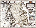
Map of the Duchy of Schleswig , 1650:
Mare Cimbricum ( Kimbrisches Meer )
or Westsee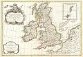
French map, 1771:
Mer d'Allemagne (German Sea)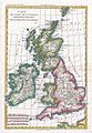
French map, 1780:
Mer du Nord (North Sea) for the northern section, Mer d'Allemagne for the southern section
_047.jpg)
_-_Geographicus_-_BritanniaeHiberniae-blaeu-1631.jpg)

_-_Geographicus_-_BritishIsles-janvier-1771.jpg)

North Sea as a route to the British Isles
The first historically guaranteed intensive use of the North Sea as a traffic route was made by the Romans . 55 and 54 BC Chr. Penetrated Julius Caesar in Britain (see Caesar's invasions of Britain ). 12 BC BC Drusus had a fleet of over 1000 ships built and sailed across the Rhine into the North Sea. The Frisians and Chauken had nothing to oppose the superior numbers, tactics and technique of the Romans , and when the Romans advanced to the mouths of the Weser and Ems, the tribes resident there had to surrender.
5 v. In the course of a military advance under Tiberius to the Elbe, Roman knowledge of the North Sea could be significantly expanded: Pliny the Elder describes that Roman maritime associations passed Heligoland and ventured as far as the northeast coast of Denmark.
With the conquest of Britain by Aulus Plautius (43 AD), a brisk and regular shipping traffic between the ports in Gaul ( Portus Itius ) and those in England began. The Roman era lasted almost 350 years and ended with the withdrawal of the Roman legions around the year 400.

In the remaining power vacuum on the British Isles, the Saxons , Angles and Jutes , originally from what is now northern Germany and Denmark, advanced across the North Sea with the next great migration. During the Roman occupation of Britain they had already been used as mercenaries during the late phase of the Roman Empire , numerous crossed the North Sea in the centuries of the Great Migration and settled in the south and east of England, bringing the Celts who originally lived there into the areas of today Displaced from Scotland and Wales .
Around the 7th century, the Frisians, originally from what is now the Netherlands, emigrated across the North Sea to the North Frisian islands of Sylt , Amrum and Föhr . In a second wave of immigration in the 11th century, the Jutland mainland between the Eider and Wiedau in southern Jutland was also settled, where the Frisians met the Jutes . The North Frisian settlement area now makes up a large part of the North Frisia district .
The next major wave of migration across the North Sea brought the Nordmanns, mainly from what is now Denmark and Norway, to the British Isles. With the attack on Lindisfarne in 793, the Viking raids began , who for the next hundred years were mainly pirates and looters. They raided coastal monasteries, homesteads, and towns and drove inland on the rivers. According to the Anglo-Saxon Chronicle , they also began to settle from 851. These migrations from Scandinavia lasted until around 1050.
Alfred the great of Wessex was the first Saxon king to resist the Vikings by setting up his own fleet. He was able to free the area from the Danes and is considered the first English king. While the sea had separated the British Anglo-Saxons from the Germanic tribes, the Scandinavians kept in contact with their old homeland throughout the North Sea. Thus, most of the British Isles and the northern part of the sea were firmly under the control of Scandinavian kings, the Vikings.
Hardiknut was the last Danish-British king, after his death the North Sea region disintegrated due to internal conflicts, the political union between Scandinavians and British across the North Sea was separated. After this separation took place, the North Sea began to lose its importance for the time being. Since the incursion of William the Conqueror from Normandy in what is now France, the British Isles, like the western coastal regions of the North Sea, have oriented themselves south along the great European rivers towards the Mediterranean and the Orient.
The most important connection to the outside world for northern Germany and Scandinavia, on the other hand, was the Baltic Sea, where the Hanseatic League flourished. The only more important trade route across the North Sea led through the German Bay of Flanders to the ports of the Hanseatic cities.
Hanse

The Hanseatic League had its main focus in the Baltic Sea, but important offices were also located in Bergen ( Bryggen ) in Norway , the Stalhof in London in England and the Hanseatic office in Bruges in Flanders .
The rise of Bruges began, not atypically for the North Sea, with a storm surge that tore a deep fairway, the Zwin , in 1134 , which made it possible for larger merchant ships to call into the city. A lively trade in British wool and Flemish shawls began to develop between Bruges and London.
From the 13th century on, German Hanseatic merchants traveled regularly to Bruges and London and began to establish a regular trade route to these cities. Bruges became the end point of the east-west trade line with the Peterhof in Novgorod in Russia and was connected to France, Italy, Spain and the Netherlands via shipping.
As early as 1441 the Hanseatic League had to recognize the economic equality of the Dutch after Bruges, the most important office of the Hanseatic League, had grown into a powerful competitor with Antwerp and the Netherlands had also allied themselves with the Danes as the "Lords of the Sound ". After winning the count's feud , the Dutch began to penetrate the trading areas of the Hanseatic League and to operate their own Baltic Sea trade .
World trading power Netherlands

The united Netherlands developed into the first world trading power in the 16th century. For the history of Dutch traders, the North Sea itself only served as a starting point for their voyages across the oceans. It had become the gateway to the world, the rule over the North Sea was decisive for having a direct route to the markets of the world.
During the Eighty Years' War , the Netherlands also began large-scale overseas trade - they hunted whales near Spitsbergen , traded spices with India and Indonesia , founded colonies in Brazil , North America ( Nieuw Nederland ), South Africa and the Caribbean (see also The Great Tulip Mania ) . The wealth they accumulated from this trade led to the “Golden Age” ( de gouden eeuw ) of the Netherlands in the 17th century .
In 1651 England imposed the Navigational Act , which damaged many Dutch commercial interests. The struggle for the files culminated in the First Anglo-Dutch War in 1652 , which ended with the Peace of Westminster in 1654 ; the navigation file was recognized by the Netherlands.
In 1665 the English declared war on the Dutch again: the Second Anglo-Dutch War began . With the support of the French , who had meanwhile invaded the Spanish Netherlands - now Belgium - the Dutch gained the upper hand. The English and Dutch concluded the Peace of Breda in 1667 after the Dutch admiral Michiel de Ruyter destroyed a large part of the English fleet on the Thames. It was agreed that the English would keep the Dutch possessions in North America (the area around what is now New York City ), while the Dutch would get Suriname from the English. The navigation file was also modified in favor of the Netherlands.

The Téméraire is towed to its last berth to be scrapped.
The year 1672 in the Netherlands as the Rampjaar known ( "disaster year"): England the Republic declared war , followed by France, the Bishopric of Münster and the Electorate of Cologne , who formed an alliance against the Netherlands. France, Kurköln and the Duchy of Munster invaded the republic, while the landing of the English on the coast could only be barely prevented.
The Dutch included the southern North Sea region as a hinterland: In Schleswig-Holstein , numerous legacies of Dutch people who immigrated or brought trade goods with them still testify today. The Dutch brought their technical mastery in dyke construction and drainage technology over the sea . House building and farming techniques were influenced by Holland, and the coastline of Schleswig-Holstein also became wealthy. Numerous residents of the coastal areas hired on Dutch ships - the whale drivers of the North Frisian Islands are particularly well known .
The sea power England / Great Britain
England's rise to dominant naval power began in 1588 when the Spanish Armada's attempt at invasion failed due to a combination of outstanding English naval battles under the leadership of Sir Francis Drake and the bad weather. The growing English Navy fought several naval wars with the Netherlands on the other side of the North Sea and was able to replace them as a global sea power at the end of the 17th century. The building of the British Empire as an empire "in which the sun never sets" was only possible because the British Navy had unrestricted control over European waters and especially the North Sea. The only serious attempt to break this supremacy was made by Napoleon . The Battle of Trafalgar , won by Admiral Horatio Nelson , which secured British supremacy at sea for more than a century, then only led to the continental barrier , with which Great Britain was to be cut off from imports from the European continent.
First World War
In this war , mainly the fleets of the two neighboring Germany ( Imperial Navy ) and Great Britain ( Grand Fleet ) faced each other in the North Sea .
Due to the overwhelming power of British ships, the Grand Fleet was able to gain control of the North Sea almost undisturbed and initiate a sea blockade . The aim of the blockade was to separate Germany from the shipping lanes in order to prevent the supply of war imports and to guarantee the undisturbed transfer of the British expeditionary force. Due to the defensive equipment of Heligoland with a strong coastal defense, only the German Bight was secured for Germany , while the rest of the North Sea and the English Channel were controlled by the Royal Navy throughout the war .

The first naval battle took place on August 28, 1914 off Heligoland and ended with a clear British victory. Since the surface forces of the Imperial Navy had no chance on the open water, the Germans initiated the submarine war . After the initial failures of German submarines , U 9 managed to sink three British armored cruisers about 50 km north of Hoek van Holland on September 22, 1914 .
In November 1914, the British Navy declared the entire North Sea a war zone , which was then mined. Ships flying the flag of neutral states could become the target of British attacks in the North Sea without warning.
In the battle on the Dogger Bank , Germany suffered another defeat against the British on January 24, 1915, and all attempts to break through the Allied North Sea blockade subsequently failed. As a result of these failures, the unrestricted submarine war began on February 4, in which not only allied ships but also neutral ships could be attacked.
On May 31st and June 1st, 1916, the Skagerrakschlacht off Jutland was the largest naval battle of the First World War and, based on the number and size of the ships involved (258), it was probably the largest naval battle in world history. The Germans' goal of decisively weakening the British Navy and thus forcing the sea blockade to be lifted was not achieved. Ultimately, the battle ended without a clear winner and Germany once again placed all hopes in unrestricted submarine warfare.
When the end of the war was approaching, another major attack on the British Navy was to take place on October 28, 1918, against the will of the new German government , whereupon the Kiel sailors' uprising broke out and the sea war came to an end. The mutiny of the sailors also initiated the development of the November Revolution in Germany.
Second World War

In terms of naval warfare on the part of the German Navy , the Second World War was also primarily a submarine war , which was rarely fought in the North Sea, but mainly in the Atlantic . In contrast to the First World War, the North Sea was no longer the exclusive territory of the Allies, but was the scene of intensive coastal warfare with small vehicles such as submarines, minesweepers and speedboats , especially in the first years of the war . However, despite initial successes that at times brought Great Britain into a supply crisis, it was not possible to decisively break the resistance. As in the First World War, the Allies soon dominated the sea, especially the North Sea because of the superior air, and cut off Germany from overseas supplies. The associated lack of resources to wage the war was one of the reasons the war was not to be won.
On October 14, 1939, Lieutenant Günther Prien succeeded in penetrating the bay of Scapa Flow with the submarine U 47 and sinking the warship HMS Royal Oak with a crew of 1,400.
On April 9, 1940, Operation Weser Exercise started on the German side , during which almost the entire German fleet was mobilized and set off in the direction of Scandinavia. A short time later, the military objectives of the invasion (occupation of the Norwegian ports, securing the iron ore supply, preventing a second front in the north) were achieved and Norway and Denmark were occupied . This occupation lasted until the end of the war and during the entire time the Shetland Bus , which runs across the North Sea, served as an important escape and supply route from Norway to Great Britain. First, operated by Norwegian fishing boats, such as the war through three were submarine hunters of the Royal Navy replaced.
Due to the inferiority of the larger combat ships, clearly visible through the early losses ( Admiral Graf Spee 1939, Blücher 1940 and Bismarck 1941), the Navy shifted more and more to warfare with small units and the remaining capital ships such as the Tirpitz almost anchored idle in Norway's fjords.
During the last years of the war and the first post-war years under Allied supervision, large quantities of ammunition were dumped in the North Sea. While chemical warfare agents were sunk mainly in the Skagerrak and the Baltic Sea, conventional ammunition (grenades, mines, bazookas, cartridges, etc.) was sunk in the German Bight. The estimates differ widely, but it seems clear that several hundred thousand tons of ammunition were dumped in the sea.
After the Second World War
.jpg)
In the period after the Second World War, the use of the North Sea for peaceful purposes came to the fore; because while the opponents of the Cold War stood face to face and eyed each other in the Baltic Sea , the North Sea was, apart from Sweden, only limited by NATO member states.
The North Sea gained economic importance in the 1960s when the neighboring countries began to use found oil and gas commercially. The biggest disaster in the history of oil and gas production in the North Sea was the sinking of the Piper Alpha oil rig in 1988, in which 167 people were killed.
In August 2011, the German Federal Government placed an order for the systematic archaeological prospecting of the southern North Sea, also outside the 12 nautical mile zone , to the German Maritime Museum in Bremerhaven, as the existence of numerous archaeological sites is threatened by planned construction projects.
According to German authorities, there are (as of 2020) around 1.3 million tons of ordnance and 280,000 tons of chemical weapons from the Third Reich sunk off the German North Sea coast.
literature
- Jürgen Ehlers The North Sea. From the Wadden Sea to the North Atlantic. Primus Verlag, Darmstadt 2008, ISBN 978-3-89678-638-8 .
- Norbert Fischer , Susan Müller-Wusterwitz and Brigitta Schmidt-Lauber (ed.): Staging of the coast. Reimer, Berlin 2007, ISBN 978-3-496-02800-0 .
- Horst Güntheroth: The North Sea - Portrait of a threatened sea. Gruner and Jahr, Hamburg 1986, ISBN 3-570-07168-5 .
- Olaf Mörke : The sibling seas: history of the North and Baltic Sea region. Stuttgart 2012.
- Richard Pott : The North Sea - a natural and cultural history. Beck, Munich 2003, ISBN 978-3-406-51030-4 .
- Michael Pye: At the edge of the world. A history of the North Sea and the beginnings of Europe. Fischer, Frankfurt am Main 2017, ISBN 978-3-10-002483-1 .
- HE Reineck, W. Schäfer: Small coastal ABC for landlocked countries on the North Sea. Senckenberg, Wilhelmshaven 1956, (PDF; 2.5 MB) .
Web links
- Map: Use of the North Sea and protected areas (PDF; 273 kB)
- BWaStr card DBWK 1000, Federal Waterways and Shipping Administration
- OSPAR (2000): Geography, hydrography and climate Quality Status Report on the North Sea, Chapter II (PDF; 2.94 MB; English)
- AWI : The consequences of climate change for life in the North Sea pdf
Individual evidence
- ↑ North Sea (at UBA)
- ↑ a b Map from 1888 in an encyclopedia
- ^ Limits of Oceans and Seas, 3rd edition. (PDF) International Hydrographic Organization, 1953, accessed December 24, 2020 .
- ^ Names and Limits of Oceans and Seas, 4th edition 2002 (final draft)
- ↑ Fact sheet No. 8 - Shipping Forecast. (PDF; approx. 913 kB) (No longer available online.) In: Met Office National Meteorological Library and Archive. metoffice.gov.uk, 2011, archived from the original on October 6, 2012 ; accessed on May 4, 2017 (English).
- ↑ Leibniz Institute for Baltic Sea Research Warnemünde: Does the Kattegatt still belong to the Baltic Sea ? → "From a physical point of view, there are arguments to place the separation between the North and Baltic Seas in the Great Belt near Langeland and in the Öresund on the drug threshold."
- ^ Karl Heinz Behre: The fluctuations of the mean high tide on the German North Sea coast in the last 3000 years according to archaeological data . (PDF; 402 kB) In: Coastline Reports 1 (2004)
- ↑ noz.de September 9, 2017: The North Sea is warming twice as fast as the oceans
- ↑ CIMAS - The Norwegian and North Cape Currents
- ↑ Tide table for Rotterdam for the next seven days, tide-forecast.com (English)
- ↑ Tide table for Hook of Holland for the next seven days, tide-forecast.com (English)
- ↑ Tide table for Den Helder for the next seven days, tide-forecast.com (English)
- ↑ Status report on the North Sea shows need for action Olaf Lies: The federal government should campaign internationally for tracking devices on dangerous goods containers. In: Environment.niedersachsen.de . January 8, 2019, accessed January 14, 2019 .
-
↑ a b c Karl-Ernst Behre, The history of the landscape around the Jade Bay , 2012, ISBN 978-3-941929-02-9 ,
• p. 25, Early settlements in the Jade region ,
• p. 35 ff., Vom Ringdeich zum modern coastal protection ,
• p. 139, Large areas of dyke form the Jade Bay - ^ History of Schleswig-Holstein: Storm surges ( Memento from March 31, 2009 in the Internet Archive )
- ↑ Tacitus: About the origin and life of the Teutons on Wikisource - Germania , Chapter 35
- ^ Oskar Tenge: Der Butjadinger Deichband (1912) (from incl. Dangast to the mouth of the Hunt), u. a. in the fund (pre-order) of the Bremen State Archives
- ↑ Oskar Tenge: 25 maps for the Butjadinger Deichband , 1912 (PDF)
- ↑ Announcement of the Federal Government's proclamation on the expansion of the German territorial sea of November 11, 1994 ( Federal Law Gazette I p. 3428 )
- ↑ International Court of Justice: North Sea Continental Shelf Cases, Judgment of 20 February 1969 ( Memento of March 4, 2016 in the Internet Archive ) Summary of the judgment (English; PDF for download)
- ↑ ICES Cooperative Research Report No. 297, August 2009: Effects of extraction of marine sediments on the marine environment 1998-2004 , p. 167.
- ↑ VDInachrichten No. 20: The North Sea on the way to the new coal bonanza . Technology & Science May 16, 2014
- ↑ Fisheries Center of the University of British Columbia ( page no longer available , search in web archives ) Info: The link was automatically marked as defective. Please check the link according to the instructions and then remove this notice.
- ↑ Wolfgang Pfeifer et al., Etymological Dictionary of German , 4th edition, Munich 1999, p. 930 f., Sv Nord .
- ^ Search for sunken cultures in the North Sea ( Memento from May 12, 2012 in the Internet Archive ) Radio Bremen (accessed on August 12, 2011)
- ↑ Solveig Grothe, DER SPIEGEL: Sunk ammunition: The arduous search for Hitler's warfare agents - DER SPIEGEL - history. Retrieved May 30, 2020 .
- ↑ Philipp Löwe, DER SPIEGEL: Ordnance clearance in Germany: Time bomb under water - DER SPIEGEL - Science. Retrieved May 30, 2020 .

North Atlantic with Sargasso Sea | South Atlantic
Side seas in the east:
Northern European Sea |
North Sea |
Kattegat |
Baltic Sea |
English Channel |
Celtic Sea |
Irish Sea |
Scottish Sea |
Biscay
Mediterranean Sea ( Adriatic , Aegean , Black Sea ) |
Gulf of Guinea
Adjoining seas in the west:
Irmingersee and Denmark Strait |
Labrador Sea |
Baffin Bay and Davis Strait |
Hudson Bay |
Gulf of Saint Lawrence |
Gulf of Maine
American Mediterranean ( Gulf of Mexico and Caribbean Sea ) |
Scotia Lake