
District of Calw
| coat of arms | Germany map |
|---|---|

|

Coordinates: 48 ° 42 ' N , 8 ° 44' E |
| Basic data | |
| State : | Baden-Württemberg |
| Administrative region : | Karlsruhe |
| Region : | Northern Black Forest |
| Administrative headquarters : | Calw |
| Area : | 797.53 km 2 |
| Residents: | 158,397 (Dec. 31, 2018) |
| Population density : | 199 inhabitants per km 2 |
| License plate : | CW |
| Circle key : | 08 2 35 |
| NUTS : | DE12A |
| Circle structure: | 25 municipalities |
| Address of the district administration: |
Vogteistraße 42-46 75365 Calw |
| Website : | |
| District Administrator : | Helmut Riegger ( CDU ) |
| Location of the Calw district in Baden-Württemberg | |
  |
|
The district of Calw is a regional authority in Baden-Württemberg . It belongs to the Northern Black Forest region in the Karlsruhe administrative district .
geography
location
In terms of landscape, the area of the district of Calw belongs predominantly to the northern Black Forest , only in the east and south some places belong to the Gäu or Black Forest foothills. Significant rivers in the district are Enz and Nagold , which with their course form a three-sided plateau, which lies in the center of the district and is known as the Enz-Nagold-Platte.
The sources of Nagold and Enz are close to each other, on the southwest edge of the district area. The course of the Enz between Enzklösterle and Pforzheim marks the north-western edge of the Enz-Nagold-Platte. To the west of it extends to the Black Forest ridge, the highest part of the district, which extends in the northwest over the ridge to the upper reaches of the Alb , where the town of Bad Herrenalb is located.
The course of the Nagold forms the southern and eastern edge of the Enz-Nagold-Platte, because it initially runs eastwards from the Black Forest ridge, then turns north in the town of Nagold on the south-eastern edge of the circle, flows through Calw and finally flows into Pforzheim, just north of the district area, in the Enz. The areas east and some south of the Nagold belong to the Heckengäu and Schlehengäu .
Neighboring areas
The district of Calw borders in a clockwise direction in the northwest on the districts of Karlsruhe and Enzkreis , the urban district of Pforzheim and the districts of Böblingen , Tübingen , Freudenstadt and Rastatt .
Division of space

According to data from the State Statistical Office , as of 2015.
Nature reserves
The district of Calw has the following 26 nature reserves . According to the protected area statistics of the State Institute for the Environment, Measurements and Nature Conservation Baden-Württemberg (LUBW), 2,231.09 hectares of the district are under nature protection, that is 2.80 percent.
- Alb valley and side valleys : 620.6 ha (of which 50.7 ha in the district of Calw); City of Bad Herrenalb and the municipality of Dobel
- Egenhäuser Kapf with Bömbach Valley : 150.3 ha; City of Altensteig and municipality of Egenhausen
- Eyach and Rotenbachtal : 223.6 ha (124.9 ha of which in the Calw district); City of Bad Wildbad and the municipalities of Dobel , Höfen an der Enz
- Falchenwiesen : 10.4 ha; community Neuweiler
- Donor sack : 16.5 ha; City of Wildberg
- Validlinger and Holzbronner Heiden : 328.8 ha; Cities Wildberg and Calw
- Hacksberg and Steckental : 61.9 ha; community Ostelsheim
- Haiterbacher Heckengäu : 137.3 ha; community Haiterbach
- Heiligkreuz and Schloßberg : 66.3 ha; City of Nagold
- Hesel-, Brand- and Kohlmisse : 195.1 ha; Municipalities of Neuweiler and Oberreichenbach
- Hörnle and Geißberg : 67.9 ha; community Simmozheim
- Hülbe near Sulz : 5.4 ha; City of Wildberg
- Kaltenbronn : 394.6 ha (of which 122.4 ha in the Calw district); City of Bad Wildbad
- Köllbachtal with side valleys : 99.9 ha; City of Altensteig, communities of Neuweiler and Simmersfeld
- Mindersbach Valley : 51.6 ha; City of Nagold and the community of Ebhausen
- Monbach, Maisgraben and St. Leonhardquelle : 42.0 ha (of which 21.0 ha in the Calw district); City of Bad Liebenzell
- Oberer Gründel : 29.5 ha; Egenhausen and Haiterbach communities
- Lard quarry : 47.9 ha; City of Altensteig and municipality of Simmersfeld
- Simmozheim Forest : 46.3 ha; Simmozheim community
- Staufen : 73.0 ha; Municipality Rohrdorf
- Devil's brain shell : 13.7 ha; City of Nagold
- Waldach and Haiterbach valleys : 72.2 ha; City of Nagold and the municipality of Haiterbach
- Forest bog peat cut : 9.2 ha; Oberreichenbach community
- Würm-Heckengäu : 299.8 ha; City of Calw, communities Althengstett and Gechingen
- Zavelsteiner Krokuswiesen : 52.5 ha; cities Bad Teinach-Zavelstein and Calw
- Ziegelberg : 55.8 ha; City of Nagold
history
The district of Calw goes back to the Counts of Calw , who had their headquarters in Sindelfingen and founded Calw Castle around 1050 , which became the nucleus of today's district town. After their extinction in the 13th century, the area of today's district was split up into the possessions of the Guelphs , the Counts of Württemberg and the Counts of Tübingen . It was only reunited in the hands of Württemberg as a result of the Reichsdeputation Hauptschluss.
19th and 20th centuries

At the beginning of the 19th century, the Württembergers formed the Oberämter Altensteig, Calw , Liebenzell, Nagold , Neuenbürg , Wildbad and Wildberg, the Amt Zavelstein and the Klosterämter Herrenalb and Hirsau. However, just one year after the elevation of Württemberg to a kingdom in 1807, some offices were revoked. Hirsau, Liebenzell and Zavelstein were combined with Calw, Wildbad with Neuenbürg and Wildberg with Nagold. In 1808 Herrenalb was also united with Neuenbürg. In 1810 the remaining offices of Calw, Nagold and Neuenbürg belonged to the Black Forest bailiff and from 1818 to the Black Forest district . The boundaries of the three higher offices have changed several times in the course of history. In 1924 the Black Forest district was dissolved and in 1934 the three main offices were renamed as districts. In 1938 the districts of Neuenbürg and Nagold were merged with the district of Calw except for six communities. After the Second World War, the district of Calw became part of the new federal state of Württemberg-Hohenzollern and after the reorganization of the federal states in 1952, it became part of Baden-Württemberg in the southwest . After that he belonged to the administrative district of Südwürttemberg-Hohenzollern .
During the district reform , the area of the district of Calw was changed again on January 1, 1973: Twelve communities were transferred to the newly formed Enzkreis , the community of ceilingpfronn came to the district of Böblingen , Loffenau moved to the district of Rastatt , but he was able to the municipality of Fünfbronn of the district Freudenstadt and the community of Hochdorf from the dissolved Horb district .
On September 1, 1971, the community of Dachtel was assigned to the district of Böblingen. The communities of Gündringen, Schietingen and Vollmaringen were taken over from the district of Horb on December 1, 1971 and incorporated into the city of Nagold on the same day .
On March 30, 1972, the Niebelsbach community moved to the Pforzheim district . To overcome the division of Moosbronn on April 1, 1972, its Württemberg portion was reclassified from the Bernbach community to the town of Gaggenau (Rastatt district).
On October 1, 1974, the municipality of Garrweiler from the Freudenstadt district was added. It was incorporated into the city of Altensteig .
After the municipal reform has been completed, the district of Calw still comprises 25 municipalities, including ten towns and of these, in turn, two large district towns ( Calw and Nagold ). The largest city is Calw, the smallest municipality is Enzklösterle . The District History Association of Calw eV is dedicated to the local and local history in the old district of Calw, i.e. in the areas that belonged to the district of Calw before the district reform.
Population development
The population figures are census results (¹) or official updates from the Baden-Württemberg State Statistical Office ( main residences only ).
|
|
politics
The district is administered by the district council and the district administrator.
MPs
Since 1987, Hans-Joachim Fuchtel ( CDU ) has been a member of the Bundestag for the Calw constituency , which consists of the districts of Calw and Freudenstadt, and Saskia Esken ( SPD ) since 2013 . Thomas Blenke (CDU) has represented the Calw state electoral district in the state parliament of Baden-Württemberg since 2001 . Daniel Caspary (CDU) has been a member of the European Parliament for the North Baden district since 2004 .
District council
The district council is elected for five years by those entitled to vote in the district. The local elections on May 26, 2019 resulted in the following distribution of seats (48 seats, previously 47 seats):
| Parties and constituencies | % 2019 |
Seats 2019 |
% 2014 |
Seats 2014 |
% 2004 |
Seats 2009 |
% 2004 |
Seats 2004 |
% 1999 |
Seats 1999 |
% 1994 |
Seats 1994 |
% 1989 |
Seats 1989 |
|
|---|---|---|---|---|---|---|---|---|---|---|---|---|---|---|---|
| CDU | Christian Democratic Union | 31.4 | 15th | 35.0 | 16 | 32.2 | 17th | 37.5 | 21st | 36.3 | 18th | 31.0 | 17th | 35.4 | 16 |
| FWV | Free voter association in the Calw district council | 25.0 | 12 | 32.1 | 15th | 33.1 | 18th | - | - | - | - | - | - | - | - |
| Flat share * | Electoral associations | - | - | - | - | - | - | 29.7 | 17th | 32.6 | 17th | 30.9 | 16 | 31.9 | 15th |
| GREEN | Alliance 90 / The Greens | 14.2 | 7th | 9.4 | 5 | 9.1 | 4th | 7.2 | 4th | 4.6 | 2 | 8.5 | 4th | 7.7 | 3 |
| SPD | Social Democratic Party of Germany | 13.9 | 7th | 16.7 | 8th | 15.0 | 8th | 15.7 | 8th | 19.6 | 10 | 19.9 | 11 | 20.2 | 9 |
| AfD | Alternative for Germany | 8.2 | 4th | - | - | - | - | - | - | - | - | - | - | - | - |
| FDP | Free Democratic Party | 6.2 | 3 | 6.8 | 3 | 10.6 | 5 | 9.9 | 5 | 6.9 | 3 | 4.6 | 2 | 4.8 | 2 |
| THE LEFT. | THE LEFT. | 1.0 | - | - | - | - | - | - | - | - | - | - | - | - | - |
| total | 100 | 48 | 100 | 47 | 100 | 53 | 100 | 55 | 100 | 50 | 100 | 52 | 100 | 45 | |
| Turnout in percent | 57.1 | 48.42 | 51.5 | 53.1 | 54.6 | 67.5 | 62.5 | ||||||||
* WG: Voting associations, as the results from 1989 to 2004 cannot be broken down to individual groups of voters.
District Administrator
The district councilor is elected by the district council for a term of eight years. He is the legal representative and representative of the district as well as chairman of the district council and its committees, but has no voting rights in the committees . He heads the district office and is an official of the district.
His area of responsibility includes the preparation of the district council meetings and its committees. He calls meetings, chairs them and implements the resolutions passed there. His deputy is the first state official.
The Oberamtmen between 1808 and 1936 are shown in the article Oberamt Calw .
The district administrators of the district of Calw from 1936:
- 1936–1945: Karl Hägele
- 1945–1949: Emil Wagner
- 1949–1955: Friedrich Geißler
- 1955–1963: Fritz Wanner
- 1963–1980: Günter Pfeiffer
- 1980–1996: Herbert Zerr
- 1996–2010: Hans-Werner Köblitz (FWG)
- since 2010: Helmut Riegger (CDU)
coat of arms
The coat of arms of the district of Calw shows a standing, blue crowned and blue-tongued red lion in gold on a blue three-mountain, from which a silver spring gushes. The coat of arms was awarded again on July 11, 1961 and after the district reform on October 12, 1973.
The lion on the Dreiberg was the heraldic animal of the Counts of Calw, who ruled today's district for a long time. The coat of arms is similar to that of the city of Calw, but the district coat of arms still contains the source, which is supposed to reflect the many health resorts in the district.
Partnerships
The district of Calw maintained a partnership with the district of Freiberg in Saxony from 1991 until its dissolution in 2008 . In addition, a partnership agreement has existed with the Polish district of Gliwice since December 3, 2009.
Several parishes in the Calw district maintain ecclesiastical partnerships with Protestant parishes in Thuringia to this day.
The Protestant parish of Aichelberg maintains a partnership with the Protestant parish in Triptis (Thuringia, SOK - Saale-Orla district) together with the Protestant parish of Stammheim (CW) and Zwerenberg.
Economy and Infrastructure
In the Future Atlas 2016 , the district of Calw was ranked 124th out of 402 districts, municipal associations and independent cities in Germany, making it one of the regions with “future opportunities”. In the 2019 edition, it was ranked 176 out of 401.
The Chamber of Crafts in Karlsruhe is responsible for the district of Calw .
traffic
Rail transport
The Württemberg State Railway opened a line between Weil der Stadt and Calw in 1872: the Württemberg Black Forest Railway from Stuttgart . Two years later the Nagold Valley Railway ran from Pforzheim via Calw to Nagold and then crossed under the Hochdorf tunnel to the height of Horb. From 1891 the Altensteigerle , a narrow-gauge railway , opened up the valley to Altensteig from the Nagold station .
The Enztalbahn , the first track in the county was in 1868 in Enztal from Pforzheim to Bad Wildbad been built. The Albtal-Verkehrs-Gesellschaft extended this in 2003 in the city area from Bad Wildbad to the spa gardens.
The health resort Bad Herrenalb received a connection with Karlsruhe through the Alb valley in 1898 by the West German Railway Company . This Albtalbahn was meter gauge until 1960, but electrified from 1911. It is the core of today's network of the Karlsruhe Stadtbahn , which leads to several districts.
Two branches were closed:
- 1962: Nagold – Altensteig railway line (15 km, gauge 1000 mm)
- 1983: Württemberg Black Forest Railway Weil der Stadt – Calw (23 km)
A reactivation of the Weil der Stadt – Calw section as Hermann-Hesse-Bahn is currently being planned. Operations were formally closed, but the line was never shut down.
Road traffic
The district area is not touched by any federal motorway. The A8 Stuttgart - Karlsruhe and the A 81 Stuttgart- Singen (Hohentwiel) but lead a few kilometers north and east of the county over. The district is therefore only accessible through federal, state and district roads. Federal roads that cross the district or begin there are:
- Bundesstrasse 28 , from Ulm to Kehl ; It used to lead from Herrenberg to Nagold and on to Altensteig and Freudenstadt, since 2019 it no longer leads through the Calw district, but on a more direct route (formerly B28a) from Tübingen via Rottenburg to Freudenstadt.
- Federal highway 294 that the Enztal of Bretten Coming via Freudenstadt to Freiburg crosses
- Bundesstrasse 295 , which comes from Stuttgart and ends in Calw
- Federal Highway 296 , the Tübingen over Herrenberg and Calw to Calmbach leads
- Bundesstrasse 463 , which, coming from Pforzheim, opens up the entire district area along the Nagold River in a southbound direction
Local public transport
The tariffs of Verkehrsgesellschaft Bäderkreis Calw VGC apply to all local public transport .

District facilities
The district of Calw is responsible for the following vocational schools :
Commercial school in Calw, Hermann-Gundert-Schule (commercial and housekeeping school) in Calw, district vocational school center Nagold ( Rolf Benz school , commercial school and Annemarie Lindner school) and technical school for part-time farmers (ALLB) Wildberg as well as a nursing school in each of the district hospitals Calw and Nagold, as well as the following special educational and advisory centers (SBBZ): Karl-Georg-Haldenwang-Schule ( specialization focus on intellectual development) with school kindergarten (specialization focus on mental and physical and motor development) Bad Teinach-Zavelstein (with a branch in Nagold) and the SBBZ for schoolchildren in long-term hospital treatment Calw. In Calw, the district maintains a student residence.
The district of Calw is also responsible for the two district hospitals in Calw and Nagold, which have joined forces with the Sindelfingen - Böblingen Clinic , Herrenberg Hospital , Leonberg , Sindelfingen and the Böblingen Rehabilitation Clinic, together they form the Südwest Clinic Association .
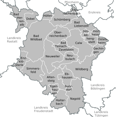
Communities
(Residents on December 31, 2018)

Municipalities before the district reform
Before the district reform on January 1, 1973 and the community reform , the (old) district of Calw had a total of 104 communities since 1938 , including twelve towns .
On March 7, 1968, the state parliament of Baden-Württemberg set the course for a community reform . With the law to strengthen the administrative power of smaller municipalities , it was possible for smaller municipalities to voluntarily unite to form larger municipalities. The beginning in the old district of Calw was made on January 1, 1971 by several communities that united with their neighboring communities, including some with the city of Bad Liebenzell . In the period that followed, the number of communities steadily decreased. The district area also changed in three cases. On September 1, 1971, the municipality of Dachtel merged with the municipality of Aidlingen and thus became part of the Böblingen district . On March 30, 1972, the Niebelsbach community was merged with other communities to form the new Keltern community and thus became part of the Pforzheim district . On April 1, 1972, the part of the village Moosbronn belonging to Bernbach was reclassified to Gaggenau and thus became part of the Rastatt district .
The remaining communities in the old district of Calw merged on January 1, 1973 in the new district of Calw, which was smaller in area than the old one. The old district of Calw last covered an area of 882 km² and had a total of 144,168 inhabitants at the 1970 census .
The table shows the population development of the old district of Calw up to 1970. All population figures are census results.
|
|
The largest municipality in the old district of Calw was the district town of Calw . The smallest community was Beuren.
In the table, the municipalities of the old district of Calw are before the municipal reform.

License Plate
On July 1, 1956, the district was assigned the CW distinctive sign when the vehicle registration number that is still valid today was introduced . It is still issued today.
literature
- The state of Baden-Wuerttemberg - official description according to districts and municipalities (in eight volumes); Edited by the Baden-Württemberg State Archives Department; Volume V: Karlsruhe District; Stuttgart 1976, ISBN 3-17-002542-2 .
Web links
- Official website of the district of Calw
- Literature from and about the district of Calw in the catalog of the German National Library
Individual evidence
- ↑ a b Statistisches Landesamt Baden-Württemberg - Population by nationality and gender on December 31, 2018 (CSV file) ( help on this ).
- ↑ Survey of land according to type of actual use in 2015
- ↑ LUBW protected area statistics, updated daily
- ↑ a b Federal Statistical Office (ed.): Historical municipality register for the Federal Republic of Germany. Name, border and key number changes in municipalities, counties and administrative districts from May 27, 1970 to December 31, 1982 . W. Kohlhammer, Stuttgart / Mainz 1983, ISBN 3-17-003263-1 , p. 488 f. and 526 f .
- ↑ [1]
- ↑ [2] ( Page no longer available , search in web archives ) Info: The link was automatically marked as defective. Please check the link according to the instructions and then remove this notice. Distribution of votes in the district elections 1989–2009.
- ↑ [3] ( page no longer available , search in web archives ) Info: The link was automatically marked as defective. Please check the link according to the instructions and then remove this notice. Distribution of seats in district elections 1989–2009.
- ↑ Future Atlas 2016. Archived from the original on December 4, 2018 ; accessed on March 23, 2018 .
- ↑ Future Atlas 2019. Accessed December 10, 2019 .
- ^ ST: B28 now leads through Rottenburg. In: Schwäbisches Tagblatt . January 24, 2018, accessed July 30, 2019 .
- ↑ Schools sponsored by the district of Calw ( Memento from December 14, 2013 in the Internet Archive ) (PDF; 18 kB).
Alb-Danube District | Baden-Baden | Biberach | Lake Constance district | Boeblingen | Breisgau-Upper Black Forest | Calw | Emmendingen | Enzkreis | Esslingen | Freiburg im Breisgau | Freudenstadt | Göppingen | Heidelberg | Heidenheim | Heilbronn (Land) | Heilbronn (city) | Hohenlohekreis | Karlsruhe (State) | Karlsruhe (city) | Constance | Loerrach | Ludwigsburg | Main-Tauber district | Mannheim | Neckar-Odenwald district | Ortenaukreis | Ostalbkreis | Pforzheim | Rastatt | Ravensburg | Rems-Murr-Kreis | Reutlingen | Rhein-Neckar District | Rottweil | Schwäbisch Hall | Schwarzwald-Baar district | Sigmaringen | Stuttgart | Tübingen | Tuttlingen | Ulm | Waldshut | Zollernalb district
.svg)
Basking | Backnang | Baden-Baden | Balingen | Biberach | Boeblingen | Bruchsal | Book | Bühl | Calw | Crailsheim | Donaueschingen | Ehingen | Emmendingen | Esslingen | Freiburg (city) | Freiburg (State) | Freudenstadt | Friedrichshafen | Göppingen | Hechingen | Heidelberg (city) | Heidelberg (Country) | Heidenheim | Heilbronn (city) | Heilbronn (Land) | Black Forest | Horb | Karlsruhe (city) | Karlsruhe (State) | Throat | Constance (city) | Constance (Country) | Künzelsau | Lahr | Leonberg | Loerrach | Ludwigsburg | Mannheim (city) | Mannheim (State) | Mergentheim | Mosbach | Muellheim | Münsingen | Neustadt | Nürtingen | Offenburg | Öhringen | Pforzheim (city) | Pforzheim (Country) | Rastatt | Ravensburg | Reutlingen | Rottweil | Säckingen | Saulgau | Schwäbisch Gmünd | Schwäbisch Hall | Sigmaringen | Sinsheim | Stockach | Stuttgart | Tauberbischofsheim | Tettnang | Tübingen | Tuttlingen | Überlingen | Ulm (city) | Ulm (State) | Vaihingen | Villingen | Villingen-Schwenningen | Waiblingen | Waldshut | Cheeks | Wolfach