
East Texas

East Texas (possible alternative spelling: East Texas, in English: East Texas ) is a geographical, cultural and political administrative region within the US - the State of Texas . It is commonly assigned to the part of the state located west of the border with Louisiana and Arkansas . Their scope is not defined uniformly: while in a narrow sense only the counties belonging to the three regional associations Ark-Tex, East Texas and Deep East Texas are included, more generous allocations include parts of the northern Gulf coast and the eastern prairie foothills. Dominant ecoregion are of strong forest - mainly coniferous forest vegetation specific Piney Woods . Both the landscape and regional culture are very similar to that of the Deep South - a feature that sets the region apart from the rest of Texas.
In addition to the abundance of forests, which already forms a contrast to the more open, savanna-like landscapes in the central, western and southern parts of Texas, East Texas is also very different from the rest of the state in terms of its history. It is not for nothing that the region is considered the birthplace of the state of Texas, which became independent in a war in 1836 and only joined the USA in 1845 . Economically, the region has always set its own accents, from the farms of the pioneering era to the logging industry to the rich oil deposits that have been developed since the beginning of the 20th century. Nevertheless, different structural adjustment problems have become noticeable in the region. A characteristic is still the comparatively thin, rural settlement and also the fact that the region is somewhat remote in the wider periphery of the large Texan metropolitan areas.
geography
Internal breakdown
.jpg)

As a rule, East Texas is the part of Texas located between the Trinity River in the west and the Sabine River in the east. The borders in the east and north are given by the three states of Louisiana, Arkansas and Oklahoma . The border with Louisiana marks two thirds of the course of the Sabine River, that of Oklahoma in the north is continuous with the Red River . The border between East Texas and the rest of the state is commonly a line west of Counties Lamar , Hopkins , Van Zandt and Henderson to the Trinity River, then along its course to its confluence with the Gulf of Mexico .
At the county level, the East Texas region is assigned 41 counties. 38 of them have come together in the four regional coordinations Ark-Tex, East Texas, Deep East Texas and South East Texas . The four Regional Councils of Government perform planning functions for the respective region. In the north-south length it extends around 430 kilometers; the west-east distance at the widest point is almost 200 kilometers. The internal breakdown in detail:
- Ark-Tex: The northernmost region includes the nine counties south of the Red River, Cass , Delta , Franklin , Hopkins, Lamar, Morris , Red River , Titus and Bowie . In addition, there is Miller County in Arkansas . The regional capital is the regional metropolis Texarkana , located partly in Arkansas and partly in Texas .
- East Texas: The part of East Texas located south of Ark-Tex includes the 12 counties of Rains , Wood , Camp , Upshur , Marion , Van Zandt, Smith , Gregg , Harrison , Henderson, Anderson , Cherokee , Rusk and Panola . The regional council capital is Kilgore, Rusk County. Largest cities in this sub-region are Tyler and Longview . In terms of structure, Ark-Tex is often listed together with this sub-region; both together occupy roughly half of the entire East Texas region.
- Deep East Texas: The sub-region adjoining East Texas to the south is very rural. It is formed by the Counties Shelby , Nacogdoches , Houston , Trinity , Angelina , San Augustine , Sabine , San Jacinto , Polk , Tyler , Jasper and Newton . Regional capital is Jasper . Larger centers are Nacogdoches and Lufkin . Historically, the earliest Anglo-American settlements were concentrated in this sub-region . In terms of landscape, the sub-region is part of the Big Thicket , a dense forest zone at the southern end of the Piney Woods region, which has since been severely shrunk as a result of logging . The remaining forest enjoys special protection as Big Thicket National Preserve by the National Park Service and forms the only national park in East Texas.
- South East Texas: This sub-region includes the three Gulf Coast counties Hardin , Orange and Jefferson . Compared to the rest of East Texas, the sub-region is heavily populated. The regional capital is Beaumont . Together with Port Arthur is Beaumont, the Beaumont-Port Arthur Metropolitan Statistical Area , the only urban population center in East Texas. Unlike the other three sub-regions, South East Texas is heavily industrialized . In terms of landscape, its appearance is mainly shaped by the coastal prairie.
- Counties belonging to a different regional association. Specifically, these are the three counties Chambers ( County Seat : Anahuac ), Liberty (County Seat: Liberty ) and Walker (County Seat: Huntsville ). All three are located in the southwest of the region and are part of the wider catchment area of the Houston metropolis . Huntsville, the capital of Walker County, is the seat of the well-known Texas penal institution, Huntsville Unit , which acts, among other things, as the central facility for the implementation of the death penalty .
Scenic, geographic and tourist definitions of the region differ from the political ones in some details. In the former, East Texas is often equated with the dominant part of the landscape, the Pineywoods forest region. With this definition, the three coastal counties of the South East Texas Council mostly operate as part of the Gulf Coast region. The western demarcation to the rest of Texas is also inconsistent. Parts of the Ark-Tex sub-region are often added to the Blackland Prairie, an agriculturally particularly productive prairie strip with the Dallas-Fort Worth metropolitan area at its center. The allocation of the three counties close to the Gulf Coast is handled particularly inconsistently. Either they are assigned to either East Texas or the Texan part of the Gulf Coast region.
The land area of the region amounts to 71,422 km². Together, around 50,000 of these are in the two subregions of East Texas and Deep East Texas, around 15,000 in Ark-Tex and around 5,500 km² in South East Texas. East Texas is less than a tenth of the total state. The borders of the counties united in the four regional councils were last fine-tuned in 1875. A few smaller areas became independent districts: Camp was separated from Upshur, Franklin and Morris from Titus. The smallest county in the region is Camp (East Texas region; 513 km²), the largest is Houston (East Texas region; 3,188 km²) on the western edge.
Landscape features


The predominant landscape is the Piney Woods or East Texas Timberlands: a flat to slightly hilly, wooded region, which is determined by a small-scale river landscape and numerous natural and man-made lakes . In terms of landscape geography , the Piney Woods form the western end of the southern forest landscape. The total area of the Piney Woods is 141,000 km²; the Texan part of it amounts to over 61,000 km². The core of the southern part of this large landscape is the so-called Big Thicket - a compacted forest zone that historically stretched as far as the Brazos River and was largely determined by the standing waters and bayous that were present there . Due to extensive logging, however, the "dense curtain" was greatly reduced in size. The features of this particular ecoregion are now only found in a few southern counties of the Deep East Texas sub-region .
In the immediate coastal area, the coastal prairie or coastal prairie is the defining feature of the landscape - in the golf area of the Sabine River it is also interspersed with marshy marshland. In the west, the region's landscape merges into the Blackland Prairie and the Post Oak Area - largely open prairie and savannah areas that provide favorable conditions for arable farming and cattle breeding . Part of this western transition zone are the counties of Lamar, Delta, Hopkins, Van Zandt, Henderson and Anderson. The Pineywoods region in turn - the dominant core of East Texas, which covers around 80% of the area - continues in the eastern states of Louisiana and Arkansas.
In terms of small landscape, East Texas is structured by the course of several rivers. In addition to Trinity and Sabine, whose course limits the region, these are the Neches River , the Angelina River , the Big Cypress and the Sulfur River. Neches and Angelina Rivers are part of the Sabine River network. The Angelina River flows into the Neches River, which in turn flows into the Sabine River, which flows into the Gulf of Mexico after crossing Sabine Lake and Sabine Pass. Big Cypress and Sulfur are part of the river network of the Red River, which flows into the Mississippi in Louisiana . The many standing waters (also called bayous) and freshwater lakes are characteristic of the East Texas landscape. Significant reservoirs are the Sam Rayburn Reservoir and the Toledo Bend Reservoir . They regulate the water supply to the two rivers Angelina River and Sabine River and are important factors for both water supply and energy generation .
The landscape within the Greater Region is largely flat. The average height above sea level ranges from a few meters to around 150 meters. The soils near the river are sandy - loamy consistency; the soils in the higher elevations are particularly suitable for arable farming. Natural riches of the region are on the one hand its wood stock , on the other hand oil and natural gas deposits , which were increasingly developed from the end of the 19th century. The East Texas Oil Field in the western center of the region is the second largest inland oil field in the USA. Another oil field that determines the region is the Spindletop Oilfield on the Gulf, the development of which from 1901 marked the beginning of industrial oil production in East Texas.
Flora and fauna

The flora of the East Texas core area of Piney Woods is heavily influenced by hardwood plants: As the name Piney Woods (translated: pine forests ) already suggests, pine trees in particular dominate. Dominating plants are pines , hardwoods , hickory trees and oaks . Three types of pine forests can be localized with different distribution :
- Marsh pine forests . They are part of the southeastern forest area, which in its original formstretchedfrom Virginia to East Texas. The original stands have meanwhile been strongly pushed back and have been largely replaced by mixed stands composed of deciduous and pine stands. They are the predominant form of forest, especially in the southern center of the region.
- Deciduous pine forests . Primarilynative forest standsin higher elevations in which short-leaved pines dominate. Here, too, a mixed growth of pine and deciduous trees has establisheditself over the course of time.
- Mixed forests of pine and hardwood trees. Historically, they occurred primarily on slopes , steep gorges , on tributaries and similar topographically prominent places, preferably where the risk of fire was limited. The predominant pine forests did not develop here in pure form, but were interspersed with stocks of other species such as white oak , red oak or starfish trees . The two last-mentioned forest forms dominate especially in the northern part of the region.
-8.jpg)
Illustrated Flora of East Texas, a standard publication on flora and botany in the region, gives Caddo Lake and the remaining Big Thicket Reserves a prominent flora. The Caddo Lake is noteworthy, among other things, because of the bald cypress trees native to it in large numbers . The Big Thicket, on the other hand, is a special case due to its primeval, uncut condition and the diversity of species to be found there . Overall, human influence has also significantly changed the eastern Texas forest landscape: in many places, logging and pasture management have led to an increase in undergrowth , which suppresses the growth of hardwood plants. Countermeasures here are to reduce logging and create meadows that do not hinder tree growth.
Of the grass species common in the region, a number are common across the North American continent , including Bermuda grass and Indian grass . Others such as Bahia grass, Longleaf Uniola or Maidencane can only be found in the southwestern US forest belt. Typical forage for grazing are savannah grasses of the genus Andropogon grasses, mercury grasses , millet -Gewächse, needle grasses, eragrostis as well as other types of grasses . In addition, common pitcher plants , pitcher plants such as the pale pitcher plant and mallow plants are typical for the region . Typical types of flowers include lupins and flowers of the gods .
In terms of animal species , a distinction must also be made between those that are (more or less) native to the entire continent and those that are primarily found in the region. As in most forest areas in the northern hemisphere , East Texas is home to numerous species that are typical of this vegetation zone , such as deer , fox , rabbits and quail . Until recently, bears were less of the native fauna; in the meantime, however, some species have moved in from other states. Typical animal species for the region are silver badgers , the black-shouldered noctule bat (a type of bat) and the marsh rabbit , a rabbit native to the region. Additional Pineywoods region native species are Wassermokassinottern , woodpeckers , eastern cottontail , squirrels and opossums , widespread in the Americas opossums -Art. In the southern nature reserves of the Big Thicket some species have their retreat habitat found. The Harris County Historical Commission lists the following species on its website, including the bald eagle , Houston toad , North American river otter , Texas horned lizard, and the wood stork .
| City | county | Sub-region | E. |
|---|---|---|---|
| Paris | Lamar | Ark-Tex | 24,936 |
| Texarkana | Bowie | Ark-Tex | 37,389 |
| Mount Pleasant | Titus | Ark-Tex | 16,115 |
| Tyler | Smith | East Texas | 101,946 |
| Marshall | Harrison | East Texas | 23,651 |
| Longview | Gregg | East Texas | 82.184 |
| Henderson | Rusk | East Texas | 13,587 |
| Kilgore | Rusk | East Texas | 14,658 |
| Carthage | Panola | East Texas | 6,828 |
| Palestine | Anderson | East Texas | 18,456 |
| Nacogdoches | Nacogdoches | Deep East Texas | 33,789 |
| Lufkin | Angelina | Deep East Texas | 36,112 |
| Jasper | Jasper | Deep East Texas | 7,663 |
| Livingston | Polk | Deep East Texas | 8,012 |
| Beaumont | Jefferson | South East Texas | 117,729 |
| Port Arthur | Jefferson | South East Texas | 54,913 |
Settlement and transport network
Settlement is rural in large parts of East Texas . The population density per square kilometer is in large areas in the single-digit to lower double-digit range. The population of the larger cities (US designation: Citys ) between 10,000 and 50,000 corresponds roughly to the German medium- sized town level. Outstanding regional centers are Beaumont (over 115,000 inhabitants), Tyler (over 100,000), Longview (82,000), Texarkana (38,000) and Lufkin (36,000). Medium-sized and small towns like Nacogdoches or San Augustine have a comparatively small population. The former centers of the pioneering era are, however, symbols of a past rich in tradition.
As a transfer region between the eastern federal states and the Texan heartland, East Texas has a well-developed supra-regional trunk road network. Important thoroughfares in the north are Interstate 30 ( Dallas - Texarkana - Little Rock ) and Interstate 20 (Dallas - Longview - Shreveport ). In the south of leading San Antonio to New Orleans leading Interstate 10 through the counties Jefferson and Orange. In the north-south direction, there are also shorter supra-regional connecting routes. As is common throughout Texas, the road network is supplemented by so-called farm-to-market roads, country roads that connect the surrounding agricultural area to the regional centers.
Compared to South Texas as well as the western half of the state, East Texas' rail network is well developed. Only the three metropolitan areas of Fort Worth – Dallas, Austin –San Antonio and Houston have a more densely developed route network. The majority of the lines are operated by the Union Pacific Railroad , one of the two major providers in the western United States. The UP maintains half a dozen larger lines in East Texas. These drive - either in a west-east or south-west-north-east direction - most of the centers in the region and connect them with the Texan metropolitan areas and the neighboring state of Louisiana. The second major provider is the Fort Worth based BNSF Railway . The route it serves from Beaumont to Longview runs along the east side of the region and is the most important north-south connection. Another longer route is maintained by the Kansas City Southern Railway (KCS). Coming from Dallas-Fort Worth, it leads through the north of the region and also ends in Louisiana.
East Texas has two major national airports : Jack Brooks Regional Airport in Beaumont and East Texas Regional Airport in Longview. The cities of Texarkana, Paris, Marshall, Tyler, Henderson, Nacogdoches, Lufkin, Jasper and Orange have smaller airports.
climate

The general weather situation in East Texas is determined by two extremes, which determine the climate in large parts of the Midwest . On the one hand, there are subarctic cold masses, which build up in the continental northern part of North America and which can freely pull through to the south through the open prairie areas of the midwest. The opposite pole is formed by the subtropical climate installations along the Gulf of Mexico. The prevailing climate in the region is subtropical . Typical is a humid subtropical weather and temperature situation - prevailing in the entire US Southeast - which is occasionally interrupted by the penetration of cold air from the north. Normal for the region are mild winters (average temperature in January between 7 ° C and 9 ° C) and warm summers with maximum temperatures of around 34 ° C in August. Winter temperatures in particular vary and increase slightly from north to south (maximum temperatures in January for Texarkana, Lufkin and Beaumont: 12.3 ° C, 15.4 ° C and 16.4 ° C). The rainfall is average for all of Texas. The monthly average varies between 66 mm in April and July and 127 mm in November (values for Lufkin). On the Gulf Coast, the months of May to July and September and October are the rainiest . The values for Beaumont in the months listed are 132, 183, 157, 161 and 141 mm.
The hurricanes and tornadoes that occur frequently in the Greater Region also affect the area of East Texas. The counties Jefferson and Orange in the catchment area of the Gulf region in particular are regularly affected by hurricanes. Hurricanes Rita (2005) and Gustav (2008) caused in part considerable damage in the region around Beaumont. Although East Texas is more on the edge of the tornado corridor in the US Midwest - so-called Tornado Alley - smaller and larger hurricanes regularly make headlines. The combination of both types of storms can cause particularly serious damage, as was the case with Hurricane Carla in 1961 : The hurricane triggered around two dozen additional cyclones, which caused further damage.
|
Monthly average temperatures and rainfall for Lufkin, Texas
Source: US climate data
|
|||||||||||||||||||||||||||||||||||||||||||||||||||||||||||||||||||||||||||
history
Native American, Spanish and Mexican periods

Before the arrival of European explorers , the greater region of East Texas and the current federal states around it were mainly inhabited by members of the Caddo ethnic group. Other significant Indian tribes were the Atakapa and the Karankawa . The former settled mainly in the Big Thicket region, the latter along the Texas Gulf coast. The Mississippi culture , established by the Caddo peoples, had also given the East Texas region an impetus towards a predominantly sedentary , arable lifestyle. The first Spanish voyages of discovery roamed the region in the 16th century - for example that of Álvarez de Pineda , who sailed along the Gulf coast with his ships in 1519, the failed voyage of discovery by Álvar Núñez Cabeza de Vaca in 1528 or the expedition of the conquistador Luis de Moscoso , who succeeded Hernando de Sotos first passed East Texas in 1542. For a long time, the administration of the Viceroyalty of New Spain showed little interest in the region. In the first half of the 18th century, the Spaniards established a number of mission stations in the area. Settlement began slowly in the second half of the 18th century. From this time results the founding of the oldest city in East Texas - Nacogdoches. The Camino Real de los Tejas - a trade route that led from Natchitoches in the Louisiana region to the northern Mexican province of Coahuila - developed to provide an infrastructural connection with the north of core Mexico .
,_1906.jpg)
Other European actors in the Greater Region were French - former residents of the French Louisiana colony. However, they did not pose a threat to the Kingdom of New Spain: the Louisiana Territory to the north of New Spain had fallen to Spain in 1763 and the French-speaking population in the region was always small. A fundamental change did not occur until the beginning of the 19th century: through the Louisiana Purchase , when the territory - which had reverted from Spanish to French possession - came into the possession of the USA. After independence in 1821, the Mexican government made increased efforts to colonize the previously largely fallow northern region. Since the incentive for Mexican settlers to settle far away from the Mexican core area was low, the Mexican government increasingly granted land concessions to US settlers. In their train the first Anglo-Saxon colonies arose in Texas. Established scheme of this Landgebungen was that the Mexican government granted the settlement permit for a certain area, the concessionaire - called Empresarios - again acted to insure to the area assigned with Neuzuzöglingen colonize .
Although the largest colony - that of Stephen F. Austin - was southwest of East Texas, East Texas developed into an important center of Anglo-Saxon settlements. Some of these early colonies - such as those of Lorenzo de Zavala or Eugen Vehlein - were entirely in the East Texas region, others - such as those of the Empresarios Frost Thorn and William T. Burnet - were partially. The confusing situation was reinforced by two other factors: firstly, as a buffer zone between the US and Mexico set up, as a Neutral Ground "Neutral Ground" called on the eastern border of the area, a big draw for outlaws, land speculators and adventurers acted to others, the vacillating attitude of the Mexican central government towards the new colonists. Especially in the region around the Mexican administrative center of Nacogdoches, there had been several attempts since the 1810s to break Texan areas out of the New Spanish or Mexican state association. The attempts at separation there culminated in another brief, isolated uprising - the Fredonian Rebellion in 1828. The battle of Nacogdoches in 1832 brought a turning point in the sense of the settlers striving for more autonomy , which de facto ended the Mexican military presence in the region.
1836 to 1900


The Texan War of Independence in 1836 also affected the East Texas hinterland - especially after General Santa Anna's advance after taking the Alamo fortress . The decisive battle of the war finally took place in East Texas: the Battle of San Jacinto . Even after independence, East Texas remained a precarious region characterized by lawlessness and vigilance . A prominent conflict was the Regulator – Moderator War , a feud between two competing vigilance groups that lasted from 1839 to 1844 and could only be ended by the intervention of the state militia. It was ordered - after initial hesitation - by Sam Houston , former Commander in Chief in the Texas War of Independence and first President of the Republic of Texas.
Compared to all of Texas, the East Texas territory was seized by Anglo-American settlers relatively early. In detail, however, the settlement process took place quite differently. In the region south of the Red River, for example, settlement began as early as 1815. In part, these settlements were due to the misconception that the settlement area belonged to the Arkansas Territory - as was the case, for example, in what would later become Bowie County. Other areas - such as Van Zandt County in the western part of the region - were not developed until the 1840s. The settlement presence on the Gulf Coast remained modest at first - regardless of the fact that trading activities of various actors had long been taking place in this area .
The breakdown of the East Texas counties - excluding some later detailed corrections - was roughly completed in 1846. The most significant boundary correction was the redistribution of the previous Nacogdoches County - a district whose western borders had been more or less indefinite until then. Under the aegis of Sam Houston's successor, Mirabeau B. Lamar , the Texas government also put an end to the Indian presence in East Texas. In addition to groups that had lived there for a long time, this mainly affected members of tribes who had settled in East Texas in the wake of US settlement pressure, such as groups of Shawnees and Kickapoos . In particular, the Cherokee groups who had settled there after 1815 were also expelled from East Texas.
The image of the early Anglo-American pioneer settlements was initially determined by subsistence farming due to poor transport routes . However, the cultivation of maize and livestock were quickly supplemented by commercial cotton cultivation . In addition, there was slavery - an institution brought from there by settlers who had mainly immigrated from the southern states . In contrast to the rest of Texas, which is more dominated by small-scale farms and cattle breeding, the economy and social structure of East Texas were already very similar to those of the deep south - that is, the eastern US states of Louisiana, Mississippi and Alabama - even before the civil war .
As in the rest of Texas, secession found widespread support in the eastern part of the state. However, there were scattered sprinkles of settlements that the Union preferred - for example in Van Zandt County, where Norwegians made up a not inconsiderable group of settlers. During the Civil War fought in different Osttexaner army associations of the Confederation . However, the state was largely spared direct military confrontations. The largest were the two battles at Sabine Pass in 1863, in the course of which Confederate units thwarted an attempt by a Union squadron to drive a military wedge between Texas and the rest of the Confederation. As in other states of the deep south, the reconstruction policy that began after 1865 resulted in major social upheavals. A major point of conflict was the liberation of slaves . As a result, offshoots of the Ku Klux Klan also emerged in Texas . The aim of these groups: to intimidate the now free group of Afro-Americans and prevent them from exercising their political rights. In the course of the economic boom and the re-admission of local political representations from the mid-1870s, anti-unionist-racist violence subsided.
In contrast to the rest of the state, the region benefited little from the general US westward development . East Texas remained a remote area until the turn of the century . The improvement of the traffic infrastructure as well as connections to the supraregional railway network ensured an economic upswing that lasted into the 1930s. The two most important new economic factors were the timber industry and the production of oil and natural gas. The timber industry experienced an upswing with the connection to the railway network and boomed until the middle of the 20th century. The discovery of significant oil fields in the region triggered a similar boom. The largest - the East Texas Oilfield - stretches over an approximately 72-kilometer strip east and southeast of Rusk County and is the second largest oil field in the United States. With the Spindlefield Oilfield, the development of which began shortly after the turn of the century, the coastal region on both sides of Sabine Lake in particular developed into the center of a new industrial infrastructure.
20th and 21st centuries


The downside of the economic boom was a renewed flare-up of racist tendencies. In the four decades before, during and after World War I , the number of lynchings increased significantly. The new outbreak of racist violence was combined with a resurgence of the Ku Klux Klan. It coincided with the conclusion of the so-called Jim Crow legislation , which severely restricted the rights of the African-American population. On the one hand, the rampant wave of lynching between 1890 and 1930 affected large parts of the United States. The center was, however, the states of the deep south - with Texas, after Mississippi and Georgia , ranked third. Of the 468 Texan victims of lynching between 1885 and 1942, the overwhelming majority - 436 - were in the eastern part of the state.
The main focal points were the counties south of the Red River and the valley of the Brazos River from Waco to the Gulf of Mexico. Two incidents in East Texas became particularly notorious because of their cruelty and the high number of victims: the public torture to death of Henry Smith on January 26, 1893 in Paris (Lamar County) and the so-called Slocum massacre on July 29, 1910, in whose train a white mob in a small town in Anderson County killed an unknown number of African Americans (today's estimates are between 22 and around 200). What most of the cases had in common was that they were either not at all or only slightly punished. Another characteristic are the abundant photographs , some of which were distributed during the period in the form of postcards .
One consequence of the Jim Crow laws and the rampant lynching was the migration of many African Americans to other regions of Texas, to neighboring states or to the industrial centers of the north - the so-called Great Migration . The economic development in East Texas between the First World War and the 1950s was shaped by different factors. One factor was the decline in traditional agriculture - especially commercial cotton cultivation, whose sales markets collapsed in some cases drastically as early as the early 1920s. The timber industry, however, remained important until the second half of the 20th century. Oil production advanced to become the new driving force of the East Texas economy. The regional oil boom started around the turn of the century and grew stronger the more new oil fields were discovered and developed in the region.
The infrastructure of East Texas, however, remained in deficit for a long time. In rural areas in particular, it lagged significantly back well into the 1930s. Access to the power grid was only partially expanded there during the New Deal period. The mechanization of agriculture was also well below that of other federal regions. The road network also no longer met contemporary requirements. Specific measures to change this situation were not taken until the 1930s. Various Texas and federal authorities - in particular with the participation of the Civilian Conservation Corps (CCC), which was newly created for job creation measures - tackled a number of infrastructure and development projects in the region - including soil protection and erosion protection projects, the expansion of national parks and the Construction of new roads, dams and bridges.
Notwithstanding the modernization of the infrastructure, the East Texas region was increasingly affected by emigration after the Second World War - this time mainly to the Texan metropolises and other industrial centers outside the region. In the 1950s and 1960s, another resource in the region was brought to economic use more systematically: water . The construction of some reservoirs - especially the Sam Rayburn Reservoir and the Toledo Bend Reservoir - improved the regional water supply and enabled the production of energy. In combination with the nearby nature reserves and national parks , the newly created reservoirs also offered tourist offers. In the meantime, some regional centers - such as Texarkana, Tyler and Longview in the north or Lufkin in the east Texas center - have also been able to break away from the stagnation tendencies in large parts of the region. The structural problems with which the region is struggling and the economically deficient situation of many residents favor, among other things, side effects such as drug abuse and crime . In 2009, for example, the online news site Houston Press reported on the coexistence of old and new forms of deviance: the drug trafficking that can be found everywhere in the USA has been joined by very specific, local forms in the region, such as the theft of cattle and oil.
Demographics and Politics
| 1850 | 1900 | 1950 | 2000 | |
|---|---|---|---|---|
| Ark-Tex | 27,078 | 200,422 | 219.028 | 270,399 |
| East Texas | 54,568 | 291.055 | 427.177 | 745.155 |
| Deep East Texas | 27,162 | 160,895 | 205,646 | 355,581 |
| South East Texas | 1,836 | 25.193 | 255.185 | 385.076 |
| East Texas | 110,644 | 677,565 | 1,107,036 | 1,756,211 |
| Texas | 212,592 | 3,048,710 | 7,711,194 | 20,851,820 |
Demographics
Compared to the total population of Texas, the population of the eastern counties was just under one twelfth in 2000 (Texas: 20,851,820; East Texas: 1,756,211). Since 1850 the ratio has steadily changed in favor of the entire state. In 1850 more than half (110,644) of the then 210,000 Texans lived in the east of the state, in 1900 it was around a quarter (of around 3 million), in 1950 it was only around a seventh (of around 7.7 million) . The main settlement area in 1850 has remained the population center to this day - the East Texas sub-region. Between a third and a half of the residents still live in the northern center of the region. A particularly rapid increase in population has been recorded in the three southern counties. In 1850, there were only 2,000 people living there; in 1900 the population was around 25,000. By 1950 it had increased almost tenfold again - to over 255,000. On the other hand, some counties in the other three sub-regions recorded population declines. The trend towards emigration in the two Ark-Tex counties Delta and Red River was particularly sustainable. While in other counties affected by stagnation or decline the process of emigration at least stagnated after 1950, the number of inhabitants continued to fall. The Delta and Red River numbers: 1900-15,249 and 29,893; 1950 - 8,964 and 21,858; 2000 - 5,319 and 14,314.

According to the 2016 census , there were 1,900,212 residents in the total area at the time - 282,796 in Ark-Tex, 845,141 in East Texas, 379,907 in Deep East Texas and 392,368 in South East Texas. The proportion of the three main ethnic groups is largely the same in the entire region. Roughly two-thirds of white people and one-third of African-American and Hispanic people. Only in the South East Texas sub-region is the proportion of whites lower at 57.1% and that of minorities correspondingly higher. Among the two largest minorities, Afro-Americans, with a population of 17.1%, rank ahead of Hispancis with 14.4%. There are significant deviations in the Beaumont region: In Jefferson County, Afro-Americans and Hispanics (or Latinos ) together make up more than half of the population (numbers: 107,034 whites, 84,956 African-Americans, 47,963 Hispanics). In the rest of the region as a whole there are counties with a proportion of minorities that is well above the average third (example: Titus County in the Ark-Tex sub-region). But there are also those with a largely dominant white population (example: Counties Sabine and Newton - both regions of Deep East Texas).
According to the 2016 census , the average percentage of people living in poverty was 17.6%, and the percentage of people without health insurance was 18.7%. The highest percentages are found in the Deep East Texas sub-region (20.6% and 19.8%), the lowest in the industrial center of South East Texas (15% and 16.2%). Even with these values there are some that are significantly above or below the average. In Hardin County, South East Texas, the poverty rate is a comparatively low 10.8%; however, it has its highest level of 23.8% in San Augustine County (Deep East Texas). The values for the median income per household were also above average in the South East Texas sub-region (50,253 US dollars), while those in the Deep East Texas sub-region were below average (38,515 US dollars). The highest median income was in Hardin County ($ 54,352) and the lowest in San Augustine County ($ 29,426). The mean for the entire region was $ 43,778 and that for all of Texas was $ 54,727.
politics


Politically, the population of the eastern part of the country is even more conservative (or more republican) than the rest of the state. In the 2016 presidential election, for example, Republicans in many counties in the East Texas region achieved voting results of 75% or more (overall Texas results: 52.1% for Donald Trump , 43.1% for Hillary Clinton ). The Republicans only achieved even higher results (with over 90 percent in some cases) in the prairie belt of West Texas and its northern appendage, the Panhandle region - with South Texas and the urban centers, as usual, voting for the majority of the Democrats . Hillary Clinton only received percentages above the state result (48.9%) in one of the 38 East Texas counties: Jefferson. With results of over 80 percent, however, the Counties Wood (83.8%), Upshur (82.5%), Panola (81.1%), Sabine (86.0%), Tyler (82.6% ) and Hardin (86.7%).
In the previous presidential elections , the Republican share of the vote in East Texas was in some cases significantly higher than in the rest of the state. In 2012 , Mitt Romney also received more votes in East Texas than the overall Texas average. Unlike in the 2016 election, however, the urban metropolitan area of Jefferson County voted for Barack Obama by a majority in 2012 . The same picture emerged in the 2008 , 2004 and 2000 elections - with the majority of the counties Morris and Newton voting democratically in George W. Bush's first candidacy . From a long-term perspective, the East Texas electorate also followed the trend away from the Democrats and towards the Republicans that can be observed in Solid South.
Regionally significant peculiarities were
- the independent candidacy of the extremely right-wing conservative Democrat George Wallace in 1968 , in which the majority of the East Texas counties - unlike the electorate in the rest of Texas - voted for Wallace by a majority,
- the candidacy of Carter against Reagan in 1980 (in which Carter, unlike the state, was the East Texas favorite),
- the 1992 election (Texas vote: George Bush ; region vote: Bill Clinton ). In terms of the overall Texas result, third place in this election was also relegated to the independent candidate and billionaire Ross Perot from the region .
In the US House of Representatives , the region is represented exclusively by representatives of the Republicans. The six East Texas with congressional constituencies 1, 4, 5, 8, 14 and 36 were represented in 2018 by Republicans Louie Gohmert , John Ratcliffe , Jeb Hensarling (from January 2019: Lance Gooden ), Kevin Brady , Randy Weber and Brian Babin . The political positions range from tea party supporters like Gohmert to moderate conservatives like Brady and Babin. In the Texas House of Representatives , the region is also represented almost entirely by Republican MPs. The exception here is Joe Deshotel - a businessman from Port Arthur who represents part of Jefferson County for the Democrats and has been an MP since 1998.
Economy and education

.jpg)

Until well into the second half of the 20th century, cotton, cattle breeding, wood and oil production were the most important branches of the economy . The industrially operated logging and the extraction of crude oil came on the scene relatively late. In contrast to agriculture, the wood industry played no role at all in the middle of the 19th century. In the fifty years between 1880 and the Great Depression , it developed into a strongly prosperous sector. It was promoted and only made possible in the industrial form by the expansion of the railway network , which also had a major influence on the development of the cities. The pay of the forest workers was poor and accidents were frequent . The logging has been done in an extremely unsustainable manner. It was carried out according to the “cut and run” principle, according to which areas were completely cleared and then moved on to the next piece of forest. Until the 1930s, the timber industry was subject to only a few regulations. Up to this point in time, the establishment of trade unions was only partially successful.
The second economic boom factor was the discovery of significant oil and gas resources in the first decades of the 20th century. One of the oldest oil fields in the region is the captured Spindletop Oilfield located on the Gulf of Mexico. It started operating in 1901. Interwoven closely its history is that of the largest petrochemical company in the region - the now with Chevron merged company Texaco . The East Texas oil boom was greatly promoted by the discovery and development of the East Texas Oilfield - a huge reservoir that stretches along the western border of Rusk County and whose mining began in 1930. The oil boom was accompanied by the industrial development of the coastline around Beaumont and Sabine Lake. Due to its water and energy requirements, it is still a significant beneficiary of large dam projects such as those implemented in the middle of the 20th century.
At the end of the 20th century, the proportion of the petrochemical industry declined - as did the proportion of well-paid jobs. The local service structure had increasingly lost ground in the course of the 20th century : local retail stores , cafes and petrol stations were increasingly being displaced by department store chains , franchisees and the branches of fast food chains . The decline of retail trade and old industries could be partially offset by less cyclical or new fields of activity, such as social and other services. The increased settlement of patent holding companies in the region has developed into a unique selling point . You benefit from regional jurisdiction, which is particularly beneficial to patent holders.
The East Texas infrastructure was changed by the improved use of the abundant water reserves in the region. The largest projects here were the construction of the Sam Rayburn Reservoir (1965) and the Toledo Bend Reservoir (1966). With the two reservoirs, the tourism factor increased in importance . It is true that East Texas does not have any destinations suitable for mass tourism . However, the region offers a number of points of contact especially for nature-oriented recreational activities such as fishing, water skiing and boating - in addition to the two large reservoirs, for example Lake Palestine, Caddo Lake, Lake Fork and Lake Livingston. National Forests in the region include: Angelina National Forest , Sabine National Forest , Davy Crockett National Forest, and Sam Houston National Forest near Huntsville. The only East Texas national park to be added is the Big Thicket National Preserve near Saratoga - a nature reserve which, in contrast to the National Forests, should not only preserve the scenic vitality of the designated area, but also its original character. In total, the nature reserves in the Piney Woods region cover a total area of around 2,500 km².
Some higher education institutions are also located in the region. Nationally known universities are Sam Houston State University in Huntsville and Stephen F. Austin State University in Nacogdoches. Small university and college institutions include: Texas A&M University in Texarkana, University of Texas in Tyler, LeTourneau University in Longview, and East Texas Baptist University in Marshall .
Culture


Unlike the rest of Texas East Texas has more similarities to the Deep South as the western prairie states or the heavily Hispanic mitgeprägten Southwest . The question of the Texan and especially the East Texas identity is also regularly discussed in the Texan media. The assignment to the US South is based on several factors. An important one is the Piney Woods landscape, which dominates the region - on a large scale, a western branch of the southeastern forest zone that protrudes over the Mississippi. Another factor is the historical development of the region. It was settled mainly by colonists from the deep south - by origin English , Scots , Irish and, to a lesser extent, Welsh . In addition, later waves of immigration , which had a decisive influence on Texas, left East Texas relatively unscathed - especially the massive immigration of Germans in the mid-19th century and that of southern Europeans at the beginning of the 20th century. Finally, a typical element of the state that is largely absent in East Texas is the integration of Hispanic culture. Instead, it is shaped by a white population classing itself as "Americans".
Closely linked to this part of history is the outstanding importance of the history of colonization - a process that began particularly early in East Texas. Some old cities such as the former administrative center of Nacogdoches and the small town of San Augustine still feed on this past. Another typical feature of East Texas is the predominance of different Protestant faiths. The religious spectrum is dominated by Baptists (especially the Southern Baptist class ). The Protestant spectrum is supplemented by Methodists , Presbyterians , Lutherans and congregations of the Pentecostal movement .
The Texan sub-dialect, which is common in the region, is also clearly present . While a "Twang" - originally from the upper south - is characteristic of Texan English , East Texas has a "drawl" that is typical of the lower south. While for the (all Texan) "Twang" phrase, in addition to specific expressions, a stretched, flattened pronunciation that tends to merge vowels is typical (example: night , pronounced "neith", becomes "naath"), in East Texas "Drawl" the soft, musical, words slowly stretching speech sound of the lower south received. The linguistics professor Guy Bailey from San Antonio regards the dialect of the entire state as a historically grown mixture of peculiarities of the lower and upper south. Only in East Texas did the speech of the lower south remain relatively unadulterated.
There are also some special local influences that can be felt throughout the region. For example the effects of the Louisiana Cajun and Creole cultures. They have been preserved in regional cuisine , among other things . In the northern part of the region, however, awareness of the importance of the Caddo culture is still present. Some institutions take this tradition into account, such as the Caddo Mounds State, a restored Indian village in Cherokee County and the Caddo Indian Collection in the Gregg Count Historical Museum in Longview.
Some styles of American popular music such as gospel , bluegrass , blues , country , rock , soul , rhythm and blues and cajun are also strongly present in the region . In particular, the development of the blues took place to a not insignificant extent on East Texas soil. Major festivals in the region include the Texas Rose Festival in Tyler, the East Texas Yamboree in Gilmer and the Great Texas Ballon Race in Longview. Although East Texas is not one of the commercially significant centers of country music, there is a nationally known institution of the genre in Carthage (Panola County): the Country Music Hall of Fame . The region also has a number of historical sites to offer. Examples: Mission Tejas State Park in Grapeland , the San Jacinto Battleground , the history of the railroad-documenting Depot Museum in Henderson , the historic village Heritage Park Museum in Edgewood and the Texas Foresty Museum in Lufkin.
Like other regions, East Texas has its regional myths and legends. Part of the local folklore are, for example, the stories of the light in Saratoga and the Ghost Roads in Big Thicket. In them, nocturnal light sources on country roads are connected to past - real or fictional - events: for example a track keeper who was run over by a train and beheaded in the process. East Texas has reduced the number of dry counties - counties where the sale of alcohol is prohibited. According to a list by the Texas Alamanac 2014, some restrictions (still) applied in the Counties Bowie, Franklin, Van Zandt, Rusk, Panola, Houston and Angelina. The only county in the region with a full ban - Delta - abolished this after a vote in 2015.
Personalities from East Texas


In keeping with the size of the region and its historical significance, there are many prominent personalities who either came from it or who spent a large part of their lives in it. Especially in the phase of Anglo-Saxon settlement and the Republic of Texas, which was founded after the War of Independence, the "density" of well-known founder figures was quite high. Sam Houston, for example, originally from Virginia, lived in Nacogdoches until 1835. For a short time - from the fall of 1835 to the late winter of 1836 - Davy Crockett, a native of Tennessee and a former member of the US House of Representatives, lived there . Thomas Jefferson Rusk , a politician, Commander-in-Chief of the Texan Army from May to October 1836 and an early proponent of the annexation of Texas to the United States, also lived in what is believed to be the oldest city in Texas . Other pioneer-era East Texas politicians include John Henninger Reagan , Confederacy politician and post office minister during the Civil War (Anderson County), Matthias Ward (Red River County), and Louis Wigfall , Confederate politician and brigadier general (Nacogdoches County).
Representatives from the region also regularly held the highest office in the state. Governors with East Texas roots included: James Pinckney Henderson (first governor of the US state of Texas; San Augustine County), George T. Wood (San Jacinto Counties and Liberty Counties), Jim Hogg (Rusk County), Ross S. Sterling ( Chambers County), Allan Shivers (born in Lufkin), Mark White and Ralph Yarborough (both: Henderson County) and Price Daniel (Liberty County). Horace Chilton (Tyler) and Morris Sheppard (Morris County) represented the state as senators or House of Representatives . Sheppard, who was one of the staunch supporters of Prohibition , introduced the 18th amendment to the constitution in the Senate, which was created for its introduction . The entrepreneur and former presidential candidate Ross Perot (Texarkana) also comes from East Texas. Finally, from Pittsburg , Camps County, is Louie Gohmert (Republican), longtime Congressman for the 4th constituency of Texas who was re-elected in 2016.
Famous musicians with East Texas roots are: the swing trumpeter Harry James (Beaumont), the rock singer Janis Joplin (Port Arthur), the blues musician Freddie King (Upshur County), the country musician Mark Chesnutt (Beaumont), the rockabilly - Crooner Johnny Horton and singer-songwriter Michelle Shocked ( Gilmer ). Other musicians from the region are: George Jones (Saratoga), Miranda Lambert (Lindale), Kacey Musgraves (Mineola), Neal McCoy (Longview and Jacksonville), Lee Ann Womack (Jacksonville), Don Henley (Linden ), Ray Price (Perryville), Johnny Mathis (Gilmer), Tex Ritter (Panola County), Jim Reeves (ibid), Tracy Byrd (Vidor), Clay Walker (Beaumont) and Chris Tomlin (Grand Saline).
Well-known actors who were born in or live in the region include Sissy Spacek (Wood County), Matthew McConaughey , who moved from South Texas to Longview in 1980, and Jamie Foxx (Kaufman County). The director Richard Linklater is also well known across the region . He graduated from Bellaire and Huntsville . From Gladewater in Upshur County originates thriller -author Joe R. Lansdale an author who often ausiedelt the plots of his novels in the region -. One of the most famous sports greats from the region is former boxing world champion George Foreman ; he was born in Marshall, Harrison County. Other nationally known athletes from East Texas are Adrian Peterson ( American Football , Anderson County) and Jay Bruce ( Baseball , Beaumont).
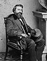
Louis T. Wigfall

Harry James

Freddie King

Mark Chestnutt

Lee Ann Womack

Michelle Shocked

Jamie Foxx

Sissy Spacek

Matthew McConaughey

Joe R. Lansdale

George Foreman

Jay Bruce

.jpg)


.jpg)


Individual evidence
- ↑ a b c East Texas . EH Johnson, Texas State Historical Association (TSHA), June 12, 2010.
- ^ A b Regional Councils of Government . Supreme Court of Texas, No. 15-0158, page 3, accessed on November 27, 2018 (PDF; Engl.).
- ↑ a b c d e f g East Texas Cities and Towns . easttexas.com, accessed on November 27, 2018.
- ↑ Texas. In: nps.gov. Retrieved November 15, 2018.
- ↑ See geographic breakdowns on Texas Regions Map on mapsofworld.com, Map of Texas Regions on Tour Texas and FAQs on Brazos Trail Region; accessed on November 27, 2018 (Engl.).
- ↑ a b Maps of Texas . Interactive map of historic county boundaries on mapofus.org, accessed November 27, 2018.
- ↑ Area information from Texas Counties: History and Information , 50 State Guide - eRD, accessed on November 27, 2018 (Engl.).
- ^ Piney Woods forests . A. Weakley / T. Cook / E. Dinerstein / K. Wolfe, worldwildlife.org, accessed November 27, 2018 (Engl.).
- ^ Piney Woods forests . Weakley / Cook / Dinerstein / Wolfe, worldwildlife.org and Haggerty / Meuth: Texas Master Naturalist , Texas A&M University Press, 2015, p. 131; excerpts online at Google Books , accessed on November 27, 2018 (Engl.).
- ↑ Big Thicket . Francis E. Abernethy, Texas State Historical Association (TSHA), June 12, 2010.
- ^ Soils of Texas . Texas Almanac, accessed November 27, 2018 (PDF; Engl.).
- ↑ See map in Developing a framework to incorporate climate change projections in water availability modeling for Texas , Nelun Fernando, University of Texas at Austin, accessed on November 27, 2018, document page 10 (PDF; Engl.).
- ^ A b c Oil and Texas: A Cultural History . Texas Almanac, accessed November 27, 2018.
- ↑ a b c Texas Plant Life . Texas Almanac, accessed January 13, 2019
- ↑ a b c George M. Diggs, Jr .: Illustrated Flora of East Texas , Botanical Research Inst of Texas, Fort Worth 2006, ISBN 978-1-88987-812-6 , pages 6 and 88 ff. (Engl.); excerpts online as PDF
- ↑ Diggs, Jr., Illustrated Flora of East Texas , pp. 149 ff.
- ↑ See maps of distribution areas in Common Flora of East Texas Version 1 . USDA / NRCS East Texas Plant Materials Center, accessed January 13, 2019 (PDF)
- ↑ Diggs, Jr., Illustrated Flora of East Texas , pp. 258 ff.
- ↑ Wildlife . Texas Almanac, accessed January 13, 2019
- ^ Harris County Historical Commission . historicalcommission.harriscountytx.gov, accessed January 13, 2019
- ↑ Values of population figures for selected cities from statisticalatlas.com ; accessed on November 27, 2017 (Engl.).
- ↑ For the road network, see the interactive map on the Texas General Land Office ; accessed on November 27, 2018 (Engl.).
- ^ State Railroad Map 2015 . Infographic with the 2015 railway network, ftp.dot.state.tx.us, accessed on January 13, 2019 (PDF)
- ↑ See airfields marked on the Texas General Land Office , gisweb.glo.texas.gov, accessed January 13, 2019.
- ↑ Diggs, Jr., Illustrated Flora of East Texas , pp. 65/66 (Engl.)
- ↑ Information on temperatures and precipitation on usclimatedata.com for Texarkana , Lufkin and Beaumont . Accessed November 27, 2018.
- ↑ Texas History Minute: Tornado Seasan in Texas . Ken Bridges, Herald Democrat, June 8, 2017.
- ↑ 57 years ago, Hurricane Carla slammed into the Texas coast . abc13.com, September 10, 2018 (Engl.).
- ↑ US climate data
- ↑ Conquistadors . thestoryoftexas, accessed November 27, 2018.
- ^ Spanish Texas . Donald E. Chipman, Texas State Historical Association (TSHA), June 15, 2010.
- ↑ a b Mexican Texas . Arnoldo De León, Texas State Historical Association (TSHA), June 15, 2010.
- ↑ Fredonian Rebellion . Archie P. McDonald, Texas State Historical Association (TSHA), June 12, 2010.
- ↑ Nacogdoches, Battle of . Archie P. McDonald, Texas State Historical Association (TSHA), June 15, 2010.
- ^ Regulator – Moderator War , Gilbert M. Cuthbertson, Texas State Historical Association (TSHA), June 15, 2010; modified: June 21, 2016 (Engl.).
- ↑ Lamar County , Michael M. Ludeman and Bowie County , Cecil Harper, Jr. Both Texas State Historical Association (TSHA), June 12, 2010.
- ^ Van Zandt County . Gerald F. Kozlowski, Texas State Historical Association (TSHA), June 15, 2010.
- ^ Jefferson County . Diana J. Kleiner, Texas State Historical Association (TSHA), June 15, 2010.
- ↑ Indians . George Klos, Texas State Historical Association (TSHA), June 15, 2010.
- ^ Antebellum Texas . Randolph B. Campbell, Texas State Historical Association (TSHA), June 15, 2010.
- ^ A b Historical Sites in East Texas . Thomas K. Arnold, USA Today, March 21, 2018 (Engl.).
- ↑ a b c Lynching . John R. Ross, Texas State Historical Association (TSHA), June 15, 2010, modified June 21, 2016.
- ^ Lumber Industry . Robert S. Maxwell, Texas State Historical Association (TSHA), June 15, 2010.
- ↑ Jochen Meissner, Ulrich Mücke , K. Weber: Black America. A history of slavery. CH Beck, Munich 2008, ISBN 978-3-40656-225-9 , p. 266. Excerpts online at Google Books .
- ^ Genocide In East Texas: A History Of The Slocum Massacre . Zinn Education Project, Huffington Post, July 28, 2016.
- ↑ Texas in the 1920s . Norman D. Brown, Texas State Historical Association (TSHA), June 15, 2010.
- ↑ Great Depression . Ben H. Procter, Texas State Historical Association (TSHA), June 15, 2010.
- ^ New Deal Projects . Texas Forest Trail Region, accessed November 27, 2018.
- ↑ a b Superthief . Paul Knight, Houston Press, September 23, 2009.
- ↑ a b Counties in Texas state . Information on population development broken down by counties on population.us; accessed on November 27, 2017
- ↑ Community Facts . Population by county on factfinder.census.gov; Pool: Demographic and Housing Estimates 2016; accessed on November 27, 2017
- ↑ United States Census . Information on median household income, poverty and health insurance, broken down by county; accessed on November 27, 2017 (Engl.).
- ^ Household Income in Texas . Comparative values of median household income Texas and USA on statisticalatlas.com; accessed on November 27, 2017 (Engl.).
- ↑ a b 2016 Presidential General Election Results . Interactive map on uselectionatlas.org, results accessed on November 27, 2018 (Engl.).
- ^ House Members . Texas House of Representatives, accessed November 27, 2018.
- ^ Timber Industry . Texas Forest Trail, accessed November 27, 2018.
- ↑ Why East Texas courts are back on "top" for patent lawsuits . Joe Mullin, ars Technica, January 17, 2013.
- ↑ What are the differences between National Parks and National Forests? , nationalforests.org, accessed January 13, 2019
- ↑ Prime Forest Lands . United States Department of Agriculture, September 2013.
- ↑ Is Texas Southern, Western, or Truly a Lone Star? . John Nova Lomax, Texas Monthly, March 3, 2015.
- ↑ Why I Don't Consider Texas a Southern State . Chris Lane, Houston Press, Dec. 17, 2014.
- ↑ Ancestry: 2000 ( Memento of the original from December 4, 2004) Info: The archive link was automatically inserted and not yet checked. Please check the original and archive link according to the instructions and then remove this notice. , census.gov, June 2004, page 9 (PDF; Engl.).
- ^ Religion in the Early Texas . Texas Almanac, accessed November 27, 2018.
- ↑ Drawl or Nothin ' . Pamela Colloff, Texas Monthly, June 2003.
- ↑ Texas Slang and Twang: How to Talk Like a Texan . Andy Rhodes, moon.com, January 15, 2014.
- ^ Caddo Mounds State Historic Site . Texas Historical Commission, accessed November 27, 2018.
- ↑ Martin Pfleiderer : Rhythm - Psychological, theoretical and style-analytical aspects of popular culture. transcript, Bielefeld 2006, ISBN 978-3-89942-515-4 , pp. 201 ff. Excerpts online at hfm-weimar.de (PDF).
- ^ The Ghost Road . Bob Bowman, texasescapes.com, Sep 29, 2001
- ^ Wet / Dry Counties 2014 . Overview map at Texas Almanac, accessed November 27, 2017.
- ^ Delta Co. residents to vote on alcohol sales . kxii.com, May 7, 2015 (Engl.).
- ↑ a b See Famous Singers, Entertainers, and Stars from East Texas at east-texas.com and Our Celebrities by Bob Bowman at texasescapes.com, accessed on November 27, 2018 (Engl.)