Jefferson County, Texas
![The Jefferson County Courthouse in Beaumont, listed on the NRHP since 1982 [1]](https://upload.wikimedia.org/wikipedia/commons/thumb/f/f0/Jefferson_courthouse.jpg/298px-Jefferson_courthouse.jpg) The Jefferson County Courthouse in Beaumont, listed on the NRHP since 1982 |
|
| administration | |
|---|---|
| US state : | Texas |
| Administrative headquarters : | Beaumont |
| Address of the administrative headquarters: |
Jefferson County Courthouse P.O. Box 1151 Beaumont, TX 77704 |
| Foundation : | 1836 |
| Made up from: | Original County |
| Area code : | 001 409 |
| Demographics | |
| Residents : | 252,273 (2010) |
| Population density : | 107.8 inhabitants / km 2 |
| geography | |
| Total area : | 2878 km² |
| Water surface : | 538 km² |
| map | |
| Website : www.co.jefferson.tx.us | |
The Jefferson County is a county in the US state of Texas . The county seat is in Beaumont .
geography
The county is located in east Texas on Sabine Lake and the Sabine Pass , which form the mouth of the Sabine River in the Gulf of Mexico and at the same time the border with Louisiana . Jefferson County covers an area of 2,878 square kilometers, of which 538 square kilometers are water. It borders on the following neighboring counties and parishes:
| Liberty County | Hardin County | Orange County |

|
Cameron Parish (Louisiana) |
|
| Chambers County |
history
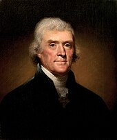
Jefferson County was formed as the original county on March 17, 1836. The administrative organization was completed the following year. It was named after Thomas Jefferson (1743-1826), the third President of the United States (1801-1809).
23 structures and sites in the county are listed on the National Register of Historic Places (NRHP) (as of November 25, 2019), with the Lucas Gusher, Spindletop Oil Field having the status of a National Historic Landmark .
Demographic data
| growth of population | |||
|---|---|---|---|
| Census | Residents | ± in% | |
| 1850 | 1836 | - | |
| 1860 | 1995 | 8.7% | |
| 1870 | 1906 | -4.5% | |
| 1880 | 3480 | 82.6% | |
| 1890 | 5857 | 68.3% | |
| 1900 | 14,239 | 143.1% | |
| 1910 | 38.182 | 168.2% | |
| 1920 | 73.120 | 91.5% | |
| 1930 | 133.391 | 82.4% | |
| 1940 | 145.329 | 8.9% | |
| 1950 | 195.083 | 34.2% | |
| 1960 | 245,659 | 25.9% | |
| 1970 | 244,773 | -0.4% | |
| 1980 | 250.938 | 2.5% | |
| 1990 | 239.397 | -4.6% | |
| 2000 | 252.051 | 5.3% | |
| 2010 | 252.273 | 0.1% | |
| 1850-2010 | |||
According to the 2010 census , Jefferson County had 252,273 people in 92,822 households. The population density was 107.8 inhabitants per square kilometer.
The racial the population was composed of 52.2 percent white, 33.8 percent African American, 0.5 percent Native American, 3.4 percent Asian and other ethnic groups; 2.0 percent were descended from two or more races. Regardless of ethnicity, 17.0 percent of the population was Hispanic or Latino of any race.
Statistically, 2.45 people lived in the 92,822 households.
23.9 percent of the population were under 18 years old, 63.4 percent were between 18 and 64 and 12.7 percent were 65 years or older. 48.9 percent of the population was female.
The median income for a household was 41,087 USD . The per capita income was $ 21,670. 19.1 percent of the population lived below the poverty line.
National protected areas
cities and communes
Census-designated places (CDP)
other unincorporated communities
See also
Individual evidence
- ↑ Extract from the National Register of Historic Places - No. 82004509.Retrieved January 5, 2012
- ^ Jefferson County in the United States Geological Survey's Geographic Names Information System.Retrieved February 22, 2011
- ↑ Information from the National Association of Counties ( Memento of the original dated April 2, 2012 in the Internet Archive ) Info: The archive link was inserted automatically and has not yet been checked. Please check the original and archive link according to the instructions and then remove this notice. . Retrieved October 10, 2012
- ↑ Charles Curry Aiken, Joseph Nathan Kane: The American Counties: Origins of County Names, Dates of Creation, Area, and Population Data, 1950-2010 . 6th edition. Scarecrow Press, Lanham 2013, ISBN 978-0-8108-8762-6 , p. 154.
-
↑ Search mask database in the National Register Information System. National Park Service , accessed December 1, 2019.
Weekly List on the National Register Information System. National Park Service , accessed December 1, 2019.
Listing of National Historic Landmarks by State: Texas. National Park Service , accessed December 1, 2019. - ↑ Texas Almanac: Population History of Countys from 1850–2010 (PDF; 698 kB), accessed September 18, 2012
- ↑ Extract from the National Register of Historic Places - No. 96001127.Retrieved January 5, 2012
- ↑ US Census ( memento July 12, 2011 on WebCite ). Retrieved October 11, 2012
Web links
- Official website
- Yahoo Image Search - Jefferson County
- www.city-data.com - Jefferson County
- Texas Handbook - Jefferson County
Coordinates: 29 ° 52 ′ N , 94 ° 8 ′ W


