District of Dillingen on the Danube
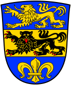
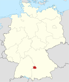
| coat of arms | Germany map |
|---|---|

|

Coordinates: 48 ° 36 ' N , 10 ° 32' E |
| Basic data | |
| State : | Bavaria |
| Administrative region : | Swabia |
| Administrative headquarters : | Dillingen on the Danube |
| Area : | 792.22 km 2 |
| Residents: | 96,562 (Dec. 31, 2019) |
| Population density : | 122 inhabitants per km 2 |
| License plate : | DLG, WHO |
| Circle key : | 09 7 73 |
| NUTS : | DE277 |
| Circle structure: | 27 municipalities |
| Address of the district administration: |
Große Allee 24 89407 Dillingen on the Danube |
| Website : | |
| District Administrator : | Leo Schrell ( Free Voters ) |
| Location of the district of Dillingen on the Danube in Bavaria | |
The district of Dillingen an der Donau , officially the district of Dillingen ad Donau , is a district in the north of the Bavarian administrative district of Swabia .
geography
location
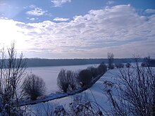
The district is shaped by the Danube , which it flows through from southwest to northeast over a length of 27 km. The river created a meadow landscape with forests that is now under nature protection . Man created numerous quarry ponds. The Donauried extends south of the river and was often flooded until the river was straightened in the 19th century. Today it is used as meadow and pasture land, on the edges of which fertile farmland spreads. Further south is the hill country of the Zusamtal , which is part of the Augsburg-Westliche Wälder nature park. The Zusam is a small right tributary of the Danube, which flows south of Donauwörth .
On the left bank of the Danube, the northern district of Dillingen still has a share in the foothills of the Swabian Alb and its foreland.
The district area extends over an altitude of 403 m above sea level. NN in the Donauried near Schwenningen up to 610 m above sea level. NN in the Zöschinger forest.
Neighboring areas
The district borders clockwise to the north, beginning with the districts of Donau-Ries , Augsburg and Günzburg (all in Bavaria) and the district of Heidenheim (in Baden-Württemberg ).
history
Until 1800
Coming from Wittislingen , the later Counts of Dillingen settled in the Danube Valley in the 10th century, with their castle becoming the center of today's district town of Dillingen on the Danube .
The Duchy of Bavaria received the County of Dillingen after the Count of Dillingen died out. In 1268 the duchy also acquired the cities of Gundelfingen an der Donau , Lauingen and Höchstädt an der Donau through the Conradin inheritance . The Landvogtamt, and later the Höchstädt Regional Court , was composed of these two acquisitions . This can also be seen as the nucleus of today's district of Dillingen an der Donau.
The city of Dillingen on the Danube itself was donated to the bishopric in 1258 and became a residential city by the bishops of Augsburg from the 15th century at the latest. Since 1505 the Bavarian part of today's district was part of the Principality of Pfalz-Neuburg ("Young Palatinate"), while Lauingen was its second residence. In 1700, Wertingen became part of the Electorate of Bavaria , which finally established a regional court in Wertingen in 1768 .
The region of the two Altland districts Wertingen and Dillingen on the Danube, which consisted of larger and many smaller spiritual and secular areas, was reorganized at the beginning of the 19th century. The individual rulers were abolished and added to the Kingdom of Bavaria .
Regional courts
The Dillingen district court was established in 1804. Together with the Höchstädt an der Donau regional court, established in 1803 , it became the Upper Danube District in 1808 . In 1809 the district court of Lauingen was established . These three regional courts were assigned to the newly formed administrative district of Swabia in 1838 .
District Offices
In 1862, justice and administration were separated in Bavaria. The newly created District Office Dillingen was responsible for the administration of all municipalities of the three regional courts. In addition, most of the municipalities of the Bissingen district court , which was dissolved in 1862, were included .
On October 1, 1865, the municipalities of Baiershofen and Hennhofen moved from the Dillingen District Office to the Zusmarshausen District Office .
On January 1, 1878, the city of Dillingen left the district office of Dillingen and became a city immediately within the district .
On the occasion of the reform of the layout of the Bavarian district offices, the district office of Dillingen ceded the municipalities of Brachstadt and Oppertshofen to the district office of Donauwörth , the municipalities of Rechbergreuthen and Winterbach to the district office of Günzburg and the municipality of Riedsend to the district office of Wertingen on January 1, 1880 .
The Dillingen district office ceded the Gundremmingen community to the Günzburg district office on June 1, 1927 .
In 1929 the Wertingen District Office was enlarged by some communities from the dissolved Zusmarshausen District Office.
Counties
On January 1, 1939, as everywhere in the German Reich, the designation district was introduced. So the district offices became the districts of Dillingen an der Donau and Wertingen.
The city of Dillingen an der Donau had to give up its district freedom on April 1, 1940 and was incorporated into the district of Dillingen an der Donau, but this was reversed on April 1, 1948.
District of Dillingen on the Danube
As part of the regional reform in Bavaria , the district of Dillingen an der Donau was formed in its current form on July 1, 1972. At that time, the new district of Dillingen an der Donau was formed from the previous district of Dillingen an der Donau, the independent city of Dillingen an der Donau and the western half of the district of Wertingen (the eastern part of the district of Wertingen was then part of the Augsburg district ). The municipality of Tapfheim was given to the district of Donau-Ries . The city of Dillingen an der Donau received the status of a large district town due to the loss of the freedom of the district . Since the municipal reform of 1978, the district of Dillingen an der Donau consists of 27 cities , markets and communities (previously 78). Four of them are unitary communities, the rest are member communities of six administrative communities.
On October 19, 1973, the new district of Dillingen an der Donau was given a new coat of arms .
Population development
The district of Dillingen an der Donau gained almost 14,000 inhabitants between 1988 and 2008 or grew by 17%. From 2005 the development was in decline.
The following figures refer to the territorial status on May 25, 1987.
| Population development | ||||||||||||||
|---|---|---|---|---|---|---|---|---|---|---|---|---|---|---|
| year | 1840 | 1900 | 1939 | 1950 | 1961 | 1970 | 1987 | 1991 | 1995 | 2000 | 2005 | 2010 | 2015 | |
| Residents | 51,275 | 53,042 | 56,289 | 82,047 | 76.180 | 78,787 | 80.209 | 84,888 | 90,821 | 93,773 | 95,512 | 93,539 | 94,575 | |
Proportion of foreigners: 8.0% (as of December 31, 2015).
The foreign population includes all persons who do not have German citizenship (e.g. stateless persons, people with unclear citizenship). Germans with another nationality are not included.
politics
District Administrator
The former mayor of Buttenwiesen, Leo Schrell , has been the district administrator since 2004 . The former incumbent Anton Dietrich died suddenly in the spring of 2004, which meant that new elections were due. Schrell, a CSU member since his mayoral election, switched to the Free Voters after an internal party defeat by Georg Winter , on whose election proposal he was able to prevail in the first ballot against Georg Winter (CSU) and Bernd Steiner (SPD).
In the district election 2010, Schrell prevailed with 83.67% against Bettina Merkl-Zierer (Greens), who came up with 16.33%. The last district election took place on March 6, 2016. Schrell prevailed with 84.74% of the votes against his competitor Hermann Mack (REP), who received 15.26%. The turnout was only 39.71%. The third term began on July 13, 2016.
List of district officials (until 1939) or district administrators
| Surname | Term of office |
|---|---|
| Georg Girisch | 1862-1883 |
| Philipp Eschenbach | 1883-1896 |
| Friedrich von Pechmann | 1896-1906 |
| Hans Anselm | 1906-1913 |
| Hermann Wegele | 1913-1933 |
| Friedrich Spengler | 1933-1938 |
| Georg Schmid | 1938-1943 |
| Rudolf Bickel | 1943-1945 |
| Karl Racke | 1945-1948 |
| Kurt Rieth | 1948-1952 |
| Martin Schweiger | 1952-1988 |
| Anton Dietrich | 1978-2004 |
| Leo Schrell | since 2004 |
District council
The 2014 district election resulted in the following distribution of seats (60 seats in total):
- CSU 21 seats (−3)
- SPD 10 seats (0)
- FW 12 seats (0)
- FDP 3 seats (−1)
- Future 5 seats (+1)
- GREEN 4 seats (+1)
- Citizens list 3 seats (+3)
- REP 2 seats (−1)
coat of arms
| Blazon : “Under the blue head of a shield, inside a striding golden lion, divided by gold and blue; above a striding, red armored black lion, below a golden lily. " | |
|
Justification of the coat of arms: The coat of arms of the district of Dillingen an der Donau, awarded on October 19, 1973, is based on the history of the district.
The former county of Dillingen, the Landvogtei Höchstädt and the former district of Dillingen on the Danube are symbolized by the top field with the golden lion. The black Staufer lion in the middle part of the coat of arms indicates the new area of the former district of Wertingen , while the lower blue field takes up the golden lily from the city coat of arms of Dillingen and indicates that the previously independent city has been incorporated and given the current district its name Has. |
Economy and Infrastructure
economy
Significant companies based in the district include: BSH Hausgeräte (dishwasher production), Creaton , Deutz-Fahr , Fahrzeugbau Demmler , Josef Gartner (part of the Permasteelisa Group in the Lixil group), Grünbeck water treatment , Gropper dairy , Surteco , publishing and printing GJ Manz , Donau-Zeitung , Sparkasse Dillingen-Nördlingen and VR-Bank Donau-Mindel eG.
In the Future Atlas 2016, the district of Dillingen an der Donau was ranked 190th out of 402 districts, municipal associations and independent cities in Germany, making it one of the places with a "balanced risk-opportunity mix" for the future.
In October 2018, the unemployment rate in the district was 1.6%.
traffic
Street
The "main traffic artery" of the district of Dillingen an der Donau is federal highway 16 , which runs through the district from southwest to northeast and connects it to the district towns of Günzburg and Donauwörth in the two neighboring districts. The B 16 connects the cities of Gundelfingen , Lauingen , Dillingen and Höchstädt. There is no motorway through the district of Dillingen, but the A 8 and A 7 are conveniently located.
train
The Ingolstadt – Neuoffingen railway runs through the district in an east-west direction , which was opened by the Bavarian State Railways in 1876/77 and on which almost all of the district's important cities are located in the Donauried. In Günzburg and Donauwörth (both not in the district of Dillingen) there is a connection to the long-distance traffic of the Deutsche Bahn .
In Gundelfingen, a cross connection to Sontheim an der Brenz to the Württemberg Brenzbahn Aalen-Ulm branched off since 1911 .
The city of Wertingen was connected to the main line Donauwörth – Augsburg in 1905 by a local railway to Mertingen station .
Finally, in 1906, the Badische Lokal-Eisenbahnen- Gesellschaft built the narrow-gauge Härtsfeldbahn from Aalen via Neresheim to Dillingen.
The always small railroad network of 68 km in length was halved from 1956 to 1981 when the following lines ceased operations:
- 1956: Gundelfingen - Bächingen - Sontheim-Brenz 7 km
- 1972: Neresheim - Reistingen - Dillingen 16 km
- 1981: Mertingen train station - Lauterbach - Wertingen 12 km
Transportation
The regional bus Augsburg GmbH operates a network of routes in the district of Dillingen. The former district of Wertingen is also connected to the Augsburg transport association .
Communities
(Residents on December 31, 2019)
Other communities
|
|
Municipalities of the district before the territorial reform 1971/78
Until the regional reform in 1971/78, the district of Dillingen an der Donau had 75 municipalities (see list below). Up until 1927, the district , which was still known as the Dillingen district office, had one more municipality. In that year the community of Gundremmingen was reclassified into the district office of Günzburg .
In the west and northwest, the district bordered the Baden-Württemberg district of Heidenheim , in the north on the district of Nördlingen , in the northeast on the district of Donauwörth , in the southeast on the district of Wertingen and in the south on the district of Günzburg .
The municipalities of the district of Dillingen an der Donau before the municipal reform in 1971/78. The churches that still exist today are in bold . All municipalities except Tapfheim, which moved to the Donau-Ries district, continue to belong to the district.
See also
- List of municipalities in the district of Dillingen an der Donau
- List of places in the district of Dillingen an der Donau
- European Ortisei Prize
Protected areas
There are five nature reserves , 17 landscape protection areas , 15 FFH areas and at least 17 geotopes designated by the Bavarian State Office for the Environment (as of May 2016) in the district.
See also:
- List of nature reserves in the district of Dillingen an der Donau
- List of landscape protection areas in the district of Dillingen an der Donau
- List of FFH areas in the district of Dillingen an der Donau
- List of geotopes in the district of Dillingen an der Donau
License Plate
On July 1, 1956, the district was assigned the distinguishing mark DLG when the vehicle registration number that is still valid today was introduced . It is still issued today. The distinctive symbol WER (Wertingen) has also been available since July 10, 2013 .
Web links
- Official website of the district
- Literature from and about the district of Dillingen an der Donau in the catalog of the German National Library
- Entry on the coat of arms of the district of Dillingen an der Donau in the database of the House of Bavarian History
Individual evidence
- ↑ "Data 2" sheet, Statistical Report A1200C 202041 Population of the municipalities, districts and administrative districts 1st quarter 2020 (population based on the 2011 census) ( help ).
- ↑ Bavarian State Statistical Office (Hrsg.): Historical municipality register: The population of the municipalities of Bavaria in the period from 1840 to 1952 (= contributions to Statistics Bavaria . Issue 192). Munich 1954, DNB 451478568 , p. 222–223 , urn : nbn: de: bvb: 12-bsb00066439-3 ( digitized version ).
- ^ Wilhelm Volkert (ed.): Handbook of Bavarian offices, communities and courts 1799–1980 . CH Beck, Munich 1983, ISBN 3-406-09669-7 , p. 97 .
- ^ Result of the district election 2010
- ↑ 2016 election results on the district's website
- ^ The district of Dillingen ad Donau in the past and present, Dillingen 2005
- ↑ Entry on the coat of arms of the district of Dillingen an der Donau in the database of the House of Bavarian History , accessed on September 4, 2017 .
- ↑ Future Atlas 2016. (No longer available online.) Archived from the original on October 2, 2017 ; accessed on March 23, 2018 . Info: The archive link was inserted automatically and has not yet been checked. Please check the original and archive link according to the instructions and then remove this notice.
- ↑ "Data 2" sheet, Statistical Report A1200C 202041 Population of the municipalities, districts and administrative districts 1st quarter 2020 (population based on the 2011 census) ( help ).
- ^ District reforms in Bavaria
- ^ Michael Rademacher: German administrative history from the unification of the empire in 1871 to the reunification in 1990. Dillingen district on the Danube. (Online material for the dissertation, Osnabrück 2006).
- ↑ BayernViewer of the Bavarian Surveying Administration (accessed on July 7, 2010)


