
Freiberg
| coat of arms | Germany map | |
|---|---|---|

|
Coordinates: 50 ° 55 ' N , 13 ° 21' E |
|
| Basic data | ||
| State : | Saxony | |
| County : | Central Saxony | |
| Height : | 400 m above sea level NHN | |
| Area : | 48.32 km 2 | |
| Residents: | 40,657 (Dec. 31, 2019) | |
| Population density : | 841 inhabitants per km 2 | |
| Postal code : | 09599 | |
| Area code : | 03731 | |
| License plate : | FG, BED, DL, FLÖ, HC, MW, RL | |
| Community key : | 14 5 22 180 | |
| City structure: | 7 districts or city districts | |
City administration address : |
Obermarkt 24 09599 Freiberg |
|
| Website : | ||
| Lord Mayor : | Sven Krüger ( independent ) | |
| Location of the district town Freiberg in the district of central Saxony | ||
  |
||


The university town of Freiberg is a large district town and mining town roughly in the middle of the Free State of Saxony between Dresden and Chemnitz . It is the administrative seat of the district of Central Saxony, formed in 2008, and with the Freiberg Mining Academy founded in 1765, it is the seat of the oldest still existing technical and mining science university in the world.
The entire historic city center is a listed building. Together with local monuments of mining history such as the Reichen Zeche , it has been part of the Ore Mountains Mining Region UNESCO World Heritage Site since 2019 . Until 1969 the city was shaped by mining and the iron and steel industry for around 800 years . In the last few decades there has been a structural change to a high-tech location in the field of semiconductor manufacturing and solar technology , making Freiberg part of Silicon Saxony . According to the city administration, 39,318 inhabitants lived in the actual city without districts as of December 31, 2015.
geography
Geographical location
The city lies on the northern slope of the Ore Mountains with most of the urban area west of the Eastern or Freiberger Mulde . The city is partly embedded in the valleys of the Münzbach and Goldbach . The center with the train station is about 412 m above sea level. NHN . The lowest point is the Münzbach at the city limits at 340 m above sea level. NHN , the highest point is 491 m above sea level. NHN on a mining dump . Freiberg lies within an old clearing landscape that was used by and shaped by mining and is surrounded by forests in the north, south-east and south-west, and fields and meadows in the other directions. At the beginning of the 21st century, with the cities of Nossen , Roßwein , Großschirma , Freiberg and Brand-Erbisdorf, a zone of urbanization is tending to emerge. This includes around 75,000 residents.
Freiberg is located about 31 km west-southwest of Dresden , about 31 km east-northeast of Chemnitz , about 82 km southeast of Leipzig and about 179 km south of Berlin and about 120 km northwest of Prague . Freiberg is located about 8.4 km west of the geographical center of the Free State and is therefore the city with its center closest to this point.
Freiberg lies on the border of two forms of the Saxon dialect : to the east, the Southeast Meissniche and to the west, the South Meissniche, both of which belong to the five Meissen dialects, and just north of the dialect area of the Eastern Ore Mountains .
Expansion of the urban area

The nucleus of the city, the former Waldhufendorf Christiansdorf , lies in the valley of the Münzbach. The walled city center was built on its slopes and on the ridge to the west of it. One of the consequences of this was that the streets going east of the old main road axis (today Erbische Straße and Burgstraße from the former Erbischer Tor at Postplatz to Freudenstein Castle ), some of which lead to the opposite slope of the Münzbach valley, are steep. The part to the east of the main road axis is called the lower town with the associated lower market . The western area is the upper town with the upper market . The city center is enclosed by the ring systems running along the old city wall. In the west these, in which the cross ponds are embedded, widen like a park. Immediately north of the city center, next to Freudenstein Castle, there are remains of the city wall with several wall towers and the key pond in front . The remains of the wall continue in an easterly direction with breakthroughs up to the Donatsturm . The historic moat dominates this area. The southern border of the old town center is partly shaped by buildings from the Wilhelminian era . The Federal Highway 101 flanked as Wall Street the West, the federal highway 173 as Schiller Street and Hornstraße the south of the old town.
Freiberg's north is shaped by the campus of the TU Bergakademie Freiberg . Its main parts on both sides of Leipziger Straße (as the B 101, the most important traffic connection in this area) were built in the 1950s and 1960s. Furthermore, the districts of Loßnitz, Lößnitz and Kleinwaltersdorf are located there , which does not extend directly to the urban development boundaries. The Nonnenwald lies between Kleinwaltersdorf and Lößnitz and an industrial area east of Leipziger Strasse.
The east of Freiberg includes the right, eastern slope of the Münzbach valley, the valley of the Freiberg Mulde and parts of the plateau to the east of it. Since intensive mining was carried out there for centuries, this area is characterized primarily by the daytime facilities of the pits, their heaps and industrial facilities from different periods. Large parts of the mining dumps were greened from the 1960s and are now forested. The district of Halsbach on the B 173 is an old scattered settlement on the eastern slope of the Mulde, where mostly miners lived with their families. Between the 1960s and 1990s there were a total of six chimneys between 120 and 200 m high in Halsbrücke and Muldenhütten , which largely shaped the Freiberg city skyline. To the east, the Saxon-Franconian Magistrale initially runs in a deep cut, in an arc out of the city open to the north, in order to take the direction to Dresden after passing the Muldenhüttener railway viaduct. A country road leads to the southeast in the direction of the Eastern Ore Mountains and the Czech Republic from the city. The closed residential development in the eastern part of the city originates mainly from the second half of the 19th and the first half of the 20th century. To the north of Dresdner Strasse , between the Donat Tower and the former Freiberg (East) train station, is the several hundred year old Donatsfriedhof . More cemeteries are to the north of it.

Freiberg's south is primarily determined by the railway line running in east-west direction, which crosses the northward running valleys of Münzbach and Goldbach on high dams. This railway line with its formerly important freight station cuts the steeper slopes leading into the Ore Mountains in the south. The surface facilities of old ore mines were located between the train station and the old town. The station suburb has occupied this area since the last third of the 19th century. There are old industrial areas around the station and the bus station is on Wernerplatz . in the eastern part there was the old Jüdenberg (Jewish suburb) and several outbuildings. To the southwest of the city center, to the south of Chemnitzer Strasse (B 173), Freibergsdorf joins. To the south of the railway line is a settlement area created in the 1930s. Between this, the railway line and the Zug district , the Seilerberg and Wasserberg residential areas were created between the 1960s and 1980s, which , in the form of a segment of a circle, close the ring almost to Chemnitzer Straße in the west. The west-east bypass runs through these residential areas, relieving the city center of long-distance traffic. Today Zug is a settlement area characterized by smaller mine dumps with many single-family houses. There are shopping centers and business parks on the B 101, Annaberger Straße . The area of Zug merges almost imperceptibly into the urban area of Brand-Erbisdorf. The district of Langenrinne in the southeast in the valley of the Münzbach was formerly characterized by agriculture and is now a residential area in a relaxed style. The solar industry has found a location between Langenrinne and Seilerberg .
The west is the preferred residential area with the city park , a leisure center and one of the two German temples of the Church of Jesus Christ of Latter-day Saints (colloquially called Mormons ). It was built from 1983 to 1985 and was consecrated on June 29, 1985. Larger villas were built there at the end of the 19th century, and single-family houses were built during the GDR era. The Friedeburg district is a mixture of villa colonies , residential buildings from the 1980s and 1990s and more recent, loosened up developments. There the road leads in the direction of Hainichen and Mittweida out of the city. In the south-west, the city is bordered by the hospital forest , in which there is an outdoor swimming pool and a campsite. The railway line runs through this forest to the west.

Surrounding area
In the Freiberg area there are industrial sites as well as agriculture, forests and local recreation areas. At the Muldenhütten and Halsbrücke locations, there are companies in the metallurgical and metal processing industry and in Weißenborn , Großschirma and Reinsberg, companies in the paper industry . The young town of Großschirma is located north of Freiberg on federal highway 101 . To the northeast, the municipality of Halsbrücke connects to the Freiberg urban area. The community of Bobritzsch-Hilbersdorf is also to the east . The Tharandt Forest recreation area is also northeast of the city . The community Weißenborn located in the southeast belongs to the administrative community Lichtenberg-Weißenborn with the even further distant town Frauenstein . The large district town of Brand-Erbisdorf and the Freiwald are located on the federal highway 101 leading south from Freiberg . To the south, to the ridge of the Ore Mountains, and to the north in the direction of Nossen and Meißen , the systems of the Freiberg Revierwasserlaufanstalt, which are interesting in terms of technology and nature protection , extend . To the west are Oberschöna and Oederan .
Districts (city structure)
The city of Freiberg is divided into eight districts:
In addition to the old town, the districts of Freiberg-Nord, Freiberg-Ost, Freiberg-Süd and Freiberg-West, these are Halsbach , Kleinwaltersdorf and Zug .
These districts include the following districts and districts:
| district | Districts and districts | Population (2013) |
|---|---|---|
| Old town | Upper town , lower town , d. H. Domviertel, Jakobiviertel, Nikolaiviertel, Petriviertel | 3,763 |
| Freiberg-North | Friedeburg, Neu-Friedeburg , Loessnitz , Loßnitz | 8,175 |
| Freiberg-East | Donatsviertel , Himmelfahrter Revier , Hüttenviertel , Muldenhütten , Scheunenviertel | 2,541 |
| Freiberg-South | Bahnhofsvorstadt , Hinter dem Bahnhof , Seilerberg , Silberhofviertel | 9,168 |
| Freiberg-West | Fernesiechen , Freibergsdorf , Hospitalviertel , Wasserberg (-North, -East, -Süd, -West) | 14,400 |
| Halsbach | Halsbach | 316 |
| Kleinwaltersdorf | Kleinwaltersdorf, train station, Fürstenbusch, Nonnenwald, Rittergut, Waltersbach | 784 |
| train | Pull (upper pull, lower pull), long channel with raisin, powder mill, red Vorwerk | 1,696 |

geology

Regionally, the Freiberg area is to be assigned to the Erzgebirge central zone within the Fichtelgebirge-Ore Mountains anticline zone. The solid rock base consists of orthogneiss Proterozoic age (also called "Freiberg gray gneiss", "Freiberg core gneiss" or "Freiberg gneiss dome"). The gneiss consists of about 40% feldspars ( potassium feldspar and plagioclase ), 33% quartz and 27% mica ( biotite and muscovite ). The mineral components are mostly elongated due to the regional metamorphic overprinting, which gives the gneiss its typical slate-plate-like (“fibrous”) rock texture. The gneiss has been the source of building material for a large number of structures in and around Freiberg since the city was founded until the recent past (see photograph of the Annenkapelle). The solid rock is criss-crossed by two systems of tectonic fracture structures. This emerged during the Variscan and alpidic orogeny . The sale of hydrothermal solutions in these deep fissure systems resulted in the polymetallic veins of the Freiberg deposit area. The ore veins were the subject of mining operations from the High Middle Ages to the second third of the 20th century, with silver being the predominant extraction component. Mining had a lasting impact on the character and importance of the town of Freiberg (see main article Freiberg Gangerz deposit ).
In terms of volcanic rocks , a north-west-south-east trending rhyolite dike is worth mentioning, touching the city area to the north-east. Depending on the morphology, the upper edge of the bedrock is usually only a few meters below the surface of the terrain. Due to its slate-like, platy texture, gneiss weathers to form flat pieces of gravel and, with continued intensity of weathering, decomposes to silty-sandy weathered loam. As a result of relocation processes, mixed areas of weathered and slope loam as well as slope debris are formed, which cover the solid rock surface and the weathered zone to varying degrees. Holocene formations only occur in a narrow area along the Münzbach in the form of alluvial clay . Recent soil formations are in the form of sand clay, brown earth and staugleye .
history
The city, whose history is closely linked to mining , was built around 1162/1170. 1195 is given as the name of the city "Vriberge", 1218 "Friberch", 1227 in the city seal "Vriberch" and 1328 "Fryberg". It was not until 1466 that the names "Freiberg" and "Freyberg" were used for the first time. This name is derived from the important feature, freedom from the mountains , i.e. the mining rights of every immigrant. In the high Middle Ages Freiberg was the largest town of the Mark Meissen and an important trading location. The wealth of silver and the important Freiberg Mint made the Electorate of Saxony a wealthy state. In 1913 silver mining was stopped due to the decline in the price of silver. Resumed before the Second World War, there was again increased mining activities for lead , zinc and tin production until 1969 . The Bergakademie was founded in 1765 , one of the world's oldest mining engineering universities.
Freiberg is the namesake for the mineral Freibergite named by Gustav Adolf Kenngott in 1853 .
An American air raid on Freiberg, especially the station suburb, on October 7, 1944 killed 172 people.
In 2015 there was an explosives attack on a home for asylum seekers in Freiberg, as well as xenophobic riots against a refugee convoy , which caused the location to get into the media nationwide.
Memorials
- Memorial with names and dates for the soldiers of Reserve Jäger Battalion 26 who died and went missing in World War I on Bebelplatz.


- Memorial stone on the Soviet Ehrenfriedhof on Himmelfahrtsgasse (previously on Donatsfriedhof) for the victims of fascism in the countries occupied by Germany during the Second World War , for eleven unknown concentration camp prisoners from a subcamp of the Buchenwald concentration camp who were killed by SS in April 1945 Men were murdered, as well as for the first post-war mayor Karl Günzel, a former beech forest prisoner
- Memorial at Platz der Oktoberopfer, where 27 demonstrators were killed and 25 injured by units of the Reichswehr in a demonstration on October 27, 1923.
- Memorial plaque at the Sächsisches Porzellanwerk GmbH , where political opponents of the regime were interned and tortured by the Nazi authorities in the spring of 1933. The plaque was removed after 1990.
- Commemorative plaque at the district office on Frauensteiner Strasse , in memory of the 1000 Jewish women prisoners in a subcamp of the Flossenbürg concentration camp and Polish forced laborers who were deported to Germany during the Second World War and were victims of forced labor.
- Memorial plaque in the same place for the Jewish director of the porcelain factory Dr. Werner Hofmann , who escaped persecution by suicide in 1939.
- Commemorative plaque for Werner Hartenstein (1879–1947), who was Lord Mayor of the city from 1924 to 1945 and who saved the city from unnecessary losses at the end of the war in 1945. Arrested by the NKVD in June 1945 , Hartenstein died on February 11, 1947 in the Jamlitz special camp .
Incorporations
| Former parish | date | annotation |
|---|---|---|
| Freibergsdorf | Jan. 1, 1907 | southwest suburb |
| Friedeburg | Apr 1, 1908 | western suburb |
| Loessnitz | Jan. 1, 1957 | scattered settlement to the northwest |
| Loßnitz | Jan. 1, 1957 | north located Waldhufendorf |
| Halsbach | Jan. 1, 1979 | scattered settlement to the east |
| train | Feb. 1, 1994 | southern litter and mining settlement; with Langenrinne , which was incorporated into Zug on July 1, 1950 |
| Kleinwaltersdorf | 1st Mar 1994 | Waldhufendorf located to the west |
| Muldenhütten | Jan. 1, 2012 | Industrial settlement; was until this point in the district of Hilbersdorf , which in turn was part of the Freiberg administrative community . With the merger of Hilbersdorf and Bobritzsch this was dissolved and Muldenhütten reclassified to Freiberg. |
In addition, on January 1, 1997, parcels of the communities Weißenborn and Oberschöna and on April 1 of the large district town of Brand-Erbisdorf were incorporated.
Population development
In December 2015, the city had 41,641 inhabitants.


from 1471 to 1988
| year | population | year | population | year | population |
|---|---|---|---|---|---|
| before 1471 | 4,845 | 1776 | about 7,800 | 1910 | about 36,200 |
| 1474 | 4.112 | 1870 | about 21,600 | 1946 | 42,278 |
| 1499 | 5,603 | 1880 | about 25,300 | 1966 | about 48,400 |
| 1515 | 6,380 | 1885 | about 26,000 | 1972 | 50,549 |
| 1533 | 8,480 | 1890 | about 29,000 | 1984 | 50,964 |
| 1546 | 9,228 | 1905 | about 30,600 | 1988 | about 51,600 |
Source: including the Freiberg City and Mining Museum, Series 6, 1986 .
The census on May 17, 1939 showed 35,712 inhabitants, 16,302 men and 19,410 women.
since 1990
| year | population | year | population | year | population |
|---|---|---|---|---|---|
| 1990 | 48,609 | 2000 | 45,428 | 2010 | 41,342 |
| 1991 | 47,582 | 2001 | 45.228 | 2011 | 40,020 |
| 1992 | 46,983 | 2002 | 44,533 | 2012 | 40,083 |
| 1993 | 46,537 | 2003 | 44.105 | 2013 | 40,268 |
| 1994 | 47,928 | 2004 | 43,683 | 2014 | 40,829 |
| 1995 | 47,403 | 2005 | 43,305 | 2015 | 41,641 |
| 1996 | 47.123 | 2006 | 42,897 | 2016 | 41,642 |
| 1997 | 46,966 | 2007 | 42,364 | 2017 | 41,496 |
| 1998 | 46.503 | 2008 | 41,823 | 2018 | 40,885 |
| 1999 | 46,027 | 2009 | 41,701 |
politics
City council
Result of the city council election on May 26, 2019:
| Political party | Share of votes | W / L% p * | Seats | G / V * |
|---|---|---|---|---|
| AfD | 21.7% | + 15.7 | 8th | + 6 |
| CDU | 20.7% | - 7.5 | 7th | - 3 |
| The left | 14.7% | - 4.4 | 5 | - 2nd |
| Free voters | 14.5% | + 8.5 | 5 | + 3 |
| SPD | 10.5% | - 2.5 | 3 | - 2nd |
| Green | 8.3% | + 0.5 | 3 | + 1 |
| FDP | 5.9% | ± 0 | 2 | ± 0 |
| House / reason | 3.7% | - 3.2 | 1 | - 1 |
* P / L: profit or loss compared to the 2014 election
The turnout was 61.6% (2014: 48.1%).
mayor
On June 24, 2015, Sven Krüger (independent, until 2018 SPD) was elected as the new Lord Mayor of Freiberg in the second ballot with a clear majority. He had previously worked in the city as an alderman for administration and finance, replacing Bernd-Erwin Schramm , who had been mayor since August 1, 2008 and who reached retirement age in 2015. Since April 1, 2009, Holger Reuter (deputy for urban development and construction, CDU) has been the department head.
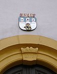
Coat of arms, flag, official seal
The coat of arms of the city of Freiberg was first documented as a seal in 1227, making it the oldest city seal of the Mark Meissen . The city of Freiberg manages it in the form approved by the Royal District Administration of Dresden on June 1, 1899 .
- “In the blue Renaissance shield, the city's coat of arms shows a silver, crenellated wall, in the raised central part of which there is a gate with a raised portcullis. The gate is covered with a golden Renaissance shield, which shows an upright black lion turned to the right. The wall is surmounted by three silver towers. The towers have arched openings, red roofs, gold buttons and golden wind flags pointing to the right. The central tower is taller and stronger. It has two arched openings under the roof and three under these; the two side towers have three such openings at the top and two such openings below [...]. The use of yellow and gray is permitted for the metals gold and silver. "
Flag description
- "The city's flag is black on top and gold (yellow) on the bottom."
Official seal The official seal of the city contains the city coat of arms. The use of the official seal is reserved for the mayor. After the Saxon State Minister of the Interior , Markus Ulbig , awarded Freiberg the title “University City ” on January 11, 2015, Freiberg also bears this title in the inscription of his official seal.

Coat of arms according to the coat of arms order

Depiction of the coat of arms from 1752 above the west portal of the Nikolaikirche
Depiction of the coat of arms from 1510 above the entrance portal of the town hall

Coat of arms on a town hall bay; allegedly the head of Kunz von Kauffungen as a gaff head in the gable field

City colors black and yellow

Today's official seal with the title "University City"

Official seal until 2015 with the designation "City"

City logo


Town twinning
Freiberg also maintains town twinning in Germany
-
 Amberg in Bavaria
 -
 Clausthal-Zellerfeld in Lower Saxony
 -
 Darmstadt in Hesse
Outside Germany, partnerships are maintained with
-
 Delft in the Netherlands (until 2018)
 -
 Gentilly in France
-
 Nes Ziona in Israel
-
 Příbram ( Pribrans or Freiberg in Bohemia ) in the Czech Republic
-
 Wałbrzych (Waldenburg) in Poland
Culture and sights
Freiberg has 1250 technical, art-historical and cultural monuments of various types and sizes. The historic old town, surrounded by remains of the city wall, consists of an undamaged city center with an unchanged floor plan from the 12th / 13th centuries. Century. The diversity is complemented by numerous geoscientific collections.

City Theatre
Daily facilities of the old Elisabeth treasure trove

Lower market with cathedral and museum

Porcelain carillon in Freiberg

View from the Obermarkt to the Church of St. Petri, on the left the Hahnenturm, on the right the higher of the two western towers

the old Jakobikirche in the lower town, which was demolished before 1900

Freibergsdorf hammer


theatre
The theater was founded in 1790 and is considered to be the oldest city theater in the world that has been preserved in its original form and is continuously performed by an urban theater company . In 1800 the first opera Das stumme Waldmädchen by the then fourteen-year-old Carl Maria von Weber was premiered there. Harry Liedtke had one of his first engagements here in the 1900s . Inge Keller later also played on this stage. Since 1993, the house has been run together with the Döbeln city theater as the Middle Saxon Theater Freiberg and Döbeln . It comprises the areas of drama, musical theater and philharmonic orchestra.
Museums / exhibitions
- Terra mineralia exhibition in Freudenstein Castle
- "Mineralogical Collection Germany" in the Krügerhaus
- City and Mining Museum
- Natural History Museum (permanently closed)
- Geoscientific collections of the Bergakademie Freiberg
- Collections of the Bergakademie Freiberg with Historicum and Winkler memorial
- Teaching and visitor mine Himmelfahrt Fundgrube (the only teaching mine in the world) with
- Abraham Shaft
- David shaft
- Turmhofschacht
- Old Elisabeth
- Rich colliery
- Mining technical monuments
- Drei-Brüder-Schacht (in Zug )
- Freiberg Bed and Sleep Museum
Buildings
St. Mary's Cathedral
Among the most important architectural attractions of Freiberg counts St. Mary's Cathedral , often as Freiberg Cathedral or Cathedral of Freiberg called a late-Gothic hall church , the 1484 to 1501 on sub-market was built. The striking Golden Gate is located on the south side of the cathedral . Adjacent to the cathedral is the Electoral Burial Chapel, which was extended in 1594 by Giovanni Maria Nosseni in the Italian Renaissance style and restored in 1885 . All Protestant princes of the Albertine line from Henry the Pious († 1541) to Johann Georg IV († 1694) rest here . The marble life-size statue of Elector Moritz († 1553) is worth seeing . Inside the cathedral there is a triumphal cross group , the free-standing stone tulip pulpit and the large Silbermann organ .
City Church of St. Petri
At the highest point in the city center, on Petriplatz not far from the Obermarkt, is the town church of St. Petri . Its north-west tower, the height of which is 74.10 m to the top of the gold-plated capstan, offers the visitor a view over large parts of the Eastern Ore Mountains from a height of around 45 m (guard room). The wooden structure with the living rooms and the guardroom was completed in 1733. These provide an insight into the working and living conditions of past centuries.
Other churches

- The Jakobi- or Jacobikirche is also equipped with an organ by Gottfried Silbermann. It is located at the point where one of the connecting routes in the network of the Way of St. James , the Frankenstrasse , reached the city from the east. The church was built at the turn of the 19th to the 20th century because the previous building , the oldest Freiberg church building, had been demolished.
- Temple of the Church of Jesus Christ of Latter-day Saints in Neu-Friedeburg
- The Nikolaikirche is also in the city center, but is no longer used as a place of worship.
- Johanniskirche in the Freibergsdorf district
- Village church in the Kleinwaltersdorf district
- Chapel in the Zug district
Profane structures


- The town hall on Obermarkt, built in 1410, has a stately clock tower and a porcelain carillon made of Meissen porcelain .
- The Ratskeller ( Obermarkt 16), built in 1545, stands next to the tallest building in the market with a striking pitched roof on the northwest side.
- According to tradition, a bluish stone marked with a carved cross on the Obermarkt marks the place where the Saxon prince robber Kunz von Kauffungen was executed in 1455 .
- The fountain monument bears the statue of the city's founder as well as four water-spouting Meissnian heraldic lions.
In the north, northeast and east of the old town between Freudenstein Castle and Donatsturm (near an old town gate) there are two completely preserved, but no longer interconnected parts of the town wall with several towers (Old Castle Tower, Tower of the Plague Pastor, Upper Roßmühlenturm, Lazarett Tower , Donatsturm, Kalkturm, Gelber Löweturm). The Swedish monument standing in front of the Peterstor on Bebelplatz, which was demolished in the 19th century, commemorates the heroic defense of the city against the besieging Swedish troops under the command of Lennart Torstensson in 1643. Other architectural sights include Petriplatz , the former Freibergsdorf hammer mill and three preserved ones Electoral Saxon post distance columns from 1723 as well as three Weichbild or city border columns from 1791.
Large areas to the northeast, east, south-east and south of the city are characterized by mining. There, as in the neighboring towns of Großschirma and Brand-Erbisdorf , the municipality of Halsbrücke and in the Muldenhütten district (which has belonged to Freiberg since 2012), there are a large number of technical systems that are directly related to the 800-year-old mining, the processing , the transport, the smelting of the ore and the dump management. Currently, these areas are mainly used as industrial and commercial areas.
For the Herderhaus see: Stadtarchiv Freiberg .

Silbermann organ in Freiberg Cathedral

Tulip pulpit in Freiberg Cathedral

Nikolaikirche

Fountain monument and Petrikirche

Jakobikirche

St. Johannis Church

Freudenstein Castle

Donatsturm

Renaissance bay window
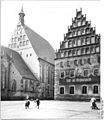
Cathedral with canon court from the northeast, 1956

Tanner houses in the lower town, 1956, partly burned down in 2004

Portal on the Obermarkt, 1956
Saxon post mile column in the form of a distance column from 1723 on Meißner Gasse, formerly in front of Meißner Tor


Parks and forests

The city center is enclosed by the green belt or old town ring, which was created instead of the medieval city fortifications . In the south-western and western part, the valley of the Goldbach , which is also called Saubach , there is an extension of the Albertpark with the two cross ponds ( Middle and Lower or Large Cross Ponds ). The key pond can be located in the northern part of this ring . Historically, Freiberg had even more ponds in the course of the green area ring and Goldbach. To the west of the Albertpark is the former Johannispark, which was transformed into the Freiberg zoo at the end of the 1950s . To the west is the Ludwig-Renn-Park . On the southwestern edge of the city is the Hospitalwald , or the Freiberg city forest, northwest of the Fürstenwald (also Fürstenbusch or Loßnitzforst ) with the Nonnenwald and the Zechenteich as well as the Black Pond . Southeast of the city, on the valley slopes on both sides of the Freiberger Mulde , you come across the raisin bush . Many of the former mining dumps are planted with forest and valuable biotopes . A large proportion of these areas belong to the Freiberg forests.
Natural monuments

In Freibergsdorf is the Torstensson-Linde , where the Swedish general Lennart Torstensson is said to have given the orders to siege Freiberg during the Thirty Years' War. The Freiberg city forest with its large pond and middle pond, the Zellwald and the Tharandt forest , and the Striegistal are located at a greater distance . The so-called grave tour is also noteworthy in botanical and technical terms .
societies
sports clubs
-
Bergstädtischer Sportclub (BSC)
- (Football, 2009/10 Chemnitz District League, 7th league). Before the Second World War, the club was called Sportfreunde Freiberg . In the GDR the names changed frequently, from BSG Einheit to HSG Wissenschaft and then to BSG Turbine until 1967 . The successor SG Union Freiberg was renamed to BSG Geology in 1981 . On June 1, 1990, the name was again changed to SV Bergstadt Freiberg . In February 1995, the merger with local rivals PSV Freiberg to form BSC followed.
-
HSG Freiberg
- Handball Spielgemeinschaft Freiberg e. V. (Handball, 2017/18 Mitteldeutsche Oberliga der Männer, 4th division) The club has a handball tradition of over 90 years. The home of the "Badgers" HSG Freiberg is the Ernst-Grube-Halle on the Wasserberg in Freiberg.
- TVL Freiberg
- Athletics training club, athletics
- SV Oberschöna 1902 e. V.
- Equestrian Department in Münzbachtal Freiberg
- RFV Freiberg
- Riding and driving club, riding
- SSV Freiberg
- Swimming club, swimming
- SV Siltronic Freiberg
- Sports club, volleyball, football, aerobics, table tennis, Nordic walking
- 1. VVF Freiberg
- Volleyball club, volleyball (2009/10 Saxon class west); about 300 members
- Freiberger HTC (FHTC)
- Hockey and tennis club (hockey, indoor season 2012/13 Central German Oberliga men) (tennis, 2012 Oberliga men)
- Gymnastics Club 1844 Freiberg
- Saxon Maunt'nverein Freiberg e. V. SMF
- Mountain sports, especially rock climbing
- Freiberg Police Sports Club e. V.
- athletics
- SV Saxonia Freiberg
- Table tennis
- ATSV Freiberg
- Basketball, volleyball
Associations for tradition and history
- Historical Freiberg Mining and Huts Association e. V.
- Traditional association for the maintenance and preservation of mining and smelting traditions. The work of the association includes, among other things, the internationally known mountain and hut parade (lifts in many regions of Germany also in Brazil, to the Steuben parade in New York, in Norway, Poland, Slovakia, France, the Czech Republic), active child and youth work, maintenance of mining and metallurgy exhibition facilities (Radstube in Oberschöna and cylinder blowers in Muldenhütten) as well as the publication of research results.
- Friends of the Ascension Fund
- Freiberger Altertumsverein e. V.
- Freiberger Münzfreunde e. V.
- Freiberger Mineralienfreunde e. V.
Artistic associations and organizations
- Freiberg Art Association
- Freiberg photo friends
- Freiberg artists' association Die Kaue
- Shape-color-gesture e. V.
- Theater for children e. V.
- Academy for the Preservation of Music-Historically Applied Art V.
- Bergmusikkorps Saxonia Freiberg e. V.
- Freiberg Tobacco College
- Freiberger Bürgerbühne
Choirs
- A cappella Chamber Choir Freiberg
- Freiberg Cathedral Choir
- City choir Freiberg
- Choir of the Collegium Musicum
- Freiberg mountain singer
- Freiberg men's choir
- Boys' Choir Freiberg Music School
Regular events

The Freiberg event calendar includes various annual celebrations. As the largest folk festival in Central Saxony, the Bergstadtfest is held on the last weekend in June with the elevator of the historical miners and huts - the parade of mines and huts . Since 2004, a two-day market for regional and national pottery and ceramic artists has established itself on the Obermarkt in April . A steam model meeting has been taking place in May since 1997 on the Drei-Brüder-Schacht in the Zug district . The Freiberg Christmas market is held during Advent - in this context, a Mettenschicht is held on the Saturday before the second Advent. In addition, the Freiberg Art Prize is awarded every year and the “Bergstadt Queen” is chosen.
Major musical events are the Freiberg Jazz Days , held since 1974 in mid-April, and the Silbermann Days in September in honor of Gottfried Silbermann .
Culinary specialties

The Freiberg farmer bunny is a fasting pastry designed in the shape of a hare. Freiberg egg pancake is a common form of egg pancake in Freiberg and the surrounding area. Freiberger Pils is brewed in a modern brewery north of the urban area .
Economy and Infrastructure
traffic
Street
Freiberg is on the motorway A4 , exit Siebenlehn and the national road 101 , coming from Dresden or Chemnitz on the national road 173 to reach. From the direction of Leipzig the A 14 motorway , exit Nossen -Ost and the federal road 101 leads to Freiberg. From the direction of Prague there is a connection via the A17 , exit Dresden- Gorbitz via the federal highway 173. Freiberg is the intersection and starting point of several state roads in the direction of Reinsberg , Halsbrücke , Dippoldiswalde , Frauenstein , Altenberg (Erzgebirge) , Brand-Erbisdorf , Kleinschirma and Hainichen . Sections of the federal highways 173 and 101 are part of the Silberstraße . This was an old post road with the Silberwagenweg between Annaberg and Freiberg. The state road in the direction of Frauenstein corresponds in its course in parts to the Alte Freiberg-Teplitzer Poststrasse . The traffic-related importance of Freiberg can be measured , among other things, by the three Saxon post mile pillars that are still in existence . No other place today has such a density of mail columns.
A 13.5-kilometer bypass from Freiberg, starting from the B 173 east of Halsbach, via the B 101 in the south, via the B 173 in the west to the B 101 in the north-west, was in the process of planning approval . This was approved by the Federal Administrative Court, with judgment of July 14, 2011, AZ. 9 A 12/10, declared unlawful and not enforceable.
railroad
Freiberg, with its two, in service stations Freiberg (Sachs) Station in 413 meters above sea level. NN and the Muldenhütten station (about 395 m above sea level ) on the Saxony-Franconian Magistrale on its section of the Dresden – Werdau railway line . The Nossen – Moldau railway line runs from Freiberg into the Ore Mountains on the section that is still in operation to Holzhau . In the direction of Nossen, to the north, there is the disused stop at Kleinwaltersdorf (about 395 m above sea level ). This route is operated in the south by the Freiberg railway , which belongs to the Rhenus-Veniro group, on behalf of the Verkehrsverbund Mittelachsen . The Freiberg – Halsbrücke railway line with Freiberg (Sachs) Ost station , 422 m above sea level. NN , is closed.
air traffic
The nearest airports are Dresden-Klotzsche (45 km), Leipzig-Altenburg (85 km) and Leipzig / Halle (110 km). There is a special landing site near Großschirma and Langhennersdorf .
Public transport
The local public transport is provided by the Regiobus Mittelachsen . This operates nine city bus routes in the city (lines A – I), which lead to Brand-Erbisdorf , Zug , Halsbrücke and Oberschöna , among others . The main transfer point is the bus station next to Freiberg train station. Here you can change between all city buses and many regional buses. In the off-peak period, at night and sometimes during the weekend, the city bus routes are supplemented by the Call Line Taxi .
Freiberg belongs to the network area of the Central Saxony transport association with tariff zone 10. Between 1902 and 1919, the Freiberg municipal tram in Saxony with a gauge of 1000 millimeters ran in the city of Freiberg .
Established businesses

Freiberg silver mining was based on the occurrence of around 1,000 veins . In Freiberg Mining Field about 180 different were minerals found. The mining promoted the city of origin crucial, but was not decisive alone for the city's founding, for about the same time was colonization of the southern part of the Meissen advanced. The ore mining , which was later expanded to include other metals , the ore processing and smelting , the related handicrafts , the service and processing industries as well as science, in particular the mining and geosciences , shaped the economic development of the city for over 800 years. One example is the German Fuel Institute , which was responsible for the gas industry .
In addition to mining, the town was home to the processing and smelting of almost all non-ferrous metals , trace elements and precious metals . Freiberg and Muldenhütten were mints . Semiconductor materials are manufactured and single crystals are grown in Freiberg . The mechanical engineering (paper machines), the lightweight metal , the electronics , the precision mechanical and optical industry, leather industry , the textile industry , the porcelain industry and the food industry are or were represented in the city.
The most important employer in the city is currently the TU Bergakademie Freiberg . A promising economic alternative to the branches of industry traditionally based in Freiberg seems to be developing with the resource-saving generation of energy and the production of corresponding technical systems. So far there are the following facilities and systems:
- Local wind turbines
- Two citizen power plants
- Use of solar thermal energy in a retirement home
- Hydropower plant in the Muldental in Halsbach
- Wood gas combined cycle power plant in Siebenlehn
- Photovoltaic systems on Freiberg industrial buildings
- Private photovoltaic systems on Freiberg roofs
- Construction of a natural gas filling station when switching to natural gas vehicles at the Freiberg municipal utility
-
Geothermal energy
- Freiberg Hospital: in summer, clean air from the mining industry is used for cooling and in winter for heating
- Heat pumps as heating for hot water preparation.
Preliminary insolvency administration was ordered on July 6, 2011 for Choren Industries , which was the first company in the world to operate a plant for the production of synthetic BtL fuel through biomass refinement ( residual forest wood , waste wood ) using subsidies . The bankruptcy of the former model company was the trigger for numerous media reports.
Deutsche Solar AG (SolarWorld) (until bankruptcy 2018), Siltronic AG and Freiberger Compound Materials GmbH are / were active in the field of high technology . With the branch of Deutsche Solar AG in Freiberg, the largest integrated solar cell factory in Germany was built in direct continuation of wafer production , which annually produced solar cells with a total output of 600 megawatts. Silicon has been processed at the Freiberg site since the VEB Trace Metals Freiberg was founded in 1957 .
ACTech GmbH Freiberg , founded in 1995, combines prototype production and parts development with the foundry trade as a service provider in the area of cast part development, meanwhile also with locations in the USA and India.
Another focus is the tourism . Due to the sights and the historical mining facilities, Freiberg, which is located on the Saxon “ Silberstraße ”, is a destination especially for educational tourists interested in technical, historical and art history. Since October 2008, the exhibition does terra mineralia in Freudenstein Castle . The intention to nominate the mining region Erzgebirge for the list of the UNESCO world cultural heritage provides new impulses.

Furthermore, manufacturers of precision mechanical devices , measuring devices and pyrotechnic products are located in Freiberg .
The food industry is represented by Freiberger Brauhaus AG and the Hainichen-Freiberg dairy, which is operated as a joint venture (50% each) by Ehrmann AG and the Champignon Hofmeister cheese dairy . Freiberg also has a service sector , especially the city specializes in scientific services in the field of geosciences and geoinformatics , which goes beyond the usual tasks of a medium- sized center .
In the housing industry , in addition to numerous private owners, the municipal housing company Freiberg, which is mostly owned by the city, is a major player with around 4,000 apartments.
Healthcare
In 1223 there was the first hospital in Freiberg with the St. Johannishospital. The Kreiskrankenhaus Freiberg gGmbH celebrated its 150th anniversary on November 8, 2011. The main shareholder of the hospital is the district of central Saxony, another shareholder is Sana Kliniken AG. Since 1998 it has been one of ten hospitals specializing in care in Saxony . The hospital has a certified stroke center. In 2010 the hospital became an academic teaching hospital of the medical faculty of the Technical University of Dresden .
Ambulance service
In Freiberg at the district hospital there is an ambulance station to which the Brand-Erbisdorf branch is assigned. An emergency vehicle is manned 24 hours a day, and another from Monday to Friday 7 a.m. to 7 p.m. As of January 2019, there are three ambulances stationed in Freiberg , two of which are manned 24 hours a day, the third is manned Monday to Friday from 7 a.m. to 7 p.m. and Saturday and Sunday 24 hours. There are also 4 ambulances available for transporting patients to and from examinations. Until January 31, 2020, the guard was operated by the Freiberg DRK district association. On February 1, there was the first change of operator to Malteser Hilfsdienste gGmbh - but only as an interim award because the DRK district association has raised an objection.
fire Department
The Freiberg Volunteer Fire Brigade "Moritz Braun" is the voluntary fire brigade with full-time employees of the city of Freiberg. Their fire station has been located in the Freiberg Süd district of Freiberg Süd on Brander Strasse 29 since 1997. It was founded as a fire fighting group in 1861 after a city council decision from the ranks of Turner. Fire fighters have been employed directly by the city since the 1940s, and in 1950 the Freiberg professional fire brigade was founded, which was then converted back into a volunteer fire brigade with full-time employees in 1990, since in addition to personnel shortages also the requirements from when a city must maintain a professional fire brigade, then 80,000 inhabitants, were no longer met. This is how today's structure emerged as a volunteer fire brigade with full-time workers, including the permanently manned Freiberg fire station, the Freiberg, Kleinwaltersdorf and Zug fire brigades .
The fire brigade of the city of Freiberg has a total of 225 members: 136 active comrades, 55 youth fire brigade members and 34 in the age and honor department. There are currently 26 full-time workers in three 24-hour watch shifts, some of which are also active in the volunteer fire brigades. All local fire brigades have had their own youth fire brigade since 2020.

| Freiberg fire station (full-time workers) |
Freiberg fire station (volunteers) |
Fire station in the district of central Saxony |
Kleinwaltersdorf fire station |
Fire station Zug |
|
|---|---|---|---|---|---|
| Location | Brander Street 29 | Walterstal 74 | Haldenstrasse 31 | ||
| vehicles | |||||
| Assignments per year |
|
|
|
|
|
| Online presence | Facebook site | Facebook site |
Facebook page website |
||
technical aid organization
The Technical Relief Organization has had a local association with 60 active helpers and 9 young helpers in Freiberg since July 1, 1997, which is located in the Zug district. It belongs to the Chemnitz branch and consists of a platoon , the 1st rescue group , the 2nd rescue group and the clearing and location specialist groups .
media
- Television : Stadtfernsehen Freiberg "eff3" (insolvent since June 2015)
- Press : Freie Presse , Wochenspiegel - Freiberger Anzeiger , Freiberger Reading Book (1998–2011)
- Radio : InPulz - your city radio
Education and Research

The Technical University Bergakademie Freiberg is the oldest still existing mining science educational institution in the world. It was founded in 1765, in the Age of Enlightenment , by Prince Xaver as a training center for miners in Freiberg, when Saxony had to force mining after its defeat in the Seven Years' War to pay reparations .
The Geschwister-Scholl-Gymnasium Freiberg was founded in 1515 as a municipal Latin school , making it the first humanistic grammar school in Saxony. It has the valuable Andreas Möller library, two choirs, the Musica Concordia wind section and numerous sports groups. The grammar school consists of two school buildings, the reconstruction and modernization of which were completed in 2002 and 2004, respectively. The Albertinum is the main building and, in addition to the school management, houses grades 9 to 12, the Dürer house , named after the painter Albrecht Dürer , grades 5 to 8.
The Ulrich-Rülein-Gymnasium emerged in 1992 from the polytechnic high schools Lenin and Gorki . In 2007 the grammar school was merged with the Geschwister-Scholl-Gymnasium and briefly continued as the Rülein building of the Geschwister-Scholl-Gymnasium.
The Freiberg-Kolleg is a state institution of the second educational path in the state of Saxony. It offers adults the opportunity to acquire a general higher education entrance qualification after completing full-time vocational training . The Freiberg College with its foundation in 1949, the oldest of the four colleges in Saxony. Around 260 students are currently studying here.
garrison
Freiberg was a garrison town of the Saxon Army , Reichswehr and Wehrmacht until 1945 . Was built u. a. the König-Friedrich-August-Kaserne .
Personalities
literature
- Gustav Eduard Benseler : History of Freiberg and its mining. 2 volumes. Freiberg 1843/1853. (Digitized version)
- Freiberger Land (= values of our homeland . Volume 47). 1st edition. Akademie Verlag, Berlin 1988.
- Karlheinz Blaschke : Freiberg. German City Atlas, Delivery II, No. 2. Dortmund 1979.
- August Breithaupt : The mountain town of Freiberg in the Kingdom of Saxony. Outlined with respect to history, statistics, culture and trade, especially mining and metallurgy. Craz and Gerlach Verlag, Freiberg 1847. (digitized version)
- Hubert Ermisch : Document book of the city of Freiberg in Saxony. Volume I-III. Leipzig 1883-1891. (= Codex diplomaticus Saxoniae regia II, 12-14.) (Digitized Volume I , Volume II , Volume III )
- Tom Graber: Document book of the Cistercian monastery Altzelle. First part 1162-1249. (= Codex diplomaticus Saxoniae II, 19). Hanover 2006.
- Horst-Günther Hahmann: Mining hikes in and around Freiberg. Bildverlag Böttger, Witzschdorf 2012, ISBN 978-3-937496-48-1 .
- Walther Herrmann: The Freiberger Bürgerbuch 1486–1605. (= Sources and research on Saxon history. 2). Dresden 1965.
- Yves Hoffmann, Uwe Richter (ed.): Monuments in Saxony. City of Freiberg. Articles I – III. (= Monument topography Federal Republic of Germany ). Werbung & Verlag, Freiberg 2002-2004, ISBN 3-936784-00-0 .
- Yves Hoffmann, Uwe Richter: Development and prosperity of the city of Freiberg. The structural development of the mountain town from the 12th to the end of the 17th century. Mitteldeutscher Verlag, Halle (Saale) 2012, ISBN 978-3-89812-930-5 .
- Yves Hoffmann, Uwe Richter (ed.): The early history of Freiberg in a national comparison. Urban early history - mining - early house building. Mitteldeutscher Verlag, Halle (Saale) 2014, ISBN 978-3-95462-132-3 .
- Hanns-Heinz Kasper , Eberhard Wächtler (Hrsg.): History of the mountain town Freiberg. Böhlau, Weimar 1986, ISBN 3-7400-0051-1 .
- Heinrich Magirius : The Freiberg Cathedral. Research and preservation of monuments. Weimar 1972.
- Andreas Möller : Theatrum Chronicum Freibergense. Description of the old, laudable mountain capital Freyberg in Meissen. Freyberg 1653.
- Margot Pfannstiel : The tulip pulpit . Pictures from the history of Freiberg and ore mining. 2nd Edition. Urania-Verlag, Leipzig / Jena / Berlin 1983.
- Uwe Richter: Archaeological investigations in Freiberg. New insights into the early history of the city. (= Series of publications by the Freiberg City and Mining Museum. 12). Freiberg 1995.
- Uwe Schirmer : Freiberg silver mining in the late Middle Ages (1353–1485). In: New archive for Saxon history. 71, 2001, pp. 1-26.
- Richard Steche : Freiberg. In: Descriptive representation of the older architectural and art monuments of the Kingdom of Saxony. 3. Issue: Amtshauptmannschaft Freiberg . CC Meinhold, Dresden 1884, p. 8.
- Manfred Unger: Municipality and mining Freiberg in the Middle Ages. (= Treatises on commercial and social history, 5). Weimar 1963.
- Otfried Wagenbreth , Eberhard Wächtler (ed.): The Freiberg mining industry. Technical monuments and history. 2nd Edition. German publishing house for basic industry, Leipzig 1988, ISBN 3-342-00117-8 .
- Günther Wartenberg : The effects of Luther on the Reformation movement in the Freiberg area and on the development of the Protestant church system under Duke Heinrich of Saxony. In: Hostels of Christendom 1981/82. Berlin. 1982, pp. 93-117.
Filmography
- Picture book Germany. Freiberg, documentation, production: MDR , director: Birgit von Gagern, first broadcast: November 19, 2000, 45 min
Web links
- Atlas Central Saxony
- Link catalog on Freiberg (Saxony) at curlie.org (formerly DMOZ )
- Official website of the city
- Website of Stadtmarketing Freiberg GmbH
- Freiberg in the Digital Historical Directory of Saxony
- Old town renovation
Individual evidence
- ↑ Population of the Free State of Saxony by municipalities on December 31, 2019 ( help on this ).
- ↑ a b The name university town was awarded with effect from January 11, 2015, cf. Announcement of the Saxon State Ministry of the Interior from December 16, 2014 SächsABl. 2015, p. 114.
- ↑ UNESCO World Heritage Ore Mountains / Krušnohoří Mining Region. Retrieved October 23, 2019 .
- ↑ Map with city structure. (PDF; 9 kB) City Administration of the University City of Freiberg, accessed on September 25, 2018 .
- ↑ Small-scale structure of the city of Freiberg. Retrieved September 25, 2018 .
- ↑ W. Pälchen, H. Walter (Ed.): Geology of Saxony - Geological construction and development history. E. Schweizerbart'sche (Nägele and Obermiller), Stuttgart 2008.
- ^ Geological overview map of the Free State of Saxony 1: 400,000; Saxon State Office for Environment and Geology 1995.
- ^ R. Jubelt, P. Schreiter: Rock determination book. VEB German publishing house for basic industry, Leipzig 1977.
- ^ H. Pforr, R. Brendler: "Alte Elisabeth" teaching pit of the Freiberg Mining Academy. (= Excursion guide. Booklet 1). Freiberg 1982.
- ↑ S. Ulrich: The geology of the Erzgebirge. Springer-Verlag, 2013.
- ↑ A. Sauer, H. Müller: Geological Special Map of the Kingdom of Saxony. Section Freiberg; Sheet No. 80 [5046], scale 1: 25,000; 1899.
- ↑ Overview map of the soils of the Free State of Saxony 1: 400,000; Saxon State Office for Environment and Geology 1993.
- ^ Ernst Eichler and Hans Walther : Saxony. All city names and their history , Faber and Faber Verlag, Leipzig 2007, ISBN 978-3-86730-038-4 , p. 61f.
- ^ The war children generation in Freiberg 1944/45 . Special exhibition in the City Museum 2010. Official Gazette of the University City of Freiberg No. 18, September 29, 2010
- ↑ There could have been deaths: The firecrackers attack on the asylum seekers' home was an explosives attack. In: Focus Online . June 19, 2015, accessed March 11, 2016 .
- ↑ Thomas Reutter (director); Südwestrundfunk (Production): Terror from the Right - The New Threat. Report & documentation. Series: The story in the first . In: daserste.de. Archived from the original on March 10, 2016 ; accessed on March 11, 2016 (first broadcast in Das Erste / ARD on March 7, 2016).
- ↑ Police protect refugees in Freiberg with large numbers. In: tagesspiegel.de . October 26, 2015, accessed March 11, 2016 .
- ↑ State Directorate: Riots in Freiberg without example. In: Free Press. October 26, 2015, accessed March 11, 2016.
- ↑ Picture of the monument on Wikimedia Commons
- ↑ netz.Werk Freiberg: Place the October victims. Archived from the original on July 22, 2007 ; Retrieved October 7, 2012 .
- ^ Book of the dead of the special camp Jamlitz (with the Russian entry Gartenschtain ).
- ^ Annette Kaminsky: Places of Remembrance: Memorial signs, memorials and museums on the dictatorship in the Soviet occupation zone and GDR. Federal Agency for Political Education, p. 341. (Google Books)
- ↑ a b The Book of Saxony. Municipal publishing house Saxony, Dresden 1943.
- ↑ a b c d municipalities 1994 and their changes since January 1, 1948 in the new federal states , Metzler-Poeschel publishing house, Stuttgart 1995, ISBN 3-8246-0321-7 , publisher: Federal Statistical Office.
- ↑ a b c State Statistical Office of the Free State of Saxony: Area changes .
- ^ Lists of the municipalities incorporated since May 1945 and evidence of the subdivision of the independent manor districts and state forest districts, 1952, publisher: Ministry of the Interior of Saxony.
- ^ Statute on the entry into force of the local law of the city of Freiberg in the by agreement of ... In: freiberg.de. (PDF; 31 kB).
- ↑ a b State Statistical Office of the Free State of Saxony: Statistics - Population. In: statistik.sachsen.de. Retrieved November 19, 2016 .
- ^ Database census 2011, Freiberg, Stadt, age + gender
- ^ The population of the Reich after the 1939 census. Issue 2, Berlin 1941.
- ^ City of Freiberg, population increased for the third year in a row. Press release. January 9, 2014.
- ↑ Saxony regional register - information for 14 5 22 180 community Freiberg, city. (PDF) State Statistical Office of the Free State of Saxony, accessed on November 20, 2016 .
- ↑ Statistics Saxony , accessed on June 16, 2019.
- ↑ Allocation of seats for the 2019 city council election , accessed on April 10, 2020
- ↑ Freiberg's OB Krüger resigns from the SPD because of GroKo frustration. In: Freiepresse.de. September 20, 2019. Retrieved September 20, 2018 .
- ↑ § 2 of the coat of arms of the city of Freiberg
- ↑ a b § 2 of the main statute of the city of Freiberg from June 6, 2014.
- ^ Official Journal of the City of Freiberg 01/2015 of January 30, 2015, p. 1.
- ^ By mail - Delft ends twinning
- ^ Gunther Galinsky , Rolf Stenzel: Freiberg. 2nd Edition. Brockhausverlag, Leipzig 1981, p. 25.
- ^ Walter Schellhas : Freiberg's highest landmark. The Petriturm through the centuries . In: Messages from the Freiberg Antiquities Association . No. 70 , 1941, pp. 79 ff . (Information on the height and presence of the "househusband").
- ↑ Bergmusikkorps Saxonia Freiberg e. V. In: www.bergmusikkorps-freiberg.de. Retrieved September 25, 2018 .
- ↑ Freiberg Tabakskollegium: We are art . Retrieved June 24, 2019
- ↑ Free press: Freiberg should receive a citizens' stage . Retrieved June 24, 2019
- ↑ Procedural information on 9 A 12.10 - Federal Administrative Court. In: www.bverwg.de. Retrieved September 25, 2018 .
- ↑ Chemnitz District Court, file number: 14 IN 1970/11.
- ^ Automotive industry: Choren is broke. ( Memento from July 22, 2012 in the web archive archive.today )
- ↑ The fuel is out. In: Technology Review , October 24, 2012.
- ↑ SolarWorld AG opens Germany's largest photovoltaic module production facility; Group-wide capacities will be expanded to 1,400 MW. Press release. May 23, 2011, accessed October 7, 2012.
- ↑ Rapid prototyping: cast parts made of aluminum, cast iron and steel. In: ACTech. Retrieved September 25, 2018 .
- ^ The mining cultural landscape of the Erzgebirge / Krušnohoří. Entry in the German tentative list .
- ^ Ore Mountains: rest or fame. In: Zeit-Online. September 1, 2010.
- ↑ Internet presence of the Freiberg District Hospital .
- ↑ List of Stroke Units .
- ↑ Ambulance service is being upgraded: on the spot within twelve minutes | Free press - Flöha. Accessed February 1, 2020 .
- ↑ Rescue workers are worried | Free press - Freiberg. Accessed February 1, 2020 .
- ↑ City administration of the University City of Freiberg: Subject area fire protection. Retrieved September 14, 2019 .
- ↑ Start page - Kleinwaltersdorf volunteer fire brigade. Retrieved September 14, 2019 .
- ↑ Zug volunteer fire brigade. Retrieved September 14, 2019 .
- ^ THW OV Freiberg - Our local association. Retrieved September 15, 2019 .
- ↑ Court - Regional television eff3 is insolvent. In: www.freipresse.de/. August 19, 2015, accessed February 23, 2020 .
- ↑ InPulz your city radio. Retrieved January 6, 2020 .
- ↑ Current list of all colleges in Saxony , accessed on April 14, 2017.
- ^ "Picture Book Germany", Freiberg in the Internet Movie Database (English).