Kutini Payamu National Park
| Kutini Payanu National Park | ||
|---|---|---|
| Kutini Payanu (Iron Range) National Park on the Cape York Peninsula | ||
|
|
||
| Location: | Queensland , Australia | |
| Specialty: | Coastal rainforest, eucalyptus forest, heathland, mountains, sandy beaches | |
| Next city: | Weipa | |
| Surface: | 471.18 km² | |
| Founding: | 1977 | |
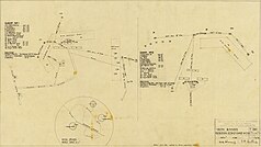
| Air Force Base Plan (ca.1942) | ||
The Kutini-Payamu National Park (English: Kutini-Payamu National Park , formerly Iron Range National Park , English: Iron Range National Park ) is a national park in the northeast of the Australian state of Queensland .
The national park is within the Lockart River Aboriginal Reserve and near the Scrubby Creek mining area . During the Second World War , several units of the Australian Army were stationed in the area.
It is administered by the local Aborigines together with the Queensland National Park Administration under the status of Cape York Peninsula Aboriginal Land (CYPAL) .
location
It is located 1,940 km northwest of Brisbane , 100 km east of Weipa and directly northwest of the village of Lockhart River on the east coast of the Cape York Peninsula .
history
Air force bases
In March 1940, Val Augensen of the Department of Civil Aviation inspected a possible area for an emergency landing site for the Royal Australian Air Force (RAAF). He then reported to the RAAF that a suitable all-weather emergency landing site could be set up in this area.
Around April 18, 1942, Walter Maiersberger , commander of the 33rd Bomb Squadron of the 22nd bomber group of the United States Army Air Forces , carried out a reconnaissance flight over the Iron Range . He was tasked with finding airfields on the Queensland coast that would be suitable for the use of the B-26 Marauders of the 22nd bomber group.
Air Commodore Lukis , Air Force Commander for the Northeast Area, reported on May 28, 1942 that RAAF pilot Trench had inspected the landscape at Portland Roads (also called Weymouth Bay ) together with Colonel Mills and Captain Herman G. Cox of the USAAF. Her first attempt to fly to the Iron Range from Coen failed. One of the Rapide's engines failed and they returned to Coen . After repairs, they took off again the next morning and landed on a beach near Portland Roads at low tide . On approach for landing, the Rapide turned seaward. The ends of the propellers hit the water, but the experienced pilot managed to turn the machine back to the beach.
The inspection team reported to Lukis that there was good mooring on Portland Roads , but no suitable place for an airfield near the jetty. They informed him that a relatively extensive area between the Iron Range in the east and the Claudie River in the west would be suitable for the construction of several airfields. On June 7, 1942, a vanguard of the 46th Engineer Service Regiment and the 26th RAAF Base Operations Unit boarded the SS Wandena in Townsville , which set out for Portland Roads . The base of operations unit arrived at Portland Roads and established a radio link to Townsville on the evening of June 10, 1942.
A few weeks after the first visit, Jim Trench and Colonel Mills returned to the Iron Range area and supervised two US engineer battalions building the first runways. They managed to build two 2,100 m long runways and 20.8 km of paved taxiways in three months. On June 14, 1942, Companies A, B and C of the 46th US Engineer Service Regiment boarded the MS Dona Nati in Townsville and arrived at Portland Roads on June 16, 1942 . The Headquarters and Service Company of the 46th Engineer Service Regiment left Townsville on July 10, 1942 and arrived at Portland Roads on July 12, 1942 . On October 27, 1942, Headquarters Detachment of the 46th Engineer Service Regiment left Townsville and arrived at the Iron Range on October 29, 1942 . The 90th bomber group arrived in Queensland in early November 1942 with their 48 B-24D Liberators .
Origin of name
The Aboriginal name 'Kutini' means ' cassowary ' in German ; the Aboriginal name 'Payanu' means ' rainbow snake ' in German .
National nature
The park includes the Tozer Range , which rises up to 543 m, as well as wide beaches and capes.
Flora and fauna
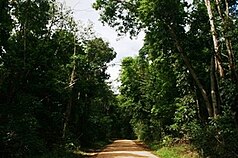
Kutini Payanu National Park contains the largest remaining areas of coastal rainforest in Australia. It is surrounded by drier eucalyptus forest and myrtle heather .
It is part of the 6,205 km² McIlwraith and Iron Ranges Important Bird Area (IBA), which has been designated as such by BirdLife International because it is one of the few known habitats of the endangered yellow breasted chicken . The IBA also contains individual populations of helmeted cassowaries , Australian singers , the white-parted leather head ( Philemon argenticeps ), various honey-eaters , the magnificent bird of paradise and the white- browed flycatcher . Representatives of the numerous reptiles of the Kutini-Payanu National Park are the Australian tree monitor (Varanus keithhornei) and the Gould's monitor (Varanus gouldii) .
Facilities
Camping is permitted on the Rainforest, Cooks Hut, Gordon Creek and Chili Beach campsites with prior notification. But there are no special facilities. There are three hiking trails in the park, Old Coen Track (10 km), Mount Tozer Viewing Platform (140 m) and Chili Beach Walk (720 m).
Driveway
The national park can only be reached by four-wheel drive vehicles. From the south it can be reached via the Peninsula Developmental Road (exit 35 km north of the Archer River Roadhouse on Portland Roads Road ). The park is reached after another 110 km to the northeast. Another approach is via the Frenchmans Track , a side street off the Telegraph Road at Batavia Downs . However, this is only suitable for expedition vehicles (with a cable winch and air intake pipe led upwards), as many streams have to be crossed and the road is not maintained.
Web links
- Official site of the park (English)
- Michael Musumeci: Iron Range Airbase Book - Carved In The Cape York Jungle
Individual evidence
- ↑ Australian Government - CAPAD 2010 ( MS Excel ; 170 kB), DSEWPaC , accessed on October 7, 2012 (English)
- ↑ Australian Government - CAPAD 1997 ( MS Excel ; 93 kB), DSEWPaC , accessed on October 7, 2012 (English)
- ^ Joint management of Cape York Peninsula national parks , Queensland Parks and Wildlife Service , accessed October 7, 2012
- ^ Steve Parish: Australian Touring Atlas . Steve Parish Publishing, Archerfield QLD 2007, ISBN 978-1-74193-232-4 , p. 15.
- ^ Iron Range Airfield, North Queensland, during WW2 . St.net.au. Accessed May 2006
- ↑ a b c d e Kutini-Payamu (Iron Range) National Park . Department of Environment and Resource Management. Retrieved November 19, 2012
- ↑ IBA: McIlwraith and Iron Ranges . In: Birdata . Birds Australia. Retrieved July 12, 2011.
- ↑ Reptiles native to the Iron Range National Park on arod.com.au


