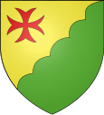
Dammartin-les-Templiers
| Dammartin-les-Templiers | ||
|---|---|---|

|
|
|
| region | Bourgogne-Franche-Comté | |
| Department | Doubs | |
| Arrondissement | Besançon | |
| Canton | Baume-les-Dames | |
| Community association | Doubs Baumois | |
| Coordinates | 47 ° 17 ′ N , 6 ° 16 ′ E | |
| height | 369-570 m | |
| surface | 9.91 km 2 | |
| Residents | 197 (January 1, 2017) | |
| Population density | 20 inhabitants / km 2 | |
| Post Code | 25110 | |
| INSEE code | 25189 | |

|
||
Dammartin-les-Templiers is a French municipality with 197 inhabitants (as of January 1 2017) in Doubs in the region Bourgogne Franche-Comté .
geography
Dammartin-les-Templiers is located at 415 m , about 19 kilometers east-northeast of the city of Besançon (as the crow flies). The village extends in the Jura , on a slight hill on the so-called first plateau, a wide basin at the southern foot of the Jura ridge (Côte).
The area of the 9.91 km² municipality covers a section of the French Jura. The main part of the area is taken up by the wide first Jura plateau, which is an average of 400 m . It forms a wide basin with no above-ground runoff and shows various karst phenomena such as the infiltration point at Fay and the Gouffre du Seu. In the Dammartin area, the plateau is predominantly made up of arable and meadow land. To the east, the communal soil extends into the wooded areas of the Bois de Seu and the Forêt de l'Aiguillon . In the far east, the Audeux valley, which is slightly sunk into the plateau, forms the boundary.
To the north, the community area extends over the elongated, wooded ridge of the Jura ridge ( Côte ). This ridge separates the plateau from the Doubstal adjoining to the north and is oriented towards the southwest-northeast. Here, at 570 m, the highest point in Dammartin-les-Templiers is reached.
Neighboring municipalities of Dammartin-les-Templiers are Ougney-Douvot in the north, Bretigney-Notre-Dame and Aïssey in the east, Glamondans in the south and Champlive in the west.
history
Since the early 13th century, Dammartin was the site of a Templar who was dependent on Besançon. There was also a Templar settlement in Fay (2 km south of the village), but this was given up before 1373. Together with Franche-Comté , the village came to France with the Peace of Nijmegen in 1678. To avoid confusion with other communities of the same name, Dammartin was officially renamed Dammartin-les-Templiers in 1922.
Attractions
Today's St. Martin's Church in Dammartin was built in 1742. The Notre-Dame de Fay chapel has also been preserved. The town center is characterized by various farmhouses in the characteristic Franche-Comté style from the 17th to 19th centuries.
population
| Population development | |
|---|---|
| year | Residents |
| 1962 | 157 |
| 1968 | 144 |
| 1975 | 120 |
| 1982 | 132 |
| 1990 | 174 |
| 1999 | 191 |
| 2016 | 206 |
With 197 inhabitants (as of January 1, 2017) Dammartin-les-Templiers is one of the small communities in the Doubs department. After the population had decreased markedly in the first half of the 20th century (395 people were still counted in 1881), the population has continued to grow steadily since the early 1980s.
Economy and Infrastructure
Until well into the 20th century, Dammartin-les-Templiers was mainly a village characterized by agriculture (arable farming, fruit growing and cattle breeding) and forestry. In addition, there are now some local small businesses. In the meantime, the village has also turned into a residential community. Many workers are commuters who work in the Besançon agglomeration.
The village is off the major thoroughfares on a departmental road that leads from Nancray to Baume-les-Dames . Another road connection is with Glamondans.
literature
- Le Patrimoine des Communes du Doubs. Volume 2, Flohic Editions, Paris 2001, ISBN 2-84234-087-6 , pp. 1144-1145.

