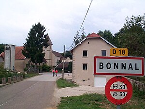
Bonnal
| Bonnal | ||
|---|---|---|
|
|
||
| region | Bourgogne-Franche-Comté | |
| Department | Doubs | |
| Arrondissement | Besançon | |
| Canton | Baume-les-Dames | |
| Community association | Pays de Villersexel | |
| Coordinates | 47 ° 30 ' N , 6 ° 21' E | |
| height | 251-292 m | |
| surface | 1.80 km 2 | |
| Residents | 29 (January 1, 2017) | |
| Population density | 16 inhabitants / km 2 | |
| Post Code | 25680 | |
| INSEE code | 25072 | |
 Entrance |
||
Bonnal is a French commune with a population of 29 (as at 1st January 2017) in the Doubs department in the region of Bourgogne Franche-Comté .
geography
Bonnal is located at an altitude of 265 m above sea level, three kilometers north of Rougemont and about 31 km west of the city of Montbéliard (as the crow flies). The village extends on the southern bank of the Ognon near the mouth of the Ruisseau de l'Étang.
The 1.80 km² municipal area covers a section of the central Ognontal. The northern border runs along the Ognon, which flows here with several turns through a wide valley. From the course of the river, the municipal area extends southwards over the alluvial plain and the lowland of the Ruisseau de l'Étang to the adjacent high terrace , which is partly wooded, partly with arable land and meadow. At 292 m, the highest point in Bonnal is reached in the Bois de la Corne forest .
Neighboring municipalities of Bonnal are Chassey-lès-Montbozon and Pont-sur-l'Ognon in the north, Rougemont in the east and south and Tressandans in the west.
history
The municipal area of Bonnal was settled very early, which was proven by the finds of a prehistoric ax and a flint . The village is mentioned in 1336 under the name Bona aula . Over time, the spelling changed from Bonale (1394), Bonalle (1401), Bonaule (1448), Bonnaule (1547) and Bonnalle (1584) to Bonnal (since the 18th century). In the Middle Ages Bonnal was under the influence of the Rougemont rule. Together with Franche-Comté , the village came to France with the Peace of Nijmegen in 1678. From the 16th to the 19th century, blast furnaces and forges were located here.
Attractions
The Saint-Paul church was rebuilt in the shape of a Latin cross in 1740 , and the bell tower was given its current shape in 1886. A manor house dates from the 18th century.
population
| Population development | |
|---|---|
| year | Residents |
| 1962 | 20th |
| 1968 | 27 |
| 1975 | 20th |
| 1982 | 25th |
| 1990 | 25th |
| 1999 | 24 |
| 2016 | 34 |
With 29 inhabitants (as of January 1, 2017) Bonnal is one of the smallest municipalities in the Doubs department. After the population had decreased significantly in the first half of the 20th century (95 people were still counted in 1881), only slight fluctuations have been recorded since then.
Economy and Infrastructure
Until well into the 20th century, Bonnal was a village dominated by agriculture (arable farming, fruit growing and cattle breeding) and forestry. Even today, the residents live mainly from their work in the first sector. Outside the primary sector there are few jobs in the village. Some workers are also commuters who work in the surrounding larger towns. There is an amusement park with water sports and a campsite to the north of the village.
The place is off the main thoroughfares on a departmental road that leads from Rougemont to Esprels. Another road connection is with Pont-sur-l'Ognon.
literature
- Le Patrimoine des Communes du Doubs. Volume 2, Flohic Editions, Paris 2001, ISBN 2-84234-087-6 , p. 1096.

